Items Similar to Antique Map of Oceania by Hérisson, 1816


Want more images or videos?
Request additional images or videos from the seller
1 of 5
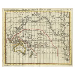
Antique Map of Oceania by Hérisson, 1816
$122.69
$153.3620% Off
£91.32
£114.1520% Off
€102.40
€12820% Off
CA$168.05
CA$210.0720% Off
A$186.91
A$233.6420% Off
CHF 97.60
CHF 12220% Off
MX$2,274.54
MX$2,843.1720% Off
NOK 1,246.50
NOK 1,558.1320% Off
SEK 1,169
SEK 1,461.2520% Off
DKK 779.54
DKK 974.4220% Off
Shipping
Retrieving quote...The 1stDibs Promise:
Authenticity Guarantee,
Money-Back Guarantee,
24-Hour Cancellation
About the Item
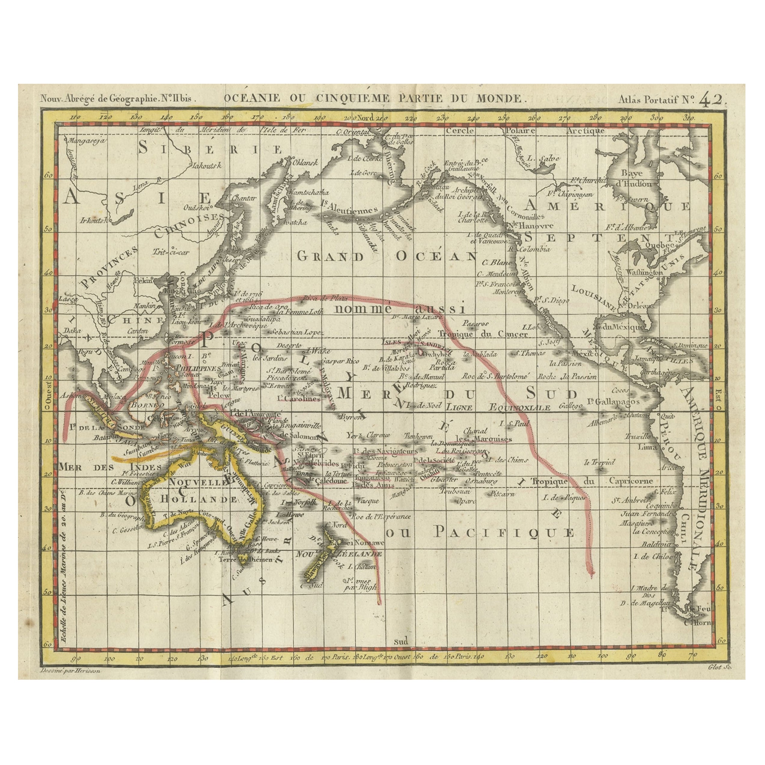
Antique map titled "Océanie ou cinquième partie du monde". This is an original antique map of Oceania, the 5th continent, by Herisson taken from atlas "Nouv. Abrége de Géographie". Artists and Engravers: Eustache Herisson (1759 - 1818) was a French cartographer and geographical engineer active in Paris during the early years of the 19th century. He?risson was a student of the 18th century hydrography Rigobert Bonne. He was a member of the Société Royale. Much of his work was republished posthumously by Bassett, Brue, and others.
Artist: Eustache He?risson (1759 ? 1818) was a French cartographer and geographical engineer active in Paris during the early years of the 19th century. He?risson was a student of the 18th century hydrography Rigobert Bonne. He was a member of the Société Royale. Much of his work was republished posthumously by Bassett, Brue, and others.
Condition: Good, general age-related toning. Small weak spot on folding line. Original folding lines, blank verso. Please study image carefully.
Date: 1826
Overall size: 24 x 20 cm.
Image size: 0.001 x 22 x 18 cm.
Antique prints have long been appreciated for both their aesthetic and investment value. They were the product of engraved, etched or lithographed plates. These plates were handmade out of wood or metal, which required an incredible level of skill, patience and craftsmanship. Whether you have a house with Victorian furniture or more contemporary decor an old engraving can enhance your living space. We offer a wide range of authentic antique prints for any budget.
- Dimensions:Height: 7.88 in (20 cm)Width: 9.45 in (24 cm)Depth: 0 in (0.01 mm)
- Materials and Techniques:
- Period:
- Date of Manufacture:1816
- Condition:
- Seller Location:Langweer, NL
- Reference Number:Seller: PCT-11671stDibs: LU3054327622912
About the Seller
5.0
Recognized Seller
These prestigious sellers are industry leaders and represent the highest echelon for item quality and design.
Platinum Seller
Premium sellers with a 4.7+ rating and 24-hour response times
Established in 2009
1stDibs seller since 2017
2,502 sales on 1stDibs
Typical response time: <1 hour
- ShippingRetrieving quote...Shipping from: Langweer, Netherlands
- Return Policy
Authenticity Guarantee
In the unlikely event there’s an issue with an item’s authenticity, contact us within 1 year for a full refund. DetailsMoney-Back Guarantee
If your item is not as described, is damaged in transit, or does not arrive, contact us within 7 days for a full refund. Details24-Hour Cancellation
You have a 24-hour grace period in which to reconsider your purchase, with no questions asked.Vetted Professional Sellers
Our world-class sellers must adhere to strict standards for service and quality, maintaining the integrity of our listings.Price-Match Guarantee
If you find that a seller listed the same item for a lower price elsewhere, we’ll match it.Trusted Global Delivery
Our best-in-class carrier network provides specialized shipping options worldwide, including custom delivery.More From This Seller
View AllOriginal Antique Map of Oceania, the 5th Continent, 1816
Located in Langweer, NL
Antique map titled ‘Océanie ou cinquième partie du monde‘.
This is an original antique map of Oceania, the 5th continent, by Herisson taken from atlas "Nouv. Abrége de Géographie...
Category
Antique 1810s Maps
Materials
Paper
$268 Sale Price
20% Off
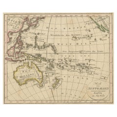
Antique Map of Oceania by Balbi '1847'
Located in Langweer, NL
Antique map titled 'Océanie'. Original antique map of Oceania. This map originates from 'Abrégé de Géographie (..)' by Adrien Balbi. Published 1847.
Category
Antique Mid-19th Century Maps
Materials
Paper

$143 Sale Price
20% Off
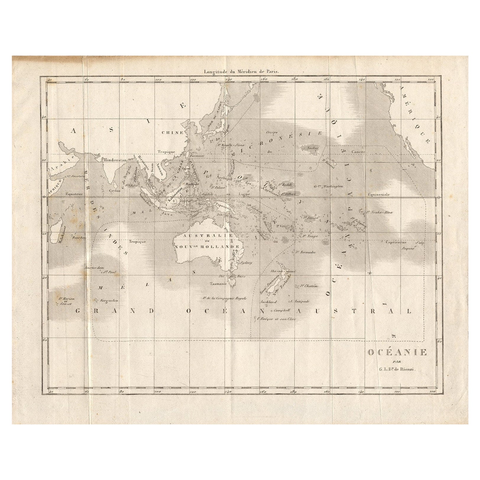
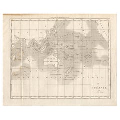
Antique Map of Oceania by Didot, 1836
Located in Langweer, NL
Antique map titled 'Oceanie par G.L.Dy. De Rienzi'. Map of the Oceania region, around Australia. This print originates from M.G.L. Domeny de Rienzi's 'Oceanie, ou Cinquieme Partie du...
Category
Antique 19th Century Maps
Materials
Paper
$84 Sale Price
20% Off
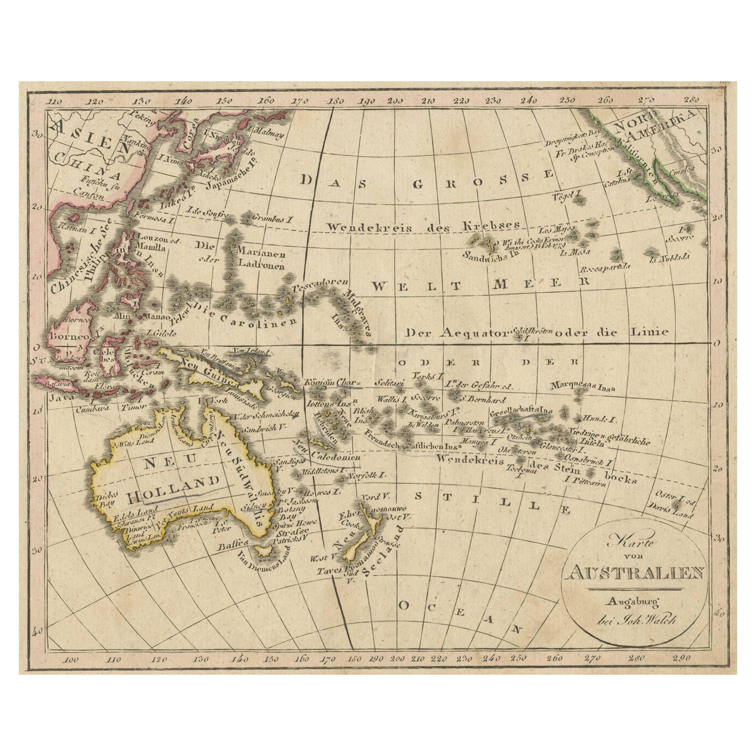
Antique Map of Oceania and the Pacific Ocean, Australia and New Zealand, 1826
Located in Langweer, NL
Antique map of Australia titled 'Karte von Australien'. Old map of Australia and New Zealand. Published in Walch's 'Neuester Schul-Atlas'.
Artists and Engravers: Johann, or Johan...
Category
Antique 19th Century Maps
Materials
Paper
$153 Sale Price
20% Off
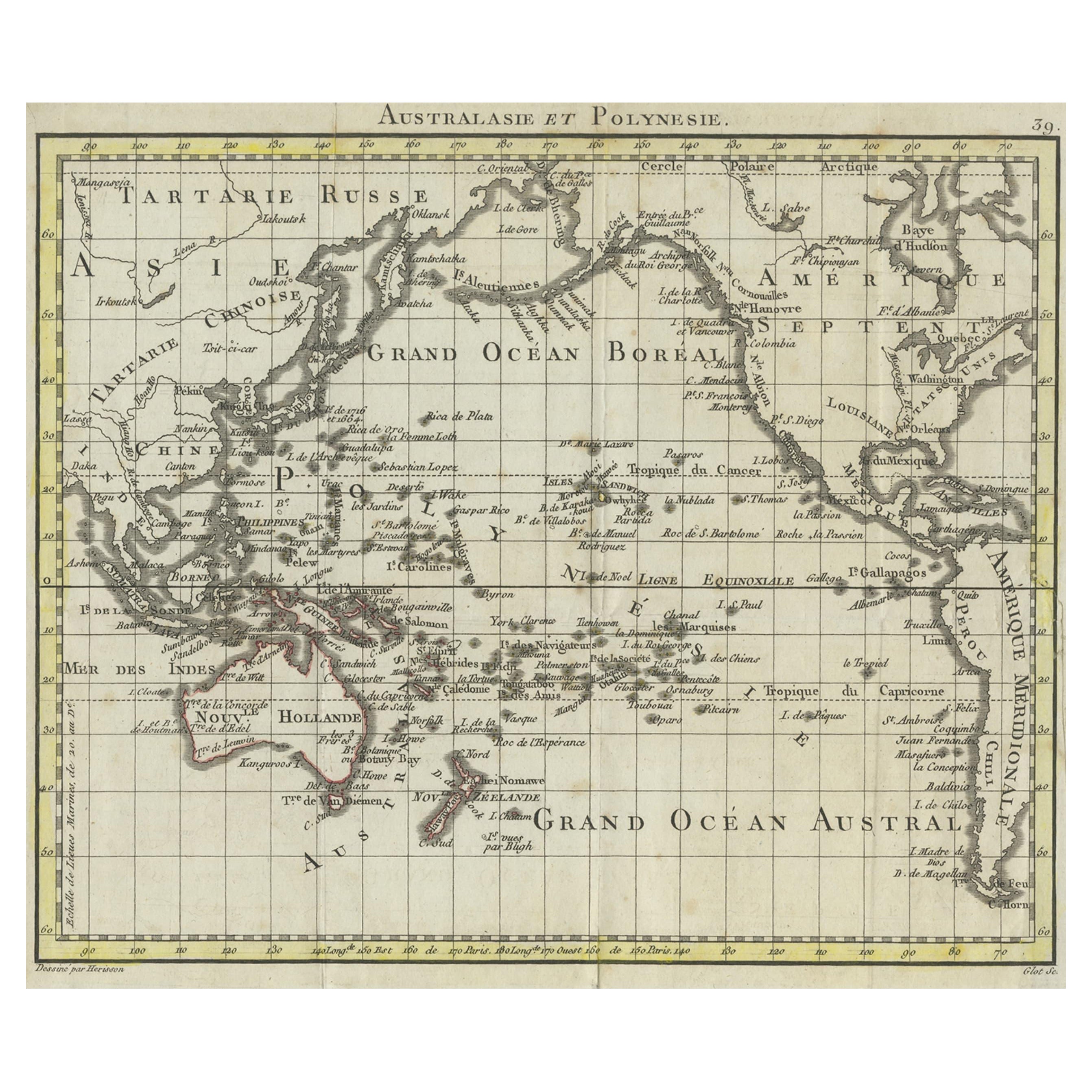
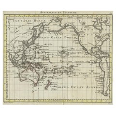
Antique French Map of the Pacific Ocean with Australia and Polynesia, 1806
Located in Langweer, NL
Antique map titled 'Australasie et Polynesie'. Old map of Oceania and the Pacific Ocean. Originates from 'Atlas Portatif contenant la Géographie Universelle Ancienne et Moderne' by H...
Category
Antique 19th Century Maps
Materials
Paper
$115 Sale Price
20% Off
Antique Map of Polynesia and Australasia by Neele, 1825
Located in Langweer, NL
Antique map titled 'Polynesia and Australasia'. It shows Australia (New Holland), part of Asia, New Zealand and many islands. This map originates from 'Encyclopedia Londinensis'.
Category
Antique Early 19th Century Maps
Materials
Paper

$114 Sale Price
20% Off
You May Also Like
Ancient Map of Oceania - Original Etching - 19th century
Located in Roma, IT
This Map of Oceania is an etching realized in the 19th century.
The state of preservation of the artwork is good. At the top of the paper, the inscription “Longitudine del Meridiano...
Category
19th Century More Prints
Materials
Etching

Original Antique Map of Australia by Dower, circa 1835
Located in St Annes, Lancashire
Nice map of Australia
Drawn and engraved by J.Dower
Published by Orr & Smith. C.1835
Unframed.
Free shipping
Category
Antique 1830s English Maps
Materials
Paper

Large Original Antique Map of Australia by Sidney Hall, 1847
Located in St Annes, Lancashire
Great map of Australia
Drawn and engraved by Sidney Hall
Steel engraving
Original colour outline
Published by A & C Black. 1847
Unframed
Free shipping.
Category
Antique 1840s Scottish Maps
Materials
Paper

Original Antique Map of The World by Thomas Clerk, 1817
Located in St Annes, Lancashire
Great map of The Eastern and Western Hemispheres
On 2 sheets
Copper-plate engraving
Drawn and engraved by Thomas Clerk, Edinburgh.
Published by Mackenzie And Dent, 1817
...
Category
Antique 1810s English Maps
Materials
Paper

Original Antique Map of The World by Dower, circa 1835
Located in St Annes, Lancashire
Nice map of the World
Drawn and engraved by J.Dower
Published by Orr & Smith. C.1835
Unframed.
Free shipping
Category
Antique 1830s English Maps
Materials
Paper

Original Antique Map of The Eastern Hemisphere by Dower, circa 1835
Located in St Annes, Lancashire
Nice map of the Eastern Hemisphere
Drawn and engraved by J.Dower
Published by Orr & Smith. C.1835
Unframed.
Free shipping
Category
Antique 1830s English Maps
Materials
Paper

More Ways To Browse
Ipswich Antique Furniture
Maps Balkans
Missouri Map
Antique Maps Of Texas
Antique Maps Virginia
Antique Railroad Scale
Jamaican Antique
Hindeloopen Furniture
Romania Map
Stanford Antique Furniture
Sardinia Map
Victorian Staircase
Nantucket Map
Afghanistan Antique Map
Antique Map Of Hawaii
Antique Florida Map
Map Of Syria
Napoleon Map