Items Similar to Antique Map op Siberia and Chinese Tartary with original hand coloring, 1732

Want more images or videos?
Request additional images or videos from the seller
1 of 6
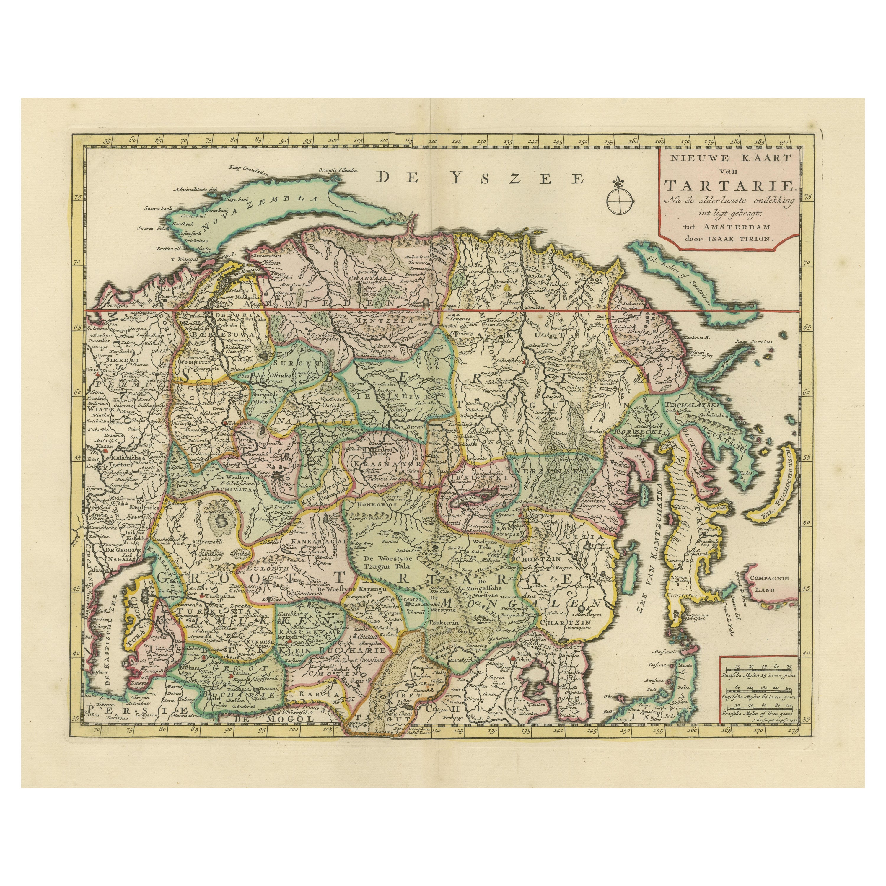
Antique Map op Siberia and Chinese Tartary with original hand coloring, 1732
$756.13
$945.1620% Off
£566.77
£708.4620% Off
€640
€80020% Off
CA$1,038.79
CA$1,298.4920% Off
A$1,159.72
A$1,449.6420% Off
CHF 607.67
CHF 759.5920% Off
MX$14,196.05
MX$17,745.0720% Off
NOK 7,717.46
NOK 9,646.8220% Off
SEK 7,276.58
SEK 9,095.7320% Off
DKK 4,871.91
DKK 6,089.8920% Off
Shipping
Retrieving quote...The 1stDibs Promise:
Authenticity Guarantee,
Money-Back Guarantee,
24-Hour Cancellation
About the Item
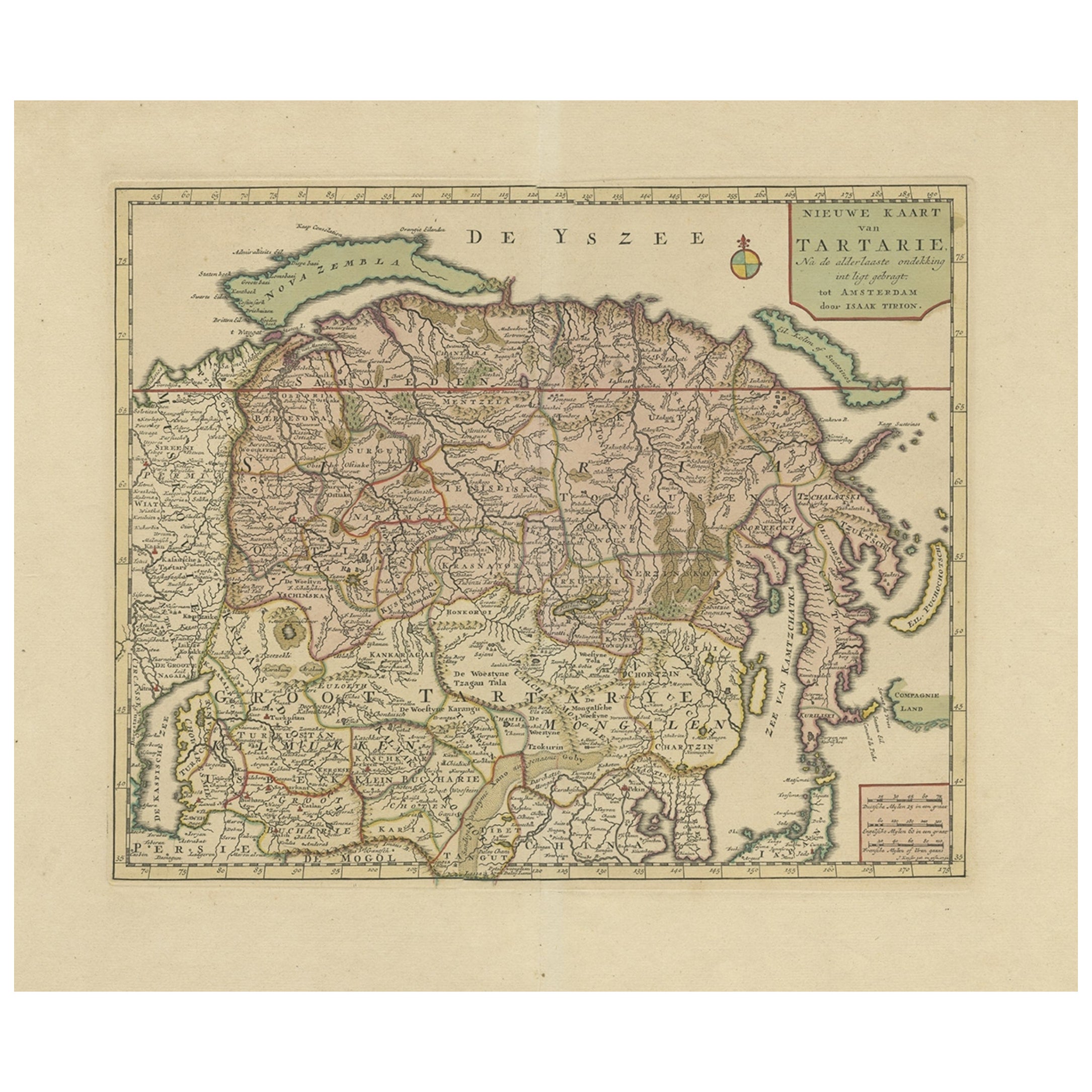
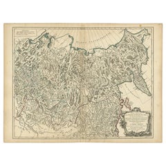
Antique map titled 'Nieuwe Kaart van Tartarie na de alderlaatste ontdekking int ligt gebragt'. Map op Siberia and Chinese tartary. In the north Novaya Zemlya curls back to attach itself to the mainland by a narrow isthmus. In the east Kamchatka reaches down almost to Japan. Published by I. Tirion, circa 1732.
- Dimensions:Height: 16.7 in (42.4 cm)Width: 21.5 in (54.6 cm)Depth: 0.02 in (0.5 mm)
- Materials and Techniques:Paper,Engraved
- Period:
- Date of Manufacture:c.1732
- Condition:Repaired: Repair on folding line and tear top margin. Original/contemporary hand coloring. Original folding line. Shows some wear and soiling. Blank verso. Please study image carefully.
- Seller Location:Langweer, NL
- Reference Number:Seller: BG-13513-41stDibs: LU3054336261822
About the Seller
5.0
Recognized Seller
These prestigious sellers are industry leaders and represent the highest echelon for item quality and design.
Platinum Seller
Premium sellers with a 4.7+ rating and 24-hour response times
Established in 2009
1stDibs seller since 2017
2,511 sales on 1stDibs
Typical response time: <1 hour
- ShippingRetrieving quote...Shipping from: Langweer, Netherlands
- Return Policy
Authenticity Guarantee
In the unlikely event there’s an issue with an item’s authenticity, contact us within 1 year for a full refund. DetailsMoney-Back Guarantee
If your item is not as described, is damaged in transit, or does not arrive, contact us within 7 days for a full refund. Details24-Hour Cancellation
You have a 24-hour grace period in which to reconsider your purchase, with no questions asked.Vetted Professional Sellers
Our world-class sellers must adhere to strict standards for service and quality, maintaining the integrity of our listings.Price-Match Guarantee
If you find that a seller listed the same item for a lower price elsewhere, we’ll match it.Trusted Global Delivery
Our best-in-class carrier network provides specialized shipping options worldwide, including custom delivery.More From This Seller
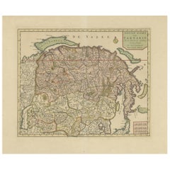
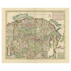
View AllAntique Map of Siberia and Chinese Tartary, Incl Nova Zembla, ca.1732
Located in Langweer, NL
Antique map of Tartary titled 'Nieuwe Kaart van Tartarie na de alderlaatste ondekking int ligt gebracht tot Amsterdam door Isaak Tirion'.
Map op Siberia and Chinese tartary. In t...
Category
Antique 1730s Maps
Materials
Paper
$812 Sale Price
20% Off
Free Shipping
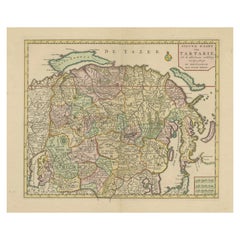
Map of Tartary by Isaak Tirion: Detailed Cartography of Northern Asia, ca.1740
Located in Langweer, NL
This is an antique map titled "Nieuwe Kaart van Tartarie," which translates to "New Map of Tartary." The map was created by Isaak Tirion, a prominent Dutch cartographer and publisher...
Category
Antique 1740s Maps
Materials
Paper
$623 Sale Price
20% Off
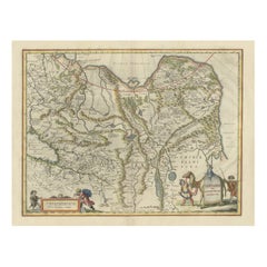
Old Genuine Antique Map of Tartary in the Russian Far East
Located in Langweer, NL
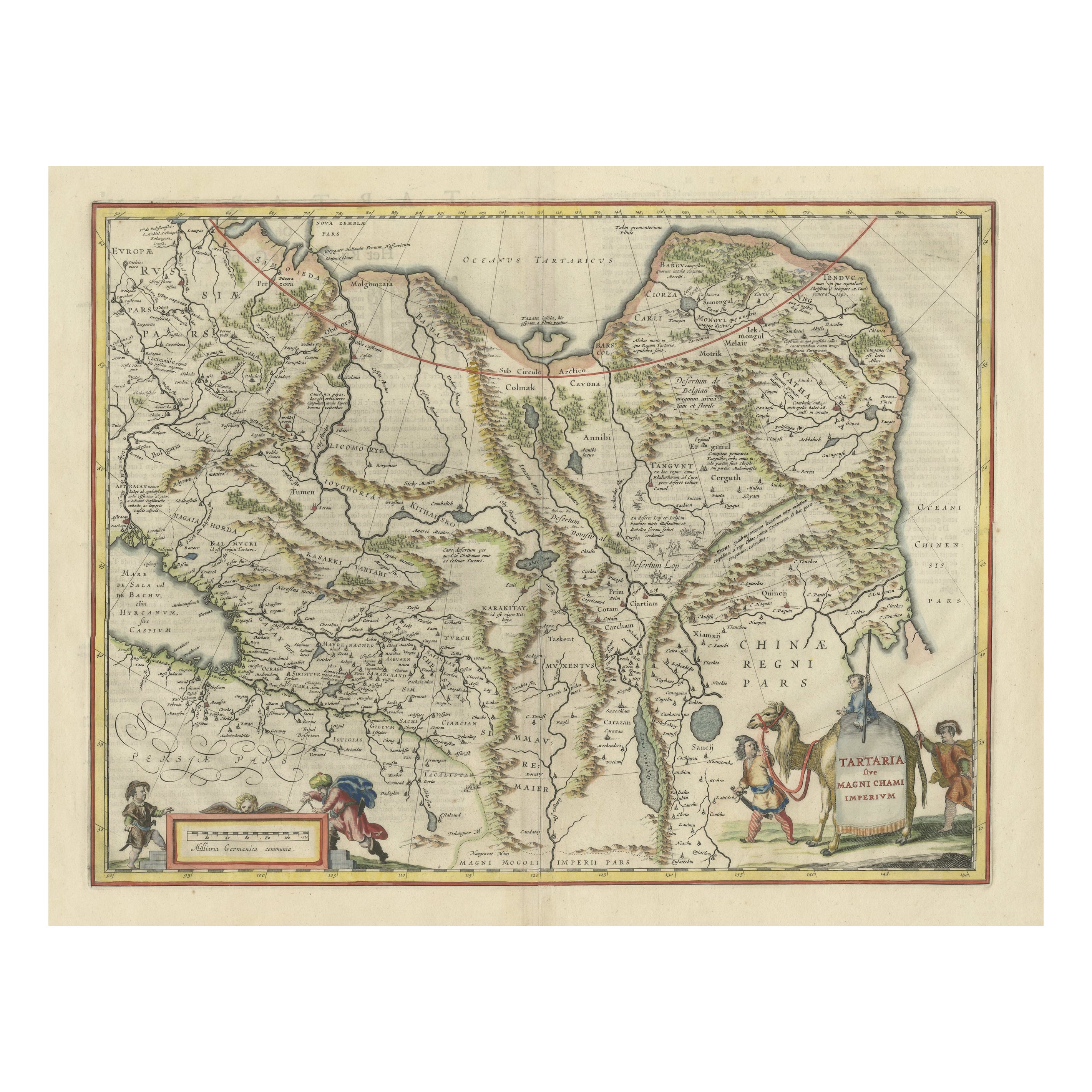
Original antique map titled 'Tartaria sive Magni Chami Imperium'. This great map of Tartary covers all of eastern Asia between the Caspian Sea and northern China and Manchuria. Being...
Category
Antique Mid-17th Century Maps
Materials
Paper
$1,323 Sale Price
20% Off
Original Antique Map of Tartary 'Northern China & Far Eastern Russia', 1757
Located in Langweer, NL
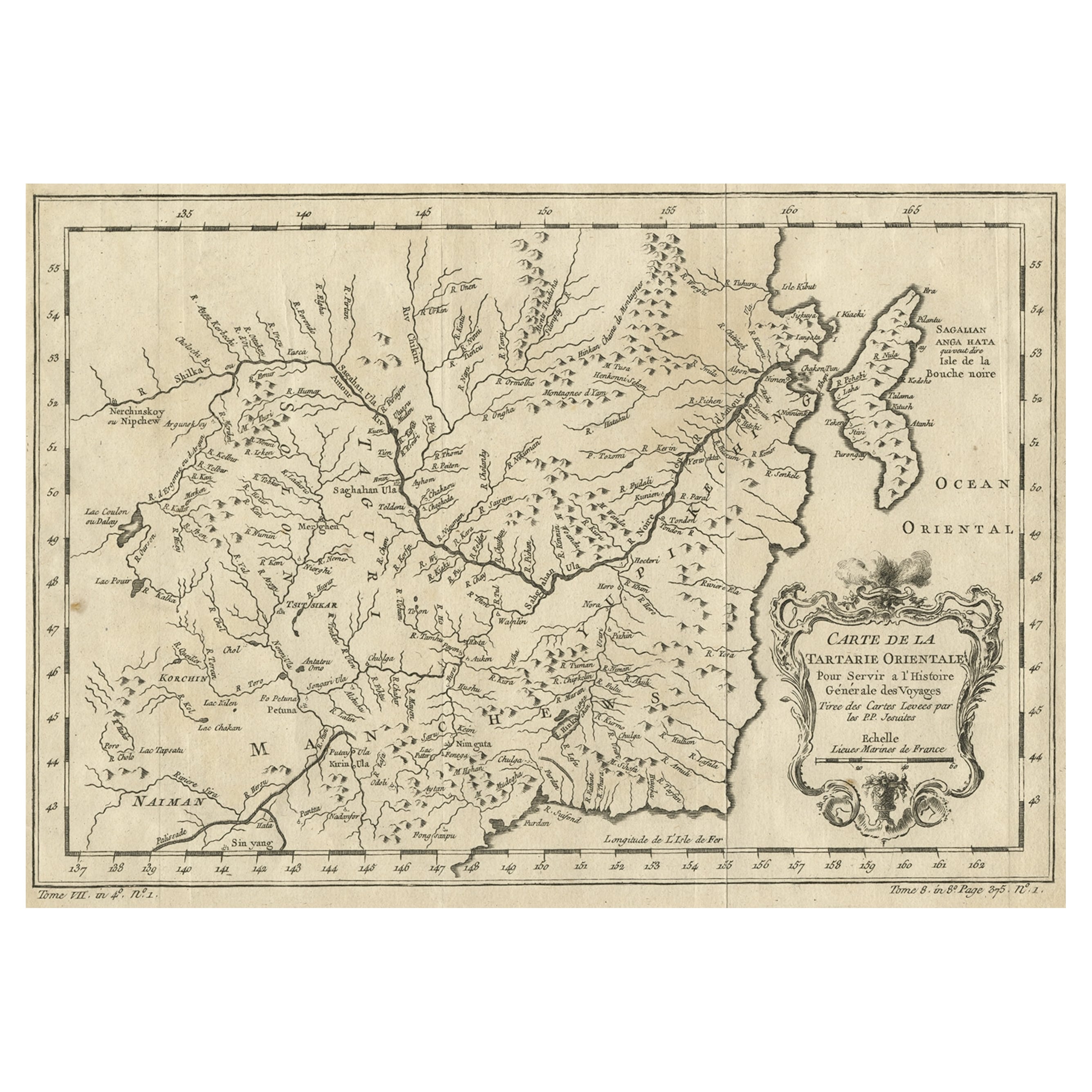
Antique map titled 'Carte de la Tartarie Orientale (..)'.
Original antique map of what is present day northern China and far eastern Russia. Centere...
Category
Antique 1750s Maps
Materials
Paper

$274 Sale Price
20% Off
Detailed Original Antique Map of the Russian Empire in Asia, 1750
Located in Langweer, NL
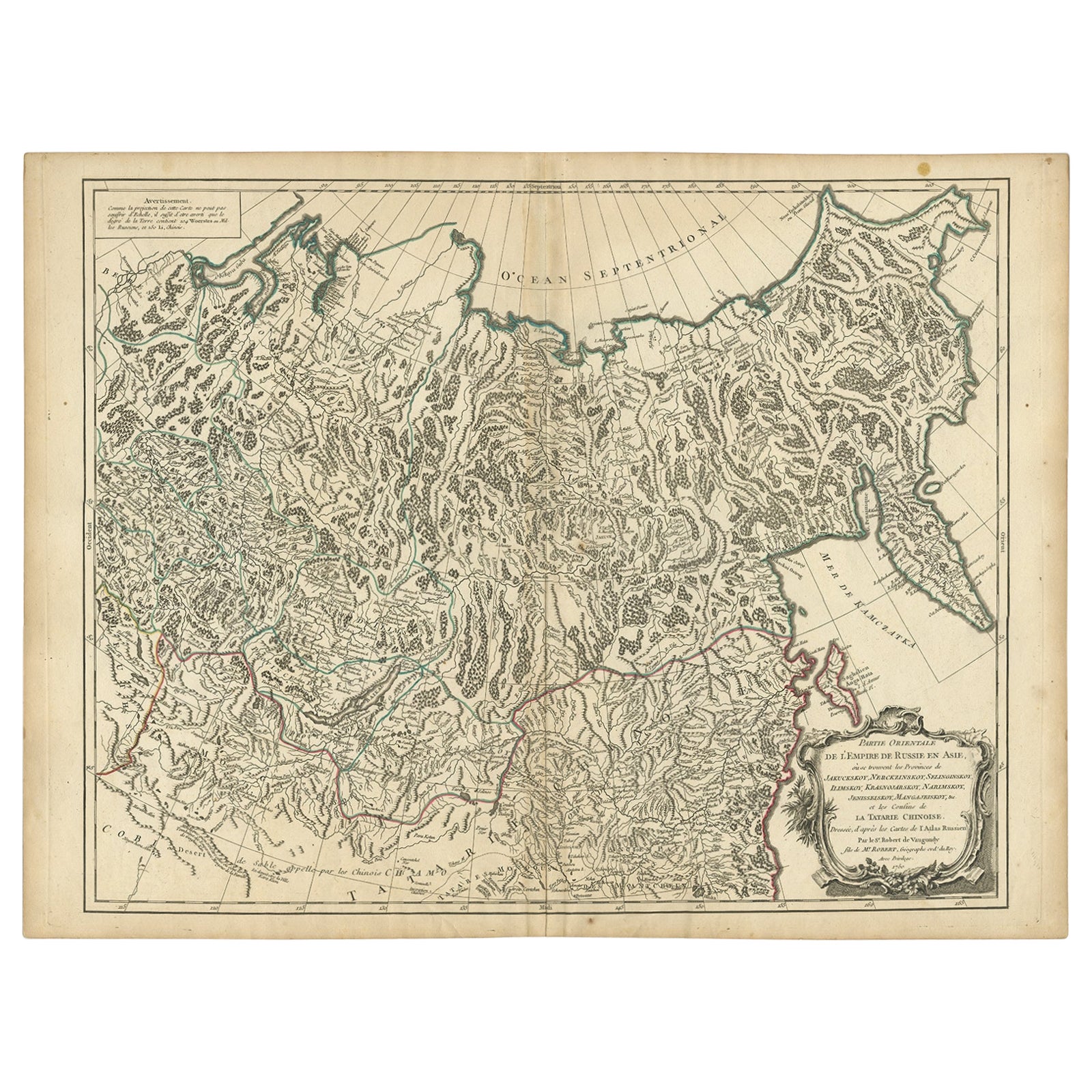
Antique map titled 'Partie Orientale de l'Empire de Russie en Asie (..)'.
Detailed map of the Russian Empire in Asia.
Artists and Engravers: Gilles Robert de Vaugondy (1688-1766) was the head of a leading family of geographers in eighteenth century France. Gilles got his start when he jointly inherited the shop of Pierre-Moullart Sanson, grandson of the famous geographer Nicholas Sanson. The inheritance included the business, its stock of plates, and a roller press...
Category
Antique 1750s Maps
Materials
Paper
$557 Sale Price
20% Off
Antique Map of Northern Asia, with Russia, Korea and Northern Japan
Located in Langweer, NL
Antique map titled 'Nieuwe Kaart van Tartarie'. Map op Siberia and Chinese tartary. In the north Novaya Zemlya curls back to attach itself to the mainland by a narrow isthmus. In the...
Category
Antique Mid-18th Century Maps
Materials
Paper
$760 Sale Price
34% Off
You May Also Like
Hand-Colored 18th Century Homann Map of the Black Sea, Turkey and Asia Minor
By Johann Baptist Homann
Located in Alamo, CA
An attractive original early 18th century hand-colored map of the Black Sea and Turkey entitled "Carte de L'Asie Minevre ou de la Natolie et du Pont Evxin Tiree des Voyages et des Ob...
Category
Antique Early 18th Century German Maps
Materials
Paper

Map of the Russian Empire: An Original 18th Century Hand-colored Map by E. Bowen
Located in Alamo, CA
This is an original 18th century hand-colored map entitled "A New & Accurate Map of The Whole Russian Empire, As Contain'd Both In Europe and Asia, Drawn from Authentic Journals, Sur...
Category
Mid-18th Century Old Masters Landscape Prints
Materials
Engraving

Scandinavia & Portions of Eastern Europe: 18th Century Hand-Colored Homann Map
By Johann Baptist Homann
Located in Alamo, CA
An early 18th century hand-colored copper-plate map entitled "Regni Sueciae in omnes suas Subjacentes Provincias accurate divisi Tabula Generalis" by Johann Baptist Homann (1663-1724...
Category
Antique Early 18th Century German Maps
Materials
Paper

Siberia as Explored by Behring: Original 18th Century Hand-colored Map by Bowen
Located in Alamo, CA
This is an original 18th century hand-colored map entitled "An Exact Chart of all the Countries through which Capt. Behring Travelled from Tobolski, Capital of Siberia to the Country...
Category
Mid-18th Century Old Masters Landscape Prints
Materials
Engraving

Antique French Map of Asia Including China Indoneseia India, 1783
Located in Amsterdam, Noord Holland
Very nice map of Asia. 1783 Dedie au Roy.
Additional information:
Country of Manufacturing: Europe
Period: 18th century Qing (1661 - 1912)
Condition: Overall Condition B (Good Used)...
Category
Antique 18th Century European Maps
Materials
Paper

$648 Sale Price
20% Off
1790 Thomas Stackhouse Map, Entitled "Russia in Europe, " , Ric.a004
Located in Norton, MA
1790 Thomas Stackhouse map, entitled
"Russia in Europe"
Ric.a004
Stackhouse, Thomas
Russia in Europe [map]
London: T. Stackhouse, 1783. Map. Matted hand-colored copper engraving. Image size: 14.5 x 15.25 inches. Mat size: 22.75 x 23.75 inches. A beautiful example of this map of Eastern Europe...
Category
Antique 17th Century Unknown Maps
Materials
Paper

More Ways To Browse
Antique Rug Wool Navy Blue Red
Antique Silver Platter
Boat Blueprint
Cream Plates
Vintage Art Deco Rugs
Vintage Serving Forks
Brewery Signs
Herati Rug
Gold Leaf Furniture Black
Italian Wood Console Tables
Maison Jansen Argentina
Antique Oushak
Mid Century Danish Directors Chairs
Moller 70
Wood Relief Art
Argentina Travel Poster
Century Furniture Faux Bamboo
Early American Chairs