Items Similar to Antique Map of Southern England & Wales, 1903, with Coastal Details and Railways


Want more images or videos?
Request additional images or videos from the seller
1 of 10
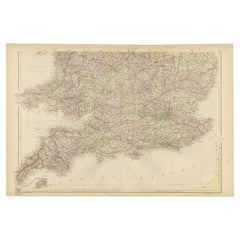
Antique Map of Southern England & Wales, 1903, with Coastal Details and Railways
$335.37
£248.53
€280
CA$457.84
A$509.33
CHF 267
MX$6,223.87
NOK 3,399.86
SEK 3,200.50
DKK 2,131.90
Shipping
Retrieving quote...The 1stDibs Promise:
Authenticity Guarantee,
Money-Back Guarantee,
24-Hour Cancellation
About the Item
Title: Antique Map of Southern England and Wales, 1903, with Coastal Details and Railways
Description:
This detailed antique map, titled "England and Wales (Southern Sheet I)," was engraved and published in 1903 by W. & A.K. Johnston in Edinburgh and London. It offers a fascinating and intricate depiction of the southern part of England and Wales, showcasing counties, cities, towns, and natural features with exceptional clarity and artistry.
The map features the vibrant regions of Southern England, including Devon, Cornwall, Somerset, and the bustling metropolis of London. It also extends to Wales, highlighting the rugged coastline along the Bristol Channel and the scenic beauty of the English Channel. The fine engraving and subtle pastel coloring—using shades of green, pink, and yellow—create a refined and harmonious composition that brings this historical period to life.
One of the map’s highlights is its inclusion of the Scilly Islands in a dedicated inset, emphasizing their geographical and navigational importance. Extensive railway lines are meticulously marked, a testament to the region’s burgeoning industrial development and the vital role of rail transport in connecting towns and fostering economic growth during this transformative period.
For collectors and history enthusiasts, this map is not only a decorative statement but also a window into the geography and infrastructure of the United Kingdom at the beginning of the 20th century. It reflects an era of rapid modernization and urban expansion while preserving the rich character of the British landscape.
Condition report:
This map is in very good antique condition, with slight toning around the edges and minor foxing consistent with its age. The colors remain vibrant and the paper stable and intact.
Framing tips:
Select a traditional wooden frame in walnut or oak to complement the map’s historic charm. Use a cream or light tan matting to highlight the pastel coloring and intricate engraving, ensuring the map stands out as a sophisticated and elegant addition to any room.
- Dimensions:Height: 14.49 in (36.8 cm)Width: 18.9 in (48 cm)Depth: 0.01 in (0.2 mm)
- Materials and Techniques:
- Period:
- Date of Manufacture:1903
- Condition:This map is in very good antique condition, with slight toning around the edges and minor foxing consistent with its age. The colors remain vibrant and the paper stable and intact. Folding line as issued.
- Seller Location:Langweer, NL
- Reference Number:Seller: BG-13577-51stDibs: LU3054345241052
About the Seller
5.0
Recognized Seller
These prestigious sellers are industry leaders and represent the highest echelon for item quality and design.
Platinum Seller
Premium sellers with a 4.7+ rating and 24-hour response times
Established in 2009
1stDibs seller since 2017
2,494 sales on 1stDibs
Typical response time: 1 hour
- ShippingRetrieving quote...Shipping from: Langweer, Netherlands
- Return Policy
Authenticity Guarantee
In the unlikely event there’s an issue with an item’s authenticity, contact us within 1 year for a full refund. DetailsMoney-Back Guarantee
If your item is not as described, is damaged in transit, or does not arrive, contact us within 7 days for a full refund. Details24-Hour Cancellation
You have a 24-hour grace period in which to reconsider your purchase, with no questions asked.Vetted Professional Sellers
Our world-class sellers must adhere to strict standards for service and quality, maintaining the integrity of our listings.Price-Match Guarantee
If you find that a seller listed the same item for a lower price elsewhere, we’ll match it.Trusted Global Delivery
Our best-in-class carrier network provides specialized shipping options worldwide, including custom delivery.More From This Seller
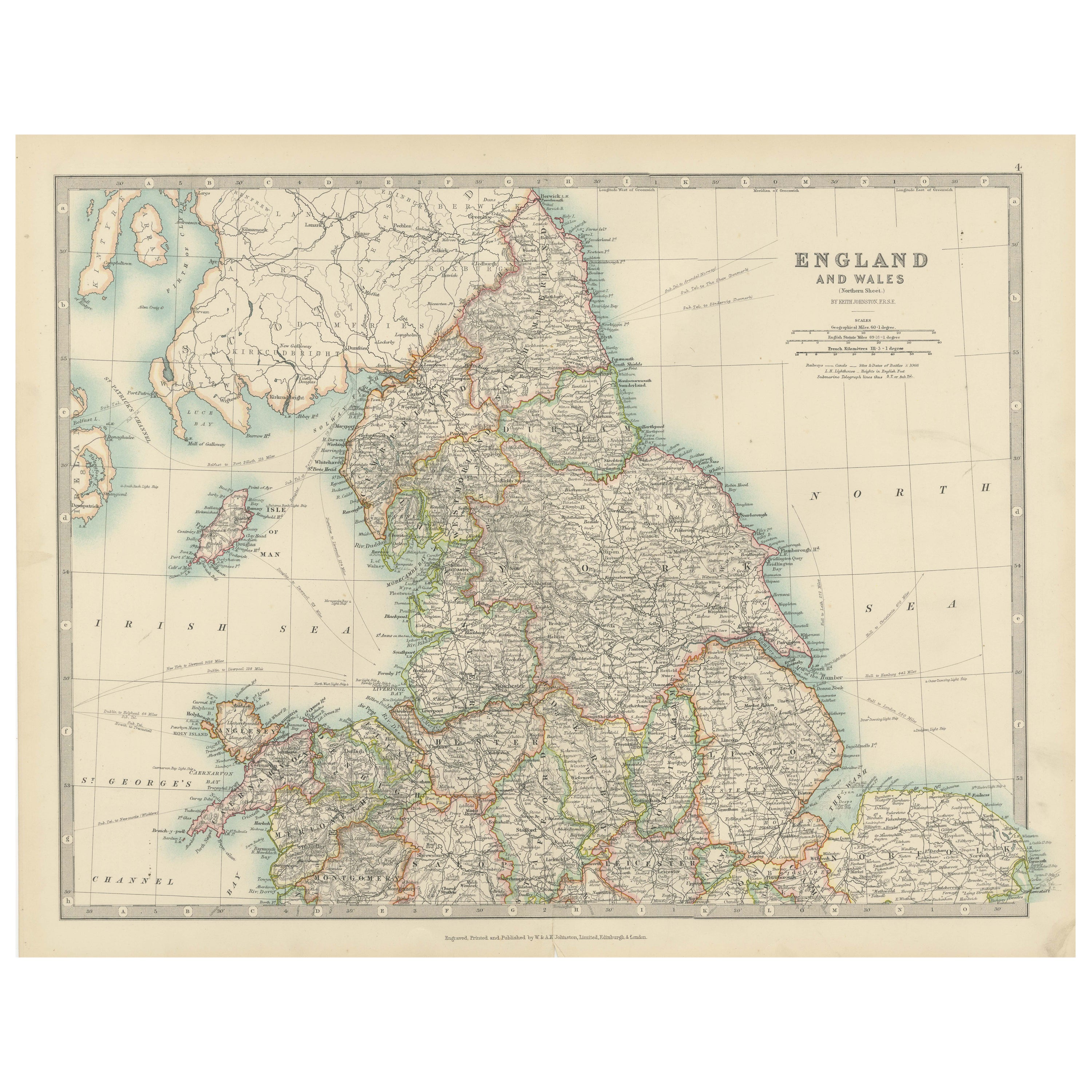
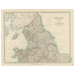
View AllAntique Map of England and Wales, 1903, with Detailed Counties and Railways
Located in Langweer, NL
Title: Antique Map of England and Wales, 1903, with Detailed Counties and Railways
Description:
This beautifully detailed antique map, titled "England and Wales," was engraved and p...
Category
Early 20th Century Maps
Materials
Paper
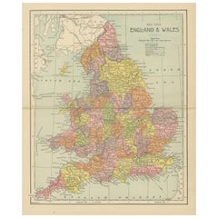
Antique Map of England and Wales by A.K. Johnston, 1865
Located in Langweer, NL
Antique map titled 'England and Wales (Southern Sheet)'. With an inset map of the Scilly Islands. This map originates from the ‘Royal Atlas of Modern Geography’ by Alexander Keith Jo...
Category
Antique Mid-19th Century Maps
Materials
Paper

$263 Sale Price
20% Off
Antique Map of England and Wales by Johnston, 1882
Located in Langweer, NL
Antique map titled 'England and Wales'. Old map of England and Wales, with an inset map of Scilly Islands. This map originates from 'The Royal Atlas of Modern Geography, Exhibiting, ...
Category
Antique 19th Century Maps
Materials
Paper

$137 Sale Price
20% Off
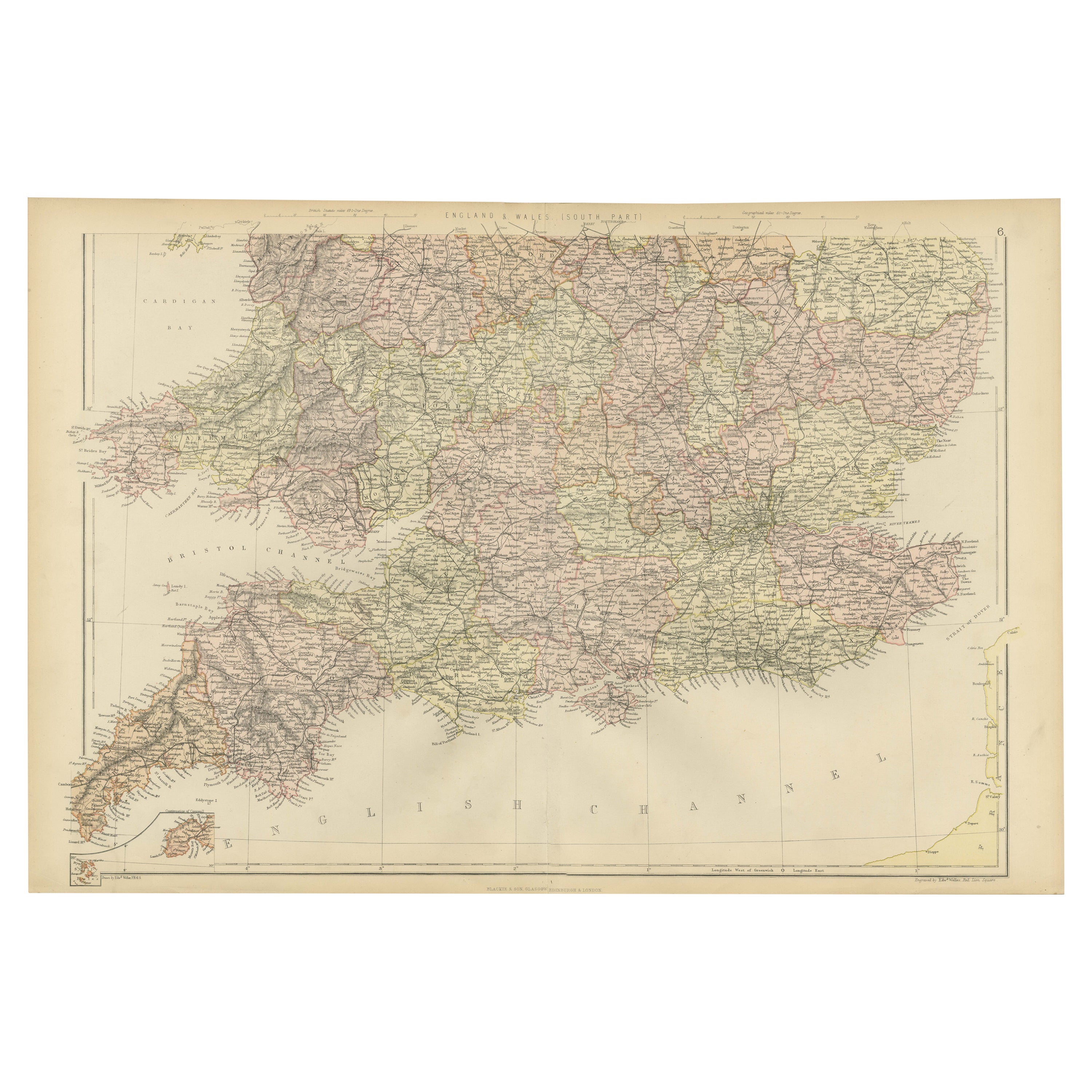
Colorful Detailed Antique Map of England and Wales (South Part), 1882
Located in Langweer, NL
Embark on a Journey Through the Southern Part of 'England and Wales' with this Exquisite Antique Map! This map provides a vivid portrayal of the captivating landscapes and cultural h...
Category
Antique 1880s Maps
Materials
Paper
$162 Sale Price
20% Off
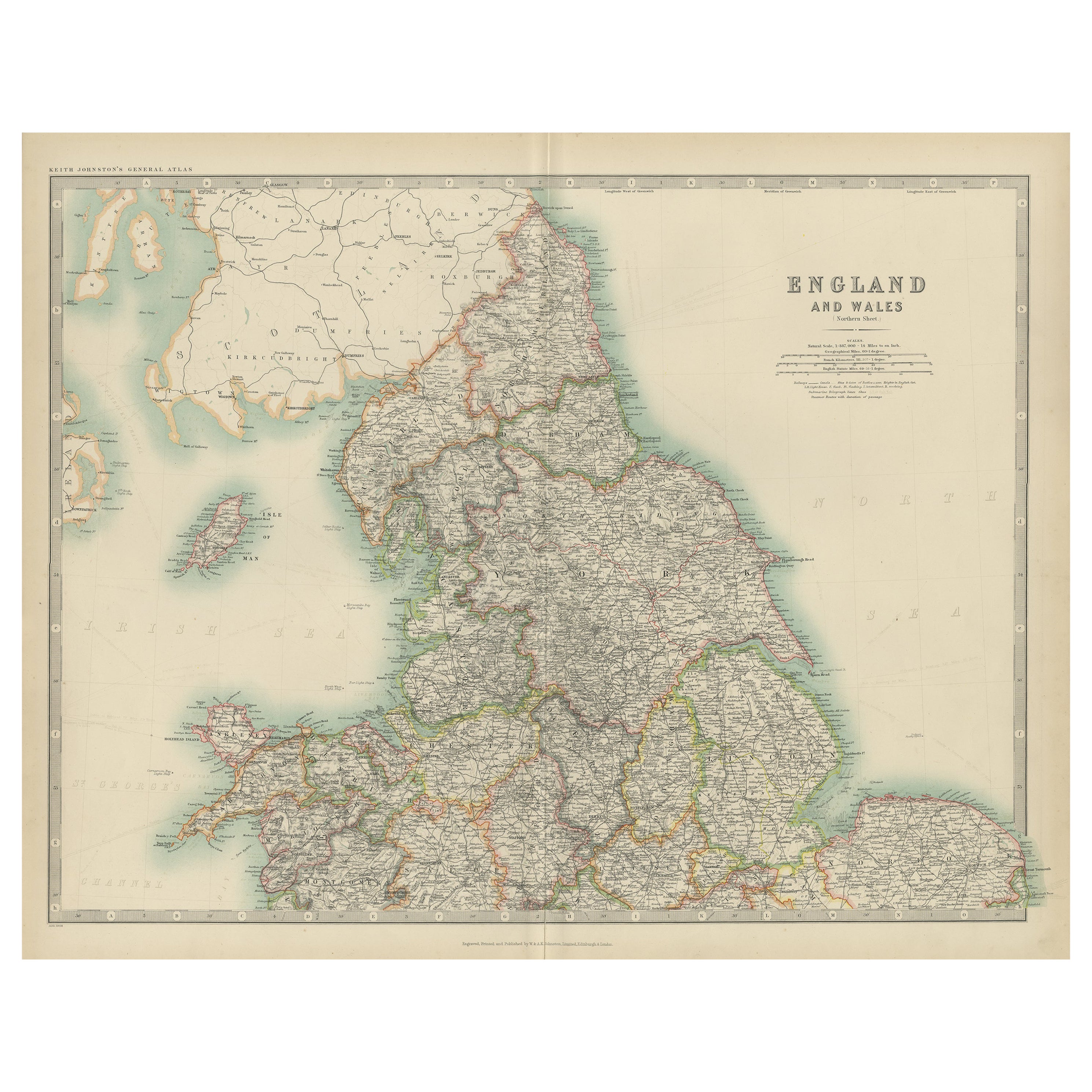
Original Antique Map of England and Wales from the 1909 Royal Atlas
Located in Langweer, NL
The antique map titled 'England and Wales' is a historical cartographic representation of these two nations. This original antique map of England...
Category
Early 20th Century Maps
Materials
Paper

$239 Sale Price
20% Off
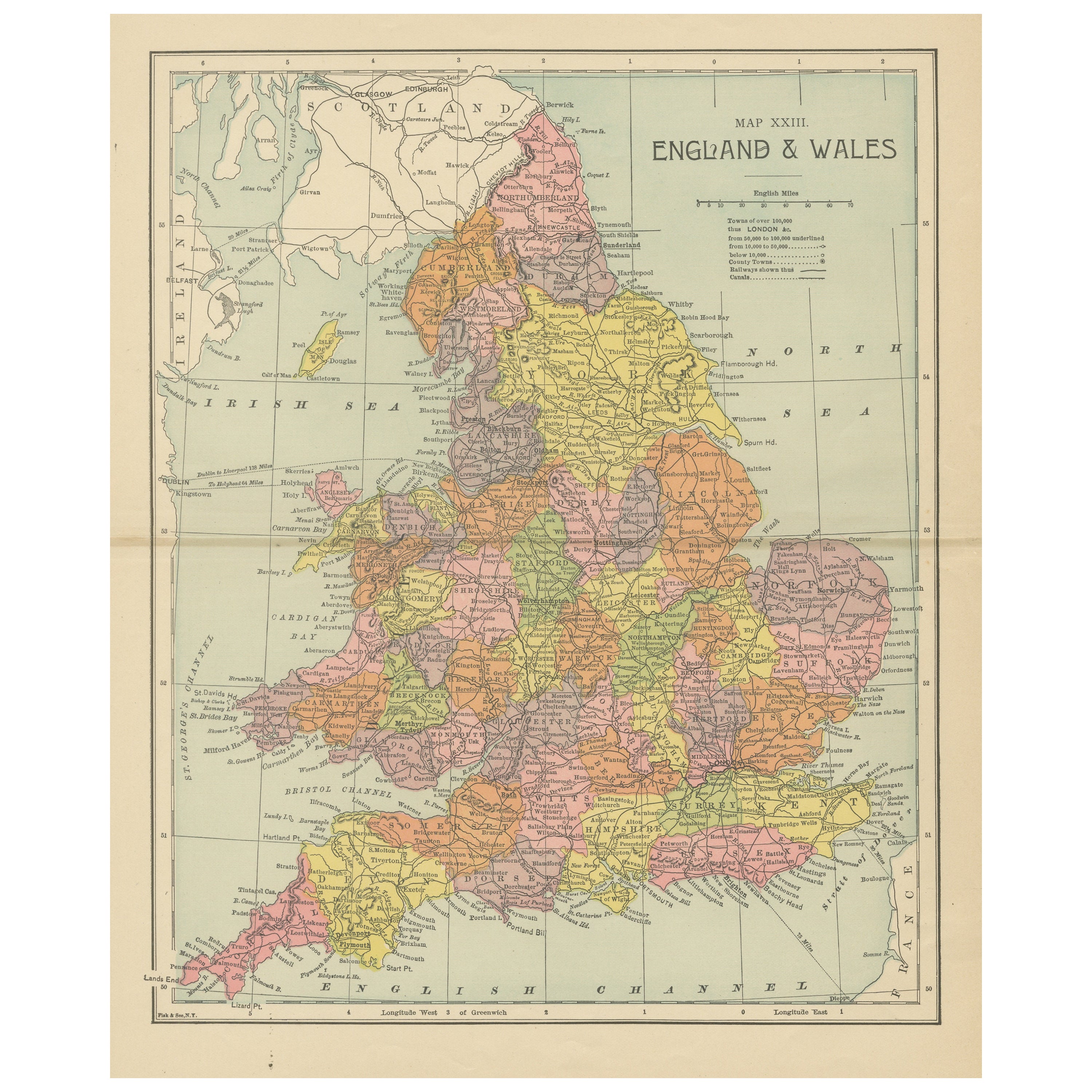
Lithographed Antique Map of England and Wales
Located in Langweer, NL
Original antique map titled 'Map XXIII England & Wales'. Lithographed map of England and Wales. Published by Fisk & See, circa 1890.
Category
Antique Late 19th Century Maps
Materials
Paper
$182 Sale Price
20% Off
You May Also Like
England and Wales, Northern Part. Century Atlas antique vintage map
Located in Melbourne, Victoria
'The Century Atlas. England and Wales, Northern Part'
Original antique map, 1903.
Central fold as issued. Map name and number printed on the reverse corners.
Sheet 29.5cm by 40cm.
Category
Early 20th Century Victorian More Prints
Materials
Lithograph

Large Original Vintage Map of the United Kingdom, circa 1920
Located in St Annes, Lancashire
Great map of The United Kingdom
Unframed
Original color
By John Bartholomew and Co. Edinburgh Geographical Institute
Published, circa 1920
Free shipping.
Category
Vintage 1920s British Maps
Materials
Paper

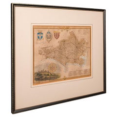
Antique County Map, Dorset, English, Framed Engraving, Cartography, Lithography
Located in Hele, Devon, GB
This is an antique lithography map of Dorset. An English, framed atlas engraving of cartographic interest, dating to the mid 19th century and later.
Superb lithography of Dorsetshi...
Category
Antique Mid-19th Century British Victorian Maps
Materials
Glass, Wood, Paper
Original Antique English County Map, Kent. J & C Walker, 1851
Located in St Annes, Lancashire
Great map of Kent
Original colour
By J & C Walker
Published by Longman, Rees, Orme, Brown & Co. 1851
Unframed.
Category
Antique 1850s English Other Maps
Materials
Paper

Original Antique English County Map, Buckinghamshire, J & C Walker, 1851
Located in St Annes, Lancashire
Great map of Buckinghamshire
Original colour
By J & C Walker
Published by Longman, Rees, Orme, Brown & Co. 1851
Unframed.
Category
Antique 1850s English Other Maps
Materials
Paper

Vicinity of London, England, United Kingdom. Century Atlas antique map
Located in Melbourne, Victoria
'The Century Atlas. Vicinity of London, England, United Kingdom.'
Original antique map, 1903.
Central fold as issued. Map name and number printed on the reverse corners.
Sheet 29.5...
Category
Early 20th Century Victorian More Prints
Materials
Lithograph

More Ways To Browse
Wales And Wales Furniture
Coastal Antique
Railway Map
Antique Oak Island
Antique Industrial Windows
Antique Furniture Cornwall
Used Office Furniture Cornwall
Solid Mahogany Table
Dessert Glasses
Geometric Glass Table
Mid Century Pin
6x10 Rug
Studded Furniture
Styles Of Antique Desks
Black And White Coffee Table
Metal Relief
Curved Velvet Couch
Velvet Curved Sofa