Items Similar to Antique Map of Various Ports in France by Röder 'circa 1800'
Want more images or videos?
Request additional images or videos from the seller
1 of 5
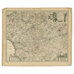
Antique Map of Various Ports in France by Röder 'circa 1800'
$1,748.55
$2,185.6920% Off
£1,310.65
£1,638.3120% Off
€1,480
€1,85020% Off
CA$2,402.21
CA$3,002.7620% Off
A$2,681.84
A$3,352.3020% Off
CHF 1,405.24
CHF 1,756.5620% Off
MX$32,828.38
MX$41,035.4720% Off
NOK 17,846.62
NOK 22,308.2820% Off
SEK 16,827.10
SEK 21,033.8720% Off
DKK 11,266.30
DKK 14,082.8720% Off
About the Item
Antique print showing various ports in France. Including plans of St. Malo, Granville, Nantes, Dieppe, Bourdeauz, Gibraltar, Lorient, Boulogne sur Mer, Les Sables d'Olonne, Brest, Le Trèport, Antibes, La Ciotat, Fécamp, Calais, Marseille, La Rochelle, St. Valery, Bayonne, Gravelins, Port Louis, Rochefort and Cette. Source unknown, to be determined. Engraved by Röder.
- Dimensions:Height: 19.3 in (49 cm)Width: 27.17 in (69 cm)Depth: 0.02 in (0.5 mm)
- Materials and Techniques:
- Period:
- Date of Manufacture:circa 1800
- Condition:General age-related toning, minor wear (mainly in margins, slightly affecting image). Blank verso. Please study images carefully.
- Seller Location:Langweer, NL
- Reference Number:Seller: BG-12390-91stDibs: LU3054318024181
About the Seller
5.0
Recognized Seller
These prestigious sellers are industry leaders and represent the highest echelon for item quality and design.
Platinum Seller
Premium sellers with a 4.7+ rating and 24-hour response times
Established in 2009
1stDibs seller since 2017
2,513 sales on 1stDibs
Typical response time: <1 hour
- ShippingRetrieving quote...Shipping from: Langweer, Netherlands
- Return Policy
Authenticity Guarantee
In the unlikely event there’s an issue with an item’s authenticity, contact us within 1 year for a full refund. DetailsMoney-Back Guarantee
If your item is not as described, is damaged in transit, or does not arrive, contact us within 7 days for a full refund. Details24-Hour Cancellation
You have a 24-hour grace period in which to reconsider your purchase, with no questions asked.Vetted Professional Sellers
Our world-class sellers must adhere to strict standards for service and quality, maintaining the integrity of our listings.Price-Match Guarantee
If you find that a seller listed the same item for a lower price elsewhere, we’ll match it.Trusted Global Delivery
Our best-in-class carrier network provides specialized shipping options worldwide, including custom delivery.More From This Seller
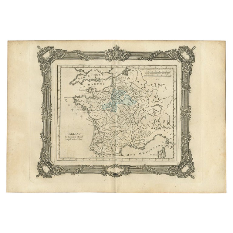
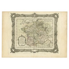
View AllAntique Map of France under the Second Race by Zannoni, 1765
Located in Langweer, NL
Antique map France titled 'Tableau du Domaine Royal (..)'. Beautiful old map of France. This map originates from 'Atlas Historique de la France Ancienne et Moderne' by M. Rizzi Zanno...
Category
Antique 18th Century Maps
Materials
Paper
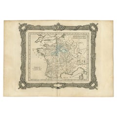
$141 Sale Price
20% Off
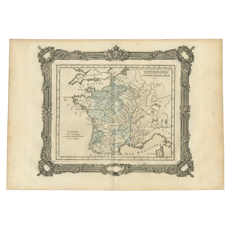
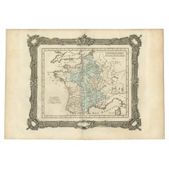
Antique Map of France under the Reign of St. Louis by Zannoni, 1765
Located in Langweer, NL
Antique map France titled 'Le Domaine de la Couronne (..)'. Beautiful old map of France. This map originates from 'Atlas Historique de la France Ancienne et Moderne' by M. Rizzi Zann...
Category
Antique 18th Century Maps
Materials
Paper
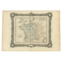
$141 Sale Price
20% Off
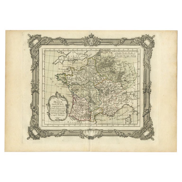
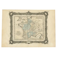
Antique Map of France in the 7th Century by Zannoni, 1765
Located in Langweer, NL
Antique map France titled 'La France sous le VIIe Siècle (..)'. Beautiful old map of France. This map originates from 'Atlas Historique de la France Ancienne et Moderne' by M. Rizzi ...
Category
Antique 18th Century Maps
Materials
Paper
$150 Sale Price
20% Off
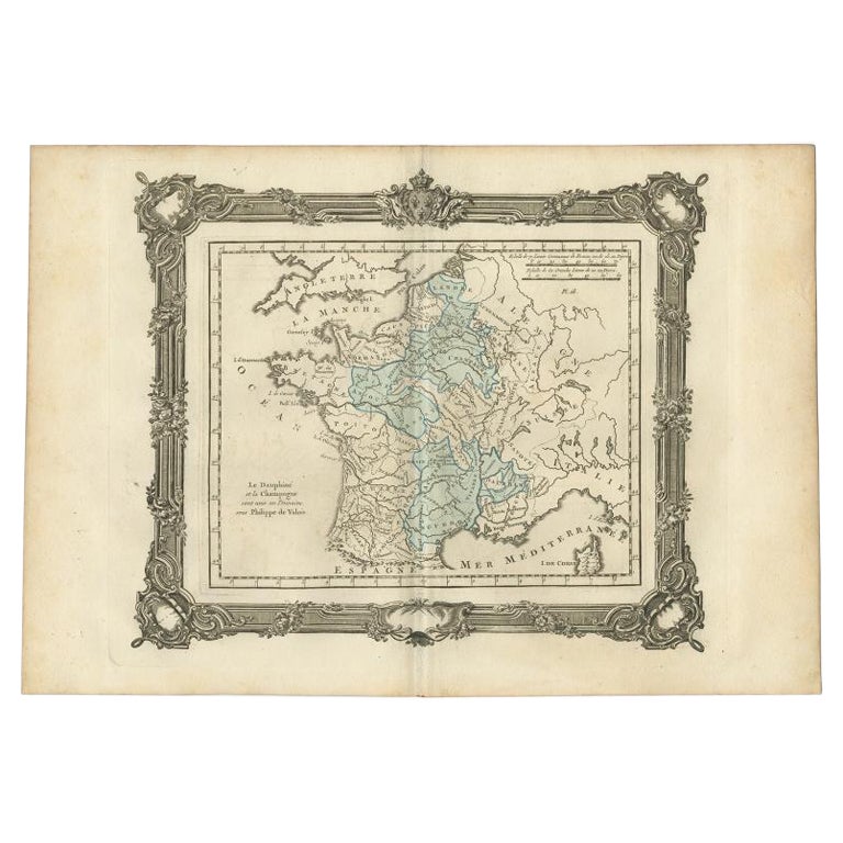
Antique Map of France under the Reign of Philip VI by Zannoni, 1765
Located in Langweer, NL
Antique map France titled 'Le Dauphine et la Champagne (..)'. Beautiful old map of France. This map originates from 'Atlas Historique de la France Ancienne...
Category
Antique 18th Century Maps
Materials
Paper
$141 Sale Price
20% Off
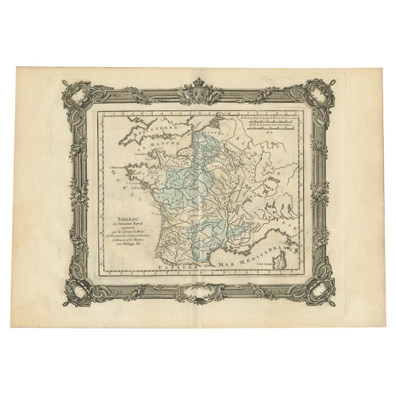
Antique Map of France under the Reign of Philip III by Zannoni, 1765
Located in Langweer, NL
Antique map France titled 'Tableau du Domaine Royal (..)'. Beautiful old map of France. This map originates from 'Atlas Historique de la France Ancienne et Moderne' by M. Rizzi Zanno...
Category
Antique 18th Century Maps
Materials
Paper
$139 Sale Price
20% Off
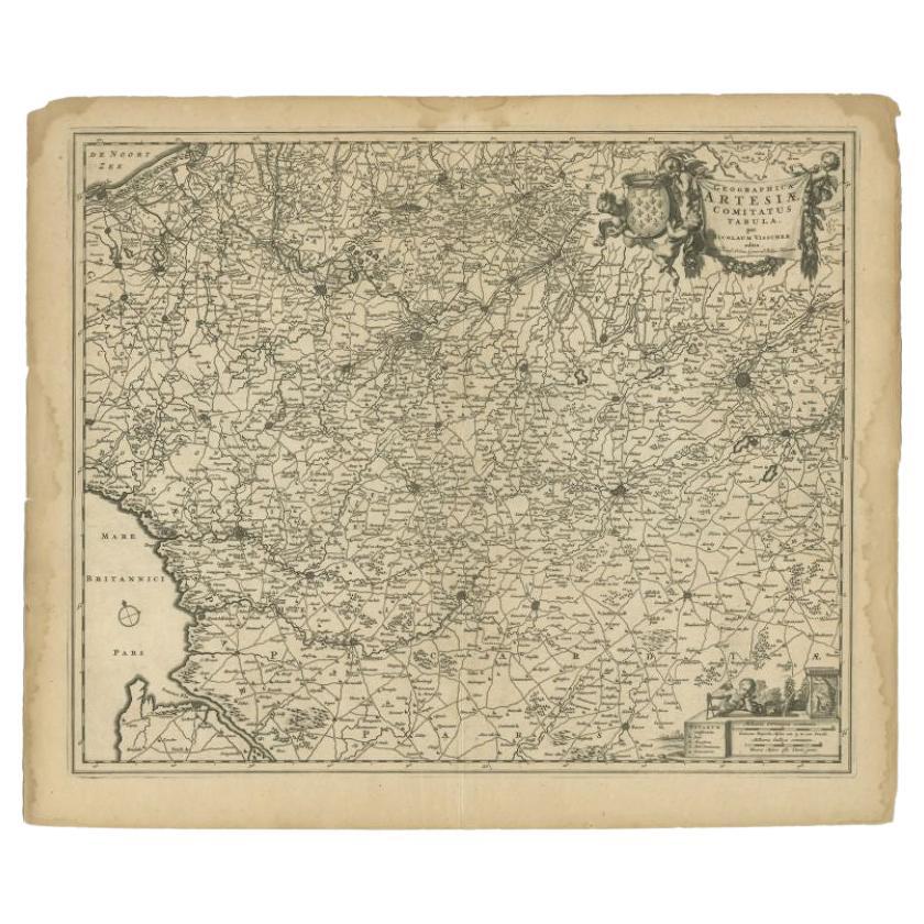
Antique Map of the Artois region by Visscher, c.1690
Located in Langweer, NL
Antique map titled 'Geographica Artesiae Comitatus Tabula'. Large map of the Artois region, France. Also shows part of Flanders. Artists and Engravers: Nicolaes Visscher II (1649, Am...
Category
Antique 17th Century Maps
Materials
Paper
$315 Sale Price
20% Off
You May Also Like
Original Large Antique Map of Paris, France by John Dower, 1861
Located in St Annes, Lancashire
Fabulous monochrome map of Paris.
Vignettes of St Germain En Laye, Saint Cloud, Versailles and Fontainbleau.
Unframed.
Drawn by J.Dower.
Lithography by Weller. 4 sheets joined to...
Category
Antique 1860s English Victorian Maps
Materials
Paper

Original Antique Map of Switzerland, Engraved By Barlow, Dated 1807
Located in St Annes, Lancashire
Great map of Switzerland
Copper-plate engraving by Barlow
Published by Brightly & Kinnersly, Bungay, Suffolk.
Dated 1807
Unframed.
Category
Antique Early 1800s English Maps
Materials
Paper

Original Antique Map of Europe, Arrowsmith, 1820
Located in St Annes, Lancashire
Great map of Europe
Drawn under the direction of Arrowsmith.
Copper-plate engraving.
Published by Longman, Hurst, Rees, Orme and Brown, 1820
...
Category
Antique 1820s English Maps
Materials
Paper

Old Map Depicting the Entire Earth's Surface Divided into Six Parts France 1850
Located in Milan, IT
Map depicting the entire earth's surface divided into six parts which depicts the position of peoples on Earth based on the assumption that it is impossible for each people to have t...
Category
Antique Mid-19th Century French Maps
Materials
Glass, Wood, Paper

Plan of Paris, France, by A. Vuillemin, Antique Map, 1845
Located in Colorado Springs, CO
This large and detailed plan of Paris was published by Alexandre Vuillemin in 1845. The map conveys a wonderful amount of information and is decorated throughout with pictorial vigne...
Category
Antique 1840s American Maps
Materials
Paper

Antique Map of Paris, "Carte Routiere des Environs de Paris" 1841
Located in Colorado Springs, CO
This beautiful hand-colored road map of Paris was published in 1841. The map shows Paris and the surrounding area in a folding pocket map. Organized and detailed for travelers, this ...
Category
Antique 1840s French Maps
Materials
Paper

More Ways To Browse
Gibraltar Antique Map
Antique Maps Of Africa
Antiques Compasses
Antique Navigation
Colonial Furniture Company
Mississippi Furniture
Antique Scottish Wood Furniture
Indonesia Map
Antique Framed Map Engravings
Atlas Furniture Company
Used Office Furniture Edinburgh
Antique 16th Century Plates
Scotland Map
Antique Maps Indonesia
Map Of Japan
Antique Rollers
Compass Rose Antique
Dutch Empire