Items Similar to Antique Plan of the Castle & City of Batavia 'Jakarta' on Java, Indonesia, c1669


Want more images or videos?
Request additional images or videos from the seller
1 of 5
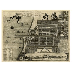
Antique Plan of the Castle & City of Batavia 'Jakarta' on Java, Indonesia, c1669
$1,199.18
$1,498.9720% Off
£892.07
£1,115.0820% Off
€1,000
€1,25020% Off
CA$1,642.09
CA$2,052.6120% Off
A$1,825.78
A$2,282.2220% Off
CHF 953.32
CHF 1,191.6520% Off
MX$22,224.14
MX$27,780.1820% Off
NOK 12,163.94
NOK 15,204.9320% Off
SEK 11,397.03
SEK 14,246.2920% Off
DKK 7,612.45
DKK 9,515.5620% Off
Shipping
Retrieving quote...The 1stDibs Promise:
Authenticity Guarantee,
Money-Back Guarantee,
24-Hour Cancellation
About the Item
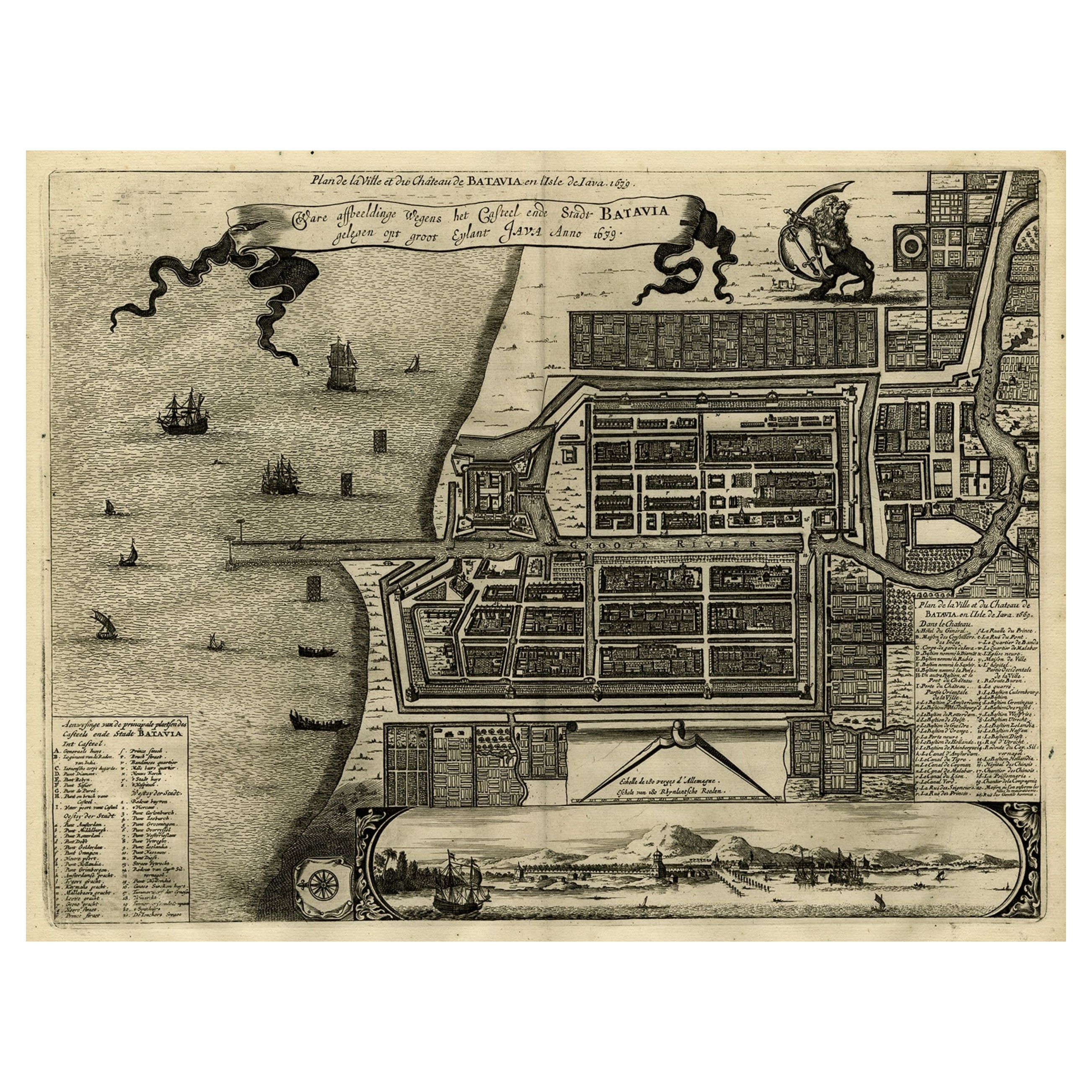
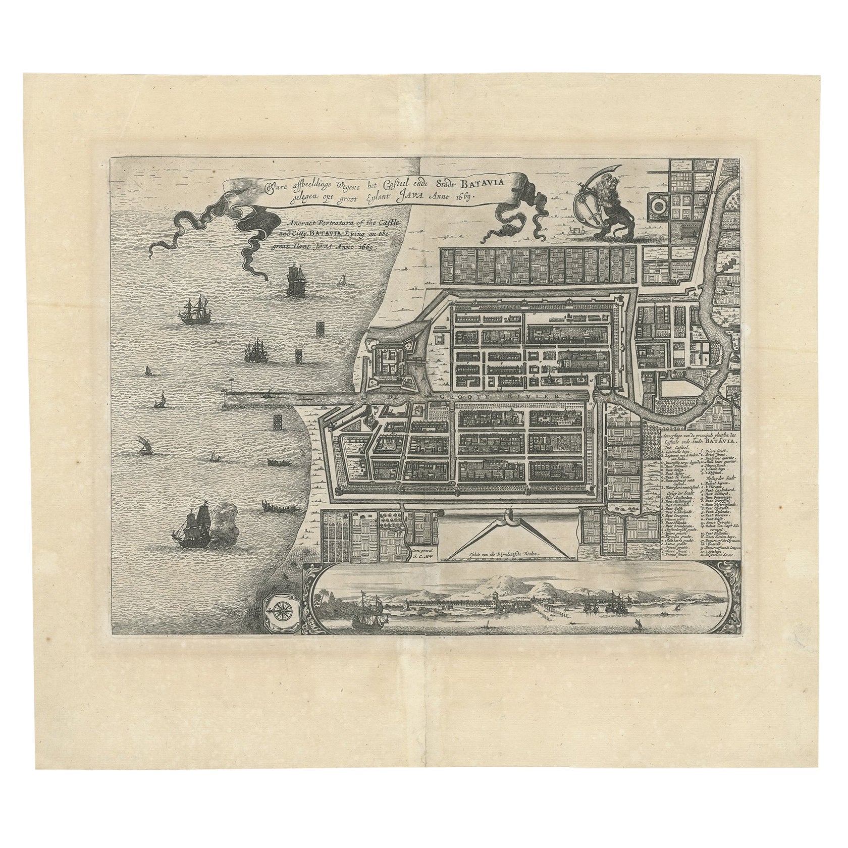
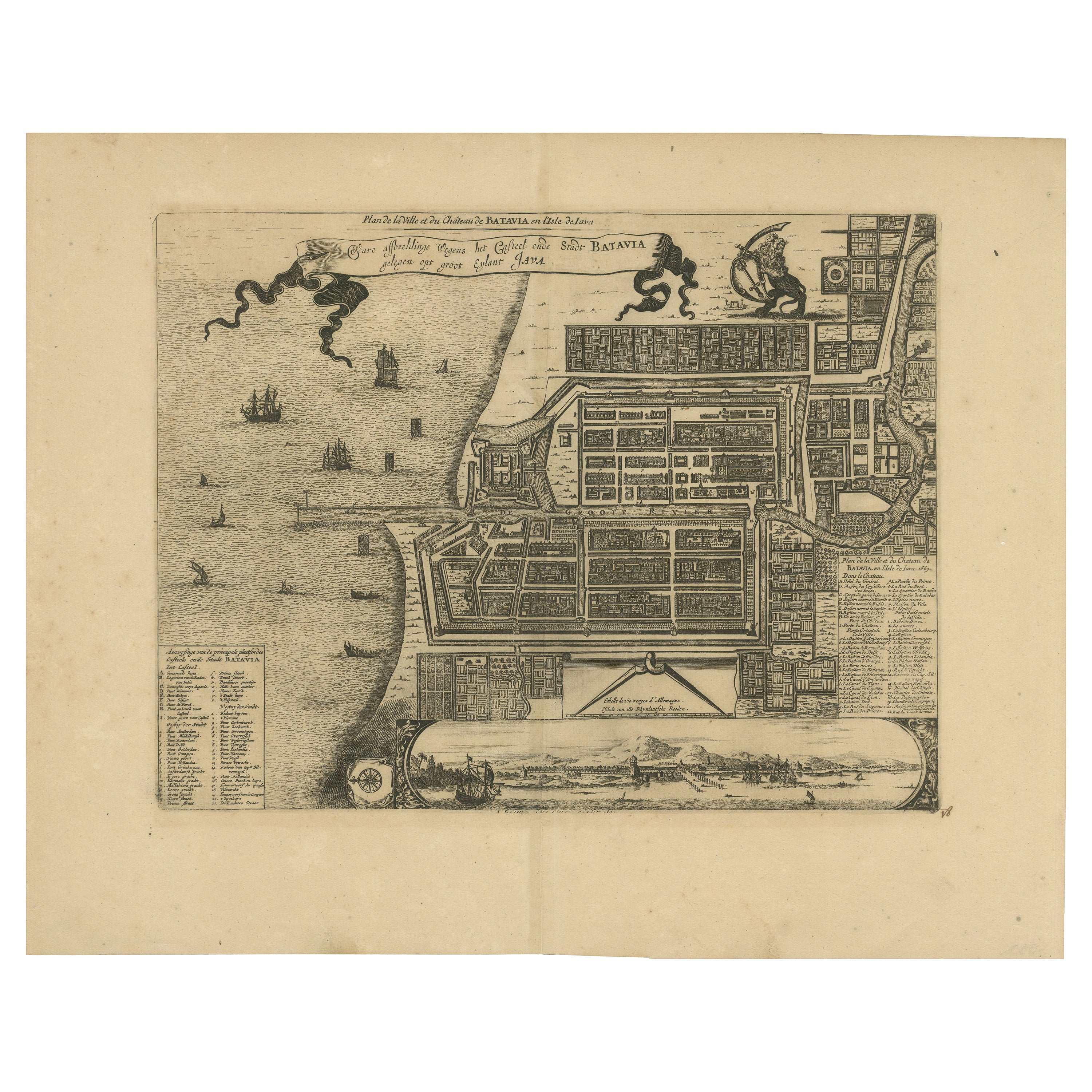
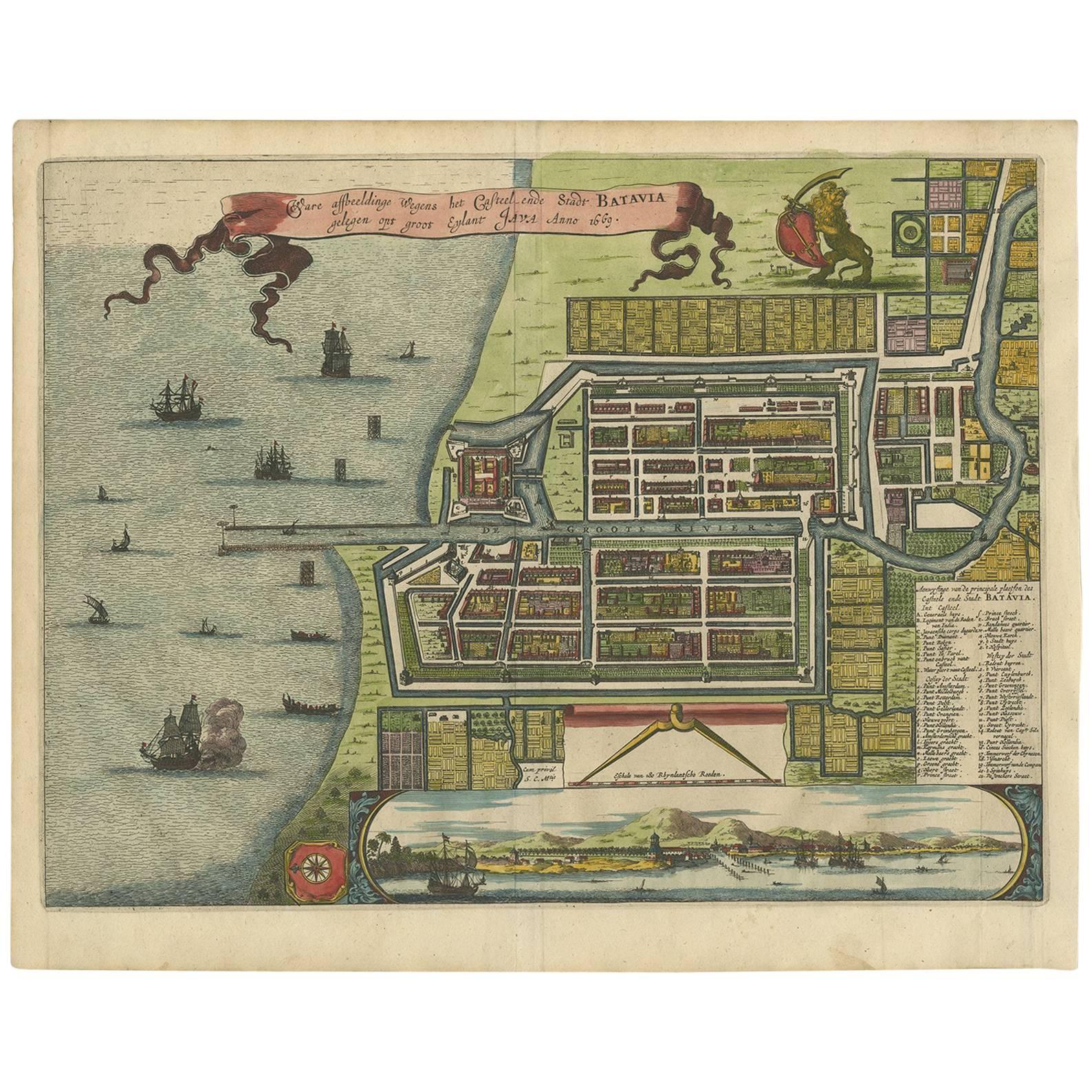
Antique map Batavia titled 'Ware Affbeeldinge wegens het Casteel ende Stadt Batavia'.
Antique print of the castle and city of Batavia on the Island of Java'. Rare edition with English subtitles 'Aneract Portatura of the Castle and Citty Batavia, lying on the great Ilant Java Anno 1669. Probably originating from an edition of 'Gedenkwaerdige gesantschappen der Oost-Indische maatschappy in t Vereenigde Nederland (..)' by A. Montanus.
Artists and Engravers: Arnoldus Montanus (c.1625–1683) was a Dutch teacher and author. He published books on theology, history, and geography.
Condition: Good, toned margins and repair on folding line. Some marginal tears. Please study image carefully.
- Dimensions:Height: 15.36 in (39 cm)Width: 17.52 in (44.5 cm)Depth: 0 in (0.02 mm)
- Materials and Techniques:
- Period:1660-1669
- Date of Manufacture:circa 1669
- Condition:Repaired: Toned margins and repair on folding line. Some marginal tears. Please study image carefully.
- Seller Location:Langweer, NL
- Reference Number:Seller: BG-11644-1 1stDibs: LU3054326706202
About the Seller
5.0
Recognized Seller
These prestigious sellers are industry leaders and represent the highest echelon for item quality and design.
Platinum Seller
Premium sellers with a 4.7+ rating and 24-hour response times
Established in 2009
1stDibs seller since 2017
2,510 sales on 1stDibs
Typical response time: <1 hour
- ShippingRetrieving quote...Shipping from: Langweer, Netherlands
- Return Policy
Authenticity Guarantee
In the unlikely event there’s an issue with an item’s authenticity, contact us within 1 year for a full refund. DetailsMoney-Back Guarantee
If your item is not as described, is damaged in transit, or does not arrive, contact us within 7 days for a full refund. Details24-Hour Cancellation
You have a 24-hour grace period in which to reconsider your purchase, with no questions asked.Vetted Professional Sellers
Our world-class sellers must adhere to strict standards for service and quality, maintaining the integrity of our listings.Price-Match Guarantee
If you find that a seller listed the same item for a lower price elsewhere, we’ll match it.Trusted Global Delivery
Our best-in-class carrier network provides specialized shipping options worldwide, including custom delivery.More From This Seller
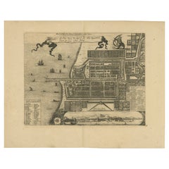
View AllAntique Map of Batavia, Dutch East Indies, Nowadays Jakarta, Indonesia, ca.1669
Located in Langweer, NL
Antique map titled 'Ware afbeeldinge wegens het Casteel ende Stadt Batavia gelegen opt groot Eylant Java Anno 1679. Plan de la Ville et du Chateau de Batavia en l'Isle de Iava. 1679....
Category
Antique 1660s Maps
Materials
Paper
$1,295 Sale Price
20% Off
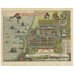
Antique Map of Batavia 'Jakarta', Indonesia by Montanus, circa 1669
Located in Langweer, NL
Antique map Batavia titled 'Ware Affbeeldinge wegens het Casteel ende Stadt Batavia'. Antique print of the castle and city of Batavia on the Island of Java'. Rare edition with Englis...
Category
Antique 17th Century Maps
Materials
Paper

$1,199 Sale Price
20% Off
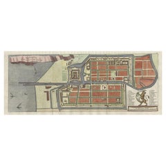
1728 Map of Batavia Castle & City, Java – Van der Aa after 1669
Located in Langweer, NL
1728 Map of Batavia Castle & City, Java – Van der Aa after 1669
This is an original antique copperplate engraving titled “Plan de la Ville et du Château de Batavia en l’Isle de Iava...
Category
Antique Early 18th Century Dutch Maps
Materials
Paper
Antique Map of the City of Batavia by Van der Aa 'c.1730'
Located in Langweer, NL
Antique map titled 'Plan de la Ville et du Chateau de Batavia en l'Isle de Iava - Ware affbeeldinge wegens het Casteel ende Stadt Batavia gelegen op groot Eylant Java'. Detailed plan...
Category
Antique Mid-18th Century Maps
Materials
Paper

$1,151 Sale Price
20% Off
Antique Map of Batavia 'Jakarta, Indonesia' by Montanus, 1679
Located in Langweer, NL
Fine early plan of Batavia (Jakarta), published by Arnoldus Montanus. This map has a vignette at the bottom showing Jakarta from the sea with the volcanoes Mount Gede, Mount Pangrnago and Mount Salak in the background. The plan is based on the earlier, much larger map of Batavia published by Clement de Jonghe...
Category
Antique Late 17th Century Unknown Maps
Materials
Paper
$1,021 Sale Price
20% Off
Antique Map of Batavia, Nowadays Jakarta, the Capital of Indonesia, 1782
Located in Langweer, NL
Antique map Batavia titled 'Batavia zo als het was in den Jaare 1731'. Old map of the city of Batavia (Jakarta) in Indonesia. Originates from 'Batavia, de Hoofdstad van Neerlands O. ...
Category
Antique 18th Century Maps
Materials
Paper
$911 Sale Price
20% Off
You May Also Like
1597 German Map of Alexandria by Georg Braun and Frans Hogenberg
By Georg Braun and Frans Hogenberg
Located in Chapel Hill, NC
1597 Map of Alexandria by Georg Braun and Frans Hogenberg, Germany. From "Civitas Orbis Terrarum", part 2, published in Cologne by Bertram Buchholz. Printed in 2 parts. Title: "Alexa...
Category
Antique 16th Century German Renaissance Maps
Materials
Paper

1633 Map "La Souverainete De Sedan Et De Raucourt, Et La Prevoste Ric0011
Located in Norton, MA
1653 map entitled
"La Souverainete de Sedan et de Raucourt, et la Prevoste de Doncheri,"
Ric0011
Description:
Lovely map centered on Sedan and Doncheri and the Meuze River fr...
Category
Antique 17th Century Dutch Maps
Materials
Paper

1646 Jansson Map Entitled "Procinvia Connactiae, " Ric.a006
Located in Norton, MA
1646 Jansson map entitled
"Procinvia connactiae,"
Ric.a006
Description: The PROVINCE of CONNAVGT 490 x 380From vol 4 of Jansson's Atlas Novus 1646, published in Amsterdam with...
Category
Antique 17th Century Unknown Maps
Materials
Paper

Antique Voc Print Holland Malaysia Old Map Melaka History, 1663
Located in Amsterdam, Noord Holland
From my own collection I offer this impressive Antique print of the city of Malakka
A very interesting piece for collectors . It is an museum piece from the Dutch Institute of Orien...
Category
Antique 17th Century European Paintings
Materials
Paper

$293 Sale Price
20% Off
18th Century Map Engraving - Newport, a Strong Sea-Port Town in Flanders
Located in Corsham, GB
A map of Nieuwpoort, anglicised to 'Newport', in northern Belgium. There is a panorama in the upper quarter depicting major landmarks. Below is a plan of the town, including its strong defences and ships at the port in the lower register. Inscribed with the title in plate to the lower edge, 'Newport a Strong Sea-Port Town...
Category
18th Century More Prints
Materials
Engraving

$269 Sale Price
20% Off
17th-18th Century Siege of Graves Mapping Engraving By Willian III
Located in Kingston, NY
RARE French 17th-18th Century Enhanced Siege of Graves Mapping Engraving BY William III, also widely known as William of Orange,
The Siege of Grave in Dutch Brabant started by Monsie...
Category
Antique 17th Century French Prints
Materials
Paper

More Ways To Browse
English Castle Furniture
Castle Dutch
Indonesia Jakarta
Persian Maps
Antique Map Of The Philippines
Large Map Of Italy
Used Marine Compass
West Indies Colonial
Antique Pamphlets
Sicily Map
Thailand Map
Antique Maps Of Russian Empire
Antique Navigational Tools
Australian Colonial
Antique German Compass
Key Trade Sign
Spanish Galleon
World Map Of Trade Routes