Items Similar to Colourful Antique Map of England and Wales Divided in Counties, 1854


Want more images or videos?
Request additional images or videos from the seller
1 of 5
Colourful Antique Map of England and Wales Divided in Counties, 1854
$614.36
$767.9420% Off
£460.50
£575.6220% Off
€520
€65020% Off
CA$844.02
CA$1,055.0220% Off
A$942.27
A$1,177.8420% Off
CHF 493.73
CHF 617.1720% Off
MX$11,534.29
MX$14,417.8720% Off
NOK 6,270.44
NOK 7,838.0420% Off
SEK 5,912.22
SEK 7,390.2820% Off
DKK 3,958.43
DKK 4,948.0420% Off
Shipping
Retrieving quote...The 1stDibs Promise:
Authenticity Guarantee,
Money-Back Guarantee,
24-Hour Cancellation
About the Item
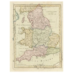
Antique map titled 'A Map Shewing the Places in England & Wales Sending Members to Parliament with the numbers returned, divisions of counties and population, places of county election, polling places and boroughs disfranchised according to the reform and boundary act.'
A map of England and Wales, divided in counties. A small table shows the populations of various cities. From James Wyld's 'A New General Atlas of Modern Geography.', published by James Wyld. Geographer to Her Majesty Charing Cross East. 1854.
Artists and Engravers: Cartographer: James Wyld. James Wyld (1812-1887) was a British publisher and cartographer. His greatest geographical achievement was Wyld's Great Globe, exhibited in Leicester Square between 1851 and 1862. The globe, sixty feet high and lighted with gas, was at that point the largest ever constructed. He was geographer to Queen Victoria and H.R.H. Prince Albert.
- Dimensions:Height: 21.38 in (54.3 cm)Width: 17.64 in (44.8 cm)Depth: 0 in (0.01 mm)
- Materials and Techniques:
- Period:
- Date of Manufacture:1854
- Condition:Condition: Very good, given age. A small brown stain in the right margin. A small tear in the right margin (not affecting image). General age-related toning and/or occasional minor defects from handling. Please study scan carefully.
- Seller Location:Langweer, NL
- Reference Number:Seller: PCT-565341stDibs: LU3054326172832
About the Seller
5.0
Recognized Seller
These prestigious sellers are industry leaders and represent the highest echelon for item quality and design.
Platinum Seller
Premium sellers with a 4.7+ rating and 24-hour response times
Established in 2009
1stDibs seller since 2017
2,511 sales on 1stDibs
Typical response time: <1 hour
- ShippingRetrieving quote...Shipping from: Langweer, Netherlands
- Return Policy
Authenticity Guarantee
In the unlikely event there’s an issue with an item’s authenticity, contact us within 1 year for a full refund. DetailsMoney-Back Guarantee
If your item is not as described, is damaged in transit, or does not arrive, contact us within 7 days for a full refund. Details24-Hour Cancellation
You have a 24-hour grace period in which to reconsider your purchase, with no questions asked.Vetted Professional Sellers
Our world-class sellers must adhere to strict standards for service and quality, maintaining the integrity of our listings.Price-Match Guarantee
If you find that a seller listed the same item for a lower price elsewhere, we’ll match it.Trusted Global Delivery
Our best-in-class carrier network provides specialized shipping options worldwide, including custom delivery.More From This Seller
View AllAntique Map of England and Wales by Johnson '1872'
Located in Langweer, NL
Antique map titled 'Johnson's England and Wales'. Original map of England and Wales. This map originates from 'Johnson's New Illustrated Family Atlas of the World' by A.J. Johnson. P...
Category
Antique Late 19th Century Maps
Materials
Paper

$239 Sale Price
20% Off
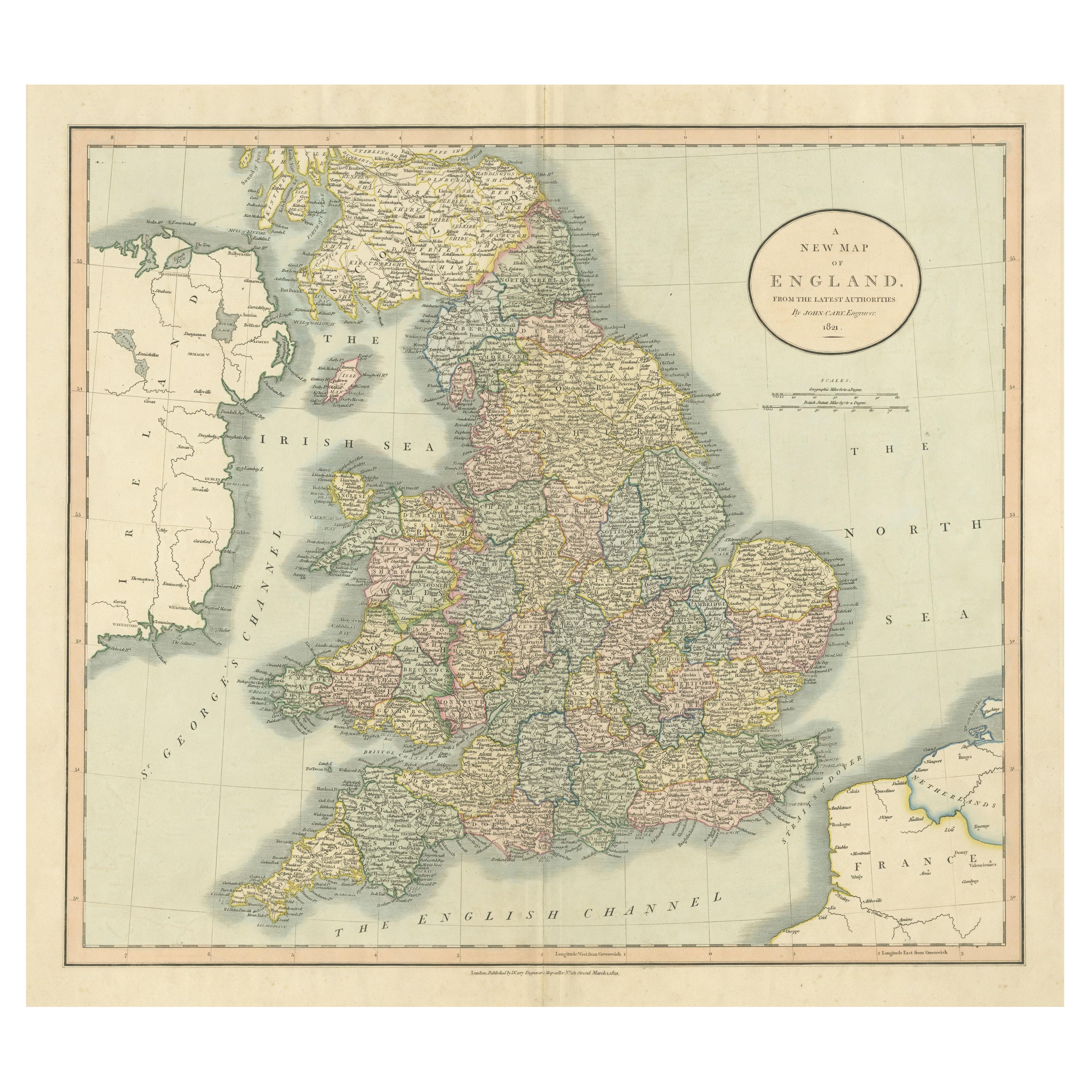
Large Antique Map of England Hand Colored by Counties
Located in Langweer, NL
Antique map titled 'A New Map of England from the latest Authorities'. Large map of England, hand colored by counties. Published by John Cary, 1821.
John Cary (1755-1835) was a B...
Category
Antique Early 19th Century Maps
Materials
Paper
$510 Sale Price
20% Off
Antique Map of England and Wales, Also Showing the English Channel
Located in Langweer, NL
Antique map titled 'England and Wales'. Original antique map of England and Wales. Drawn and engraved by J. Dower. Originates from 'A General Descriptive Atlas Of The Earth, Containi...
Category
Antique Mid-19th Century Maps
Materials
Paper

$141 Sale Price
20% Off
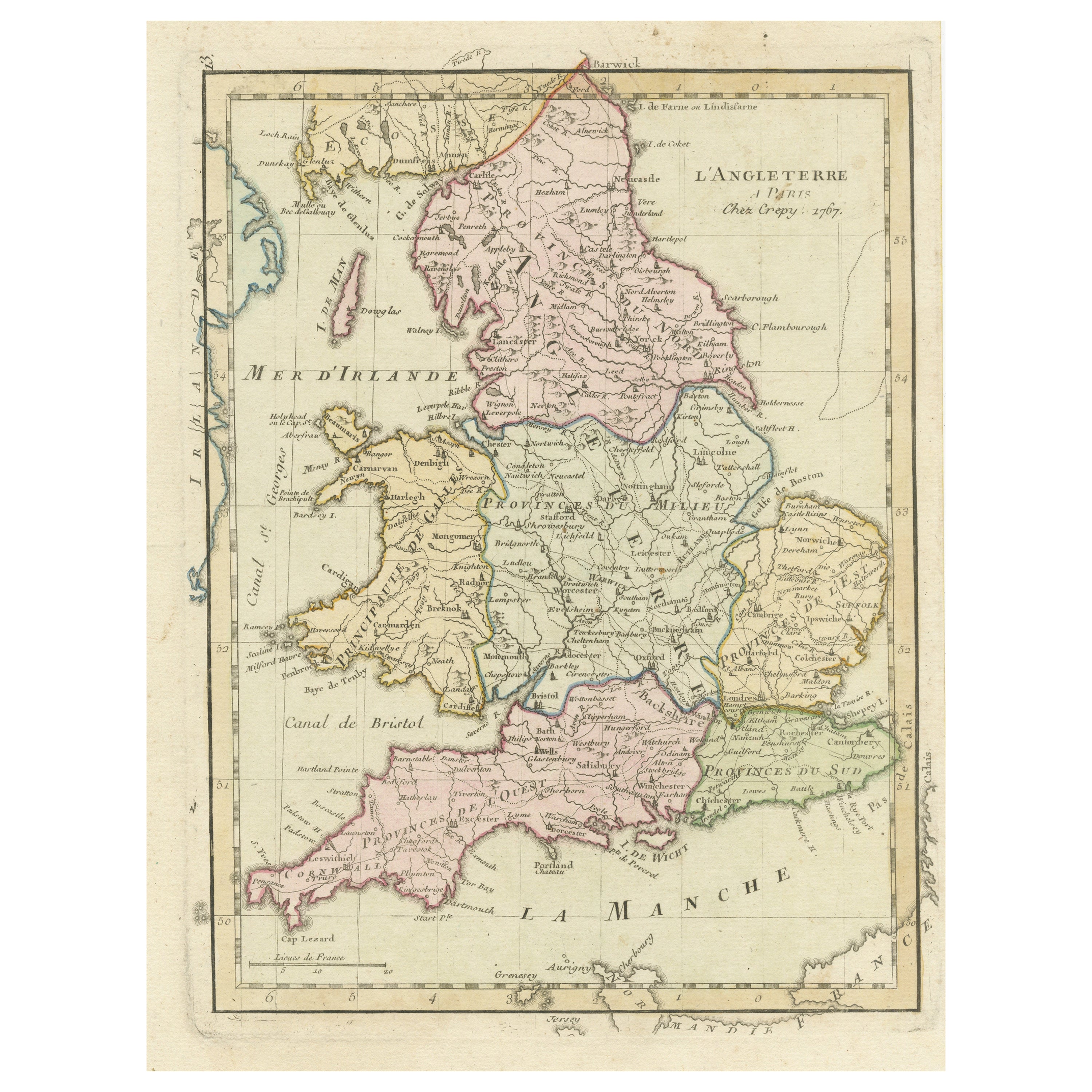
Antique Map of England with Contemporary Hand Coloring
Located in Langweer, NL
Antique map titled 'l'Angleterre'. Original antique map of England, with original/contemporary hand coloring. Published by Crepy, circa 1767.
Category
Antique Late 18th Century Maps
Materials
Paper
$245 Sale Price
20% Off
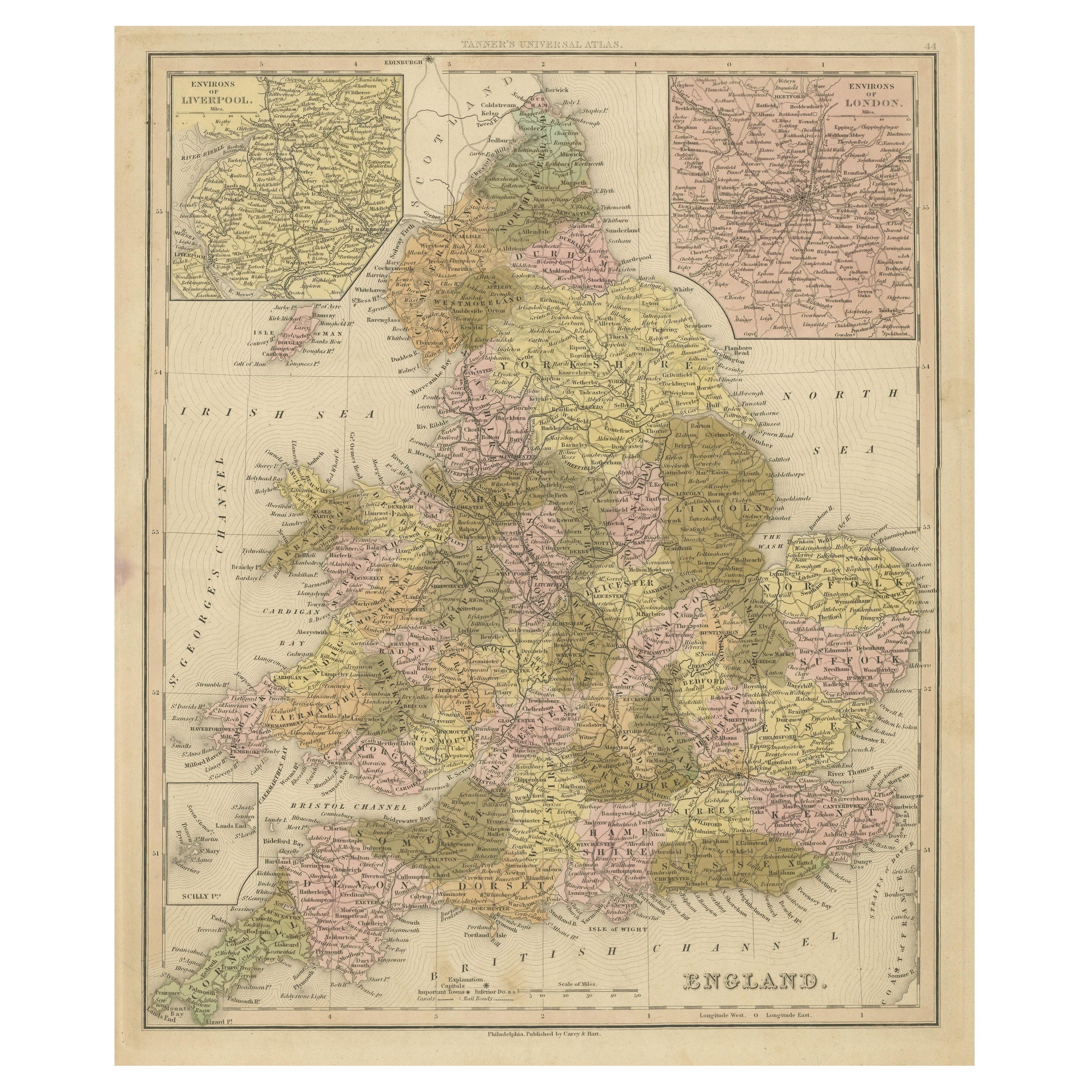
Antique Map of England with Inset Maps of the Region of Liverpool and London
Located in Langweer, NL
Antique map titled 'England'. Original antique map of England, with two inset maps of the region of Liverpool and London. This map originates from Tanner's 'Universal Atlas'. Publish...
Category
Antique Mid-19th Century Maps
Materials
Paper

$359 Sale Price
20% Off
Antique Map of England & Wales by Wyld '1845'
Located in Langweer, NL
Antique map titled 'England & Wales'. Original antique map of England & Wales. This map originates from 'An Atlas of the World, Comprehending Se...
Category
Antique Mid-19th Century Maps
Materials
Paper

$135 Sale Price
24% Off
You May Also Like
England and Wales, Northern Part. Century Atlas antique vintage map
Located in Melbourne, Victoria
'The Century Atlas. England and Wales, Northern Part'
Original antique map, 1903.
Central fold as issued. Map name and number printed on the reverse corners.
Sheet 29.5cm by 40cm.
Category
Early 20th Century Victorian More Prints
Materials
Lithograph

Original Antique English County Map, Nottinghamshire, J & C Walker, 1851
Located in St Annes, Lancashire
Great map of Nottinghamshire
Original colour
By J & C Walker
Published by Longman, Rees, Orme, Brown & Co. 1851
Unframed.
Category
Antique 1850s English Other Maps
Materials
Paper

Original Antique English County Map, Herefordshire, J & C Walker, 1851
Located in St Annes, Lancashire
Great map of Herefordshire
Original colour
By J & C Walker
Published by Longman, Rees, Orme, Brown & Co. 1851
Unframed.
Category
Antique 1850s English Other Maps
Materials
Paper

England, Scotland & Ireland: A Hand Colored Map of Great Britain by Tirion
By Isaak Tirion
Located in Alamo, CA
This is a hand-colored double page copperplate map of Great Britain entitled "Nieuwe Kaart van de Eilanden van Groot Brittannien Behelzende de Kon...
Category
Antique Mid-18th Century Dutch Maps
Materials
Paper

Original Antique English County Map, Kent. J & C Walker, 1851
Located in St Annes, Lancashire
Great map of Kent
Original colour
By J & C Walker
Published by Longman, Rees, Orme, Brown & Co. 1851
Unframed.
Category
Antique 1850s English Other Maps
Materials
Paper

Original Antique English County Map, Derbyshire, J & C Walker, 1851
Located in St Annes, Lancashire
Great map of Derbyshire
Original colour
By J & C Walker
Published by Longman, Rees, Orme, Brown & Co. 1851
Unframed.
Category
Antique 1850s English Other Maps
Materials
Paper

More Ways To Browse
Wales And Wales Furniture
Queen Victoria Of England
Antique Prince Albert
Paper Globe Light
Queen Victoria Tables
Prince Of Wales Table
Antique Railroad Collectibles
Blaeu World Map
Roman Empire Map
Antique Map Of Middle East
Caribbean Map
Antique Map Of Egypt
Antique Map Ortelius
Antique Farm Antiques Collectibles
Antique Galleon
Biblical Maps
Medieval Capital
Civil War Map