Items Similar to Decorative Original Antique Map of Normandy, France
Want more images or videos?
Request additional images or videos from the seller
1 of 11
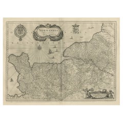
Decorative Original Antique Map of Normandy, France
$901.78
$1,127.2320% Off
£670.84
£838.5420% Off
€752
€94020% Off
CA$1,234.85
CA$1,543.5620% Off
A$1,372.98
A$1,716.2320% Off
CHF 716.90
CHF 896.1220% Off
MX$16,712.56
MX$20,890.6920% Off
NOK 9,147.29
NOK 11,434.1120% Off
SEK 8,570.57
SEK 10,713.2120% Off
DKK 5,724.56
DKK 7,155.7020% Off
Shipping
Retrieving quote...The 1stDibs Promise:
Authenticity Guarantee,
Money-Back Guarantee,
24-Hour Cancellation
About the Item
Original antique map titled 'Ducato D'Normandie Scala di Miglia d'Italia'. Very decorative map of Normandy, with a fine title cartouche featuring Leda in her carriage drawn by swans. On verso are plans of Le Havre and Dieppe.
Published by Vincenzo Coronelli, c.1690. Vincenzo Maria Coronelli, a Venetian scholar and Minorite Friar, was one of the most celebrated map and globe makers of his era. Cornelli produced more than one hundred terrestrial and celestial globes, several hundred maps, and a wealth of cartographic publications. In 1683, he completed the Marly Globes for Louis XIV, the largest and most magnificent globes ever made. In 1684 he founded the Academia Cosmografica degli Argonauti, the first geographical society, and was appointed Cosmographer of the Republic of Venice.
- Dimensions:Height: 19.3 in (49 cm)Width: 26.5 in (67.3 cm)Depth: 0.02 in (0.5 mm)
- Materials and Techniques:Paper,Engraved
- Place of Origin:
- Period:Late 17th Century
- Date of Manufacture:circa 1690
- Condition:Wear consistent with age and use. General age-related toning, minor wear. Later hand coloring. Italian text on verso and 2 other small black and white maps (Havre de Grace & Dieppe). Please study image carefully.
- Seller Location:Langweer, NL
- Reference Number:Seller: BG-132331stDibs: LU3054331151512
About the Seller
5.0
Recognized Seller
These prestigious sellers are industry leaders and represent the highest echelon for item quality and design.
Platinum Seller
Premium sellers with a 4.7+ rating and 24-hour response times
Established in 2009
1stDibs seller since 2017
2,511 sales on 1stDibs
Typical response time: <1 hour
- ShippingRetrieving quote...Shipping from: Langweer, Netherlands
- Return Policy
Authenticity Guarantee
In the unlikely event there’s an issue with an item’s authenticity, contact us within 1 year for a full refund. DetailsMoney-Back Guarantee
If your item is not as described, is damaged in transit, or does not arrive, contact us within 7 days for a full refund. Details24-Hour Cancellation
You have a 24-hour grace period in which to reconsider your purchase, with no questions asked.Vetted Professional Sellers
Our world-class sellers must adhere to strict standards for service and quality, maintaining the integrity of our listings.Price-Match Guarantee
If you find that a seller listed the same item for a lower price elsewhere, we’ll match it.Trusted Global Delivery
Our best-in-class carrier network provides specialized shipping options worldwide, including custom delivery.More From This Seller
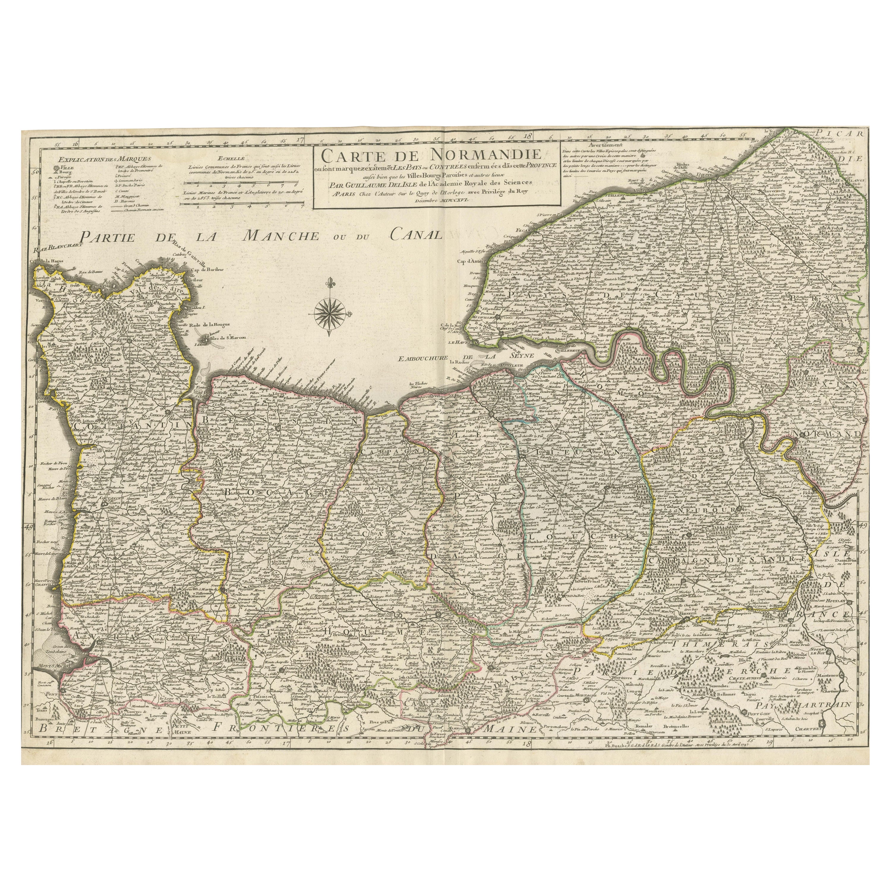
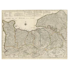
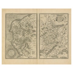
View AllOriginal Antique Map of Normandy, France
Located in Langweer, NL
Antique map titled 'Carte de Normandie (..)'. Attractive map of Normandy, France. it depicts the former French Duchy of Normandy, covers the region fro...
Category
Antique Mid-18th Century Maps
Materials
Paper
$757 Sale Price
20% Off
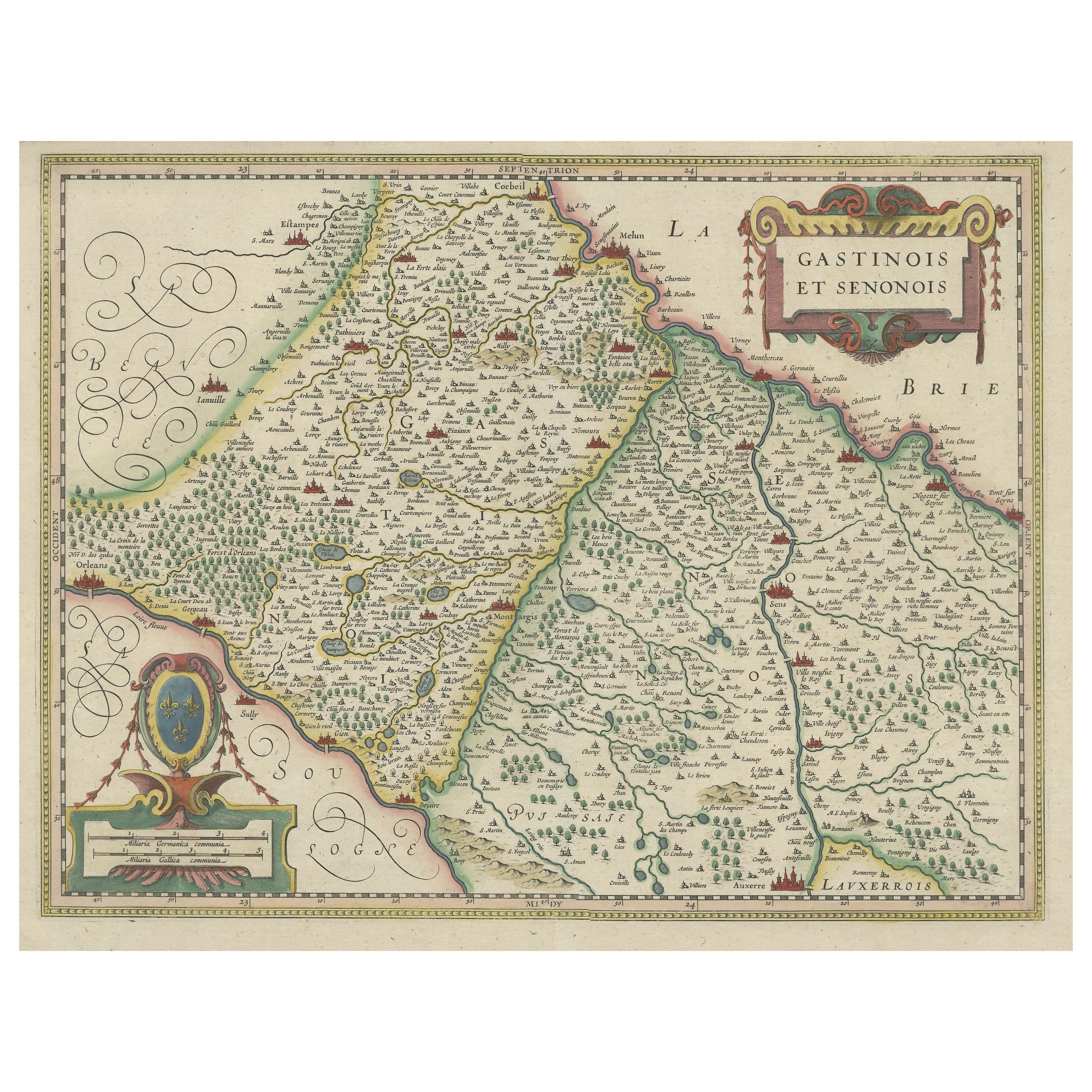
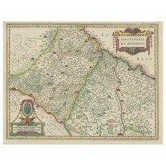
Original Antique Regional Map of France with Orleans, Auxerre and Montargis
By Johannes Janssonius
Located in Langweer, NL
Original antique map titled 'Gastinois et Senonois'. Beautiful regional map of France. With Corbeil in the north, Pont sur Seyne in the east, Auxerre in the south, and Orleans in the...
Category
Antique Mid-17th Century Maps
Materials
Paper
$805 Sale Price
20% Off
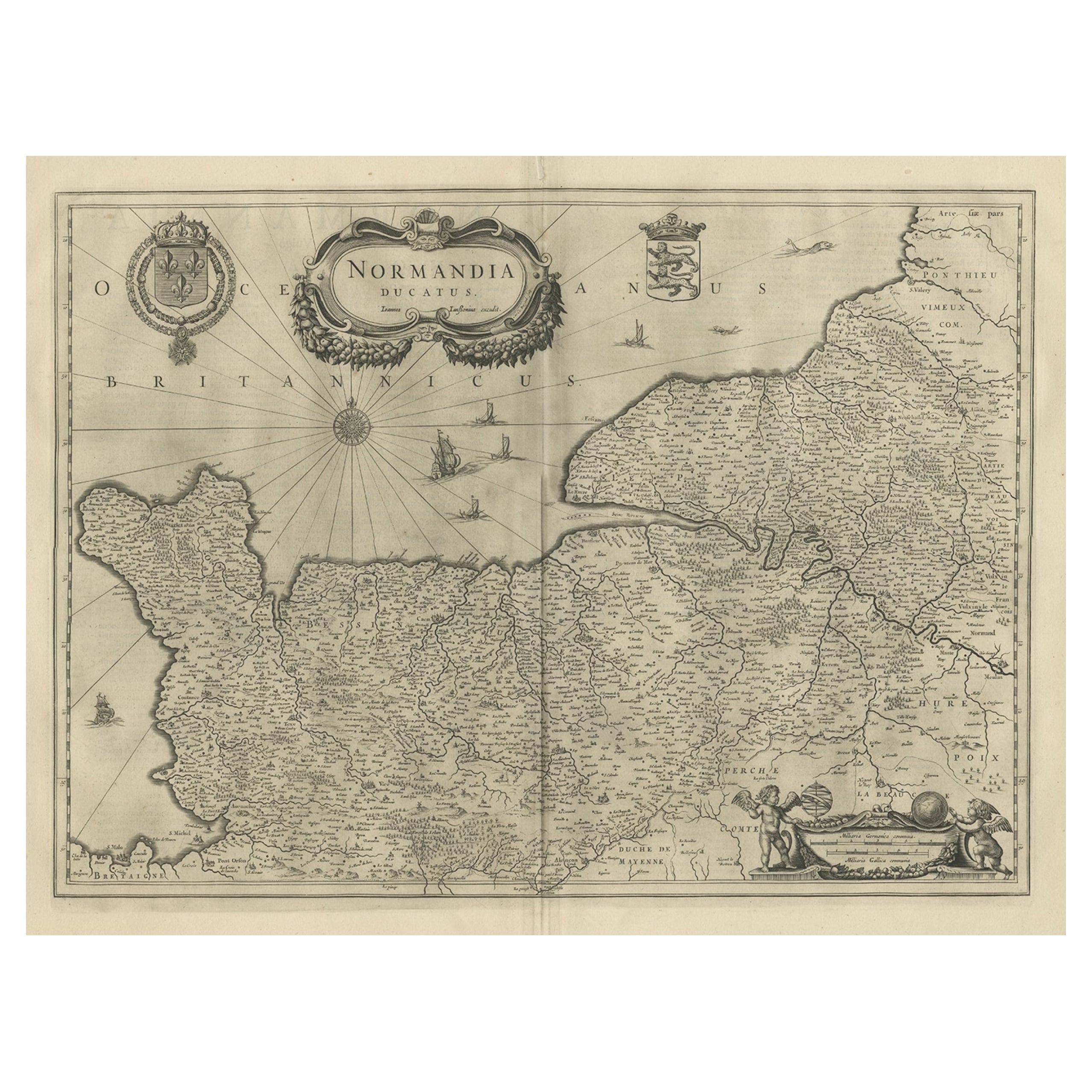
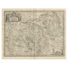
Antique Map of Normandy by Janssonius, 1657
Located in Langweer, NL
Antique map of France titled 'Normandia Ducatus'. Decorative map of the Normandy region, including decorative cartouche, sailing ships and compass rose. This map originates from 'Atl...
Category
Antique 17th Century Maps
Materials
Paper
$343 Sale Price
20% Off
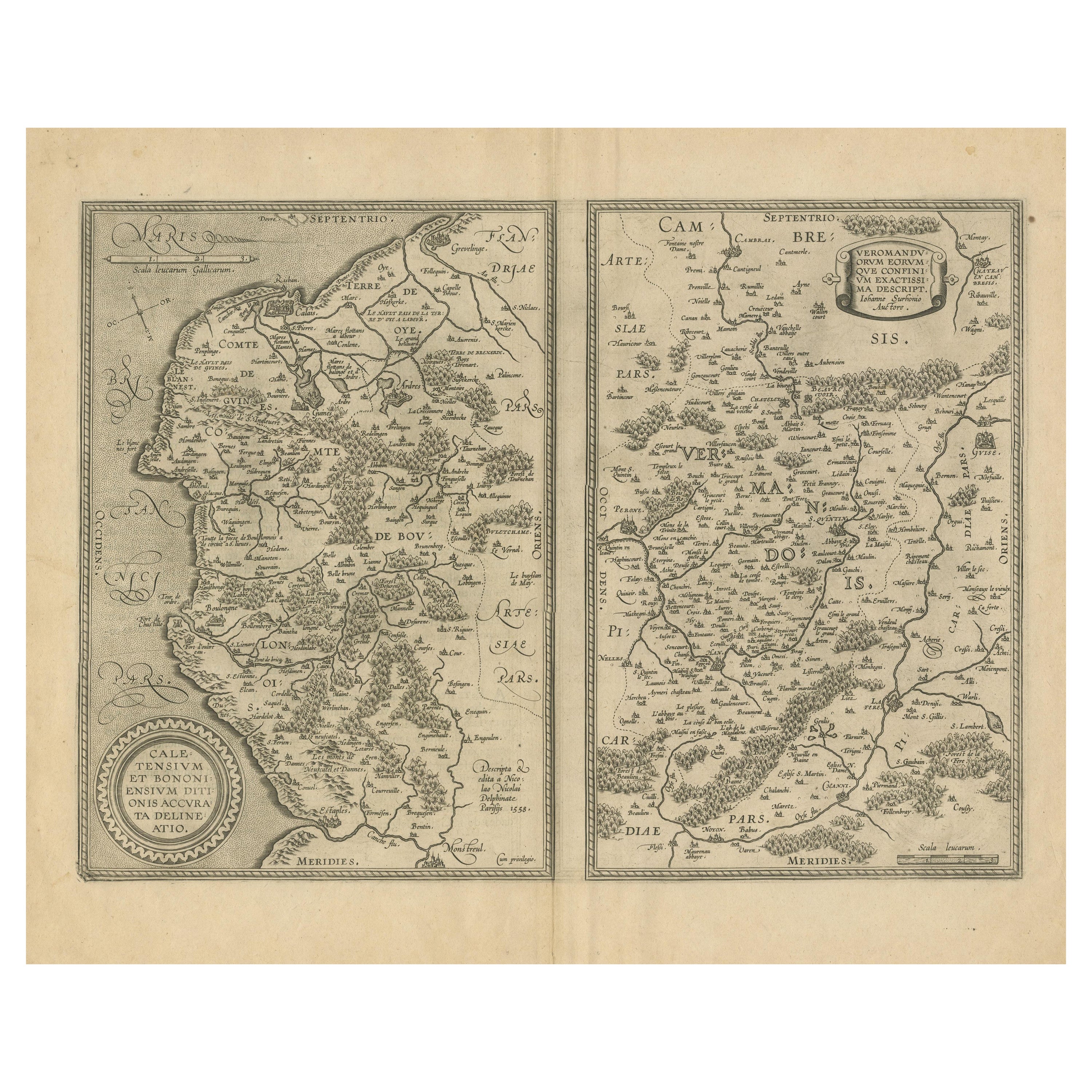
Antique Map of the Coastline Between Calais and Estaples and Northern France
Located in Langweer, NL
Antique map titled 'Caletensium et Bononiensium Ditionis Accurata Delinatio [on sheet with] Veromanduorum Eorumque Confinium Exactissima Discriptio'. Two maps on a folio sheet. Calentensium covers the coastline between Calais and Estaples based in part on a four-sheet map by Nicolas de Nicolay...
Category
Antique Early 17th Century Maps
Materials
Paper
$326 Sale Price
20% Off
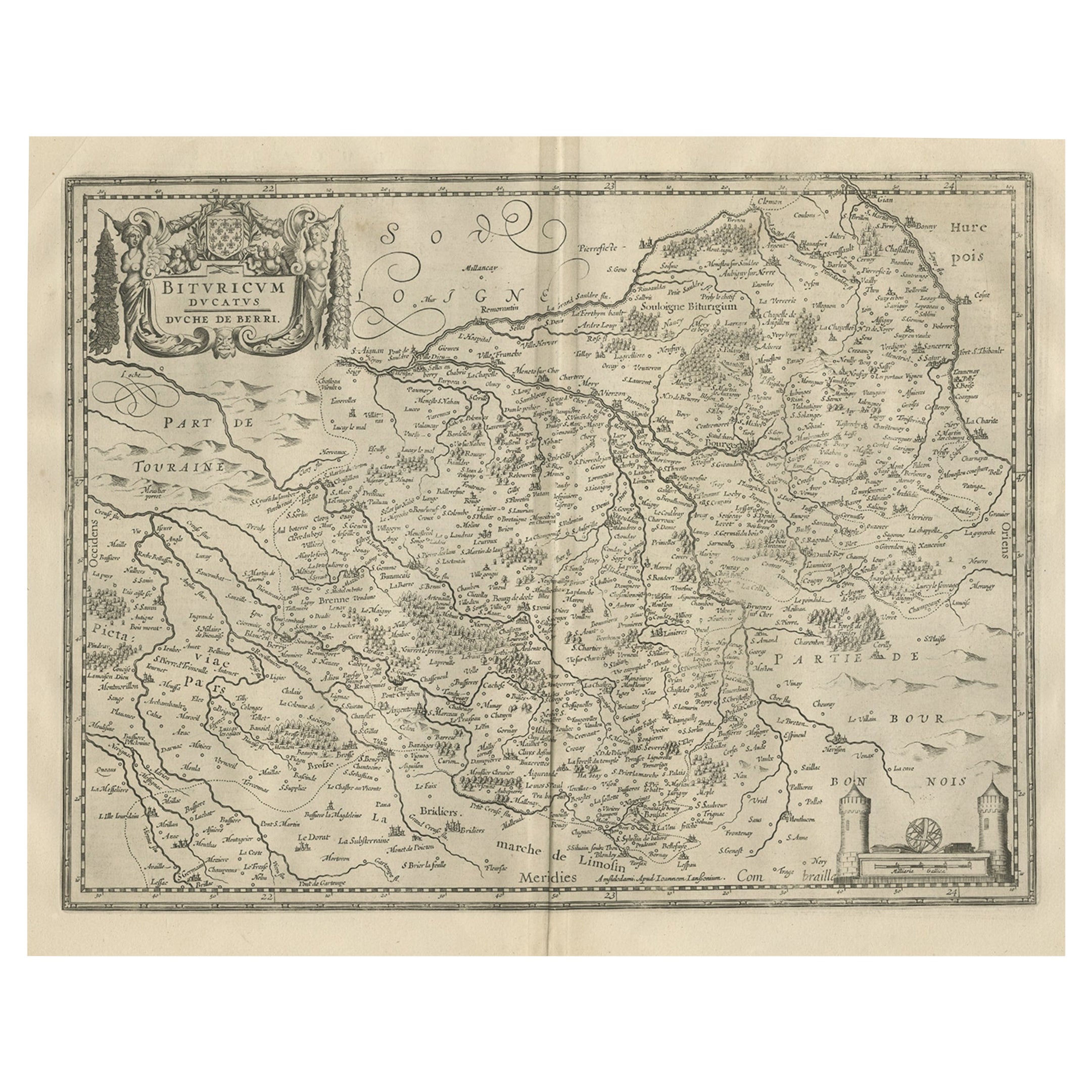
Decorative Antique Map of the Berry Region, France, 1657
Located in Langweer, NL
Antique map of France titled 'Bituricum Ducatus - Duche de Berri'.
Decorative map of the Berry region, France. Berry is a region located in the center of France. It was a provinc...
Category
Antique 1650s Maps
Materials
Paper
$537 Sale Price
20% Off
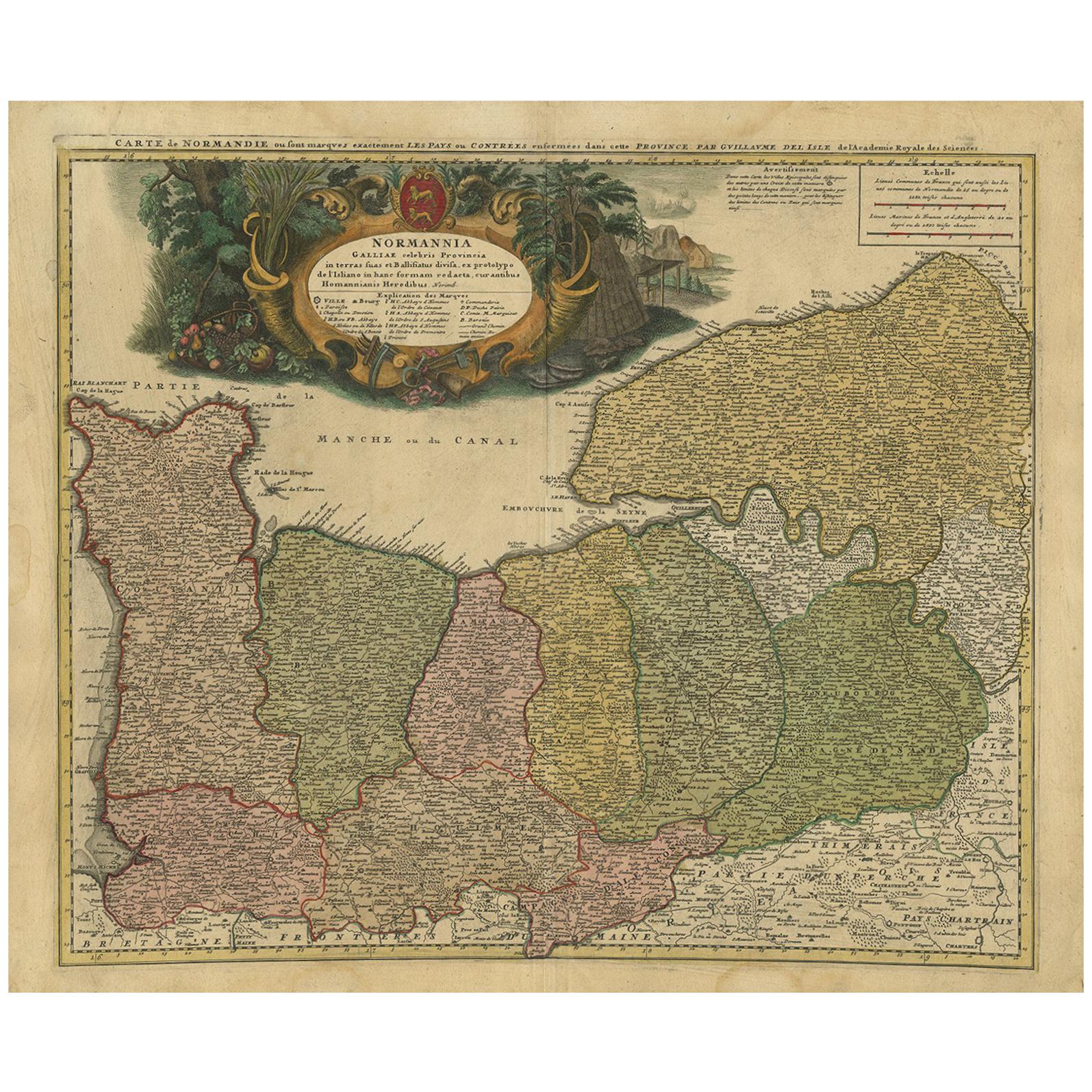
Antique Map Normandy 'France' by Homann Heirs, Published in c.1740
By Homann Heirs
Located in Langweer, NL
Antique map France titled 'Normannia Galliae celebris Provincia in terras suas Ballisiatus (..)'.
Decorative regional map of Normandy, France, circa ...
Category
Antique Mid-18th Century German Maps
Materials
Paper
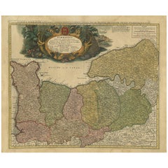
$767 Sale Price
5% Off
You May Also Like
1752 Vaugoundy Map of Flanders : Belgium, France, and the Netherlands, Ric.a002
Located in Norton, MA
Large Vaugoundy Map of Flanders:
Belgium, France, and the Netherlands
Colored -1752
Ric.a002
Description: This is a 1752 Didier Robert de Vaugondy map of Flanders. The map de...
Category
Antique 17th Century Unknown Maps
Materials
Paper

The Normandy Region of France: A 17th C. Hand-colored Map by Sanson and Jaillot
By Nicolas Sanson
Located in Alamo, CA
This large hand-colored map entitled "Le Duché et Gouvernement de Normandie divisée en Haute et Basse Normandie en divers Pays; et par evêchez, avec le Gouvernement General du Havre ...
Category
Antique 1690s French Maps
Materials
Paper

Prussia, Poland, N. Germany, Etc: A Hand-colored 17th Century Map by Janssonius
By Johannes Janssonius
Located in Alamo, CA
This is an attractive hand-colored copperplate engraved 17th century map of Prussia entitled "Prussia Accurate Descripta a Gasparo Henneberg Erlichensi", published in Amsterdam by Joannes Janssonius in 1664. This very detailed map from the golden age of Dutch cartography includes present-day Poland, Latvia, Lithuania, Estonia and portions of Germany. This highly detailed map is embellished by three ornate pink, red, mint green and gold...
Category
Antique Mid-17th Century Dutch Maps
Materials
Paper

17th Century Hand-Colored Map of a Region in West Germany by Janssonius
By Johannes Janssonius
Located in Alamo, CA
This attractive highly detailed 17th century original hand-colored map is entitled "Archiepiscopatus Maghdeburgensis et Anhaltinus Ducatus cum terris adjacentibus". It was published ...
Category
Antique Mid-17th Century Dutch Maps
Materials
Paper

Antique Map of France
Located in Dallas, TX
Nice antique map of France in wood frame. This would make a great gift for a collector. A wonderful accessory!
Category
Early 20th Century Decorative Art
Materials
Glass, Wood, Paper

$1,760
Antique Berkshire Map, English County, Framed Engraving, Cartography, Lithograph
Located in Hele, Devon, GB
This is an antique county map of Berkshire. An English, framed atlas engraving of cartographic interest, dating to the mid 19th century and later.
Superb lithography of Berkshire a...
Category
Antique Mid-19th Century British Victorian Maps
Materials
Glass, Wood, Paper

More Ways To Browse
Celestial Globe
Antique Celestial Globe
French Terrestrial Globe
Celestial Map
Antique Terrestrial Globes
Coronelli Globe
Antique Map Of Cornwall
Coronelli Globe
Vintage Bartholomew Maps
Antique Alabama Map
Cape Cod Map
Goa France
Antique Planisphere
Charlotte Reine
Dutch Malacca
Gabon Antique Map
J And C Bavaria
Map Of Barbados