Items Similar to Denmark & German Empire – Antique Map by A.K. Johnston, 1882 Atlas Edition

Video Loading
Want more images or videos?
Request additional images or videos from the seller
1 of 11
Denmark & German Empire – Antique Map by A.K. Johnston, 1882 Atlas Edition
$226.43
$283.0320% Off
£169.49
£211.8620% Off
€192
€24020% Off
CA$311.63
CA$389.5420% Off
A$347.34
A$434.1820% Off
CHF 182.24
CHF 227.8020% Off
MX$4,241.61
MX$5,302.0220% Off
NOK 2,307.54
NOK 2,884.4220% Off
SEK 2,180.97
SEK 2,726.2220% Off
DKK 1,461.64
DKK 1,827.0520% Off
About the Item
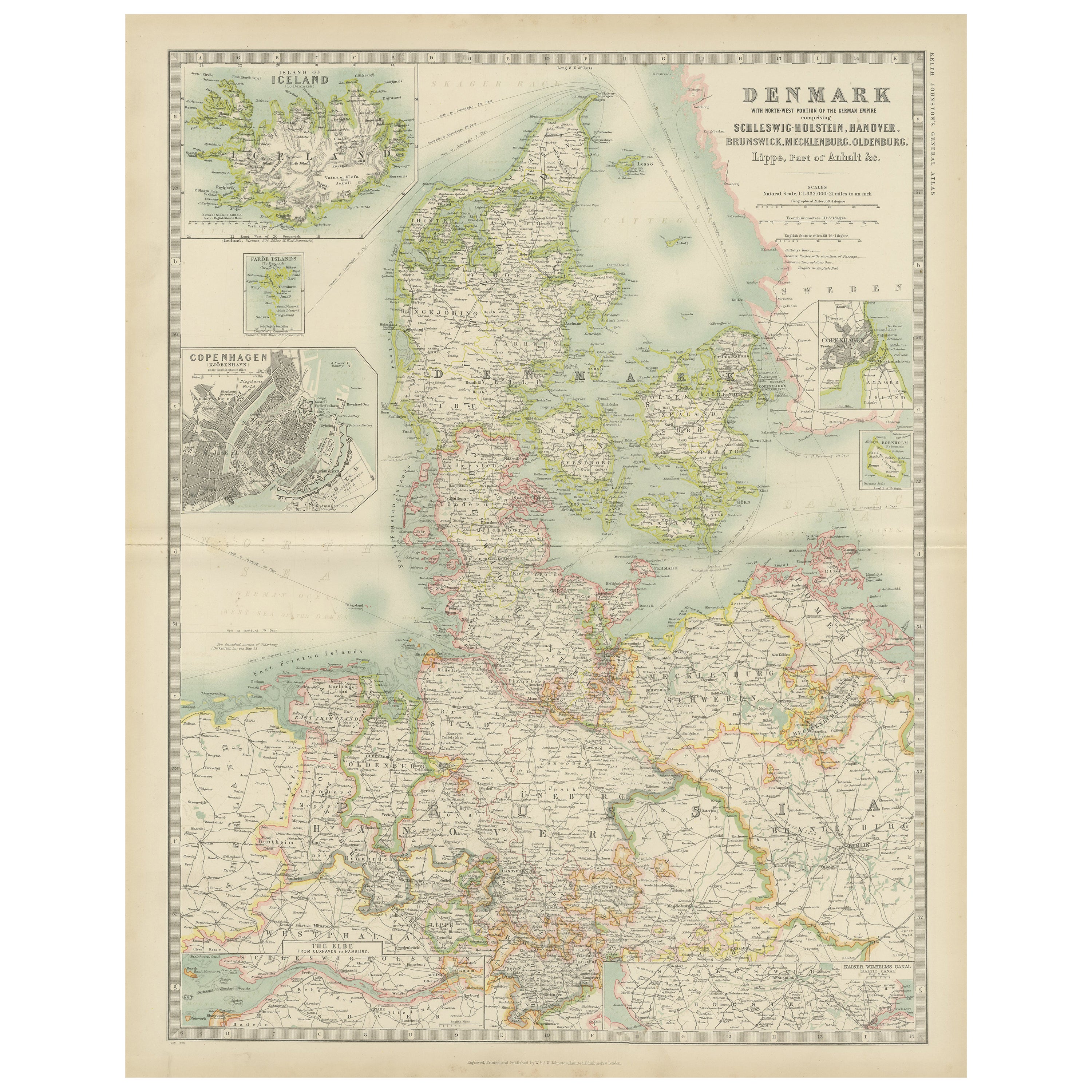
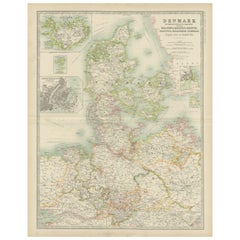
Denmark & German Empire – Antique Map by A.K. Johnston, 1882 Atlas Edition
This detailed antique map titled Denmark with North-West portion of the German Empire comprising Schleswig-Holstein, Hanover, Brunswick, Mecklenburgh, Oldenburg, Anhalt, Lippe &c. offers a comprehensive view of Denmark and adjacent German territories as understood in the late 19th century. The map was published in 1882 by the renowned Scottish firm W. and A.K. Johnston for The Royal Atlas of Modern Geography, a landmark work reflecting the latest discoveries and political boundaries of the era.
Drawn by Alexander Keith Johnston LLD, a leading geographer of his time, the map presents Denmark in fine detail, highlighting provinces, towns, railway lines, rivers, and topographical contours. Insets show the island of Iceland, a detailed plan of Copenhagen, and the Elbe River. The map reflects the geopolitical structure shortly after the Second Schleswig War (1864), in which Denmark lost Schleswig and Holstein to Prussia and Austria—making this a historically significant piece.
The Johnston brothers’ work is celebrated for combining aesthetic clarity with scientific accuracy, and this map exemplifies that standard. With clean copperplate engraving and original hand-coloring to distinguish borders and regions, it would have been an indispensable reference for educational institutions, libraries, and informed households of the Victorian period.
This piece is especially attractive to collectors interested in Denmark, Northern Germany, or 19th-century British atlas cartography.
Condition report: Good condition overall with general age-related toning. Central horizontal fold line as issued, has split along fold. No significant tears or staining. Blank verso.
Framing tips: A classic maple or walnut frame with a light ivory or grey mat works well to complement the subdued pastel tones. Consider UV-protective glass to maintain the color quality over time.
Date: 1882
Overall size: 49.6 x 61.5 cm.
Image size: 44.3 x 57.2 cm.
- Dimensions:Height: 24.22 in (61.5 cm)Width: 19.53 in (49.6 cm)Depth: 0 in (0.01 mm)
- Materials and Techniques:
- Place of Origin:
- Period:
- Date of Manufacture:1882
- Condition:Good condition overall with general age-related toning. Central horizontal fold line as issued, has split along fold. No significant tears or staining. Blank verso.
- Seller Location:Langweer, NL
- Reference Number:Seller: BG-11823-171stDibs: LU3054326159812
About the Seller
5.0
Recognized Seller
These prestigious sellers are industry leaders and represent the highest echelon for item quality and design.
Platinum Seller
Premium sellers with a 4.7+ rating and 24-hour response times
Established in 2009
1stDibs seller since 2017
2,517 sales on 1stDibs
Typical response time: <1 hour
- ShippingRetrieving quote...Shipping from: Langweer, Netherlands
- Return Policy
Authenticity Guarantee
In the unlikely event there’s an issue with an item’s authenticity, contact us within 1 year for a full refund. DetailsMoney-Back Guarantee
If your item is not as described, is damaged in transit, or does not arrive, contact us within 7 days for a full refund. Details24-Hour Cancellation
You have a 24-hour grace period in which to reconsider your purchase, with no questions asked.Vetted Professional Sellers
Our world-class sellers must adhere to strict standards for service and quality, maintaining the integrity of our listings.Price-Match Guarantee
If you find that a seller listed the same item for a lower price elsewhere, we’ll match it.Trusted Global Delivery
Our best-in-class carrier network provides specialized shipping options worldwide, including custom delivery.More From This Seller
View AllAntique Map of Denmark by Johnston '1909'
Located in Langweer, NL
Antique map titled 'Denmark'. Original antique map of Denmark. With inset maps of Iceland, Faroe Island, and Copenhagen. This map originates from the ‘Royal Atlas of Modern Geography...
Category
Early 20th Century Maps
Materials
Paper
$235 Sale Price
20% Off
Denmark & Schleswig-Holstein Map with Copenhagen & Iceland Insets – 1865 Atlas
Located in Langweer, NL
Denmark & Schleswig-Holstein Map with Copenhagen & Iceland Insets – 1865 Atlas
This detailed antique map titled Denmark and the Duchies Schleswig, Holstein & Lauenburg; Hanover, Bru...
Category
Antique Mid-19th Century Maps
Materials
Paper

$259 Sale Price
20% Off
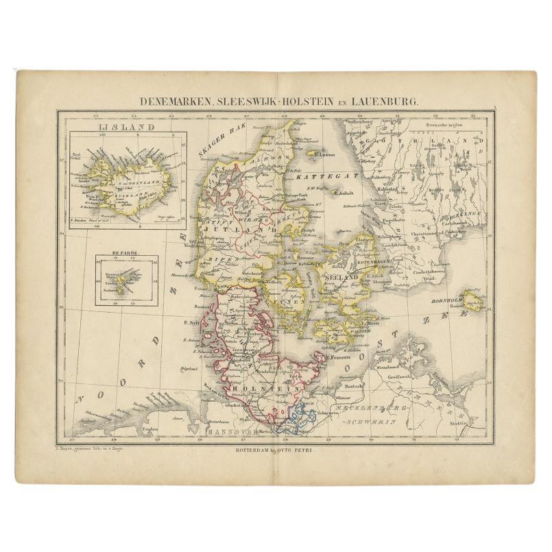
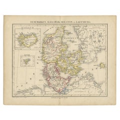
Antique Map of Denmark with Insets of Iceland and the Faroe Islands, c.1873
Located in Langweer, NL
Antique map titled 'Denemarken, Sleeswijk-Holstein en Lauenburg'. Old map depicting Denmark, with inset maps of Iceland and the Faroe Islands. This map originates from 'School-Atlas ...
Category
Antique 19th Century Maps
Materials
Paper
$150 Sale Price
20% Off
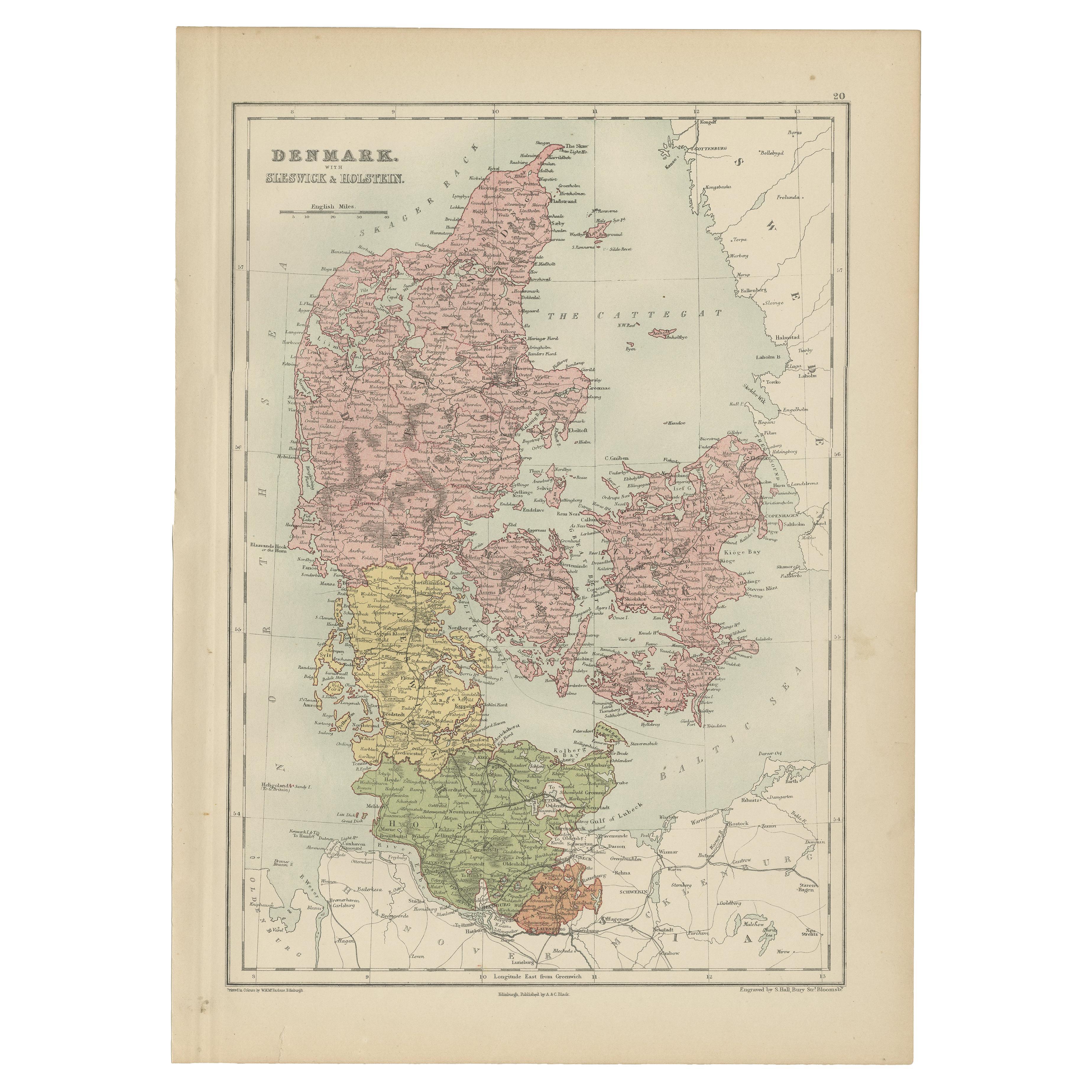
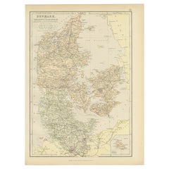
Antique Map of Denmark with Schleswig & Holstein by A & C. Black, 1870
Located in Langweer, NL
Antique map titled 'Denmark with Schleswig & Holstein'. Original antique map of Denmark with Schleswig & Holstein. This map originates from ‘Black's General Atlas of The World’. Publ...
Category
Antique Late 19th Century Maps
Materials
Paper

$123 Sale Price
40% Off
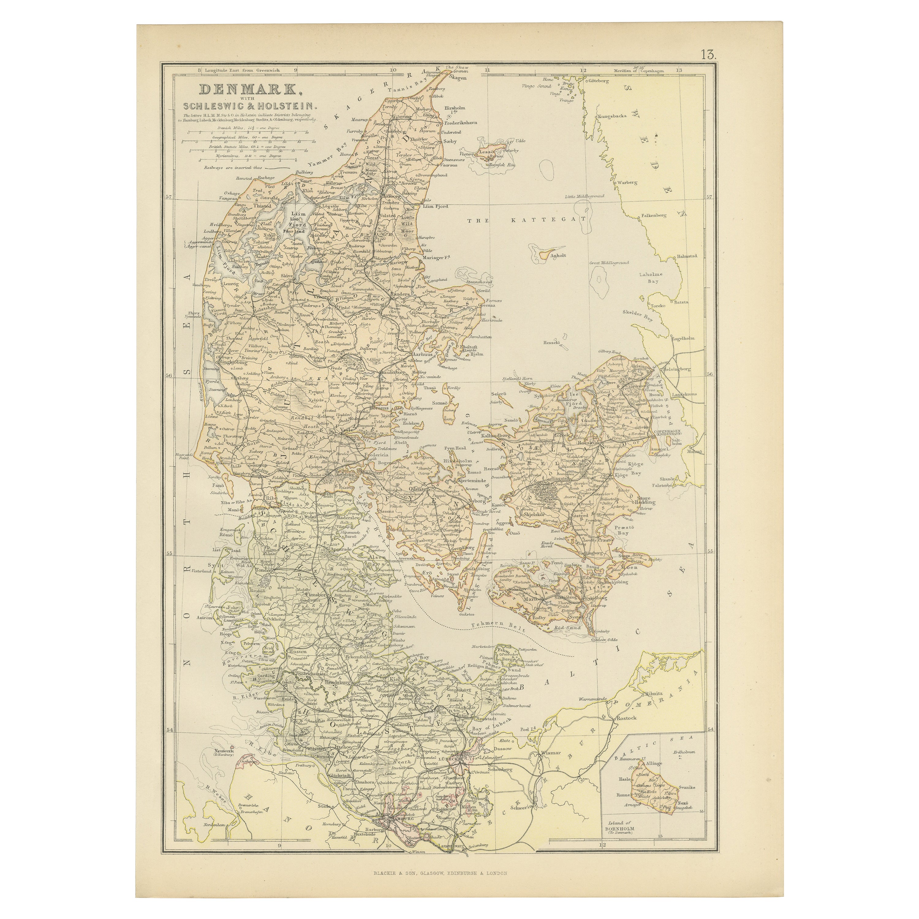
1882 Map of Denmark, Schleswig, and Holstein Highlighting Geographical Details
Located in Langweer, NL
This 1882 map of Denmark, Schleswig, and Holstein, published by Blackie and Son as part of the 'Comprehensive Atlas and Geography of the World,' provides a detailed representation of...
Category
Antique 1880s Maps
Materials
Paper
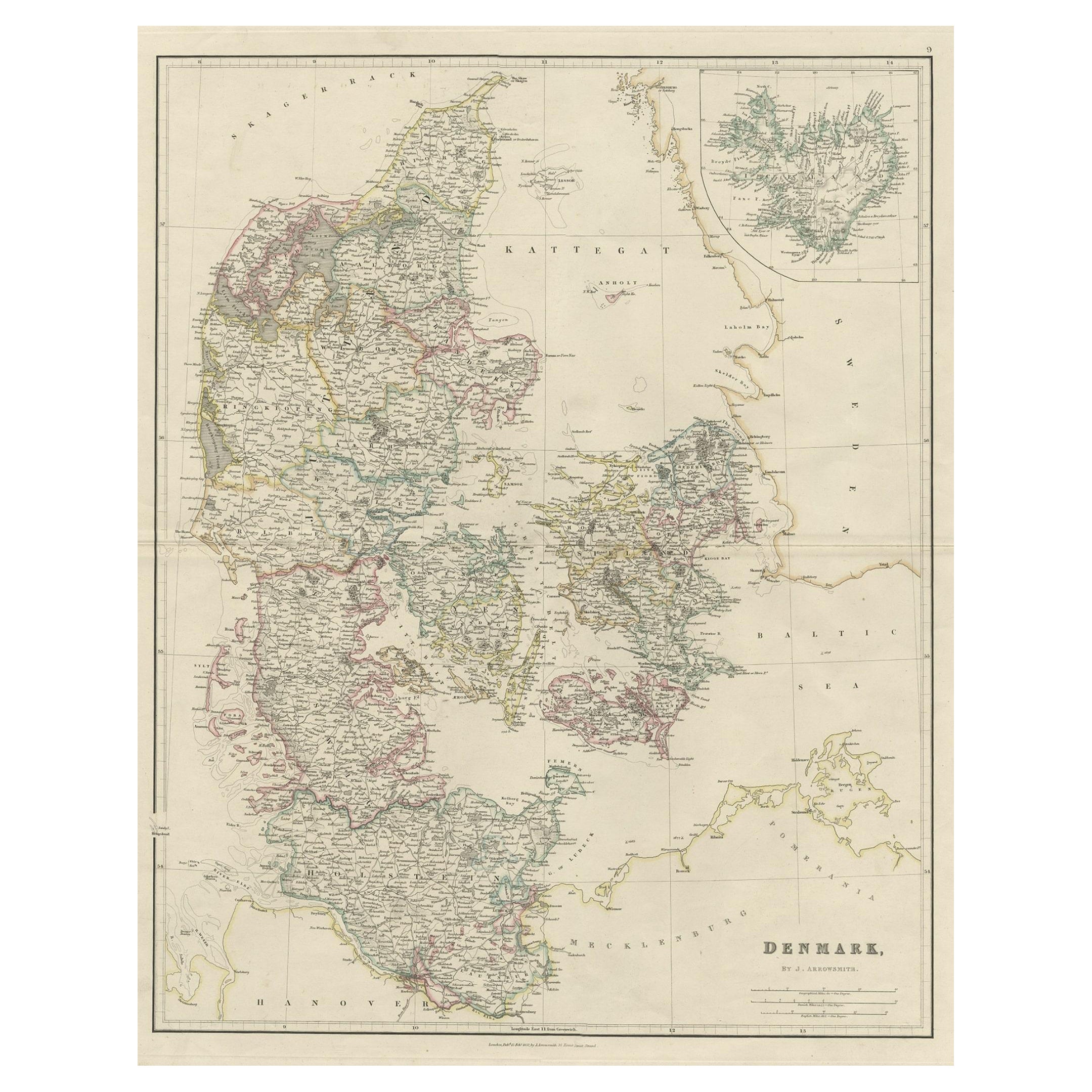
Antique Map of Denmark with an Inset Map of Iceland, 1832
Located in Langweer, NL
Antique map titled 'Denmark'. Large map of Denmark with an inset map of Iceland.
Artists and Engravers: Published by J. Arrowsmith in London, 1832.
Condition: Good, general age...
Category
Antique 19th Century Maps
Materials
Paper

$330 Sale Price
20% Off
You May Also Like
Denmark. Century Atlas antique vintage map
Located in Melbourne, Victoria
'The Century Atlas. Denmark'
Original antique map, 1903.
Inset maps of 'Faroe Islands', 'Iceland' and 'Copenhagen'.
Central fold as issued. Map name and number printed on the reve...
Category
Early 20th Century Victorian More Prints
Materials
Lithograph

1853 Map of "Russia in Europe Including Poland" Ric.r016
Located in Norton, MA
Description
Russia in Europe incl. Poland by J Wyld c.1853
Hand coloured steel engraving
Dimension: Paper: 25 cm W x 33 cm H ; Sight: 22 cm W x 28 cm H
Condition: Good ...
Category
Antique 19th Century Unknown Maps
Materials
Paper

Large Original Vintage Map of Sweden and Norway circa 1920
Located in St Annes, Lancashire
Great map of Sweden and Norway
Original color. Good condition
Published by Alexander Gross
Unframed.
Category
Vintage 1920s English Victorian Maps
Materials
Paper

1849 Map of "Europaische Russland", 'Meyer Map of European Russia', Ric. R017
Located in Norton, MA
1849 Map of
"Europaische Russland"
( Meyer Map of European Russia)
Ric.r017
A lovely map of European Russia dating to 1849 by Joseph Meyer. It covers the European portions of...
Category
Antique 19th Century Unknown Maps
Materials
Paper

Russia in Europe with Poland and Finland. Century Atlas antique vintage map
Located in Melbourne, Victoria
'The Century Atlas. Russia in Europe with Poland and Finland'
Original antique map, 1903.
Central fold as issued. Map name and number printed on the reverse corners.
Sheet 40cm by ...
Category
Early 20th Century Victorian More Prints
Materials
Lithograph

German Empire, Northern Part. Century Atlas antique vintage map
Located in Melbourne, Victoria
'The Century Atlas. German Empire, Northern Part.'
Original antique map, 1903.
Central fold as issued. Map name and number printed on the reverse corne...
Category
Early 20th Century Victorian More Prints
Materials
Lithograph

More Ways To Browse
German Empire
James Denmark
Hanover Furniture
Iceland Antique
Icelandic Antique
Antique Furniture Brunswick
Antique Map Iceland
Joan Blaeu
Antique Nautical Maps
Antique Portuguese Plates
New Zealand Map
Antique Railroad Collectibles
Blaeu World Map
Roman Empire Map
Antique Map Of Middle East
Caribbean Map
Antique Map Of Egypt
Antique Map Ortelius