Items Similar to Engraving of St. Gallen and its Monastery, from Civitates Orbis Terrarum (1575)
Want more images or videos?
Request additional images or videos from the seller
1 of 7
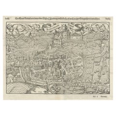
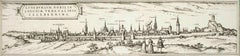
Engraving of St. Gallen and its Monastery, from Civitates Orbis Terrarum (1575)
$661.38
$826.7220% Off
£492.26
£615.3220% Off
€552
€69020% Off
CA$905.92
CA$1,132.4020% Off
A$1,007.58
A$1,259.4720% Off
CHF 526.13
CHF 657.6620% Off
MX$12,261.17
MX$15,326.4620% Off
NOK 6,719.44
NOK 8,399.3020% Off
SEK 6,301.65
SEK 7,877.0620% Off
DKK 4,202.18
DKK 5,252.7320% Off
Shipping
Retrieving quote...The 1stDibs Promise:
Authenticity Guarantee,
Money-Back Guarantee,
24-Hour Cancellation
About the Item
Description of the Engraving: Braun & Hogenberg’s "S. Galli Opp. et Monasterium Heluetiorum" from Civitates Orbis Terrarum (1575)
This is an original, hand-colored copper engraving from Braun & Hogenberg's monumental work, Civitates Orbis Terrarum, published in 1575.
The engraving depicts a detailed bird’s-eye view of the Swiss town of St. Gallen ("S. Galli Opp."), including the famous St. Gall Monastery ("Monasterium Heluetiorum").
It is a striking representation of the city during the late Renaissance period, showcasing its layout, surrounding countryside, and architectural highlights.
Key Features:
1. View of St. Gallen:
- The engraving presents St. Gallen, a town located in northeastern Switzerland, with a perspective that highlights the city's medieval walls, winding streets, and prominent religious structures.
- The city is dominated by large towers and spires, including the tall spires of churches, with the St. Gall Abbey being one of the most prominent buildings. The abbey was an important center of learning and culture in medieval Europe, known for its library and religious influence.
2. Surrounding Countryside:
- The landscape surrounding the town is lush with fields, vineyards, and orchards, indicating the agricultural economy that sustained the town. Farmers are seen tending to their fields, and travelers on horseback can be spotted along the main roads leading into the city.
- The engraving includes pastoral scenes, with people walking on the roads, horse-drawn carts, and citizens engaging in daily activities.
3. Citizens in Traditional Dress:
- In the foreground of the engraving, two figures dressed in traditional Swiss costumes are depicted, adding a human element to the scene. The costumes reflect the local fashion of the time, providing a glimpse into the region’s cultural identity during the 16th century.
4. Architectural Detail:
- The town’s fortifications are clearly visible, with well-defined city walls, gates, and towers that provided defense for the medieval city. The layout of the city streets, which follow a maze-like pattern typical of medieval urban design, is rendered with precision.
- Churches and other important buildings are easily distinguishable by their larger size and placement within the city center.
5. Cartouche and Latin Text:
- At the bottom left of the engraving is an **ornate cartouche** with Latin text that provides a brief description of St. Gallen. The cartouche adds an artistic and historical flourish to the map, a typical feature of Renaissance cartography.
- The text reads: “S. GALLI OPP. et Monasterium Heluetiorum, assente Ottone Friisingensi lib. V Chron; a S. Gallo, qui in Suevia, et Constantinensi territorio resedit, erectum." This indicates the historical and religious significance of the town and its monastery, founded by St. Gall, an Irish missionary.
6. Historical and Artistic Significance:
- The engraving is part of the Civitates Orbis Terrarum, one of the most famous and influential city atlases of the Renaissance, produced by Georg Braun and Frans Hogenberg. This work aimed to capture the essence of major cities around the world during the 16th century, providing both artistic renderings and valuable geographic knowledge for scholars and travelers of the time.
- The depiction of St. Gallen, with its vibrant color, detailed architecture, and lively surroundings, exemplifies the blend of artistic skill and geographic accuracy that made Braun & Hogenberg’s works so valuable and sought after.
This engraving is an important cultural and historical artifact, offering insight into the town of St. Gallen, its architectural landmarks, and its role as a center of monastic life during the Renaissance. The vibrant hand coloring and detailed craftsmanship reflect the artistic excellence of the period.
- Dimensions:Height: 9.85 in (25 cm)Width: 21.66 in (55 cm)Depth: 0 in (0.02 mm)
- Materials and Techniques:Paper,Engraved
- Period:
- Date of Manufacture:1575
- Condition:Condition: Good given age. Trimmed from larger sheet. General age-related toning and/or occasional minor defects from handling. Vertical folding line as issued. Please study scan carefully.
- Seller Location:Langweer, NL
- Reference Number:Seller: BG-13648-11stDibs: LU3054341508852
About the Seller
5.0
Recognized Seller
These prestigious sellers are industry leaders and represent the highest echelon for item quality and design.
Platinum Seller
Premium sellers with a 4.7+ rating and 24-hour response times
Established in 2009
1stDibs seller since 2017
2,502 sales on 1stDibs
Typical response time: <1 hour
- ShippingRetrieving quote...Shipping from: Langweer, Netherlands
- Return Policy
Authenticity Guarantee
In the unlikely event there’s an issue with an item’s authenticity, contact us within 1 year for a full refund. DetailsMoney-Back Guarantee
If your item is not as described, is damaged in transit, or does not arrive, contact us within 7 days for a full refund. Details24-Hour Cancellation
You have a 24-hour grace period in which to reconsider your purchase, with no questions asked.Vetted Professional Sellers
Our world-class sellers must adhere to strict standards for service and quality, maintaining the integrity of our listings.Price-Match Guarantee
If you find that a seller listed the same item for a lower price elsewhere, we’ll match it.Trusted Global Delivery
Our best-in-class carrier network provides specialized shipping options worldwide, including custom delivery.More From This Seller
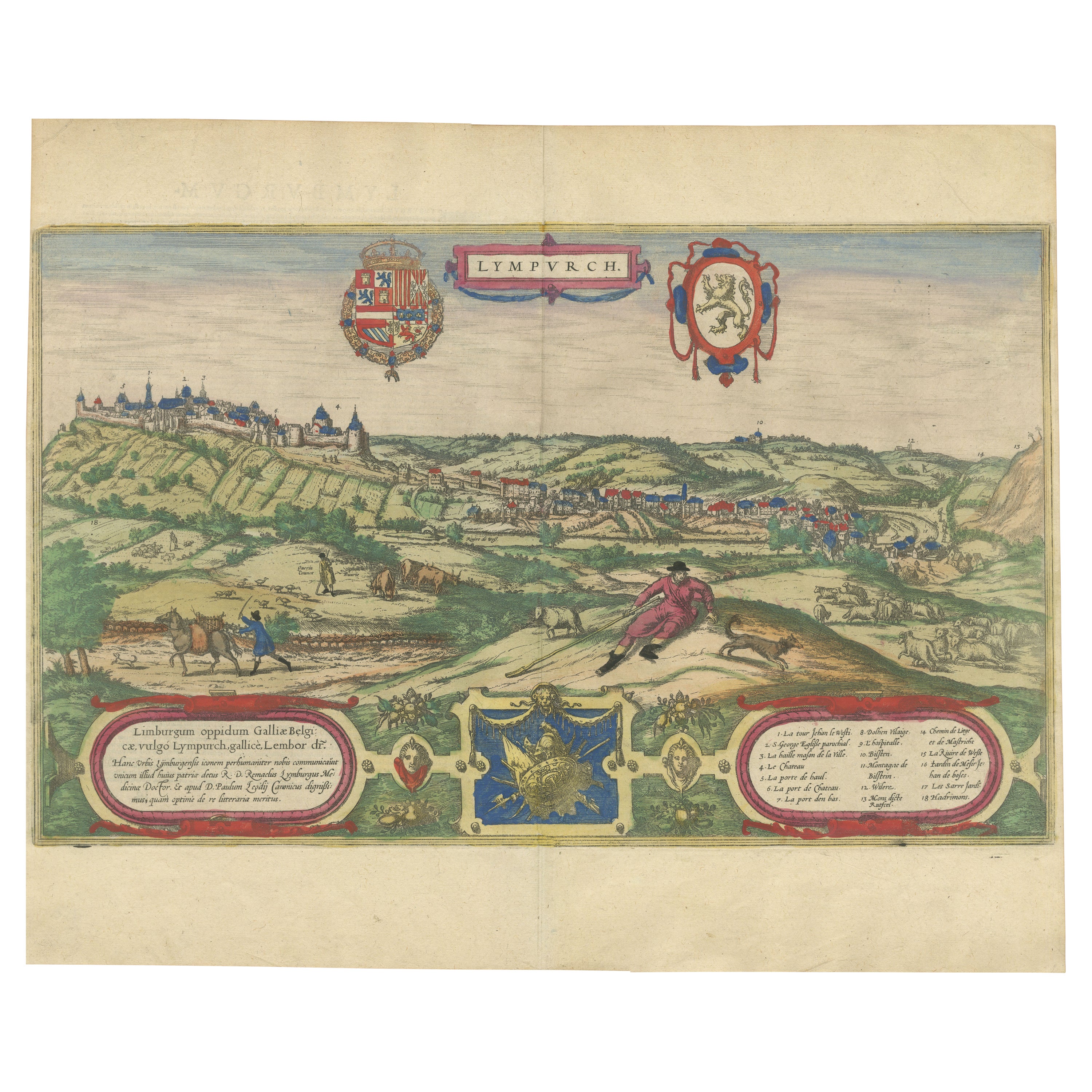
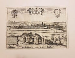
View AllLimburg Cityscape 1580: Historical Copper Engraving by Braun and Hogenberg
Located in Langweer, NL
Title: Limburgum Oppidum Galliae Belgicae, vulgo Lympurch, gallicè, Lembor Dr.
Type: Print (Copper Engraving)
Circa 1580
Technique: Colored Copper Engraving
Medium: Handmade Paper
S...
Category
Antique 16th Century Maps
Materials
Paper

$613 Sale Price
20% Off
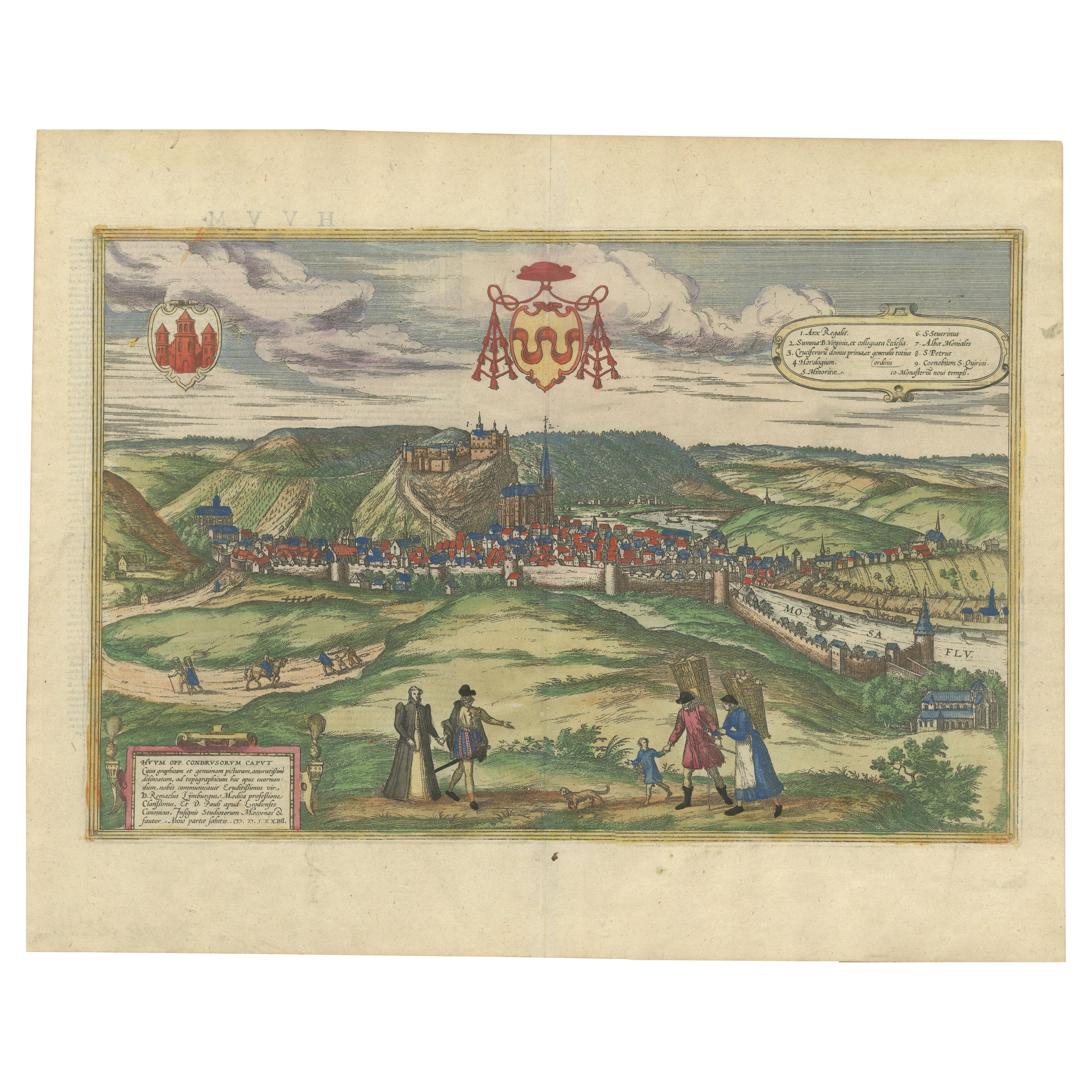
Huy (Huum) Cityscape 1574: Historical Copper Engraving by Braun & Hogenberg
Located in Langweer, NL
Title: Huum opp. condrusorum caput (...) Anno partae salutis 1574.
**Type:** Print (Colored Copper Engraving)
**Year:** Circa 1580
**Technique:** Colored Copper Engraving
**Medium:...
Category
Antique 16th Century Maps
Materials
Paper
$613 Sale Price
20% Off
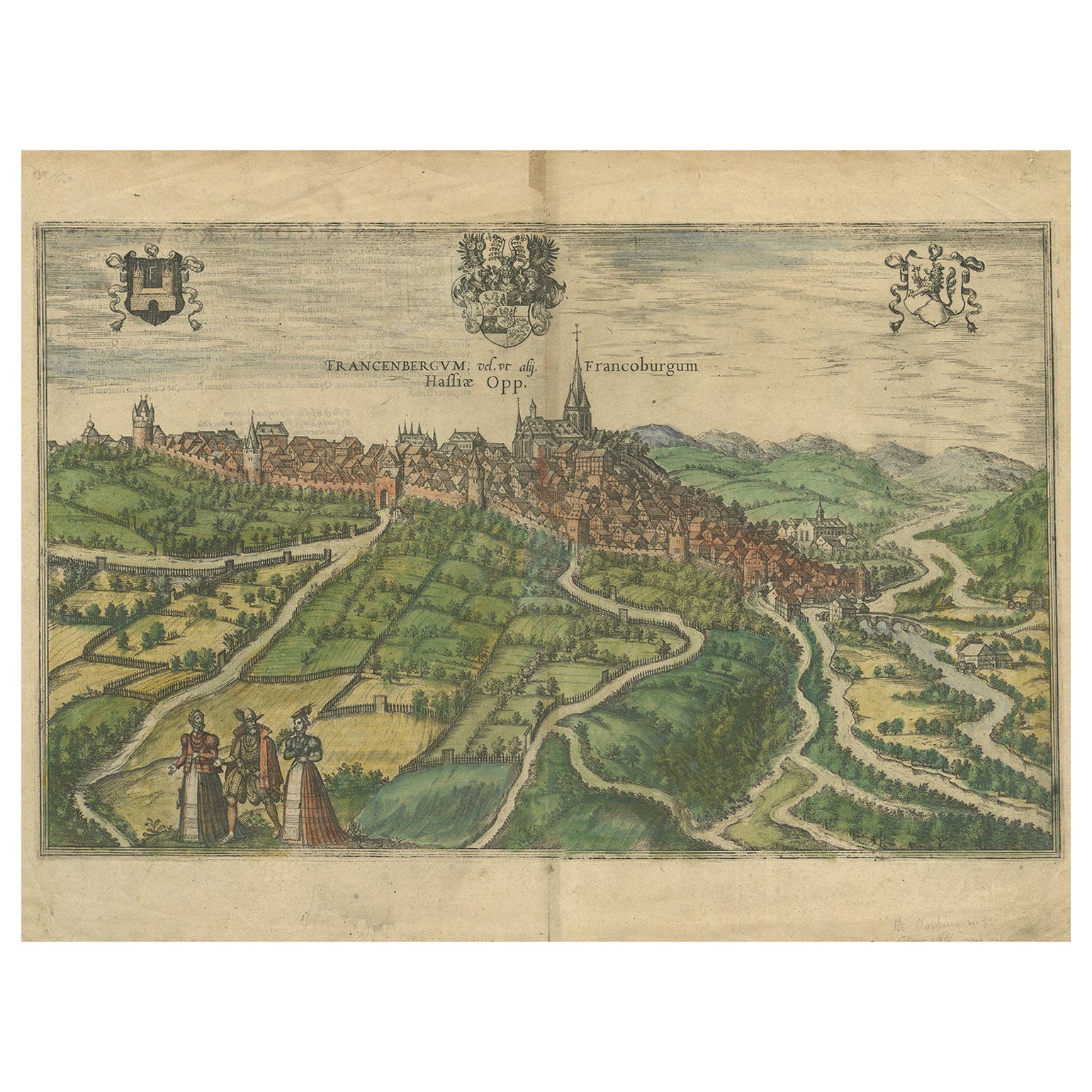
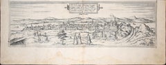
View of Frankenberg: Braun & Hogenberg's Historic Bird's-Eye Map, 1599
Located in Langweer, NL
The antique print titled 'Francenbergum, vel ut alij Francoburgum Hassiae Opp', published by Braun & Hogenberg around 1599, is a remarkable historical ...
Category
Antique 16th Century Prints
Materials
Paper
$479 Sale Price
20% Off
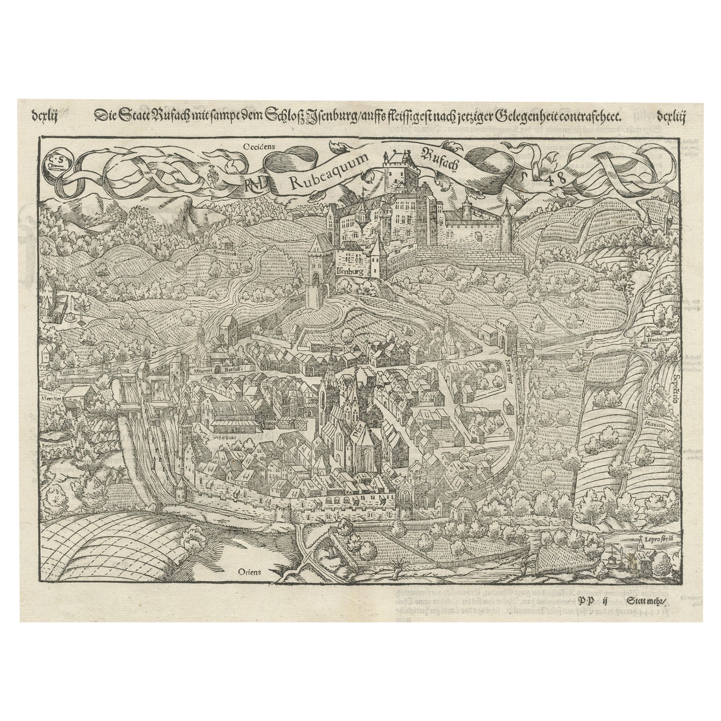
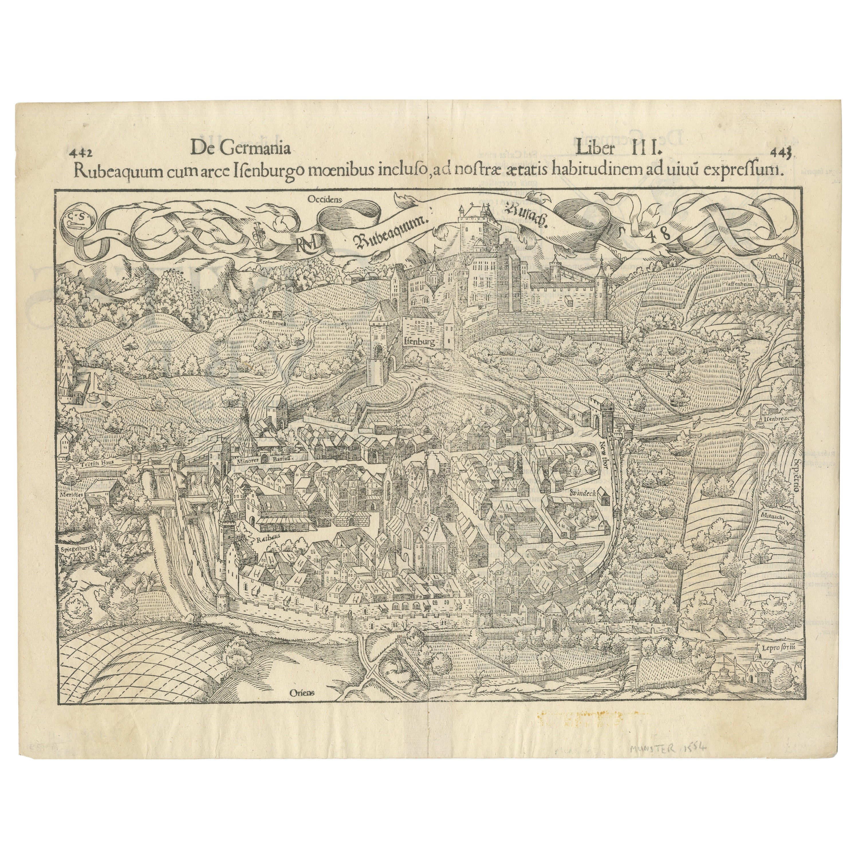
Original Antique Plan of Rouffach, France, with Chateau d'Isenbourgh, 1588
Located in Langweer, NL
Antique map titled 'Die Statt Rufach mit sampt dem Schloss Isenburg (..)'.
Original antique bird's-eye view plan of Rouffach, France, with Chateau d'Isenbourg. This map originate...
Category
Antique 16th Century Maps
Materials
Paper
$460 Sale Price
20% Off
Early Woodcut Bird's Eye View of Rouffach, France, by Sebastian Münster, 1554
Located in Langweer, NL
Early Woodcut Bird's Eye View of Rouffach, France, by Sebastian Münster, 1554
Description: This rare 1554 woodcut is a bird's eye view of Rouffach, a town in the Haut-Rhin departmen...
Category
Antique 16th Century Maps
Materials
Paper
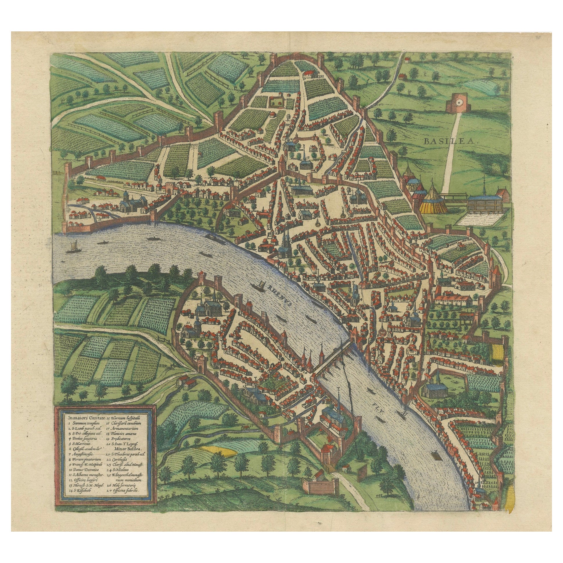
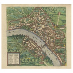
Bird’s-Eye View of Basel from Braun & Hogenberg’s Civitates Orbis Terrarum, 1575
Located in Langweer, NL
Bird’s-Eye View of Basel from Braun & Hogenberg’s "Civitates Orbis Terrarum" (Circa 1572-1617)
This highly detailed map of Basel is a bird's-eye view, originally based on Sebastian Münster’s map...
Category
Antique 16th Century Maps
Materials
Paper
$1,150 Sale Price
20% Off
You May Also Like
Munchen, Antique Map from "Civitates Orbis Terrarum" - 1572-1617
By Franz Hogenberg
Located in Roma, IT
Wonderful black and white aquatint showing an antique view of Munchen, capital of Bavaria.
From the collection by Braun G. and Hogenberg F., "Civitates Orbis Terrarum", Cologne, T. ...
Category
16th Century Landscape Prints
Materials
Etching
Luneburg, Map from "Civitates Orbis Terrarum" - by F.Hogenberg - 1575
By Franz Hogenberg
Located in Roma, IT
"Luneburg", from the collection "Civitates Orbis Terrarum", Cologne, T. Graminaeus, 1575.
The “Civitates Orbis Terrarum” (Atlas of Cities of the World) was the second oldest print...
Category
16th Century Figurative Prints
Materials
Etching, Aquatint
Danzig, Antique Map from "Civitates Orbis Terrarum" - 1572-1617
By Franz Hogenberg
Located in Roma, IT
Braun G., Hogenberg F., Dantziat, from the collection Civitates Orbis Terrarum, Cologne, T. Graminaeus, 1572-1617.
Image dimensions: cm 32.8 x 47.9; dimensions: cm 42 x 55.3; passep...
Category
16th Century Landscape Prints
Materials
Etching
Buda, Antique Map from "Civitates Orbis Terrarum" - 1572-1617
By Franz Hogenberg
Located in Roma, IT
Braun G., Hogenberg F., Buda, from the collection Civitates Orbis Terrarum, Cologne, T. Graminaeus, 1572-1617.
Very fine B/W aquatint showing a view of Buda, an actual part of Budap...
Category
16th Century Landscape Prints
Materials
Etching
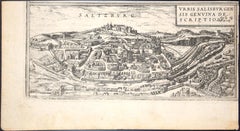
Salzburg, Map from "Civitates Orbis Terrarum"-by F. Hogenberg - 1575
By Franz Hogenberg
Located in Roma, IT
Aquatint black and white showing the antique map of "Saltzburg", Salzburg. One of the first views of the famous Austrian city of Wolfgang Amadeus Mozart. Good conditions, some disco...
Category
16th Century Figurative Prints
Materials
Etching, Aquatint
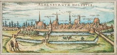
Stade, Antique Map from "Civitates Orbis Terrarum" - 1572-1617
By Franz Hogenberg
Located in Roma, IT
Braun G., Hogenberg F., Aldenburgum Holsatiae, or Stade, from the collection Civitates Orbis Terrarum, Cologne, T. Graminaeus, 1572-1617.
Precious hand-colored aquatint showing a vi...
Category
16th Century Landscape Prints
Materials
Etching
More Ways To Browse
Monastery Furniture
16th Century Antiques
Large Wall Maps
16th Century Dress
Hand Colored Copper Engraving
Textable Trolley
Library Trolley
Vineyard Antiques
Antique Gates Ireland
Library Cart
Tables With Inlaid Wood
World War Table
Antonio Jacobsen
Ariston Chairs
Coffee Tables Europe
Marble Top Dining Tables
Nordiska Argentina
Pink And Black Rug