Items Similar to Original Antique Plan of Rouffach, France, with Chateau d'Isenbourgh, 1588

Want more images or videos?
Request additional images or videos from the seller
1 of 5
Original Antique Plan of Rouffach, France, with Chateau d'Isenbourgh, 1588
About the Item
Antique map titled 'Die Statt Rufach mit sampt dem Schloss Isenburg (..)'.
Original antique bird's-eye view plan of Rouffach, France, with Chateau d'Isenbourg. This map originates from 'Cosmographey oder Beschreibung aller Länder' published 1588.
Artists and Engravers: Sebastian Münster (1488-1552) was a cosmographer and professor of Hebrew who taught at Tübingen, Heidelberg, and Basel. He settled in the latter in 1529 and died there, of plague, in 1552. Münster made himself the center of a large network of scholars from whom he obtained geographic descriptions, maps, and directions.
- Dimensions:Height: 13.19 in (33.5 cm)Width: 15.95 in (40.5 cm)Depth: 0 in (0.02 mm)
- Materials and Techniques:
- Period:
- Date of Manufacture:1588
- Condition:Repaired: Original folding line, with repair. Wear consistent with age and use. Condition: Fair/good, general age-related toning. Shows some wear and small defects, mostly in margins. German text on verso. Please study image carefully.
- Seller Location:Langweer, NL
- Reference Number:
About the Seller
5.0
Platinum Seller
These expertly vetted sellers are 1stDibs' most experienced sellers and are rated highest by our customers.
Established in 2009
1stDibs seller since 2017
1,933 sales on 1stDibs
Typical response time: <1 hour
- ShippingRetrieving quote...Ships From: Langweer, Netherlands
- Return PolicyA return for this item may be initiated within 14 days of delivery.
More From This SellerView All
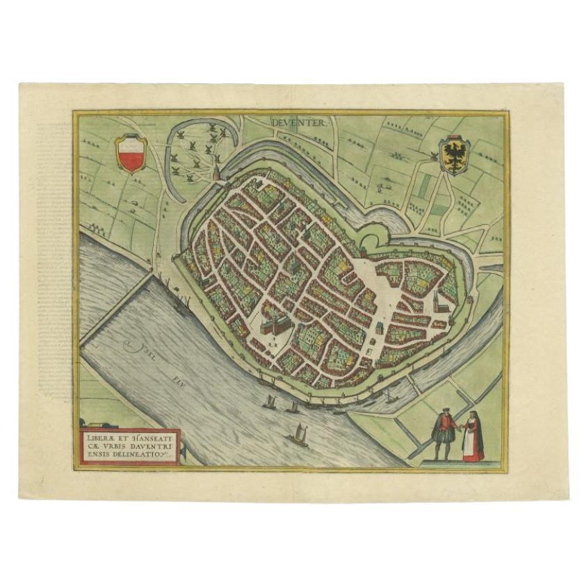
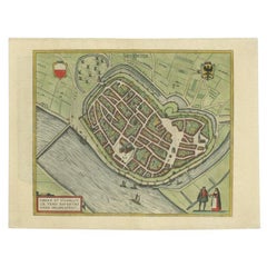
- Antique Original Map of the City of Deventer, the Netherlands, 1588Located in Langweer, NLAntique map titled 'Liberae et Hanseaticae urbis Daventriensis delineatio'. Original bird's eye plan of the Dutch hanseatic city Deventer, on the situated IJssel river. This map ...Category
Antique 16th Century Maps
MaterialsPaper
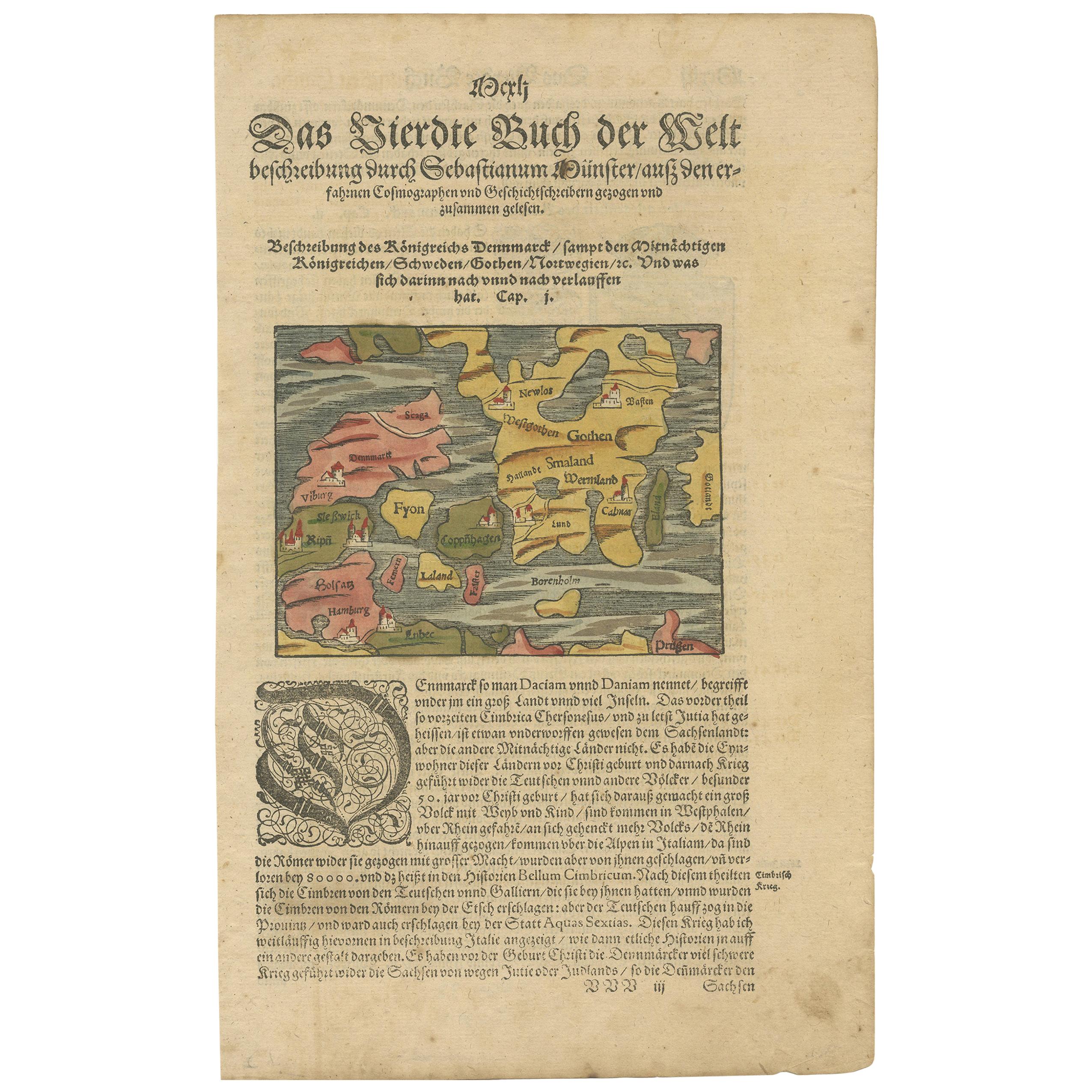
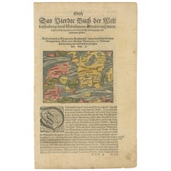
- Antique Map of Denmark by Münster '1588'Located in Langweer, NLAntique map titled 'Beschreibung des Königreichs Dennmarck (..)'. Early map of Denmark. This map originates from 'Cosmographey Oder beschreibung Aller Länder (..)' by Sebastian Münster.Category
Antique 16th Century Maps
MaterialsPaper
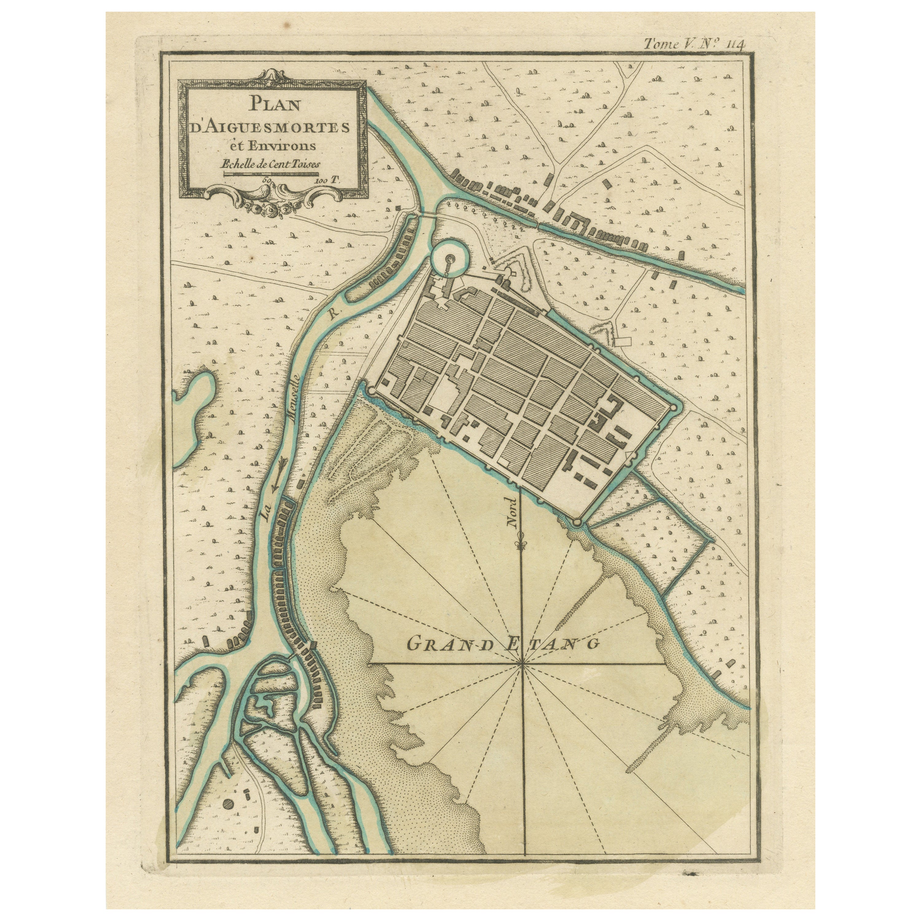
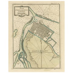
- Antique Plan of Aigues-Mortes, FranceLocated in Langweer, NLAntique map titled 'Plan d'Aiguesmortes et environs'. Original plan of the region of Aigues-Mortes, France. This map originates from 'Le Petit Atlas Maritime (..)' by J.N. Bellin. Pu...Category
Antique Mid-18th Century Maps
MaterialsPaper
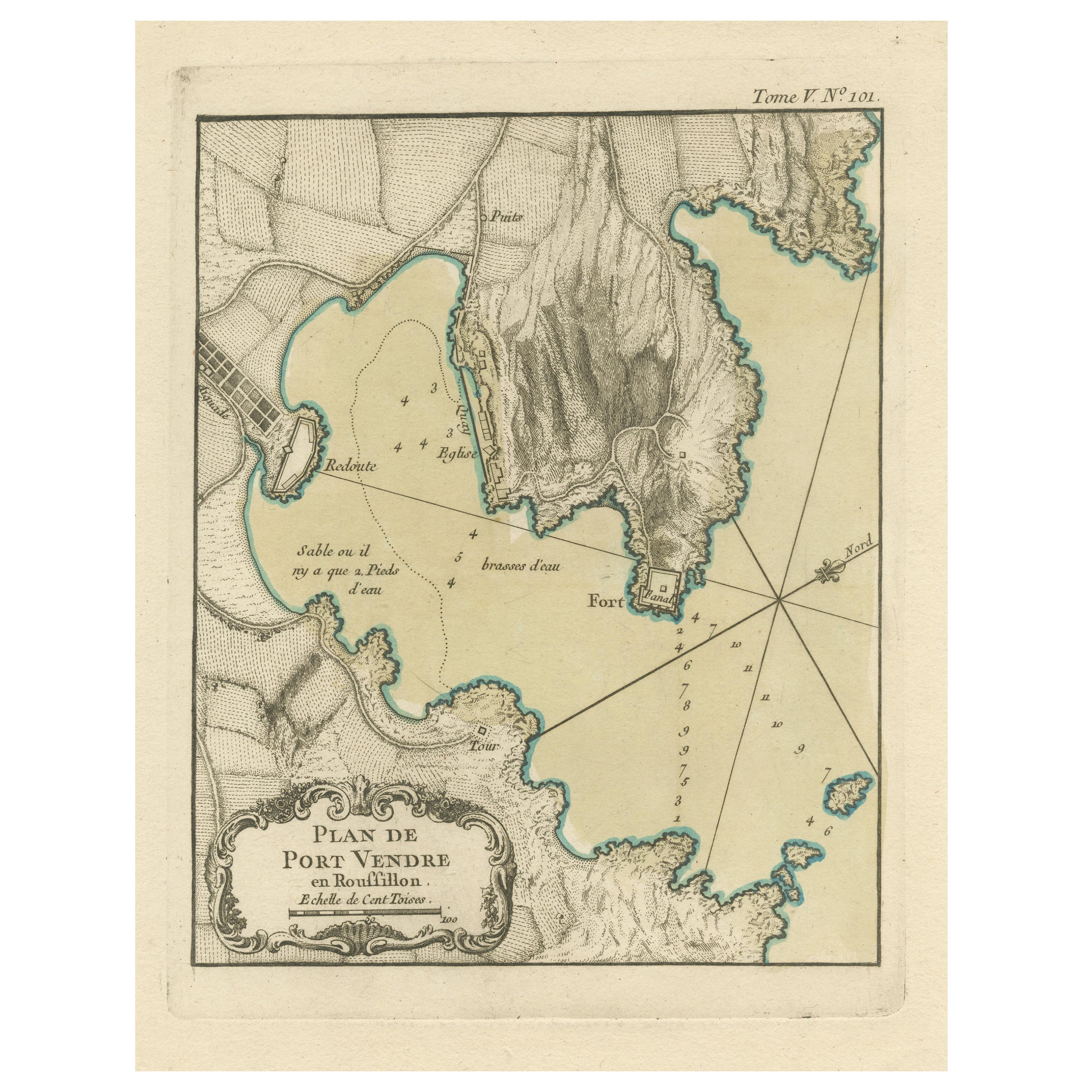
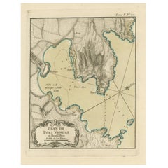
- Antique Plan of Port-Vendres, Roussillon, FranceLocated in Langweer, NLAntique map titled 'Plan de Port Vendre en Roussillon'. Original plan of Port-Vendres, Roussillon, France. This map originates from 'Le Petit Atlas Maritime (..)' by J.N. Bellin. Pub...Category
Antique Mid-18th Century Maps
MaterialsPaper
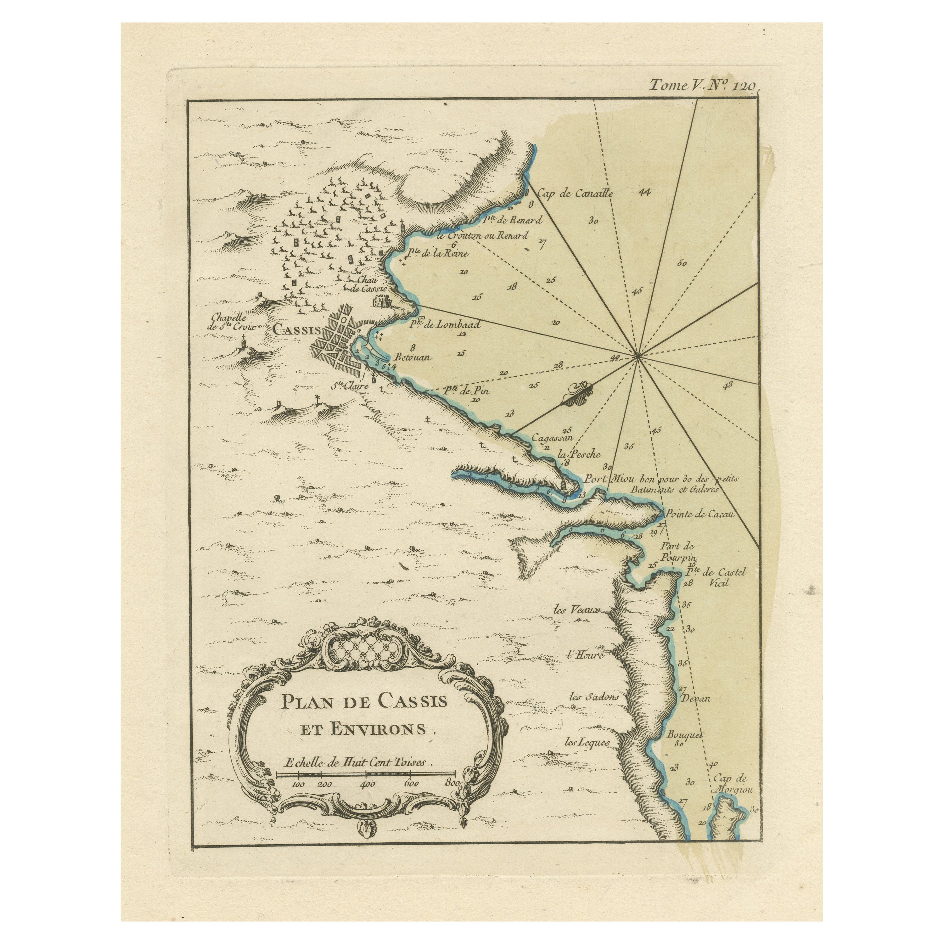
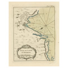
- Antique Plan of the Region of Cassis, FranceLocated in Langweer, NLAntique map titled 'Plan de Cassis et environs'. Original plan of the region of Cassis, France. This map originates from 'Le Petit Atlas Maritime (..)' by J.N. Bellin. Published 1764...Category
Antique Mid-18th Century Maps
MaterialsPaper
- Antique Plan of the City of Bayonne, FranceLocated in Langweer, NLAntique map titled 'Plan de Bayonne'. Original old plan of the city of Bayonne, France. This map originates from 'Le Petit Atlas Maritime (..)' by J.N. Bellin. Published 1764. Be...Category
Antique Mid-18th Century Maps
MaterialsPaper

You May Also Like
- Original Antique Map / City Plan of Brussels by Tallis, circa 1850Located in St Annes, LancashireGreat map of Brussels. Steel engraving. Published by London Printing & Publishing Co. (Formerly Tallis), C.1850 Free shipping.Category
Antique 1850s English Maps
MaterialsPaper
- Original Antique Map of France, Arrowsmith, 1820Located in St Annes, LancashireGreat map of France Drawn under the direction of Arrowsmith. Copper-plate engraving. Published by Longman, Hurst, Rees, Orme and Brown, 1820 Unframed.Category
Antique 1820s English Maps
MaterialsPaper
- Original Antique Map of France, Sherwood, Neely & Jones, Dated 1809Located in St Annes, LancashireGreat map of France Copper-plate engraving by Cooper Published by Sherwood, Neely & Jones. Dated 1809 Unframed.Category
Antique Early 1800s English Maps
MaterialsPaper
- Original Antique Map of Italy. C.1780Located in St Annes, LancashireGreat map of Italy Copper-plate engraving Published C.1780 Unframed.Category
Antique Early 1800s English Georgian Maps
MaterialsPaper

- Original Antique Map of Asia. C.1780Located in St Annes, LancashireGreat map of Asia Copper-plate engraving Published C.1780 Two small worm holes to right side of map Unframed.Category
Antique Early 1800s English Georgian Maps
MaterialsPaper

- Original Antique Map of India. C.1780Located in St Annes, LancashireGreat map of India Copper-plate engraving Published C.1780 Three small worm holes to right side of map and one bottom left corner Unframed.Category
Antique Early 1800s English Georgian Maps
MaterialsPaper


Recently Viewed
View AllMore Ways To Browse
D Plan
Original Antique Birds
Antique Hebrew
Hebrew Antique
Birds Eye View Map
Sebastian Munster
Antique Map Munster
Antique French Globe
18th Century Southern Antiques
South African Antique Furniture
Antique Furniture South Africa
Used Booksellers
Used Bookseller
Antique British Maps
Antique 17th Century World Map
Scotland Map
General Empire
Wood And Sons Plate