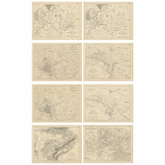
Items Similar to Four Antique Battle Plans of Echmühl, Hohenlinden, Abensberg and Marengo, 1852
Want more images or videos?
Request additional images or videos from the seller
1 of 6
Four Antique Battle Plans of Echmühl, Hohenlinden, Abensberg and Marengo, 1852
$226.84per set
$283.55per set20% Off
£170.03per set
£212.54per set20% Off
€192per set
€240per set20% Off
CA$311.64per set
CA$389.55per set20% Off
A$347.91per set
A$434.89per set20% Off
CHF 182.30per set
CHF 227.88per set20% Off
MX$4,258.82per set
MX$5,323.52per set20% Off
NOK 2,315.24per set
NOK 2,894.05per set20% Off
SEK 2,182.98per set
SEK 2,728.72per set20% Off
DKK 1,461.57per set
DKK 1,826.97per set20% Off
Shipping
Retrieving quote...The 1stDibs Promise:
Authenticity Guarantee,
Money-Back Guarantee,
24-Hour Cancellation
About the Item
Set of 4 antique battle plans. Included are:
1) Battle of Hohenlinden 3d. December 1800
2) Battle of Echmühl 22. April 1809
3) Battle of Arensberg 20. April 1809.
4) Battle of Maarengo 14. June 1800
These prints originate from 'Atlas to Alison's history of Europe: constructed and arranged under the direction of Sir Archibald Alison by W. & A.K. Johnston. Published 1852.
- Dimensions:Height: 7.09 in (18 cm)Width: 8.98 in (22.8 cm)Depth: 0.02 in (0.5 mm)
- Sold As:Set of 4
- Materials and Techniques:
- Period:
- Date of Manufacture:1852
- Condition:General age-related toning. Defects in left margin, the Hohenlinden print is also sl. affecting image. Shows some wear and foxing, blank verso. Please study images carefully.
- Seller Location:Langweer, NL
- Reference Number:Seller: BG-12209-88, -89, -91, -941stDibs: LU3054334760882
About the Seller
5.0
Recognized Seller
These prestigious sellers are industry leaders and represent the highest echelon for item quality and design.
Platinum Seller
Premium sellers with a 4.7+ rating and 24-hour response times
Established in 2009
1stDibs seller since 2017
2,511 sales on 1stDibs
Typical response time: <1 hour
- ShippingRetrieving quote...Shipping from: Langweer, Netherlands
- Return Policy
Authenticity Guarantee
In the unlikely event there’s an issue with an item’s authenticity, contact us within 1 year for a full refund. DetailsMoney-Back Guarantee
If your item is not as described, is damaged in transit, or does not arrive, contact us within 7 days for a full refund. Details24-Hour Cancellation
You have a 24-hour grace period in which to reconsider your purchase, with no questions asked.Vetted Professional Sellers
Our world-class sellers must adhere to strict standards for service and quality, maintaining the integrity of our listings.Price-Match Guarantee
If you find that a seller listed the same item for a lower price elsewhere, we’ll match it.Trusted Global Delivery
Our best-in-class carrier network provides specialized shipping options worldwide, including custom delivery.More From This Seller
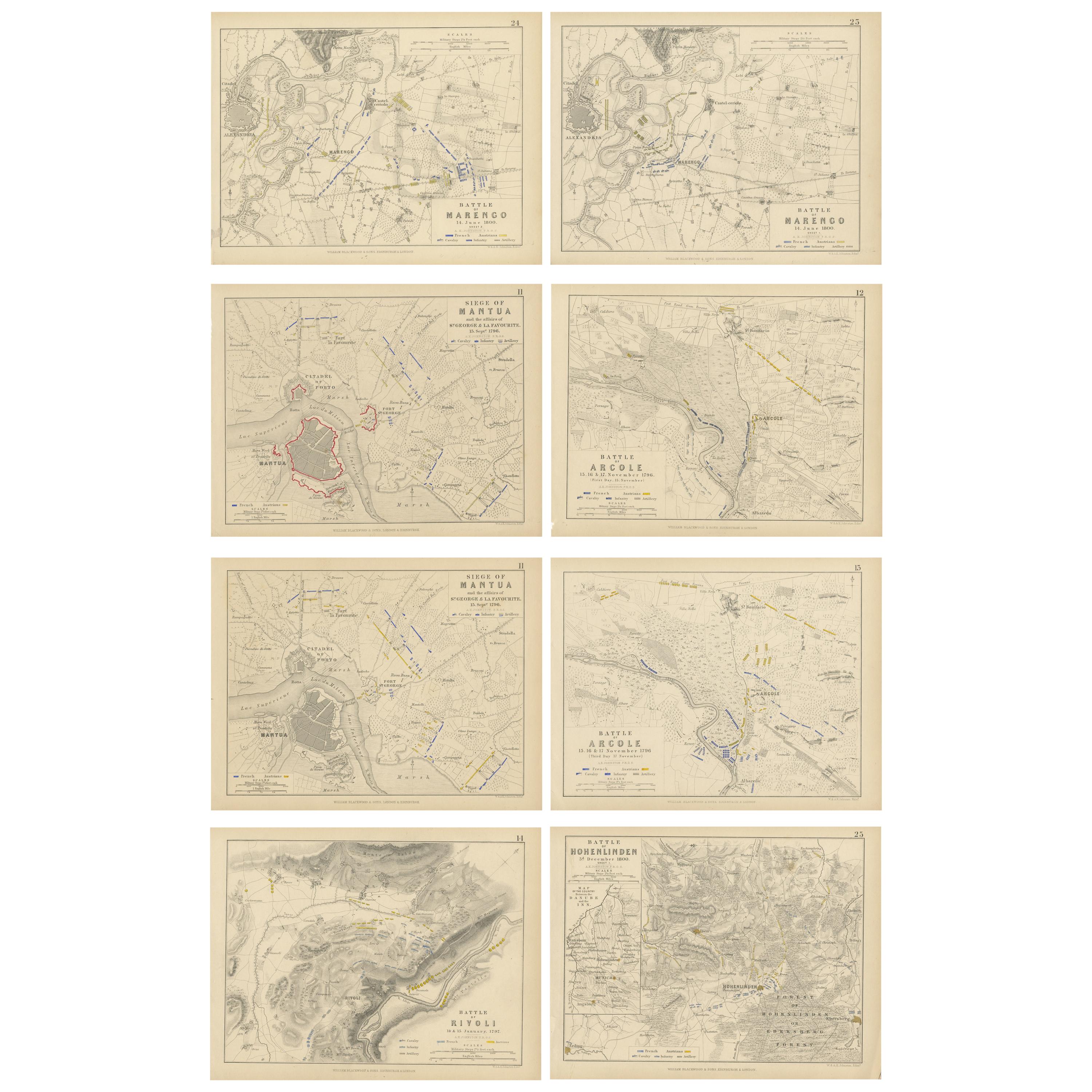
View AllSet of 8 Battle Plans, Rivoli, Arcole, Mantua, Marengo, Hohenlinden, 1852
Located in Langweer, NL
Set of 8 battle plans including battle plans of Rivoli, Arcole, Mantua, Marengo and Hohenlinden. These prints originate from 'Atlas to Alison's history of...
Category
Antique Mid-19th Century Prints
Materials
Paper
$378 Sale Price / set
20% Off
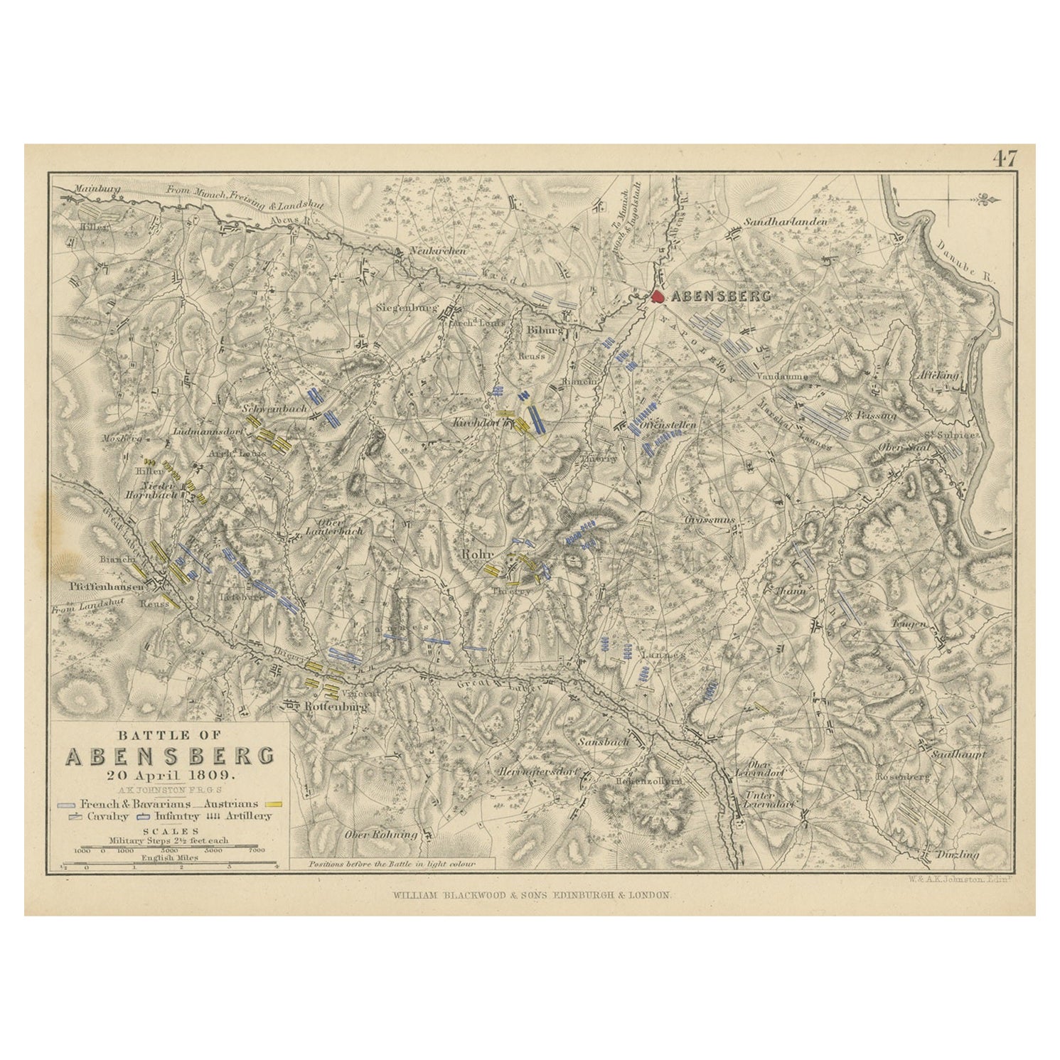
Antique Plan of the Battle of Abensberg in Germany
Located in Langweer, NL
Antique battle map titled 'Battle of Abensberg 20 April 1809'. Plan of the Battle of Abensberg, fought on 20 April 1809 between a Franco-German force under ...
Category
Antique Mid-19th Century Maps
Materials
Paper
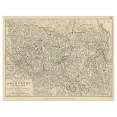
$132 Sale Price
20% Off
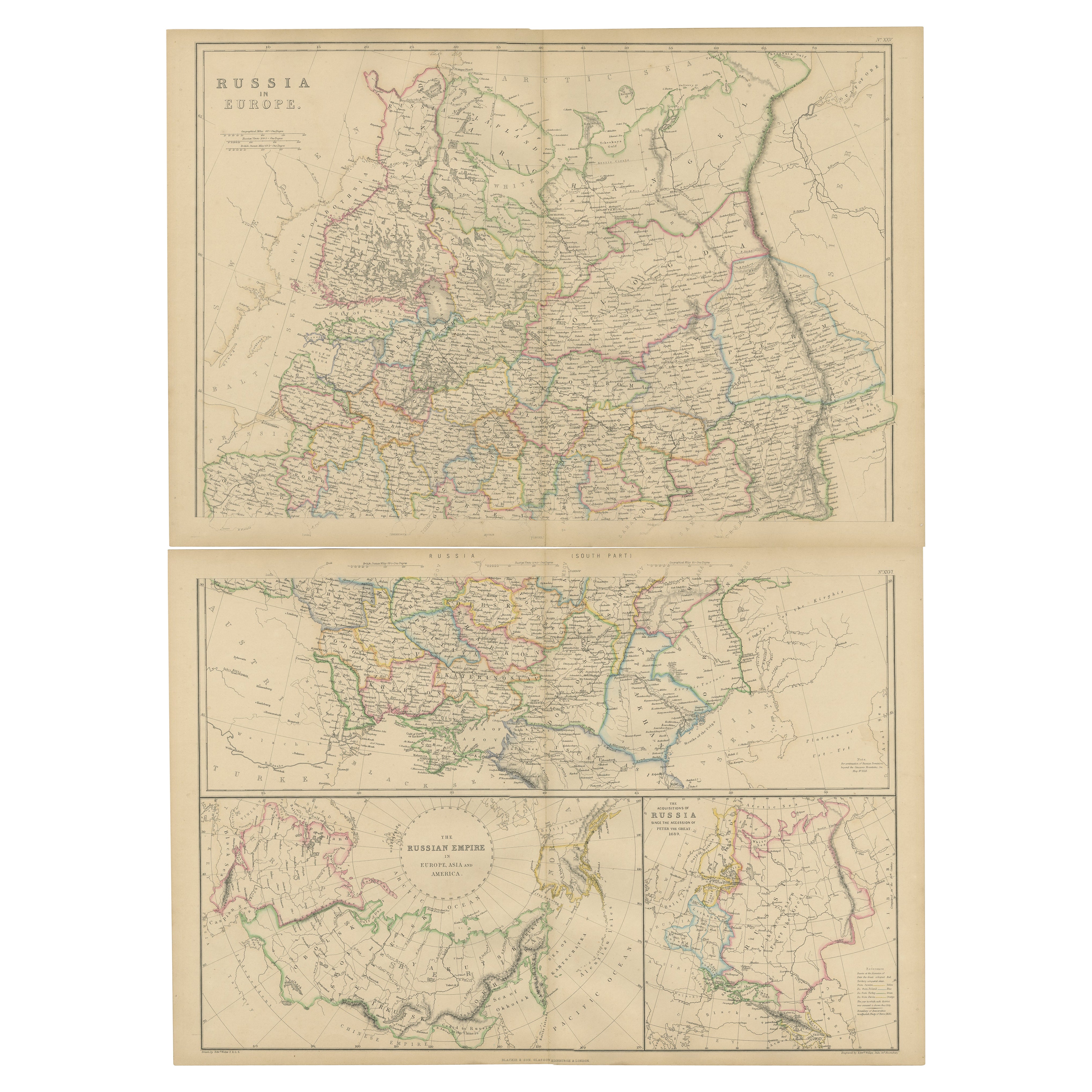
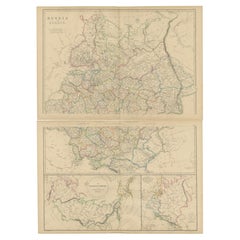
Set of 2 Antique Maps of Russia in Europe by W. G. Blackie, 1859
Located in Langweer, NL
Antique map titled 'Russia in Europe'. Original antique map of Russia in Europe with inset maps of the Russian Empire in Europe, Asia and America and the acquisition of Russia since ...
Category
Antique Mid-19th Century Maps
Materials
Paper
$378 Sale Price / set
20% Off
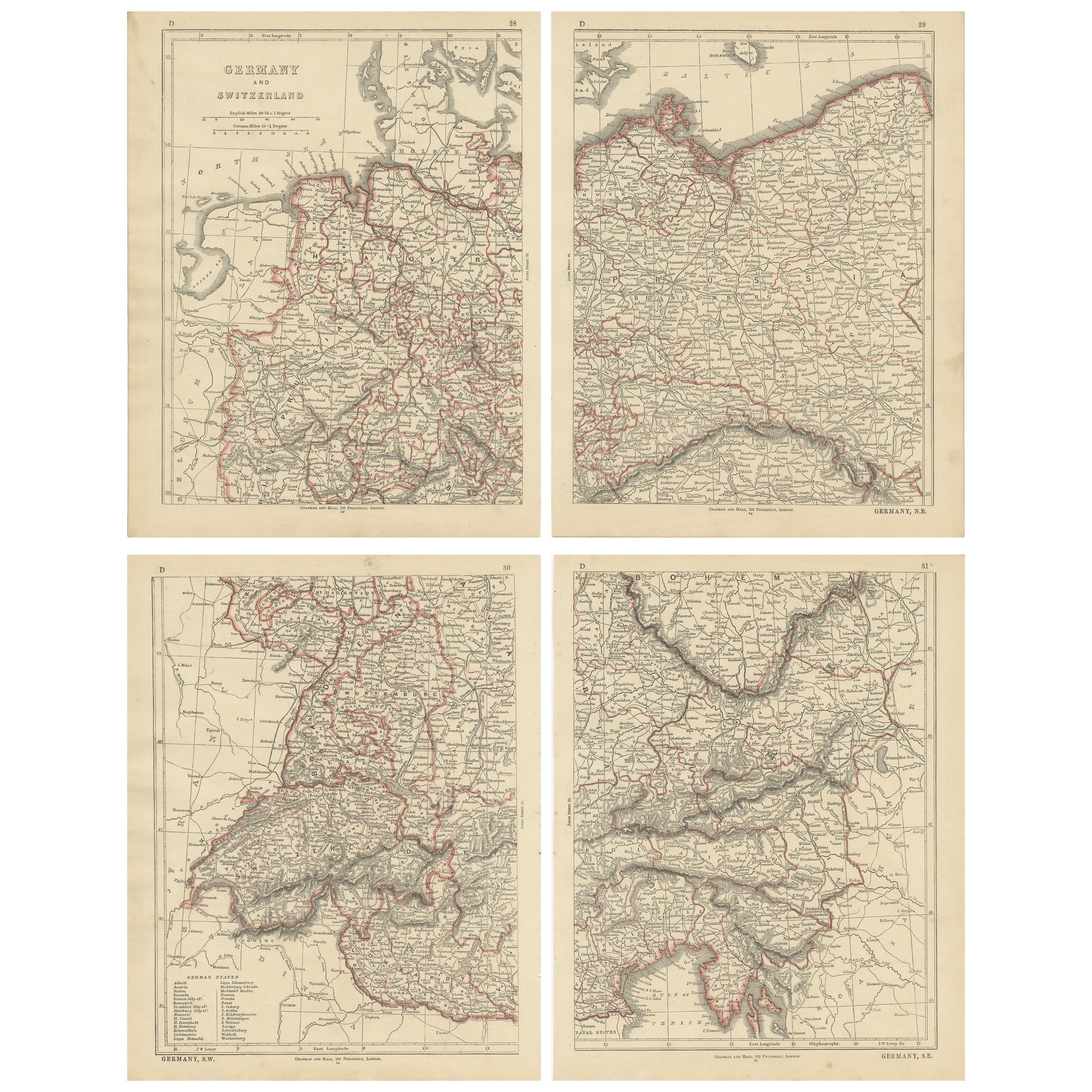
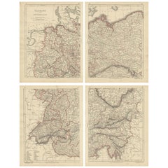
Antique Map of Germany and Switzerland by Lowry, '1852'
Located in Langweer, NL
Antique map titled 'Germany and Switzerland'. Four individual sheets of Germany and Switzerland. This map originates from 'Lowry's Table Atlas constructed and engraved from the most ...
Category
Antique Mid-19th Century Maps
Materials
Paper
$236 Sale Price / set
20% Off
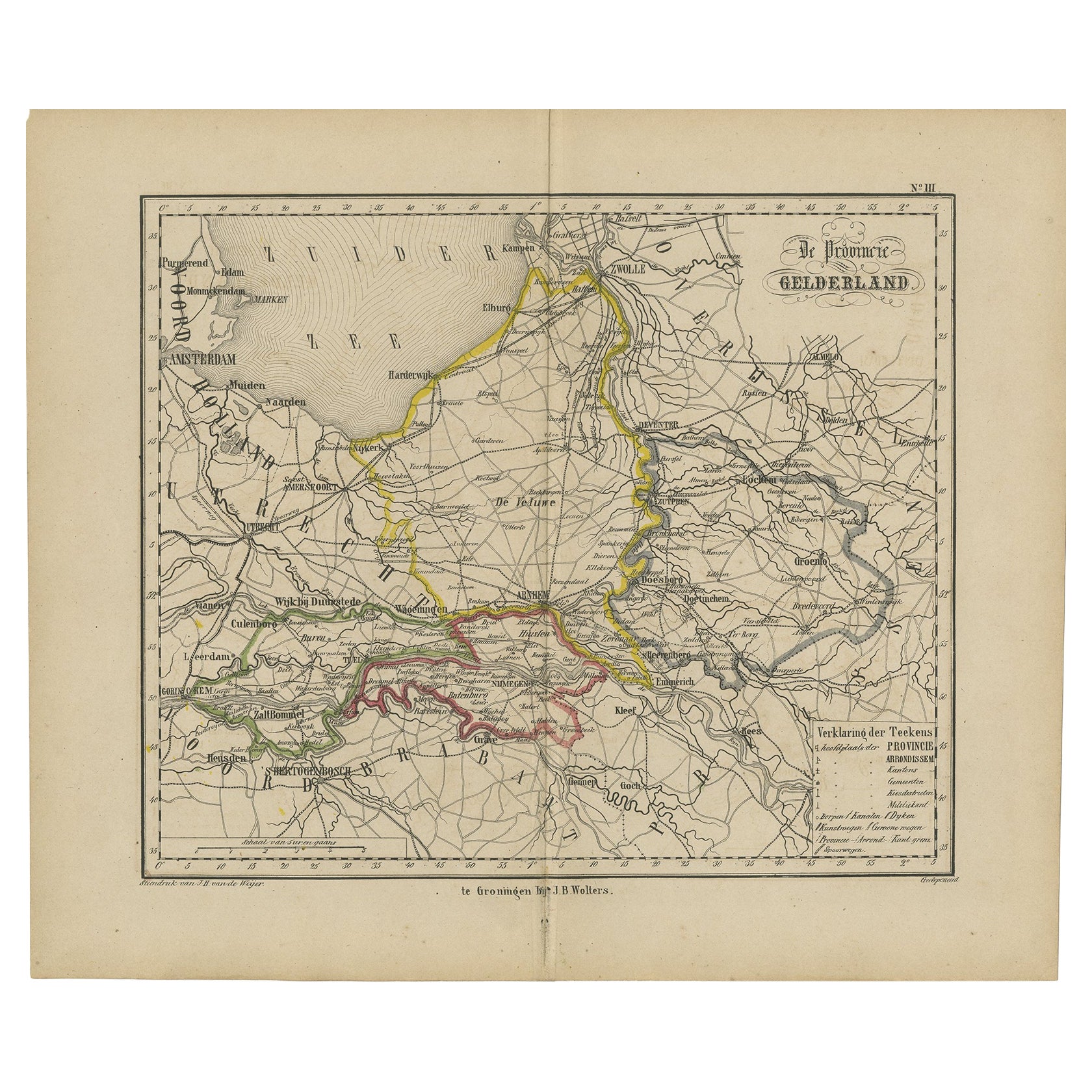
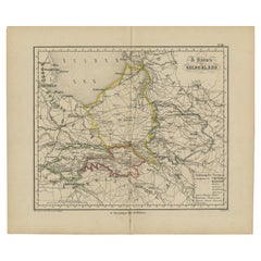
Antique Map of Gelderland with the Veluwe Etc, the Netherlands, 1864
Located in Langweer, NL
Antique map titled 'De Provincie Gelderland'. Map of the province of Gelderland, the Netherlands.
This map originates from 'F. C. Brugsma's Atlas van het Koninkrijk der Nederland...
Category
Antique 19th Century Maps
Materials
Paper
Antique Detailed Map of the Mountain Chains of Europe and Asia, c.1850
Located in Langweer, NL
Antique map titled 'The Mountain Chains of Europe & Asia'.
Old map depicting the mountain chains of Europe and Asia. Originates from 'The Physical Atlas of Natural Phenomena'.
Ar...
Category
Antique 19th Century Maps
Materials
Paper

You May Also Like
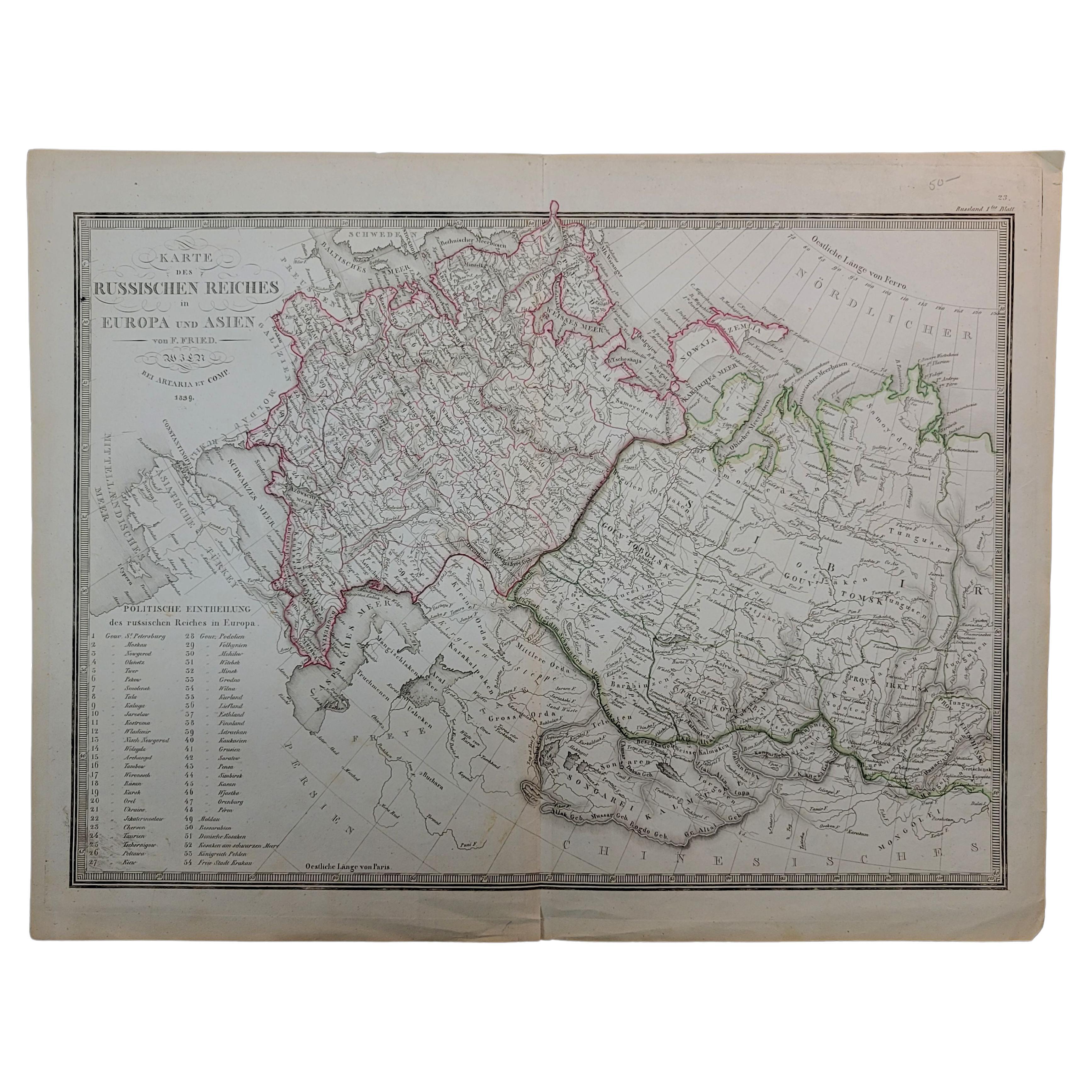
1839 Map of Karte Des "Russischen Reiches in Europa Und Asien" Ric.R0013
Located in Norton, MA
1839 map of Karte Des
"Russischen Reiches in Europa and Asien"
Ric.r013
Map of the European and Asian parts of Russian Empire. Karte der Russischen Reiches in Europa und Asien...
Category
Antique 19th Century Unknown Maps
Materials
Paper

1849 Map of "Europaische Russland", 'Meyer Map of European Russia', Ric. R017
Located in Norton, MA
1849 Map of
"Europaische Russland"
( Meyer Map of European Russia)
Ric.r017
A lovely map of European Russia dating to 1849 by Joseph Meyer. It covers the European portions of...
Category
Antique 19th Century Unknown Maps
Materials
Paper

1844 Map "Russia in Eurpoe, Part II to Part VIII", 7 Maps Ric.r023
Located in Norton, MA
1844 Map "Russia in Eurpoe, Part II to Part VIII"
7 Maps
Ric.r023
Fine, original, steel-engraved Map of Russia in Europe Part II t oPart VIII, by the Society for the Diffusion of Useful Knowledge. Detailed map of the regions to the northeast of Moscow. Including Arkhangel, Vologda, Viatka, Perm, Olonetz, Iaroslavl. The SDUK began its map publishing project under the leadership of Captain Francis Beaufort R.N. in 1829, and published the maps in parts, haltingly, over the next 15 years, completing the series in 1844, finally permitting the publication of a whole atlas. Many of the maps were actually drawn by Beaufort, who at the time was the Hydrographer to the Royal Navy, and all were closely supervised by him. J. & C. Walker worked closely with Beaufort in engraving the maps. Finely engraved, carefully researched, the maps set...
Category
Antique 19th Century Unknown Maps
Materials
Paper

1853 Map of "Russia in Europe Including Poland" Ric.r016
Located in Norton, MA
Description
Russia in Europe incl. Poland by J Wyld c.1853
Hand coloured steel engraving
Dimension: Paper: 25 cm W x 33 cm H ; Sight: 22 cm W x 28 cm H
Condition: Good ...
Category
Antique 19th Century Unknown Maps
Materials
Paper

Ancient National Atlas of France with Marengo
Located in Alessandria, Piemonte
Ancient National Atlas of France with the department of Marengo: a rare French etching dated 1806.
ST/178.
Category
Antique Early 19th Century French Other Prints
Materials
Paper

Original Antique English County Map, Nottinghamshire, J & C Walker, 1851
Located in St Annes, Lancashire
Great map of Nottinghamshire
Original colour
By J & C Walker
Published by Longman, Rees, Orme, Brown & Co. 1851
Unframed.
Category
Antique 1850s English Other Maps
Materials
Paper

More Ways To Browse
1681 Moses Pitt
Antique Maps Washington Dc
Ithaca Antique Map
J Thayer
Rust Red Rug
Vintage Studio Chair
1890s French Posters
Casa Finland
Mobelfabrik Danish
Playful Chair
Giacometti Chairs
Antique Rug Wool Navy Blue Red
Bauhaus Flower Stand
French Table With Drawers
North Carolina Furniture
Antique Silver Platter
Boat Blueprint
Cream Plates