Items Similar to Antique Map of Gelderland with the Veluwe Etc, the Netherlands, 1864
Want more images or videos?
Request additional images or videos from the seller
1 of 5
Antique Map of Gelderland with the Veluwe Etc, the Netherlands, 1864
About the Item
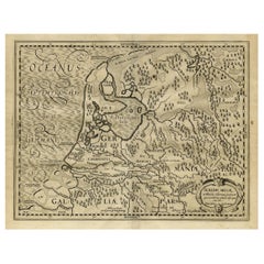
Antique map titled 'De Provincie Gelderland'. Map of the province of Gelderland, the Netherlands.
This map originates from 'F. C. Brugsma's Atlas van het Koninkrijk der Nederlanden (..)'.
Artist: Author: Frederik Carel Brugsma. Published by J.B. Wolters.
Condition: Good, general age-related toning. Original folding line, minor wear. Blank verso. Please study image carefully.
Date: 1864
We sell original antique maps to collectors, historians, educators and interior decorators all over the world. Our collection includes a wide range of authentic antique maps from the 16th to the 20th centuries. Buying and collecting antique maps is a tradition that goes back hundreds of years. Antique maps have proved a richly rewarding investment over the past decade, thanks to a growing appreciation of their unique historical appeal. Today the decorative qualities of antique maps are widely recognized by interior designers who appreciate their beauty and design flexibility. Depending on the individual map, presentation, and context, a rare or antique map can be modern, traditional, abstract, figurative, serious or whimsical. We offer a wide range of authentic antique maps for any budget.
- Dimensions:Height: 10.04 in (25.5 cm)Width: 12.01 in (30.5 cm)Depth: 0 in (0.01 mm)
- Materials and Techniques:
- Period:
- Date of Manufacture:1864
- Condition:
- Seller Location:Langweer, NL
- Reference Number:
About the Seller
5.0
Platinum Seller
These expertly vetted sellers are 1stDibs' most experienced sellers and are rated highest by our customers.
Established in 2009
1stDibs seller since 2017
1,933 sales on 1stDibs
Typical response time: <1 hour
- ShippingRetrieving quote...Ships From: Langweer, Netherlands
- Return PolicyA return for this item may be initiated within 14 days of delivery.
More From This SellerView All
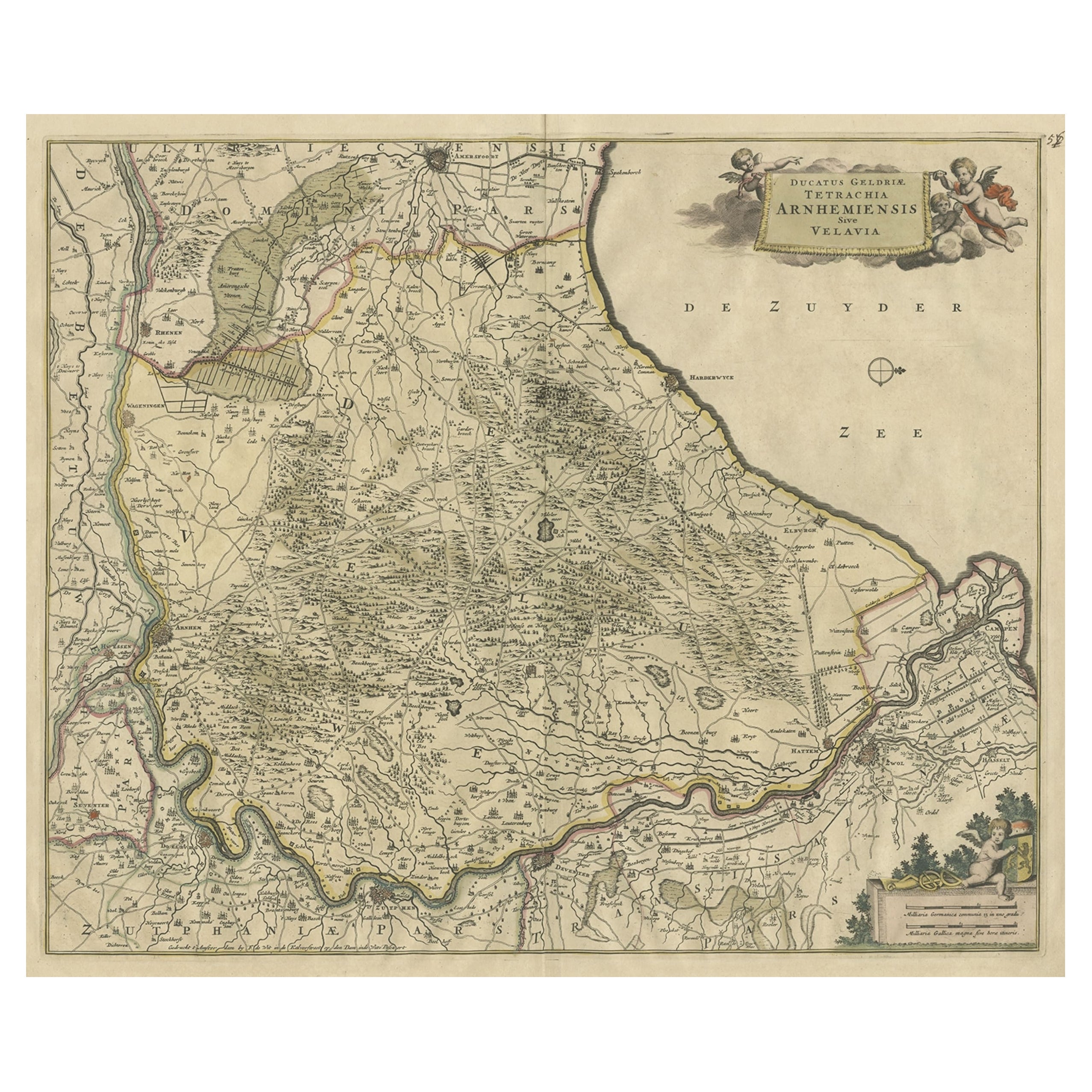
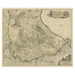
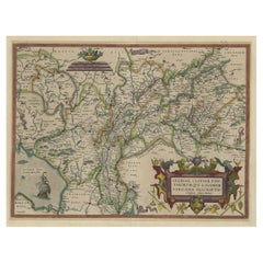
- Beautiful Map of Arnhem and the Veluwe Region, Gelderland, The Netherlands, 1690Located in Langweer, NLAntique map titled 'Ducatus Geldriae tetrachia Arnhemiensis sive Velavia'. Beautiful map of the region of Arnhem and the Veluwe region, Gelderland, the Netherlands. Artists an...Category
Antique 1690s Maps
MaterialsPaper
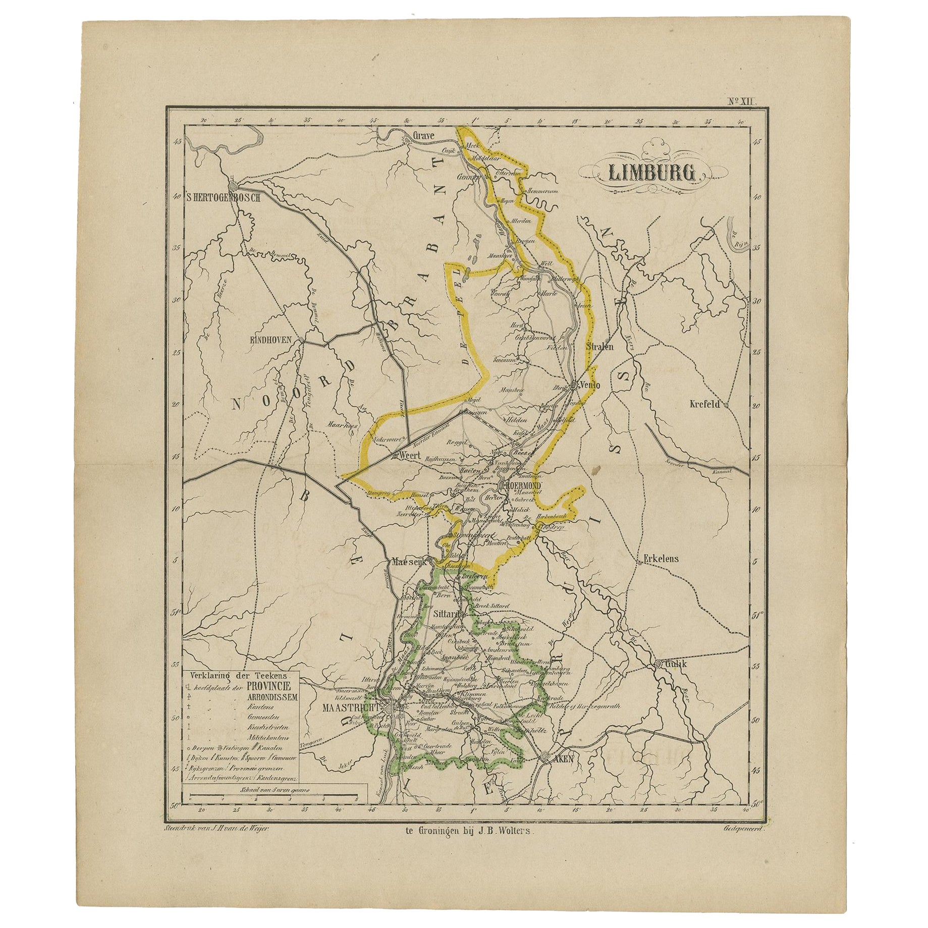
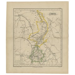
- Antique Map of the Province Limburg, The Netherlands, 1864Located in Langweer, NLAntique map titled 'De Provincie Limburg'. Map of the province of Limburg, the Netherlands. This map originates from 'F. C. Brugsma's Atlas van het Koninkrijk der Nederlanden (..)'. ...Category
Antique 19th Century Maps
MaterialsPaper
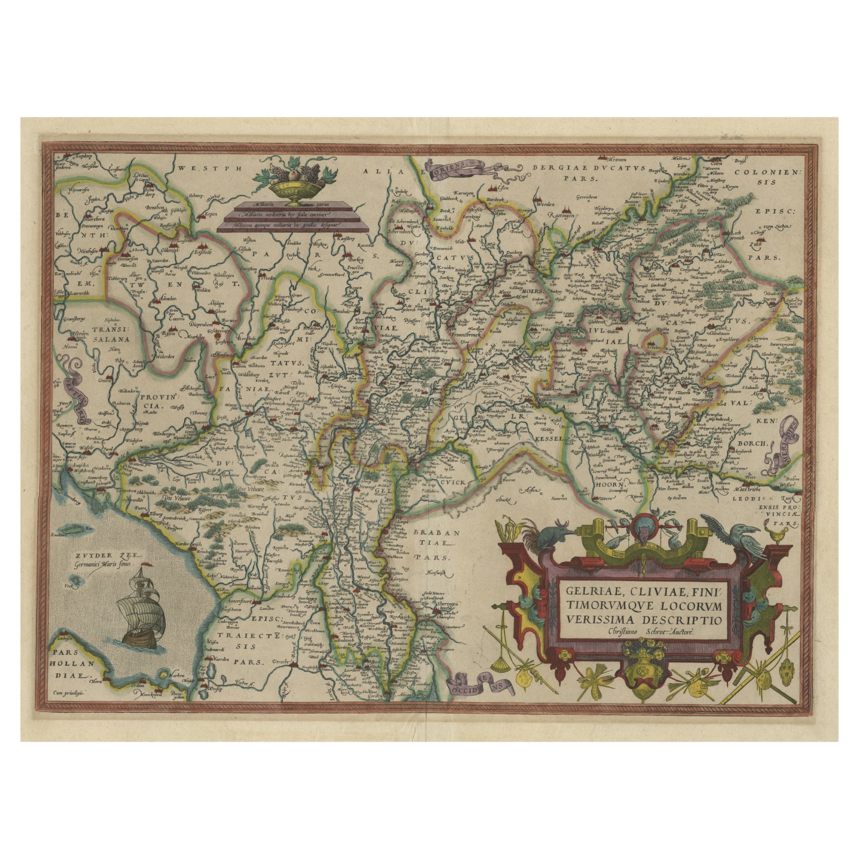
- Superb Antique Map of the Province of Gelderland, the Netherlands, ca.1575Located in Langweer, NLAntique map titled 'Gelriae, Cliviae, Finitimorumque Locorum Verissima Descriptio Christiano Schrot. Auctore'. This superb map is Ortelius' first plate covering Gelderland. It is...Category
Antique 16th Century Maps
MaterialsPaper
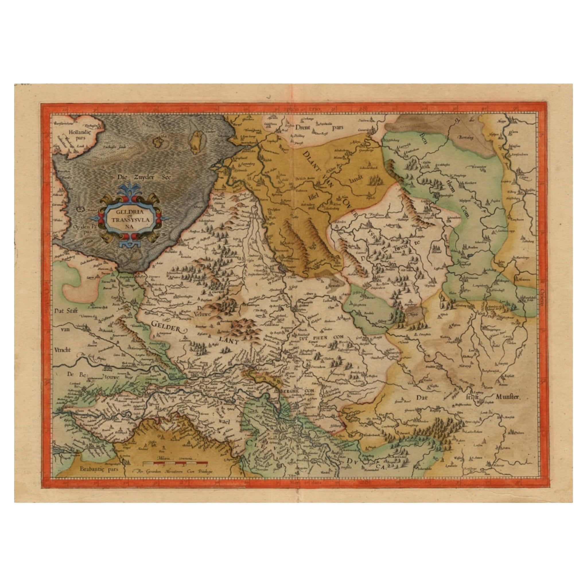
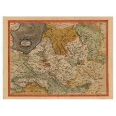
- Early Antique Map of Gelderland and Overijssel in the Netherlands, c.1625Located in Langweer, NLAntique map titled 'Geldria et Transysulana'. One of the earliest maps of Gelderland and Overijssel in the Netherlands, prepared by Gerard Mercator. Artists and Engravers: Gerard...Category
Antique 17th Century Maps
MaterialsPaper
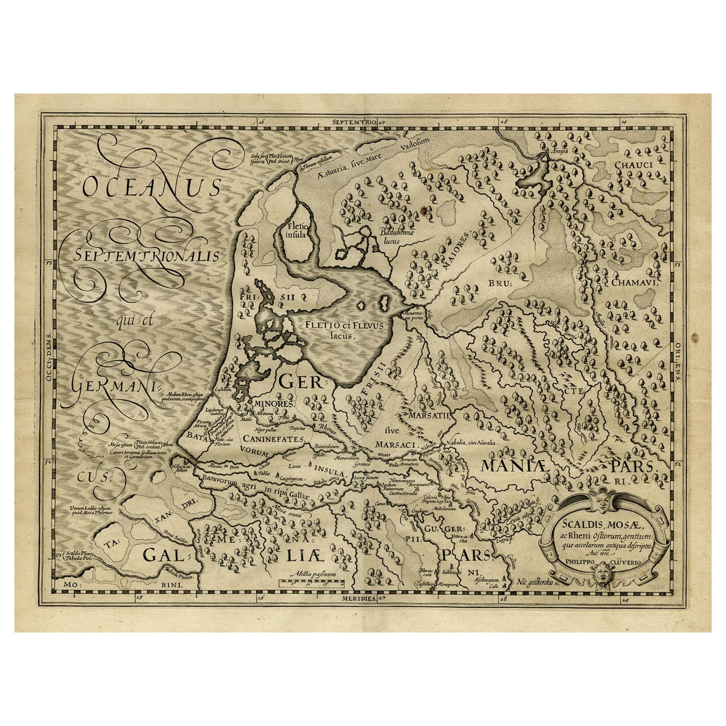
- Antique Latin Map of the Netherlands & Germany, Incl Roman Forts, Etc., 1631Located in Langweer, NLAntique map titled 'Scaldis Mosae, ac Rheni Ostiorum, gentiumque accolarum antiqua descriptio.' A Latin map of the Netherlands and Germany, showing all the major rivers as well a...Category
Antique 1630s Maps
MaterialsPaper
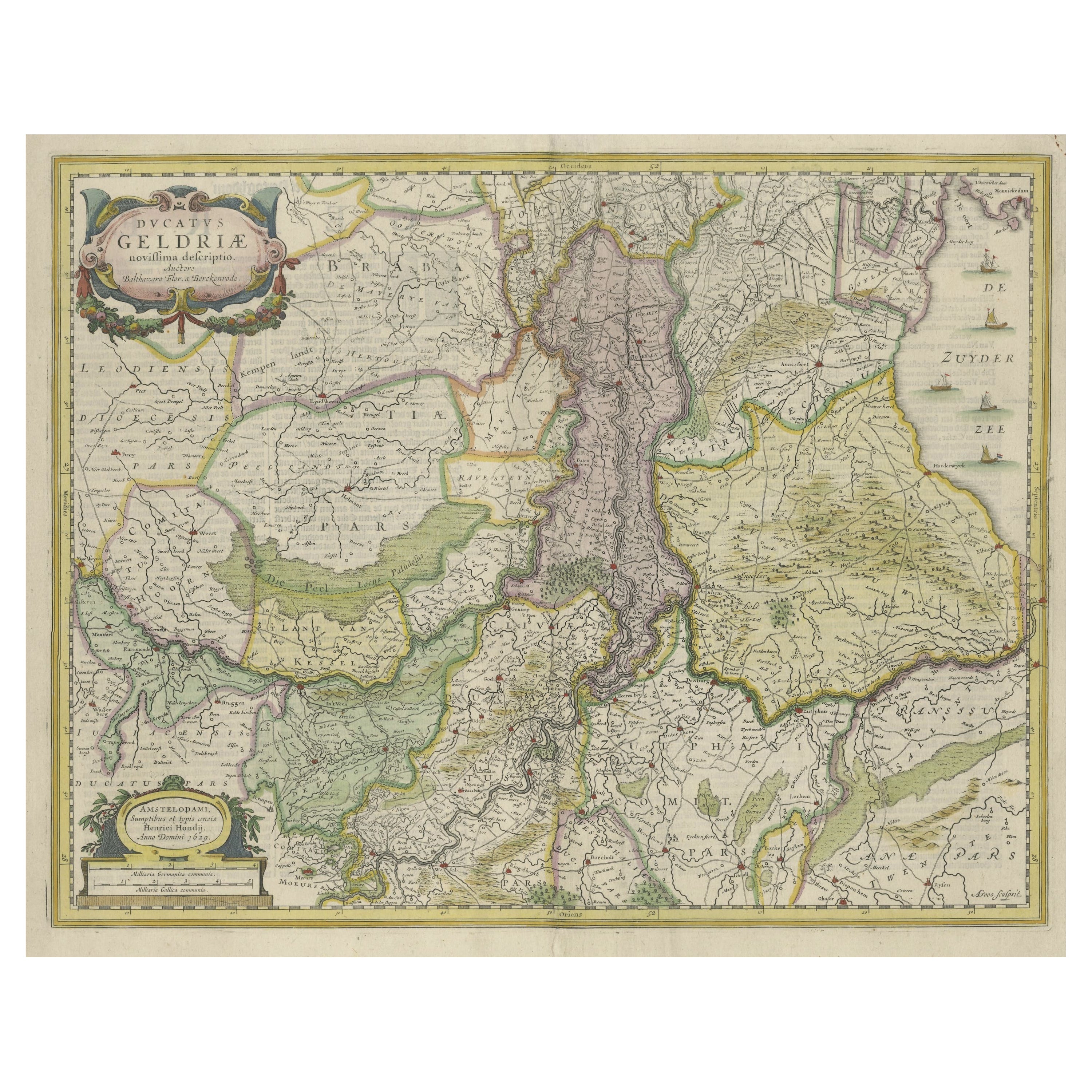
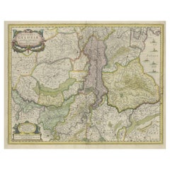
- Original Hand-Colored Antique Map of Gelderland and Utrecht in the NetherlandsLocated in Langweer, NLAntique map titled 'Ducatus Geldriae novissima descriptio'. Detailed map of Gelderland, a province in the Netherlands. Two coats of arms, one with scale. Ships on ‘De Zuyderzee’. Pub...Category
Antique Mid-17th Century Maps
MaterialsPaper
You May Also Like
- Original Antique Map of The Netherlands, Engraved by Barlow, Dated 1807Located in St Annes, LancashireGreat map of Netherlands Copper-plate engraving by Barlow Published by Brightly & Kinnersly, Bungay, Suffolk. Dated 1807 Unframed.Category
Antique Early 1800s English Maps
MaterialsPaper
- Original Antique Map of The Netherlands, Sherwood, Neely & Jones, Dated 1809Located in St Annes, LancashireGreat map of The Netherlands Copper-plate engraving by Cooper Published by Sherwood, Neely & Jones. Dated 1809 Unframed.Category
Antique Early 1800s English Maps
MaterialsPaper
- 1864 "Proclamation of Emancipation, " Antique Engraving by Charles ShoberLocated in Colorado Springs, COThis 1865 engraving features the Emancipation Proclamation in elaborate calligraphic text, with five patriotic vignettes and a small portrait...Category
Antique 1860s American Historical Memorabilia
MaterialsPaper
- Map of the Republic of GenoaLocated in New York, NYFramed antique hand-coloured map of the Republic of Genoa including the duchies of Mantua, Modena, and Parma. Europe, late 18th century. Dimension: 25...Category
Antique Late 18th Century European Maps
- Civil War Panorama of the Seat of War by John Bachmann, Antique Print circa 1864Located in Colorado Springs, COPanorama of the seat of war. Bird's-eye View of Virginia, Maryland, Delaware and the District of Columbia. This third state of this fascinating bird's eye view of the northernmost p...Category
Antique 1860s American Maps
MaterialsPaper
- Antique Map of Principality of MonacoBy Antonio Vallardi EditoreLocated in Alessandria, PiemonteST/619 - "Old Geographical Atlas of Italy - Topographic map of ex-Principality of Monaco" - ediz Vallardi - Milano - A somewhat special edition ---Category
Antique Late 19th Century Italian Other Prints
MaterialsPaper


Recently Viewed
View AllMore Ways To Browse
Antique Etc
Antique The Netherlands
Antique World Globe
Antique World Globes
World Globes Antique
Antique Rollers
Russian Antique Collectables
Framed Map United States
Doctor Office
Edinburgh Antiques
Antique Map Of The United States
Antique Maps Of The United States
Antique Sea Map
Sea Map
Antique African American
African American Antique
Antique Furniture East London
Antique Eastern European Furniture