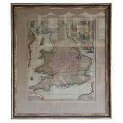
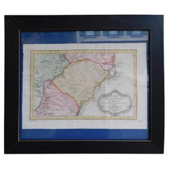
Framed Britannia Map Hand Tinted and Colored, Signed Matthaus Seutter, C. 1725
View Similar Items

Want more images or videos?
Request additional images or videos from the seller
1 of 9
Framed Britannia Map Hand Tinted and Colored, Signed Matthaus Seutter, C. 1725
$12,000List Price
About the Item
- Dimensions:Height: 33 in (83.82 cm)Width: 28.75 in (73.03 cm)Depth: 1.25 in (3.18 cm)
- Style:George II (Of the Period)
- Materials and Techniques:
- Place of Origin:
- Period:1720-1729
- Date of Manufacture:Circa 1725
- Condition:Wear consistent with age and use.
- Seller Location:Charleston, SC
- Reference Number:Seller: # 49021stDibs: LU887219294902
About the Seller
4.7
Vetted Professional Seller
Every seller passes strict standards for authenticity and reliability
Established in 1970
1stDibs seller since 2010
431 sales on 1stDibs
Typical response time: 7 hours
Authenticity Guarantee
In the unlikely event there’s an issue with an item’s authenticity, contact us within 1 year for a full refund. DetailsMoney-Back Guarantee
If your item is not as described, is damaged in transit, or does not arrive, contact us within 7 days for a full refund. Details24-Hour Cancellation
You have a 24-hour grace period in which to reconsider your purchase, with no questions asked.Vetted Professional Sellers
Our world-class sellers must adhere to strict standards for service and quality, maintaining the integrity of our listings.Price-Match Guarantee
If you find that a seller listed the same item for a lower price elsewhere, we’ll match it.Trusted Global Delivery
Our best-in-class carrier network provides specialized shipping options worldwide, including custom delivery.More From This Seller
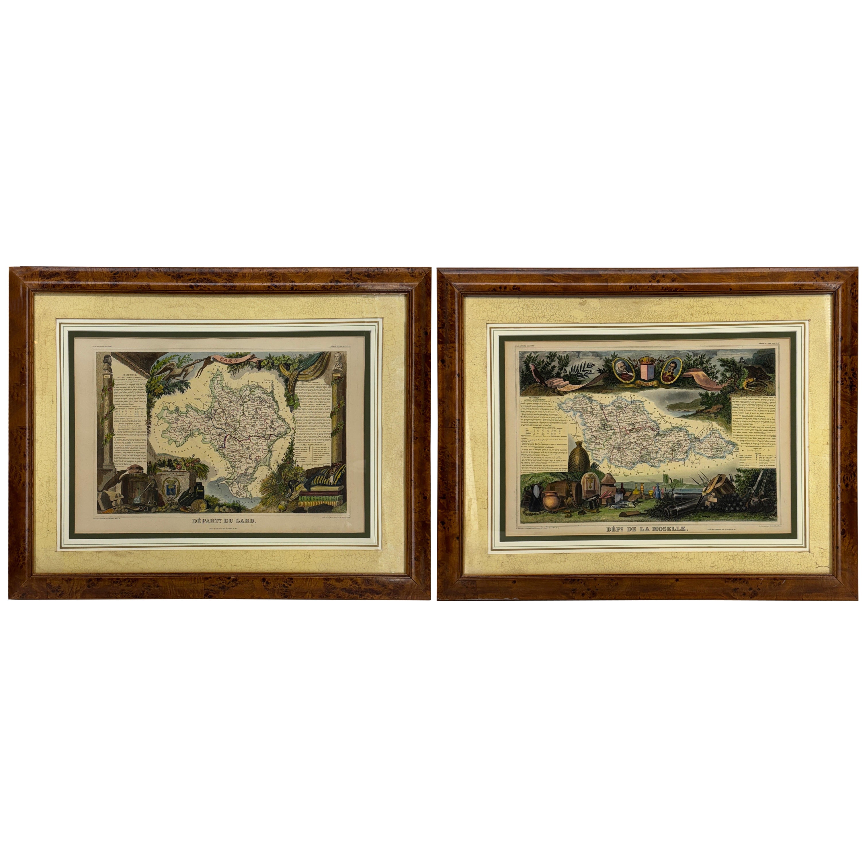
View AllFrench Framed Copper Engraved Hand Colored Map of Carolina & Georgia, Circa 1757
Located in Charleston, SC
French copper engraved hand colored map of Carolina & Georgia matted under glass with a painted frame, mid-18th century
Category
Antique 1750s French Louis XV Maps
Materials
Glass, Wood, Paint, Paper
English Engraved Hand Colored Map of the North Eastern United States, circa 1817
Located in Charleston, SC
English copper engraved hand colored map of the North Eastern United States matted under glass in a gilt frame, Early 19th Century. Drawn and Engraved for Thomson's New General Atlas...
Category
Antique 1810s English George III Maps
Materials
Glass, Giltwood, Paint, Paper

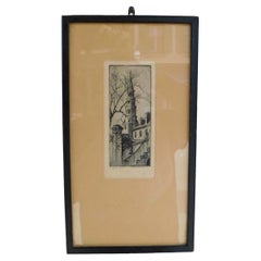
Elizabeth O'Neil Verner Framed Etching St. Phillips Steeple, Charleston, SC 1925
Located in Charleston, SC
Elizabeth O'Neil Verner framed dry point etching of St. Phillips Church Steeple, Charleston, SC. Early 20th Century
Category
Vintage 1920s American Art Nouveau Drawings
Materials
Glass, Wood, Paper
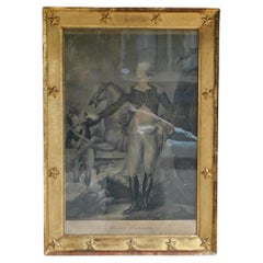
American Steel Engraving of George Washington in Orig. Gilt Starred Frame C 1800
By John Trumbull
Located in Charleston, SC
American Steel Engraving of General George Washington "Before the Battle of Trenton" By John Trumbull Under Original Wavy Glass and Thirteen Starred Gilt Frame, Early 19th Century. T...
Category
Antique Early 1800s American American Colonial Drawings
Materials
Steel
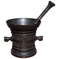
Italian Bronze Mortar and Pestle, Signed, Christopher Eberhardt, Circa 1830
Located in Charleston, SC
Italian bronze mortar and pestle. Christopher Eberhardt, Anno J667 Grabavw, Early 19th Century. Measures: 7.25" diameter at top, 5.75" diamete...
Category
Antique 1830s Italian Neoclassical Scientific Instruments
Materials
Bronze
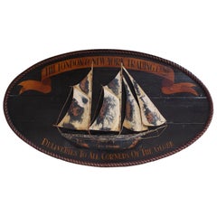
American Oval Timber Trade Sign with Two Masted Ship and Rope Boarder. C. 1850
Located in Charleston, SC
American oval hand carved timber trade sign with a centered two masted ship, rope border, upper painted banner "The London and New York Trading Company"...
Category
Antique 1850s American American Empire Nautical Objects
Materials
Rope, Wood, Paint
You May Also Like
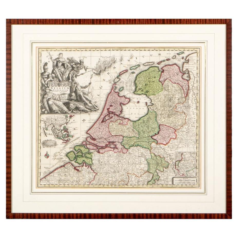
Matthaus Seutter, Framed 1730 Color Engraving Map of "Belgium Fonderatum"
Located in Bridgeport, CT
Label on verso. From Grosser Atlas. The name Belgium comes from the ancient designation "Gallis Belgica". Figural decoration upper left. M. Seutter was a famed German mapmaker in the...
Category
Antique 18th Century European Renaissance Maps
Materials
Brass

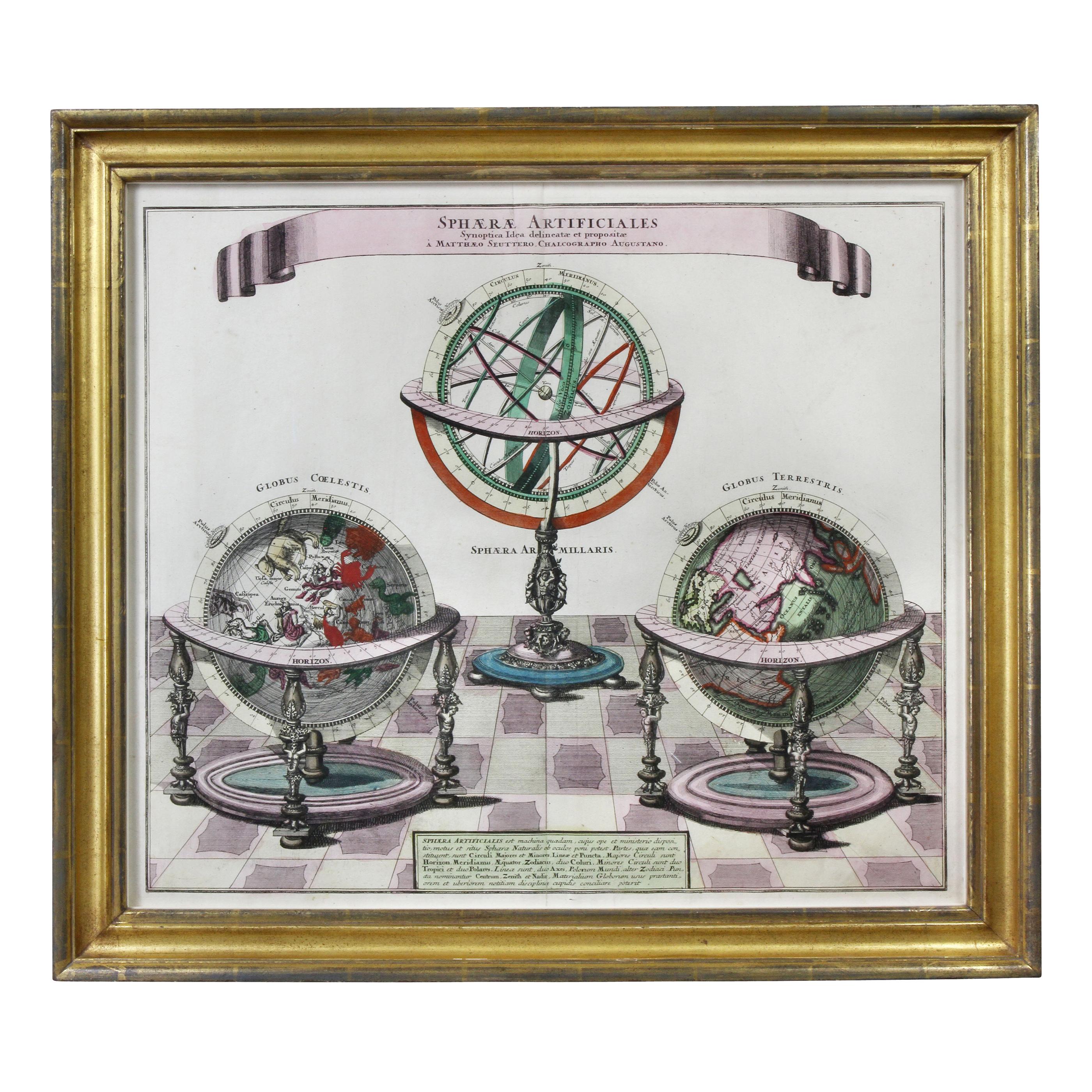
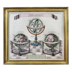
Framed Engraving By Matthaus Seutter Of Sphaerae Artificiales
Located in Essex, MA
Cartographer from Germany 1678-1757. Hand colored. Gilt wood frame. Estate of William Hodgins.
Category
Antique Early 1700s German Prints
Materials
Paper
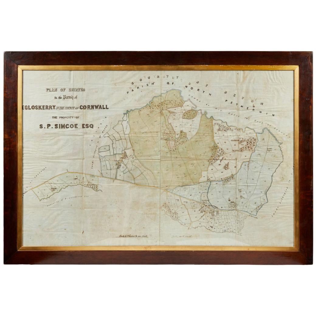
Antique Framed Pen and Ink on Fabric Map of Cornwall from Early 19th Century
Located in Los Angeles, CA
This English fabric map of Cornwall, rendered in pen-and-ink, showcases exquisite hand-drawn details and charming faded sepia tones. Encased in a classic frame, this piece elegantly ...
Category
Antique Early 19th Century English Drawings
Materials
Walnut, Fabric

Framed 17th Century Map of Cumberland, England by John Speed, 1610
By John Speed
Located in Middleburg, VA
A fascinating and richly detailed antique map of Cumberland County in northwest England, drawn and published by the celebrated English cartographer John Spe...
Category
Antique Early 17th Century English British Colonial Maps
Materials
Copper, Gold Leaf

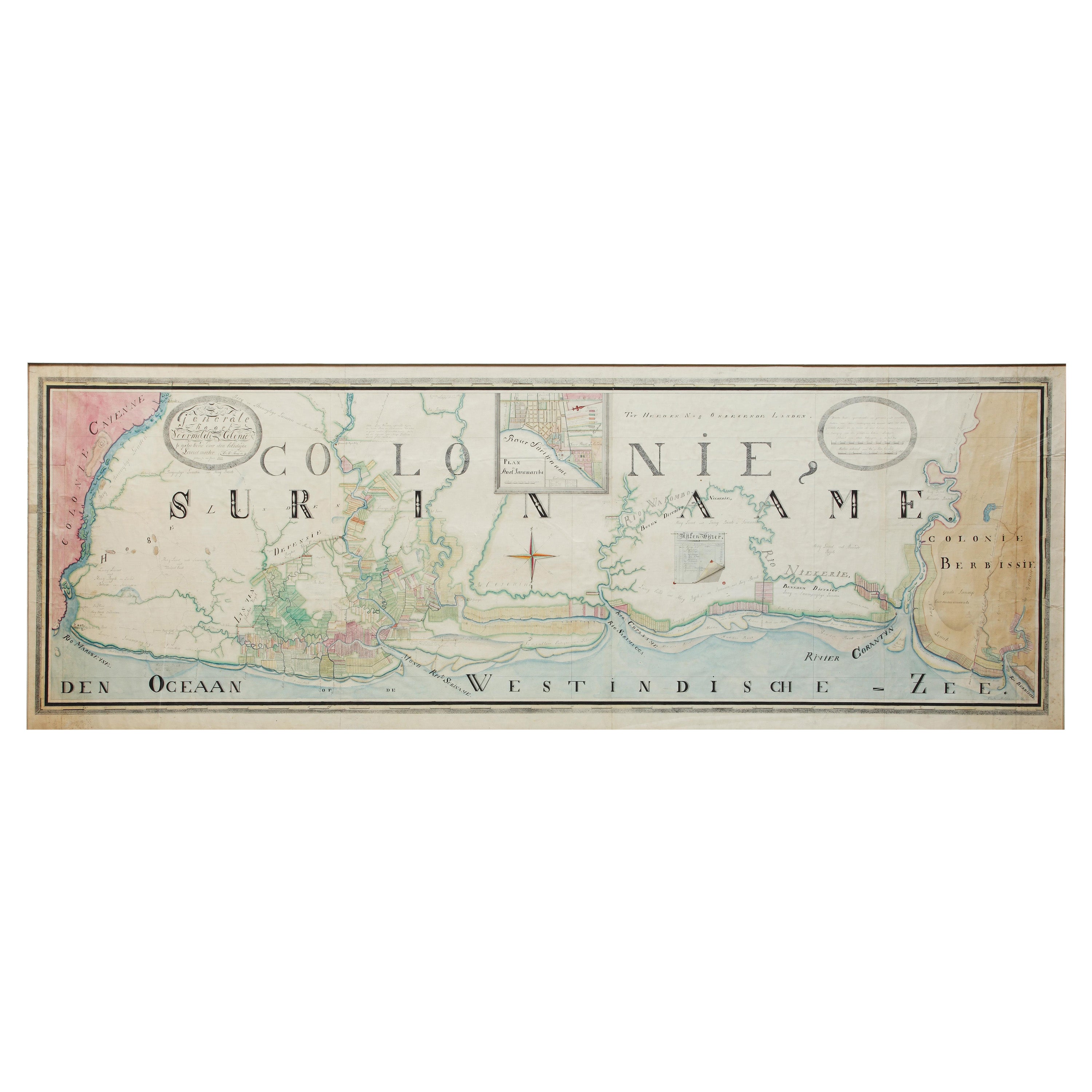
Extremely Large Hand-Drawn Manuscript Map of Surinam, 1830, History of Slavery
Located in Amsterdam, NL
A unique large hand-drawn map of Surinam by Albrecht Helmut Hiemcke (German, 1760-1839)
?
'Colonie Surinaame', 1830
A large hand-drawn and coloured map of the colony of Suri...
Category
Antique Mid-19th Century Surinamer Maps
Materials
Paper

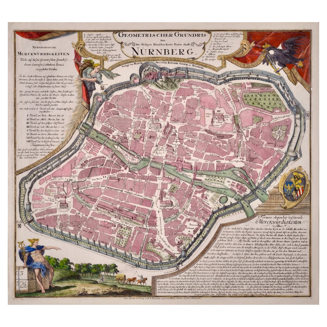
City View of Nuremberg, Germany: An 18th Century Hand-Colored Map by M. Seutter
By Matthew Seutter
Located in Alamo, CA
An 18th century hand-colored city view of Nuremburg, Germany entitled "Geometrischer Grundris der des Heiligen Römischen Reichs Freyen Stadt Nürnberg" by Matthaus Seutter from his "A...
Category
Antique Mid-18th Century German Maps
Materials
Paper
