Items Similar to Historic 1858 Map of South America – Pre-Border Consolidation


Want more images or videos?
Request additional images or videos from the seller
1 of 10
Historic 1858 Map of South America – Pre-Border Consolidation
$507.85
£382.34
€430
CA$699.60
A$783.51
CHF 408.82
MX$9,570.24
NOK 5,201.42
SEK 4,902.96
DKK 3,273.22
About the Item
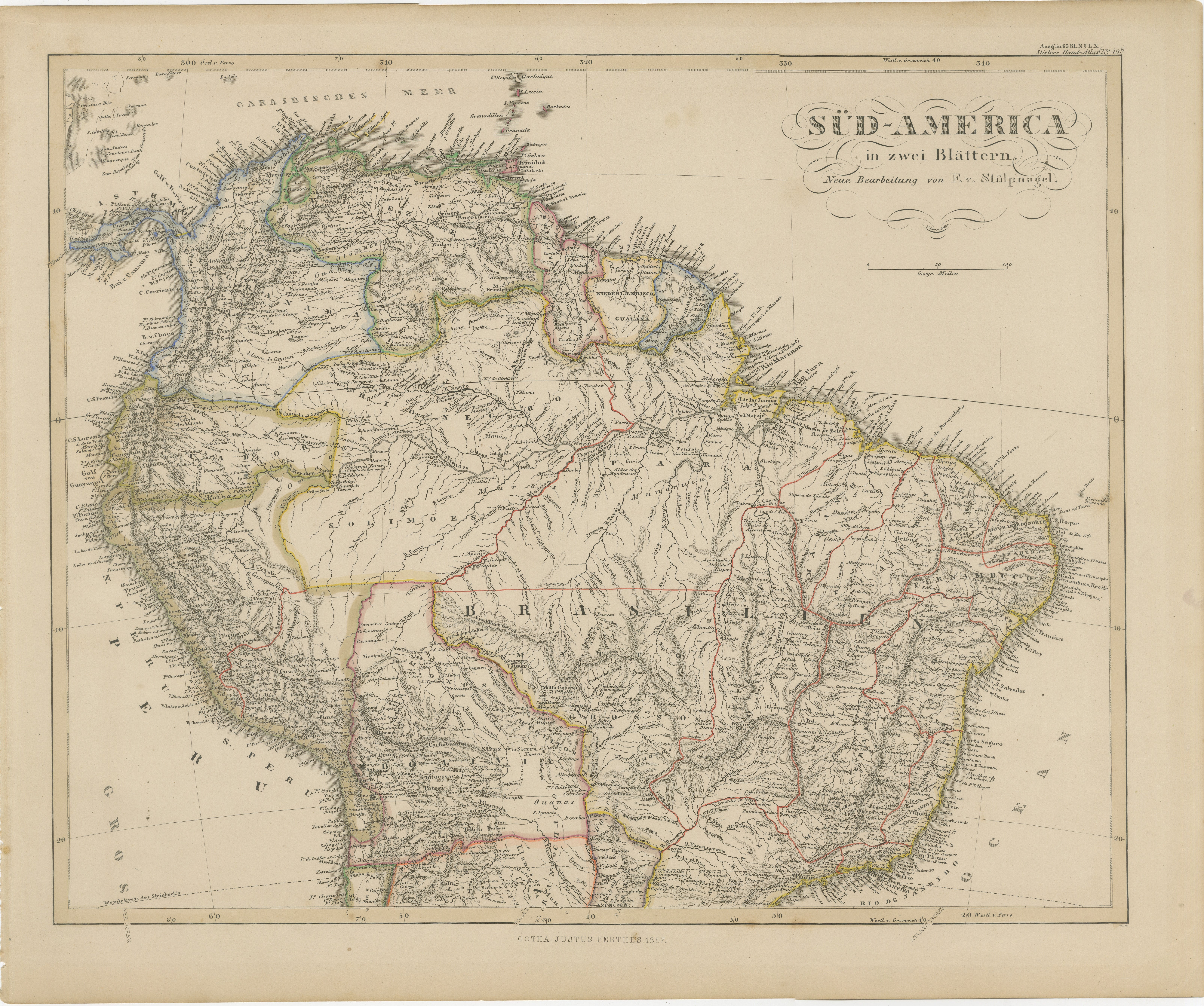
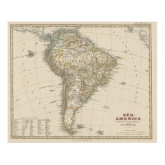
Antique Map of South America – Stülpnagel Engraving Published by Perthes, 1858
Detailed 19th-century engraved map titled "Süd-America", designed and drawn by F. von Stülpnagel and published by Justus Perthes in Gotha in 1856. This elegantly engraved and hand-colored map offers a comprehensive view of the political and physical geography of South America in the mid-1800s, a period marked by the early independence of many nations on the continent.
The map outlines the major countries of the time in hand-colored borders, including Brazil, Argentina, Bolivia, Chile, Peru, Colombia, Venezuela, and others. Many of these borders were still evolving during the 1850s, and this map reflects the geopolitical uncertainties and emerging national identities in post-colonial Latin America.
Topographic details are finely engraved, especially the Andes mountain range, which stretches down the western spine of the continent. Major rivers such as the Amazon, Orinoco, and Paraná are prominently featured, along with important cities including Rio de Janeiro, Buenos Aires, Lima, Santiago, and Bogotá. Coastal features and islands are also carefully delineated, and the southern tip includes the Strait of Magellan and Tierra del Fuego.
A reference legend at the bottom left provides further classification of political divisions, populations, and other annotations relevant to the era. Longitude is marked from the Ferro meridian, and a clear scale of miles is included. The work was produced by the Geographical Institute of Justus Perthes, one of the premier cartographic publishers of the 19th century.
This map presents both historical and artistic interest, ideal for collectors focused on early Latin American geography or decorative antique cartography.
Condition report:
Very good overall condition. Minor toning and faint spotting in the lower margin, not affecting the printed area. Original hand-coloring remains fresh. No tears or repairs. Please study the image for further details.
Framing tips:
We recommend a dark wood frame with a cream or ivory mat to enhance the soft tones and contrast of the engraving. A thin gold fillet can add elegance. UV-protective, non-glare glass will help preserve the hand-coloring and fine lines. This piece works beautifully in study spaces, offices, or alongside other 19th-century maps.
Technique: Engraving with original hand-coloring
Maker: F. von Stülpnagel, published by Justus Perthes, Gotha, 1858
- Dimensions:Height: 14.77 in (37.5 cm)Width: 17.88 in (45.4 cm)Depth: 0.01 in (0.2 mm)
- Materials and Techniques:Paper,Engraved
- Place of Origin:
- Period:
- Date of Manufacture:1858
- Condition:Very good overall condition. Minor toning and faint spotting in the lower margin, not affecting the printed area. Original hand-coloring remains fresh. No tears or repairs. Please study the image for further details.
- Seller Location:Langweer, NL
- Reference Number:Seller: BG-05552-521stDibs: LU3054346115892
About the Seller
5.0
Recognized Seller
These prestigious sellers are industry leaders and represent the highest echelon for item quality and design.
Platinum Seller
Premium sellers with a 4.7+ rating and 24-hour response times
Established in 2009
1stDibs seller since 2017
2,533 sales on 1stDibs
Typical response time: <1 hour
- ShippingRetrieving quote...Shipping from: Langweer, Netherlands
- Return Policy
Authenticity Guarantee
In the unlikely event there’s an issue with an item’s authenticity, contact us within 1 year for a full refund. DetailsMoney-Back Guarantee
If your item is not as described, is damaged in transit, or does not arrive, contact us within 7 days for a full refund. Details24-Hour Cancellation
You have a 24-hour grace period in which to reconsider your purchase, with no questions asked.Vetted Professional Sellers
Our world-class sellers must adhere to strict standards for service and quality, maintaining the integrity of our listings.Price-Match Guarantee
If you find that a seller listed the same item for a lower price elsewhere, we’ll match it.Trusted Global Delivery
Our best-in-class carrier network provides specialized shipping options worldwide, including custom delivery.More From This Seller
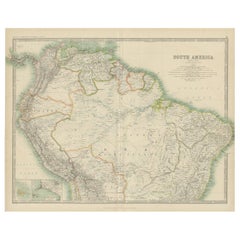
View All1857 Map of Northern South America – Brazil, Colombia, Peru by Stülpnagel
Located in Langweer, NL
1857 Map of Northern South America – Brazil, Colombia, Peru by Stülpnagel
Antique map titled “Süd-America in zwei Blättern” (South America in Two Sheets), newly edited by V. v. Stül...
Category
Antique Mid-19th Century German Maps
Materials
Paper

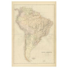
Antique Map of South America, c.1840
Located in Langweer, NL
Antique map titled 'South America'. Original, antique map depicting South America. With outline coloring. Source unknown, to be determined. Artists and Engravers: Anonymous.
Artist:...
Category
Antique 19th Century Maps
Materials
Paper

$68 Sale Price
20% Off
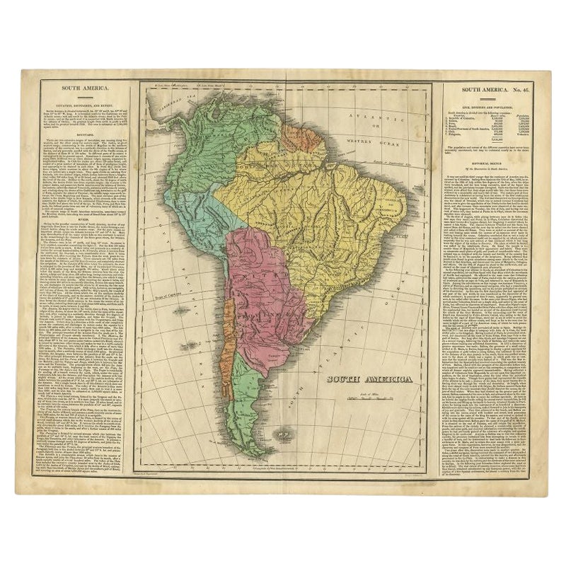
Interesting Original Antique Map of South America, 1822
Located in Langweer, NL
Antique map titled 'South America'.
Map of South America with attractive topography, surrounded on three sides by text on the history, geography, and economy of the continent. Sh...
Category
Antique 19th Century Maps
Materials
Paper

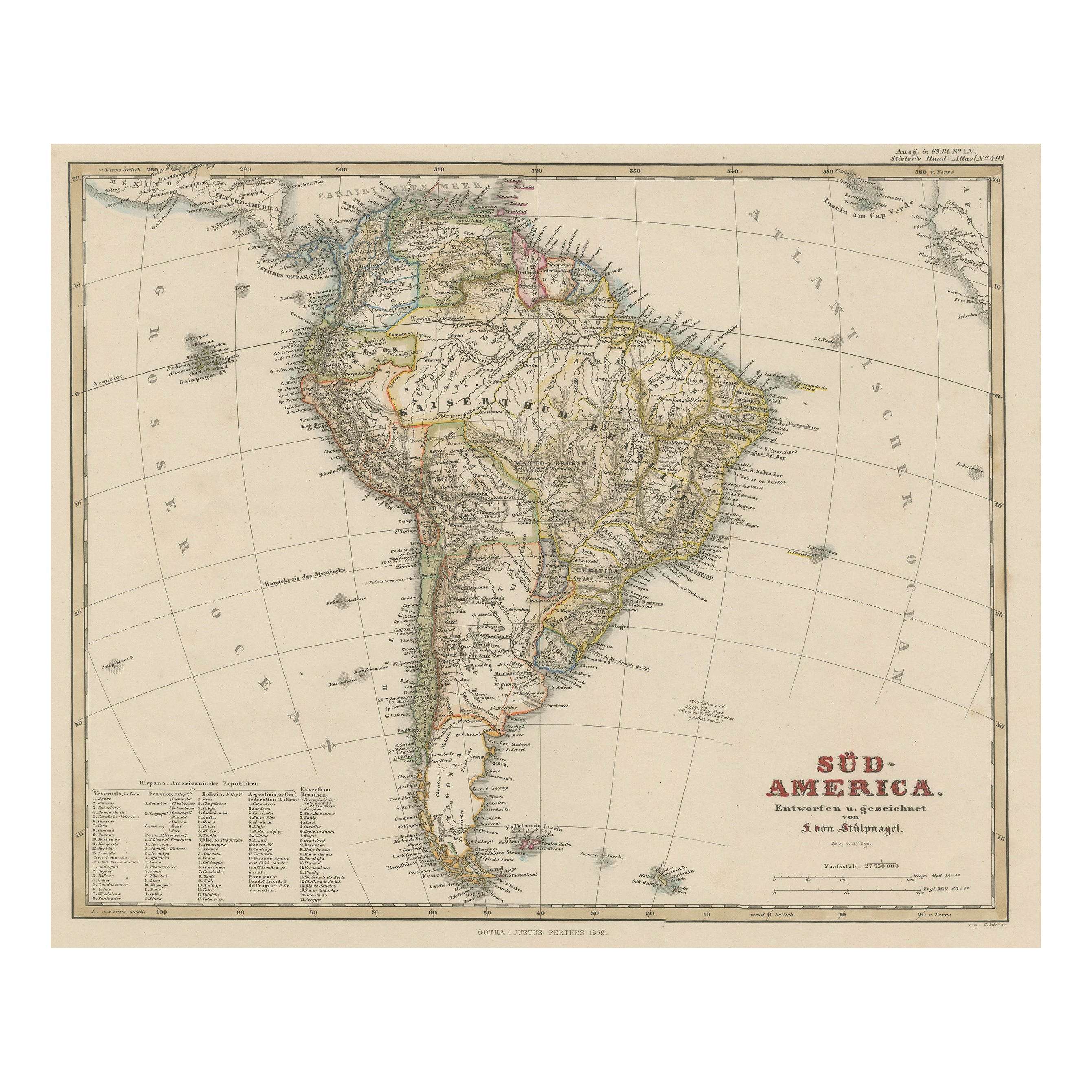
Antique Map of South America with Many Details, ca.1859
Located in Langweer, NL
Original antique map titled 'Süd-America'. Beautiful old map of South America, with many details and legend.
This map originates from Stielers Handatlas, published circa 1859. St...
Category
Antique Mid-19th Century Maps
Materials
Paper
$548 Sale Price
20% Off
1882 Detailed Map of South America showing Political and Geographical Features
Located in Langweer, NL
This 1882 map of South America, published by Blackie and Son as part of the 'Comprehensive Atlas and Geography of the World,' showcases the continent in remarkable detail. It provide...
Category
Antique 1880s Maps
Materials
Paper
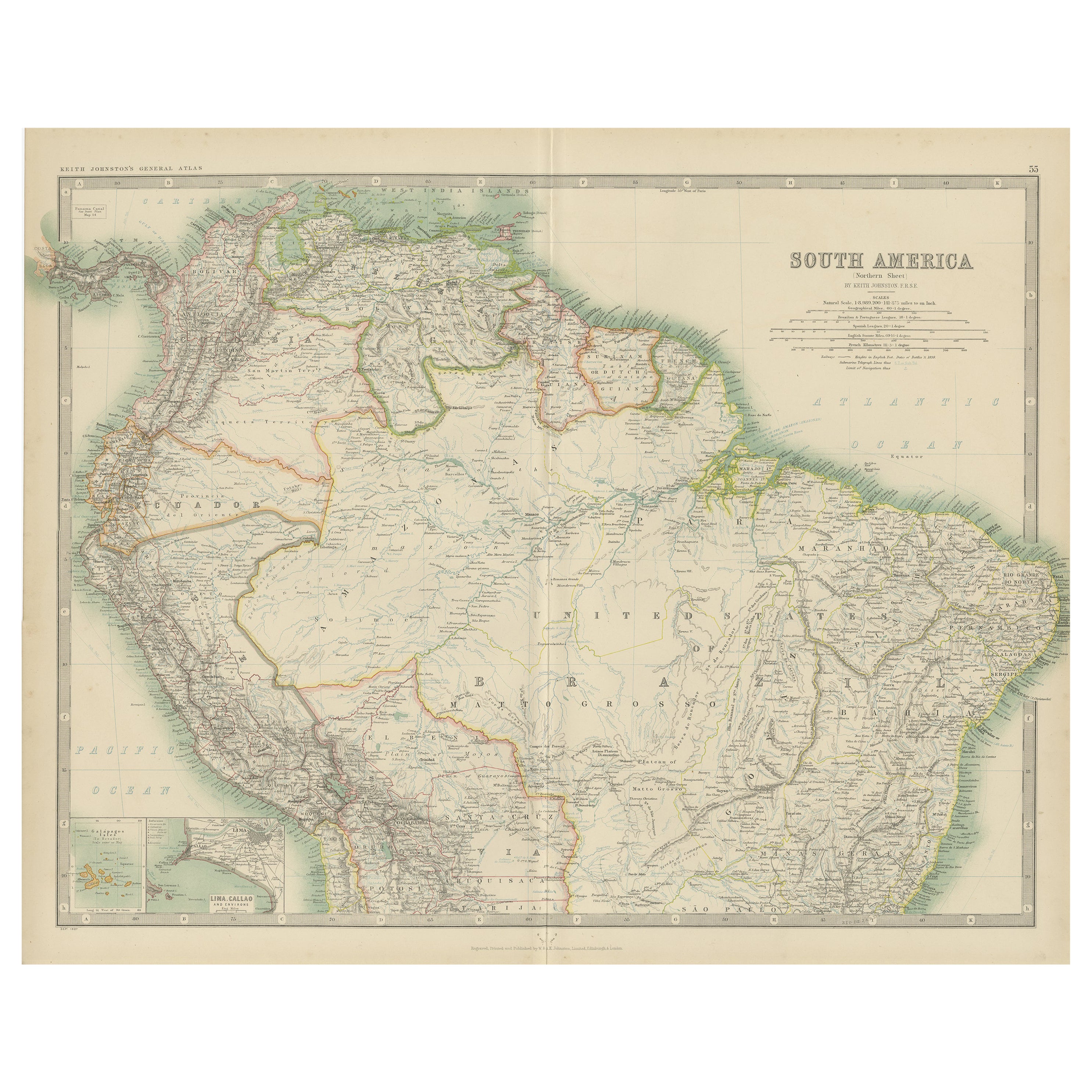
Exploring South America's North: Antique Map from the Royal Atlas of 1909
Located in Langweer, NL
The antique map titled 'South America, Northern Sheet' is a historical cartographic representation of the northern part of South America. This original antique map features inset map...
Category
Early 20th Century Maps
Materials
Paper
$236 Sale Price
20% Off
You May Also Like
South America, Eastern Part. Century Atlas antique vintage map
Located in Melbourne, Victoria
'The Century Atlas. South America. Eastern Part'
Original antique map, 1903.
Inset map 'Rio de Janeiro and Vicinity'.
Central fold as issued. Map name and number printed on the rev...
Category
Early 20th Century Victorian More Prints
Materials
Lithograph

South America, North-West Part. Century Atlas antique vintage map
Located in Melbourne, Victoria
'The Century Atlas. South America, North-West Part'
Original antique map, 1903.
Central fold as issued. Map name and number printed on the reverse corners.
Sheet 40cm by 29.5cm.
Category
Early 20th Century Victorian More Prints
Materials
Lithograph

Carte du Bresil, antique 1860s engraved map of Brazil
Located in Melbourne, Victoria
'Carte du Bresil'
Engraving with original outline colouring, circa 1860, by Alexandre Vuillemin, published in Paris.
31cm by 41cm (sheet)
21.5cm by 31.5cm (image)
Category
Late 19th Century Victorian More Prints
Materials
Lithograph

Original Antique Map of The Western Hemisphere by Dower, circa 1835
Located in St Annes, Lancashire
Nice map of the Western Hemisphere
Drawn and engraved by J.Dower
Published by Orr & Smith. C.1835
Unframed.
Free shipping
Category
Antique 1830s English Maps
Materials
Paper

Charte von Sud-America (Map of South America) - Etching with Hand-Drawn Outlines
Located in Soquel, CA
Map of south America, engraved by Franz Pluth (Czech, 1800-1871), from the book "Neueste Länder - und Völkerkunde, ein geographisches Lesebuch für alle Stände" by Linder, F. L. (Prag...
Category
1820s Other Art Style More Prints
Materials
Paper, Printer's Ink, Etching

Antique Lithography Map, South America, English, Framed, Cartography, Victorian
Located in Hele, Devon, GB
This is an antique lithography map of South America. An English, framed atlas engraving of cartographic interest by John Rapkin , dating to the early Victorian period and later, circ...
Category
Antique Mid-19th Century British Early Victorian Maps
Materials
Wood
