Items Similar to Huge Europe and Asia Vintage Wall Map

Want more images or videos?
Request additional images or videos from the seller
1 of 11
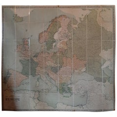
Huge Europe and Asia Vintage Wall Map
$380
$47520% Off
£290.53
£363.1620% Off
€334.63
€418.2920% Off
CA$532.50
CA$665.6220% Off
A$594.48
A$743.1020% Off
CHF 311.50
CHF 389.3720% Off
MX$7,277.05
MX$9,096.3120% Off
NOK 3,956.05
NOK 4,945.0620% Off
SEK 3,730.05
SEK 4,662.5720% Off
DKK 2,497.39
DKK 3,121.7420% Off
About the Item
A huge Europe and Asia vintage wall map, circa 1950s. The map is in fair vintage condition and measures 78"W x 73"H". #2863
- Dimensions:Height: 73 in (185.42 cm)Width: 78 in (198.12 cm)Depth: 0.2 in (5.08 mm)
- Materials and Techniques:
- Place of Origin:
- Period:
- Date of Manufacture:1950s
- Condition:Wear consistent with age and use. Minor losses. Minor fading.
- Seller Location:San Diego, CA
- Reference Number:Seller: #28631stDibs: LU936633249202
About the Seller
4.9
Platinum Seller
Premium sellers with a 4.7+ rating and 24-hour response times
Established in 2000
1stDibs seller since 2012
4,157 sales on 1stDibs
Typical response time: <1 hour
- ShippingRetrieving quote...Shipping from: San Diego, CA
- Return Policy
Authenticity Guarantee
In the unlikely event there’s an issue with an item’s authenticity, contact us within 1 year for a full refund. DetailsMoney-Back Guarantee
If your item is not as described, is damaged in transit, or does not arrive, contact us within 7 days for a full refund. Details24-Hour Cancellation
You have a 24-hour grace period in which to reconsider your purchase, with no questions asked.Vetted Professional Sellers
Our world-class sellers must adhere to strict standards for service and quality, maintaining the integrity of our listings.Price-Match Guarantee
If you find that a seller listed the same item for a lower price elsewhere, we’ll match it.Trusted Global Delivery
Our best-in-class carrier network provides specialized shipping options worldwide, including custom delivery.More From This Seller
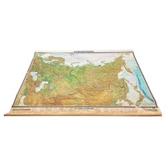
View AllMassive Vintage Wall Map of the Soviet Union 'Sowjetunion' by Karl Wenschow
By Denoyer-Geppert
Located in San Diego, CA
A massive vintage wall map of the Soviet Union (Sowjetunion) published by Karl Wenschow in Munich, Germany, circa 1950s. The map was distributed by De...
Category
Mid-20th Century American Maps
Materials
Paper, Wood
$540 Sale Price
20% Off
Antique Map of the Royal Botanic Garden & Arboretum Kew in London, England
Located in San Diego, CA
A very nice antique map of the Royal Botanic Garden & Arboretum in London, England, circa 1880s. The map itself measures 12" x 16" and is professionall...
Category
Antique Late 19th Century English Prints
Materials
Paper
$900 Sale Price
25% Off
Antique Map of California as an Island "The 5 Californias" by Robert de Vaugondy
Located in San Diego, CA
A very nice and rare antique map entitled "Carte de la Californie Suivant" (The 5 Californias), by Didier Robert de Vaugondy of Paris, circa 1772. The map itself measures 15.5" x 13...
Category
Antique Mid-19th Century American Maps
Materials
Paper

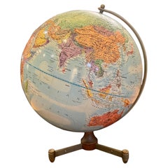
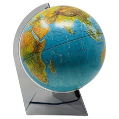
American Mid Century Atomic Age Vintage 12" Replogle Globe Rare Walnut & Metal
By Replogle Globes
Located in San Diego, CA
A very rare mid century modern atomic age Replogle Globe , sitting on walnu & metal base very hard to find , original condition and patina , circa 1950's some fading and wear as shown .
Category
20th Century American Mid-Century Modern Historical Memorabilia
Materials
Metal, Brass
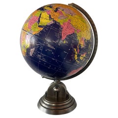
Illuminated French Edition Scan-Globe Denmark 1986
By Scanglobe
Located in San Diego, CA
Beautiful illuminated French edition globe. This piece is magical, glamorous and chic. The aerodynamic lucite base holds the beautiful blue globe that when illuminated reveals in the...
Category
Vintage 1980s Danish Modern Table Lamps
Materials
Fiberglass, Lucite
Vintage Art Deco Style 12" Reploge Globemaster World Globe
By Replogle Globes
Located in San Diego, CA
Beautiful 12" fiberglass and metal earth globe by Globemaster Reploge Globes Inc. Chicago. Incredibly stylish piece that stands on a metal base with full detail. This whimsical pi...
Category
Vintage 1980s American Mid-Century Modern Globes
Materials
Metal
You May Also Like
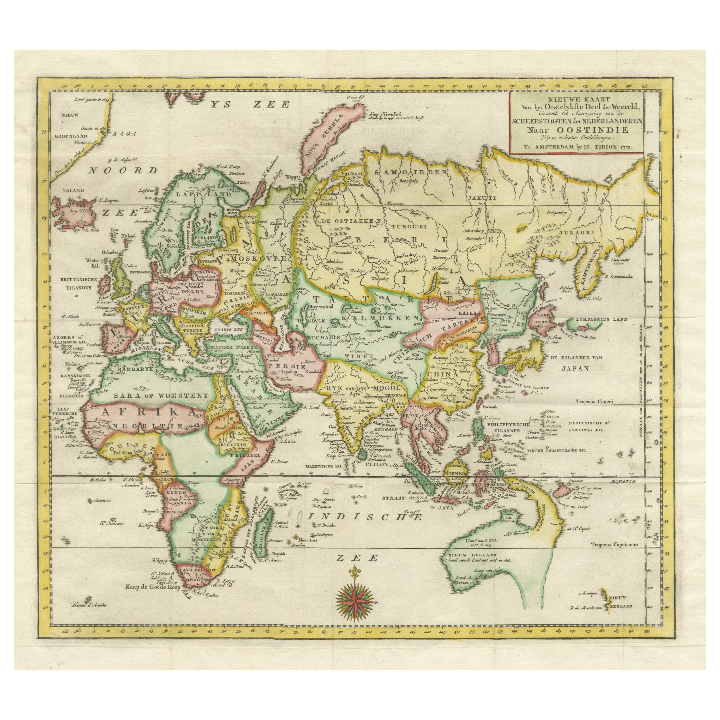
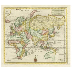
Antique Map of the Eastern Part of the World
Located in Langweer, NL
Antique map titled 'Nieuwe Kaart van het Oostelykste Deel der Weereld, diendende tot aanwyzing van de Scheepstogten der Nederlanderen Naar Oostindie'. This finely engraved map of the...
Category
Antique Mid-18th Century Maps
Materials
Paper
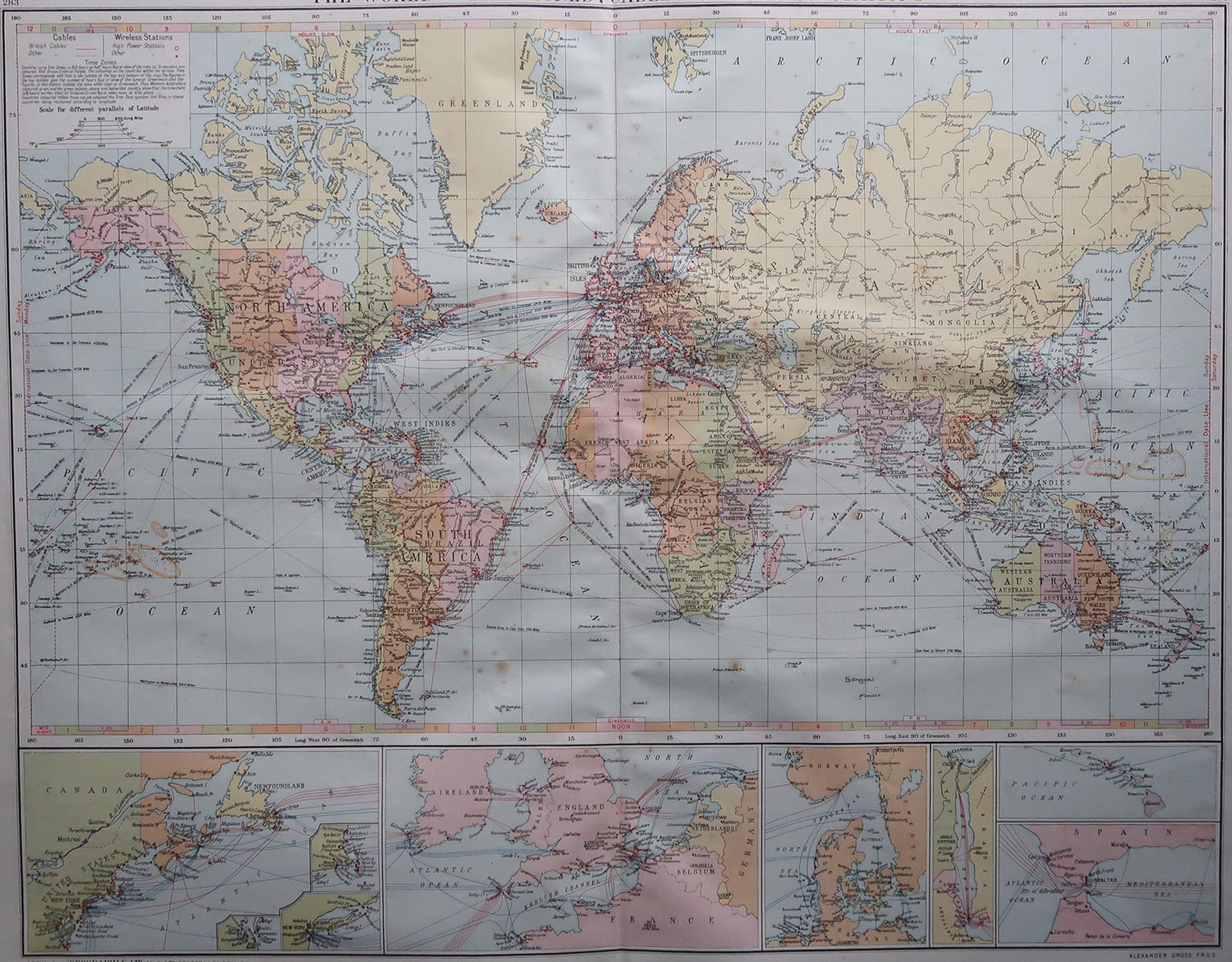
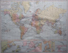
Large Original Vintage Map of The World, circa 1920
Located in St Annes, Lancashire
Great map of The World
Original color.
Good condition / minor foxing
Published by Alexander Gross
Unframed.
Category
Vintage 1920s English Maps
Materials
Paper
Vintage Mural Pull-Down Map Asia China Japan India Russia Wall Chart Poster
Located in Berghuelen, DE
The impressive rollable wall map shows the continent of Asia (among others China, Japan, India and Russia), published by Westermann. Colorful print on paper reinforced with canvas.
M...
Category
Late 20th Century German Country Prints
Materials
Canvas, Wood, Paper

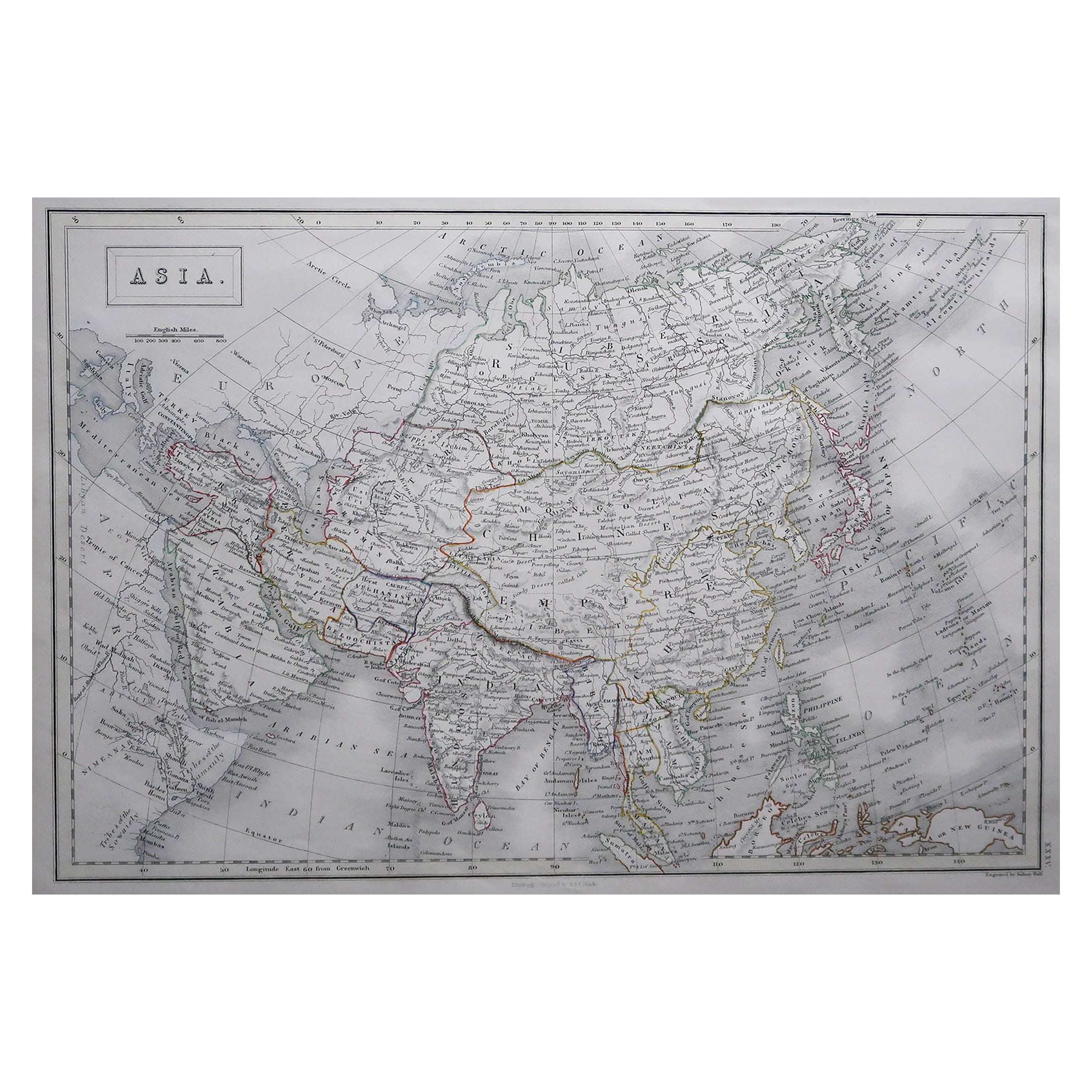
Large Original Antique Map of Asia by Sidney Hall, 1847
Located in St Annes, Lancashire
Great map of Asia
Drawn and engraved by Sidney Hall
Steel engraving
Original colour outline
Published by A & C Black. 1847
Unframed
Free shipping
Category
Antique 1840s Scottish Maps
Materials
Paper

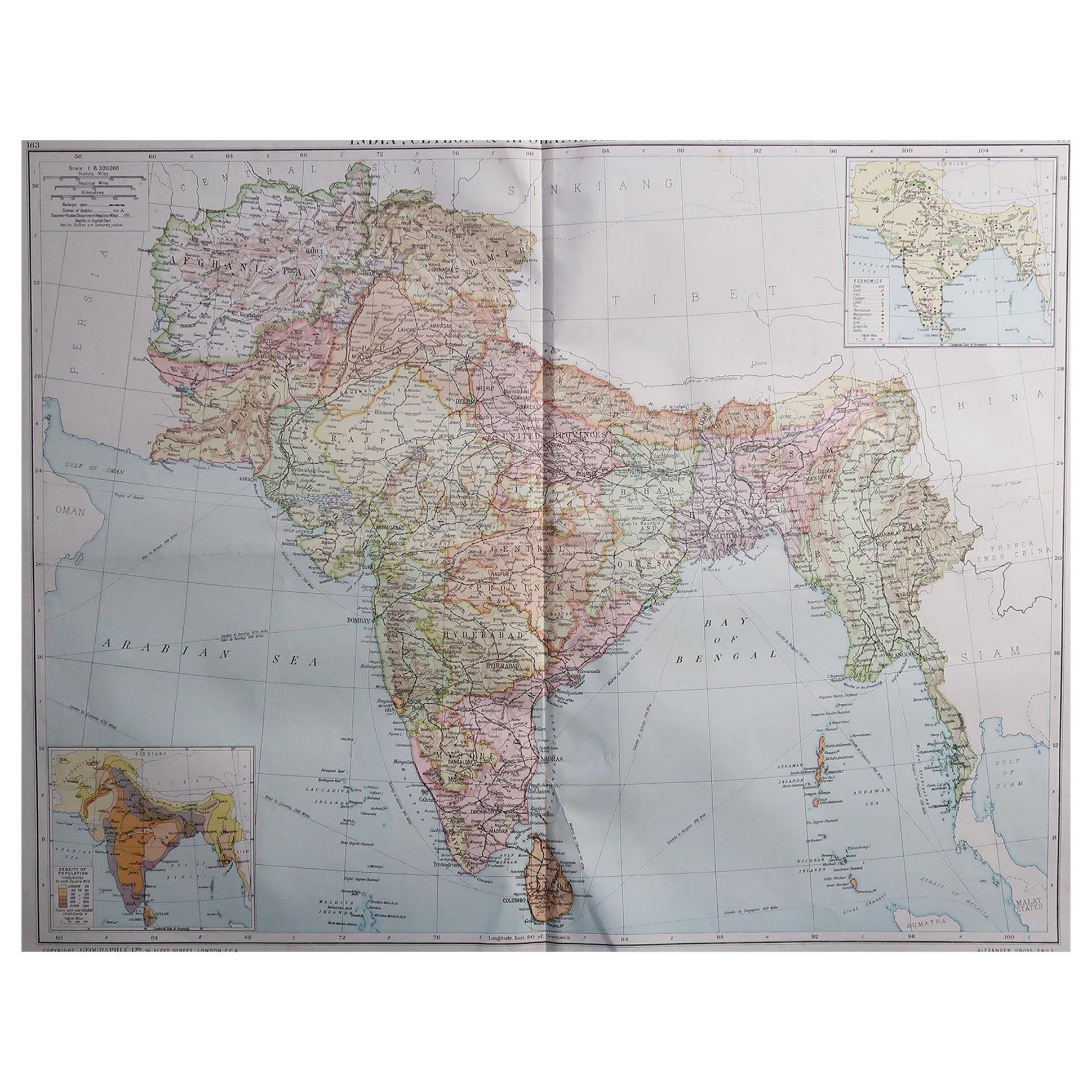
Large Original Vintage Map of India, circa 1920
Located in St Annes, Lancashire
Great map of India
Original color.
Good condition / repair to some minor damage just above Sri Lanka. Shown in the last image.
Published by Alexander Gross
Unframed.
Category
Vintage 1920s English Maps
Materials
Paper

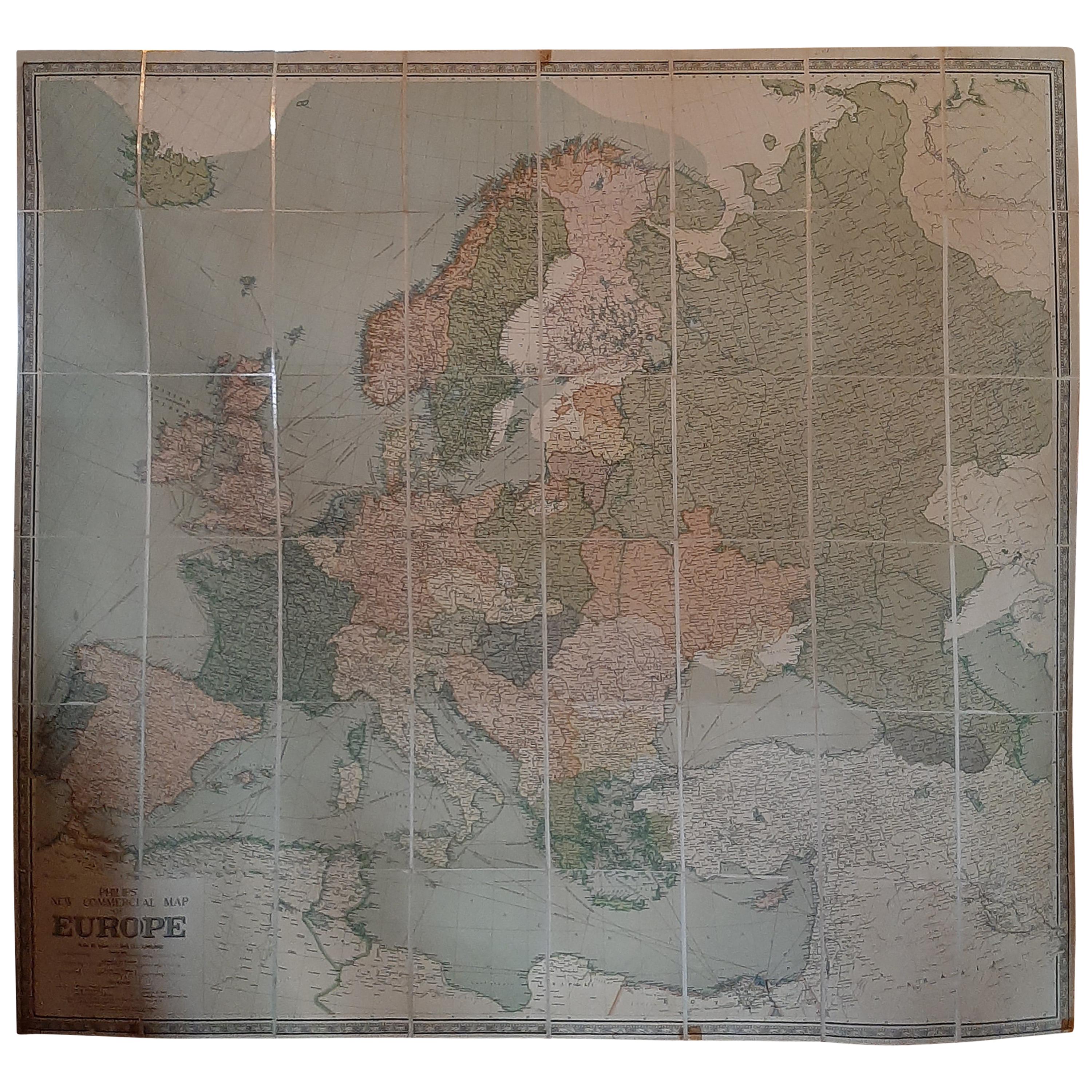
Large Wall Map of Europe by George Philip & Son, circa 1920
Located in Langweer, NL
Antique map titled 'Philips' New Commercial Map of Europe'. Very large wall map of Europe including the North African coast and Turkey. Decorative bord...
Category
Early 20th Century Maps
Materials
Linen, Paper
$2,067 Sale Price
30% Off