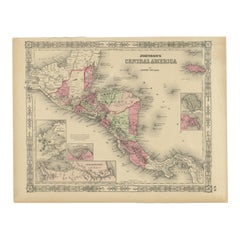
Items Similar to Johnson’s Mexico Map with Tehuantepec Inset, USA c.1864 – Hand-Colored


Video Loading
Want more images or videos?
Request additional images or videos from the seller
1 of 12
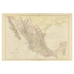
Johnson’s Mexico Map with Tehuantepec Inset, USA c.1864 – Hand-Colored
$388.95
£292.95
€330
CA$536.37
A$602.59
CHF 314.85
MX$7,354.90
NOK 3,997.73
SEK 3,763.02
DKK 2,511.83
About the Item
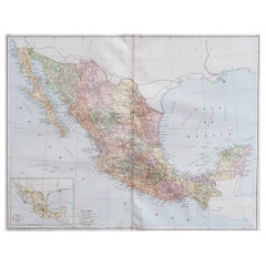
Johnson’s Mexico Map with Tehuantepec Inset, USA c.1864 – Hand-Colored
This is a finely engraved and hand-colored map titled Johnson’s Mexico, published by Johnson and Ward in New York circa 1864. It depicts Mexico in detail with political divisions, states shaded in pastel pink and green, and clear topographical features including mountains, rivers, and cities. Major cities such as Mexico City, Veracruz, Guadalajara, Monterrey, and Acapulco are marked, along with regional towns and transport routes.
The map includes an inset at the lower left titled “Vera Cruz and Tehuantepec Railway,” showing a detailed railway route across the Isthmus of Tehuantepec, an area of significant strategic interest in the mid-19th century as a proposed transit route between the Atlantic and Pacific Oceans before the Panama Canal was built.
This map is surrounded by Johnson’s distinctive decorative border with interlaced geometric and floral motifs, enhancing its decorative appeal. Johnson and Ward were leading American atlas publishers during this period, known for combining accurate cartographic information with attractive presentation. Their Mexico maps are valued for documenting political boundaries shortly after the Mexican-American War (1846-48) and during the era of French intervention in Mexico under Emperor Maximilian I (1864-67).
Condition report:
Good condition. Strong impression with bright original hand coloring. Light general age toning and a few minor spots or handling marks in margins, typical for antique atlas maps. No tears or repairs visible. Wide margins and plate mark intact.
Framing suggestion:
Frame with a simple dark wood or black frame and an archival off-white mat to emphasize the pastel coloring and decorative border. Use UV-protective glass to preserve color vibrancy and paper quality.
- Dimensions:Height: 14.06 in (35.7 cm)Width: 18 in (45.7 cm)Depth: 0.01 in (0.2 mm)
- Materials and Techniques:
- Place of Origin:
- Period:
- Date of Manufacture:circa 1864
- Condition:Good condition. Strong impression with bright original hand coloring. Light general age toning and a few minor spots or handling marks in margins, typical for antique atlas maps. No tears or repairs visible. Wide margins and plate mark intact.
- Seller Location:Langweer, NL
- Reference Number:Seller: BG-13952-421stDibs: LU3054345720192
About the Seller
5.0
Recognized Seller
These prestigious sellers are industry leaders and represent the highest echelon for item quality and design.
Platinum Seller
Premium sellers with a 4.7+ rating and 24-hour response times
Established in 2009
1stDibs seller since 2017
2,533 sales on 1stDibs
Typical response time: <1 hour
- ShippingRetrieving quote...Shipping from: Langweer, Netherlands
- Return Policy
Authenticity Guarantee
In the unlikely event there’s an issue with an item’s authenticity, contact us within 1 year for a full refund. DetailsMoney-Back Guarantee
If your item is not as described, is damaged in transit, or does not arrive, contact us within 7 days for a full refund. Details24-Hour Cancellation
You have a 24-hour grace period in which to reconsider your purchase, with no questions asked.Vetted Professional Sellers
Our world-class sellers must adhere to strict standards for service and quality, maintaining the integrity of our listings.Price-Match Guarantee
If you find that a seller listed the same item for a lower price elsewhere, we’ll match it.Trusted Global Delivery
Our best-in-class carrier network provides specialized shipping options worldwide, including custom delivery.More From This Seller
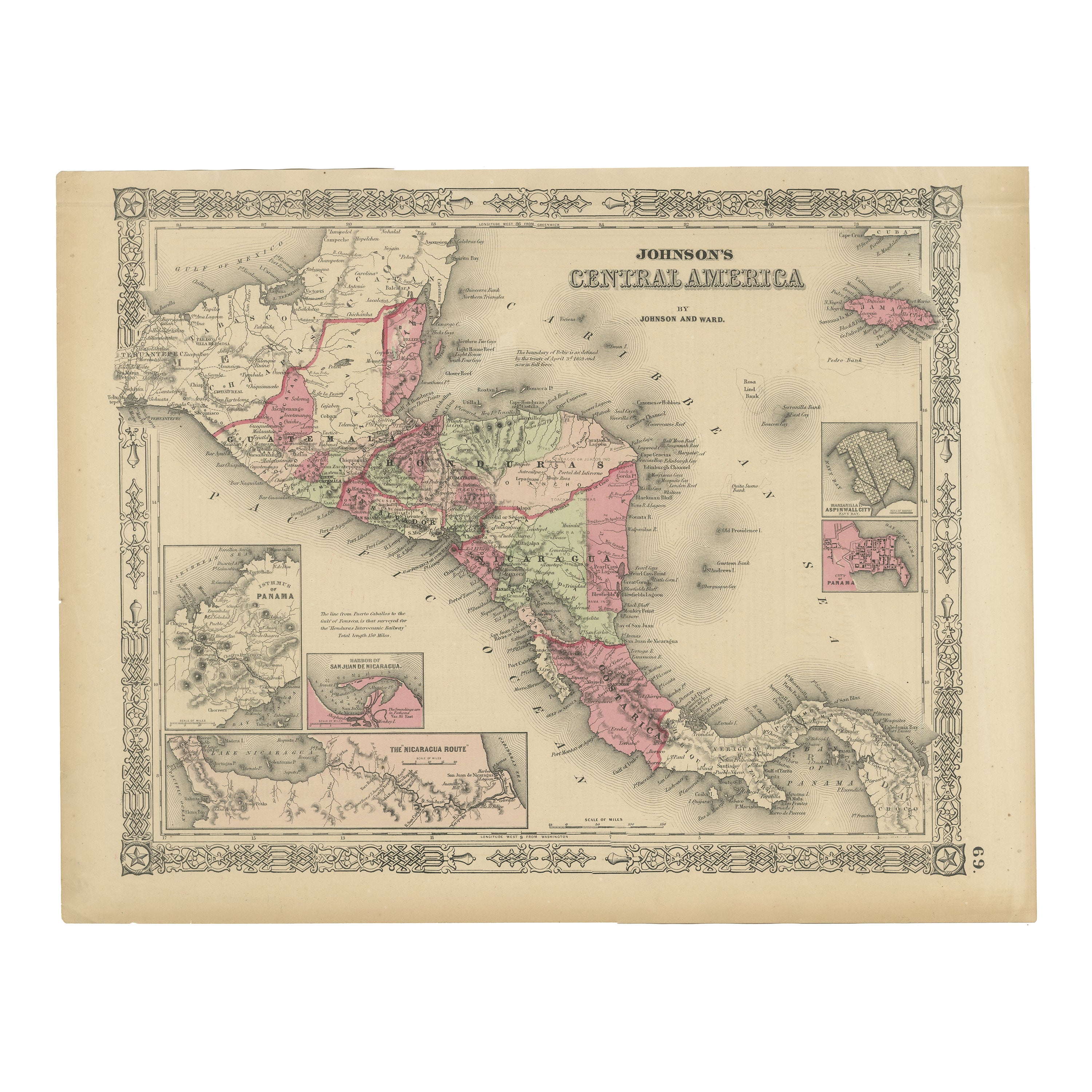
View AllCentral America Map – Johnson, Hand-Colored with Insets, c.1864
Located in Langweer, NL
Johnson’s Central America Map, USA c.1864 – Hand-Colored with Insets
This is a finely engraved and hand-colored map titled Johnson’s Central America, published by Johnson and Ward i...
Category
Antique Mid-19th Century American Maps
Materials
Paper
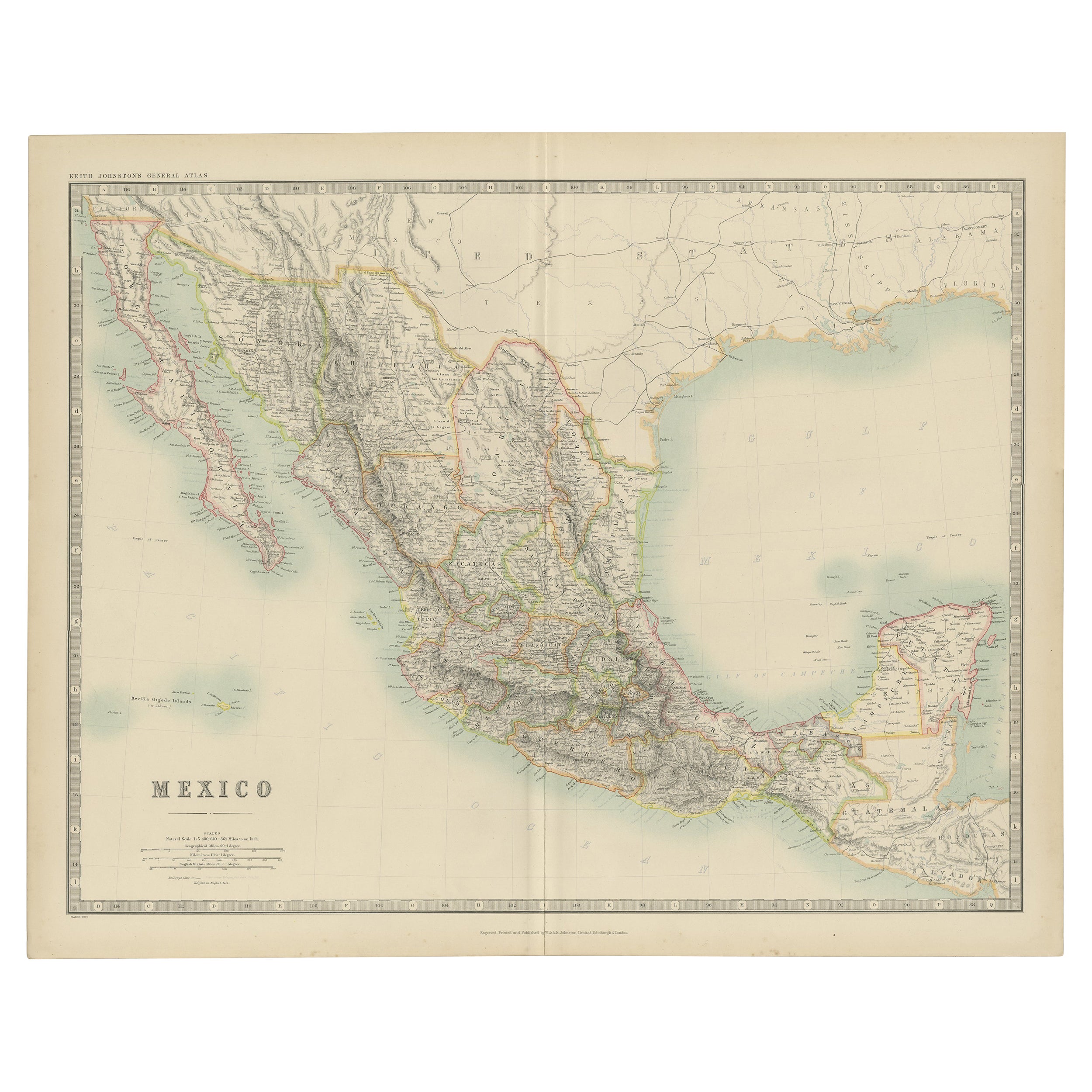
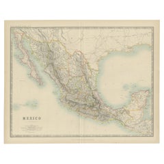
1882 Antique Map of Mexico Highlighting Geographical and Political Boundaries
Located in Langweer, NL
This 1882 map of Mexico, published by Blackie and Son as part of the 'Comprehensive Atlas and Geography of the World,' provides a highly detailed representation of the country's geog...
Category
Antique 1880s Maps
Materials
Paper
Antique Map of Mexico by Johnston, '1909'
Located in Langweer, NL
Antique map titled 'Mexico'. Original antique map of Mexico. This map originates from the ‘Royal Atlas of Modern Geography’. Published by W. & A....
Category
Early 20th Century Maps
Materials
Paper
$235 Sale Price
20% Off
Antique Map of Mexico and Central America by Johnson '1872'
Located in Langweer, NL
Antique map titled 'Johnson's Mexico (..)'. Two maps one one sheet showing Mexico and Central America, with inset maps of Tehuantepec and Panama. This map originates from 'Johnson's ...
Category
Antique Late 19th Century Maps
Materials
Paper

$282 Sale Price
20% Off
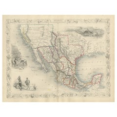
Texas California Mexico Map – Antique Tallis Map with Gold Region, c.1850
Located in Langweer, NL
Texas California Mexico Map – Antique Tallis Map with Gold Region, c.1850
This highly decorative and historically rich map titled 'Mexico, California and Texas' was published around...
Category
Antique Mid-19th Century Maps
Materials
Paper
Antique Map of the United States with inset map of the region of Mexico City
Located in Langweer, NL
Antique map titled 'Verein-Staaten von Nord-America, Mexico, Yucatan u.a.'. Very detailed map of the United States of America showing the Caribbean. With an inset map of the surround...
Category
Antique Mid-19th Century Maps
Materials
Paper

$810 Sale Price
20% Off
You May Also Like
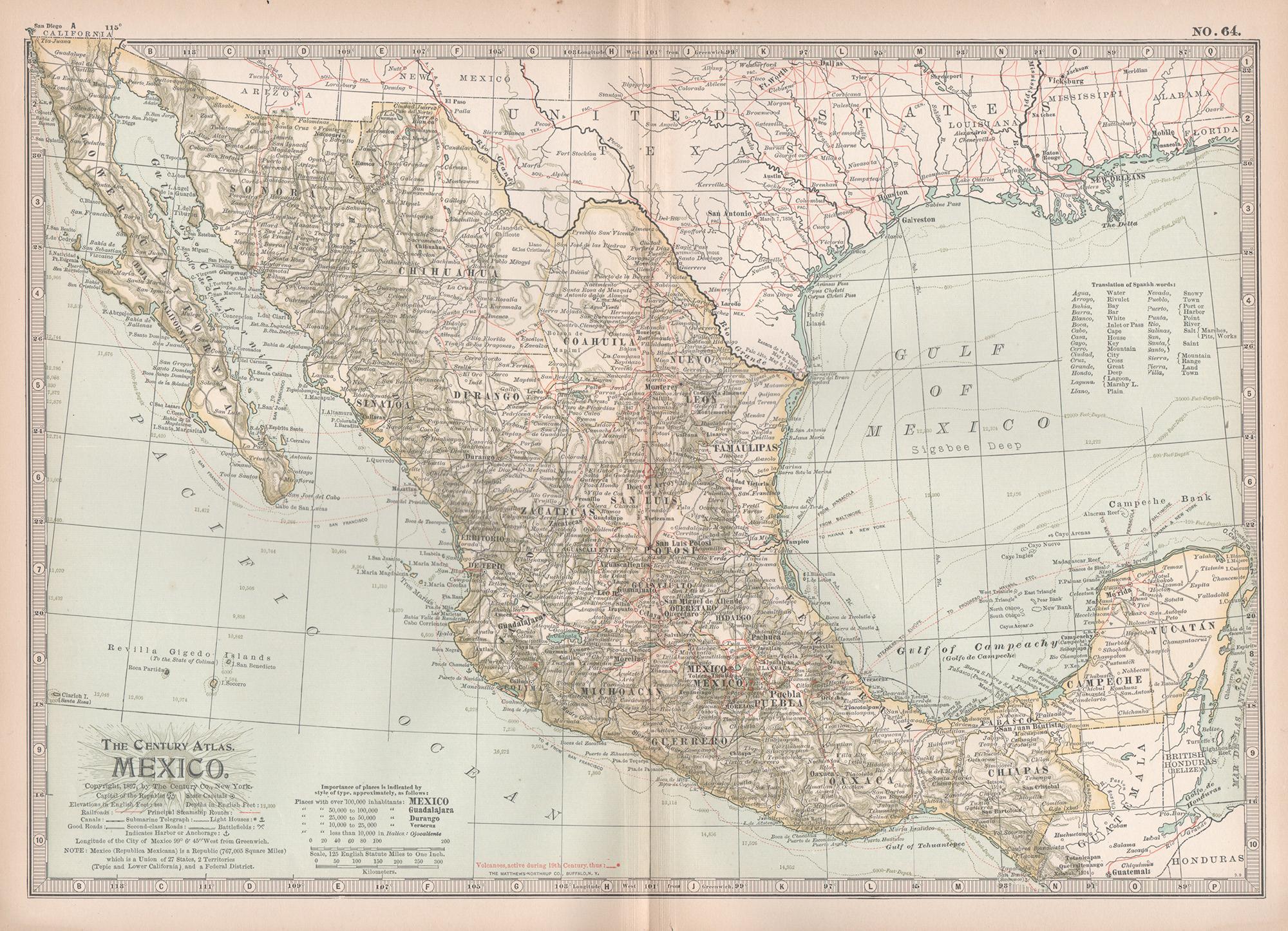
Mexico. Century Atlas antique vintage map
Located in Melbourne, Victoria
'The Century Atlas. Mexico.'
Original antique map, 1903.
Central fold as issued. Map name and number printed on the reverse corners.
Sheet 29.5cm by 40cm.
Category
Early 20th Century Victorian More Prints
Materials
Lithograph

Ancient Map of Mexico - Original Etching - 19th Century
Located in Roma, IT
This Map of Mexico is an etching realized in 19th century.
The state of preservation of the artwork is good with some small missing papers on the right angles. At the top of the pap...
Category
19th Century More Prints
Materials
Etching
Large Original Vintage Map of Mexico, circa 1920
Located in St Annes, Lancashire
Great map of Mexico
Original color.
Good condition
Published by Alexander Gross
Unframed.
Category
Vintage 1920s English Edwardian Maps
Materials
Paper
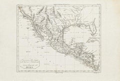
1847 Antique Map of Mexico, Texas and California by Samuel Augustus Mitchell
By Samuel Augustus Mitchell 1
Located in Colorado Springs, CO
Presented is the second edition of Samuel Augustus Mitchell's Map of Mexico, Including Yucatan & Upper California, an important map showing the progress of the Mexican-American War. ...
Category
Antique 1840s American Maps
Materials
Paper

Central America. Century Atlas antique vintage map
Located in Melbourne, Victoria
'The Century Atlas. Central America.'
Original antique map, 1903.
Inset maps of 'The Country around Lake Nicaragua'.
Central fold as issued. Map name and number printed on the reve...
Category
Early 20th Century Victorian More Prints
Materials
Lithograph

1834 Mexico & Guatemala Framed Map by H.S. Tanner
Located in Stamford, CT
1834 Mexico & Guatemala map of published by H.S. Tanner, Philadelphia, Pennsylvania. Engraved by J. Knight.
As found high end custom framing with carved wood frame, custom matting a...
Category
Antique 1830s American American Classical Maps
Materials
Glass, Wood, Paper

More Ways To Browse
19th Century Mexican Furniture
Railway Map
Guadalajara Furniture
Antique Transits
Antique Mexican Plates
Emperor Maximilian
Curved Velvet Couch
Velvet Curved Sofa
Wood Round Coffee Tables
Oak Brutalist
Used College Furniture
Wood Minimalist Chair
Antique Imperial Furniture
Gold Modern Coffee Table
Large Side Tables
18th Century Gilded Furniture
Fluted Column
Japanese Silver Ceramics