Items Similar to Large Sea Chart of the Zuyder Zee & The Northsea with the Wadden Islands, 1773

Want more images or videos?
Request additional images or videos from the seller
1 of 6
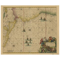
Large Sea Chart of the Zuyder Zee & The Northsea with the Wadden Islands, 1773
$1,175.20
$1,678.8530% Off
£874.23
£1,248.9030% Off
€980
€1,40030% Off
CA$1,609.24
CA$2,298.9230% Off
A$1,789.26
A$2,556.0930% Off
CHF 934.25
CHF 1,334.6530% Off
MX$21,779.66
MX$31,113.8030% Off
NOK 11,920.66
NOK 17,029.5230% Off
SEK 11,169.09
SEK 15,955.8530% Off
DKK 7,460.20
DKK 10,657.4330% Off
Shipping
Retrieving quote...The 1stDibs Promise:
Authenticity Guarantee,
Money-Back Guarantee,
24-Hour Cancellation
About the Item
The copper engraving by Herman van Loon, published by Pieter Mortier in 'Le Neptune François' in Amsterdam, is a remarkable piece within the realm of seventeenth-century cartography. 'Le Neptune François' is esteemed as the finest and most sophisticated sea atlas to be published in Amsterdam during that era.
Mortier's aim with this work was to compete with the popular 'Nieuwe groote lichtende zeefakkel' by Johannes van Keulen. To achieve this, Mortier collaborated with esteemed craftsmen such as Romeyn de Hooghe and Herman van Loon.
The atlas is considered a 'contrefaçon', an identical reproduction, with Mortier adding several maps to the original. The original work was by Jean Colbert, who, along with a group of mathematicians and astronomers from the Académie Royale des Sciences, compiled a sublime atlas of 29 sheets. The publication was overseen by the royal geographer Alexis-Hubert Jaillot in Paris.
Pieter Mortier obtained the privilege in 1690 to distribute maps and atlases from French publishers in Holland, a significant development in his career as a cartographer and publisher. This collaboration and privilege underscore Mortier's ambition to produce high-quality cartography and compete with other prominent publishers of the time.
'Le Neptune François' stands as a testament to Mortier's commitment to excellence and innovation in cartography. The inclusion of additional maps, coupled with the expertise of renowned cartographers and engravers, solidifies its reputation as a pinnacle of seventeenth-century mapmaking.
In summary, this piece provides insight into the competitive and complex world of seventeenth-century cartography and publishing, highlighting the role of individuals like Pieter Mortier in advancing this art and science.
- Creator:H. van Loon (Artist)
- Dimensions:Height: 25.2 in (64 cm)Width: 36.62 in (93 cm)Depth: 0.02 in (0.5 mm)
- Materials and Techniques:
- Period:
- Date of Manufacture:1773
- Condition:Please study images carefully.
- Seller Location:Langweer, NL
- Reference Number:Seller: BG-003491stDibs: LU305438911273
About the Seller
5.0
Recognized Seller
These prestigious sellers are industry leaders and represent the highest echelon for item quality and design.
Platinum Seller
Premium sellers with a 4.7+ rating and 24-hour response times
Established in 2009
1stDibs seller since 2017
2,510 sales on 1stDibs
Typical response time: <1 hour
- ShippingRetrieving quote...Shipping from: Langweer, Netherlands
- Return Policy
Authenticity Guarantee
In the unlikely event there’s an issue with an item’s authenticity, contact us within 1 year for a full refund. DetailsMoney-Back Guarantee
If your item is not as described, is damaged in transit, or does not arrive, contact us within 7 days for a full refund. Details24-Hour Cancellation
You have a 24-hour grace period in which to reconsider your purchase, with no questions asked.Vetted Professional Sellers
Our world-class sellers must adhere to strict standards for service and quality, maintaining the integrity of our listings.Price-Match Guarantee
If you find that a seller listed the same item for a lower price elsewhere, we’ll match it.Trusted Global Delivery
Our best-in-class carrier network provides specialized shipping options worldwide, including custom delivery.More From This Seller
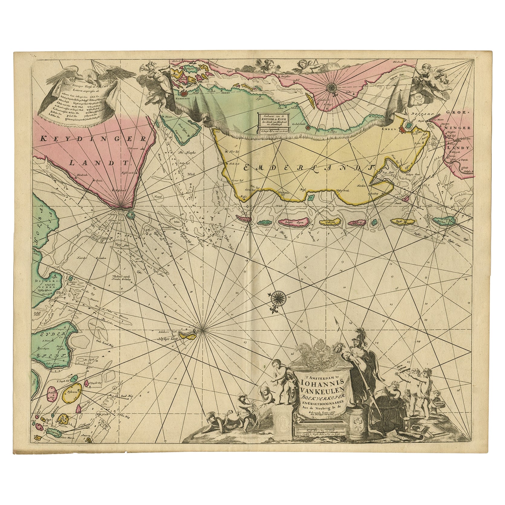
View AllRare Sea Chart of the East Frisian Islands or Watten and the North Sea, c.1700
Located in Langweer, NL
Description: Antique map titled 'Paskaarte van de rievier de Elve streckende van Oldenbroek tot Hamburgh.'
Rare and interesting chart of the East Frisian Islands (or Watten) and ...
Category
Antique Early 1700s Maps
Materials
Paper
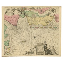
$1,774 Sale Price
20% Off
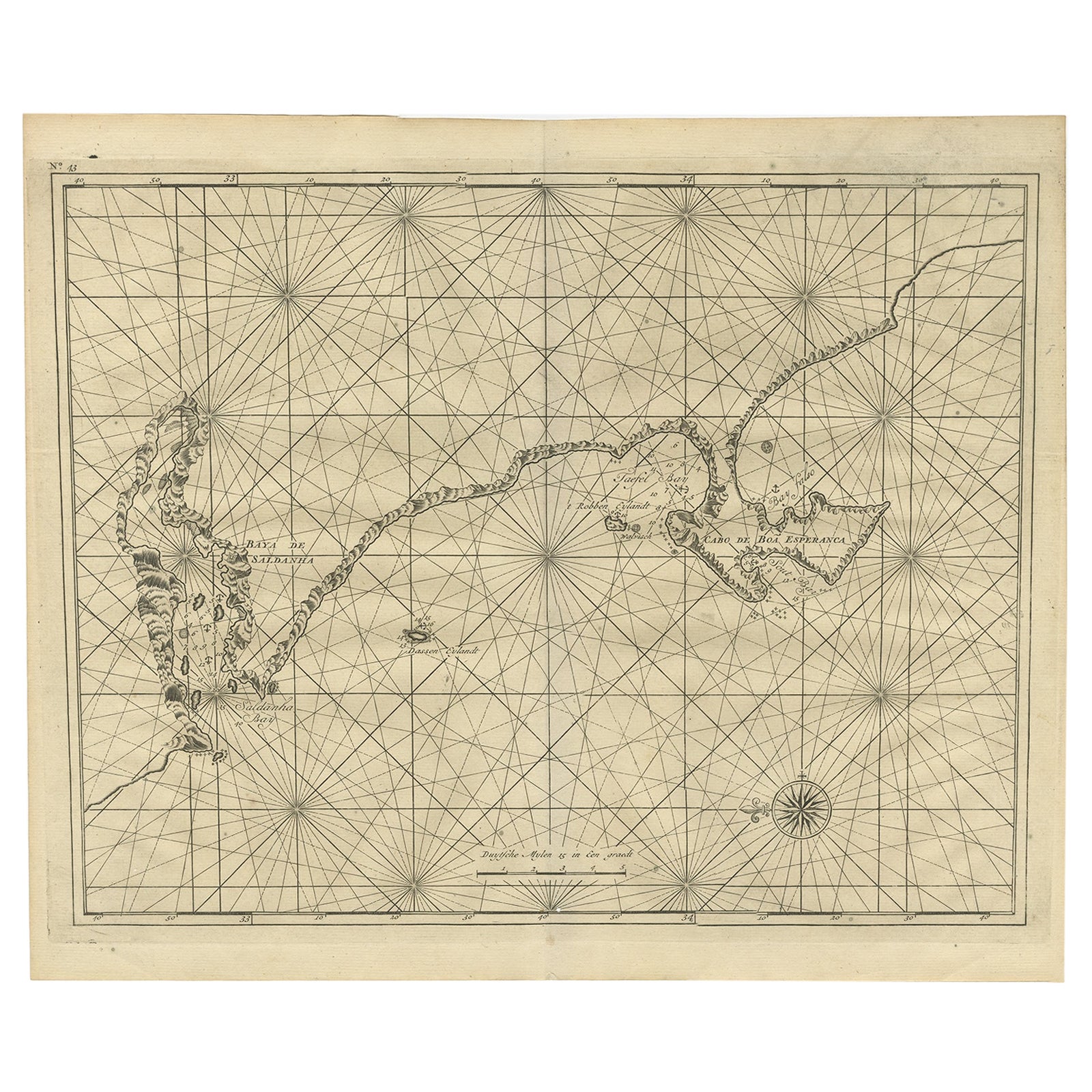
Sea Chart Titled 'Baya de Saldanha' with Robben Island in South Africa, 1726
Located in Langweer, NL
Antique map titled 'Baya de Saldanha'.
Sea chart covering the South African coast from the Cape of Good Hope to Saldanha Bay. This print originates from 'Oud en Nieuw Oost-Indiën...
Category
Antique 1720s Maps
Materials
Paper
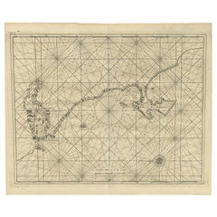
$1,074 Sale Price
20% Off
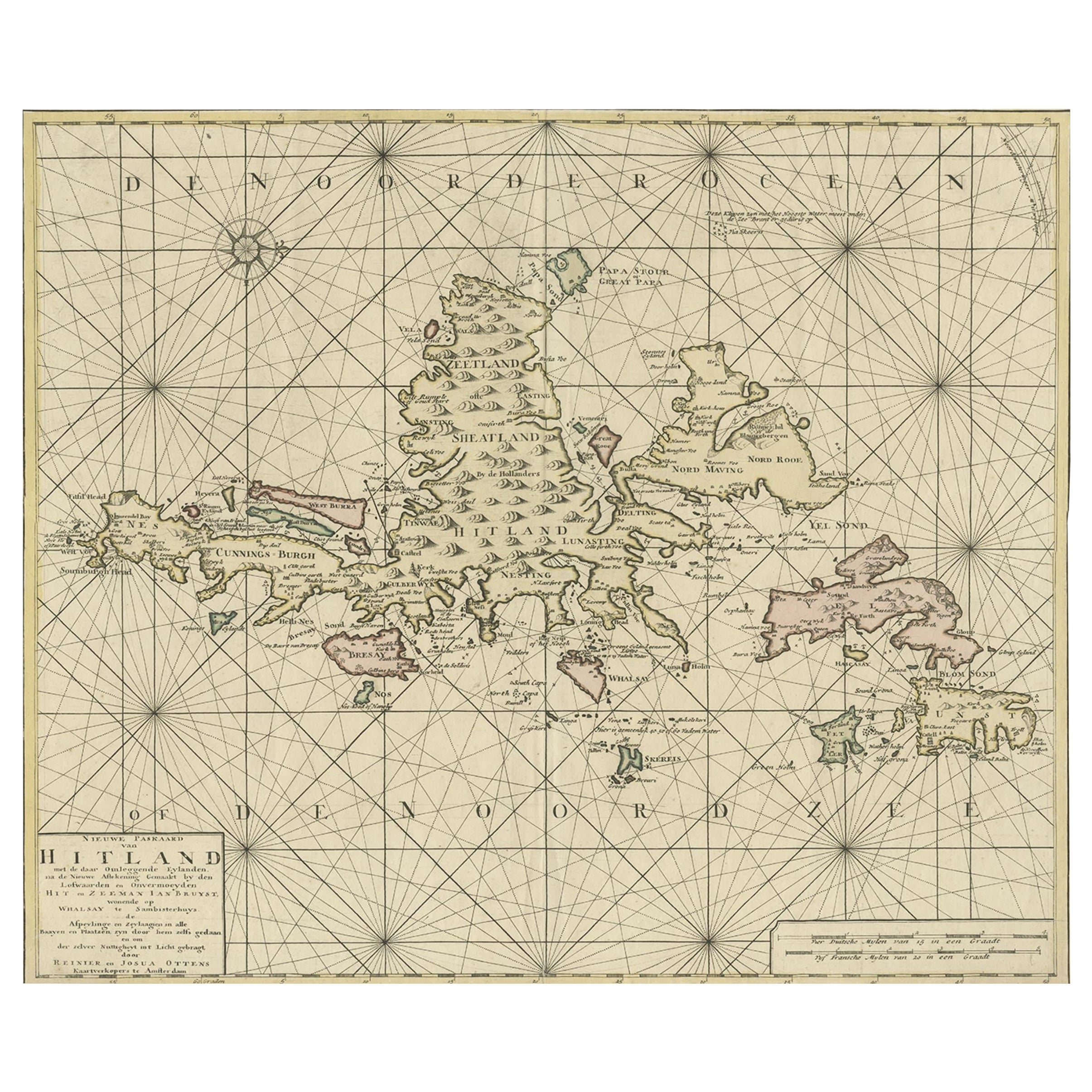
Shetland Islands Sea Chart – Antique Nautical Map by Ottens Brother c.1745
Located in Langweer, NL
Shetland Islands Sea Chart – Antique Nautical Map by Ottens Brothers, c.1740s
This striking antique nautical chart titled Nieuwe Paskaard van Hitland… presents the Shetland Islands ...
Category
Antique 1740s Dutch Maps
Materials
Paper
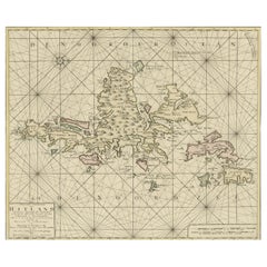
$1,199 Sale Price
20% Off
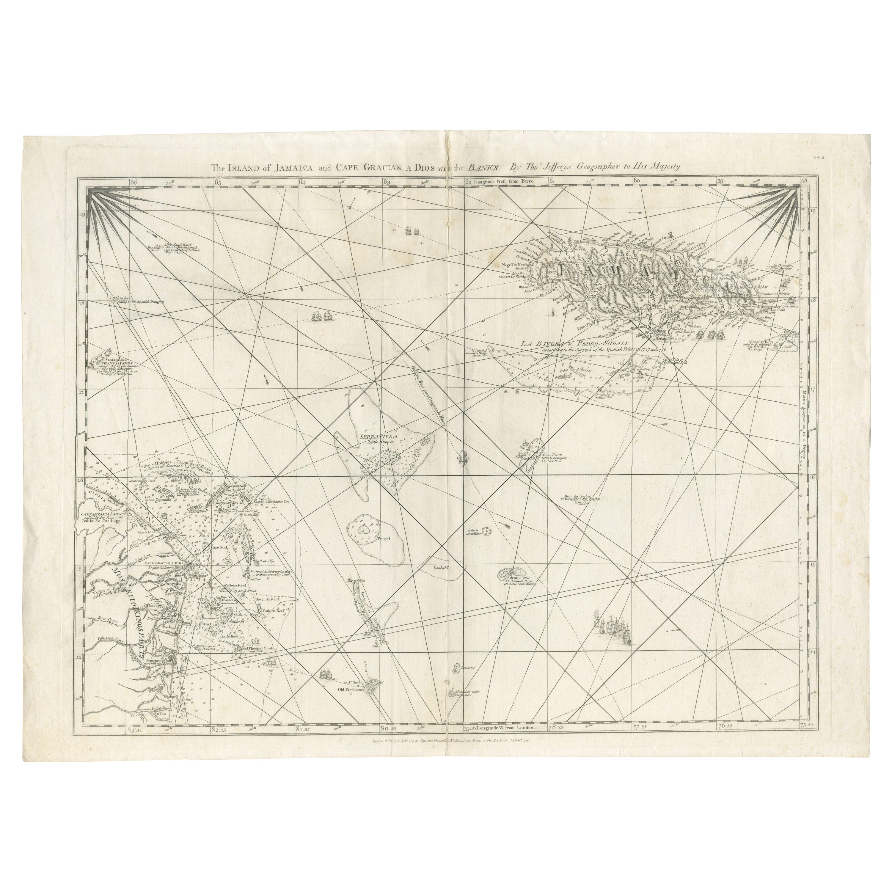
Navigational Chart of Jamaica, Cape Gracias a Dios, and the Mosquito Coast, 1775
Located in Langweer, NL
The map titled "The Island of Jamaica and Cape Gracias a Dios with the Banks (Shows Moskito Kings Party)" illustrates a significant historical period marked by shifting colonial infl...
Category
Antique 1770s Maps
Materials
Paper

$1,007 Sale Price
30% Off
Free Shipping
Antique Sea Chart of North America by Ottens, circa 1745
Located in Langweer, NL
Antique map titled 'Septemtrionaliora Americae a Groenlandia (..)'. Sea chart of the northern waters of North America, including the coast of Labrador and pa...
Category
Antique Mid-18th Century Maps
Materials
Paper

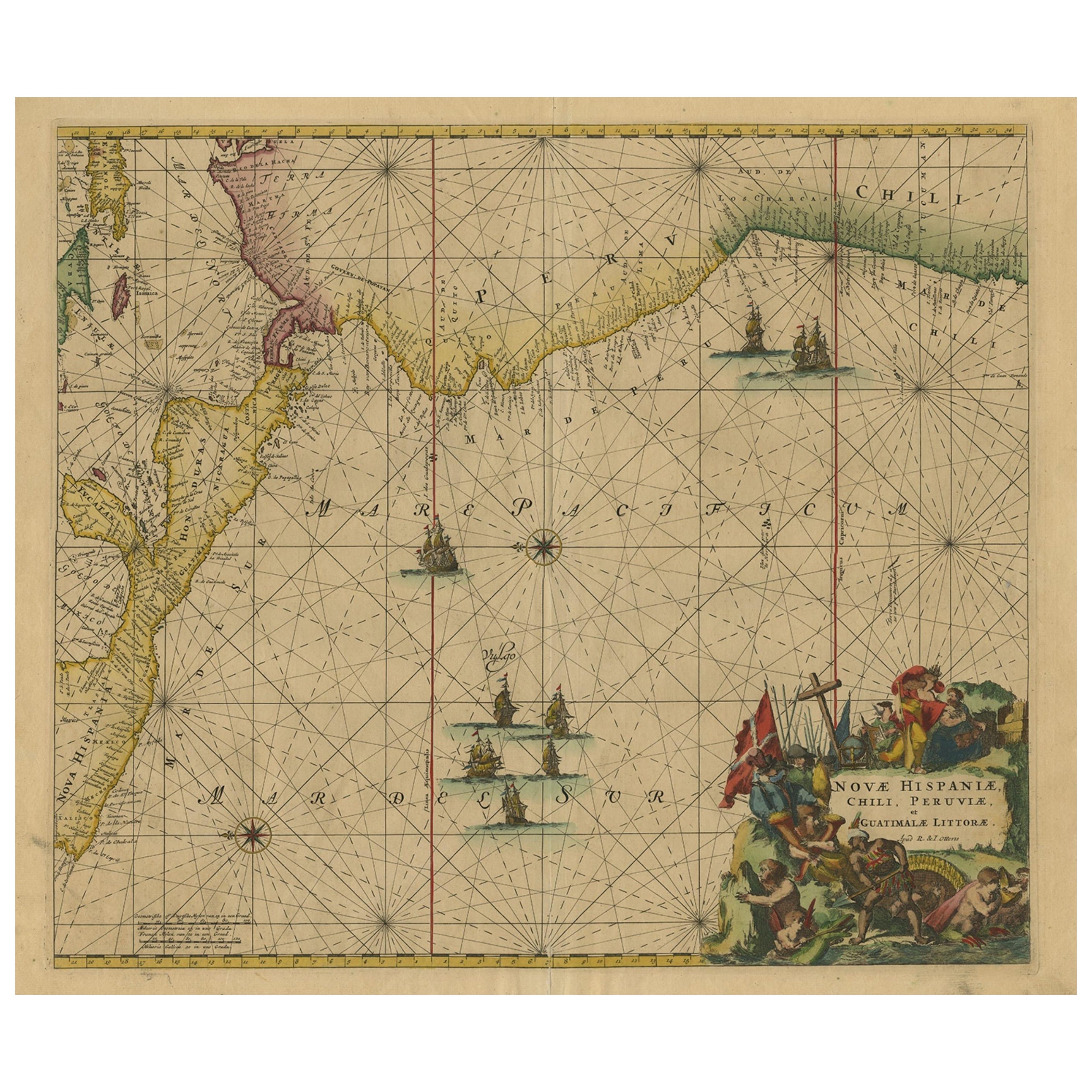
Sea Chart of Central America and the Northwest Coast of South America, ca.1745
Located in Langweer, NL
Antique map titled 'Novae Hispaniae, Chili, Peruviae et Guatamala Littorae.'
Sea chart of Central America and the northwest coast of South America, oriented to the east, by Reinier & Joshua Ottens (after Frederick de Wit - 1675) in 1745 ('Atlas van de Zeevaart'). The map shows all or parts of the coasts of Peru, Chili, Honduras, Costa Rica and Mexico as well as the western Caribbean and the Galapagos...
Category
Antique 1740s Maps
Materials
Paper
$2,350 Sale Price
20% Off
Free Shipping
You May Also Like
Hand-Colored 18th Century Homann Map of Denmark and Islands in the Baltic Sea
By Johann Baptist Homann
Located in Alamo, CA
An 18th century copper plate hand-colored map entitled "Insulae Danicae in Mari Balthico Sitae utpote Zeelandia, Fionia, Langelandia, Lalandia, Falstria, Fembria Mona" created by Joh...
Category
Antique Early 18th Century German Maps
Materials
Paper

Plymouth, England: A Hand-Colored 17th Century Sea Chart by Captain Collins
By Captain Greenvile Collins
Located in Alamo, CA
This hand-colored sea chart of the area around Plymouth, England from "Great Britain's Coasting Pilot. Being a New and Exact Survey of the Sea-Coast of England", first published in 1...
Category
Antique Late 17th Century English Maps
Materials
Paper

Flanders, Holland & Norfolk: Hand-Colored 17th Century Sea Chart by Collins
By Captain Greenvile Collins
Located in Alamo, CA
This hand-colored chart of the seas about Flanders, Holland, Frisia, and Norfolk is from "Great Britain's Coasting Pilot. Being a New and Exact Survey of the Sea-Coast of England" by...
Category
Antique Late 17th Century English Maps
Materials
Paper

California, Alaska and Mexico: 18th Century Hand-Colored Map by de Vaugondy
By Didier Robert de Vaugondy
Located in Alamo, CA
This is an 18th century hand-colored map of the western portions of North America entitled "Carte de la Californie et des Pays Nord-Ouest separés de l'Asie par le détroit d'Anian, ex...
Category
Antique 1770s French Maps
Materials
Paper

Dartmouth, England: A Hand-Colored 17th Century Sea Chart by Captain Collins
By Captain Greenvile Collins
Located in Alamo, CA
This hand-colored sea chart of the area around Dartmouth, England is from "Great Britain's Coasting Pilot. Being a New and Exact Survey of the Sea-Coast of England", first published ...
Category
Antique Late 17th Century English Maps
Materials
Paper

West Coast of Africa, Guinea & Sierra Leone: An 18th Century Map by Bellin
By Jacques-Nicolas Bellin
Located in Alamo, CA
Jacques Bellin's copper-plate map entitled "Partie de la Coste de Guinee Dupuis la Riviere de Sierra Leona Jusquau Cap das Palmas", depicting the coast of Guinea and Sierra Leone in ...
Category
Antique Mid-18th Century French Maps
Materials
Paper

More Ways To Browse
Science Charts
Gold Modern Coffee Table
Large Side Tables
Japanese Silver Ceramics
One Of A Kind Chair
Used Oak Dining Room Chairs
17th Century Plate
Childrens Vintage Poster
Chinese Ship
Vintage Travel Poster Mid Century
Desk Key
Woven Silk Art
Carved Cabriole Table
Dark Antique Table
White Wooden Table
Antique Wall Table
1960 Chair Wood Danish
Unusual Dining Table