Items Similar to Map of Batavia’s Surroundings with Early Reference to Jakarta, Indonesia, c.1770


Want more images or videos?
Request additional images or videos from the seller
1 of 10
Map of Batavia’s Surroundings with Early Reference to Jakarta, Indonesia, c.1770
$518.90
£388.41
€440
CA$714.15
A$795.99
CHF 417.63
MX$9,720.37
NOK 5,288.10
SEK 4,998.06
DKK 3,349.59
About the Item
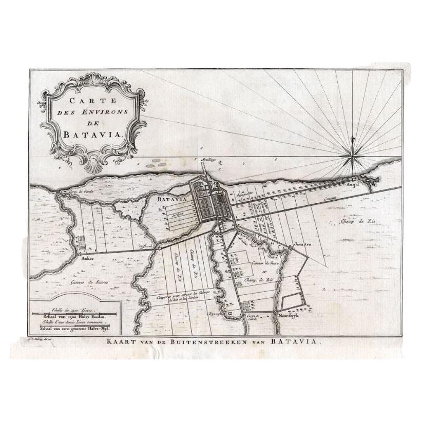
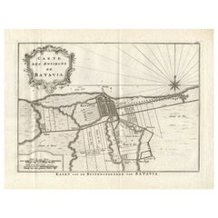
Map of Batavia’s Surroundings with Early Reference to Jakarta, circa 1770
Description:
This finely engraved map titled "Carte des Environs de Batavia" offers a compelling and historically rich view of the colonial landscape surrounding Batavia, the capital of the Dutch East Indies, known today as Jakarta. Created circa 1770, the plan is attributed to Jakob van der Schley, an accomplished Dutch engraver known for his contributions to 18th-century geographical publications, especially the *Histoire générale des voyages*.
At the heart of the map lies the fortified city of Batavia, clearly delineated in its orderly grid layout, surrounded by a meticulous depiction of the surrounding agricultural lands, water infrastructure, and strategic outposts. One of the most fascinating aspects of this plan is its early mention of “Jacatra” (a local name for Jakarta) southeast of the city, offering a rare glimpse of the historical layering of colonial and indigenous place-naming.
The region is crisscrossed by a detailed network of canals, which served both transport and irrigation purposes. These waterways were vital to the functioning of the Dutch colonial economy and are drawn with technical precision. Adjacent to them, plots marked as “Jardins” reflect European-style horticulture interwoven with local cultivation.
Of particular note are the extensive “Champ de Riz” (rice fields) and “Canne de Sucre” (sugar cane plantations), shown in green and pale red tones. These were not just staples of subsistence and local consumption but also pillars of colonial commerce. Their central placement on the map reveals their economic and symbolic importance in the landscape.
The lower-left corner includes a scale bar rendered in Dutch, French, and Latin units, a multilingual detail underscoring the map’s intended European readership. The map is ornamented with a rococo-style cartouche in the upper left, beautifully hand-colored and embellished with floral and foliate motifs.
Condition summary:
The print is in very good condition for its age, with crisp impressions and original hand coloring. There is a central fold, as issued, and light toning to the margins, along with a faint watermark and minor foxing at the lower edge. No restoration has been carried out.
Framing suggestion:
This map would be best presented in a classic dark wood frame with a subtle gold fillet, paired with a cream or soft beige archival mat. It is an ideal display piece for collectors of Southeast Asian cartography, VOC-era history, or early urban plans of Jakarta.
- Dimensions:Height: 9.93 in (25.2 cm)Width: 14.06 in (35.7 cm)Depth: 0.01 in (0.2 mm)
- Materials and Techniques:Paper,Engraved
- Place of Origin:
- Period:
- Date of Manufacture:circa 1770
- Condition:The print is in very good condition for its age, with crisp impressions and original hand coloring. There is a central fold, as issued, and light toning to the margins, along with a faint watermark and minor foxing at the lower edge. No restoration h.
- Seller Location:Langweer, NL
- Reference Number:Seller: M-15591stDibs: LU3054345460162
About the Seller
5.0
Recognized Seller
These prestigious sellers are industry leaders and represent the highest echelon for item quality and design.
Platinum Seller
Premium sellers with a 4.7+ rating and 24-hour response times
Established in 2009
1stDibs seller since 2017
2,517 sales on 1stDibs
Typical response time: <1 hour
- ShippingRetrieving quote...Shipping from: Langweer, Netherlands
- Return Policy
Authenticity Guarantee
In the unlikely event there’s an issue with an item’s authenticity, contact us within 1 year for a full refund. DetailsMoney-Back Guarantee
If your item is not as described, is damaged in transit, or does not arrive, contact us within 7 days for a full refund. Details24-Hour Cancellation
You have a 24-hour grace period in which to reconsider your purchase, with no questions asked.Vetted Professional Sellers
Our world-class sellers must adhere to strict standards for service and quality, maintaining the integrity of our listings.Price-Match Guarantee
If you find that a seller listed the same item for a lower price elsewhere, we’ll match it.Trusted Global Delivery
Our best-in-class carrier network provides specialized shipping options worldwide, including custom delivery.More From This Seller
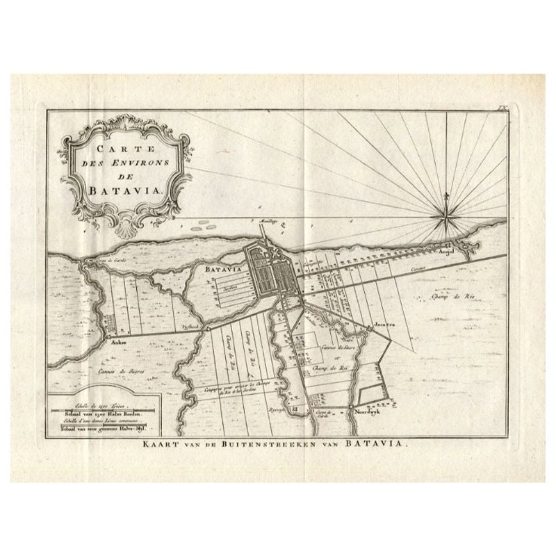
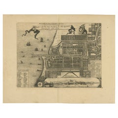
View AllAntique Map of the Region of Batavia by Van Schley, c.1750
Located in Langweer, NL
Antique map titled 'Carte des environs de Batavia - Kaart van de Buitenstreken van Batavia'. Map of the Batavia area (Jakarta) in Indonesia. With cartouche, scale and compass rose. P...
Category
Antique 18th Century Maps
Materials
Paper

$158 Sale Price
20% Off
Antique Map of the Region of Batavia by Conrade, 1782
Located in Langweer, NL
Antique map titled 'Carte des environs de Batavia.' (Map of Batavia and its surroundings.) Map of the Batavia area (Jakarta) in Indonesia. With cartouche, scale and compass rose. Thi...
Category
Antique 18th Century Maps
Materials
Paper
$297 Sale Price
20% Off
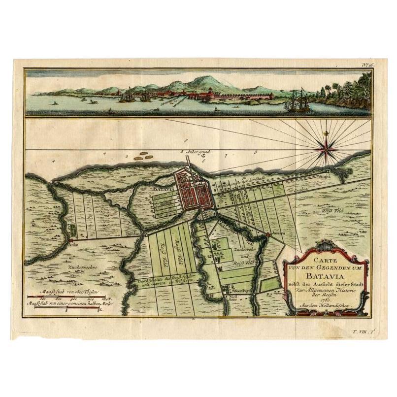
Antique Map of Batavia, Capital of The Dutch East Indies at the Time, 1751
Located in Langweer, NL
Antique map titled 'Carte von den Gegenden um Batavia ...' (Map of Batavia and surroundings.) This print shows a map and a view of Batavia, (Jakarta) Indones...
Category
Antique 18th Century Maps
Materials
Paper

$424 Sale Price
20% Off
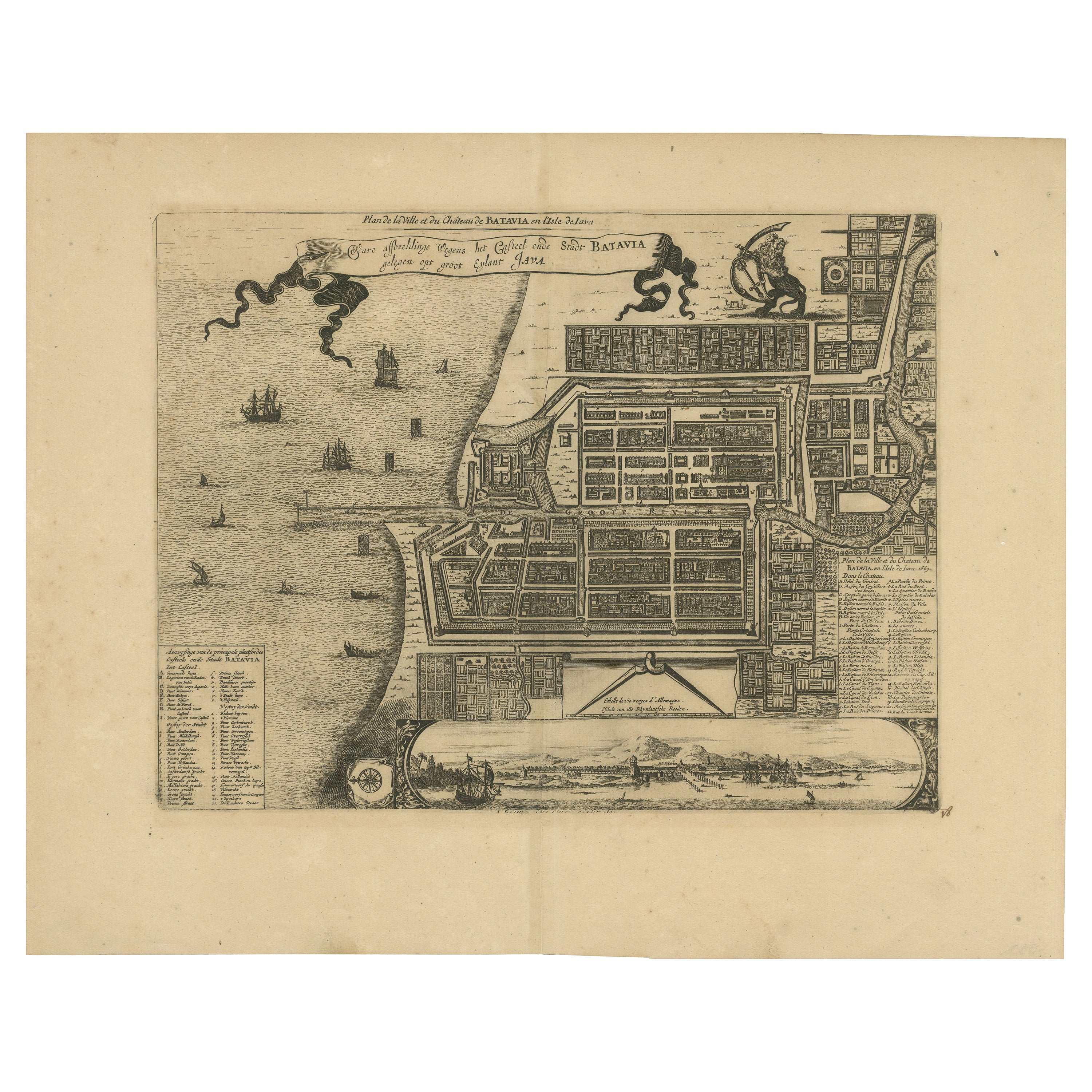
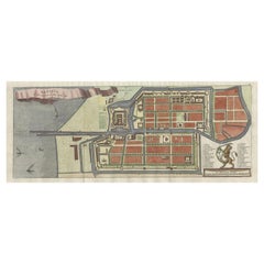
Antique Map of the City of Batavia by Van der Aa 'c.1730'
Located in Langweer, NL
Antique map titled 'Plan de la Ville et du Chateau de Batavia en l'Isle de Iava - Ware affbeeldinge wegens het Casteel ende Stadt Batavia gelegen op groot Eylant Java'. Detailed plan...
Category
Antique Mid-18th Century Maps
Materials
Paper

$1,132 Sale Price
20% Off
1728 Map of Batavia Castle & City, Java – Van der Aa after 1669
Located in Langweer, NL
1728 Map of Batavia Castle & City, Java – Van der Aa after 1669
This is an original antique copperplate engraving titled “Plan de la Ville et du Château de Batavia en l’Isle de Iava...
Category
Antique Early 18th Century Dutch Maps
Materials
Paper
Antique Map of Batavia, Nowadays Jakarta, the Capital of Indonesia, 1782
Located in Langweer, NL
Antique map Batavia titled 'Batavia zo als het was in den Jaare 1731'. Old map of the city of Batavia (Jakarta) in Indonesia. Originates from 'Batavia, de Hoofdstad van Neerlands O. ...
Category
Antique 18th Century Maps
Materials
Paper
$896 Sale Price
20% Off
You May Also Like
1635 Willem Blaeu Map of Northern France"Comitatvs Bellovacvm" Ric.a08
Located in Norton, MA
1635 Willem Blaeu map of northern France, entitled.
"Comitatvs Bellovacvm Vernacule Beavvais,"
Colored
Ric.a008
“COMITATVS BELLOVACVM…” Amsterdam: W...
Category
Antique 17th Century Unknown Maps
Materials
Paper

1643 Willem&Joan Blaeu Map NW Flanders "Flandriae Teutonicae Pars Prientalior
Located in Norton, MA
1643 Willem and Joan Blaeu map of northwest Flanders, entitled
"Flandriae Teutonicae Pars Prientalior,"
Ric0012
" Authentic" - Map of the northwest Fl...
Category
Antique 17th Century Dutch Maps
Materials
Paper

1620 Map of Artois Entitled "Artesia Comitatvs Artois, " by Bleau, Ric.a012
Located in Norton, MA
1640 map of Artois entitled
"Artesia Comitatvs Artois,"
by Bleau
Colored
A-012.
Detailed map of the northern province of Artois, France on the border with Belgium. Feature...
Category
Antique 17th Century Dutch Maps
Materials
Paper

Utrecht, Netherlands: A Large 17th Century Hand-colored Map by Sanson & Jaillot
By Nicholas Sanson d'Abbeville
Located in Alamo, CA
This large hand-colored map entitled "La Seigneurie d'Utrecht. Dressé sur les memoires les plus nouveaux par le Sr. Sanson" was originally created by Nicholas Sanson d'Abbeville. Thi...
Category
1690s Landscape Prints
Materials
Engraving

Ancient Map - Zeilan - Etching by Johannes Janssonius - 1650s
By Johannes Janssonius
Located in Roma, IT
Ancient Map - Zeilan is an ancient map realized in 1650 by Johannes Janssonius (1588-1664).
The Map is Hand-colored etching, with coeval watercoloring.
...
Category
1650s Modern Figurative Prints
Materials
Etching

1633 Map Entitled "Beauvaisis Comitatus Belova Cium, Ric.0002
Located in Norton, MA
1633 map entitled
"Beauvaisis Comitatus Belova Cium,"
Hand Colored
Ric.0002
Description: Cartographer : - Hondius, Henricus 1587-1638
Artists and Engravers:Jodocus Hondius, one of the most notable engravers of his time. He is known for his work in association with many of the cartographers and publishers prominent at the end of the sixteenth and the beginning of the seventeenth century. A native of Flanders, he grew up in Ghent, apprenticed as an instrument and globe maker and map engraver. In 1584, to escape the religious troubles sweeping the Low Countries at that time, he fled to London where he spent some years before finally settling in Amsterdam about 1593. In the London period he came into contact with the leading scientists and geographers of the day and engraved maps in The Mariner\\\\\\\\\\\\\\\'s Mirrour, the English edition of Waghenaer\\\\\\\\\\\\\\\'s Sea Atlas, as well as others with Pieter van den Keere, his brother-in-law. No doubt his temporary exile in London stood him in good stead, earning him an international reputation, for it could have been no accident that Speed chose Hondius to engrave the plates for the maps in The Theatre of the Empire of Great Britaine in the years between 1605 and 1610. In 1604 Hondius bought the plates of Mercator\\\\\\\\\\\\\\\'s Atlas which, in spite of its excellence, had not competed successfully with the continuing demand for the Ortelius Theatrum Orbis Terrarum. To meet this competition Hondius added about 40 maps to Mercator\\\\\\\\\\\\\\\'s original number and from 1606 published enlarged editions in many languages, still under Mercator\\\\\\\\\\\\\\\'s name but with his own name as publisher. These atlases have become known as the Mercator/Hondius series. The following year the maps were reengraved in miniature form and issued as a pocket Atlas Minor. After the death of Jodocus Hondius the Elder in 1612, work on the two atlases, folio and miniature, was carried on by his widow and sons, Jodocus II and Henricus, and eventually in conjunction with Jan Jansson in Amsterdam.
In all, from 1606 onwards, nearly 50 editions with increasing numbers of maps with texts in the main European languages were printed. Summaries of these issues are given under the entry for Gerard Mercator. Jodocus Hondius the Elder * 1588 Maps in The Mariner\\\\\\\\\\\\\\\'s Mirrour (Waghenaer/Ashley) * 1590 World Map...
Category
Antique 17th Century Dutch Maps
Materials
Paper

More Ways To Browse
Voc Antique
Antique Staples
Indonesia Jakarta
Caned Folding
Sugar Cane
18th Century Wood Canes
Indonesian Mat
Cane Plantation
Styles Of Antique Desks
Black And White Coffee Table
Curved Velvet Couch
Velvet Curved Sofa
Wood Round Coffee Tables
Antique Paper Flowers
Oak Brutalist
Used College Furniture
Wood Minimalist Chair
2002 Lamp