Items Similar to Antique Map of Batavia, Capital of The Dutch East Indies at the Time, 1751
Want more images or videos?
Request additional images or videos from the seller
1 of 5
Antique Map of Batavia, Capital of The Dutch East Indies at the Time, 1751
About the Item
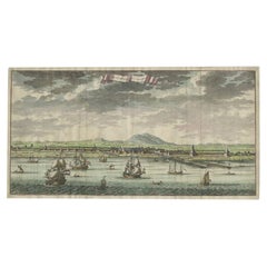
Antique map titled 'Carte von den Gegenden um Batavia ...' (Map of Batavia and surroundings.) This print shows a map and a view of Batavia, (Jakarta) Indonesia. With compass rose, cartouche and legend. Ships. This map originates from 'Allgemeine Historie der Reisen zu Wasser und zu Lande (..)', by J. Schwabe, Leipzig 1751.
Artists and Engravers: Johann Joachim Schwabe (1714 - 1784), German philosopher, translator and scientist.
Condition: Good, general age related toning; some light staining from handling. Please study image carefully.
Date: 1751
Overall size: 32 x 24.5 cm.
Image size: 28 x 20 cm.
We sell original antique maps to collectors, historians, educators and interior decorators all over the world. Our collection includes a wide range of authentic antique maps from the 16th to the 20th centuries. Buying and collecting antique maps is a tradition that goes back hundreds of years. Antique maps have proved a richly rewarding investment over the past decade, thanks to a growing appreciation of their unique historical appeal. Today the decorative qualities of antique maps are widely recognized by interior designers who appreciate their beauty and design flexibility. Depending on the individual map, presentation, and context, a rare or antique map can be modern, traditional, abstract, figurative, serious or whimsical. We offer a wide range of authentic antique maps for any budget.
- Dimensions:Height: 9.65 in (24.5 cm)Width: 12.6 in (32 cm)Depth: 0 in (0.01 mm)
- Materials and Techniques:
- Period:
- Date of Manufacture:1751
- Condition:
- Seller Location:Langweer, NL
- Reference Number:
About the Seller
5.0
Platinum Seller
These expertly vetted sellers are 1stDibs' most experienced sellers and are rated highest by our customers.
Established in 2009
1stDibs seller since 2017
1,928 sales on 1stDibs
Typical response time: <1 hour
- ShippingRetrieving quote...Ships From: Langweer, Netherlands
- Return PolicyA return for this item may be initiated within 14 days of delivery.
More From This SellerView All
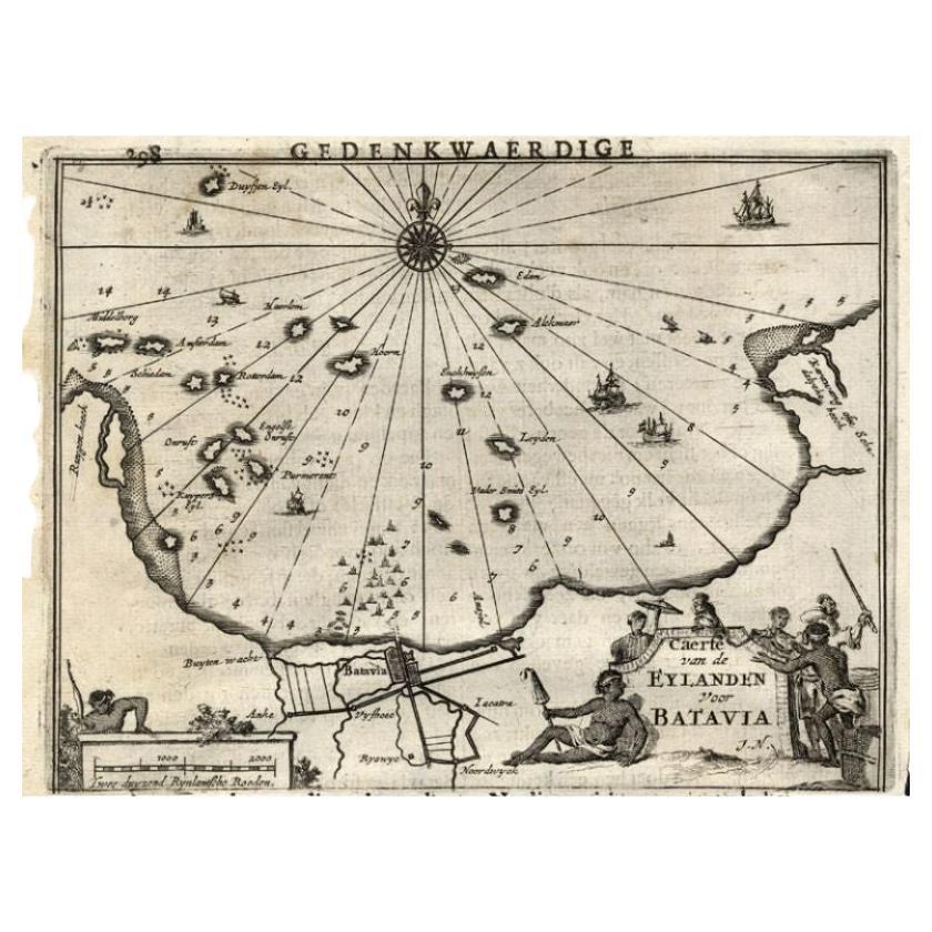
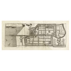
- Antique Map of the Islands Near Batavia, Capital of the Dutch East Indies, 1682Located in Langweer, NLAntique map titled 'Caerte van de Eylanden voor Batavia.' Map of the islands near Batavia, Indonesia. With scale, compass rose, cartouche and ships on the sea. Sheet with engraving...Category
Antique 17th Century Maps
MaterialsPaper
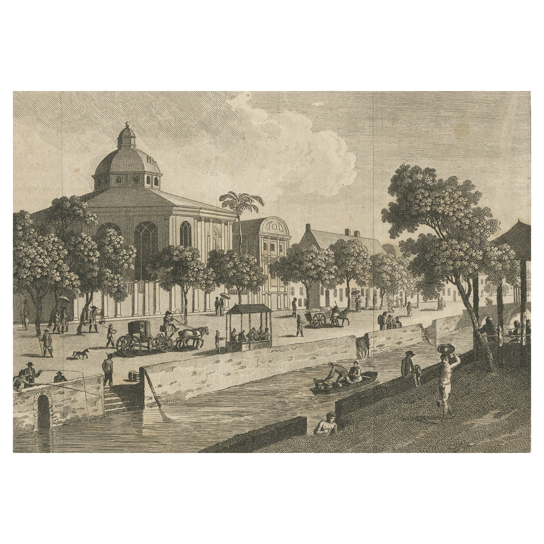
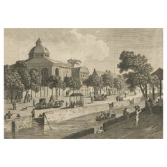
- Antique Print of Batavia, Capital of the Dutch East Indies 'Indonesia', c.1820Located in Langweer, NLAntique print titled 'Ansicht einer Strasse in Batavia'. Old print with a view on a street in Batavia (Jakarta), Indonesia. Source unknown, to be determined. Artists and Engraver...Category
Antique 19th Century Prints
MaterialsPaper
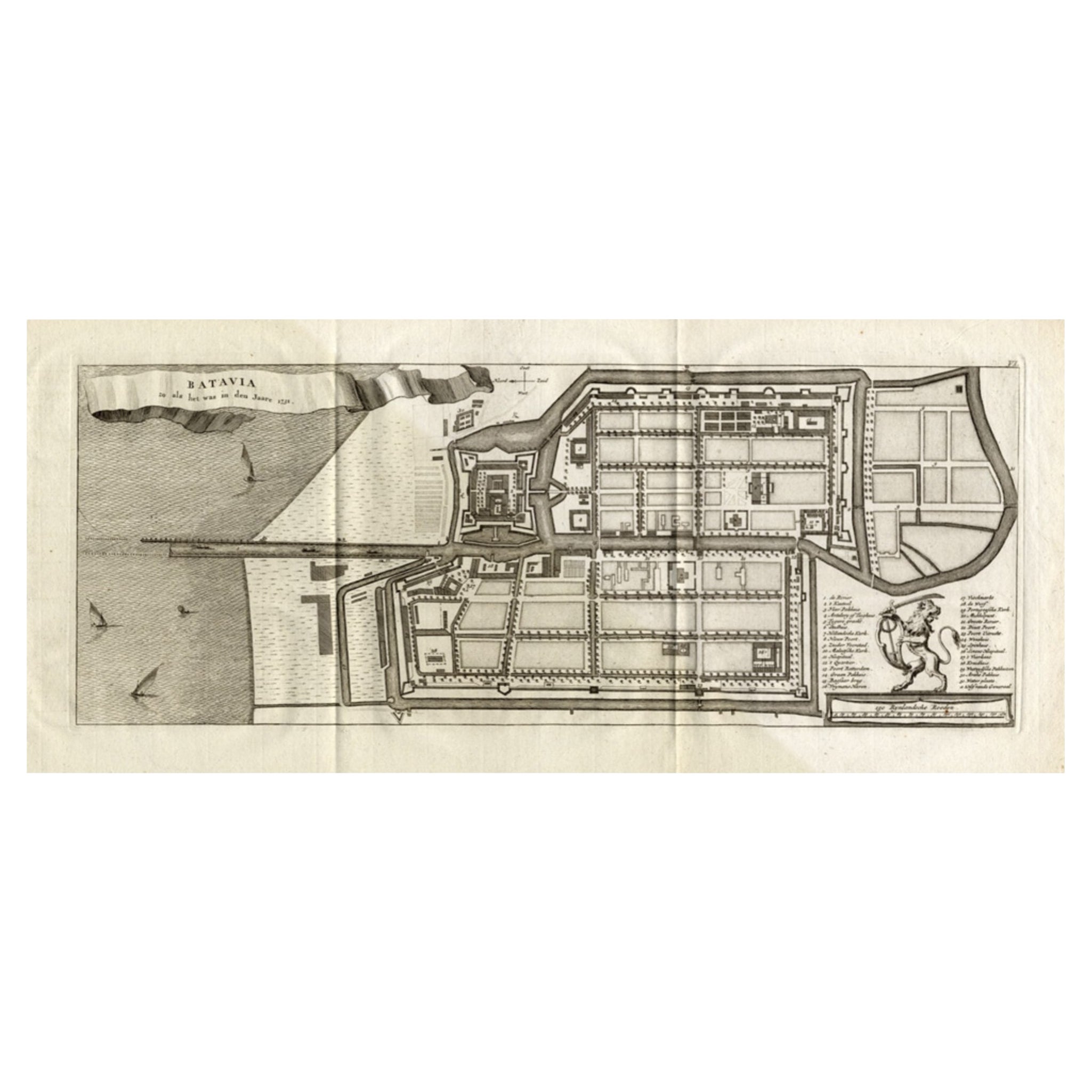
- Antique Map of Batavia 'Jakarta, Indonesia', the Dutch East-Indies, 1782Located in Langweer, NLAntique map titled 'Batavia zo als het was in den Jaare 1731.' (Batavia as it was in the year 1731.) Map of the city of Batavia (Jakarta) in Indonesia. With legend and scale. This pr...Category
Antique 18th Century Maps
MaterialsPaper
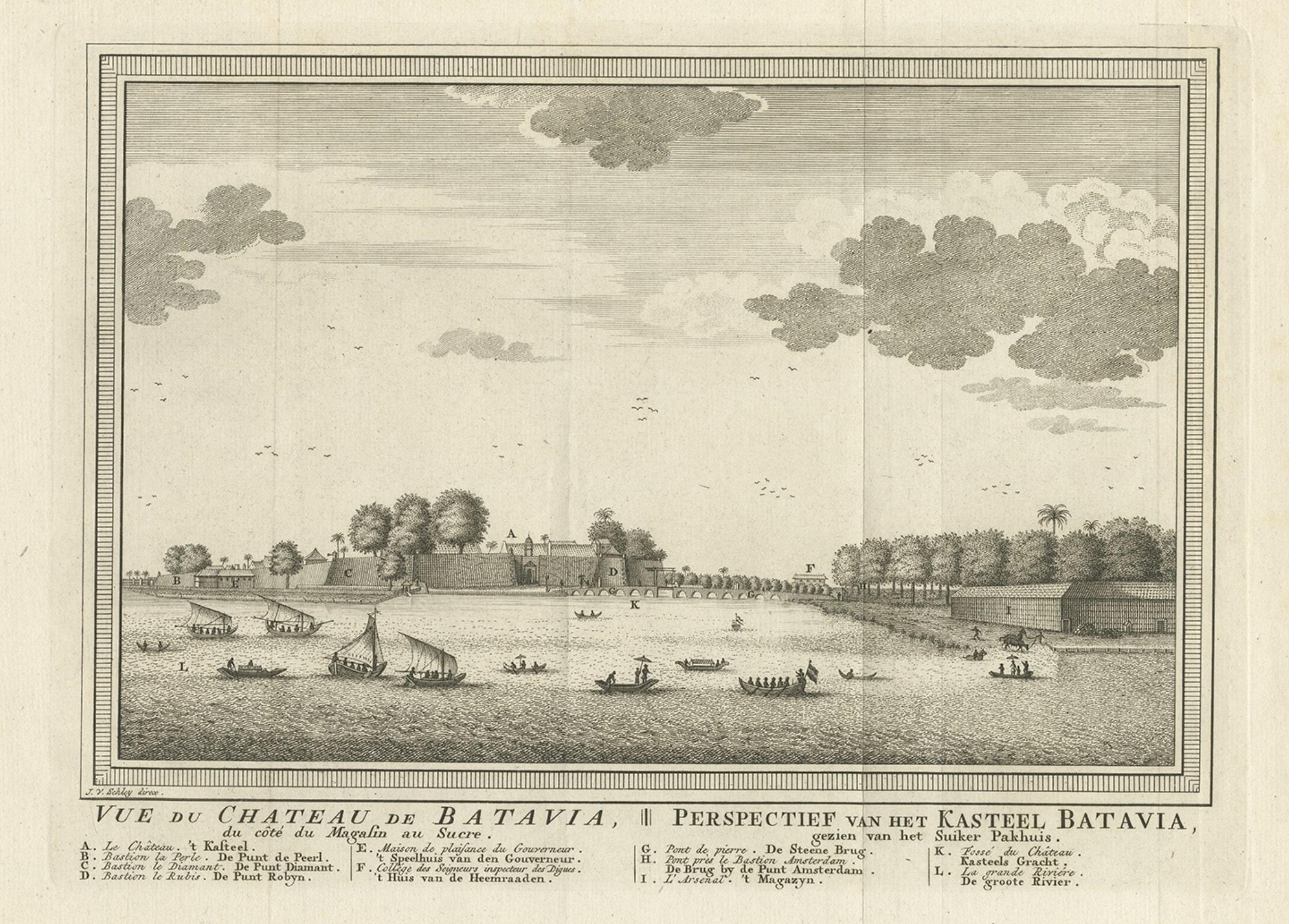
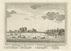
- Antique Print of Capital Batavia in the Dutch East Indies 'Indonesia', C.1752Located in Langweer, NLAntique print Indonesia titled 'Vue Du Chateau De Batavia - Perspectief van het kasteel Batavia'. View of the Castle of Batavia, seen from the sugar warehouse. Originates from Antoin...Category
Antique 18th Century Prints
MaterialsPaper
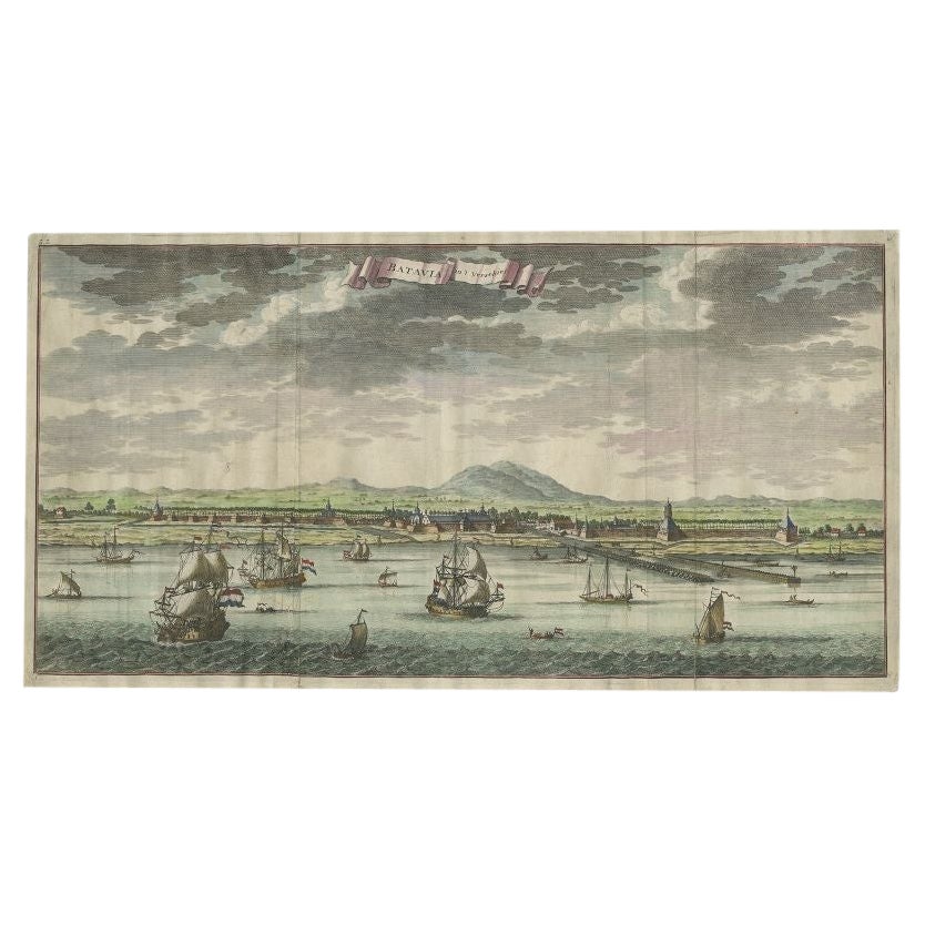
- Antique Print of Batavia, Capital of the Dutch East Indies or Indonesia, '1726'Located in Langweer, NLAntique print Indonesia titled 'Batavia in 't Verschiet'. Large panoramic view on Batavia, present day Jakarta, Indonesia. Originates from 'Oud en Nieuw Oost-Indiën (..)' by François...Category
Antique 18th Century Prints
MaterialsPaper
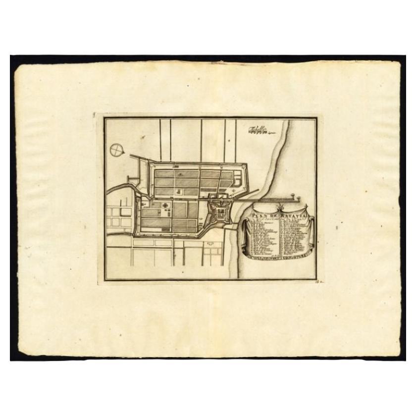
- Antique Plan of Batavia, Capital of the Dutch East Indies, by Van Der Aa, 1725By Pieter Van Der AaLocated in Langweer, NLAntique map titled 'Plan de Batavia'. (Plan of Batavia.) This plate shows a plan of the city of Batavia / Jakarta in Indonesia. With extensive legend, compass rose and scale. This pl...Category
Antique 18th Century Maps
MaterialsPaper


You May Also Like
- The Holy Land at the Time of Jesus: A 17th Century Dutch Map by VisscherBy Nicolaes Visscher IILocated in Alamo, CAThis detailed Dutch map entitled "Het Beloofe de Landt Canaan door wandelt van onsen Salichmaecker Iesu Christo, nessens syne Apostelen" by Nicolaes Visscher was published in Amsterd...Category
Antique Mid-17th Century Dutch Maps
MaterialsPaper
- Seminal guide to the East and West Indies, with 42 coloured maps and platesBy Jan Huygen van LinschotenLocated in ZWIJNDRECHT, NLSeminal guide to the East and West Indies, with 42 double-page and folding plates, including 6 maps, all engravings beautifully coloured by a contemporary hand LINSCHOTEN, Jan Huygh...Category
Antique Early 17th Century Dutch Dutch Colonial Books
MaterialsPaper
- East German MapBy VEB Hermann HaackLocated in Baltimore, MDA brilliantly colourful map of the Leipzig, Karl Marx Stadt and Dresden area in the former German Democratic Republic by VEB Hermann Haack of Gotha.Category
Vintage 1970s German Maps
- Original Antique Map of South East Asia, Arrowsmith, 1820Located in St Annes, LancashireGreat map of South East Asia Drawn under the direction of Arrowsmith Copper-plate engraving Published by Longman, Hurst, Rees, Orme and Brown, 1820 Unframed.Category
Antique 1820s English Maps
MaterialsPaper
- Original Antique Map of South East Asia by Becker, circa 1840Located in St Annes, LancashireGreat map of South East Asia Steel engraving with original color outline Engraved by Becker Published by Virtue, circa 1840. Unframed.Category
Antique 1840s English Other Maps
MaterialsPaper
- Original Antique Map of South East Asia by Thomas Clerk, 1817Located in St Annes, LancashireGreat map of South East Asia Copper-plate engraving Drawn and engraved by Thomas Clerk, Edinburgh. Published by Mackenzie And Dent, 1817 Unframed.Category
Antique 1810s English Maps
MaterialsPaper


Recently Viewed
View AllMore Ways To Browse
Capital Of Antique
Antique Capital
Ship Map
Dutch 16th Century Furniture
East Indies Furniture
East Indies
Antique Dutch Light
Compass Rose
Dutch Indies
Dutch East Indies
Rare Compass
Compass Rose Antique
Antique Compass Rose
Compass 18th Century
18th Century Compass
East German Light
Batavia Furniture
Dutch Batavia