Items Similar to Map of Northern South America – Vibrant Engraving by Keith Johnston, 1903


Want more images or videos?
Request additional images or videos from the seller
1 of 10
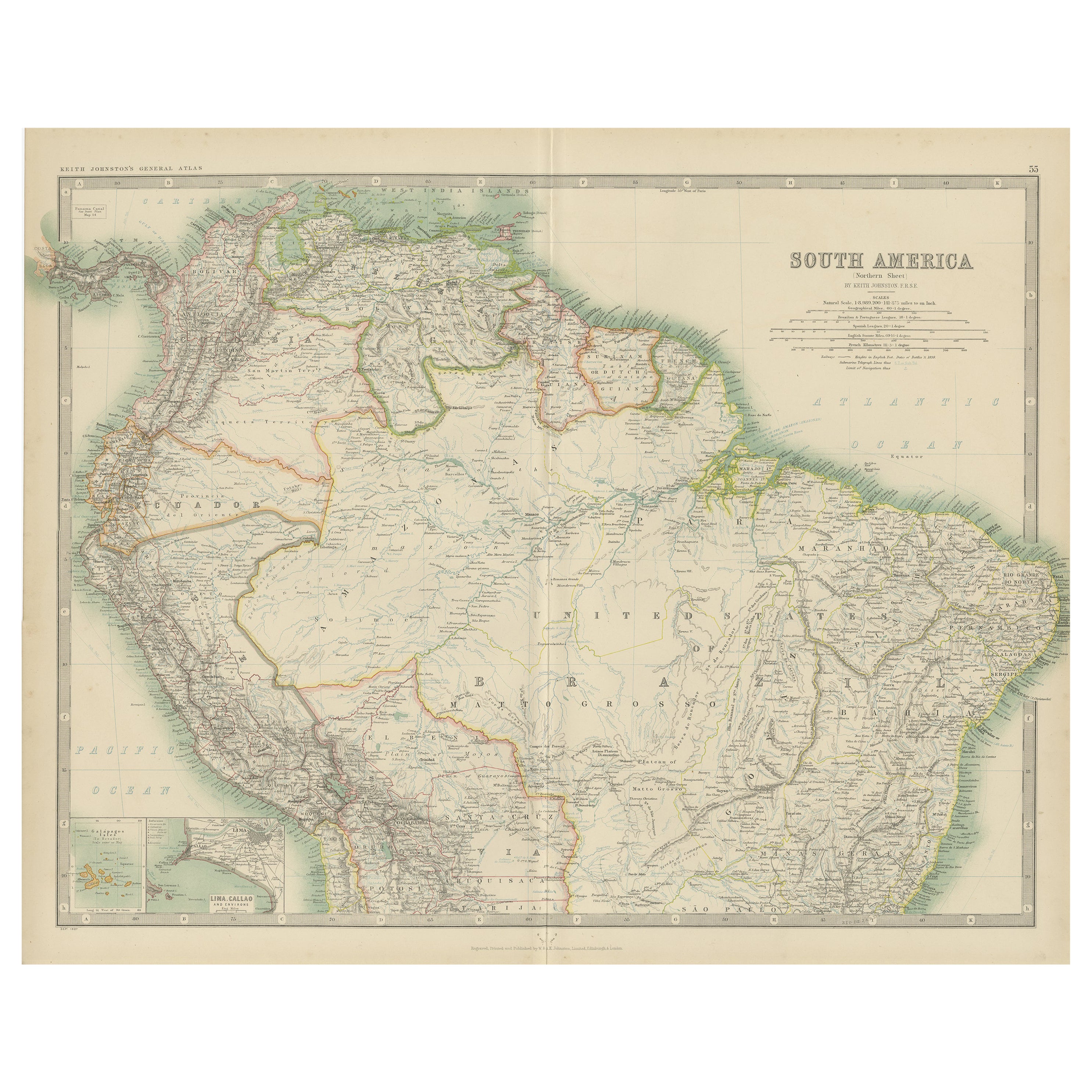
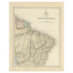
Map of Northern South America – Vibrant Engraving by Keith Johnston, 1903
$400.96
£300.13
€340
CA$551.84
A$615.09
CHF 322.71
MX$7,511.19
NOK 4,086.26
SEK 3,862.14
DKK 2,588.32
About the Item
Map of Northern South America – Vibrant Engraving by Keith Johnston, 1903
This beautifully engraved map titled "South America: Northern Sheet" was created by Keith Johnston, F.R.G.S., and published by W. & A.K. Johnston, Limited, Edinburgh & London, in 1903. It provides a detailed and colorful portrayal of the northern regions of South America, reflecting the colonial and political landscape of the early 20th century.
The map covers Colombia, Venezuela, Ecuador, Peru, northern Brazil, Guyana, Suriname, French Guiana, and the western edge of the Amazon Basin. Inset in the lower left corner is a detailed depiction of the Galapagos Islands, emphasizing their strategic location in the Pacific.
The precision and artistry of the engraving are notable, with clear typography, fine hachures to show topography, and vibrant color washes that highlight national boundaries. The map features a wealth of geographical details, including major cities, rivers, mountain ranges, and other natural features. It also captures important historical routes and settlements, offering a glimpse into the political and economic structures of the era.
This antique map is in very good to excellent condition, with minimal age-related wear, clear printing, and strong color retention. It’s an invaluable piece for collectors, historians, or enthusiasts of South American geography.
For framing, consider using a deep brown or black wooden frame to complement the soft pastel shades of the map, along with a neutral mat that emphasizes the delicate engraved lines and vibrant color washes. This would make a striking addition to any study, library, or office, providing both aesthetic appeal and historical significance.
- Dimensions:Height: 14.49 in (36.8 cm)Width: 18.51 in (47 cm)Depth: 0.01 in (0.2 mm)
- Materials and Techniques:
- Period:
- Date of Manufacture:1903
- Condition:This antique map is in very good to excellent condition, with minimal age-related wear, clear printing, and strong color retention.
- Seller Location:Langweer, NL
- Reference Number:Seller: BG-13577-501stDibs: LU3054345292102
About the Seller
5.0
Recognized Seller
These prestigious sellers are industry leaders and represent the highest echelon for item quality and design.
Platinum Seller
Premium sellers with a 4.7+ rating and 24-hour response times
Established in 2009
1stDibs seller since 2017
2,513 sales on 1stDibs
Typical response time: <1 hour
- ShippingRetrieving quote...Shipping from: Langweer, Netherlands
- Return Policy
Authenticity Guarantee
In the unlikely event there’s an issue with an item’s authenticity, contact us within 1 year for a full refund. DetailsMoney-Back Guarantee
If your item is not as described, is damaged in transit, or does not arrive, contact us within 7 days for a full refund. Details24-Hour Cancellation
You have a 24-hour grace period in which to reconsider your purchase, with no questions asked.Vetted Professional Sellers
Our world-class sellers must adhere to strict standards for service and quality, maintaining the integrity of our listings.Price-Match Guarantee
If you find that a seller listed the same item for a lower price elsewhere, we’ll match it.Trusted Global Delivery
Our best-in-class carrier network provides specialized shipping options worldwide, including custom delivery.More From This Seller
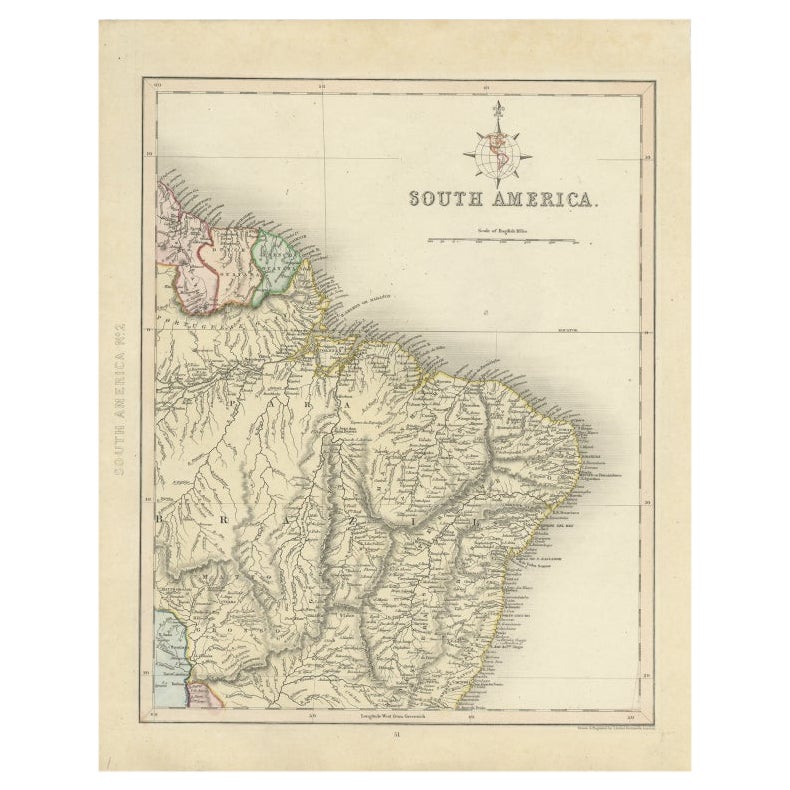
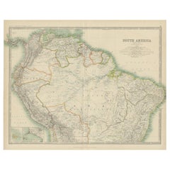
View AllAntique Map of South America ‘North’ by A.K. Johnston, 1865
Located in Langweer, NL
Antique map titled 'South America, Northern Sheet'. Depicting Guiana, Ecuador, Brazil, Bolivia the Amazones and more. This map originates from the ‘Royal Atlas of Modern Geography’ b...
Category
Antique Mid-19th Century Maps
Materials
Paper

$259 Sale Price
20% Off
Antique Map of Part of South America by Archer, C.1860
Located in Langweer, NL
Antique map titled 'South America'. This antique map depicts the north-east of South America, including a large part of Brazil. Artists and Engravers: Drawn and engraved by J. Archer...
Category
Antique 19th Century Maps
Materials
Paper
$89 Sale Price
20% Off
Exploring South America's North: Antique Map from the Royal Atlas of 1909
Located in Langweer, NL
The antique map titled 'South America, Northern Sheet' is a historical cartographic representation of the northern part of South America. This original antique map features inset map...
Category
Early 20th Century Maps
Materials
Paper
$235 Sale Price
20% Off
Antique Map of South America by A & C. Black, 1870
Located in Langweer, NL
Antique map titled 'South America'. Original antique map of Map of South America. This map originates from ‘Black's General Atlas of The World’. Published by A & C. Black, 1870.
Category
Antique Late 19th Century Maps
Materials
Paper

$259 Sale Price
20% Off
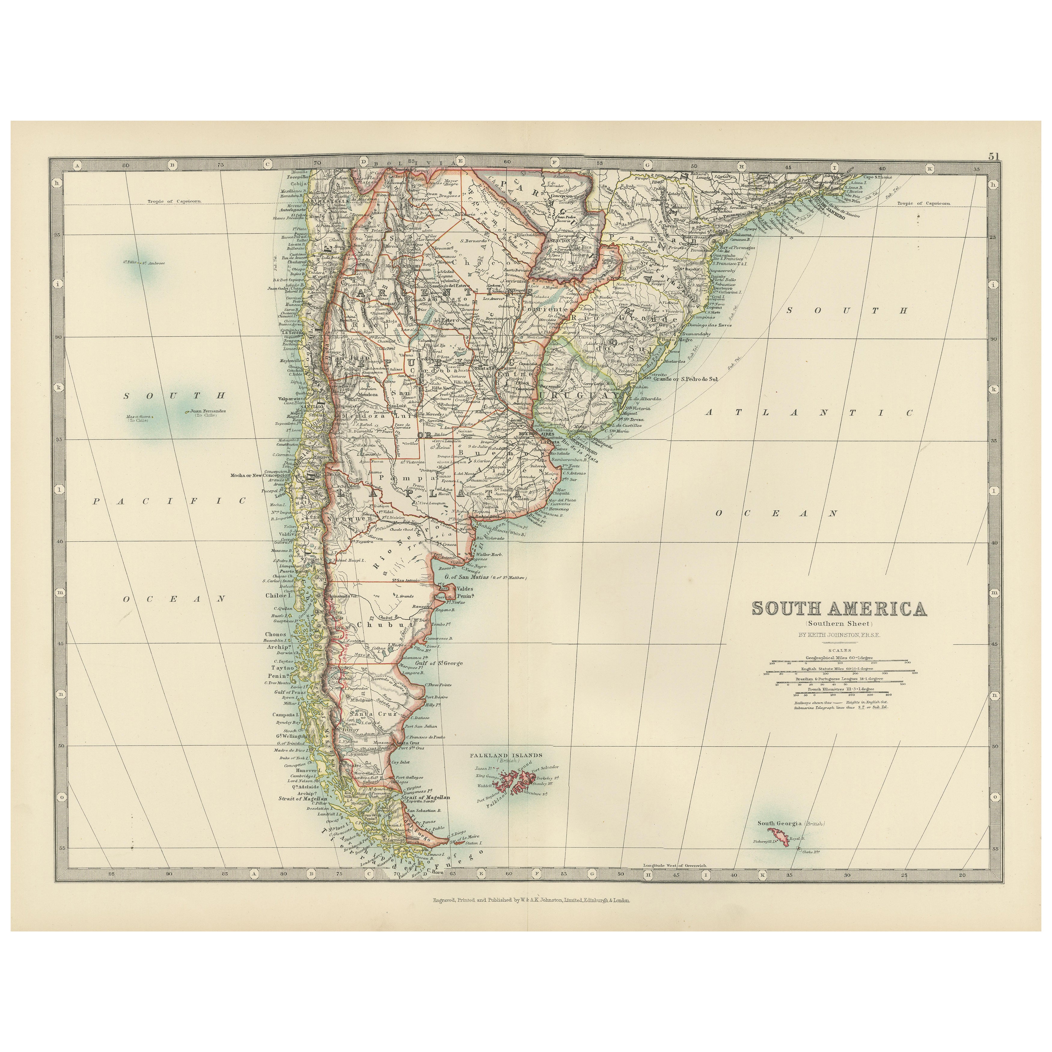
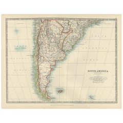
Map of Southern South America – Richly Detailed Engraving by K.Johnston, 1903
Located in Langweer, NL
Title (80 characters, keyword-first):
Map of Southern South America – Richly Detailed Engraving by Keith Johnston, 1903
Description:
This elegant map titled "South America: Southern...
Category
Early 20th Century Maps
Materials
Paper
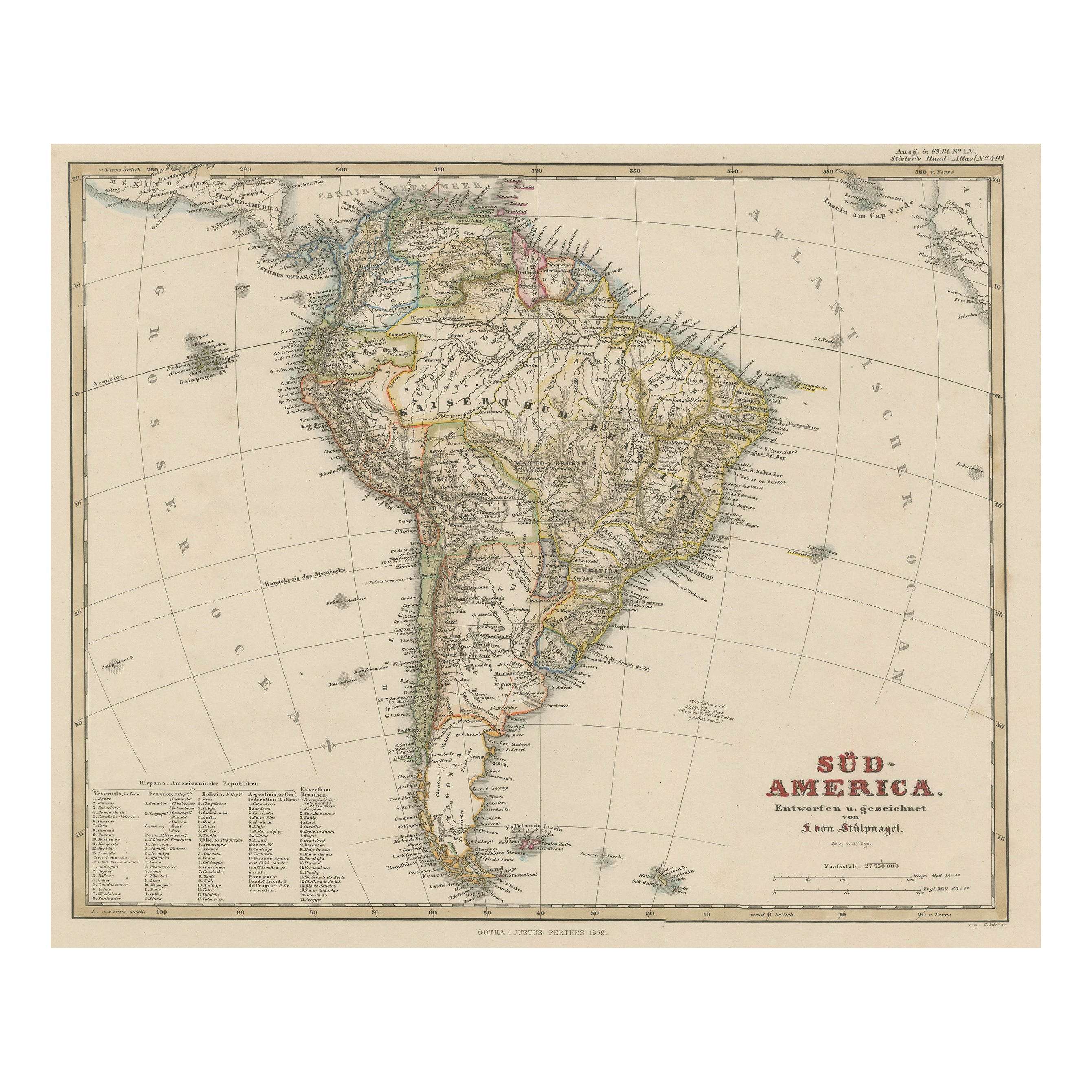
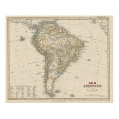
Antique Map of South America with Many Details, ca.1859
Located in Langweer, NL
Original antique map titled 'Süd-America'. Beautiful old map of South America, with many details and legend.
This map originates from Stielers Handatlas, published circa 1859. St...
Category
Antique Mid-19th Century Maps
Materials
Paper
$547 Sale Price
20% Off
You May Also Like
South America, Eastern Part. Century Atlas antique vintage map
Located in Melbourne, Victoria
'The Century Atlas. South America. Eastern Part'
Original antique map, 1903.
Inset map 'Rio de Janeiro and Vicinity'.
Central fold as issued. Map name and number printed on the rev...
Category
Early 20th Century Victorian More Prints
Materials
Lithograph

Charte von Sud-America (Map of South America) - Etching with Hand-Drawn Outlines
Located in Soquel, CA
Map of south America, engraved by Franz Pluth (Czech, 1800-1871), from the book "Neueste Länder - und Völkerkunde, ein geographisches Lesebuch für alle Stände" by Linder, F. L. (Prag...
Category
1820s Other Art Style More Prints
Materials
Paper, Printer's Ink, Etching

South America, North-West Part. Century Atlas antique vintage map
Located in Melbourne, Victoria
'The Century Atlas. South America, North-West Part'
Original antique map, 1903.
Central fold as issued. Map name and number printed on the reverse corners.
Sheet 40cm by 29.5cm.
Category
Early 20th Century Victorian More Prints
Materials
Lithograph

Antique Lithography Map, South America, English, Framed, Cartography, Victorian
Located in Hele, Devon, GB
This is an antique lithography map of South America. An English, framed atlas engraving of cartographic interest by John Rapkin , dating to the early Victorian period and later, circ...
Category
Antique Mid-19th Century British Early Victorian Maps
Materials
Wood

Carte du Bresil, antique 1860s engraved map of Brazil
Located in Melbourne, Victoria
'Carte du Bresil'
Engraving with original outline colouring, circa 1860, by Alexandre Vuillemin, published in Paris.
31cm by 41cm (sheet)
21.5cm by 31.5cm (image)
Category
Late 19th Century Victorian More Prints
Materials
Lithograph

Antique Map of South America in Roma Frame
Located in Malibu, CA
Antique map of South America. Displayed in a new Roma frame with museum quality matting. Custom frame in platinum. No print date, but cert...
Category
Antique Late 19th Century Victorian Prints
Materials
Hardwood, Paper

$262 Sale Price
30% Off
More Ways To Browse
Brazilian Colonial Furniture
Peruvian Colonial
Wooden Basin
Colonial Peru
R Johnston
6x10 Rug
Styles Of Antique Desks
Black And White Coffee Table
Metal Relief
Curved Velvet Couch
Velvet Curved Sofa
Wood Round Coffee Tables
Antique Paper Flowers
Oak Brutalist
Used College Furniture
Wood Minimalist Chair
2002 Lamp
Antique Imperial Furniture