Items Similar to Monumental Framed Medieval Facsimile Map Of The World Fra Mauro Wood Wall Panel

Want more images or videos?
Request additional images or videos from the seller
1 of 16
Monumental Framed Medieval Facsimile Map Of The World Fra Mauro Wood Wall Panel
$2,950
£2,269.34
€2,634.05
CA$4,160.20
A$4,660.13
CHF 2,447.67
MX$56,665.67
NOK 30,995.47
SEK 29,423.03
DKK 19,658.97
About the Item
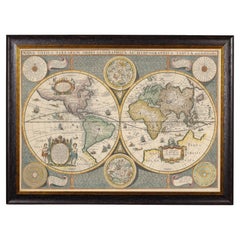
A remarkable palatial nearly 7.5ft x 7.5ft facsimile of the important Map of the World (circa 1450) by Fra MauroFra Mauro (Italian; circa 1400–1464), featuring a solid wood framed high-quality facsimile print on paper mounted to linen. Wooden frame with wall hanging / mounting hardware to verso.
Dimensions: (approx)
Overall: 88.25" Tall, 90.25" Wide, 2" Deep;
Site: 86" High x 88" Long;
History:
Fra Mauro (c.1400–1464) was an Italian (Venetian) 15th century cartographer who lived in Murano in the Republic of Venice. He is celebrated for creating the most detailed, advanced, and accurate map of the world up until that time, arguably one of if not the most important map in history, the Fra Mauro map.
The Fra Mauro map of the world was made around circa 1450, and is “considered the greatest memorial of medieval cartography" A truly remarkable work of art and fascinating historic cartography that offers us a glimpse into the middle-ages understanding of the world.
The Fra Mauro World Map, or Mappa Mundi, was a major cartographical work that compiled much of the geographical knowledge of the time and took several years to complete. Commission by King Afonso V of Portugal, the map is massive, covering over five square meters, it is remarkably accurate and extremely detailed, containing over 3000 descriptive texts, colorful illustrations with vibrant colors, and countless intricate details.
Distinctive in that it is a geocentric projection, meaning that it is centered on the Earth and gives a unique perspective, it is a circular planisphere drawn on parchment and set in a wooden frame that measures over two by two meters, for a total surface area of over five square meters. Including Asia, the Indian Ocean, Africa, Europe, and the Atlantic, it is orientated with south at the top.
A commemorative medal of the period struck in honor of his cartographic work describes Fra Mauro as "chosmographus incomparabilis".
The original surviving map is incredibly still in existence nearly six centuries later, and usually housed at and on display in the Biblioteca Nazionale Marciana in Venice in Italy.
*Please note, we are not offering the original 15th century map, as it is literally a priceless historical artifact that would never be allowed to leave Italy. Like most all high quality maps, this is an exact print or professional facsimile*
Condition Report:
Overall a wonderful example, in very good antique / vintage condition.
Excellent presentation, with nicely aged patina, intentional distressing, worn and aged appearance after the original. Beautifully patinated, enhanced by antique character and charm throughout, including creasing and discoloration line where panels meet, separation at corners, minor wear commensurate with age, use, handling and exposure. Metal hardware to verso, ready for immediate wall hanging and display, sure to add timeless sophistication, elegant warmth, historic interest, and rustic old world European charm to any space!
Versatile, complimenting a variety of different interior styles, from Italian Renaissance, Baroque, Mediterranean revival, Victorian Gothic, Spanish Colonial, British Tudor, English Georgian, Jacobean, Elizabethan, French Louis revivalist, old fashioned early American, country farmhouse office or study, and much, much more!
World Wide Shipping available
Local Pick-up and Delivery available around Dallas, Texas
- Dimensions:Height: 88.25 in (224.16 cm)Width: 90.25 in (229.24 cm)Depth: 2 in (5.08 cm)
- Style:Medieval (In the Style Of)
- Materials and Techniques:
- Period:
- Date of Manufacture:Early 20th Century
- Condition:Wear consistent with age and use. Overall wonderful example, good antique/vintage condition. Presents well, beautifully patinated, intentional distressed worn aged appearance after original, creasing discoloration line, separation at corners, wear commensurate with age, use, handling.
- Seller Location:Forney, TX
- Reference Number:1stDibs: LU5977242739212
About the Seller
4.8
Platinum Seller
Premium sellers with a 4.7+ rating and 24-hour response times
Established in 2013
1stDibs seller since 2021
294 sales on 1stDibs
Typical response time: <1 hour
- ShippingRetrieving quote...Shipping from: Forney, TX
- Return Policy
Authenticity Guarantee
In the unlikely event there’s an issue with an item’s authenticity, contact us within 1 year for a full refund. DetailsMoney-Back Guarantee
If your item is not as described, is damaged in transit, or does not arrive, contact us within 7 days for a full refund. Details24-Hour Cancellation
You have a 24-hour grace period in which to reconsider your purchase, with no questions asked.Vetted Professional Sellers
Our world-class sellers must adhere to strict standards for service and quality, maintaining the integrity of our listings.Price-Match Guarantee
If you find that a seller listed the same item for a lower price elsewhere, we’ll match it.Trusted Global Delivery
Our best-in-class carrier network provides specialized shipping options worldwide, including custom delivery.More From This Seller
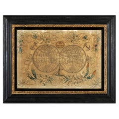
View All19th Century Embroidered Silk Panel Map Of The World
Located in Forney, TX
A rare and visually striking framed antique European embroidered silk panel.
Exquisitely hand-crafted in Continental Europe in the 19th ...
Category
Antique 19th Century European Victorian Decorative Art
Materials
Silk, Thread
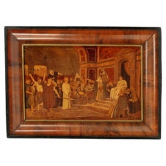
Antique Marquetry Panel Religious Artwork After Mihaly Munkacsy Signed Pittel B
Located in Forney, TX
A rare and most impressive, exquisitely hand-crafted marquetry plaque, early 20th century, exceptionally executed masterpiece, intricately inlaid exot...
Category
Early 20th Century European Decorative Art
Materials
Wood
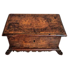
17th/18th Century Italian Venetian Marquetry Table Box
Located in Forney, TX
An important early antique Italian Renaissance table box, handcrafted in Northern Italy in the 17th/18th century, cassone chest form, richly inlaid, the top and front panel with fruitwood banding framing...
Category
Antique 18th Century Italian Renaissance Decorative Boxes
Materials
Wood, Fruitwood
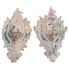
Monumental Pair of Medieval Antique Italian Church Armorial Shields
Located in Forney, TX
A magnificent pair of large one-of-a-kind medieval Italian armorial shield church architectural elements.
Dating to around the late 15th century, hand-crafted in Italy, most impressive size, standing over 6-feet tall, bow front shaped shield form, polychrome painted Memento Mori - The Wars of the...
Category
Antique 15th Century and Earlier Italian Renaissance Religious Items
Materials
Wood, Paint
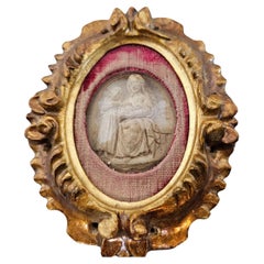
Antique Italian Religious Giltwood Reliquary Relief Carved Sculpture
Located in Forney, TX
A rare antique Italian giltwood framed reliquary. 18th/19th century, hand carved giltwood frame housing an exceptional relief carving, d...
Category
Antique Early 19th Century Italian Baroque Religious Items
Materials
Bone, Giltwood
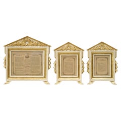
Rare Antique Religious Italian Catholic Church Carta Gloria Altar Card Frame Set
Located in Forney, TX
A rare complete set of three antique Italian Grand Tour ecclesiastical hand carved parcel gilt cream painted pine "Carta Gloria" altar card frames.
Italy...
Category
Antique 19th Century Italian Neoclassical Religious Items
Materials
Pine, Giltwood
You May Also Like
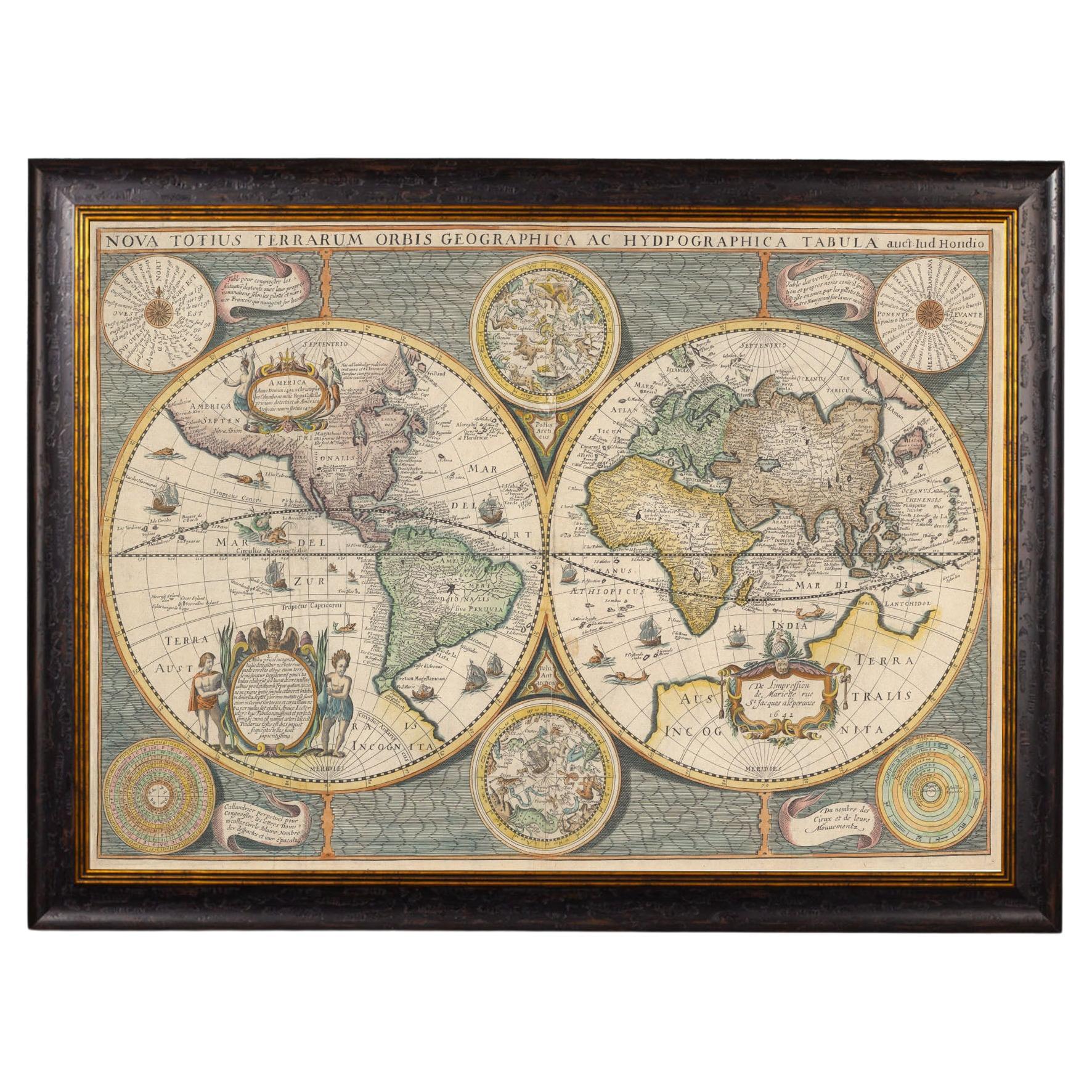
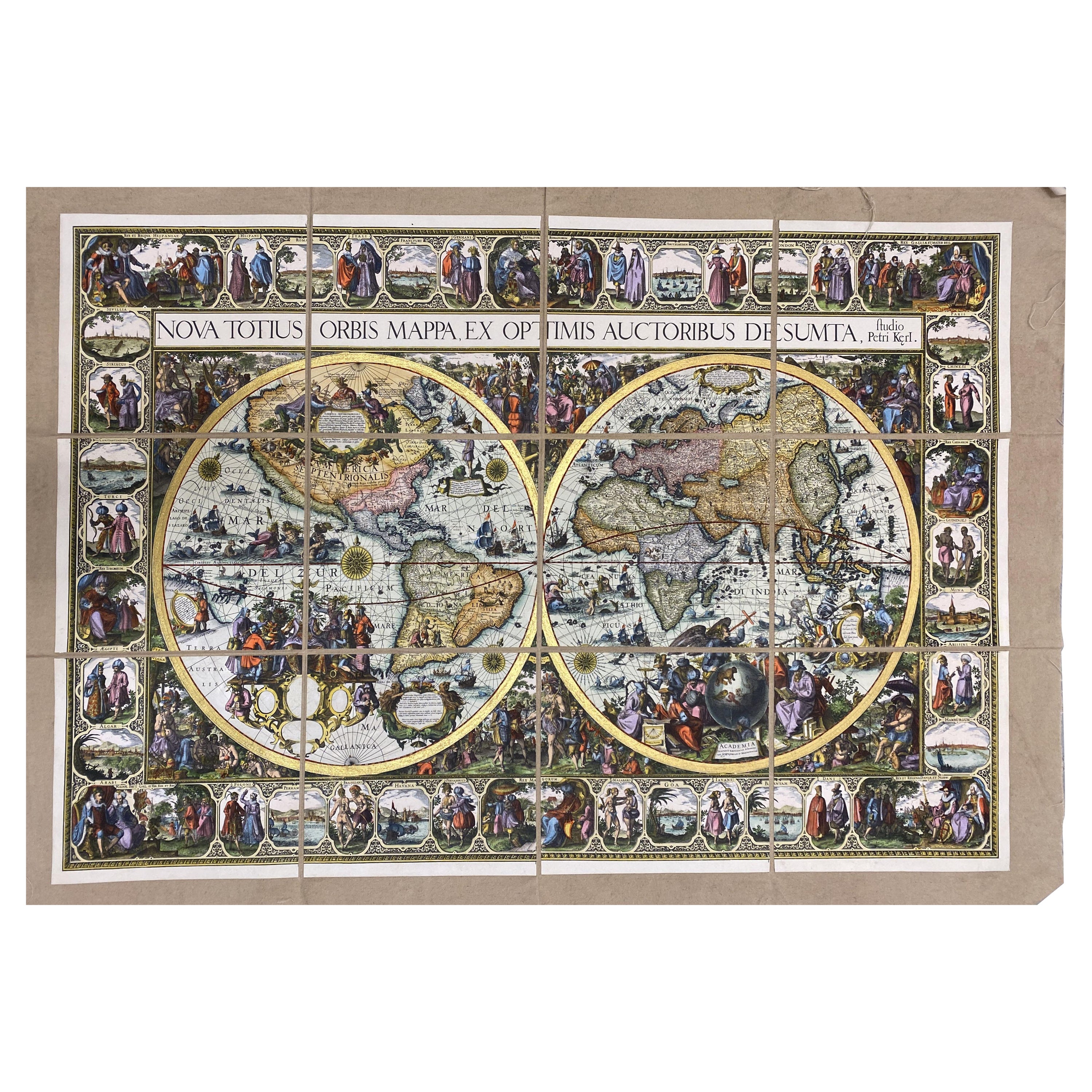
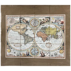
Framed World Map print showing double hemisphere dating to 1642 originally, New
Located in Lincoln, Lincolnshire
This is a digitally remastered World Map Conjuring up the golden age of exploration, from an original 1642 double hemisphere map of the world. It...
Category
2010s British Charles II Prints
Materials
Glass, Wood, Paper
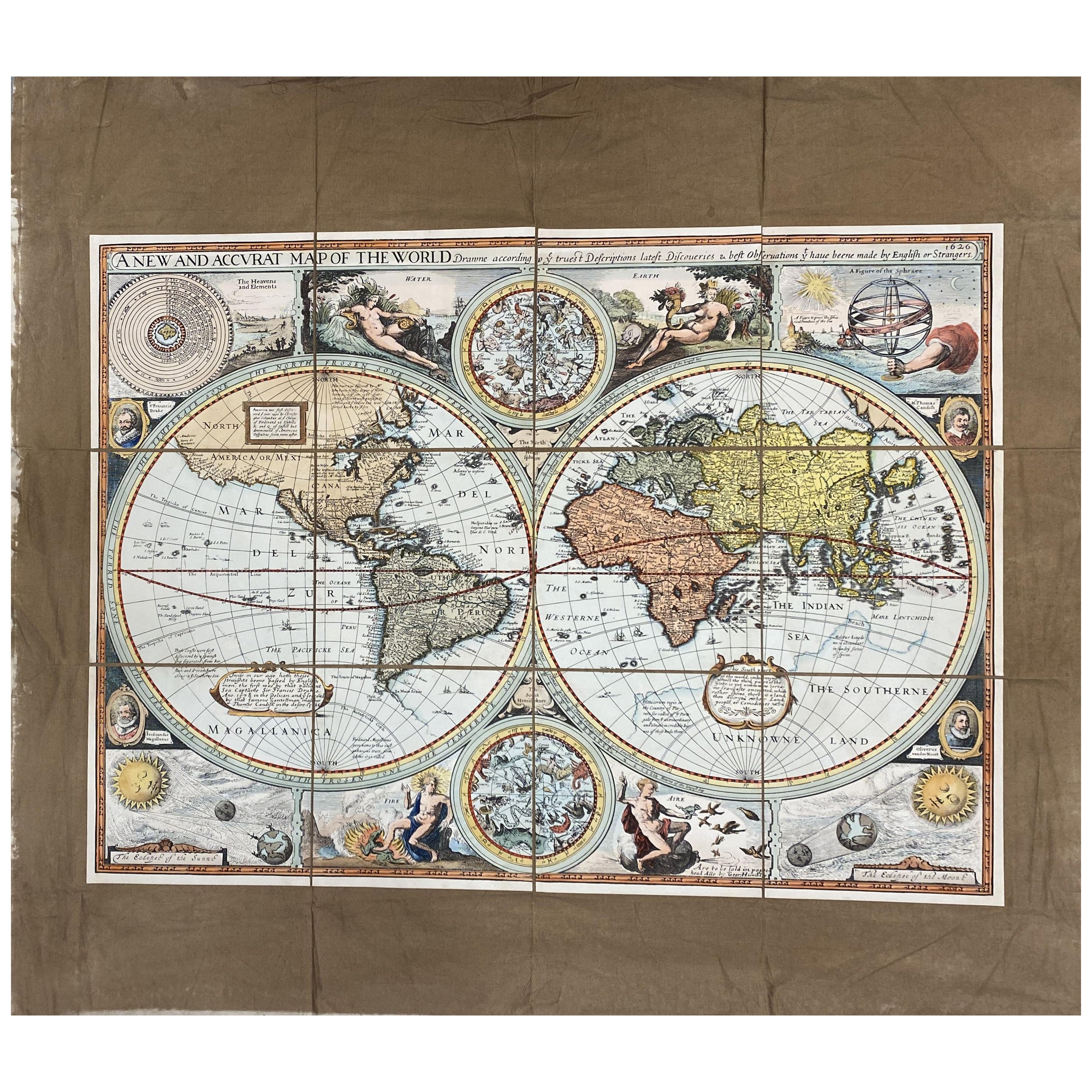
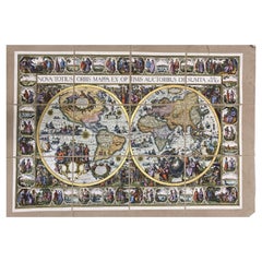
Italian Contemporary Handcolored Old Map Printed Rough Canvas "Planisphere"
Located in Scandicci, Florence
Beautiful reproduction of an antique English map showing th Planisfere, with astral hemisfere, made in 1629.
We can see with what mastery of join...
Category
21st Century and Contemporary Italian Prints
Materials
Cotton, Paper
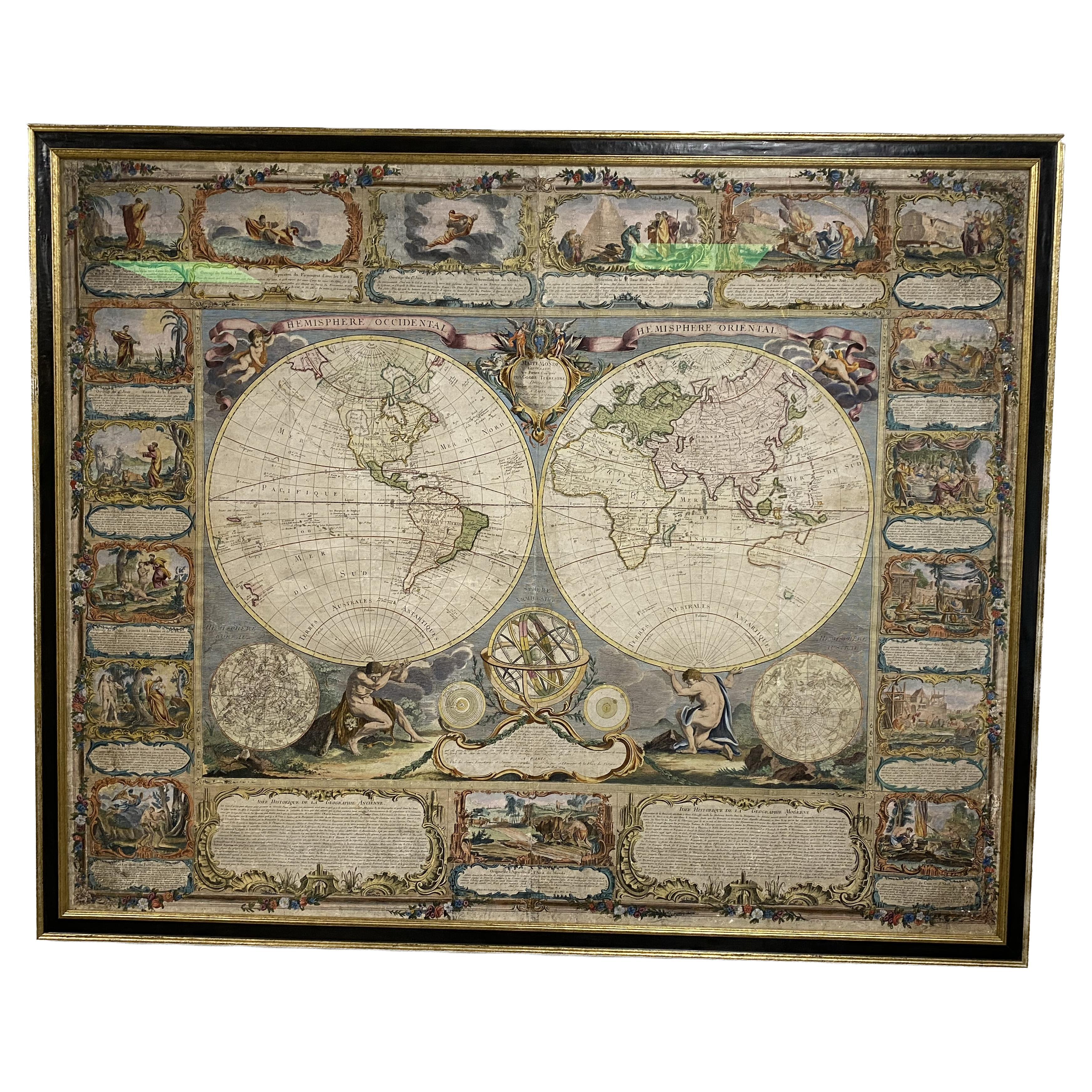
Colored wall map of the WORLD
By Chambon
Located in ZWIJNDRECHT, NL
“Mappe Monde, contenant les Parties Connues du Globe Terrestre”
CHAMBON, Gobert-Denis (France, 17.. - 1781)
Paris, Longchamps et Janvier, 1754
Size H. 115 x W. 145 cm.
Gobert-Denis Chambon made copper engraving after the work of Guillaume De L’Isle, published in 1754 by Jean Janvier and S.G. Longschamps.
A huge wall map of the world in two hemispheres printed on two sheets, depicting the Eastern and Western hemispheres supported by two male figures, decorated at the bottom right and left with two celestial hemispheres (boreal and southern) and at the bottom in the middle with an armillary sphere, in addition.
This map is most notable for its depiction of the Sea of Japan labeled "Mer de Corée" and of "Mer de L'Ouest" or Sea of the West - a great sea, easily the size of the Mediterranean, to flow from the then-known Strait of Juan de Fuca...
Category
Antique Mid-18th Century French French Provincial Maps
Materials
Wood, Paper

17th Century Map of Denmark by French Cartographer Sanson, Dated 1658
By Nicolas Sanson
Located in Copenhagen, K
17th century map of Denmark by French cartographer Sanson.
Nicolas Sanson (20 December 1600-7 July 1667) was a French cartographer, termed by some the creator of French geography an...
Category
Antique 17th Century French Maps
Materials
Paper

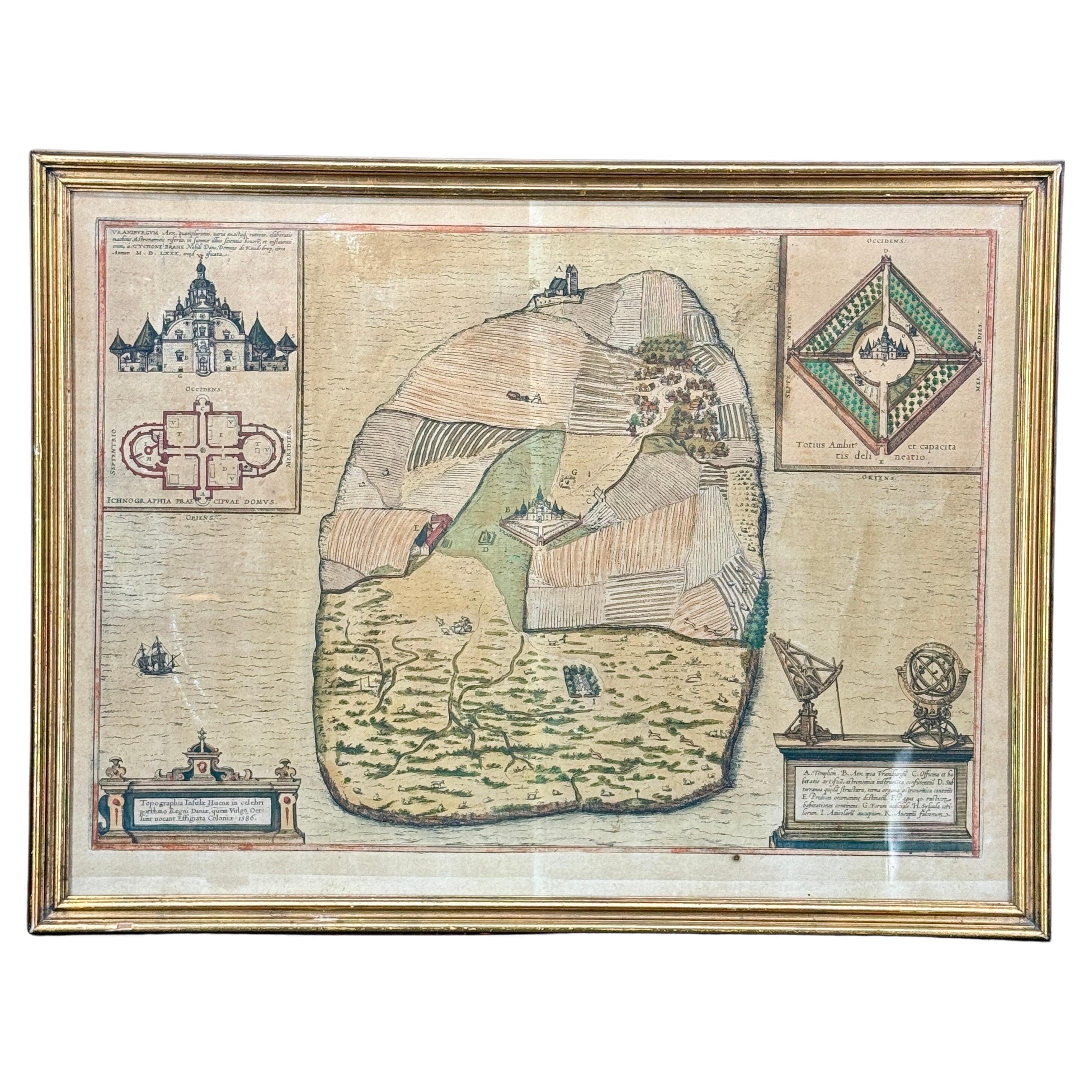
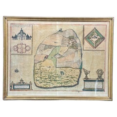
16th Century Antique Map of Ven Framed in Gold
Located in Haddonfield, NJ
Ven (older Swedish spelling Hven), is a Swedish island in the Öresund strait laying between Skåne, Sweden and Zealand and Denmark. The island was historically under Danish rule. Dani...
Category
Antique 16th Century Danish Baroque Maps
Materials
Wood, Paper
Italian Contemporary Handcolored Old Map Printed on Canvas "Planisphere Ethnics"
Located in Scandicci, Florence
Beautiful reproduction of an antique English map showing th Planisfere, with continets, views of important cities and their population, made in 1...
Category
21st Century and Contemporary Italian Prints
Materials
Cotton, Paper
More Ways To Browse
Italian Old World
Antique Medieval Furniture
Antique Wood Wall Panels
Early Texas Furniture
Renaissance Wood Panels
15th Century Panels
Mediterranean Revival
Medieval English Furniture
Tudor Revival Furniture
Medieval Panel
Spanish Jacobean
Early American Farmhouse Furniture
Antique Metal Wall Hanging
Wood Panel Wall Hanging
Old Antique Jacobean Furniture
Tall Wood Wall Panels
Asian Wood Wall Panels
Spanish Wood Wall Panels