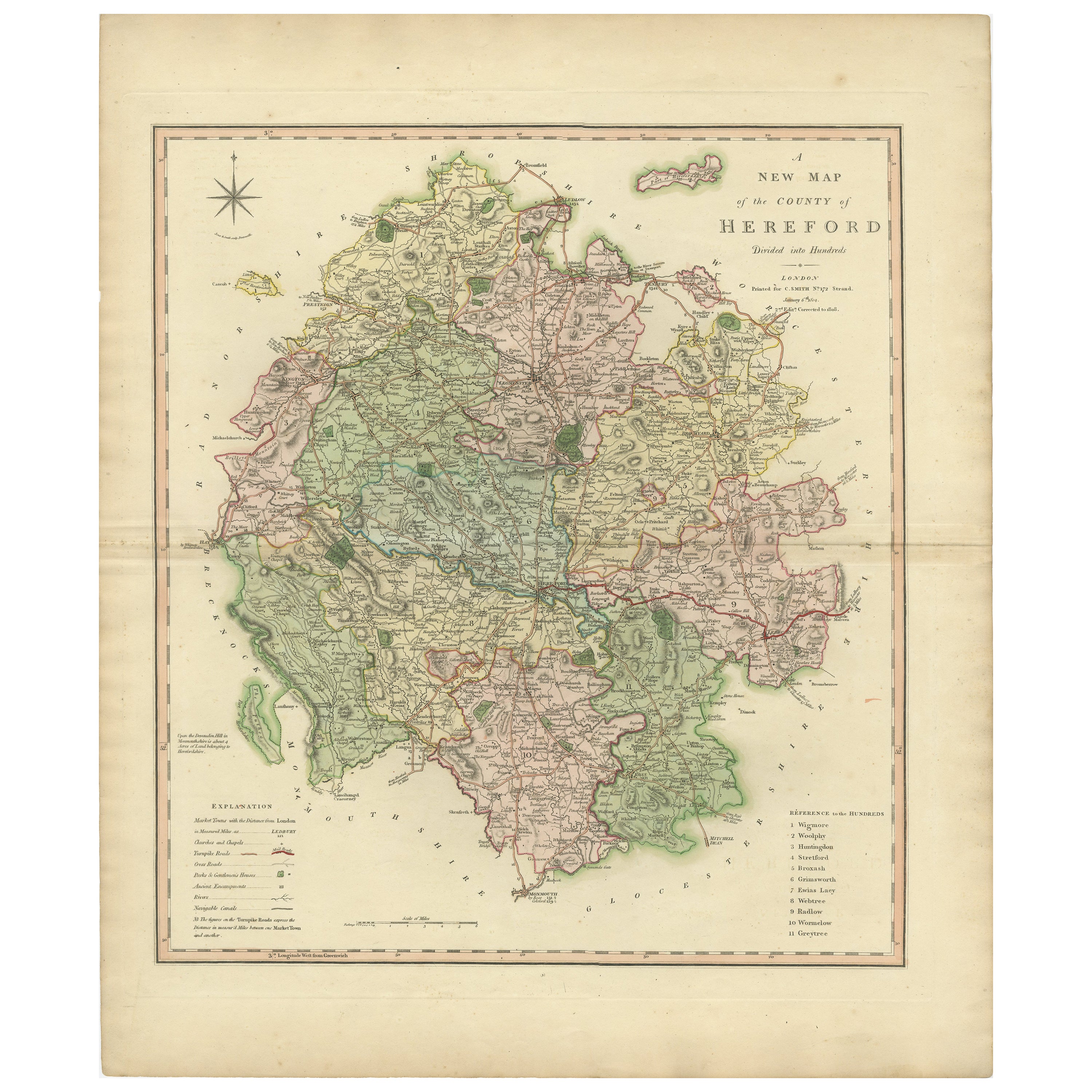
Items Similar to Old Map of Herefordshire 1844 – Hereford Leominster Ross-on-Wye Kington Bromyard
Want more images or videos?
Request additional images or videos from the seller
1 of 10
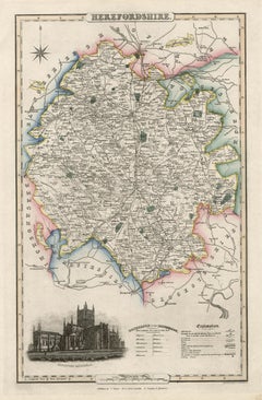
Old Map of Herefordshire 1844 – Hereford Leominster Ross-on-Wye Kington Bromyard
$179.25
$224.0720% Off
£134.18
£167.7220% Off
€152
€19020% Off
CA$246.71
CA$308.3820% Off
A$274.98
A$343.7220% Off
CHF 144.27
CHF 180.3420% Off
MX$3,357.94
MX$4,197.4320% Off
NOK 1,826.80
NOK 2,283.5020% Off
SEK 1,726.60
SEK 2,158.2520% Off
DKK 1,157.13
DKK 1,446.4120% Off
About the Item
Title:
Old Map of Herefordshire by Samuel Lewis 1844 – Hereford Leominster Ross-on-Wye Kington Bromyard
Description:
This 1844 map of Herefordshire was drawn and engraved for Samuel Lewis’ Topographical Dictionary of England. It features major towns including Hereford, Leominster, Ross-on-Wye, Kington, and Bromyard. The map shows roads, rivers, topographical features, and surrounding counties such as Shropshire, Gloucestershire, and Monmouthshire. Hand-colored borders outline the county and a decorative compass rose enhances its historical charm.
Condition:
The map is in good antique condition with light even toning and wide margins. The engraving is sharp and the hand coloring remains bright. There are no tears or significant blemishes.
Framing suggestions:
Use an ivory or soft beige acid-free mat to complement the aged paper. A dark wood, antique gold, or soft black frame will bring out the map's classic style. UV-protective glass is recommended to preserve color and detail. A fine choice for traditional interiors, libraries, or heritage-themed décor.
Keywords:
Herefordshire map 1844 Samuel Lewis antique map England Hereford Leominster Ross-on-Wye Kington Bromyard Victorian map historical cartography hand-colored county map
- Dimensions:Height: 10.71 in (27.2 cm)Width: 8.27 in (21 cm)Depth: 0.01 in (0.2 mm)
- Materials and Techniques:
- Period:
- Date of Manufacture:1844
- Condition:The map is in good antique condition with light even toning and wide margins. The engraving is sharp and the hand coloring remains bright. There are no tears or significant blemishes.
- Seller Location:Langweer, NL
- Reference Number:Seller: BG-027261stDibs: LU3054344602172
About the Seller
5.0
Recognized Seller
These prestigious sellers are industry leaders and represent the highest echelon for item quality and design.
Platinum Seller
Premium sellers with a 4.7+ rating and 24-hour response times
Established in 2009
1stDibs seller since 2017
2,517 sales on 1stDibs
Typical response time: <1 hour
- ShippingRetrieving quote...Shipping from: Langweer, Netherlands
- Return Policy
Authenticity Guarantee
In the unlikely event there’s an issue with an item’s authenticity, contact us within 1 year for a full refund. DetailsMoney-Back Guarantee
If your item is not as described, is damaged in transit, or does not arrive, contact us within 7 days for a full refund. Details24-Hour Cancellation
You have a 24-hour grace period in which to reconsider your purchase, with no questions asked.Vetted Professional Sellers
Our world-class sellers must adhere to strict standards for service and quality, maintaining the integrity of our listings.Price-Match Guarantee
If you find that a seller listed the same item for a lower price elsewhere, we’ll match it.Trusted Global Delivery
Our best-in-class carrier network provides specialized shipping options worldwide, including custom delivery.More From This Seller
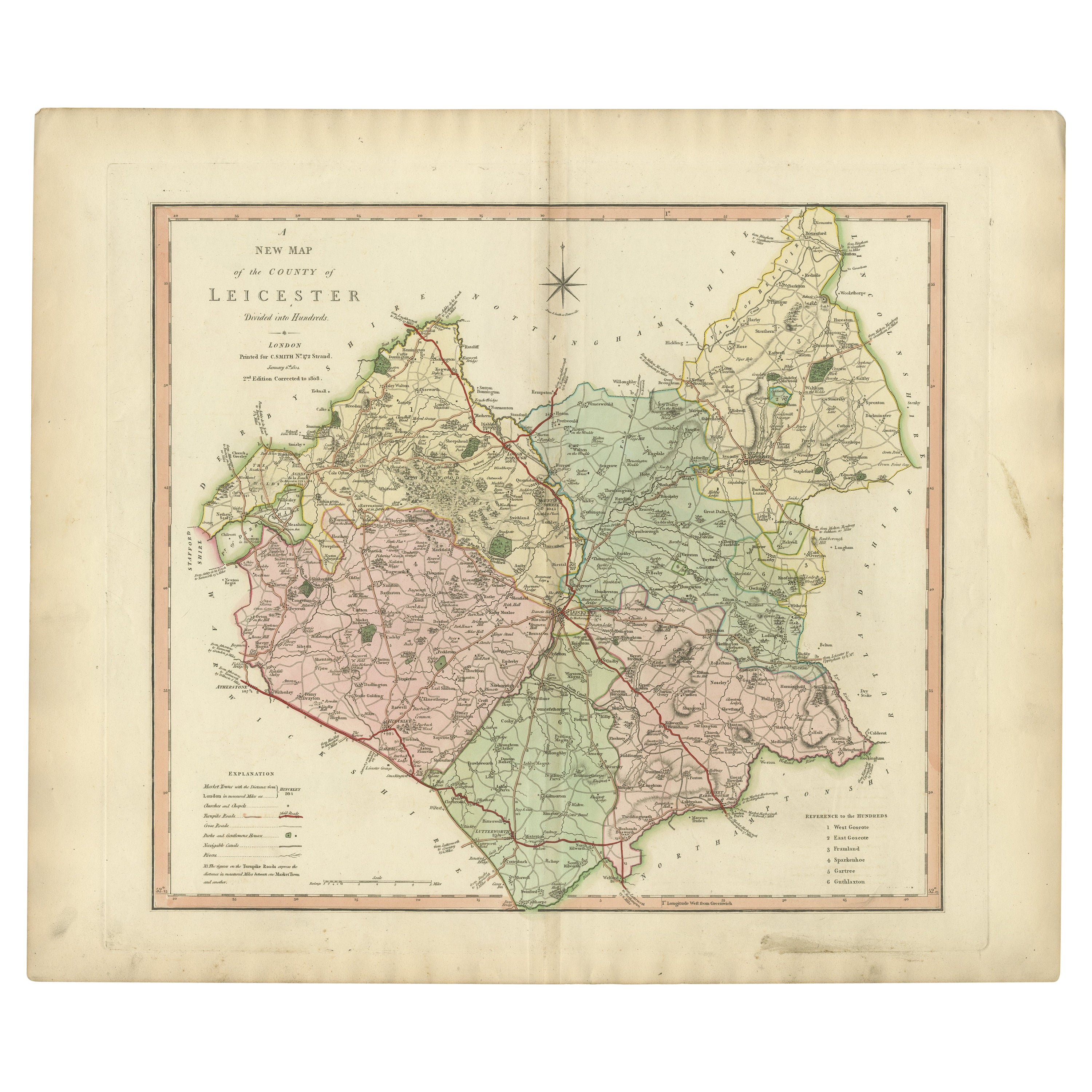
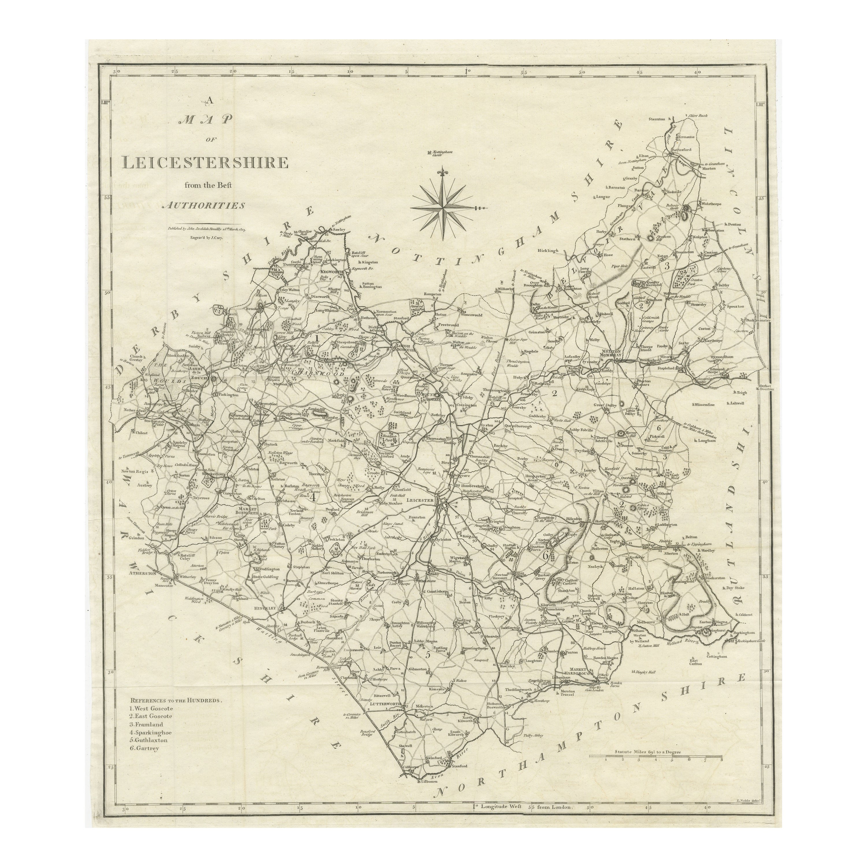
View AllAntique County Map of Leicestershire, England, 1804
Located in Langweer, NL
Antique county map of Leicestershire first published c.1800. Villages, towns, and cities illustrated include Lutterworth, Ashby, Hinkley, and Marke...
Category
Antique Early 1800s Maps
Materials
Paper
$306 Sale Price
20% Off
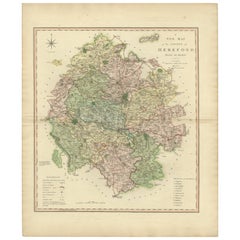
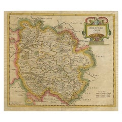
Original Hand-Colored Antique Map of the County of Hereford in England, 1804
Located in Langweer, NL
Antique county map of Herefordshire first published c.1800. Villages, towns, and cities illustrated Avenbury, Ashpurton, Kineton, and Bromyard.
...
Category
Antique Early 19th Century Maps
Materials
Paper
$306 Sale Price
20% Off
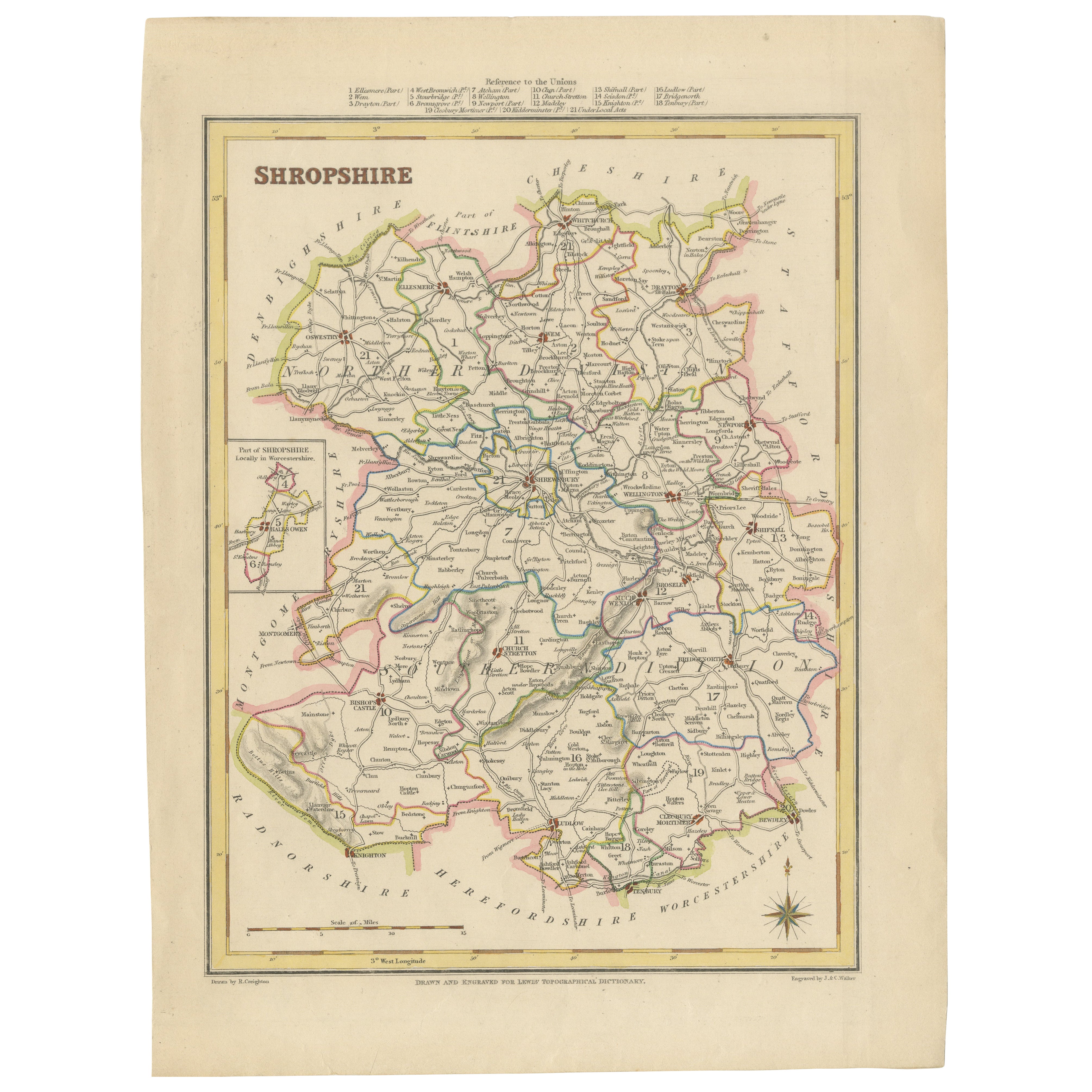
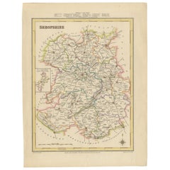
Map of Shropshire, 1844: Telford, Shrewsbury, Oswestry, Bridgnorth & Wellington
Located in Langweer, NL
Old Map of Shropshire by Samuel Lewis, 1844: Telford, Shrewsbury, Oswestry, Bridgnorth, and Wellington
This 1844 map of Shropshire is an antique engraving from Samuel Lewis' Topogr...
Category
Antique 1840s Maps
Materials
Paper
$179 Sale Price
20% Off
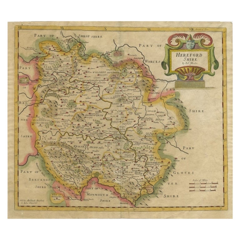
Antique Map of Herefordshire by Morden, c.1700
Located in Langweer, NL
Antique map titled 'Herefordshire'. Detailed map of the county of Herefordshire embellished with a decorative title cartouche. Three scales. Imprint of Abel Swale, Awnsham Churchill ...
Category
Antique 18th Century Maps
Materials
Paper
$377 Sale Price
20% Off
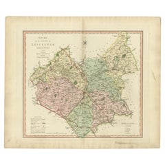
Large Antique County Map of Leicestershire, England, 1805
Located in Langweer, NL
Explore Leicestershire's Past: Antique Map by John Cary
Step into the history of Leicestershire, England, with this original old county map engraved by the renowned cartographer Joh...
Category
Antique Early 19th Century Maps
Materials
Paper

$216 Sale Price
20% Off
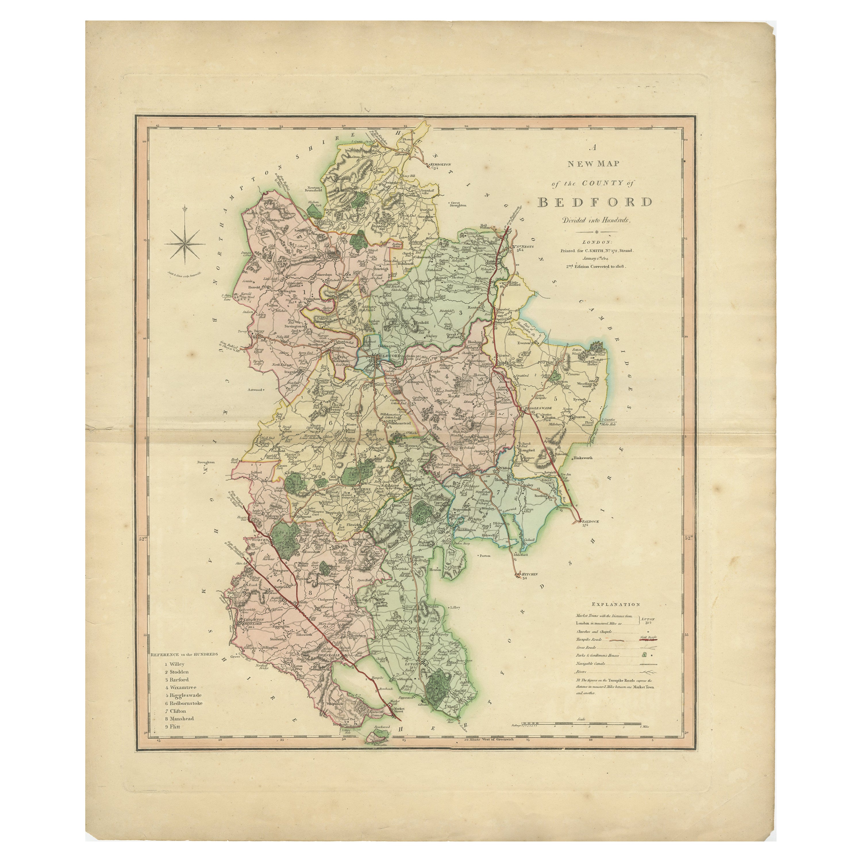
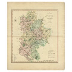
Antique Colourful and Decorative County Map of Bedfordshire, England, 1804
Located in Langweer, NL
Antique county map of Bedfordshire first published c.1800. Villages, towns, and cities illustrated include Bedford, Todington, and Potton.
Charl...
Category
Antique Early 1800s Maps
Materials
Paper
$306 Sale Price
20% Off
You May Also Like
Herefordshire, English County Antique map, 1847
By Isaac Slater
Located in Melbourne, Victoria
Steel-engraved map with original outline colouring by Isaac Slater. A detailed engraved map of the English county with title, scale, and key. Decorated with an uncoloured engraved vi...
Category
19th Century Naturalistic Landscape Prints
Materials
Engraving
Original Antique English County Map, Leicestershire, J & C Walker, 1851
Located in St Annes, Lancashire
Great map of Leicestershire
Original colour
By J & C Walker
Published by Longman, Rees, Orme, Brown & Co. 1851
Unframed.
Category
Antique 1850s English Other Maps
Materials
Paper

Original Antique English County Map, Herefordshire, J & C Walker, 1851
Located in St Annes, Lancashire
Great map of Herefordshire
Original colour
By J & C Walker
Published by Longman, Rees, Orme, Brown & Co. 1851
Unframed.
Category
Antique 1850s English Other Maps
Materials
Paper

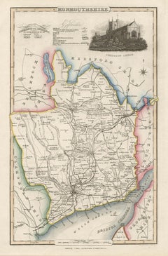
Monmouthshire, English County Antique map, 1847
By Isaac Slater
Located in Melbourne, Victoria
Steel-engraved map with original outline colouring by Isaac Slater. A detailed engraved map of the English county with title, scale, and key. Decorated with an uncoloured engraved vi...
Category
19th Century Naturalistic Landscape Prints
Materials
Engraving
Original Antique English County Map, Warwickshire, J & C Walker, 1851
Located in St Annes, Lancashire
Great map of Warwickshire
Original colour
By J & C Walker
Published by Longman, Rees, Orme, Brown & Co. 1851
Unframed.
Category
Antique 1850s English Other Maps
Materials
Paper

Original Antique English County Map, Nottinghamshire, J & C Walker, 1851
Located in St Annes, Lancashire
Great map of Nottinghamshire
Original colour
By J & C Walker
Published by Longman, Rees, Orme, Brown & Co. 1851
Unframed.
Category
Antique 1850s English Other Maps
Materials
Paper

More Ways To Browse
Antique Ivory Collectables
Antique Gold Compass
Compass Rose Gold
Antique Furniture Hereford
Used Furniture Leominster
Silver Bowl Large
Down Couch
Used Lighter Art
Blue Edge Glass
Mahogany 1950s Furniture
Solid Mahogany Table
Dessert Glasses
Geometric Glass Table
Mid Century Pin
6x10 Rug
Studded Furniture
Styles Of Antique Desks
Black And White Coffee Table