Italian Maps
to
4
11
3
16
1
10
3
3
1
1
1
1
12
3
3
1
1
214,991
716
331
217
146
16
16
16
2
1
1
1
1
Place of Origin: Italian
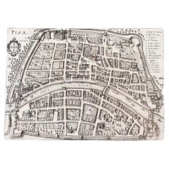
Italian Parchment Map of the City of Pisa Dated, 1640
By Matthäus Merian the Elder
Located in Florence, Tuscany
An antique map of the Tuscan city of Pisa engraved for The 'Itinerarium Italiæ Nov-antiquæ' by Matthäus Merian the Elder and printed in 1640....
Category
1640s Antique Italian Maps
Materials
Paper
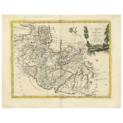
Antique Map of Persia by A. Zatta, circa 1785
Located in Langweer, NL
Antique map titled 'L'Impero della Persia diviso ne suoi Stati'. The Empire of Persia divided into its states. Originates from 'Atlante Novissimo, illustrato ed accresciuto sulle oss...
Category
Late 18th Century Antique Italian Maps
Materials
Paper
World Globe With Wooden Foot, and Brass 20th Century
Located in Mombuey, Zamora
Beautiful and elegant ball of the world to decorate any studio, living room or bedroom, it is small, with the base about 26 cm high and 10 wide.
Category
20th Century Other Italian Maps
Materials
Brass
$670 Sale Price
20% Off
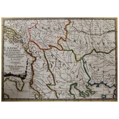
18th Century Map of the Southern Balkans by Giovanni Maria Cassini
By Giovanni Maria Cassini
Located in Hamilton, Ontario
18th century map by Italian engraver Giovanni Maria Cassini (Italy 1745-1824).
Map of the Southern Balkans: Rome. Hand colored and copper engraved print done in the year 1788. It in...
Category
18th Century Antique Italian Maps
Materials
Paper
$795 Sale Price
36% Off
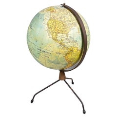
Italian modern Table globe map of the world in metal, 1960s
Located in MIlano, IT
Italian modern Table globe map of the world in metal, 1960s
Table map of the world with metal structure. The globe rotates thanks to the pins of the curved metal structure. The base ...
Category
1960s Modern Vintage Italian Maps
Materials
Metal
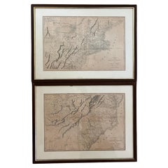
Pair Antique Italian Maps of the North American Eastern Seaboard
Located in New York, NY
Pair antique Italian maps of the North American Eastern Seaboard. Late 18th early 19th century original Italian documentation of the East Coast of the United States from Passamaquadd...
Category
Late 18th Century Antique Italian Maps
Materials
Wood, Paper
Decorative Original Antique Map of Normandy, France
Located in Langweer, NL
Original antique map titled 'Ducato D'Normandie Scala di Miglia d'Italia'. Very decorative map of Normandy, with a fine title cartouche featuring Leda ...
Category
Late 17th Century Antique Italian Maps
Materials
Paper
$901 Sale Price
20% Off
Antique Map of the Cape Verde Islands and Part of Senegal, West Africa, 1690
Located in Langweer, NL
Antique map titled 'Bocche del Fivme Negro et Isole di Capo Verde'. Beautiful double-page map of the Cape Verde Islands and part of the coast of Senegal, with large decorative cartou...
Category
17th Century Antique Italian Maps
Materials
Paper
Antique Map of Western Africa and the Cape Verde Islands by Coronelli, 1691
By Vincenzo Coronelli
Located in Langweer, NL
Antique map titled 'Bocche del Fiume Negro et Isole di Capo Verde'. Antique map of Western Africa with the Cape Verde Islands and an inset of Goree Island. Originates from 'Atlante V...
Category
Late 17th Century Antique Italian Maps
Materials
Paper
Antique Map of Eastern Hemisphere from the collection of Thierry Despont
Located in New York, NY
Designed by Enrico Bonetti (E. Bonatti) and published by Francesco Vallardi Editore. Based on an earlier map by Evangelista Azzi (Ev. Azzi). Labeled as such at bottom edge of map.
T...
Category
Late 19th Century Antique Italian Maps
Materials
Canvas, Wood
1562 Map of Toscana Nuova Tavola by Girolamo Ruscelli
Located in Chapel Hill, NC
A 1562 map of Toscana Nuova Tavola by Girolamo Ruscelli. Tuscany is the heart of Italy & birthplace of the Italian language. Early hand-coloring. Copper plate engraving. Interestingl...
Category
16th Century Renaissance Antique Italian Maps
Materials
Paper
Map of the Kingdom of Sardinia and Part of the Kingdom of Genoa, Rome
By Giovanni Maria Cassini
Located in Hamilton, Ontario
18th century map by Italian engraver Giovanni Maria Cassini (Italy 1745-1824). Map of Part of the Kingdom of Sardinia and Part of the Kingdom of Genoa: Rome. This is a hand colored a...
Category
18th Century Antique Italian Maps
Materials
Paper
$795 Sale Price
36% Off
Antique Map of Principality of Monaco
By Antonio Vallardi Editore
Located in Alessandria, Piemonte
ST/619 - "Old Geographical Atlas of Italy - Topographic map of ex-Principality of Monaco" -
ediz Vallardi - Milano -
A somewhat special edition ---
Category
Late 19th Century Other Antique Italian Maps
Materials
Paper
Luminous Earth Globe on a Chrome Base, Italy, 1980
Located in Paris, FR
Unusual luminous globe on a large chromed metal base, made in Italy by Ricoscope Editions in Firenze.
In perfect condition, except for two very small missing pieces at the junction ...
Category
1980s Space Age Vintage Italian Maps
Materials
Chrome
Old Horizontal Map of England
By Tasso
Located in Alessandria, Piemonte
ST/520 - Old rare Italian map of England, dated 1826-1827 - by Girolamo Tasso, editor in Venise, for the atlas of M.r Le-Sage.
Category
Early 19th Century Other Antique Italian Maps
Materials
Paper
Geographical Antique Map of Principality of Monaco
By Bruno Santini
Located in Alessandria, Piemonte
ST/609 - Interesting antique color map of Monaco Principality in French language : "Carte qui contient le Principauté de Piémont, le Monferrat et la comté de...
Category
Late 18th Century Other Antique Italian Maps
Materials
Paper
Related Items
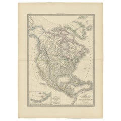
Antique Map of North America by Lapie '1842'
Located in Langweer, NL
Antique map titled 'Carte de l'Amérique septentrionale'. Map of North America, with an inset map of the Aleutian Islands. This map originates from 'Atlas universel de géographie anci...
Category
Mid-19th Century Antique Italian Maps
Materials
Paper
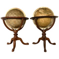
Pair of 19th Century English J & W Cary Celestial/Terrestrial Table Model Globes
By John & William Cary
Located in Milford, NH
A fine assembled pair of 12-inch English table model globes on stands manufactured by J & W. Cary, the left globe with cartouche labeled “The New Celestial Globe, on which are correc...
Category
Early 19th Century Antique Italian Maps
Materials
Brass
$18,900 / set
H 25 in Dm 16.5 in
Antique Map of North America by Dufour 'circa 1834'
Located in Langweer, NL
Antique map titled 'Amérique Septentrionale'. Uncommon map of North America. Published by or after A.H. Dufour, circa 1834. Source unknown, to be determined.
Category
Mid-19th Century Antique Italian Maps
Materials
Paper
$191 Sale Price
20% Off
H 8.08 in W 10.44 in D 0.02 in
Antique Map of North America by Johnson, '1872'
Located in Langweer, NL
Antique map titled 'Johnson's North America'. Original map of North America, with an inset map of the Hawaiian group or Sandwich Islands. This map originates from 'Johnson's New Illu...
Category
Late 19th Century Antique Italian Maps
Materials
Paper
$383 Sale Price
20% Off
H 26.58 in W 18.12 in D 0.02 in
Antique Map of the United States with inset map of the region of Mexico City
Located in Langweer, NL
Antique map titled 'Verein-Staaten von Nord-America, Mexico, Yucatan u.a.'. Very detailed map of the United States of America showing the Caribbean. With an inset map of the surround...
Category
Mid-19th Century Antique Italian Maps
Materials
Paper
$825 Sale Price
20% Off
H 14.69 in W 17.92 in D 0.02 in
Mid-Century World Map Globe Table Light or Lamp
Located in Miami, FL
Good quality world map globe lamp.
If you are looking for stylish and beautiful quality item to upgrade your interior (whether at home or in your office) then this Parisian globe...
Category
Mid-20th Century Mid-Century Modern Italian Maps
Materials
Chrome
Antique World Globe From Fleet Street London 1923 on Wooden Stand
Located in Reading, Berkshire
Antique Terrestrial Geographia of Fleet Street London 12"inch World Globe on handcrafted Wooden Three Legged Base 1923
Made 55 Fleet Street, London
Beautiful desktop globe, sho...
Category
1920s Art Deco Vintage Italian Maps
Materials
Wood, Paper
$1,326 Sale Price
25% Off
H 18.51 in Dm 11.82 in
Antique Map of The United States of North America, Pacific States, 1882
Located in Langweer, NL
The map is from the same 1882 Blackie Atlas and focuses on the Pacific States of the United States of America during that period. Here are some details and historical context about t...
Category
1880s Antique Italian Maps
Materials
Paper
$239 Sale Price
20% Off
H 14.97 in W 11.03 in D 0 in
Antique Map of North America by Johnston, 1882
By Alexander Keith Johnston
Located in Langweer, NL
Antique map titled 'North America'.
Old map of North America. This map originates from 'The Royal Atlas of Modern Geography, Exhibiting, in a Series of Entirely Original and Authen...
Category
19th Century Antique Italian Maps
Materials
Paper
Mid Century Modern 1970s Rotating Replogle World Globe with Brass Floor Stand
By Replogle Globes, Paul McCobb
Located in San Jose, CA
Vintage world map Replogle globe with stand in brass, circa 1970's. This piece rotates on a full swing meridian and displays plenty of vintage charm. The perfect accessory piece for ...
Category
1970s Mid-Century Modern Vintage Italian Maps
Materials
Brass
$1,475
H 35 in Dm 14.75 in
19th Century German Miniature Pocket Terrestrial Globe
By C. Abel-Klinger
Located in Essex, MA
A miniature 19th century 3.5 inch diameter pocket terrestrial globe by C. Abel-Klinger, Nuremberg, Germany, in English for the English speaking markets. Signed with cartouche reading...
Category
1880s Antique Italian Maps
Materials
Brass
Map Exploring The World, Midi Format
Located in New York, NY
A compelling exploration of the ways that humans have mapped the world throughout history - now in a compact new edition
Map: Exploring the World brings together more than 250...
Category
21st Century and Contemporary Italian Maps
Materials
Paper
Previously Available Items
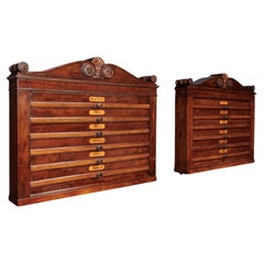
Pair of Containers for Geographical Atlas Henry Thomas Peters (1792-1852) att
By Henry Thomas Peters
Located in Milano, IT
Pair of poplar wall cabinets veneered in mahogany, each with six pull-out drawers with maps signed "J. Andriveau-Goujon, Paris, 1837." On the front of each of the pulls is an inlaid ...
Category
1840s Restauration Antique Italian Maps
Materials
Poplar
H 22.84 in W 27.37 in D 4.73 in
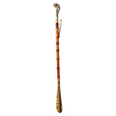
Italian Faux Bamboo Shoehorn and Backscratcher, Italy circa 1960, Brown Color
Located in Auribeau sur Siagne, FR
Large Faux Bamboo Shoe Horn & Back Scratcher, Marble-Effect Hand, Vintage Elegance
This vintage dual-purpose shoe horn and back scratcher is a refined a...
Category
1960s Modern Vintage Italian Maps
Materials
Faux Bamboo, Plastic
H 22.05 in W 0.79 in D 1.19 in
17th Century Hand Colored Prospect Map of Venice Engraving
Located in Houston, TX
A nice engraved, hand colored view of Venice, originally engraved in 1635. Highly detailed showing the important buildings, the course of the Grand Canal, the Rialto bridge, All in a...
Category
19th Century Other Antique Italian Maps
Materials
Wood, Paper
Set of 4 Antique Geographical Maps French-German War 1870-71
Located in Casale Monferrato, IT
Elegant late 19th century set of four antique geographical maps relating to the positioning of the armies in the Franco-German War 1870-71.
A...
Category
1890s Antique Italian Maps
Materials
Paper
1880s Map of The Italian Alps from Milan to Lake Garda
Located in Florence, Tuscany
Geographical Map of the Profile and Elevation of the Italian Alps from Milano to Lake Garda. The map features the name of each peak and key cities including Monza, Brescia and Bergam...
Category
1880s Antique Italian Maps
Materials
Parchment Paper
17th Century Miniature Map of Venice
Located in Florence, Tuscany
An extraordinary miniature map of the ancient city of Venice published in Padua by Matteo Cadorin in the 1670 edition of Francesco Scoto's 'Itinerary of Italy' guide.
This delightf...
Category
1670s Antique Italian Maps
Materials
Parchment Paper
17th Century Miniature Map of Milan
Located in Florence, Tuscany
An extraordinary miniature map of the ancient city of Milan published in Padua by Matteo Cadorin in the 1670 edition of Francesco Scoto's 'Itinerary of Italy' guide.
This delightfu...
Category
1670s Antique Italian Maps
Materials
Parchment Paper
17th Century Miniature Map of Florence
Located in Florence, Tuscany
An extraordinary miniature map of the ancient city of Florence. Published in Padua by Matteo Cadorin in the 1670 edition of Francesco Scoto's 'Itinerary of Italy' guide.
This delig...
Category
1670s Antique Italian Maps
Materials
Parchment Paper
Antique Italian Map of Viaggio da Roma a Napoli 1775
Located in Florence, Tuscany
An original print from 1775 showing an early route map of the journey from Rome to Naples. This route map was part of a collection of travellers routes published in a book translated...
Category
1770s Antique Italian Maps
Materials
Parchment Paper
17th Century Geographical Map of Italy
By Matthäus Merian the Elder
Located in Florence, Tuscany
This beautifully detailed geographical map of Italy was printed in 1640. It was made by the expert Swiss engraver Matthaus Merian the Elder (1593-1650). Its high quality uniform inki...
Category
Mid-17th Century Antique Italian Maps
Materials
Parchment Paper
Italian Parchment Map of the City of Lucca Dated 1640
By Matthäus Merian the Elder
Located in Florence, Tuscany
An antique map of the Tuscan city of Lucca engraved for The 'Itinerarium Italiæ Nov-antiquæ' by Matthäus Merian the Elder and printed in 1640...
Category
1640s Antique Italian Maps
Materials
Paper, Parchment Paper
Italian Faux Bamboo Shoehorn and Backscratcher, Italy circa 1960, Brown Color
Located in Auribeau sur Siagne, FR
Listed is a fabulous, 1960s Italian faux-bamboo shoehorn/backscratcher. The piece has a beautiful, 'burnt' bamboo look to the wood frame. Shoehorn and backscratcher are a heavy resin...
Category
1960s Modern Vintage Italian Maps
Materials
Faux Bamboo, Resin
H 22.45 in W 1.58 in D 1.19 in
Recently Viewed
View AllMore Ways To Browse
Antique Wellington Chests
Antonio Cassi Ramelli
Archimede Seguso Birds
Art Deco Coasters
Art Deco Footballer
Art Deco Music Cabinet
Art Deco Waterfall Bedroom Furniture
Art Deco Waterfall Bedroom
Art Deco Whisky
Art Foulard
Art Nouveau Sunflower
Arts And Crafts Silver Coffee Pot
Asian Pink Bowl
Avesn Vase
Baccarat Carafe
Bakelite Bird
Bakelite Cocktail Picks
Bamboo Ikebana Vase
