Mexican Maps
to
2
2
1
1
2
2
2
7,817
749
332
219
154
2
2
2
Place of Origin: Mexican
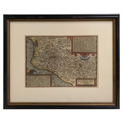
1608 Hispaniae Novae Sive Magnae Vera Descriptio Framed Mexico Map
Located in Stamford, CT
1608 Hispaniae Novae Sive Magnae Vera Descriptio Framed Mexico Map. As found custom black wooden frame/ matting.
This map is based on the work of Abraham Ortelius as is an example o...
Category
Early 1600s Spanish Colonial Antique Mexican Maps
Materials
Glass, Wood, Paper
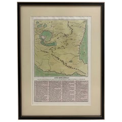
1826 Antigo Impero Messicano Mexico Hand Colored Framed Map
Located in Stamford, CT
1826 Antigo Impero Messicano Mexico Hand Colored Framed Map. As found black wood frame.
Category
1820s Spanish Colonial Antique Mexican Maps
Materials
Glass, Wood, Paper
Related Items
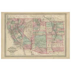
Antique Map of California, Utah, Nevada, Colorado, New Mexico & Arizona '1872'
Located in Langweer, NL
Antique map titled 'Johnson's California (..)'. Original map of California, Utah, Nevada, Colorado, New Mexico and Arizona. This map originates from ...
Category
Late 19th Century Antique Mexican Maps
Materials
Paper
$236 Sale Price
20% Off
H 18.12 in W 26.38 in D 0.02 in
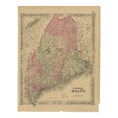
Maine County Map – Johnson, Hand-Colored, USA c.1864
Located in Langweer, NL
Johnson’s Maine Map, USA Published c.1864 – Hand-Colored County Map
This is a finely engraved and hand-colored map titled Johnson’s Maine, published by Johnson and Ward in New York ...
Category
Mid-19th Century Antique Mexican Maps
Materials
Paper
Texas California Mexico Map – Antique Tallis Map with Gold Region, c.1850
Located in Langweer, NL
Texas California Mexico Map – Antique Tallis Map with Gold Region, c.1850
This highly decorative and historically rich map titled 'Mexico, California and Texas' was published around...
Category
Mid-19th Century Antique Mexican Maps
Materials
Paper
$791
H 10.44 in W 13.78 in D 0.02 in
Virgin of Guadalupe Hand Colored Spanish Colonial Drawing - Signed Mexico
Located in Oklahoma City, OK
This is an exquisite vintage depiction of Our Lady of Guadalupe, rendered in delicate hand-painted detail. The piece features soft, vibrant hues that highlight the iconic radiance of...
Category
20th Century Spanish Colonial Mexican Maps
Materials
Paper
$220
H 7 in W 5 in D 0.01 in
Antique North America Map, USA, Canada, Mexico, Cartography, Colton, Victorian
Located in Hele, Devon, GB
This is an antique North America map. A USA, framed lithography atlas engraving of the continent by JH Colton, dating to the Victorian period and later, circa 1860.
Fascinating, large framed map...
Category
Mid-19th Century Victorian Antique Mexican Maps
Materials
Paper
$1,162
H 22.45 in W 18.71 in D 0.99 in
United States, Canada & Mexico – 1857 North America Map
Located in Langweer, NL
North America Map – United States, Canada, Mexico 1857
This impressive antique print shows “Nord-America” meaning “North America,” published in 1857 by Justus Perthes in Gotha as pa...
Category
Mid-19th Century Antique Mexican Maps
Materials
Paper
16th-Century Map of the Ottoman Empire and Near East: Turcici Imperii Descriptio
Located in Langweer, NL
Title: Original 16th-Century Map of the Ottoman Empire and Near East: *Turcici Imperii Descriptio* by Ortelius, 1571
This rare copperplate engraving, Turcici Imperii Descriptio, i...
Category
16th Century Antique Mexican Maps
Materials
Paper
$1,511 Sale Price
20% Off
H 14.97 in W 19.69 in D 0.01 in
1930s AM Radio Map of US, Canada, Cuba, Mexico – Stations & Frequencies
Located in Langweer, NL
Title: 1930s Lewis Bros. Limited Detailed Radio Station Map of the United States and Canada – AM Stations, Call Signs, Frequencies, Vintage Advertising
Detailed Description: This v...
Category
1930s Vintage Mexican Maps
Materials
Paper
$935 Sale Price
20% Off
H 27.41 in W 33.51 in D 0 in
Antique Map of Mexico and Central America by Johnson '1872'
Located in Langweer, NL
Antique map titled 'Johnson's Mexico (..)'. Two maps one one sheet showing Mexico and Central America, with inset maps of Tehuantepec and Panama. This map originates from 'Johnson's ...
Category
Late 19th Century Antique Mexican Maps
Materials
Paper
$283 Sale Price
20% Off
H 26.38 in W 18.12 in D 0.02 in
Original Antique Hand-colored World Map with or without Frame, '1696'
Located in Langweer, NL
Antique world map titled 'Mappe-Monde dressee sur les Observations de Mrs. de l'Academie Royale des Sciences (..)'. Beautiful original antique world map...
Category
Late 17th Century Antique Mexican Maps
Materials
Paper
$4,252 Sale Price
20% Off
H 28.75 in W 33.67 in D 1.58 in
1847 Ornamental Map of the United States & Mexico by H. Phelps
Located in Colorado Springs, CO
Offered is an original 1847 ornamental map of the U.S. entitled "Ornamental Map of the United States & Mexico" by Humphrey Phelps. The map was issued as an act of Congress by Phelps on Fulton Street, New York. The broadside is elaborately hand-colored.
This is a very detailed and graphic propaganda map of the United States expressing U.S. dominance of the North American continent. The hand-colored map proclaims the Manifest Destiny, with the recent acquisition of Upper California and Texas at the conclusion of the Mexican-American War. The newly acquired land is boldly colored, standing in stark contrast to the rest of the U.S. The map details a potential route for a railroad running from New York City, to Buffalo, to Chicago, then west along the Oregon Trail to Oregon City. This route anticipates the construction of the transcontinental railroad by nearly 20 years.
The map includes elaborately detailed renderings of George Washington, Hernan Cortez, and Montezuma at top to represent European expansion to the Americas. At bottom are four inset designs with text showing the following: a chronological history of the U.S. beginning from settlement to the U.S. victory in the Mexican-American war; an illustration of General Zachary Taylor with details on the Oregon Territory; an illustration of the Aztec Temple of the Sun in Tenochtitlan and a chronology of the Conquest of the Aztec Empire under Cortez; a portrait of General Antonio Lopez de Santa Anna...
Category
1840s Antique Mexican Maps
Materials
Paper
Antique Map of the United States with inset map of the region of Mexico City
Located in Langweer, NL
Antique map titled 'Verein-Staaten von Nord-America, Mexico, Yucatan u.a.'. Very detailed map of the United States of America showing the Caribbean. With an inset map of the surround...
Category
Mid-19th Century Antique Mexican Maps
Materials
Paper
$812 Sale Price
20% Off
H 14.69 in W 17.92 in D 0.02 in
Recently Viewed
View AllMore Ways To Browse
Antique Wellington Chests
Antonio Cassi Ramelli
Archimede Seguso Birds
Art Deco Coasters
Art Deco Footballer
Art Deco Music Cabinet
Art Deco Waterfall Bedroom Furniture
Art Deco Waterfall Bedroom
Art Deco Whisky
Art Foulard
Art Nouveau Sunflower
Arts And Crafts Silver Coffee Pot
Asian Pink Bowl
Avesn Vase
Baccarat Carafe
Bakelite Bird
Bakelite Cocktail Picks
Bamboo Ikebana Vase


