South American Maps
to
1
2
2
1
1
2
12,615
695
325
210
146
2
2
2
Place of Origin: South American
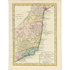
Antique Map of the Brazilian Coast by A. Van Krevelt
Located in Langweer, NL
Uncommon edition of this accurate map of part of Brazil, from San Salvador till Rio de Janeiro and S.Paulo. In lower right engraved "29b." Originates from 'Atlas Portatif pour servir...
Category
Late 18th Century Antique South American Maps
Materials
Paper
$231 Sale Price
22% Off
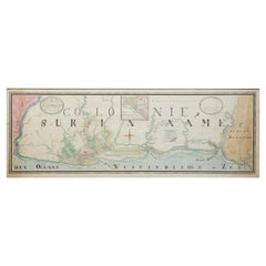
Extremely Large Hand-Drawn Manuscript Map of Surinam, 1830, History of Slavery
Located in Amsterdam, NL
A unique large hand-drawn map of Surinam by Albrecht Helmut Hiemcke (German, 1760-1839)
?
'Colonie Surinaame', 1830
A large hand-drawn and coloured map of the colony of Suri...
Category
Mid-19th Century Antique South American Maps
Materials
Paper
Related Items
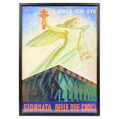
Italy 1939s Sketch Futurist Poster "Day of Two Crosses" Against Tuberculosis
By Fortunato Depero
Located in Milan, IT
Sketch of the futurist poster "Day of two crosses, 16th April 1939, XVII", mixed technique of pastel and water-color, for an Italian campaign against tuberculosis, to inform people a...
Category
1930s Futurist Vintage South American Maps
Materials
Paper
$1,436
H 20.48 in W 14.57 in D 0.12 in
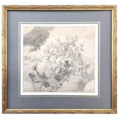
Original Drawing, Circle of Giovanni Battista Tiepolo 1696-1770 Venice, Italy
By Giovanni Battista Tiepolo
Located in Vero Beach, FL
Original Drawing, Circle of Giovanni Battista Tiepolo 1696-1770 Venice, Italy
Although we offer this old master drawing as circle of Tiepolo, we are convinced, based on the composi...
Category
18th Century Rococo Antique South American Maps
Materials
Paper
$8,200
H 19.25 in W 20.25 in D 0.5 in
Large 17th Century Hand Colored Map of England and the British Isles by de Wit
By Frederick de Wit
Located in Alamo, CA
A large hand colored 17th century map of England and the British Isles by Frederick de Wit entitled "Accuratissima Angliæ Regni et Walliæ Principatus", published in Amsterdam in 1680. It is a highly detailed map of England, Scotland, the Scottish Isles...
Category
Late 17th Century Antique South American Maps
Materials
Paper
$1,175
H 35 in W 30.5 in D 2 in
The Devonshire Collection of Italian Drawings Roman & Neapolitan Schools 1st Ed
Located in valatie, NY
The Devonshire Collection of Italian Drawings: Roman and Neapolitan Schools by Michael Jaffe. Published by Phaidon Press, London, 1994. 1st Ed hardcover with dust jacket. The Collection of Old Master drawings at Chatsworth House, Derbyshire, home of the Dukes of Devonshire, ranks with the Royal Collection at Windsor Castle as the finest privately owned group of such drawings in Britain and as one of the great princely collections of Europe. It contains outstanding drawings by the great masters from every artistic school. The book is devoted to the Italian drawings have detailed entries for nearly 1,000 works from the fifteenth to the eighteenth centuries, among them numerous reattributions and discoveries. This volume includes the works of Pietro da Cortona, Giulio Romano...
Category
1990s South American Maps
Materials
Paper
$165
H 11.75 in W 10 in D 1.25 in
Italian Master Drawings: Wolfgang Ratjen Collection Property of Herbert Kasper
Located in valatie, NY
Italian Master Drawings: From the Wolfgang Ratjen Collection 1525--1835, Personal Property of Herbert Kasper. Published by Paul Holberton Publis...
Category
21st Century and Contemporary South American Maps
Materials
Paper
$275
H 12.75 in W 9.75 in D 1 in
Original Antique Map of Ancient Greece, Achaia, Corinth, 1786
Located in St Annes, Lancashire
Great map of Ancient Greece. Showing the region of Thessaly, including Mount Olympus
Drawn by J.D. Barbie Du Bocage
Copper plate engraving by P.F Tardieu
Original hand color...
Category
1780s Other Antique South American Maps
Materials
Paper
Original Antique Map of Spain and Portugal, circa 1790
Located in St Annes, Lancashire
Super map of Spain and Portugal
Copper plate engraving by A. Bell
Published, circa 1790.
Unframed.
Category
1790s Other Antique South American Maps
Materials
Paper
New Map of North America from the Latest Discoveries, 1763
Located in Philadelphia, PA
A fine antique 18th century map of the North American seaboard.
Entitled "A New Map of North America from the Latest Discoveries 1763".
By the Cartographer/Engraver - John Spil...
Category
Mid-18th Century Georgian Antique South American Maps
Materials
Paper
Michelangelo. The Drawings of a Genius, 1st Ed Exhibition Catalog
Located in valatie, NY
Michelangelo. The Drawings of a Genius. By Achim Gnann. Preface by Klaus Albrecht Schröder. Published by the Albertina, Vienna. This catalogue is published in conjunction with the exhibition "Michelangelo: The Drawings of a Genius", Albertina, Vienna; October 8, 2010 - January 9, 2011. 478th. Published by Hatje Cantz, Ostfildern, 2010. 1st Ed softcover exhibition catalog. Michelangelo's drawings endowed human physique with an expressive musculature that remains to be rivaled in its feeling for corporeal articulation. His drawings of male nudes in particular, fraught as they are with tempestuous longing, project both tension and pliancy, and a compelling sense of health in the exertions and torque of bodies. He was also readily able to bring contrary qualities of grace and swiftness to depictions of women and cherubim. With over 300 color plates and extensive contextualizing scholarship, Michelangelo: The Drawings of a Genius is the most complete treatment of his work ever published, and thus constitutes a publication of great importance. Masterpieces from the world's finest museums are gathered, from the early studies for the "Battle of Cascina" and the studies for the Sistine Chapel frescoes, to the drawings for the tomb of Julius II, the Medici tombs...
Category
21st Century and Contemporary South American Maps
Materials
Paper
Italian Drawings Before 1600 in the Art Institute of Chicago A Catalogue 1st Ed
Located in valatie, NY
Italian drawings before 1600 in the Art Institute of Chicago: A Catalogue of the Collection, The Art Institute of Chicago, by Suzanne Folds McCullagh and Laura Giles. Published in Princeton, NJ, Princeton Univ. Press, 1997. 1st Ed hardcover with dust jacket The third in a series of scholarly catalogs on the permanent collection of The Art Institute of Chicago, this book focuses on the museum's important holdings of Italian drawings of the fifteenth and sixteenth centuries. The catalog contains comprehensive entries on over 700 drawings, including preliminary studies for major compositions, cartoons, modelli, independent drawings, and copies after Renaissance and Mannerist masters. Featured are major works by some of the most significant artists of the time: Baccio Bandinelli, Federico Barocci, Fra...
Category
1990s South American Maps
Materials
Paper
$150
H 11.75 in W 10 in D 1.75 in
Collection of 4 Antique Anatomical Drawings
Located in Miami, FL
Antique anatomical drawings for the study of the human body, nude males.
The history of anatomy extends from the earliest examinations of...
Category
Late 19th Century Antique South American Maps
Materials
Paper
$1,200 Sale Price / set
32% Off
H 23.63 in W 18 in D 0.07 in
Portrait Gallery of Grand Bostonians from Joe Tecce's
By Daniel Varoujan Hejinian
Located in Hanover, MA
Framed series of American modern pen and ink drawings, sixteen portraits of Boston "pols" and Italian American civic leaders, all of whom were the famous 'Friends of Joe Tecce's' of the eponymously named restaurant in Boston's North End.
The frame is sixteen feet long by one foot tall...
Category
1970s Mid-Century Modern Vintage South American Maps
Materials
Plexiglass, Wood, Paper
Previously Available Items
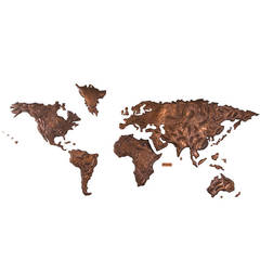
Copper World Map from Sabena Airlines, JFK Airport, New York, 1972
Located in Wilton, CT
Commissioned by Sabena Airlines Belgium. This unique copper repousse world map was the backdrop for Sabena's check in counter at JFK Airport, New York, in ...
Category
1970s Mid-Century Modern Vintage South American Maps
Materials
Copper
