Items Similar to Original 1806 Engraved Map of Asia and Surrounding Regions by John Cary


Want more images or videos?
Request additional images or videos from the seller
1 of 9
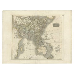
Original 1806 Engraved Map of Asia and Surrounding Regions by John Cary
$757.23
$946.5320% Off
£563.71
£704.6320% Off
€632
€79020% Off
CA$1,037.21
CA$1,296.5120% Off
A$1,153.61
A$1,442.0120% Off
CHF 602.38
CHF 752.9720% Off
MX$14,038.15
MX$17,547.6920% Off
NOK 7,693.27
NOK 9,616.5920% Off
SEK 7,214.93
SEK 9,018.6720% Off
DKK 4,811.20
DKK 6,013.9920% Off
Shipping
Retrieving quote...The 1stDibs Promise:
Authenticity Guarantee,
Money-Back Guarantee,
24-Hour Cancellation
About the Item
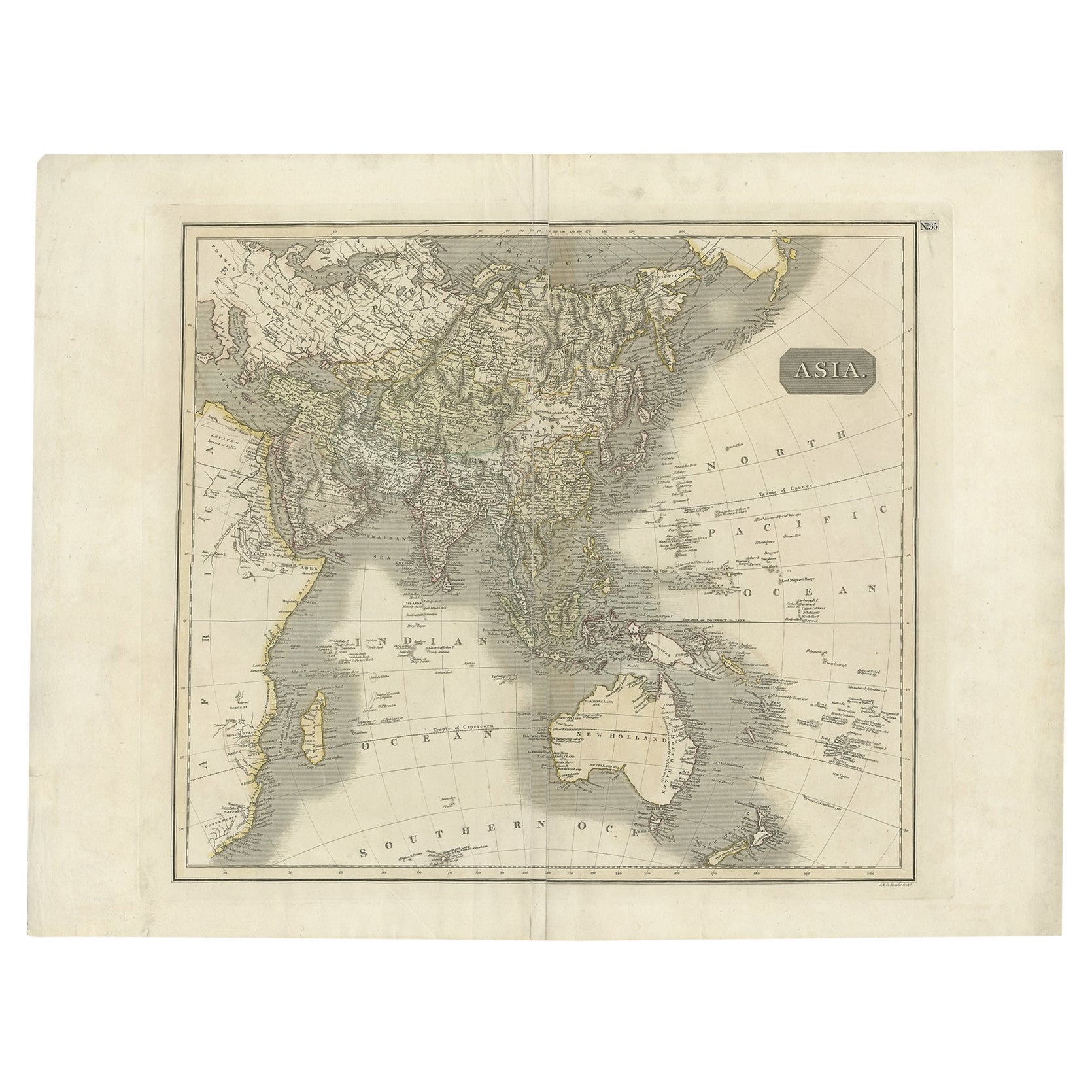
The map titled "A New Map of Asia, From the Latest Authorities" was published in 1806. It is a detailed and comprehensive depiction of the continent of Asia, extending from Europe and the Arabian Peninsula in the west to Japan and the Pacific Islands in the east, and from the Arctic regions in the north to parts of New Holland (Australia) and the Indian Ocean in the south.
The map is finely engraved, with political boundaries delineated using color to distinguish different empires, kingdoms, and colonial possessions of the time. Key geographical features such as mountain ranges, rivers, and major cities are clearly marked. It also includes significant maritime routes and islands across the Indian and Pacific Oceans, reflecting the global trade and exploration activities of the early 19th century.
Notable Features:
- Asia is represented with its vast and diverse regions, including the extensive Russian Empire in the north, the Ottoman Empire in the west, the Qing Dynasty's control over China, and the Mughal Empire's influence in India, which is under increasing British control.
- India is shown with its numerous princely states, many of which are under British influence or control.
- Southeast Asia includes the colonial possessions of European powers, particularly the Dutch East Indies, Spanish Philippines, and British-controlled regions in Malaya.
- China is depicted with its traditional boundaries, along with neighboring Korea and Japan.
- Australia is referred to as "New Holland," a name used by early European explorers, reflecting its status before widespread British colonization.
- The Pacific Ocean features numerous islands, some of which were important stops for naval and merchant vessels.
The Mapmaker:
This map was created by John Cary, a renowned English cartographer and engraver active in the late 18th and early 19th centuries. Cary was known for his meticulous and accurate maps, which were highly regarded for their clarity and precision. He contributed significantly to the mapping of the world during a period of intense exploration and colonial expansion.
Cary's maps often included the latest geographical information available from explorers, and they were used for both practical navigation and educational purposes. His work represents a high point in the art of mapmaking before the advent of modern cartography techniques.
This particular map is a reflection of the geopolitical realities of the early 19th century, highlighting the territorial extent of empires and the ongoing colonial activities in Asia and the Pacific region.
- Dimensions:Height: 19.41 in (49.3 cm)Width: 21.46 in (54.5 cm)Depth: 0.01 in (0.2 mm)
- Materials and Techniques:Paper,Engraved
- Period:
- Date of Manufacture:1806
- Condition:Condition: good, given age. Fold as published. General age-related toning and/or occasional minor defects from handling. Please study scans carefully.
- Seller Location:Langweer, NL
- Reference Number:Seller: BG-13746-51stDibs: LU3054341031972
About the Seller
5.0
Recognized Seller
These prestigious sellers are industry leaders and represent the highest echelon for item quality and design.
Platinum Seller
Premium sellers with a 4.7+ rating and 24-hour response times
Established in 2009
1stDibs seller since 2017
2,508 sales on 1stDibs
Typical response time: <1 hour
- ShippingRetrieving quote...Shipping from: Langweer, Netherlands
- Return Policy
Authenticity Guarantee
In the unlikely event there’s an issue with an item’s authenticity, contact us within 1 year for a full refund. DetailsMoney-Back Guarantee
If your item is not as described, is damaged in transit, or does not arrive, contact us within 7 days for a full refund. Details24-Hour Cancellation
You have a 24-hour grace period in which to reconsider your purchase, with no questions asked.Vetted Professional Sellers
Our world-class sellers must adhere to strict standards for service and quality, maintaining the integrity of our listings.Price-Match Guarantee
If you find that a seller listed the same item for a lower price elsewhere, we’ll match it.Trusted Global Delivery
Our best-in-class carrier network provides specialized shipping options worldwide, including custom delivery.More From This Seller
View AllAntique Map of Asia by Guthrie, 1787
Located in Langweer, NL
Antique map titled 'Asia from the best Authorities'. Old map of the Asian continent. This map originates from 'A New Geographical, Historical and Commercial Grammar; and Present State of the several Kingdoms of the World' 10th ed. by W. Guthrie.
Artists and Engravers: Published by Ch.Dilly; GGJ...
Category
Antique 18th Century Maps
Materials
Paper

$138 Sale Price
20% Off
Antique Map of Asia by A. Blondeau, circa 1800
Located in Langweer, NL
This is a fine circa 1800 map of Asia by Alexandre Blondeau. It covers the entire continent from Africa and the Mediterranean east to the Bering Sea and south as far as Java and New ...
Category
Antique Early 19th Century Maps
Materials
Paper

$268 Sale Price
20% Off
Antique Map of Asia Depicting Asia and Australia, c.1814
Located in Langweer, NL
Antique map titled 'Asia'. This map depicts Asia and Australia. Engraved by J. and G. Menzies and issued for Thomson's 'New General Atlas'.
Artists and Engravers: John Thomson (1...
Category
Antique 19th Century Maps
Materials
Paper
$335 Sale Price
20% Off
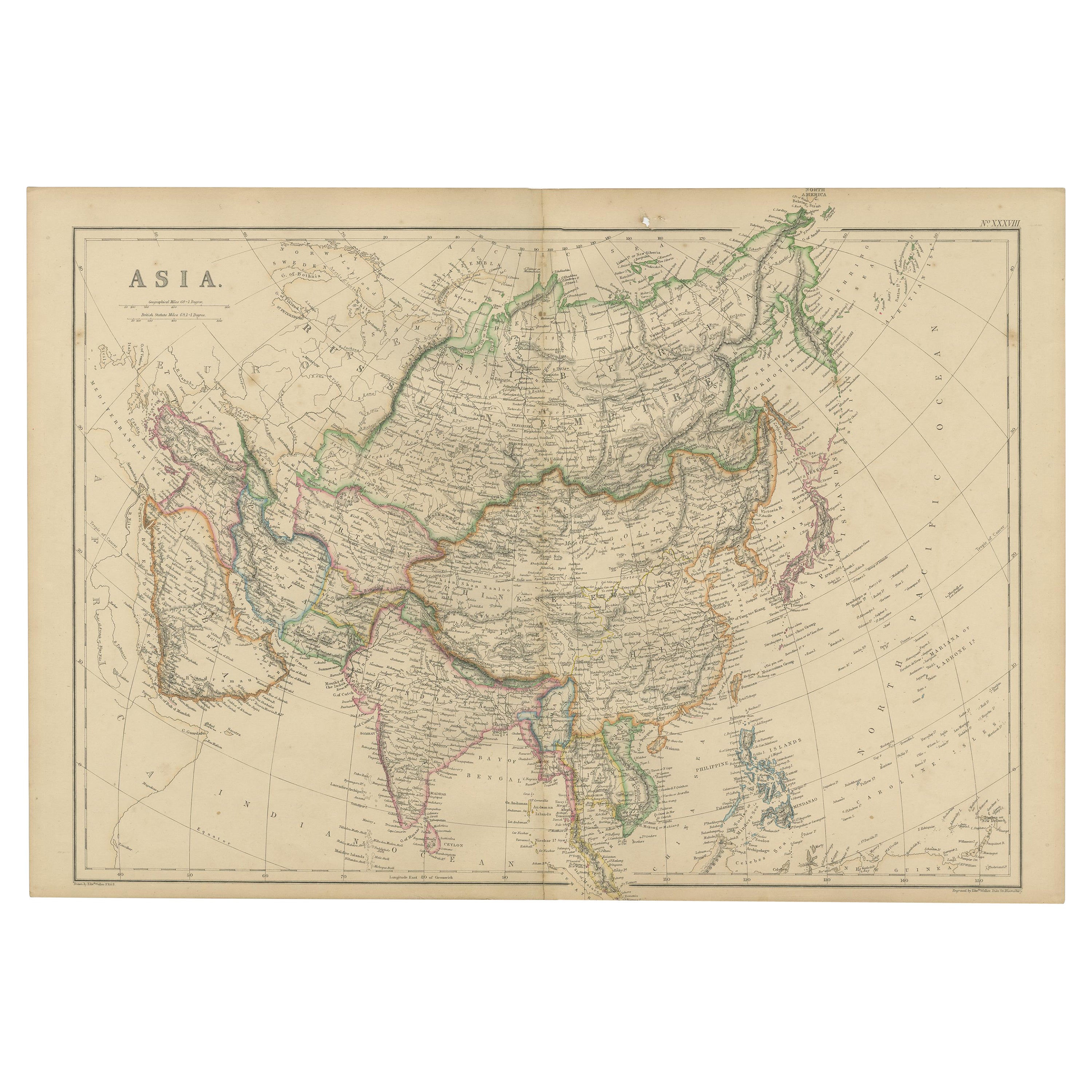
Original 1859 Map of Asia from W.G. Blackie's Imperial Atlas of Modern Geography
Located in Langweer, NL
Antique map titled 'Asia'. Original antique map of Asia. This map originates from ‘The Imperial Atlas of Modern Geography’. Published by W. G. Blackie, 1859.
The "Classic Cartograph...
Category
Antique Mid-19th Century Maps
Materials
Paper
$239 Sale Price
20% Off
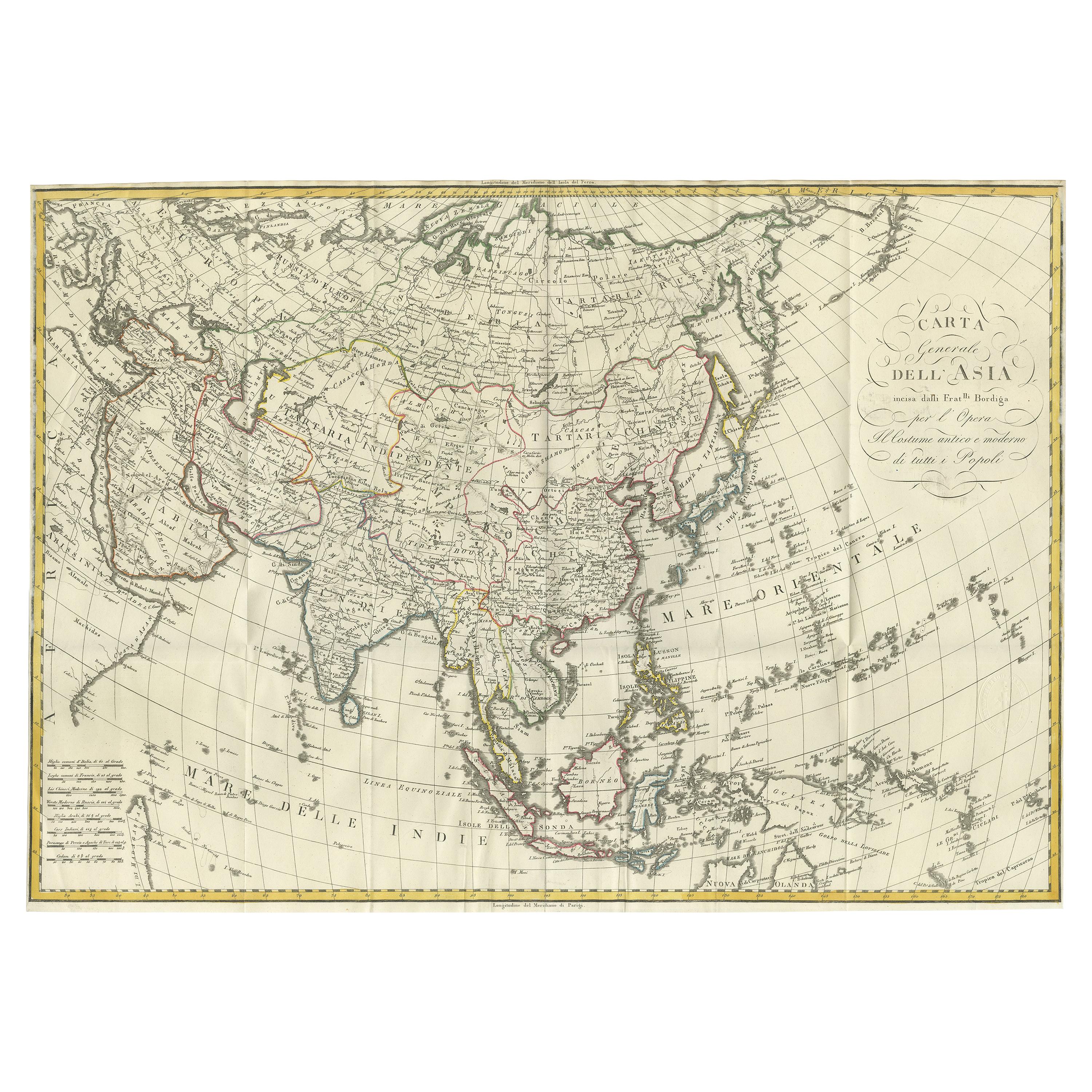
Antique Map of Asia by Ferrario '1815'
Located in Langweer, NL
Antique map titled 'Carta generale dell' Asia (..)'. Original antique map of Asia. This map originates from ' Le Costume Ancien et Moderne' by Jule...
Category
Antique Early 19th Century Maps
Materials
Paper
$910 Sale Price
20% Off
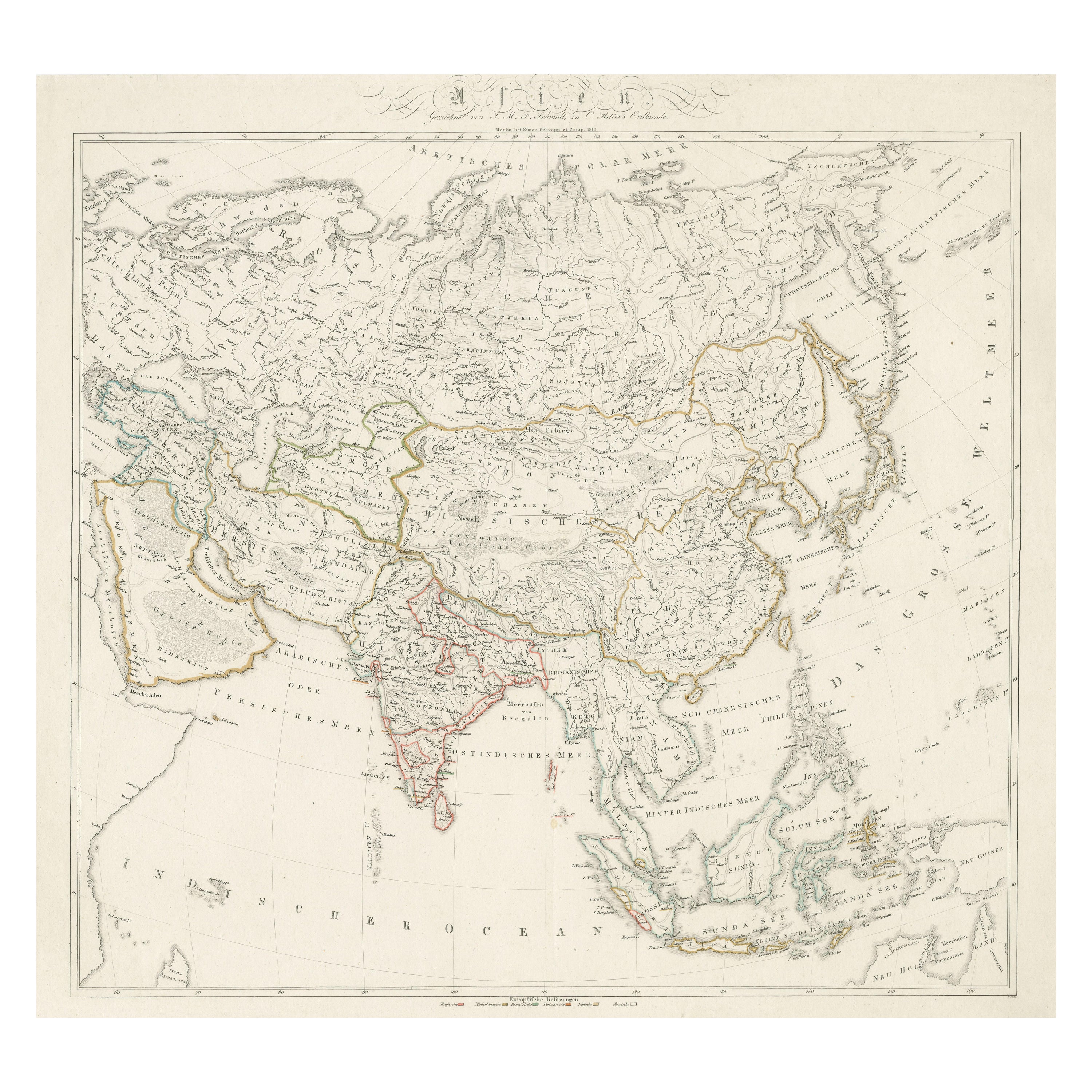
1819 Antique Map of Asia - 'Asien' by Simon Schropp et Comp, Berlin
Located in Langweer, NL
Antique map titled 'Asien'. Original old map of Asia. Published in Berlin by Simon Schropp et Comp, 1819.
"1819 Antique Map of Asia - 'Asien' by Simon Sch...
Category
Antique Early 19th Century Maps
Materials
Paper
$1,821 Sale Price
20% Off
You May Also Like
Antique 1803 Italian Map of Asia Including China Indoneseia India
Located in Amsterdam, Noord Holland
Antique 1803 Italian Map of Asia Including China Indoneseia India
Very nice map of Asia. 1803.
Additional information:
Type: Map
Country of Manufacturing: Europe
Period: 19th centu...
Category
Antique 19th Century European Maps
Materials
Paper

$584 Sale Price
20% Off
Large Original Antique Map of Asia by Sidney Hall, 1847
Located in St Annes, Lancashire
Great map of Asia
Drawn and engraved by Sidney Hall
Steel engraving
Original colour outline
Published by A & C Black. 1847
Unframed
Free shipping
Category
Antique 1840s Scottish Maps
Materials
Paper

Original Antique Map of South East Asia by Thomas Clerk, 1817
Located in St Annes, Lancashire
Great map of South East Asia
Copper-plate engraving
Drawn and engraved by Thomas Clerk, Edinburgh.
Published by Mackenzie And Dent, 1817
Unframed.
Category
Antique 1810s English Maps
Materials
Paper

Original Antique Map of The Eastern Hemisphere by Dower, circa 1835
Located in St Annes, Lancashire
Nice map of the Eastern Hemisphere
Drawn and engraved by J.Dower
Published by Orr & Smith. C.1835
Unframed.
Free shipping
Category
Antique 1830s English Maps
Materials
Paper

Antique French Map of Asia Including China Indoneseia India, 1783
Located in Amsterdam, Noord Holland
Very nice map of Asia. 1783 Dedie au Roy.
Additional information:
Country of Manufacturing: Europe
Period: 18th century Qing (1661 - 1912)
Condition: Overall Condition B (Good Used)...
Category
Antique 18th Century European Maps
Materials
Paper

$648 Sale Price
20% Off
Super Rare Antique French Map of Chine and the Chinese Empire, 1780
Located in Amsterdam, Noord Holland
Super Rare Antique French Map of Chine and the Chinese Empire, 1780
Very nice map of Asia. 1780 Made by Bonne.
Additional information:
Type: Map
...
Category
Antique 18th Century European Maps
Materials
Paper

$584 Sale Price
33% Off
More Ways To Browse
Japanese Art Ocean
Antique Advent
Japanese Ottoman
18th Century Naval
Spanish Filipino
British East Indies
John Powers
Coffee Table Black Italian Modern
Christofle America
Iranian Silk Rug Carpet
Poul Moller
Tables With Inlaid Wood
World War Table
Antonio Jacobsen
Ariston Chairs
Coffee Tables Europe
Marble Top Dining Tables
Nordiska Argentina