Items Similar to Original Antique Engraving of the Creation of the World According to Mozes, 1725


Want more images or videos?
Request additional images or videos from the seller
1 of 6
Original Antique Engraving of the Creation of the World According to Mozes, 1725
$629.42
$786.7720% Off
£466.97
£583.7120% Off
€528
€66020% Off
CA$861.70
CA$1,077.1320% Off
A$965.39
A$1,206.7320% Off
CHF 502.48
CHF 628.1020% Off
MX$11,756.57
MX$14,695.7120% Off
NOK 6,400.96
NOK 8,001.2120% Off
SEK 6,027.90
SEK 7,534.8820% Off
DKK 4,020.28
DKK 5,025.3520% Off
Shipping
Retrieving quote...The 1stDibs Promise:
Authenticity Guarantee,
Money-Back Guarantee,
24-Hour Cancellation
About the Item
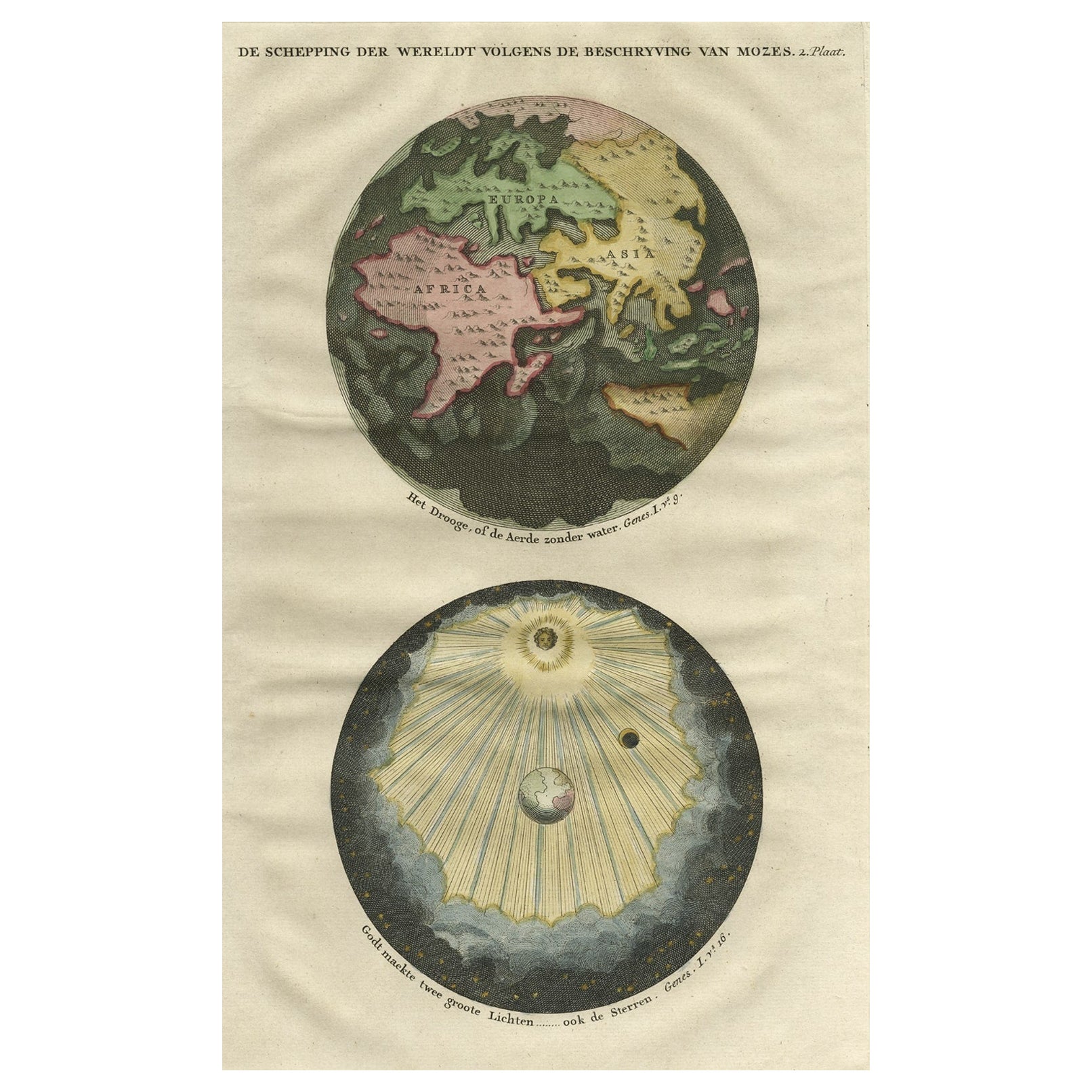
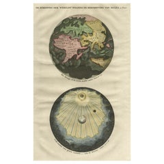
Antique map titled 'De Schepping der Wereldt volgens de Beschryving van Mozes' - This plate shows the creation of the world according to Moses. The upper depiction shows the world without water ( after Goeree); the lowest depiction shows the creation of sun,moon and stars. This plate originates from: 'Het algemeen groot historisch, oordeelkundig, chronologisch, geografisch, en letterlyk naam- en woord-boek, van den gantschen H. Bijbel. Dienende tot de gedenk-stukken der Jooden en andere oudheden, ter opheldering der H. Schrift ... Nu in't Nederduitsch overgezet, merkelyk vermeerdert, en met aanmerkingen verrykt, door Mattheus Gargon.' and it's additons: 'Byvogzel tot het algemeen groot ... Naam- en woord-boek ... En nu in zuiver Nederduitsch overgezet, merkelyk vermeerdert, en metv aanmerkingen verrykt, door Jakob van Ostade en Arn. Henr. Westerhovius.', by Augustines Calmet, published in Leiden, Amsterdam, by Samuel Luchtmans, R. & J. Wetstein en Smith 1725-1731. This is a reknown encyclopaedic dictionary on all aspects of the history, geography and culture of the Bible and Biblical times. This Dutch translation originates from Calmet's work in French including: 'Commentaire litteral sur tous les livres de l'Ancien et du Nouveau Testament ...', first published in Paris in 1707.
Artists and Engravers: Made by 'Antoine Augustin Calmet' after an anonymous artist. Antoine Augustin Calmet (1672-1757), French Benedictine. Translation by: translation by Mattheus Gargon (1661-1728), a minister in Vlissingen. Engravings in this work by A. de Putter, F. van Bleyswyk, M. Pool, Ph. van Gunst, etc.
Condition: Good, given age. Some crinkles and light creases. Edges browned and light soiling in the margins. General age-related toning and/or occasional minor defects from handling. Please study scan carefully.
Date: 1725
Overall size: 24.3 x 40 cm.
Image size: 19 x 30.7 cm.
We sell original antique maps to collectors, historians, educators and interior decorators all over the world. Our collection includes a wide range of authentic antique maps from the 16th to the 20th centuries. Buying and collecting antique maps is a tradition that goes back hundreds of years. Antique maps have proved a richly rewarding investment over the past decade, thanks to a growing appreciation of their unique historical appeal. Today the decorative qualities of antique maps are widely recognized by interior designers who appreciate their beauty and design flexibility. Depending on the individual map, presentation, and context, a rare or antique map can be modern, traditional, abstract, figurative, serious or whimsical. We offer a wide range of authentic antique maps for any budget.
- Dimensions:Height: 15.75 in (40 cm)Width: 9.57 in (24.3 cm)Depth: 0 in (0.01 mm)
- Materials and Techniques:
- Period:
- Date of Manufacture:1725
- Condition:Condition: Good, given age. Some crinkles and light creases. Edges browned and light soiling in the margins. General age-related toning and/or occasional minor defects from handling. Please study scan carefully.
- Seller Location:Langweer, NL
- Reference Number:Seller: PCT-592511stDibs: LU3054329642052
About the Seller
5.0
Recognized Seller
These prestigious sellers are industry leaders and represent the highest echelon for item quality and design.
Platinum Seller
Premium sellers with a 4.7+ rating and 24-hour response times
Established in 2009
1stDibs seller since 2017
2,493 sales on 1stDibs
Typical response time: <1 hour
- ShippingRetrieving quote...Shipping from: Langweer, Netherlands
- Return Policy
Authenticity Guarantee
In the unlikely event there’s an issue with an item’s authenticity, contact us within 1 year for a full refund. DetailsMoney-Back Guarantee
If your item is not as described, is damaged in transit, or does not arrive, contact us within 7 days for a full refund. Details24-Hour Cancellation
You have a 24-hour grace period in which to reconsider your purchase, with no questions asked.Vetted Professional Sellers
Our world-class sellers must adhere to strict standards for service and quality, maintaining the integrity of our listings.Price-Match Guarantee
If you find that a seller listed the same item for a lower price elsewhere, we’ll match it.Trusted Global Delivery
Our best-in-class carrier network provides specialized shipping options worldwide, including custom delivery.More From This Seller
View AllBeautiful Original Print of The Creation of the World According to Moses, 1725
Located in Langweer, NL
Antique map, titled: 'De Schepping der Wereldt volgens de Beschryving van Mozes.'
Two separate maps on one sheet showing the creation of the world according to Moses. The upper dep...
Category
Antique 1720s Maps
Materials
Paper
$934 Sale Price
20% Off
Original Antique Engraving of the Eastern Hemisphere, c.1700
Located in Langweer, NL
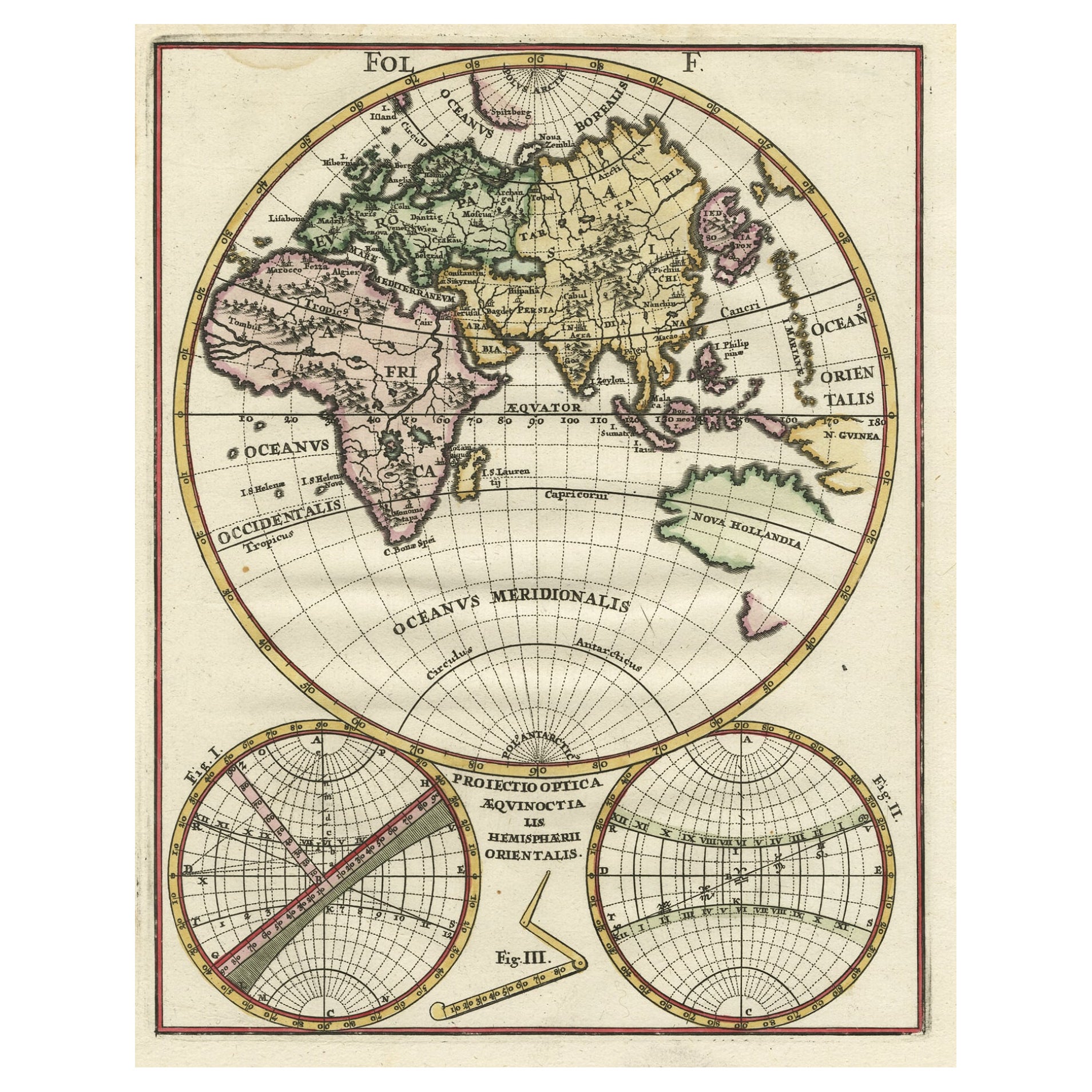
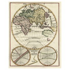
Antique map titled 'Proiectio Optica Aequinoctia lis Hemishaerii Orientalis' - Map of the Eastern Hemisphere with Africa, Europe, Asia and Nova Hollandia...
Category
Antique 17th Century Maps
Materials
Paper
$877 Sale Price
20% Off
Interesting Antique Engraving of the World in Hemispheres with 6 Diagrams, 1788
Located in Langweer, NL
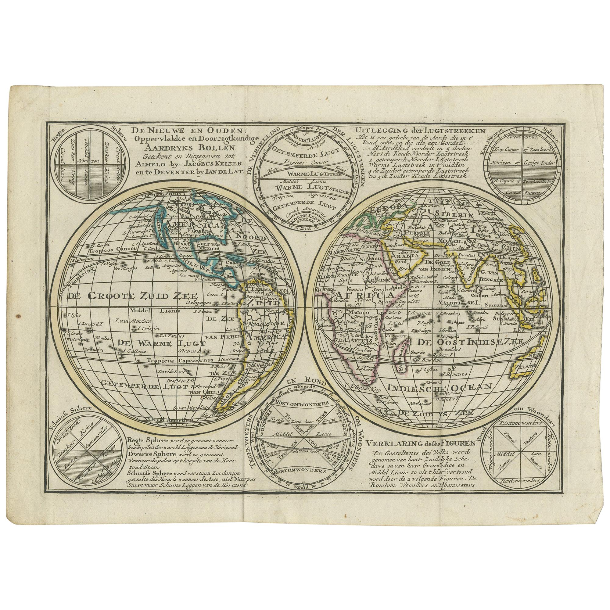
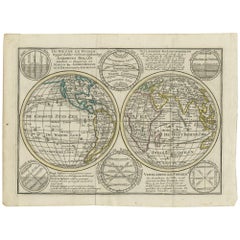
Antique map titled 'De Nieuwe en Ouden oppervlakke en doorzigtkundige Aardrykes Bollen (..)'. Twin hemispheres surrounded by six diagrams showing various divisions of the globe. Cali...
Category
Antique Late 18th Century Maps
Materials
Paper
$476 Sale Price
20% Off
Antique Map of the World in Hemispheres by Keizer & de Lat, 1788
Located in Langweer, NL
Antique map titled 'Schuine Ronde Aard-Bolle waar van 't Middelpunt is Amsterdam (..)'. Interesting double hemisphere world map on polar projections. In North America, there is a large Island of California. Australia and New Zealand are shown with incomplete coastlines. The map contains six smaller astronomical...
Category
Antique Late 18th Century Maps
Materials
Paper

$476 Sale Price
20% Off
18th Century Antique Engraving of the Southern Hemisphere by G. de L'Isle
By Guillaume De L'Isle
Located in Langweer, NL
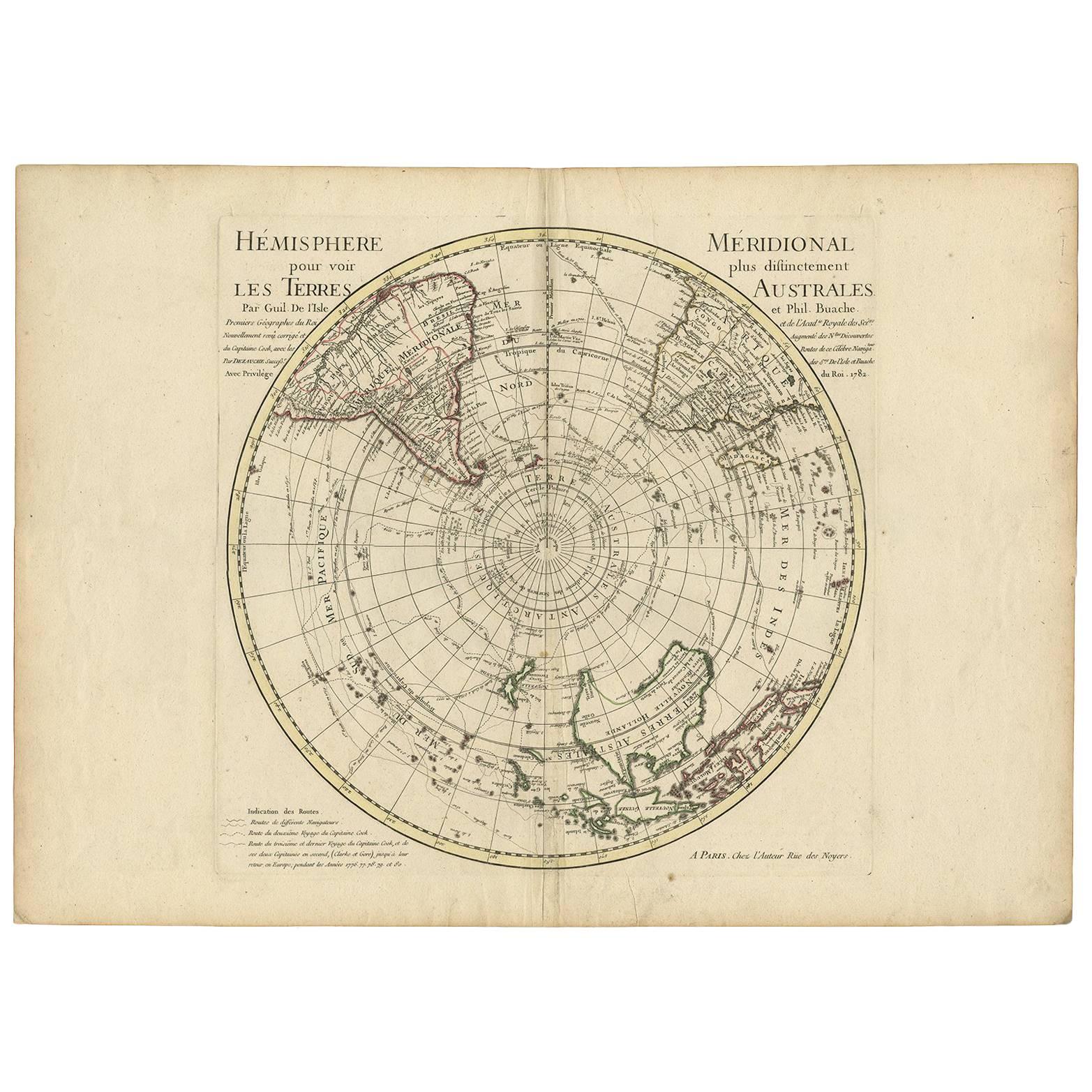
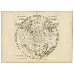
Antique map titled 'Hemisphere Meridional pour voir plus distinctement Les Terres Australes'. Hemispherical map of the southern hemisphere centered on ...
Category
Antique Late 18th Century Maps
Materials
Paper
$948 Sale Price
20% Off
Antique Map of the World with Polar Projections by Keizer & de Lat, 1788
Located in Langweer, NL
Antique map titled 'Schuine Ronde Aard-Klooten (..)'. Interesting double hemisphere world map with polar projections. In North America, there is a...
Category
Antique Late 18th Century Maps
Materials
Paper

$447 Sale Price
25% Off
You May Also Like
Original Antique Map of The World by Thomas Clerk, 1817
Located in St Annes, Lancashire
Great map of The Eastern and Western Hemispheres
On 2 sheets
Copper-plate engraving
Drawn and engraved by Thomas Clerk, Edinburgh.
Published by Mackenzie And Dent, 1817
...
Category
Antique 1810s English Maps
Materials
Paper

Map of the World - Original Etching - 1820
Located in Roma, IT
Map of the World is an Original Etching realized by an unknown artist of 19th century in 1820.
Very good condition on two sheets of white paper joine...
Category
1820s Modern Figurative Prints
Materials
Etching

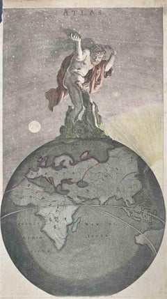
Atlas (Frontispiece) - Etching by Frederick de Wit - 1680 ca
By Frederick de Wit
Located in Roma, IT
This etching with contemporary coloring, depicting Atlas supporting the heavens, was realized by the cartographer Frederick de Wit as frontispiece of the famous Atlas published in Am...
Category
1680s Modern Figurative Prints
Materials
Etching
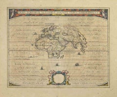
Orbis Terrarum - Etching by Johannes Janssonius - 1650s
By Johannes Janssonius
Located in Roma, IT
Antique Map - Orbis Terrarum is an antique map realized in 1650 by Johannes Janssonius (1588-1664).
The Map is Hand-colored etching, with coeval watercoloring.
Good conditions with...
Category
1650s Modern Figurative Prints
Materials
Etching
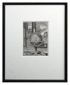
Early 18th Century Globe Terrestre Engraving
By Francois Halma
Located in Soquel, CA
Wonderfully detailed steel engraving of the earth, locations labeled in French: Afrique, Grande Tartarie, La Chine, etc., by By Francois Halma (Dutch, 1653-1722), 1705. Interesting f...
Category
Early 1700s Realist Landscape Prints
Materials
Paper, Ink
$460 Sale Price
20% Off
WORLD MAP - Planisphaerium Terrestre Sive Terrarum Orbis... 1696
By Carel Allard
Located in Santa Monica, CA
CAREL ALLARD (1648 – 1709)
PLANISPHAERIUM TERRESTRE SIVE TERRARUM ORBIS… 1696 (Shirley 578)
Engraving, 20 ½ x 23 ½”, sheet 21 x 24 1/8". A stunning double hemisphere World Map...
Category
17th Century Old Masters Landscape Prints
Materials
Engraving

More Ways To Browse
Antique French Bible
Sun Moon Stars
Rare Antique Bibles
Rare And Antique Bibles
Bible 16th Century
Antique Putters
Tunisia Antique Map
Antique Map New Orleans
Antique Maps Of Maryland
Gambia Antique Map
Antique Manitoba
Antique Map Of Brooklyn
Antique Map Of Michigan
Cham Antiques
Map Of Native American Tribes
Antique Furniture Halifax Furniture
Antique Furniture Trinidad
Antique Kiel Furniture