Items Similar to Original Antique Engrving of Chinese Tartary in the 18th Century, 1737


Want more images or videos?
Request additional images or videos from the seller
1 of 7
Original Antique Engrving of Chinese Tartary in the 18th Century, 1737
$415.12
$518.9020% Off
£310.73
£388.4120% Off
€352
€44020% Off
CA$571.32
CA$714.1520% Off
A$636.79
A$795.9920% Off
CHF 334.10
CHF 417.6320% Off
MX$7,776.29
MX$9,720.3720% Off
NOK 4,230.48
NOK 5,288.1020% Off
SEK 3,998.45
SEK 4,998.0620% Off
DKK 2,679.67
DKK 3,349.5920% Off
About the Item
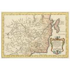
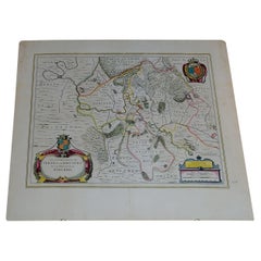
The antique map titled " Ozieme feuille particuls de la Tartarie Chinoise, qui contient un pays dependant de la russie aucouchant de NIPTCHOU " translates to "Sixth sheet of parts of Chinese Tartary, which includes a country dependent on Russia to the west of NIPTCHOU. " This map, originating from the 18th century, is a part of a series delineating sections of the Chinese Tartary region.
It specifically highlights a territory within Chinese Tartary, situated to the west of NIPTCHOU, likely referencing the Nizhny Novgorod region in Russia. These maps aimed to provide geographic insights into regions within Chinese Tartary, detailing boundaries, cities, rivers, and topographical features.
As a historical artifact, this map contributes to the understanding of territorial demarcations and geographic knowledge prevalent during the 18th century. The map's details and cartographic accuracy offer valuable insights into the region's landscape and the geopolitical relationships between China and Russia at that time.
Source; Map of the Chinese Tartary. Relief shown pictorially.
D'Anville's map showcases the northern region adjacent to Mongolia, emphasizing rivers, sparse settlements, and the road linking Niptchou (or Nerzinskoi) to Beijing. The map's eastern portion marks the road's beginning, and a decorative cartouche adds ornamental detail.
An anonymous French source from 1765 describes Nerzinskoi as a fortified city-state under the Grand Duke of Muscovy, positioned in Siberia and serving as the provincial capital of the Nerz dows. Inhabited by pagans, it boasts a robust garrison and enjoys the Czar's protective patronage.
New atlas of China, Chinese Tartary and Tibet. drawn up by Jean Baptiste Bourguignon d’ Anville. The first edition of "the principal cartographic authority on China during the 18th century ". It was the second major atlas of China produced in Europe following the Martini/ Blaeu Novus Atlas Sinensis 1655. Atlas composed of general & special maps of these countries, as well as the map of the Kingdom of Korea. Includes engraved title page, with index “Liste et ordre des cartes comprises dans cet atlas ”,12 pages of descriptive text by a Swedish officer and 42 engraved maps, with decorative cartouches and compass roses. Some maps bound out of sequence, some folded and some outline hand color. Descriptive text on some maps. Includes a general map of Tibet together with 9 regional maps and 12 maps of Chinese Tartary. Maps 3, 11, 12 show Great Wall of China. Map 18 shows Japan. Maps show topography, vegetation, waterways, ports, roads. Some maps include notes. Relief shown pictorially. D'Anville's maps also appeared in du Halde's 1732 "Description geographique historique... de l'Empire de la Chine et de la Tartarie Chinoise." Based on Jesuit sources, D' Anville's maps remained the definitive European rendering of China's provinces until the end of the 19th century. "The Kangxi Emperor employed Jesuit brothers (1708–18) to produce maps of the provinces of China using a combination of Western and Chinese survey methods. The maps were completed by 1721. They were sent back to Europe and became the basis for maps of China produced by Jean Baptiste Bourguignon d’ Anville in 1735. The main changes from traditional Chinese mapping were to use latitude and longitude as primary coordinates, map them using a spherical projection, and use astronomical measurements of latitude and longitude to establish baselines. Changes in latitude and longitude were found using traditional metric survey and relationships between distance north–south and latitude and distance east–west and longitude to convert to degrees.
- Dimensions:Height: 11.42 in (29 cm)Width: 18.9 in (48 cm)Depth: 0 in (0.02 mm)
- Materials and Techniques:Paper,Engraved
- Period:1730-1739
- Date of Manufacture:1737
- Condition:Good conditon. Strong paper. Later hand coloring.
- Seller Location:Langweer, NL
- Reference Number:Seller: BGJC-001701stDibs: LU3054337328192
About the Seller
5.0
Recognized Seller
These prestigious sellers are industry leaders and represent the highest echelon for item quality and design.
Platinum Seller
Premium sellers with a 4.7+ rating and 24-hour response times
Established in 2009
1stDibs seller since 2017
2,517 sales on 1stDibs
Typical response time: <1 hour
- ShippingRetrieving quote...Shipping from: Langweer, Netherlands
- Return Policy
Authenticity Guarantee
In the unlikely event there’s an issue with an item’s authenticity, contact us within 1 year for a full refund. DetailsMoney-Back Guarantee
If your item is not as described, is damaged in transit, or does not arrive, contact us within 7 days for a full refund. Details24-Hour Cancellation
You have a 24-hour grace period in which to reconsider your purchase, with no questions asked.Vetted Professional Sellers
Our world-class sellers must adhere to strict standards for service and quality, maintaining the integrity of our listings.Price-Match Guarantee
If you find that a seller listed the same item for a lower price elsewhere, we’ll match it.Trusted Global Delivery
Our best-in-class carrier network provides specialized shipping options worldwide, including custom delivery.More From This Seller
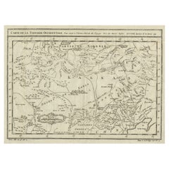
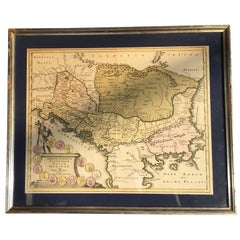
View AllOriginal Antique Map of Tartary 'Northern China & Far Eastern Russia', 1757
Located in Langweer, NL
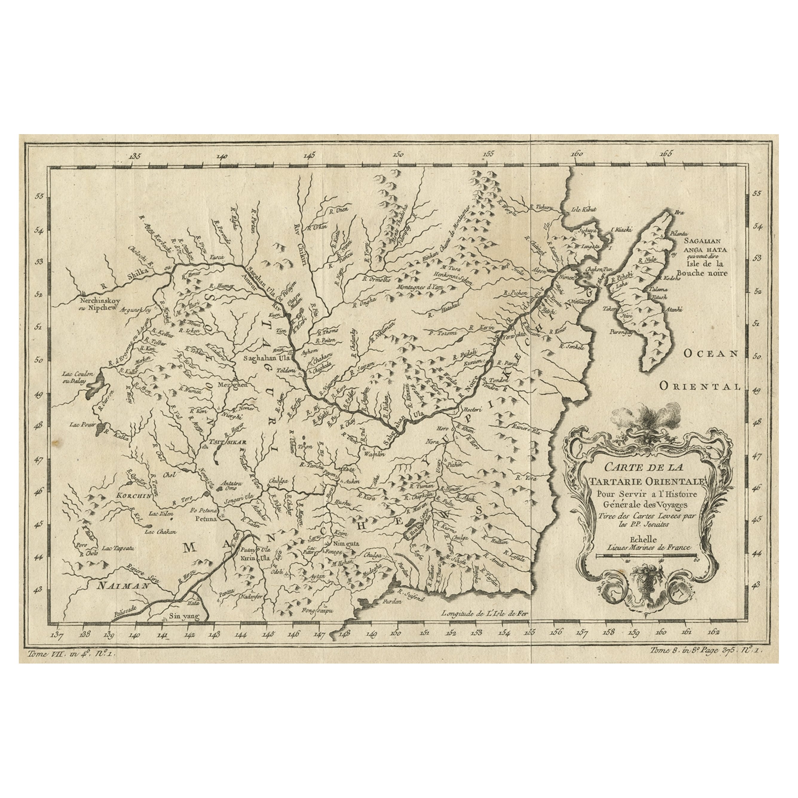
Antique map titled 'Carte de la Tartarie Orientale (..)'.
Original antique map of what is present day northern China and far eastern Russia. Centere...
Category
Antique 1750s Maps
Materials
Paper

$273 Sale Price
20% Off
Charting Eastern Tartary: An 18th-Century Jesuit and English Collaboration, 1757
Located in Langweer, NL
The antique map titled 'Carte de la Tartarie Orientale pour Servir a l'Histoire Generale des Voyages Tiree des Cartes Levees par les P.P. Jesuites' is an original old map that covers...
Category
Antique Mid-18th Century Maps
Materials
Paper
$358 Sale Price
20% Off
Free Shipping
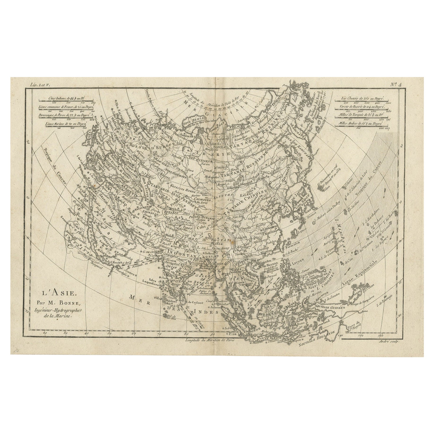
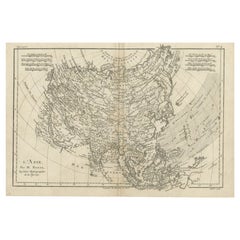
Original Antique Map of Asia
Located in Langweer, NL
Antique map titled 'l'Asie'. Original antique map of Asia. Engraved by André after Bonne. Published circa 1780.
Category
Antique Late 18th Century Maps
Materials
Paper
$273 Sale Price
20% Off
Antique Map of the West Coast of North America & North East Coast of Asia '1772'
Located in Langweer, NL
Antique map titled 'Carte des nouvelles decouvertes/ Extrait d'une Carte Japonoise de l'Universe'. Map of the West Coast of North America and North-East Coast of Asia, based upon Buache's report of the various Russian Discoveries between 1731 and 1742 including the various explorers routes and notes. The lower map is based upon a Japanese map...
Category
Antique Late 18th Century Maps
Materials
Paper

$613 Sale Price
20% Off
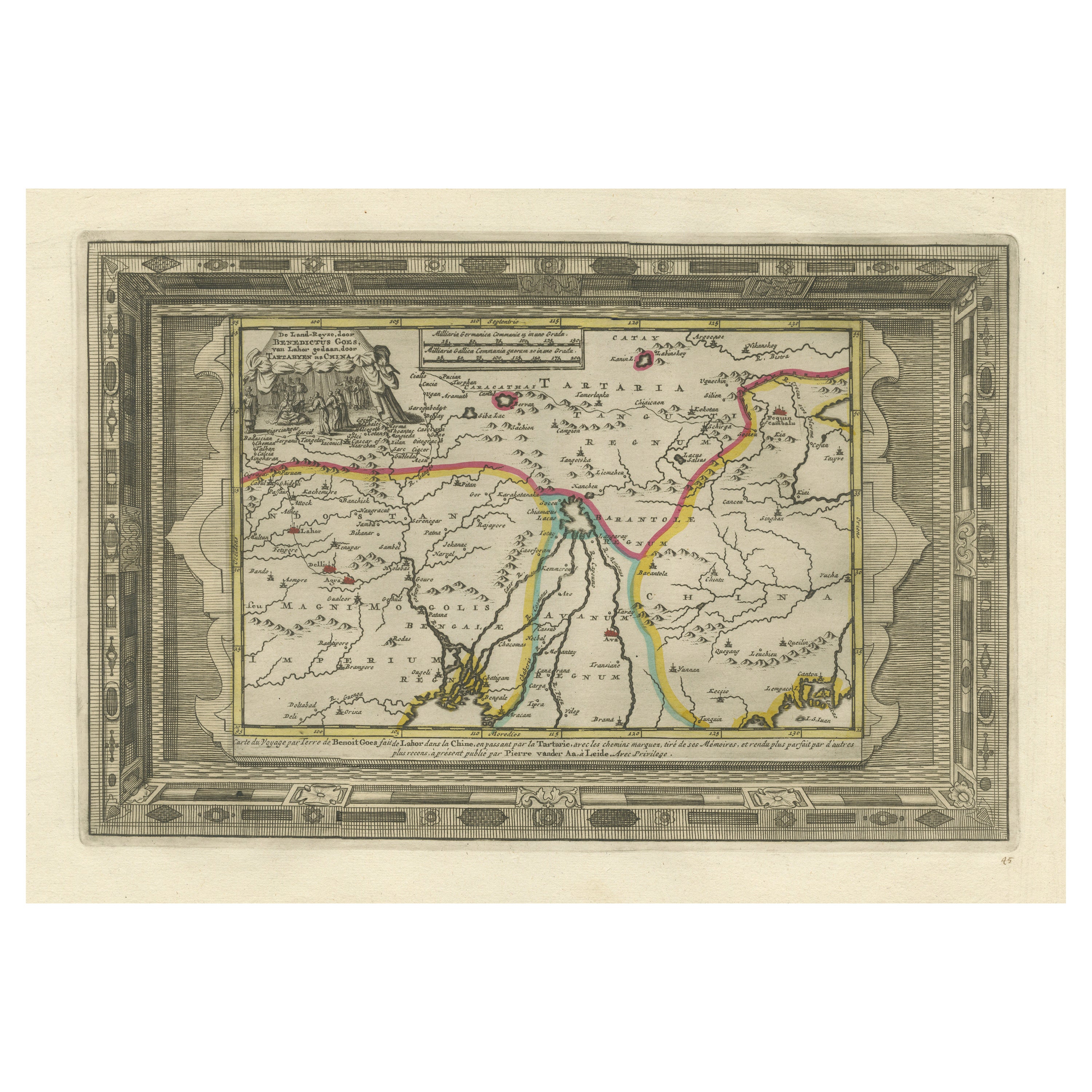
Benedictus Goes’ Route – Antique Map of Tartary to China by Van der Aa, 1714
Located in Langweer, NL
Benedictus Goes’ Route – Antique Map of Tartary to China by Van der Aa, 1714
This fascinating antique map titled De Land-Reyse door Benedictus Goes, van Lahor gedaan, door Tartaryen...
Category
Antique Early 18th Century Dutch Maps
Materials
Paper
$509 Sale Price
20% Off
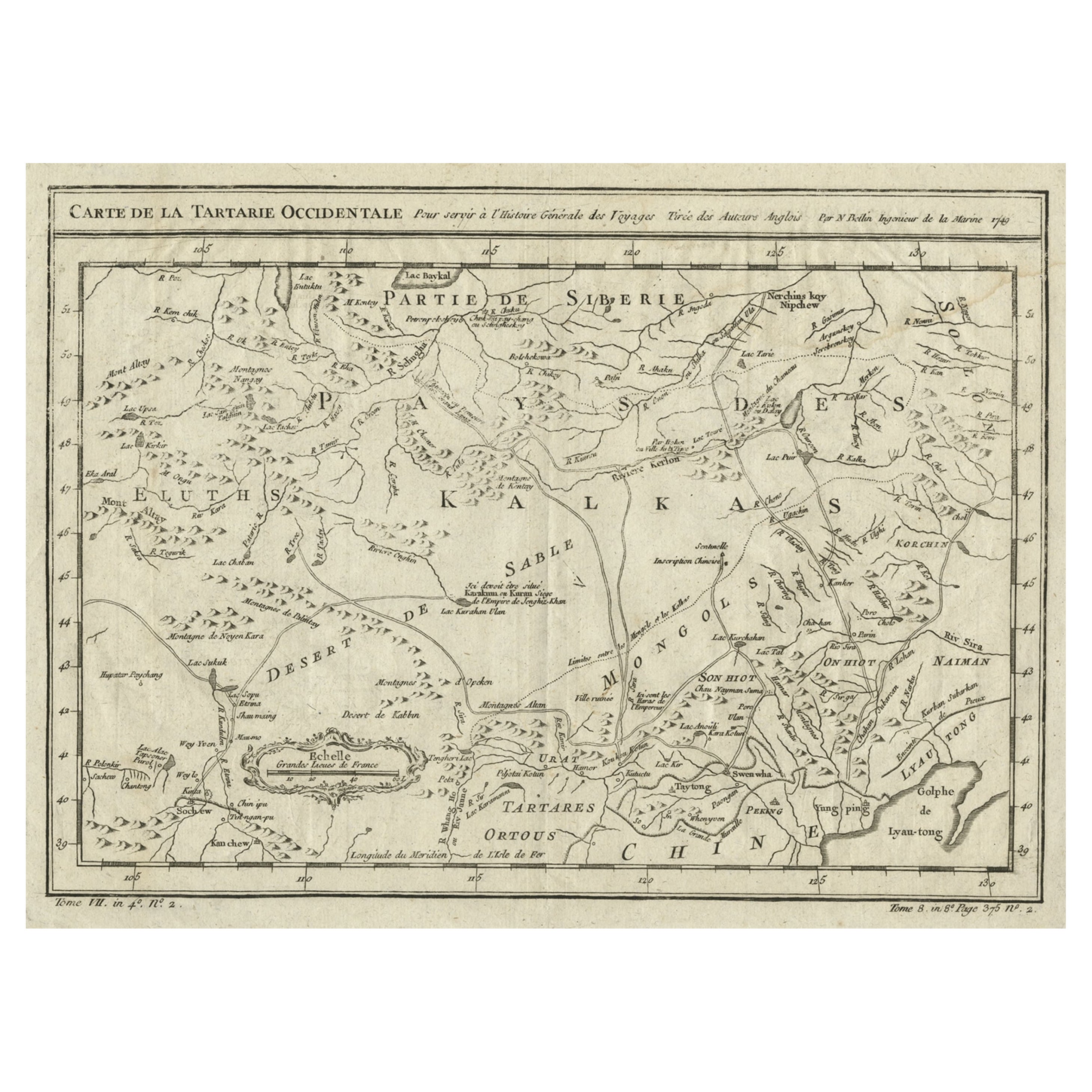
Interesting Antique Map of Tartary and Northeast Asia, 1749
Located in Langweer, NL
Condition: Good, given age. Original folds, as issued. Some small water stains above image and top-right. Please study scan carefully.
Category
Antique 1740s Maps
Materials
Paper
$273 Sale Price
20% Off
You May Also Like
Antique French Map of Asia Including China Indoneseia India, 1783
Located in Amsterdam, Noord Holland
Very nice map of Asia. 1783 Dedie au Roy.
Additional information:
Country of Manufacturing: Europe
Period: 18th century Qing (1661 - 1912)
Condition: Overall Condition B (Good Used)...
Category
Antique 18th Century European Maps
Materials
Paper

$648 Sale Price
20% Off
1656 "La Souverainete de Sedan et de Raucourt, et la Prevoste de Doncheri Ric004
Located in Norton, MA
1656 map entitled
"La Souverainete de Sedan et de Raucourt, et la Prevoste de Doncheri,"
Hand Colored
Ric0004.
Description:
Lovely map centered on Sedan and Doncheri an...
Category
Antique 17th Century Dutch Maps
Materials
Paper
Antique 1803 Italian Map of Asia Including China Indoneseia India
Located in Amsterdam, Noord Holland
Antique 1803 Italian Map of Asia Including China Indoneseia India
Very nice map of Asia. 1803.
Additional information:
Type: Map
Country of Manufacturing: Europe
Period: 19th centu...
Category
Antique 19th Century European Maps
Materials
Paper

$584 Sale Price
20% Off
Four 18th Century Engraved and Hand-Colored Maps by Weigel
By Christoph Weigel
Located in Copenhagen, K
Small collection of four engraved maps of Italy, Balkan and of Central Asia.
Two are of Italy, one Corsica and Northern Italy and the other of the Southern Italian boot...
Category
Antique 18th Century German Maps
Materials
Paper
Super Rare Antique French Map of Chine and the Chinese Empire, 1780
Located in Amsterdam, Noord Holland
Super Rare Antique French Map of Chine and the Chinese Empire, 1780
Very nice map of Asia. 1780 Made by Bonne.
Additional information:
Type: Map
...
Category
Antique 18th Century European Maps
Materials
Paper

$584 Sale Price
32% Off
1633 Map "La Souverainete De Sedan Et De Raucourt, Et La Prevoste Ric0011
Located in Norton, MA
1653 map entitled
"La Souverainete de Sedan et de Raucourt, et la Prevoste de Doncheri,"
Ric0011
Description:
Lovely map centered on Sedan and Doncheri and the Meuze River fr...
Category
Antique 17th Century Dutch Maps
Materials
Paper

More Ways To Browse
Mongolian Antique
Antique Serving Carts
42 North Antiques
Japanese Compass
Blaeu Wall Map
Textable Trolley
Antique Surveying Compass
Antique Rug Wool Navy Blue Red
Antique Silver Platter
Boat Blueprint
Cream Plates
Vintage Art Deco Rugs
Vintage Serving Forks
Brewery Signs
Herati Rug
Gold Leaf Furniture Black
Italian Wood Console Tables
Maison Jansen Argentina