Items Similar to Original Antique Map of India by Dower, circa 1835


Want more images or videos?
Request additional images or videos from the seller
1 of 5
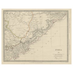
Original Antique Map of India by Dower, circa 1835
$60
£46.10
€52.96
CA$84.40
A$94.82
CHF 49.54
MX$1,157.28
NOK 629.04
SEK 592.11
DKK 395.23
About the Item
Nice map of India
Drawn and engraved by J.Dower
Published by Orr & Smith. C.1835
Unframed.
Free shipping
- Dimensions:Height: 12.25 in (31.12 cm)Width: 9.25 in (23.5 cm)Depth: 0.07 in (1.78 mm)
- Materials and Techniques:Paper,Other
- Place of Origin:
- Period:
- Date of Manufacture:1837
- Condition:Wear consistent with age and use.
- Seller Location:St Annes, GB
- Reference Number:1stDibs: LU1836345665612
About the Seller
4.9
Platinum Seller
Premium sellers with a 4.7+ rating and 24-hour response times
1stDibs seller since 2016
3,120 sales on 1stDibs
Typical response time: 1 hour
Associations
International Confederation of Art and Antique Dealers' Associations
- ShippingRetrieving quote...Shipping from: St Annes, United Kingdom
- Return Policy
Authenticity Guarantee
In the unlikely event there’s an issue with an item’s authenticity, contact us within 1 year for a full refund. DetailsMoney-Back Guarantee
If your item is not as described, is damaged in transit, or does not arrive, contact us within 7 days for a full refund. Details24-Hour Cancellation
You have a 24-hour grace period in which to reconsider your purchase, with no questions asked.Vetted Professional Sellers
Our world-class sellers must adhere to strict standards for service and quality, maintaining the integrity of our listings.Price-Match Guarantee
If you find that a seller listed the same item for a lower price elsewhere, we’ll match it.Trusted Global Delivery
Our best-in-class carrier network provides specialized shipping options worldwide, including custom delivery.More From This Seller
View AllLarge Original Vintage Map of India, circa 1920
Located in St Annes, Lancashire
Great map of India
Original color.
Good condition / repair to some minor damage just above Sri Lanka. Shown in the last image.
Published by Alexander Gross
Unframed.
Category
Vintage 1920s English Maps
Materials
Paper

Original Antique Map of The Eastern Hemisphere by Dower, circa 1835
Located in St Annes, Lancashire
Nice map of the Eastern Hemisphere
Drawn and engraved by J.Dower
Published by Orr & Smith. C.1835
Unframed.
Free shipping
Category
Antique 1830s English Maps
Materials
Paper

Original Antique Map of The World by Dower, circa 1835
Located in St Annes, Lancashire
Nice map of the World
Drawn and engraved by J.Dower
Published by Orr & Smith. C.1835
Unframed.
Free shipping
Category
Antique 1830s English Maps
Materials
Paper

Original Antique Map of Africa by Dower, circa 1835
Located in St Annes, Lancashire
Nice map of Africa
Drawn and engraved by J.Dower
Published by Orr & Smith. C.1835
Unframed.
Free shipping
Category
Antique 1830s English Maps
Materials
Paper

Original Antique Map of Australia by Dower, circa 1835
Located in St Annes, Lancashire
Nice map of Australia
Drawn and engraved by J.Dower
Published by Orr & Smith. C.1835
Unframed.
Free shipping
Category
Antique 1830s English Maps
Materials
Paper

Original Antique Map of The United States of America by Dower, circa 1835
Located in St Annes, Lancashire
Nice map of the USA
Drawn and engraved by J.Dower
Published by Orr & Smith. C.1835
Unframed.
Free shipping
Category
Antique 1830s English Maps
Materials
Paper

You May Also Like
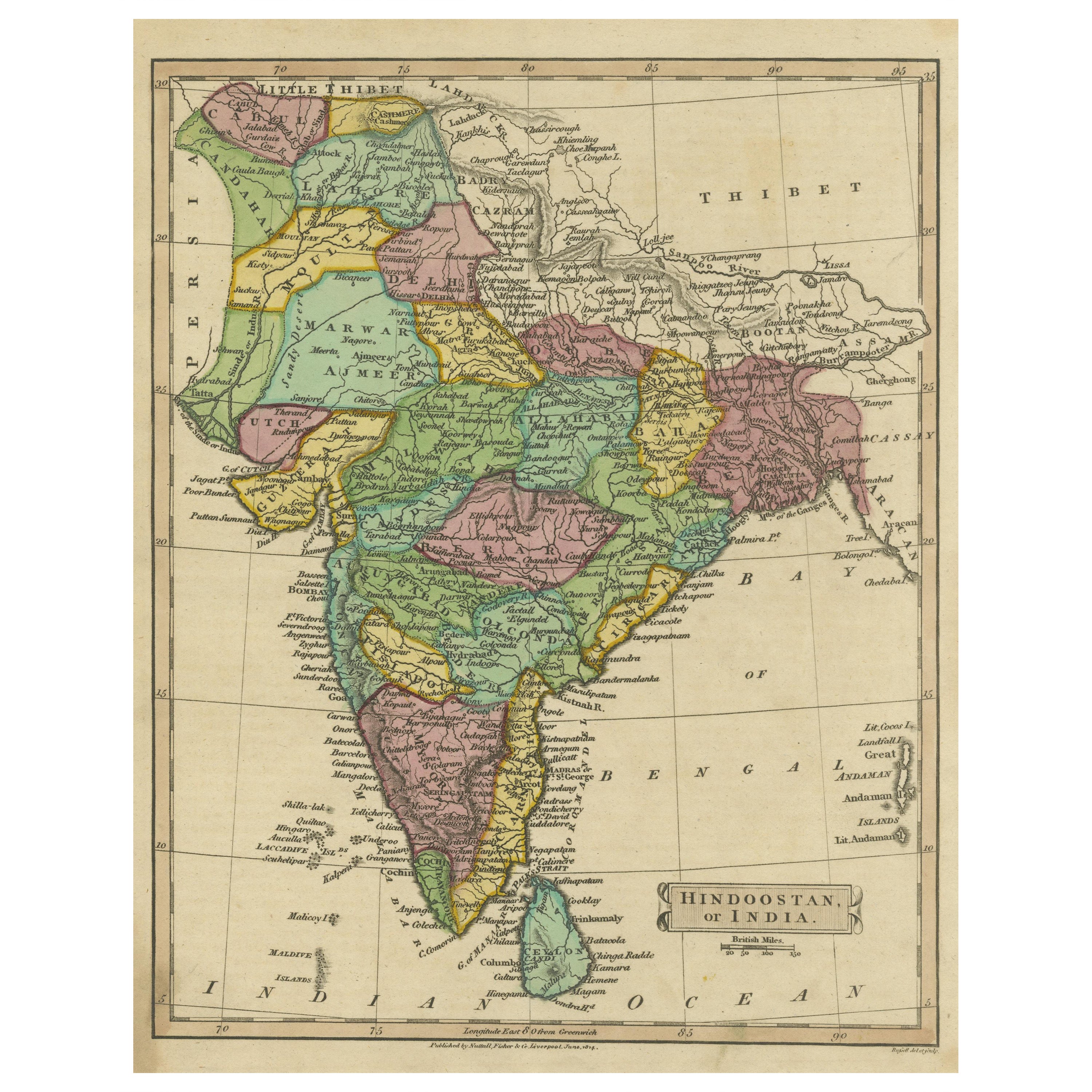
Antique Map of Hindustan, or India
Located in Langweer, NL
Antique map titled 'Hindoostan, or India'. Original antique map of India (Hindustan) and Sri Lanka (Ceylon). Engraved by Russell. Published by Nuttall, Fisher & Co, 1814.
Category
Antique Early 19th Century Maps
Materials
Paper

$273 Sale Price
20% Off
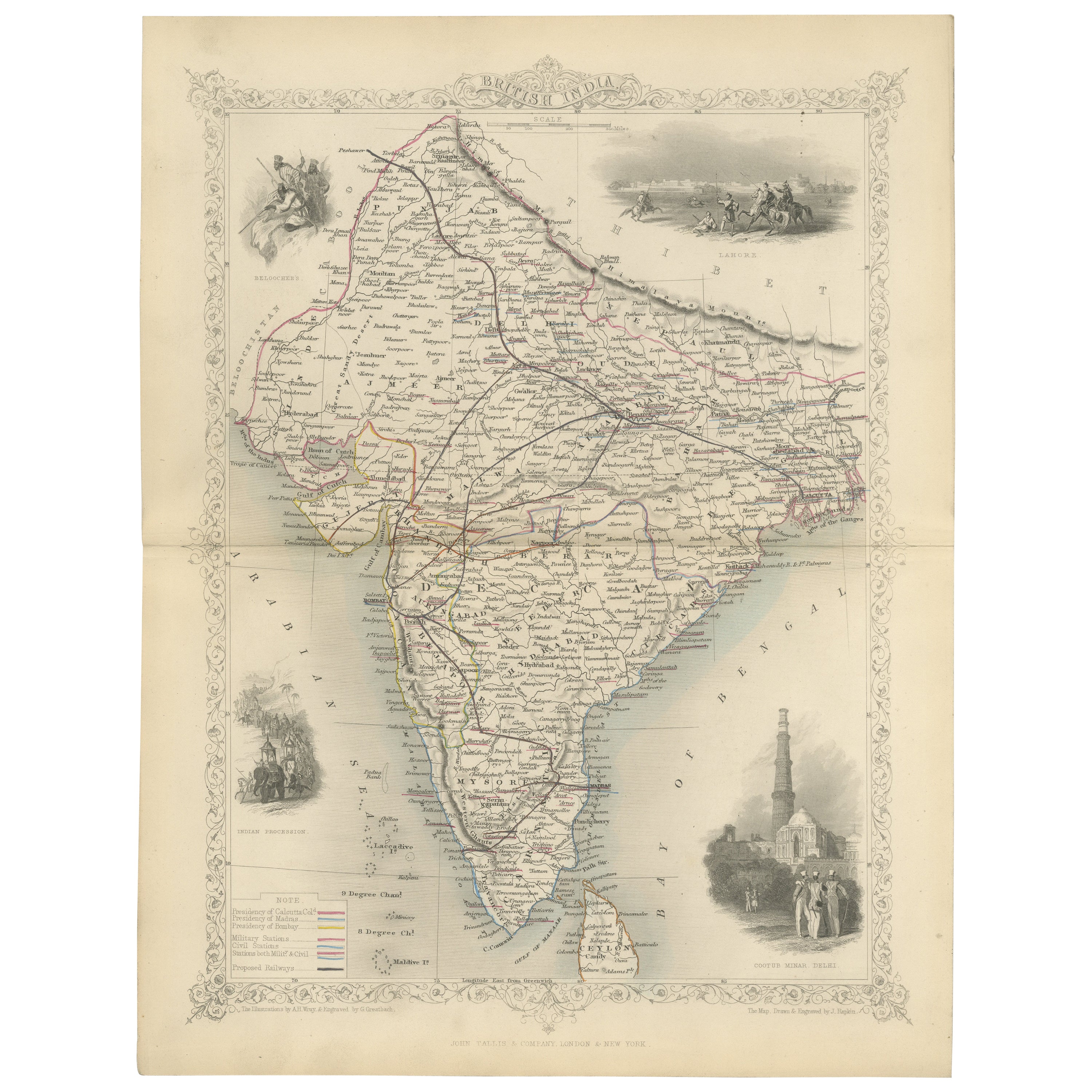
Mid-19th Century Decorative Map of India with Cultural and Natural Vignettes
Located in Langweer, NL
The Tallis maps, including the one of India, are known for their detailed and ornamental style. They were produced during the mid-19th century, a time when cartographic publishing became as much an art form as a means of geographic representation.
John Tallis & Company, founded by John Tallis, was known for creating maps with elaborate borders and vignettes surrounding the map itself. These maps often included illustrations that depicted scenes representative of the region's culture, significant local wildlife, architectural landmarks, and portraits of indigenous peoples...
Category
Antique 1850s Maps
Materials
Paper

$292 Sale Price
20% Off
Antique Map of India and Southeast Asia by Balbi '1847'
Located in Langweer, NL
Antique map titled 'India en deçà et au delà du Gange'. Original antique map of India and Souteast Asia. This map originates from 'Abrégé de Géographie (..)' by Adrien Balbi. Publish...
Category
Antique Mid-19th Century Maps
Materials
Paper

$141 Sale Price
20% Off
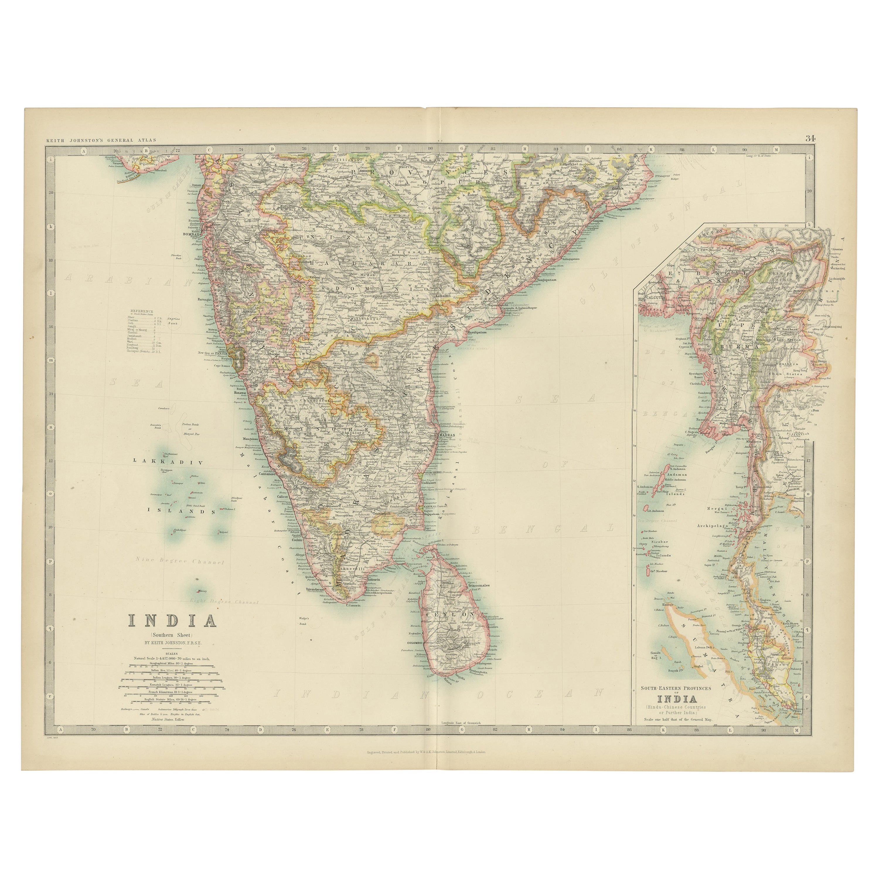
Antique Map of India ( Southern ) by Johnston (1909)
Located in Langweer, NL
Antique map titled 'India'. Original antique map of India Southern sheet. With inset maps of south eastern provinces of India. This map originates from the ‘Royal Atlas of Modern Geo...
Category
Early 20th Century Maps
Materials
Paper

$235 Sale Price
20% Off
Detailed Antique Map of the Region of Malwa in India, 1833
Located in Langweer, NL
Antique map titled 'India VI'. Old steel engraved map of the region of Malwa showing great detail.
Artists and Engravers: Engraved by J. & C. Walker. Published under the superint...
Category
Antique 19th Century Maps
Materials
Paper
$273 Sale Price
20% Off
Interesting Detailed Antique Map of Eastern India, 1832
Located in Langweer, NL
Antique map titled 'India IV'. Old steel engraved map of the eastern part of India, including the Bay of Bengal, Hydrabad and Masulipatam.
Artists and...
Category
Antique 19th Century Maps
Materials
Paper
$273 Sale Price
20% Off
More Ways To Browse
Curved Velvet Couch
Velvet Curved Sofa
Wood Round Coffee Tables
Oak Brutalist
Used College Furniture
Wood Minimalist Chair
Antique Imperial Furniture
Gold Modern Coffee Table
Large Side Tables
18th Century Gilded Furniture
Fluted Column
Japanese Silver Ceramics
One Of A Kind Chair
Used Oak Dining Room Chairs
17th Century Plate
Childrens Vintage Poster
Chinese Ship
Nursery Art