Items Similar to Original Antique Map of the Peninsula of India with Part of Ceylon by Wyld, 1844

Want more images or videos?
Request additional images or videos from the seller
1 of 6
Original Antique Map of the Peninsula of India with Part of Ceylon by Wyld, 1844
$1,150.22
$1,437.7720% Off
£856.26
£1,070.3320% Off
€960
€1,20020% Off
CA$1,575.51
CA$1,969.3920% Off
A$1,752.31
A$2,190.3920% Off
CHF 915
CHF 1,143.7520% Off
MX$21,323.77
MX$26,654.7220% Off
NOK 11,685.98
NOK 14,607.4820% Off
SEK 10,959.39
SEK 13,699.2420% Off
DKK 7,308.14
DKK 9,135.1820% Off
Shipping
Retrieving quote...The 1stDibs Promise:
Authenticity Guarantee,
Money-Back Guarantee,
24-Hour Cancellation
About the Item
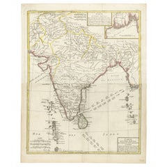
This extensive map of India, spanning two sheets, draws from Reynell’s original map and incorporates data provided by Sir Archibald Campbell, as well as surveys conducted by Colonel Pringle and Colonel Allan. It features a comprehensive list of European colonial settlements and an accompanying key that clarifies the map's color-coded details.
The map, created by James Wyld, depicts the Peninsula of India from the 19th degree of North Latitude to Cape Comorin. It's a significant representation of India and part of Ceylon (now Sri Lanka) in the lower right corner, printed on two large sheets.
**Title:** Map of the Peninsula of India
**Cartographer:** James Wyld
**Description:** Large two-sheet map of India with part of Ceylon in the lower right
**Technique:** Engraving with some outline hand-coloring
**Dimensions:** Each sheet approximately 590 x 850 mm
This map, printed across two sizable sheets but joined together on one linen backing, offers extensive coverage of the Indian Peninsula, ranging from the 19th degree of North Latitude to Cape Comorin. Wyld's cartographic work is notable for its precision and detail, presenting a comprehensive view of the geographical features, boundaries, and topography of the region.
The use of engraving techniques allows for intricate lines and fine details, while the outline hand-coloring likely helps distinguish various geographical elements, such as borders, coastlines, rivers, and important settlements.
Given the map's dimensions and the coverage it provides, it serves as an essential reference for understanding the geographical layout and significant features of the Indian Peninsula during the period it was created.
Wyld's maps are often prized for their accuracy and clarity, making them valuable resources for historical and geographical research. This particular map, spanning two sheets and showcasing India and part of Ceylon, is a significant cartographic piece offering insights into the geographical understanding of the region during the time of its creation.
Platemarks approx. 510 x 835 mm. (20 x 32 7/8 in), each sheet approx. 590 x 850 mm. (23 1/4 x 33 1/2 in), 1844.
James Hope Wyld, born in 1812, was a highly respected British mapmaker renowned for his dedication to producing maps featuring the most current and recently acquired information. Initially educated at Woolwich with intentions to join the army, Wyld changed course at 18 and joined his father, James Wyld the elder, in their esteemed map publishing enterprise. Following his father's footsteps, he gained considerable esteem, earning 17 European orders of merit throughout his lifetime.
Wyld demonstrated remarkable business acumen and upon his father's passing in 1836, he assumed sole proprietorship of the business. His contributions to cartography earned him recognition, leading to his election as a fellow of the Royal Geographical Society in 1839. Additionally, he was appointed Royal Geographer to Queen Victoria and Prince Albert, a prestigious position previously held by his father.
Famous for his prolific and current mapmaking, Wyld was humorously praised by the satirical newspaper Punch in 1849 for his ability to foresee beyond others. The publication jokingly suggested that if a new country were discovered in the center of the earth, Wyld would swiftly create a "Grand Map of that delightful spot, the Centre of the Earth" for potential emigrants. This jest was inspired by Wyld's ambitious project, "Wyld's Great Globe," an immense spherical hall resembling a globe, allowing visitors a unique inside-out view of the world. This attraction, situated in London's Leicester Square, attracted substantial crowds, second only to the Great Exhibition in visitor numbers.
Simultaneously managing this attraction, Wyld served as a Whig Member of Parliament for the Bodmin seat during two periods (1847-1852 and 1857-1868). His diverse roles and significant contributions to both cartography and public service marked a distinguished career. He passed away in 1887 in Kensington, after which his son, James John Cooper Wyld, assumed control of the family business, continuing the legacy of cartographic excellence.
- Dimensions:Height: 33.47 in (85 cm)Width: 23.23 in (59 cm)Depth: 0 in (0.02 mm)
- Materials and Techniques:
- Period:
- Date of Manufacture:1844
- Condition:Minor surface dirt, the northern section sheet with small split to central vertical fold. Overall a large impressive map backed on linnen and ready to be framed. Please study the image carefully. Folded, easy to ship.
- Seller Location:Langweer, NL
- Reference Number:Seller: BG-132601stDibs: LU3054337498142
About the Seller
5.0
Recognized Seller
These prestigious sellers are industry leaders and represent the highest echelon for item quality and design.
Platinum Seller
Premium sellers with a 4.7+ rating and 24-hour response times
Established in 2009
1stDibs seller since 2017
2,510 sales on 1stDibs
Typical response time: <1 hour
- ShippingRetrieving quote...Shipping from: Langweer, Netherlands
- Return Policy
Authenticity Guarantee
In the unlikely event there’s an issue with an item’s authenticity, contact us within 1 year for a full refund. DetailsMoney-Back Guarantee
If your item is not as described, is damaged in transit, or does not arrive, contact us within 7 days for a full refund. Details24-Hour Cancellation
You have a 24-hour grace period in which to reconsider your purchase, with no questions asked.Vetted Professional Sellers
Our world-class sellers must adhere to strict standards for service and quality, maintaining the integrity of our listings.Price-Match Guarantee
If you find that a seller listed the same item for a lower price elsewhere, we’ll match it.Trusted Global Delivery
Our best-in-class carrier network provides specialized shipping options worldwide, including custom delivery.More From This Seller
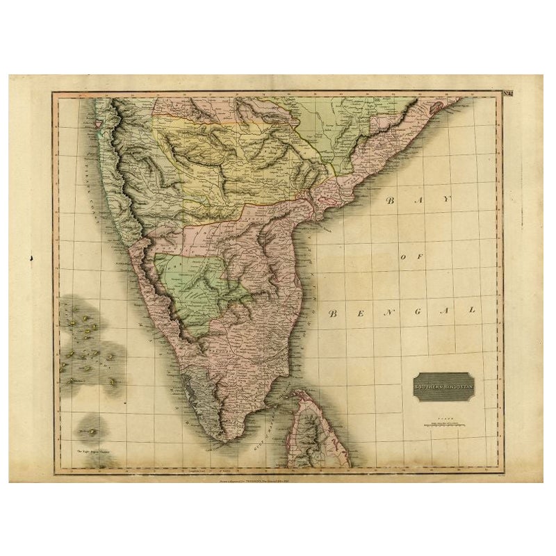
View AllAntique Map of Southern India and Ceylon by Thomson, 1816
Located in Langweer, NL
"Antique map titled 'Southern Hindostan'. A map of Southern India and the North of Ceylon. From Thomson's 'New General Atlas', 1816. Artists and Engravers: Engraved by Neele.
Arti...
Category
Antique 19th Century Maps
Materials
Paper
$167 Sale Price
20% Off
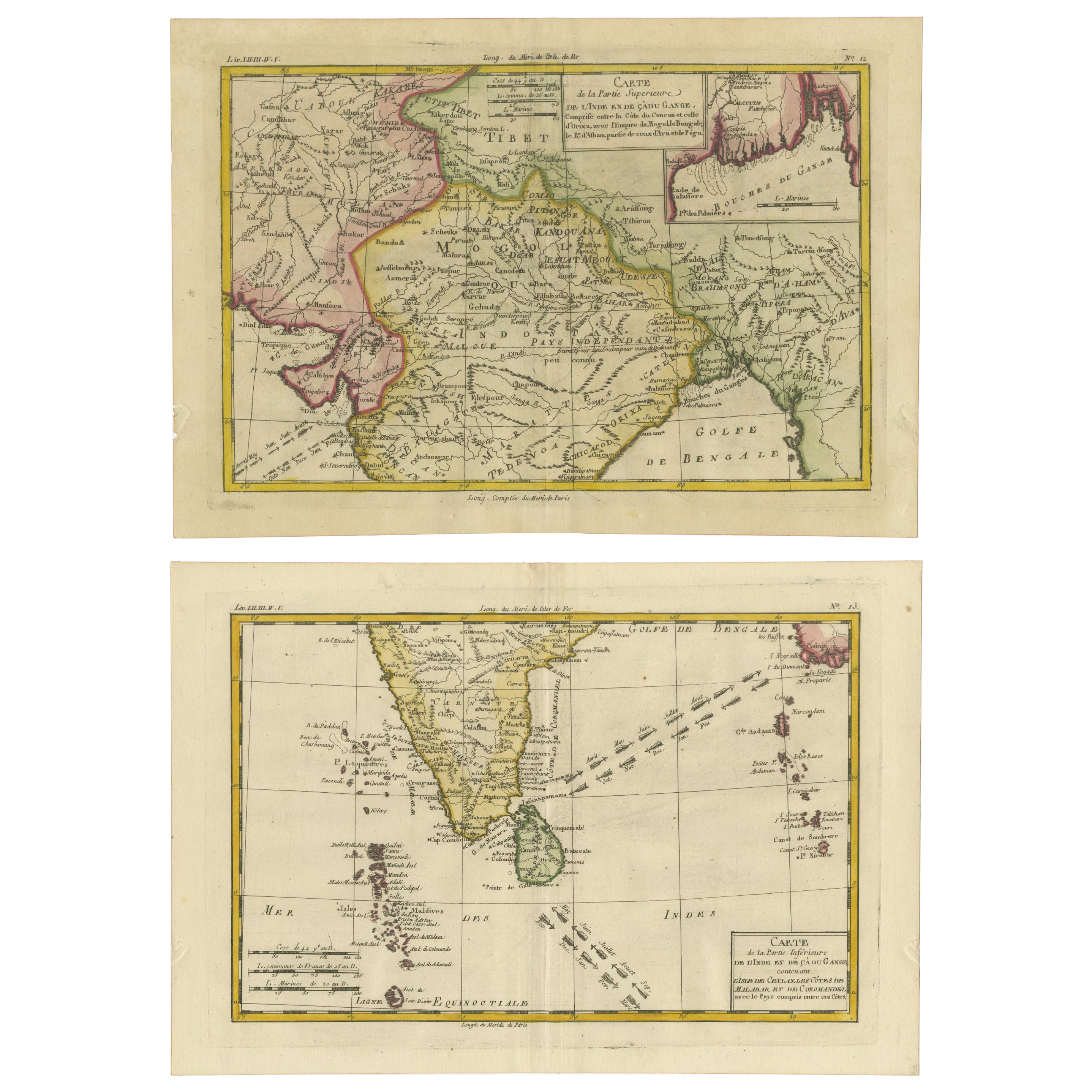
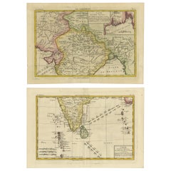
18th Century Cartographic Depiction of Upper India and Ceylon, 1835
Located in Langweer, NL
An exquisite set of two maps, 'Carte de la Partie Superieure De L'Inde en de Cadu Gange,' masterfully crafted by the renowned 18th-century French cartographer, Charles Marie Rigobert...
Category
Antique 1830s Maps
Materials
Paper
$421 Sale Price
20% Off
Free Shipping
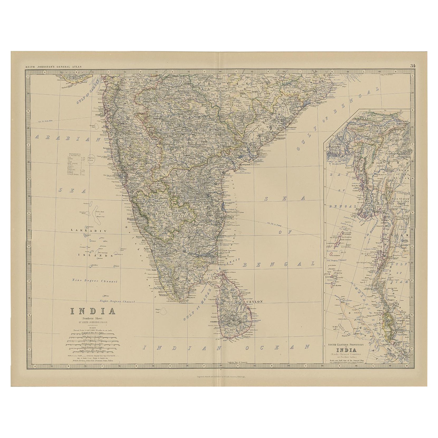
Old Map of Southern India and Ceylon 'Sri Lanka', 1882
Located in Langweer, NL
Antique map titled 'India (Southern Sheet)'.
Old map of Southern India and Ceylon (Sri Lanka). With an inset map of the South-Eastern Provinces of India. This map originates from...
Category
Antique 1880s Maps
Materials
Paper
$277 Sale Price
20% Off
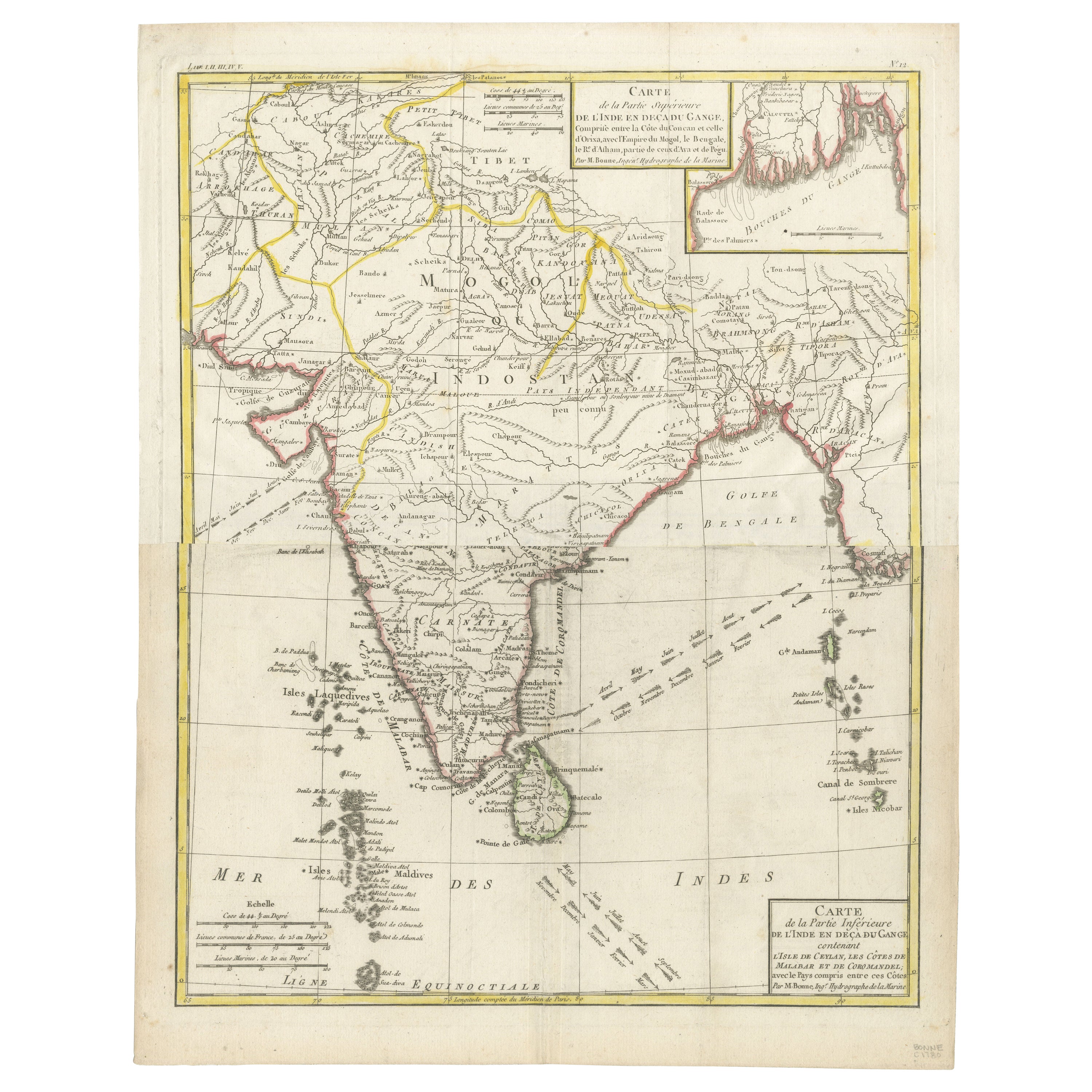
Map of India and Ceylon with Inset of Calcutta and the Ganges, by Bonne, 1780
Located in Langweer, NL
The map on offer is an antique copperplate engraving of India and Ceylon (Sri Lanka), created by Rigobert Bonne (1727-1794), a prominent French cartographer. Here is a breakdown of t...
Category
Antique 1780s Maps
Materials
Paper
$325 Sale Price
20% Off
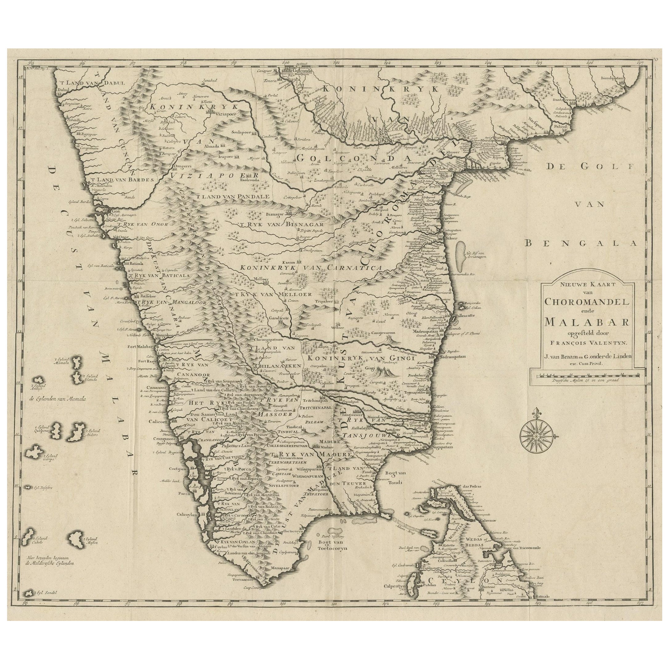
Map of Choromandel & Malabar, Incl Kerala, Tamil Nadu & Part of Sri Lanka, 1726
Located in Langweer, NL
Antique map titled 'Nieuwe kaart van Choromandel ende Malabar.'
Original antique map of Southern India documenting the VOC's areas of influence. Included is Kerala, Tamil Nadu...
Category
Antique 1720s Maps
Materials
Paper
$821 Sale Price
30% Off
Free Shipping
Antique Map of India and Ceylon by Lapie, 1842
Located in Langweer, NL
Antique map titled 'Carte de l'Inde en deca et au dela du Gange'. Map of India and Ceylon (Sri Lanka). This map originates from 'Atlas universel de géographie ancienne et moderne (.....
Category
Antique Mid-19th Century Maps
Materials
Paper

$527 Sale Price
20% Off
You May Also Like
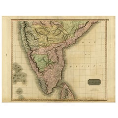
Original Antique Map of India by Dower, circa 1835
Located in St Annes, Lancashire
Nice map of India
Drawn and engraved by J.Dower
Published by Orr & Smith. C.1835
Unframed.
Free shipping
Category
Antique 1830s English Maps
Materials
Paper

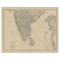
India (Southern Sheet), English antique map by Alexander Keith Johnston, 1901
Located in Melbourne, Victoria
'India (Southern Sheet)', antique lithographic map by Keith Johnston.
Inset maps of 'Bombay Island & Town', 'Madras & Environs', and 'South-Eastern Provinces of India'.
Central vertical fold as issued.
495mm by 625mm (sheet)
Alexander Keith...
Category
Early 20th Century Victorian More Prints
Materials
Lithograph

Map Of India - Original Lithograph - 19th Century
Located in Roma, IT
Map of India is an original lithograph artwork realized by an Anonymous engraver of the 19th Century.
Printed in the series of "France Pittoresque".
Titled "France Pittoresque".
...
Category
19th Century Modern Figurative Prints
Materials
Lithograph

Antique 1803 Italian Map of Asia Including China Indoneseia India
Located in Amsterdam, Noord Holland
Antique 1803 Italian Map of Asia Including China Indoneseia India
Very nice map of Asia. 1803.
Additional information:
Type: Map
Country of Manufacturing: Europe
Period: 19th centu...
Category
Antique 19th Century European Maps
Materials
Paper

$584 Sale Price
20% Off
Large Original Vintage Map of India, circa 1920
Located in St Annes, Lancashire
Great map of India
Original color.
Good condition / repair to some minor damage just above Sri Lanka. Shown in the last image.
Published by Alexander Gross
Unframed.
Category
Vintage 1920s English Maps
Materials
Paper

Antique French Map of Asia Including China Indoneseia India, 1783
Located in Amsterdam, Noord Holland
Very nice map of Asia. 1783 Dedie au Roy.
Additional information:
Country of Manufacturing: Europe
Period: 18th century Qing (1661 - 1912)
Condition: Overall Condition B (Good Used)...
Category
Antique 18th Century European Maps
Materials
Paper

$648 Sale Price
20% Off
More Ways To Browse
Antique Ceylon
Victoria And Son
Ceylon Furniture
Colonial British India Furniture
Indian Prince
Antique Swift
Antique Print Ceylon
Colonial Sri Lankan
Vintage Art Deco Rugs
Vintage Serving Forks
Herati Rug
Italian Wood Console Tables
Maison Jansen Argentina
Antique Oushak
Mid Century Danish Directors Chairs
Moller 70
Wood Relief Art
Argentina Travel Poster