1610s Maps
to
10
16
16
1
1
2,976
2,230
476
3
290
34
10
126
9
37
9
2
5
4
3
3
16
4
2
2
2
16
16
16
Period: 1610s
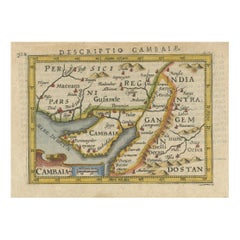
1616 Petrus Bertius Miniature Map of Cambay (Gujarat, India)
Located in Langweer, NL
Title: 1616 Petrus Bertius Map of Cambay and Gujarat, India
Description: This early seventeenth-century map, titled Descriptio Cambaiæ, was published in 1616 by Petrus Bertius, a ...
Category
Antique 1610s Maps
Materials
Paper
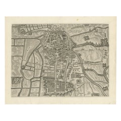
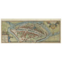
Map of Groningen from The Genealogy of the Illustrious Counts of Nassau (1615)
Located in Langweer, NL
Title: Map of Groningen from "The Genealogy of the Illustrious Counts of Nassau" (1615)
Description: This antique map, titled "Gronenga," offers a detailed depiction of the forti...
Category
Antique 1610s Maps
Materials
Paper
$512 Sale Price
20% Off
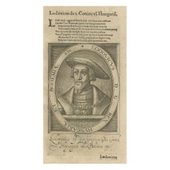
Original Engraved Portrait of Louis II, King of Hungary, Croatia & Bohemia, 1615
Located in Langweer, NL
Antique portrait titled 'Lodovicus D.G. (..)'.
Portrait of Louis II, King of Hungary, Croatia and Bohemia. This print originates from 'Tooneel der keysere...
Category
Antique 1610s Maps
Materials
Paper
$270 Sale Price
20% Off
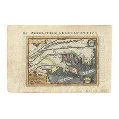
1616 Petrus Bertius Map of Arakan and Pegu in Southeast Asia
Located in Langweer, NL
Title: 1616 Petrus Bertius Map of Arakan and Pegu in Southeast Asia
Description: This early seventeenth-century map, titled Descriptio Arachan et Pegu, was published in 1616 by P...
Category
Antique 1610s Maps
Materials
Paper
Dutch City Plan of Sloten in Friesland by N. Van Geelkercken, hand-colored 1616
Located in Langweer, NL
Bird’s-Eye View of Sloten in Friesland by Nicolaes van Geelkercken, ca. 1616
This captivating hand-colored engraving presents an early 17th-century bird’s-eye view of the fortified ...
Category
Dutch Antique 1610s Maps
Materials
Paper
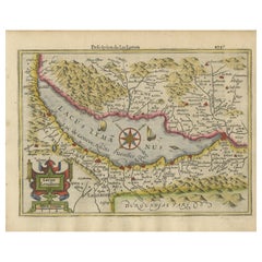
Beautiful Original Copper Engraved Map of Lake Geneva in Switzerland, 1613
Located in Langweer, NL
Description: Antique map titled 'Lacus Lemanus'.
Old map of Lake Geneva with good detail of surrounding towns and villages. Decorated with a large compass rose with two sailing boats and a sea monster in the lake. Originates from 'Atlas Minor'.
Artists and Engravers: Henricus Hondius...
Category
Antique 1610s Maps
Materials
Paper
$605 Sale Price
20% Off
Dutch City Plan of Workum in Friesland by N. Van Geelkercken, hand-colored 1616
Located in Langweer, NL
Workum in Friesland by Nicolaes van Geelkercken, hand-colored map ca. 1616
This beautifully hand-colored engraving titled 'Worcum' presents an early 17th-century bird’s-eye view of ...
Category
Dutch Antique 1610s Maps
Materials
Paper
Exploring Ancient Persia: Ptolemaic Map of Iran and Iraq by Ptolemy and Mercator
Located in Langweer, NL
Claudius Ptolemy was a mathematician, astronomer and geographer who worked in Alexandria, then a part of the Roman Empire, in the 2nd century AD. One of the most learned and influent...
Category
Antique 1610s Maps
Materials
Paper
$456 Sale Price
20% Off
Rare 16th Century Original Handcolored Miniature Map of Java, Indonesia, 1616
Located in Langweer, NL
Very handsome original old coloured copper engraving by Bertius of the island of Java in the early days of the Dutch colonisation - at that time named The Dutch East Indies or nowada...
Category
Antique 1610s Maps
Materials
Paper
$456 Sale Price
20% Off
Original Old & Rare View of the City of Workum, Friesland, The Netherlands, 1616
Located in Langweer, NL
Antique map titled 'Worcum'. This print depicts the city of Workum (Friesland, The Netherlands). With German captions. This print originates from 'Rerum Frisicarum Historia' publishe...
Category
Antique 1610s Maps
Materials
Paper
$391 Sale Price
20% Off
Rare Old Map of the City of Stavoren, Friesland, the Netherlands, 1616
Located in Langweer, NL
Antique map titled 'Staveren'.
Old map of the city of Stavoren, Friesland. This map originates from 'Rerum Frisicarum Historia' by U. Emmius.
Artists and Engravers: Nicolaes ...
Category
Antique 1610s Maps
Materials
Paper
$792 Sale Price
20% Off
Stunning Decorative Antique Map of East Frisia with an Inset of Emden, c.1610
Located in Langweer, NL
Description: Antique map titled 'Typus Frisie Orientalis a Dullarto (..)'. One of the most decorative maps of East Frisia and its important shipping center of Emden and the Watten Is...
Category
Antique 1610s Maps
Materials
Paper
$3,029 Sale Price
20% Off
Two Maps of Asia on One Sheet, India, Bangladesh and Malaysia & Burma etc., 1617
Located in Langweer, NL
Antique map titled 'Tabula Asiae'.
Two maps of Asia on one sheet, recto and verso. The recto features an interesting map of India, Bangladesh and the Ganges River. On the verso, ...
Category
Antique 1610s Maps
Materials
Paper
$596 Sale Price
20% Off
Table Low Sofa Vintage 1950s Map Isle of Man John Speed 1610 Thomas Durham 1595
Located in BUNGAY, SUFFOLK
- The juxtaposition of modern design and this ancient map create a unique small table and conversation piece
- This is the first map featuring the Isle of Man on its own.
- It is also the first map of the Island based on an actual survey, undertaken by Thomas Durham 1595 and was first published by Speed in 1605-1611 and reprinted many times over the next century. This is the second state or print from 1610.
The map is inset within a fruitwood box frame with a glass top. Supported by tapering stick legs.
The map is based on a survey (and presumably a MS map) by Thomas Durham, of whom nothing is known other that he was paid by Sir Thomas Gerrard to make a survey of the Island. This survey, almost certainly for military purposes, arose from the disputed possession of the Island during which time Elizabeth had assumed control in order to prevent the Scots or the Spanish from using the Island as a base.
Speed had used the Durham Map in his slightly earlier 4-sheet wall map showing invasions and battles of c1603/4 [ref: Shirley #261] - there are some differences from this 1605/10 map - Port Eran (rather than Earn on 1605);Knockalo point (= Contrary Hd) not on 1605;Spalbrecke shown west of Calf rather than E as on 1605/10. Thus it is possible that the Durham Map had even more detail than Speed used in his derived version.
In sea are four mythical beasts with riders: to NW of Island Unicorn with Scottish flag...
Category
English Mid-Century Modern Antique 1610s Maps
Materials
Paper
Antique Map of the Namen or Namur Region in Wallonia, Belgium
Located in Langweer, NL
Description: Antique map titled 'Namurcum Comitatus' A map of the Namen/Namur region in Wallonia, Belgium. It is the capital of the province Namur and hosts the Walloon Parliament. T...
Category
Antique 1610s Maps
Materials
Paper
$410 Sale Price
20% Off
Countye of Monmouth, Dated 1610
By John Speed
Located in BUNGAY, SUFFOLK
The countye of Monmouth with the situation of the townshire described Anno, 1610
The reverse with Monmouthshire, Chapter VI and an alphabetical list of towns.
In a beautiful Flemish oak polished and gilded frame
Cartographer: John Speed...
Category
English Baroque Antique 1610s Maps
Materials
Paper
Related Items
Rubáiyát of Omar Khayyám, E. Fitzgerald transl. – 1889 – Petrus Ruban binding
Located in Middletown, NY
This is the first McCarthy translation of this popular text by the Persian polymath.
London: David Nutt / Chiswick Press, 1889.
12mo, 6 3/4 x 4 1/8 in (170 x 105 mm) pp. lxii + clv...
Category
English Antique 1610s Maps
Materials
Leather, Paper
$600
H 6.7 in W 4.14 in D 0.4 in
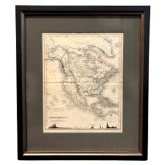
1846 "North America" Map, Engraved by I. Dower
Located in Colorado Springs, CO
Presented is an original 1846 map of “North America.” The map was drawn and engraved by I. Dower and published in London by Orr & Company. The map depicts North America, to include G...
Category
English Victorian Antique 1610s Maps
Materials
Paper
Miniature Iron Maiden of Nuremberg
Located in Hanover, MA
Miniature "Iron Maiden" in blackened cast metal attached to its original round wood base. The front doors are pin-hinged and open to reveal pointed spikes. At base of doors is printe...
Category
German Gothic Antique 1610s Maps
Materials
Iron
Georgian Oak Miniature Chest of Drawers
Located in Bedfordshire, GB
An extremely attractive and very good quality late 18th century, Georgian, oak miniature chest, having well figured rectangular top, over two short and three long drawers retaining original turned wooden knobs, flanked by elegant half turned columns, raised on elegant original shaped bracket feet.
A beautifully charming little piece of 18th century miniature furniture, constructed from rich, warm oak timbers which retain an exceptional colour and patina, it boasts original handles and feet. Almost certainly it was made as a sample piece of furniture originally.
There is regular debate over whether miniature furniture was made as an apprentice piece, which is when a craftsmen who was looking for a job at a workshop would create something to showcase their talents. Or whether it was made as a travelling salesman...
Category
English Georgian Antique 1610s Maps
Materials
Oak
Original Antique Map or City Plan of Rome, Italy. Circa 1835
Located in St Annes, Lancashire
Nice map of Rome
Drawn and engraved by J.Dower
Published by Orr & Smith. C.1835
Unframed.
Free shipping
Category
English Antique 1610s Maps
Materials
Paper
Victorian Miniature Mahogany Bowfront Chest Of Drawers
Located in Bedfordshire, GB
An Attractive And Elegant Mid 19th Century, Victorian Period, Mahogany Bowfront Miniature Mahogany Chest, Having Very Well Figured Top, Over Two Short And Two Long Drawers Retaining ...
Category
English Victorian Antique 1610s Maps
Materials
Mahogany
$1,888 Sale Price
30% Off
H 14.5 in W 12.75 in D 7.25 in
Miniature Antique Miniature Marquetry Desk
Located in New York, NY
Miniature antique miniature marquetry desk. Measure: 8.75" H.
Category
1610s Maps
Materials
Wood
Antique Map of Eastern Hemisphere from the collection of Thierry Despont
Located in New York, NY
Designed by Enrico Bonetti (E. Bonatti) and published by Francesco Vallardi Editore. Based on an earlier map by Evangelista Azzi (Ev. Azzi). Labeled as such at bottom edge of map.
T...
Category
Italian Antique 1610s Maps
Materials
Canvas, Wood
$3,500
H 92 in W 95 in D 1 in
Letter signed by the Count of Floridablanca – 1786
Located in Madrid, ES
Rare historical document: handwritten letter signed in 1786 by José Moñino y Redondo, better known as the Count of Floridablanca, a prominent 18th-century Spanish political figure an...
Category
Spanish Other Antique 1610s Maps
Materials
Paper
Miniature Painted Italian Chest of Drawers
Located in West Palm Beach, FL
Miniature hand painted five drawer chest.
Category
Italian 1610s Maps
Materials
Wood, Paint
Weapon Keris Ukurian Ceremonial Sword Dagger, Southeast Asia Indonesia, 20th C.
Located in Amsterdam, Noord Holland
20th c Weapon Keris Ukurian Ceremonial Sword Dagger Southeast Asia Indonesia.
Additional information:
Material: Bronze & Metal, Wood / Bamboo
Region of Origin: India/Indonesia
Perio...
Category
Indonesian 1610s Maps
Materials
Bronze
Superb Large India Silver Tribal Necklace Gujarat Vintage Asian Tribal Jewellery
Located in London, GB
A superb large Indian Tribal silver necklace from the Gujarat region with large ornate central silver medallion with turquoise and coral beads
Weight 400 grams
Category
Indian 1610s Maps
Materials
Silver
$879
H 3.55 in W 11.82 in D 0.4 in
Previously Available Items
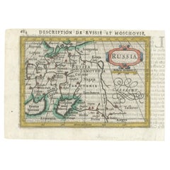
Early 17th Century Dutch Miniature Antique Map of The Russian Empire, 1616
Located in Langweer, NL
This rare miniature map of Russia covers the Russian Empire in Eastern Europe and is embellished with a strapwork title cartouche. The map extends north to include the tip of Nova Semla, and south to the Black and Caspian Seas, which are depicted with rudimentary shapes. The geography is limited to key cities...
Category
Antique 1610s Maps
Materials
Paper
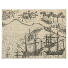
Rare Small Engravings of the Dutch Siege of Malacca in 1606, Published in 1614
Located in Langweer, NL
The siege of Malacca of 1606 was a military engagement between a Dutch force commanded by Cornelis Matelief and the Portuguese commander André Furtado de Mendonça. One on engraving w...
Category
Antique 1610s Maps
Materials
Paper
H 4.5 in W 5.9 in D 0.002 in
