1830s Maps
to
30
61
4
65
2
2,974
2,230
473
3
288
34
9
126
8
36
9
2
5
4
3
2
65
2
2
17
17
17
3
3
65
65
65
Period: 1830s
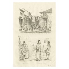
Old Street View in Guangzhou 'Canton' and Inhabitants of Guangzhou, China, 1834
Located in Langweer, NL
Antique print titled 'Une Rue de Canton - Barbier - Habitans de Canton'.
View of a street in Guangzhou (Canton) and inhabitants of Guangzhou, also includes a small image of a Chinese barber...
Category
Antique 1830s Maps
Materials
Paper
$113 Sale Price
20% Off
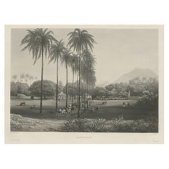
Rare Chine-collé Aquatint of Banyuwangi, East Java, Indonesia, 1835
Located in Langweer, NL
Antique print titled 'Banjowangui'. Chine-collé aquatint of Banyuwangi, Java, Indonesia. Originates from the series 'Voyage autour du monde par les mers de l'In...
Category
Antique 1830s Maps
Materials
Paper
$745 Sale Price
20% Off
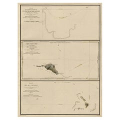
Map of the Laughlan Islands, Rossel Island & Reef North of New Caledonia, 1833
Located in Langweer, NL
Antique map titled 'Plan de l'extremite septentrionale du Recif de D'entrecasteaux. Carte Particuliere d'un partie de l'Ile Rossel (Louisiade). Plan des Iles Laughlan.'
Map of th...
Category
Antique 1830s Maps
Materials
Paper
$424 Sale Price
20% Off
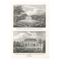
Residence of English missionaries in Hihifothe & Tomb of Tongamana, Tonga, 1836
Located in Langweer, NL
Antique print titled 'Grabmal des Häuptlings Tongamana' and 'Wohnung der Englischen Missionairs in Hifo'.
Old print with two views, the upper image depicts the tomb of Tongamana. The lower image depicts a residence of an English missionary in Hihifo. This print originates from 'Entdeckungs, Reise der Franzosischen Corvette Astrolabe Unternomen auf Befehl Konig Karls...
Category
Antique 1830s Maps
Materials
Paper
$339 Sale Price
20% Off
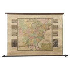
"The United States from the Latest Authorities" Antique Wall Map, 1835
Located in Colorado Springs, CO
This is a 1835 map of “The United States from the Latest Authorities” by Ezra Strong. A hand-colored engraved wall map of the eastern half of the United States, this map has a large inset of the "Oregon District" and several engraved city views and two portraits.
The primary map extends to Mexico Texas and the Missouri Territory, showing the course of the Missouri River to Ft. Mandan and Old Ft. Mandan, and noting many forts along the river. The territories to the east of Missouri Territory are separately delineated as Sioux District and Huron District. The western details of the map are very good for a map of this time period, with many Native American settlements, villages, forts and other details noted.
The map is bordered with vignettes of Boston, New York, Philadelphia, Hartford, Cincinnati, and Baltimore. Each vignette notes the date settled, primary settler, and the population as of 1830. Two portraits of LaFayette and George Washington are presented in full length with related biographical information.
A large inset map at lower right shows the Oregon District, centered on the Columbia River and extending to the Rocky Mountains. This is one of the earliest commercial appearances of a separate map of Oregon...
Category
American Antique 1830s Maps
Materials
Paper
