1870s Maps
to
14
25
2
27
2,975
2,239
474
3
289
34
9
126
8
36
9
2
5
4
3
2
27
7
7
7
2
1
27
27
27
Period: 1870s
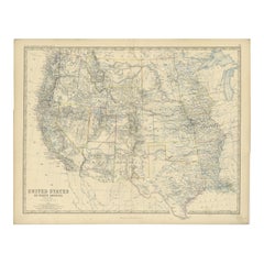
1874 Map of Western United States – Detailed Atlas by Keith Johnston
Located in Langweer, NL
1874 Map of Western United States by Keith Johnston – Detailed Atlas
This is an original antique map titled “United States of North America (Western States)” by Alexander Keith John...
Category
Scottish Antique 1870s Maps
Materials
Paper
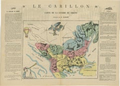
1877 Satirical Map of the Eastern War: Europe's Powers as Caricatured Characters
Located in Langweer, NL
Title: 1877 Caricature Map of the Eastern War - "Carte de la Guerre en Orient" by H. Demare
Description: This 1877 satirical map, titled "Carte de la Guerre en Orient," was publis...
Category
Antique 1870s Maps
Materials
Paper
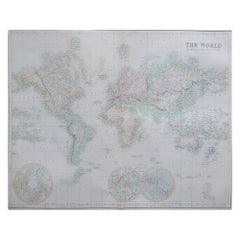
Large Original Antique Map of the World, Fullarton, circa 1870
Located in St Annes, Lancashire
Great map of the World.
From the celebrated Royal Illustrated Atlas
Lithograph. Original color.
Published by Fullarton, Edinburgh, circa 1870.
Unframed.
Category
Scottish Antique 1870s Maps
Materials
Paper
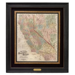
1873 "Map of the States of California and Nevada" by Chas. Drayton Gibbes
Located in Colorado Springs, CO
Presented is Warren Holt and Charles Drayton Gibbes' 1873 “Map of California and Nevada.” This map is considered to be one of the finest large-scale ...
Category
American Antique 1870s Maps
Materials
Paper
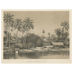
Old Print of a Mosque in a Kampung Java or Village of Javanese, Indonesia, 1874
Located in Langweer, NL
Antique print titled 'Missigit in Kampong Djawa'.
Antique print depicting a scene in Indonesia. Originates from 'De Oorlog tusschen Nederland en Atchin' by G.L. Klepper.
Artis...
Category
Antique 1870s Maps
Materials
Paper
$249 Sale Price
20% Off
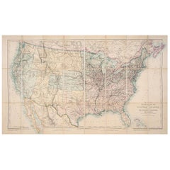
1876 Map of the United States: Detailing the Railroads and Unsettled Territories
Located in Langweer, NL
Stanford’s Smaller Railway Map of the United States, 1876
This original 1876 map, titled "Stanford's Smaller Railway Map of the United States Distinguishing the Unsettled Territorie...
Category
Antique 1870s Maps
Materials
Paper
Antique Map of the Antilles and Central America – 1872
Located in Langweer, NL
Title: Antique Map of the Antilles and Central America – 1872
Description:
This finely detailed antique map, titled Antilles et Amérique Centrale, was published in 1872 under t...
Category
Antique 1870s Maps
Materials
Paper
1874 Map of the United States with Territorial Boundaries
Located in Langweer, NL
Title: 1874 Map of the United States with Territorial Boundaries
Description: This is an 1874 map titled "Map of the United States," showcasing the country during a period of rapid ...
Category
Antique 1870s Maps
Materials
Paper
$249 Sale Price
20% Off
Steel Engraving of Haddon Hall, River Wye, Bakewell, Derbyshire, England, 1875
Located in Langweer, NL
Antique print titled 'The Terrace, Haddon Hall'.
Steel engraving of the terrace of Haddon Hall. Haddon Hall is an English country house on the River Wye ...
Category
Antique 1870s Maps
Materials
Paper
$172 Sale Price
20% Off
1876 Antique Map of New York State with Niagara and Hudson River Insets
Located in Langweer, NL
Title: Detailed Map of New York State - 1876 by Samuel Augustus Mitchell Jr.
Description: This is a hand-colored map of the state of New York from 1876, created by Samuel Augustus ...
Category
Antique 1870s Maps
Materials
Paper
$210 Sale Price
20% Off
Decorative Print of Costumes of Hungary, England, Germany Holland Etc., C.1875
Located in Langweer, NL
Antique costume print including many different costumes including costumes of Hungary, Holland and others. This print originates from 'Blätter für Kostümkunde. Historische und Volks-...
Category
Antique 1870s Maps
Materials
Paper
$210 Sale Price
20% Off
Antique Map of French Colonies – La France, 19th Century
Located in Langweer, NL
Title: Antique Map of French Colonies – La France, 19th Century
Description: This antique 19th-century map, titled La France, presents a detailed depiction of France’s overseas c...
Category
Antique 1870s Maps
Materials
Paper
Large Original Antique Map of The Pacific Ocean, Fullarton, C.1870
Located in St Annes, Lancashire
Great map of The Pacific Ocean
From the celebrated Royal Illustrated Atlas
Lithograph by Swanston. Original color.
Published by Fullarton,...
Category
Scottish Antique 1870s Maps
Materials
Paper
Northern Australia Map with The Routes of Explorers Ringwood and McMinn, 1878
Located in Langweer, NL
Antique map titled 'Neue Aufnahmen in Nord-Australien'.
Old map of Northern Australia showing the 'new routes' of the exploration of Ringwood and McMinn. Covers as far east as pa...
Category
Antique 1870s Maps
Materials
Paper
$124 Sale Price
20% Off
Old Original Antique German Map of North America, ca.1870
Located in Langweer, NL
Antique map titled 'Nord-America'.
Old map of North America. This map originates from 'H. Kiepert's Kleiner Atlas der Neueren Geographie für Schule und Haus'.
Artists and Engrave...
Category
Antique 1870s Maps
Materials
Paper
$469 Sale Price
20% Off
Old Prints of Costumes of Hungary, Tyrol, Sweden, Romania, Holland, Etc., Ca1875
Located in Langweer, NL
Antique costume print including many different costumes including costumes of Hungary, Tyrol, Sweden and others.
This print originates from 'Blätter für Kostümkunde. Historische ...
Category
Antique 1870s Maps
Materials
Paper
$210 Sale Price
20% Off
Large Original Antique Map of The World, Fullarton, C.1870
Located in St Annes, Lancashire
Great map of the World. Showing both hemispheres
From the celebrated Royal Illustrated Atlas
Lithograph. Original color.
Published by Fullarton, Edinburgh, C.1870
Unframed.
Rep...
Category
Scottish Antique 1870s Maps
Materials
Paper
Old German Map of the Austrian Empire, ca.1870
Located in Langweer, NL
Antique map titled 'Kaiserthum Österreich'.
Old map of the Austrian Empire. This map originates from 'H. Kiepert's Kleiner Atlas der Neueren Geographie für Schule und Haus'.
Arti...
Category
Antique 1870s Maps
Materials
Paper
$277 Sale Price
20% Off
Original Antique Decorative Map of Iceland & Faroe, Fullarton, C.1870
Located in St Annes, Lancashire
Great map of Iceland and The Faroe Islands
Wonderful figural border
From the celebrated Royal Illustrated Atlas
Lithograph. Original color.
Published by Fullarton, Edinb...
Category
Scottish Antique 1870s Maps
Materials
Paper
Old Map of the Pacific, Incl Australia, Polynesia, Melanesia and Malaysia, 1872
Located in Langweer, NL
Antique map Oceania titled 'Map of Oceanica exhibiting its various divisions, island groups & c'.
Map of the Pacific, including Australia, Polynes...
Category
Antique 1870s Maps
Materials
Paper
$182 Sale Price
20% Off
Original Antique Decorative Map of South America-West Coast, Fullarton, C.1870
Located in St Annes, Lancashire
Great map of Chili, Peru and part of Bolivia
Wonderful figural border
From the celebrated Royal Illustrated Atlas
Lithograph. Original color.
Published by Fullarton, Edi...
Category
Scottish Antique 1870s Maps
Materials
Paper
1873 Martha's Vineyard and Nantucket Chart
Located in Norwell, MA
Original chart of Nantucket and Martha's Vineyard by George Eldridge, Cartographer, 125 State Street, Boston. Dated 1873. Mounted to canvas. Also showing the coast of Cape Cod includ...
Category
North American Antique 1870s Maps
Materials
Paper
Nice Antique Asian Village View in Aceh, Sumatra, Indonesia, 1874
Located in Langweer, NL
Antique print Indonesia titled 'Fort en Dorp Pedir, ten oosten van de hoofdstad Atchin gelegen'. Antique print depicting a scene in Indonesia. Originates from 'De Oorlog tusschen Ned...
Category
Antique 1870s Maps
Materials
Paper
$229 Sale Price
20% Off
Map of the Dutchy of Holstein and the Territories of Hamburg & Lübek, 1875
Located in Langweer, NL
Title: Map of the Dutchy of Holstein and the Territories of Hamburg & Lübek by James Wyld, ca. 1875
Description: This is an antique map titled "A Map of the Dutchy of Holstein, with...
Category
Antique 1870s Maps
Materials
Paper
$900 Sale Price
20% Off
Western Hemisphere - 1876 Edition by Adolf Stieler, Published by Justus Perthes
Located in Langweer, NL
Map titled "Westliche Halbkugel" (Western Hemisphere), is a copperplate engraving from 1876 by Adolf Stieler, a renowned German cartographer. Here's an expanded analysis based on the...
Category
Antique 1870s Maps
Materials
Paper
$229 Sale Price
20% Off
Large Original Antique Map of Java and Borneo, Fullarton, C.1870
Located in St Annes, Lancashire
Great map of Java and Borneo
Wonderful figurative borders
From the celebrated Royal Illustrated Atlas
Lithograph. Original color.
Published by Fullarton, Edinburgh. C.1870
Unfr...
Category
Scottish Antique 1870s Maps
Materials
Paper
The Costumes of Germany, Bohemia & Austria; Wedding Crowns, Jewellery etc., 1870
Located in Langweer, NL
Antique print, titled: 'Brautkronen, Rosenkranz (..).'
This original antique print shows the costumes of Germany, Bohemia and Austria; wedding crowns, jewellery etc . This origin...
Category
Antique 1870s Maps
Materials
Paper
$249 Sale Price
20% Off
Related Items
Manly P Hall, the Secret Teachings of All Ages, First Edition Book & 4 Prints
By TASCHEN
Located in Los Angeles, CA
The classic encyclopedia of the arcane in an expanded edition.
Renowned philosopher and lecturer Manly P. Hall’s masterful encyclopedia of ancient symbols, hidden rituals, and arcane practices has remained a classic since first published in 1928. Hall’s densely detailed writings explore topics ranging from Hermeticism to Tarot, Egyptian mythology to Pythagorean theory. Each chapter is accompanied by the vivid illustrations of artist J. Augustus Knapp, with additional images by Mihran Serailian found in the companion volume, each taking their own unique approach to nearly 60 artworks depicting occult subject matter.
The initial concept for what became known as Hall’s “Great Book”, first began in 1923 when the young Los Angeles-based orator began a months-long trip around the globe. Circumnavigating by ship, Hall visited Egypt, China and India, immersing himself in the philosophical and religious history of each country. Upon his return he spent the next five years penning his massive compendium of philosophy and myth.
Nearly a century after its release, this iconic masterwork has been reproduced for the first time from the rare and extravagant original edition. This meticulously-restored version of Hall’s “Great Book” is also accompanied by an expansive companion book, featuring condensed summaries of each chapter of The Secret Teachings, alongside newly-discovered artworks, rare photography...
Category
1870s Maps
Materials
Foil
$500 / item
H 18.7 in W 13.2 in D 3 in
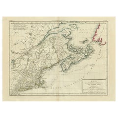
Antique Map of the Northeastern United States and Canada by Tardieu, 1802
Located in Langweer, NL
This antique map titled "Carte de la Partie Septentrionale des Etats Unis," created by Pierre Antoine Tardieu, depicts the northeastern part of the United States and parts of Canada....
Category
Antique 1870s Maps
Materials
Paper
$538 Sale Price
20% Off
H 16.34 in W 22.25 in D 0.01 in
Antique Map of Part of the United States Including Lower California & Arizona
Located in Langweer, NL
Antique map of part of the United States of America including Lower California, Arizona and part of Mexico. This map was part of a set of six individual sheets with maps of the Unite...
Category
Antique 1870s Maps
Materials
Paper
$421 Sale Price
20% Off
H 15.08 in W 18.75 in D 0.02 in
Small Map of the United States
Located in Langweer, NL
Antique map titled 'Amérique septe. Physique'. Small map of the United States. lithographed by C. Callewaert brothers in Brussels circa 1870.
Category
Antique 1870s Maps
Materials
Paper
Antique Map of California, Utah, Nevada, Colorado, New Mexico & Arizona '1872'
Located in Langweer, NL
Antique map titled 'Johnson's California (..)'. Original map of California, Utah, Nevada, Colorado, New Mexico and Arizona. This map originates from ...
Category
Antique 1870s Maps
Materials
Paper
$239 Sale Price
20% Off
H 18.12 in W 26.38 in D 0.02 in
Rhodes, James Ford, History of the United States, 7 Vols, in a Fine Binding
Located in Hillsborough, NJ
AUTHOR: RHODES, James Ford.
TITLE: History Of The United States From The Compromise of 1850 To The Final Restoration Of Home Rule At The South In 1877.
PUBLISHER: NY: The Macm...
Category
American Vintage 1870s Maps
Materials
Leather
$1,250 / set
H 8.69 in W 6.25 in D 2 in
Antique Map of The United States of North America, Pacific States, 1882
Located in Langweer, NL
The map is from the same 1882 Blackie Atlas and focuses on the Pacific States of the United States of America during that period. Here are some details and historical context about t...
Category
Antique 1870s Maps
Materials
Paper
$240 Sale Price
20% Off
H 14.97 in W 11.03 in D 0 in
Collection of 18 Prints of Musical Instruments from Gabinetto Armonico, 1722
Located in valatie, NY
A collection of 18 framed prints from engravings of musical instruments from the book by Gabinetto Armonico, which was published in 1722. The book had a total of 150 instruments. The...
Category
Italian Baroque Antique 1870s Maps
Materials
Paper
$2,750 / set
H 16.5 in W 13.5 in D 1 in
Set of 2 Antique Maps of the United States by W. G. Blackie, 1859
Located in Langweer, NL
Antique map titled 'The United States of North America, Atlantic States and Valley of the Mississippi'. Original antique map of the United States of North America, Atlantic States an...
Category
Antique 1870s Maps
Materials
Paper
$383 Sale Price / set
20% Off
H 14.57 in W 21.26 in D 0.02 in
1839-1877 The Works of Charles Dickens
Located in Bath, GB
A beautiful and very clean and bright set of works by renowned author Charles Dickens. In a tree calf Mansell binding.
Five volumes. From the renowned English writer and social crit...
Category
British Antique 1870s Maps
Materials
Paper
Antique Map of the United States by Titus '1871'
Located in Langweer, NL
Antique map titled 'The United States of America'. Original antique map of the United States. This map originates from 'Atlas of Prebl...
Category
Antique 1870s Maps
Materials
Paper
$768 Sale Price
20% Off
H 16.54 in W 26.78 in D 0.02 in
Three Centuries of American Prints: from the National Gallery of Art, Exhib. Cat
Located in valatie, NY
Three Centuries of American Prints: From the National Gallery of Art
by Judith Brodie, Amy Johnston and Michael J. Lewis. Publisher Thames & Hudson Lt...
Category
American 1870s Maps
Materials
Paper
$95
H 11.75 in W 9.75 in D 1.5 in
Previously Available Items
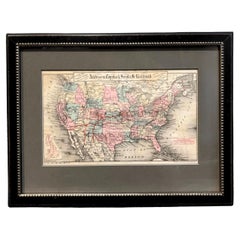
1879 Map of the United States, Showing the Santa Fe Railroad by GW & CB Colton
By G.W. & C.B. Colton
Located in Colorado Springs, CO
Presented is an original "General Map of the United States Showing the Lines of the Atchison, Topeka & Santa Fe Railroad and Its Connections with the Sea Ports". Undated, this map wa...
Category
American High Victorian Antique 1870s Maps
Materials
Paper
H 9.75 in W 12.88 in D 0.63 in
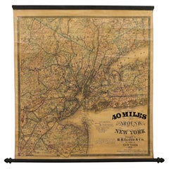
1870 "40 Miles Around New York" by H. H. Lloyd, Hanging Map on Original Rollers
Located in Colorado Springs, CO
This is an antique hanging map, “40 Miles Around New York,” published by H. H. Lloyd in New York in 1870. Presented on its original wooden rollers, this small-scale lithographed wall map is centered on Manhattan and its surrounding counties. Throughout the map, the counties are colored and the towns and cities well labeled. A reference key in the bottom margin provides symbols for railroads, railroad stations, proposed railways, aqueducts and canals, cemeteries, blacksmith shops, wheelwrights, grist mills, and sawmills. This map is especially notable for the countless railway lines and stations depicted, with distances in miles noted between stations. Lloyd’s “40 Miles Around New York” was first issued in 1867 as a folding pocket map.
This map offers interesting insight about the map trade of the times, revealing the competitive nature of print publishing. In the lower margin, Lloyd warns customers of another, similar sounding named map business, presumably map dealer and known rival J. T. Lloyd. He states, “reasons that are well known to many compel us to state that we have no relationship and never had any business connection whatever with another party who advertises ‘Lloyds Maps.’” He also reminds his customers against potential fraud, stressing “We do not collect money in advance for Maps which have never been, and can never be, published. Our agents are not allowed to collect before delivery in any case.”
Henry Huggins Lloyd was born in Blandford, Massachusetts, in 1828. With his brothers, James Lloyd and Myron Lloyd, he worked as H. H. Lloyd & Co., mapmakers and maps publishers based in New York City. H. H. Lloyd & Co. had an impressive map output, especially during the Civil War. He issued maps of coastal cities and harbors, military maps of the northern and southern states, maps of key battle states like Virginia and New York, as well as larger United States maps...
Category
American Late Victorian Antique 1870s Maps
Materials
Linen, Wood, Paper
H 31 in W 28.75 in D 1 in
1877 General Geological Map of Colorado by F. V. Hayden
Located in Colorado Springs, CO
Offered is an original “General Geological Map of Colorado” by F. V. Hayden. The map was printed as part of the 1877 “Geological and Geographical Atlas of Colorado and Portions of Ad...
Category
American Antique 1870s Maps
Materials
Paper
1879 "United States of America, Western Part" by O. J. Stuart
Located in Colorado Springs, CO
This colorful original map, titled “United States of America, Western Part,” was issued in Volume 16 of “The American Cyclopædia.” A detailed reference map, the map was printed in co...
Category
American Antique 1870s Maps
Materials
Paper
1875 "North America" Map by J. Bartholomew
Located in Colorado Springs, CO
Presented is an original 1875 map of “North America.” The map was issued in Volume 1 of the Ninth Edition of the Encyclopædia Britannica, published in Edinburgh. The map was drawn by famous Scottish mapmaker John Bartholomew. The map depicts North America, to include Greenland, the Dominion of Canada, the United States, Mexico, the countries of Central America, and the islands of the West Indies. Prominent rivers, mountain ranges, and cities are labeled on the map, and country borders are emphasized in red.
The Encyclopædia Britannica has been published continuously since 1768, appearing in fifteen official editions. The landmark ninth edition of the Encyclopædia Britannica, often called "the Scholar's Edition," was published from January 1875 to 1889 in 25 volumes. The editor and author of the “Foreword” was Thomas Spencer Baynes, the first English-born editor after a series of Scots. After 1880, Baynes was assisted by William Robertson Smith. The 9th edition is often lauded as a high point among early editions for scholarship.
The 9th edition was far more luxurious than any previously printed Encyclopædia Britannicas, with thick boards and quality leather bindings, premier paper, and a production which took full advantage of the technological advances of printing in the years between the 1850s and 1870s. The publishers took advantage of the new ability to print large graphic illustrations on the same pages as the text, as opposed to limiting illustrations to separate copper plate engravings. Although this technology had first been used in a primitive fashion the 7th edition, and to a much lesser extent in the 8th, in the 9th edition there were thousands of quality illustrations and maps set...
Category
Scottish Antique 1870s Maps
Materials
Paper
Antique Map of Asia Showing Political Divisions & Routes of Travel, 1874
Located in Langweer, NL
Antique map titled 'Map of Asia showing its Gt. Political Divisions and also the various routes of Travel between London & India, China & Japan & c'.
This map covers from the Ara...
Category
Antique 1870s Maps
Materials
Paper
Antique Map of the United States from an Old Dutch School Atlas, 1873
Located in Langweer, NL
Description: Antique map titled 'De Vereenigde Staten Noord-Amerika'. Old map depicting the United States. This map originates from 'School-Atlas van alle Deelen der Aarde'.
Arti...
Category
Antique 1870s Maps
Materials
Paper
Detailed Antique Map of Texas and Indian Territory, 1875
Located in Langweer, NL
Description: Antique map titled 'Gray's New Map of Texas and the Indian Territory'. Detailed map of Texas and Indian Territory, colored by counties, from ...
Category
Antique 1870s Maps
Materials
Paper
Large Original Antique Map of Switzerland, Fullarton, C.1870
Located in St Annes, Lancashire
Great map of Switzerland
From the celebrated Royal Illustrated Atlas
Lithograph. Original color.
Published by Fullarton, Edinburgh. C.1870
Repair to a small edge tear on...
Category
Scottish Antique 1870s Maps
Materials
Paper
Large Original Antique Map of Texas, United States &c. Fullarton, C.1870
Located in St Annes, Lancashire
Great map of Texas. Also showing Indian Territory, Arkansas, Louisiana etc
From the celebrated Royal Illustrated Atlas
Lithograph by Swanston. O...
Category
Scottish Antique 1870s Maps
Materials
Paper
H 18.5 in W 22.5 in D 0.07 in
Large Original Antique Map of British Columbia & Vancouver, Fullarton, C.1870
Located in St Annes, Lancashire
Great map of British Columbia
From the celebrated Royal Illustrated Atlas
Lithograph by Swanston. Original color.
Published by Fullarton, Edin...
Category
Scottish Antique 1870s Maps
Materials
Paper
H 18.5 in W 22.5 in D 0.07 in
Large Original Antique Map of Africa, Fullarton, C.1870
Located in St Annes, Lancashire
Great map of Africa
From the celebrated Royal Illustrated Atlas
Lithograph by Swanston. Original color.
Published by Fullarton, Edinburgh. C.1870
Repairs to minor edge t...
Category
Scottish Antique 1870s Maps
Materials
Paper
