1910s Maps
to
1
6
4
10
1
1
2,929
2,257
475
3
290
34
10
126
10
37
9
2
5
4
3
3
8
3
2
2
1
6
6
1
1
1
10
10
10
1
1
1
1
1
Period: 1910s
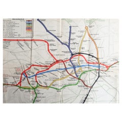
Original Antique Map of The London Underground. 1911
Located in St Annes, Lancashire
Superb map of The London Underground
Published by Ward Lock, 1911
Folding map. Printed on paper
Unframed.
Good condition/ Minor repair to an edge tear on right edge ( shown in ...
Category
English Vintage 1910s Maps
Materials
Canvas, Paper
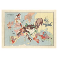
WWI Satirical Cartoon Map: 'Kill That Eagle' by J.H. Amschewitz, 1914
Located in Langweer, NL
This fascinating serio-comic map was created by John Henry Amschewitz and published in December 1914, at the beginning of WWI.
Amschewitz was a British born artist who was unable to enlist for war service due to an injury he sustained while working on a mural project in Liverpool. Instead Amschewitz focused on his interests in art and theater, themes which are apparent in this map and even the title itself: European Revue.
The eagle refers of course to Germany, which has its claw on Marianne's bayonet, while its other claw is being pulled by the Russian bear...
Category
Vintage 1910s Maps
Materials
Paper
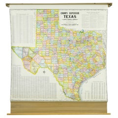
1850-1960 Cram's Superior Latest Federal Census Texas Map
By G. F. Cram Company
Located in New York, NY
The 1850-1960 Cram's Superior Latest Federal Census Texas Map, crafted from pine wood, steel, and canvas, is a valuable historical cartographic piece. Publi...
Category
American Vintage 1910s Maps
Materials
Canvas
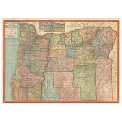
Colorful 1915 Road Map of Oregon with Portland Inset & Index – Geographical Pub.
Located in Langweer, NL
Colorful 1915 Road Map of Oregon with Portland Inset & Index – Geographical Pub.
Description:
This vibrant and information-rich folding map of Oregon, titled "Premier Series Oregon"...
Category
Vintage 1910s Maps
Materials
Paper
Rare and Early Plaster Relief Map of Adirondack Mountains by F J H Merrill
By P.F. Howells, E. W. Merrill
Located in Buffalo, NY
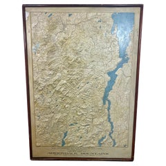
Rare and Early Monumental Plaster Relief Map of Adirondack Mountains by The University of the State of New York, New York State Museum..F J H Merrill director,,,modeled by Howell's ...
Category
American Industrial Vintage 1910s Maps
Materials
Plaster, Wood
1917 "New Hudson River Map" by Wallace Bruce, Later Edition, Folding Map
Located in Colorado Springs, CO
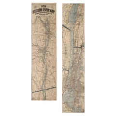
Presented is a 1917 printing of “New Hudson Map” by Wallace Bruce. The map was published by Bryant Union Publishing Co., in New York City. The map is a later edition, issued in a distinct strip-chart format that is over 100 inches long. The map includes amazing detail, compiled mostly from U.S. Coast Survey data. It is drawn on a scale of 1.5 miles per inch, allowing ample space for it to show historical landmarks, landings, islands, list prominent residents, and more. The verso is filled with related text and illustrations about the Hudson River valley. The map folds into cream paper wrappers, titled "Hudson River Map...
Category
American Beaux Arts Vintage 1910s Maps
Materials
Paper
Large Sea Chart of the British Islands, 1918
Located in Langweer, NL
Antique map titled 'The British Islands'.
Large sea chart of the British Islands. It shows Ireland, Scotland, England, the Shetland Islands and part of Fra...
Category
Vintage 1910s Maps
Materials
Paper
$529 Sale Price
20% Off
1915 "San Francisco City and County" Hanging Map by W. Bashford Smith
Located in Colorado Springs, CO
Presented is a rare wall map of San Francisco by W. Bashford Smith. Published in San Francisco in 1915, this map indicates streets and city districts, and, most notably, shows the si...
Category
American Art Deco Vintage 1910s Maps
Materials
Wood, Paper
1912 "Panoramic View of New York City and Vicinity" by Jacob Ruppert
Located in Colorado Springs, CO
This is an attractive and very scarce map of New York, published by the Yorkville brewer Jacob Ruppert in 1912. The map shows an expansive view of the region reaching from Sandy Hook in the south and Yonkers to the north, to Hicksville in the east and past Newark to the west. This beautifully colored birds eye view shows waterways with all shipping traffic, boroughs, and clearly labeled railroad routes. It is presented on period dowels and backed on its original linen.
Jacob Ruppert was born in New York City in 1842 to Bavarian immigrants. His father owned a brewery in Manhattan where young Jacob learned the business of brewing. In 1862, Jacob established the Jacob...
Category
American Vintage 1910s Maps
Materials
Paper
1918 American Frohse Anatomical Chart, A. J. Nystrom, Max Brodel Illustrator
By Max Brödel, A.J. Nystrom & Co
Located in Buffalo, NY
Antique American Frohse Anatomical pull down chart, by A. J. Nystrom, ,revised and augmented by Max Brodel illustrator... Amazing color, patina, age appropriate wear. dated 1918..
Max (Paul Heinrich) Brödel
1870-1941
Brödel, an illustrator and the first director of the Art as Applied to Medicine program at Johns Hopkins...
Category
American Steampunk Vintage 1910s Maps
Materials
Wood, Paper
Related Items
Large Antique Map of the State of Texas, 1861
Located in Langweer, NL
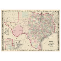
Antique map titled 'Johnson's New Map of the State of Texas' Large map of Texas, shows railroads, wagon roads, the U.S. Mail Route, rivers, ports, ...
Category
American Antique 1910s Maps
Materials
Paper
Signature Dishes That Matter
Located in New York, NY
A global celebration of the iconic restaurant dishes that defined the course of culinary history over the past 300 years
Today's food-lovers often travel the globe to enjoy the foo...
Category
European 1910s Maps
Materials
Paper
1846 "North America" Map, Engraved by I. Dower
Located in Colorado Springs, CO
Presented is an original 1846 map of “North America.” The map was drawn and engraved by I. Dower and published in London by Orr & Company. The map depicts North America, to include G...
Category
English Victorian Antique 1910s Maps
Materials
Paper
Antique Map of Principality of Monaco
Located in Alessandria, Piemonte
ST/619 - "Old Geographical Atlas of Italy - Topographic map of ex-Principality of Monaco" -
ediz Vallardi - Milano -
A somewhat special edition ---
Category
Italian Other Antique 1910s Maps
Materials
Paper
Antique Map of Venezuela by Montanus, 1671
Located in Langweer, NL
Antique map titled 'Venezuela cum parte Australi Novae Andalusiae'. The map extends from Coquibocoa to the Orinoque River, centered on Bariquicemento and Cape de Curiacao. Large cart...
Category
English Antique 1910s Maps
Materials
Paper
Bruce Weber by Bruce Weber, 1st Limited Edition
Located in valatie, NY
Bruce Weber by Bruce Weber. Published by Twelvetrees Press, Los Angeles, 1983. Stated 1st Limited Edition (1/5000) hardcover with dust jacket. Beautifully illustrated with over 50 full-page photogravure plates of male models and actors, a few tinted with halftone colors. Contains subjects: Brothers, Matt...
Category
American Vintage 1910s Maps
Materials
Paper
Rare Antique Map of Southwestern Europe and West Africa by V.M. Coronelli, 1692
Located in Langweer, NL
Antique Globe Gore: Southwestern Europe and West Africa by Vincenzo Coronelli
This exquisite, hand-colored globe gore by Vincenzo Coronelli, one of the most renowned 17th-century cartographers, represents Southwestern Europe and West Africa. A segment of Coronelli's monumental 42-inch terrestrial globe, this gore is a remarkable example of the artistry and geographical knowledge of the late 1600s. Covering France, the Iberian Peninsula, and all of Africa west of a line extending from Algeria to the Bight of Benin, it also includes the Canary Islands and Madeira.
Coronelli’s globe gores are celebrated for their exceptional engraving and accuracy, and this piece is no exception. The coastline of Africa is depicted with remarkable precision for its time, reflecting the latest geographical knowledge of European explorers. In contrast, the interior of Africa—still a mystery to European mapmakers—features mythical elements such as fantastical mountain ranges and exotic fauna. Giraffes, elephants, lions, and mysterious giant birds populate the landscape, offering a glimpse into the imagination and curiosity of the era. One notable detail is the Gambia...
Category
Antique 1910s Maps
Materials
Paper
$2,315 Sale Price
20% Off
H 19.3 in W 13.59 in D 0.02 in
Texas California Mexico Map – Antique Tallis Map with Gold Region, c.1850
Located in Langweer, NL
Texas California Mexico Map – Antique Tallis Map with Gold Region, c.1850
This highly decorative and historically rich map titled 'Mexico, California and Texas' was published around...
Category
Antique 1910s Maps
Materials
Paper
$791
H 10.44 in W 13.78 in D 0.02 in
Vintage Cram’s Imperial 12 Inch Teaching World Globe 20thC
Located in Big Flats, NY
Vintage Cram’s Imperial 12 Inch Teacher's World Globe 20thC.
Measures - 17"H x 13.25"W x 13.5"D.
A vintage Cram’s Imperial 12-inch world globe from the 20th century. This globe...
Category
1910s Maps
Materials
Paper
$200 Sale Price
20% Off
H 17 in W 13.25 in D 13.5 in
Modernism: Designing a New World 1914-1939 by Christopher Wilk
Located in valatie, NY
Modernism: Designing a New World 1914-1939 by Christopher Wilk. Victoria & Albert Museum, 2010. Hardcover with dust jacket. "Modernism: Designing a New World" is the first book to ex...
Category
English 1910s Maps
Materials
Paper
Princess Mary Box, WWI Era, Christmas, 1914
Located in Austin, TX
An authentic WWI-era Princess Mary box of brass.
A stamped brass box, circa 1914, given as a thank you gift to all commissioned British troops at ...
Category
English Vintage 1910s Maps
Materials
Brass, Metal
New Encyclopedia of Dog Hardcover Book by Bruce Fogle
Located in North Hollywood, CA
New Encyclopedia of Dog Bruce Fogle.
"One of the most comprehensive explorations of the canine world ever published." All About Dogs
Everything you need to know about man's best fr...
Category
American Expressionist 1910s Maps
Materials
Paper
Previously Available Items
1918 George Eldridge Chart of Massachusetts Bay
Located in Norwell, MA
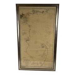
Rare early twentieth century chart of Cape Cod bay by George Eldridge showing Massachusetts Bay, and the coast from Chatham to Gloucester 1918. Signed George Eldridge.
This great ch...
Category
North American Vintage 1910s Maps
Materials
Paper
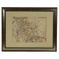
Original 1913 Chart of Boston Harbor
Located in Norwell, MA
Boston harbor chart by George Eldridge of Vineyard Haven and Boston. Detailed chart of Boston Harbor from the Neponset River in Quincy the south down to Kimballs Island in Cohasset. ...
Category
Vintage 1910s Maps
Materials
Paper
George Eldridge Chart "C" Vineyard Sound Lightship to Chatham
Located in Norwell, MA
This chart displays the islands of Nantucket, Martha's Vineyard, Nahshon, Cuttyhunk, Grand Island in Osterville, as well as many shoals. Many Cape Cod towns are shown including Falmouth, Osterville, Centerville, South Yarmouth, Harwich, Dennisport, Harwich port...
Category
North American Vintage 1910s Maps
Materials
Paper
1917 "Map of the City of Denver, Colorado" by L. L. Poates Eng, Co.
Located in Colorado Springs, CO
This is a detailed antique map of Denver, Colorado. The map was printed in the 1917 “New Encyclopedic Atlas and Gazetteer of the World” and first engrave...
Category
American Vintage 1910s Maps
Materials
Paper
1911 Rand-McNally Pocket Map and Shippers' Guide of Montana
Located in Colorado Springs, CO
1911 Rand-McNally Indexed County and Township Pocket Map and Shippers' Guide of Montana
This is a 1911 Indexed County and Township Pocket Map and Shipper’s...
Category
Vintage 1910s Maps
Materials
Paper
Antique Map of Walcheren in the Province of Zeeland, the Netherlands, ca.1910
Located in Langweer, NL
Antique map of Walcheren, part of the province of Zeeland, the Netherlands.
Shows the cities of Veere, Middelburg, Vlissingen and others. Source unknown, to be determined. Publis...
Category
Vintage 1910s Maps
Materials
Paper
H 7.49 in W 8.08 in D 0 in
George Washington University Antique Map, Bird's-Eye View, circa 1912
Located in Colorado Springs, CO
The George Washington University, Washington D.C. Founded, 1821. An Artist’s Depiction of The University and Its Environs in The Nation’s ...
Category
American Vintage 1910s Maps
Materials
Paper
20th Century German World Atlas, 1912
Located in LEGNY, FR
1912 World Atlas Huge Andrees Handatlas. Jubilaums- Ausgabe, Funfte Auflage.
This is a stunning Handatlas made in 1912. This is a very hard edition to fin...
Category
German Vintage 1910s Maps
Materials
Paper
Antique Oak 26-Drawer Map Flat File, circa 1913
Located in South Bend, IN
Antique oak 26-drawer map flat file
Made by Library Bureau Sole Makers,
USA, circa 1913
Oak + original Rand McNally maps - 1912 and 1913 editio...
Category
American Arts and Crafts Vintage 1910s Maps
Materials
Brass
Map of Paris, Published by Robelin, Antique Pictorial Map, circa 1913
Located in Colorado Springs, CO
Titled “Paris Monumental Et Metropolitain,” this large and detailed bird’s-eye view of Paris was published by Robelin, circa 1913. Designed for tourists, this foldout pocket map cove...
Category
French Vintage 1910s Maps
Materials
Paper
