1930s Maps
to
4
6
3
9
2
1
2,974
2,233
473
3
288
34
9
126
8
36
9
2
5
4
3
2
7
2
1
1
4
4
1
1
9
9
9
2
Period: 1930s
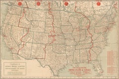
1930s AM Radio Map of US, Canada, Cuba, Mexico – Stations & Frequencies
Located in Langweer, NL
Title: 1930s Lewis Bros. Limited Detailed Radio Station Map of the United States and Canada – AM Stations, Call Signs, Frequencies, Vintage Advertising
Detailed Description: This v...
Category
Vintage 1930s Maps
Materials
Paper
$935 Sale Price
20% Off
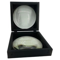
Large European 1930's Nautical Map Reader Magnifying Glass
Located in Haddonfield, NJ
This European set of two nautical magnifying glass map-readers are quite unusual and rarely found. It is fully encased in it's heavy wooden and metal enforced box. Hailing from betwe...
Category
German Industrial Vintage 1930s Maps
Materials
Metal
$2,000 Sale Price
20% Off
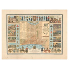
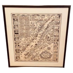
Map of Philadelphia with a Historical Tribute to its Volunteer Fire Companies
Located in Langweer, NL
This elaborate map of Philadelphia in Pennsylvania served as a historical tribute to the city's first volunteer fire departments. It was drawn by J...
Category
Vintage 1930s Maps
Materials
Paper
$529 Sale Price
20% Off
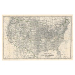
Old Map of the American Railroad Network and All Weather Roads on Verso, 1931
Located in Langweer, NL
This is the “New Census Edition” of Clason’s United States Green Guide. It features two large maps of the United States on a single sheet.
The recto map shows the complete road net...
Category
Vintage 1930s Maps
Materials
Paper
$425 Sale Price
20% Off
Tony Sarg Map of Nantucket Town, 1937
By Tony Sarg
Located in Nantucket, MA
Tony Sarg Map of Residential Main Street, Nantucket, 1937, a black and white printed map of our historic downtown area, with images of each building, street names and whimsical figur...
Category
American Other Vintage 1930s Maps
Materials
Paper
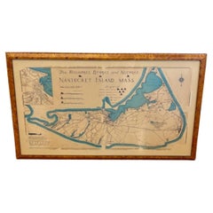
Nantucket High-Ways, By-Ways and Not-Ways Decorative Map by Tony Sarg, ca 1930
By Tony Sarg
Located in Nantucket, MA
Vintage Nantucket High-Ways, By-Ways and Not-Ways Decorative Map by Tony Sarg, (Nantucket: 1880 - 1942) circa 1930, a decorative tourist map of Nantucket Island with details of roadw...
Category
American Other Vintage 1930s Maps
Materials
Paper
Art Deco Cartoon Style Map of Paris possibly by Arthur Zaindenberg circa 1930's
By Arthur Zaidenberg
Located in New York, NY
Art Deco cartoon style map of Paris possibly by Arthur Zaidenberg. The map depicts witty references to Parisians lifestyle, along with drawings of notable landmarks, circa 1930's. T...
Category
American Art Deco Vintage 1930s Maps
Materials
Paper
Cram's 16" Deluxe Globe W/Daily Sun Ray and Season Indicator
Located in San Francisco, CA
Cram's 16" Deluxe Globe W/Daily Sun Ray and Season Indicator
1936
Category
Vintage 1930s Maps
Materials
Metal
1939 "A Good-Natured Map of the United States" by Greyhound
Located in Colorado Springs, CO
Presented is an original 1939 map, titled “A Good-Natured Map of the United States Setting Forth the Services of the Greyhound Lines and a Few Principal Connecting Bus Lines.” This brightly colored pictographic map was one of several similar United States maps...
Category
American Art Deco Vintage 1930s Maps
Materials
Paper
Related Items
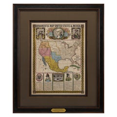
1847 Ornamental Map of the United States & Mexico by H. Phelps
Located in Colorado Springs, CO
Offered is an original 1847 ornamental map of the U.S. entitled "Ornamental Map of the United States & Mexico" by Humphrey Phelps. The map was issued as an act of Congress by Phelps on Fulton Street, New York. The broadside is elaborately hand-colored.
This is a very detailed and graphic propaganda map of the United States expressing U.S. dominance of the North American continent. The hand-colored map proclaims the Manifest Destiny, with the recent acquisition of Upper California and Texas at the conclusion of the Mexican-American War. The newly acquired land is boldly colored, standing in stark contrast to the rest of the U.S. The map details a potential route for a railroad running from New York City, to Buffalo, to Chicago, then west along the Oregon Trail to Oregon City. This route anticipates the construction of the transcontinental railroad by nearly 20 years.
The map includes elaborately detailed renderings of George Washington, Hernan Cortez, and Montezuma at top to represent European expansion to the Americas. At bottom are four inset designs with text showing the following: a chronological history of the U.S. beginning from settlement to the U.S. victory in the Mexican-American war; an illustration of General Zachary Taylor with details on the Oregon Territory; an illustration of the Aztec Temple of the Sun in Tenochtitlan and a chronology of the Conquest of the Aztec Empire under Cortez; a portrait of General Antonio Lopez de Santa Anna...
Category
American Antique 1930s Maps
Materials
Paper
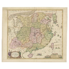
Antique Map of China and Korea incl Formosa and Hainan, by Janssonius, ca.1650
Located in Langweer, NL
Antique map titled 'Imperii Sinarum Nova Descriptio'. Beautiful map of China and Korea, much detail troughout the map. Including the Islands of Formosa (Taiwan) and Hainan. The Great...
Category
Antique 1930s Maps
Materials
Paper
$2,788 Sale Price
20% Off
H 20.48 in W 24.02 in D 0 in
Antique North America Map, USA, Canada, Mexico, Cartography, Colton, Victorian
Located in Hele, Devon, GB
This is an antique North America map. A USA, framed lithography atlas engraving of the continent by JH Colton, dating to the Victorian period and later, circa 1860.
Fascinating, large framed map...
Category
American Victorian Antique 1930s Maps
Materials
Paper
$1,164
H 22.45 in W 18.71 in D 0.99 in
Large Scale Hand Crafted Sail Boat Model
Located in Douglas Manor, NY
3-569 Hand crafted sail boat model on base.
Category
Vintage 1930s Maps
Materials
Canvas, Hardwood
Old Map of Holstein with the Imperial Towns Hamburg & Lubeck, Germany, 1854
Located in Langweer, NL
Antique map titled 'Map of the Duchy of Holstein with the territories of the Imperial Towns Hamburg & Lubeck (..)
Based on a map by Fischer.' Map of the Duchy of Holstein. From Jam...
Category
Antique 1930s Maps
Materials
Paper
$916 Sale Price
20% Off
H 22.13 in W 27.96 in D 0 in
Antique Map of Arkansas
Located in Langweer, NL
Antique map titled 'Arkansas'. Original antique map of Arkansas, United States. This print originates from 'Encyclopaedia Britannica', Ninth Edition. P...
Category
Antique 1930s Maps
Materials
Paper
American Nautical Brass Yacht Binnacle Mounted in Mahogany Case, Circa 1890
Located in Charleston, SC
American nautical mahogany yacht binnacle with a hinged locking oval glass viewing port, original removable brass side light burner with font, brass carrying handle, and fitted with ...
Category
American American Empire Antique 1930s Maps
Materials
Brass
$6,500
H 10 in W 10.5 in D 8 in
1930s Magnadyne Art Deco Tube Radio, Empire Style, Working, All Original Parts
Located in Vigonza, Padua
Italian 1930s Magnadyne (Turin) Art Deco tube radio, empire style, working, all original parts
Measures in cm: H 45, W 42, D 45.
Category
Italian Art Deco 1930s Maps
Materials
Walnut
$3,780
H 17.72 in W 16.54 in D 17.72 in
1834 Mexico & Guatemala Framed Map by H.S. Tanner
Located in Stamford, CT
1834 Mexico & Guatemala map of published by H.S. Tanner, Philadelphia, Pennsylvania. Engraved by J. Knight.
As found high end custom framing with carved wood frame, custom matting a...
Category
American American Classical Antique 1930s Maps
Materials
Glass, Wood, Paper
Scale Nautical Vintage Model of an English Motorboat, 1950s
Located in Milan, IT
Scale model of an English motorboat (antique motor yacht) from the 1950s, wooden planking hull. Measures: Length 57 cm, 23.44 inches, width 13.5 cm, 5.3 ...
Category
British Vintage 1930s Maps
Materials
Wood
Framed 1838 Mexico & Gulf of Mexico Map
Located in Stamford, CT
Framed 1838 Mexico & Gulf of Mexico map. Printed by Fisher, Son & Co. of London in 1838. As found framed condition. Map has not been examined outside of th...
Category
English American Classical Antique 1930s Maps
Materials
Glass, Wood, Paper
Faux Albino Sea Turtle Shell Scrimshaw with American Historical Vignettes
Located in West Palm Beach, FL
Faux Albino Sea Turtle Shell Scrimshaw with American Historical Vignettes
Circa 1980s, Simulated Tortoiseshell
The faux albino sea turtle shell scrimshaw sculpture is a unique an...
Category
Victorian 1930s Maps
Materials
Resin
$1,516 Sale Price
20% Off
H 24 in W 16 in D 6 in
Previously Available Items
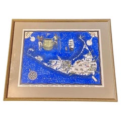
Vintage Whimsical Map of Nantucket Island by Fred Gardner, 1933.
Located in Nantucket, MA
Vintage Whimsical Map of Nantucket Island by Fred Gardner, 1933, a classic tourist map from the golden age of poster art, etched and printed by the young Fred Gardner on Nantucket Island, and then in this example hand colored by him and inscribed as a present to a friend. The map shows the three islands of the Nantucket archipelago, with place names and visual accents, as well as a Nantucket "coat-of-arms" of a sailor and harpooneer flanking a whale oil barrel with inscription of the island's purchase by Bartholomew Gosnold in 1609, anthropomorphic winds blowing out of the Northwest and Northeast, compass rose, ships, breaching white whale and a soaring seagull, hand signed, dated and copyrighted "(c) Fred H. Gardner, '33" in the lower left, and hand inscribed across the bottom "To Francey: Wishingf you many more enjoyable visits on this quaint island. "Freddy" August 17, 1934."
The map remains in excellent condition, with the colors bold and strong with no fading whatsoever. It is mounted in a mat and gilded frame that appears from the 1970s or so.
Fred Gardner, while not from Nantucket, was descended from an old island family, and summered here all his life. He was one of the first major collectors of scrimshaw, and a serious student of Nantucket history. He was a young art student when he created this map, inspired by those of his friends Austin Strong...
Category
American Folk Art Vintage 1930s Maps
Materials
Paper
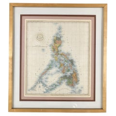
Vintage 1939 Map of the Philippines and 1939 Cenus
Located in Van Nuys, CA
This vintage piece is a 1939 map of the Philippines accompanied by a census, sourced from Volume V of a book containing historical statistical information. Encased in a stylish black...
Category
British Colonial Vintage 1930s Maps
Materials
Paper
1932 "Principal Events in the Life of George Washington" Pictorial Map
Located in Colorado Springs, CO
Presented is the 1932 pictorial map of the principal events in George Washington’s life from the General Drafting Company. The map displays the eastern coastline of the United States...
Category
American Mid-Century Modern Vintage 1930s Maps
Materials
Paper
20th Century Art Deco Glass Globe Lamp c.1930
Located in Royal Tunbridge Wells, Kent
Crafted in Great Britain during the early 20th century, this extraordinary glass globe table lamp stands as a testament to rare and timeless design. The lamp showcases an elegant fus...
Category
British Art Deco Vintage 1930s Maps
Materials
Metal
Whimsical Decorative Map of Nantucket by Jack Atherton, 1937
Located in Nantucket, MA
A wonderful vintage pictorial map of Nantucket Island, by Jack Atherton, 1937, simple and whimsical, showing the general lay of the land and feat...
Category
American Modern Vintage 1930s Maps
Materials
Paper
1930s Antique Terrestrial Globe Edited By Vallardi Editore in Milan
Located in Milan, IT
Terrestrial globe published in the 1930s by Vallardi Editore, papier-mâché sphere covered with engraving paper on a copper plate and watercolored, turned wooden base complete with engraved brass meridian circle.
Very good condition, height 57 cm, inches 22.5 - sphere diameter 27 cm, inches 10.6.
Shipping is insured by Lloyd's London; it is available our free gift box (look at the last picture).
The origins of the publisher Vallardi date back to 1750 when founder Francesco Cesare (1736-1799) acquired a small craft in the heart of old Milan. In the early nineteenth century, the publishing house was noted for the production of works of art, geography and science, including a "Tour of Italy" which took twenty-two printings between 1819 and 1835. The complete works of various maps and directions for travel, including timetables and fares for transportation of the time, can be considered the first modern tourist guide. The firm "Vallardi" was born in 1843 and the company became industrial, with the opening of branches on national scale.
Category
Vintage 1930s Maps
Materials
Paper
1930s Antique Italian Terrestrial Globe Signed Vallardi Editore Milano
Located in Milan, IT
Terrestrial globe edited by Vallardi Editore Milano in 1930s, engraved by A. Minelli, diameter of sphere cm 18 – inches 7, height cm 38 – inches 15.
Wooden base and cardboard sphere covered by paper printed by engraving on a copper plate and watercoloured. Good condition.
Shipping is insured by Lloyd's London; our gift box is free, see last picture.
The origins of the publisher Vallardi date back to 1750 when founder Francesco Cesare (1736-1799) acquired a small craft in the heart of old Milan. In the early nineteenth century, the publishing house was noted for the production of works of art, geography and science, including a "Tour of Italy" which took twenty-two printings between 1819 and 1835. The complete works of various maps and directions for travel, including timetables and fares for transportation of the time, can be considered the first modern tourist guide. The firm "Vallardi" was born in 1843 and the company became industrial, with the opening of branches on national scale...
Category
Vintage 1930s Maps
Materials
Paper
1937 "The Dole Map of the Hawaiian Islands, U.S.A"
Located in Colorado Springs, CO
Offered is a stunning "Dole Map of the Hawaiian Islands'' from 1937. The work was designed by Parker Edwards and published in Honolulu by Hawaiian Pineapple C...
Category
Vintage 1930s Maps
Materials
Paper
Pictorial Vintage Map of New York City Showing Numerous Landmarks, 1939
Located in Langweer, NL
This pictorial souvenir map focuses on New York City and the site of the 1939 World's Fair. It was drawn by graphic artist George Annand and published by Sinclair Oil...
Category
Vintage 1930s Maps
Materials
Paper
1939 Vintage Map "The City of New York" by Richard Edes Harrison
Located in Colorado Springs, CO
This 1939 Richard Edes Harrison map of New York City, published for an issue of Fortune Magazine, represents a triumph of the visual display of quantitative information. Its aesthetic impact is all the more impressive in its clear expression of municipal and demographic data, making this a map of the people of New York City, as much as of the physical city itself.
The map centers on Brooklyn and Manhattan, but includes much of the surrounding burrows. The color-coded detail of the map is nothing short of an impressive work for its time. The map is color coded by residential, industrial, business, parks and parkways, airports, cemeteries, public and private institutions, and Federal Government Property.
An inset map, “The Lower Half of Manhattan in Detail,” positioned below the title provides a more detailed street layout of lower Manhattan, from Central Park to Battery Park. Using a new color code for this inset map, Harrison marked the city’s most valuable real estate, including structures assessed at 5 million dollars or more.
In the lower right, two comparative insert maps show the difference between day and night population densities for the entire area shown in the main map. The map also has a very decorative and unique compass rose. Within the rose’s circuit is yet another inset map, showing the limit of the main map in the context of the greater metropolitan area and the surrounding states.
Harrison’s map of New York City is based mainly on a series of maps issued in 1933 by the City Planning Commission. Produced as an Emergency Relief Project, those 1933 maps illustrated the distribution of living and working populations, the age, type, and rental of buildings, and the use of land, existing streets, and waterways in great detail. Harrison’s street grid was reproduced directly from “Existing Streets 1935,” which in turn was based on the “Board of Estimate and Apportionment Map,” copyrighted in 1933 by Herman Smith. Harrison did the impressive work of designing the present map, bringing the material up to date, revising shorelines, and adding new construction from the past six years.
This map appeared in only one edition, as a supplement to the July issue of Fortune magazine. OCLC lists only five examples in institutional collections.
Richard Edes Harrison (1902- 1994) was an American cartographer and cartoonist. Harrison is credited with redefining cartography, by employing spherical perspective, bold shading, and graphic design to both make maps more publicly accessible. Born in Baltimore, Maryland, Harrison studied design at Yale, graduating in 1923. He relocated to New York City at the height of the Great Depression and worked in industrial design. Harrison created his first cartographic work while he worked a fill-in job at Fortune magazine. The success of his first project launched a long-standing collaboration with Fortune, including expertly executed WWII maps...
Category
American Vintage 1930s Maps
Materials
Paper
Hand Painted Watercolor, "Provincia dalla Forma di Venezia", circa 1930
Located in Atlanta, GA
Painted by an employee of the Estevan Rossetto glass blowing factory in an almost cartoonish style during the 1930, reminiscent of the style of Ludwig Bemelmans, acquired from the Pa...
Category
Italian Art Deco Vintage 1930s Maps
Materials
Paint
1937 Hawaii Map "The Dole Map of the Hawaiian Islands" by Parker Edwards
Located in Colorado Springs, CO
This vintage map emulates a travel poster with its vibrant colors, encouraging tourism to the islands of Hawaii. The map depicts the Hawaiian Islands of Hawaii, Maui, Kahoolawe, Lana...
Category
American Vintage 1930s Maps
Materials
Paper
