Items Similar to Plan of Paris, France, by A. Vuillemin, Antique Map, 1845


Want more images or videos?
Request additional images or videos from the seller
1 of 5
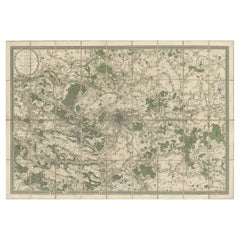
Plan of Paris, France, by A. Vuillemin, Antique Map, 1845
$4,950
£3,784.54
€4,359.02
CA$6,936.47
A$7,743.91
CHF 4,057.69
MX$94,793.11
NOK 51,532.76
SEK 48,588.85
DKK 32,531.84
About the Item
This large and detailed plan of Paris was published by Alexandre Vuillemin in 1845. The map conveys a wonderful amount of information and is decorated throughout with pictorial vignettes of major buildings, bridges, trains, and monuments.
It also includes a table with an alphabetized street index; a list of suburbs with distances to Paris, population and festival days; a table listing forts surrounding Paris with distances to the center of the city; and a list of passages located throughout the city.
Alexandre Vuillemin (1812-1880) was a leading 19th century French cartographer and editor. He studied under French cartographer Auguste Dufour and set up shop in Paris. Vuillemin produced over ten different atlases during his career; many of which were so popular they went through multiple editions. His maps are noted for the frequent use of extensive margin illustrations – vignettes, portraits of famous people, and inset birds-eye views of cities.
CONDITION:
This is a nice impression, with age appropriate toning to the paper. The map has been backed onto linen. It is displayed in a custom archival wood frame with a gold beaded border.
- Dimensions:Height: 42.5 in (107.95 cm)Width: 51.25 in (130.18 cm)Depth: 2.5 in (6.35 cm)
- Materials and Techniques:
- Place of Origin:
- Period:
- Date of Manufacture:1845
- Condition:Additions or alterations made to the original: Rebacked onto new linen. Wear consistent with age and use. Nice impression and backed onto linen with age appropriate toning to the paper.
- Seller Location:Colorado Springs, CO
- Reference Number:Seller: M0771stDibs: LU90974627213
About the Seller
4.9
Platinum Seller
Premium sellers with a 4.7+ rating and 24-hour response times
Established in 2010
1stDibs seller since 2011
461 sales on 1stDibs
- ShippingRetrieving quote...Shipping from: Colorado Springs, CO
- Return Policy
Authenticity Guarantee
In the unlikely event there’s an issue with an item’s authenticity, contact us within 1 year for a full refund. DetailsMoney-Back Guarantee
If your item is not as described, is damaged in transit, or does not arrive, contact us within 7 days for a full refund. Details24-Hour Cancellation
You have a 24-hour grace period in which to reconsider your purchase, with no questions asked.Vetted Professional Sellers
Our world-class sellers must adhere to strict standards for service and quality, maintaining the integrity of our listings.Price-Match Guarantee
If you find that a seller listed the same item for a lower price elsewhere, we’ll match it.Trusted Global Delivery
Our best-in-class carrier network provides specialized shipping options worldwide, including custom delivery.More From This Seller
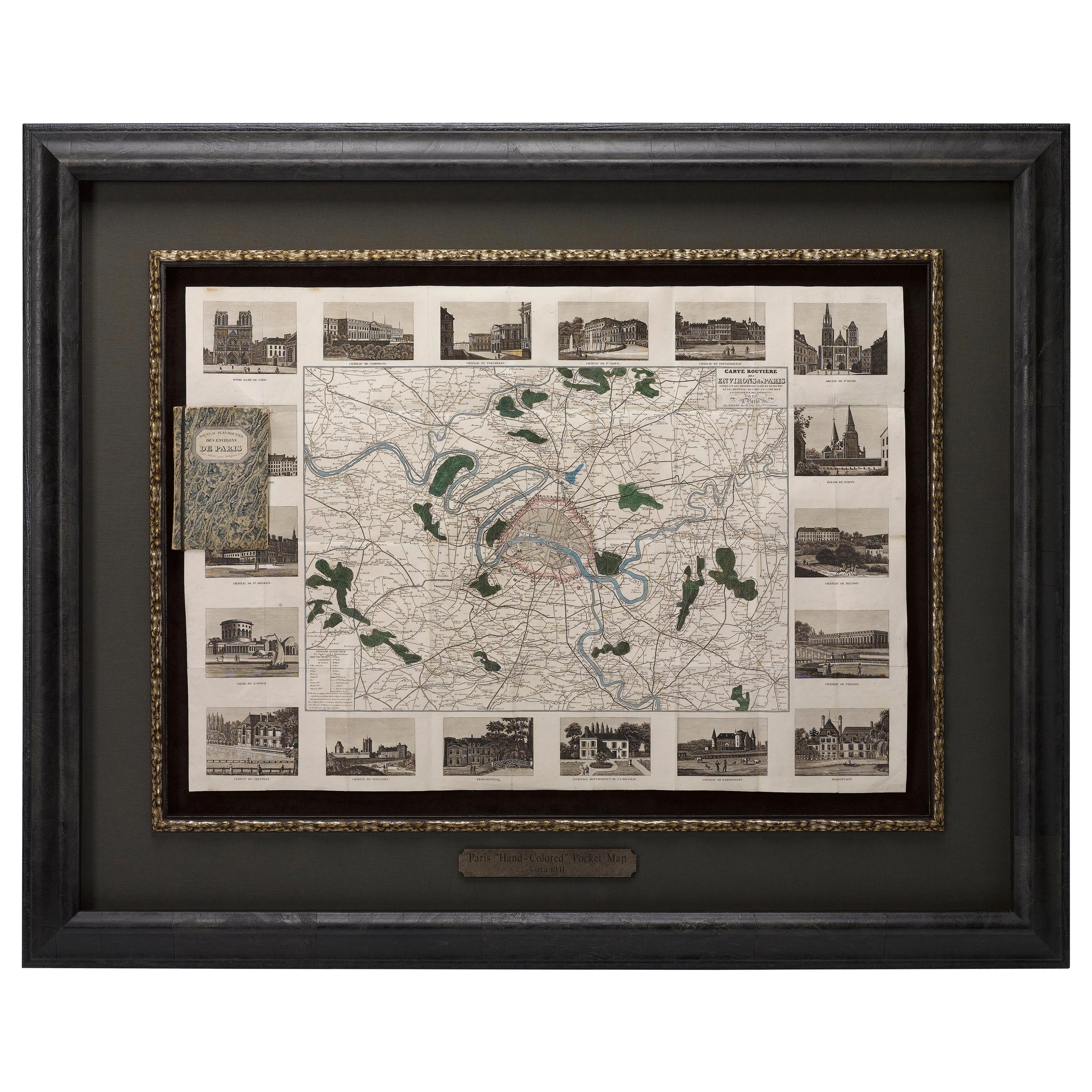
View AllAntique Map of Paris, "Carte Routiere des Environs de Paris" 1841
Located in Colorado Springs, CO
This beautiful hand-colored road map of Paris was published in 1841. The map shows Paris and the surrounding area in a folding pocket map. Organized and detailed for travelers, this ...
Category
Antique 1840s French Maps
Materials
Paper

1840 "New Map of the City of New York With Part of Brooklyn & Williamsburg"
Located in Colorado Springs, CO
Presented is a hand-colored, engraved folding map titled "New Map of the City of New York With Part of Brooklyn & Williamsburg" by J. Calvin Smith. The map was issued bound in the bo...
Category
Antique 1840s American Maps
Materials
Paper

1864 Map of North America, Antique Hand-Colored Map, by Adolphe Hippolyte Dufour
Located in Colorado Springs, CO
Offered is a map of North America entitled Amerique du Nord from 1864. This rare, separately published wall map was produced by Adolphe Hippolyte Dufour. This map includes vibrant an...
Category
Antique 1860s French Maps
Materials
Paper

1859 "Map of the United States of America..." by J. H. Colton
By J.H. Colton
Located in Colorado Springs, CO
Presented is an 1859 “Map of the United States of America, the British Provinces, Mexico, the West Indies and Central America with Part of...
Category
Antique 1850s American Maps
Materials
Paper

1837 Mitchell's "Tourist's Pocket Map of the State of Virginia" by J.H. Young
Located in Colorado Springs, CO
This is J. H. Young's pocket map of the Virginia, which shows county development current to 1835. The map was engraved by E. Yeager and F. Dankworth and published by S. A. Mitchell. ...
Category
Antique 1830s American Maps
Materials
Paper

1812 United States Map, by Pierre Tardieu, Antique French Map Depicting the U.S.
By Pierre François Tardieu
Located in Colorado Springs, CO
1812 "United States of Nth America -- Carte des Etats-Unis De L'Amerique Septentrionale" Two-Sheet Map by Tardieu
This attractive map, published in Paris in 1812, is one of the most rare large format maps from the period. It features a view of the East Coast of the U.S. from Maryland to just below South Carolina. Additionally, Ellicott’s plan for the City of Washington D.C. is included at the top right and an illustration of Niagara Falls is shown at the bottom right with a description in both French and English. This extremely detailed map not only depicts the mountainous regions of the southeastern U.S., but also includes names of regions, rivers, and towns.
Based on the first state of Arrowsmith’s 4-sheet map of the United States, this map is completely engraved by Tardieu in Paris and showcases high quality engravings. This detailed map of the recently independent United States includes one of the largest and earliest examples of the Ellicott plan of Washington DC.
The artist, Pierre François Tardieu (PF Tardieu) was a very well-known map engraver, geographer, and illustrator. Awarded a bronze medal by King Louis-Phillipe for the accuracy and beauty of his map-making, Tardieu produced many fine works including maps of Louisiana...
Category
Antique 1810s French Maps
Materials
Paper

You May Also Like
Original Large Antique Map of Paris, France by John Dower, 1861
Located in St Annes, Lancashire
Fabulous monochrome map of Paris.
Vignettes of St Germain En Laye, Saint Cloud, Versailles and Fontainbleau.
Unframed.
Drawn by J.Dower.
Lithography by Weller. 4 sheets joined to...
Category
Antique 1860s English Victorian Maps
Materials
Paper

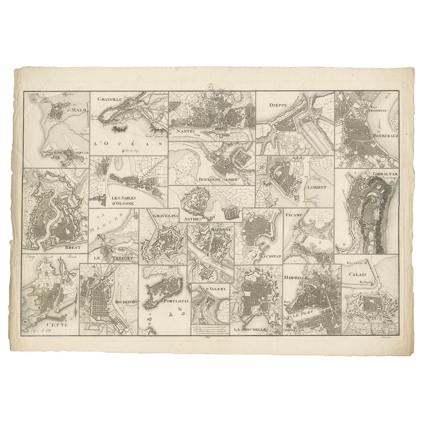
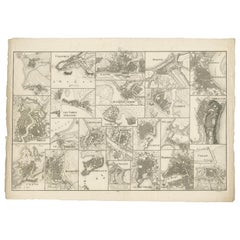
Antique Map of Various Ports in France by Röder 'circa 1800'
Located in Langweer, NL
Antique print showing various ports in France. Including plans of St. Malo, Granville, Nantes, Dieppe, Bourdeauz, Gibraltar, Lorient, Boulogne sur Mer, Les Sables d'Olonne, Brest, Le Trèport, Antibes, La Ciotat...
Category
Antique Early 19th Century Maps
Materials
Paper
$1,748 Sale Price
20% Off
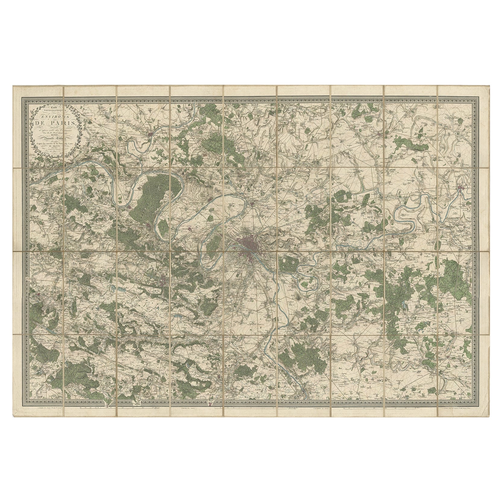
Large Folding Map of Paris, France, on Linen, 36 Segments, Published in 1836
Located in Langweer, NL
Antique map Paris titled 'Carte Topographique des Environs de Paris Nouvelle edition rectifié d'apres les travaux de la Nouvelle Carte De France'.
...
Category
Antique 1830s Maps
Materials
Paper
$1,275 Sale Price
20% Off
Antique Map of the City of Paris by Tirion '1763'
Located in Langweer, NL
Antique map titled 'Nieuwe Kaart der platte Grond van de Stad Parys (..)'. Beautiful city plan of Paris, France. This map originates from 'Nieuwe en Beknopte Hand-Atlas, bestaande in...
Category
Antique Mid-18th Century Maps
Materials
Paper

Old Map Depicting the Entire Earth's Surface Divided into Six Parts France 1850
Located in Milan, IT
Map depicting the entire earth's surface divided into six parts which depicts the position of peoples on Earth based on the assumption that it is impossible for each people to have t...
Category
Antique Mid-19th Century French Maps
Materials
Glass, Wood, Paper

1851 Original map by Maillard - Plan de Paris et ses Fortifications
Located in PARIS, FR
In the world of cartography, maps transcend mere geography; they are historical records and works of art, encapsulating the essence of a place at a specific moment in time. The 1851 ...
Category
1850s Prints and Multiples
Materials
Paper, Lithograph, Linen

More Ways To Browse
Antique Table Plans
Wood Minimalist Chair
Antique Imperial Furniture
Gold Modern Coffee Table
Large Side Tables
18th Century Gilded Furniture
Japanese Silver Ceramics
One Of A Kind Chair
Used Oak Dining Room Chairs
17th Century Plate
Childrens Vintage Poster
Chinese Ship
Nursery Art
Vintage Travel Poster Mid Century
Desk Key
Woven Silk Art
Carved Cabriole Table
Dark Antique Table