Items Similar to Rare 18th-Century Hand-Colored Map of Southeast Asia and the East Indies, 1748


Want more images or videos?
Request additional images or videos from the seller
1 of 7
Rare 18th-Century Hand-Colored Map of Southeast Asia and the East Indies, 1748
$2,646.45
£1,983.68
€2,240
CA$3,635.78
A$4,059
CHF 2,126.86
MX$49,686.19
NOK 27,011.10
SEK 25,468.04
DKK 17,051.70
Shipping
Retrieving quote...The 1stDibs Promise:
Authenticity Guarantee,
Money-Back Guarantee,
24-Hour Cancellation
About the Item
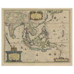
1748 Homann Map of Southeast Asia and East Indies by Homann Heirs
This original 1748 map, published by the renowned Homann Heirs, depicts Southeast Asia, the East Indies, and adjacent regions with remarkable detail. The map includes India, the Malay Peninsula, the Philippines, Borneo, Sumatra, Java, and parts of China and the Pacific islands, emphasizing the geographic scope of European interest in the region during the 18th century.
The map is adorned with a highly decorative baroque cartouche, typical of the Homann workshop, featuring symbols of exploration and commerce. Rhumb lines radiating from key points on the map were used for navigational purposes, reflecting the maritime focus of European powers in this era. Place names, rivers, mountain ranges, and island groups are meticulously engraved, showcasing the precision of Homann’s cartographic craftsmanship.
The map’s hand-coloring enhances its visual appeal, delineating political boundaries and regions of interest to European explorers and colonial powers. Its 1748 publication date, noted in the cartouche, situates it within the period of intense European competition for influence and trade in Southeast Asia.
-----
Condition report: The map is in very good condition for its age. The paper remains strong and stable with original hand-coloring that is still vivid. Some uniform age-toning is present, consistent with 18th-century paper. Light scattered foxing is mostly found in the margins and does not affect the central image. The map has ample margins that are slightly browned with minor imperfections. The centerfold shows some typical wear from atlas binding, but there are no major splits or damage. Overall, this is a well-preserved example with only minor signs of handling and aging.
Matting and framing tips: Use archival, acid-free mat board to protect the map from further aging and discoloration. A neutral ivory or off-white mat will complement the map’s tones without overwhelming the composition. UV-protective glass or acrylic is recommended to prevent fading, while anti-reflective museum glass can reduce glare.
For a period-appropriate frame, a walnut or dark oak wood frame with subtle ornamentation suits the 18th-century aesthetic. A gilded frame with baroque-style elements will add a more decorative appeal, while a thin black or charcoal-toned wooden frame provides a minimalist and modern presentation.
Float mounting with archival hinges slightly above the backing will create a shadow effect, adding depth to the display. A spacer should be used to prevent the map from touching the glass and to allow proper airflow.
To preserve the map’s integrity, avoid displaying it in direct sunlight, humid environments, or areas with fluctuating temperatures. A controlled setting such as a study, library, or office will ensure longevity while enhancing the historical and decorative value of the piece.
This thoughtful preservation approach will ensure that this 1748 Homann map of Southeast Asia and the East Indies remains in excellent condition for years to come while being beautifully displayed.
- Dimensions:Height: 20.87 in (53 cm)Width: 34.65 in (88 cm)Depth: 0.01 in (0.2 mm)
- Materials and Techniques:Paper,Engraved
- Period:1740-1749
- Date of Manufacture:1748
- Condition:Good condition. Strong paper with vivid original hand-coloring. Light age-toning and minor foxing due to age, mainly in margins. Ample but slightly browned edges. Typical centerfold wear from atlas binding, no major splits. Minimal handling marks.
- Seller Location:Langweer, NL
- Reference Number:Seller: BG-14044-21stDibs: LU3054343391782
About the Seller
5.0
Recognized Seller
These prestigious sellers are industry leaders and represent the highest echelon for item quality and design.
Platinum Seller
Premium sellers with a 4.7+ rating and 24-hour response times
Established in 2009
1stDibs seller since 2017
2,511 sales on 1stDibs
Typical response time: <1 hour
- ShippingRetrieving quote...Shipping from: Langweer, Netherlands
- Return Policy
Authenticity Guarantee
In the unlikely event there’s an issue with an item’s authenticity, contact us within 1 year for a full refund. DetailsMoney-Back Guarantee
If your item is not as described, is damaged in transit, or does not arrive, contact us within 7 days for a full refund. Details24-Hour Cancellation
You have a 24-hour grace period in which to reconsider your purchase, with no questions asked.Vetted Professional Sellers
Our world-class sellers must adhere to strict standards for service and quality, maintaining the integrity of our listings.Price-Match Guarantee
If you find that a seller listed the same item for a lower price elsewhere, we’ll match it.Trusted Global Delivery
Our best-in-class carrier network provides specialized shipping options worldwide, including custom delivery.More From This Seller
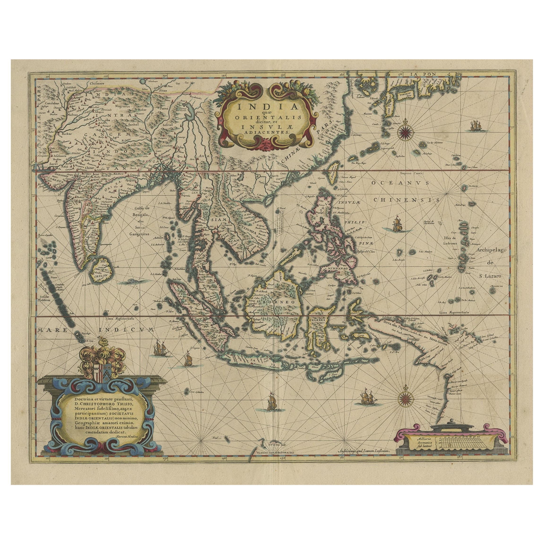
View AllOriginal Antique Hand-Colored Map of The East Indies and Southeast Asia, c.1644
Located in Langweer, NL
Antique map titled 'India quae Orientalis dicitur, et Insulae adiacentes'.
Old map of the East Indies and Southeast Asia showing the area between India in the West and parts of J...
Category
Antique 1640s Maps
Materials
Paper
$2,362 Sale Price
20% Off
Old Antique Map of the East Indies and Southeast Asia, ca.1644
Located in Langweer, NL
Antique map titled 'India quae Orientalis dicitur, et Insulae adiacentes'.
Old map of the East Indies and Southeast Asia showing the area between India in the West and parts of Japan, the Marianas and New Guinea/Australia in the East. This map is dedicated to D. Christophorus Thisius by Henricus...
Category
Antique 1640s Maps
Materials
Paper

$2,504 Sale Price
20% Off
Antique Map of the East Indies by Bonne '1776'
Located in Langweer, NL
Antique map titled 'Indes IVe Feuille'. Very decorative original antique map of the East Indies. Covbers from the Gulf of Siam (Gulf of Thailand) and Malacca (Malaysia) eastward to i...
Category
Antique Late 18th Century Maps
Materials
Paper

$519 Sale Price
20% Off
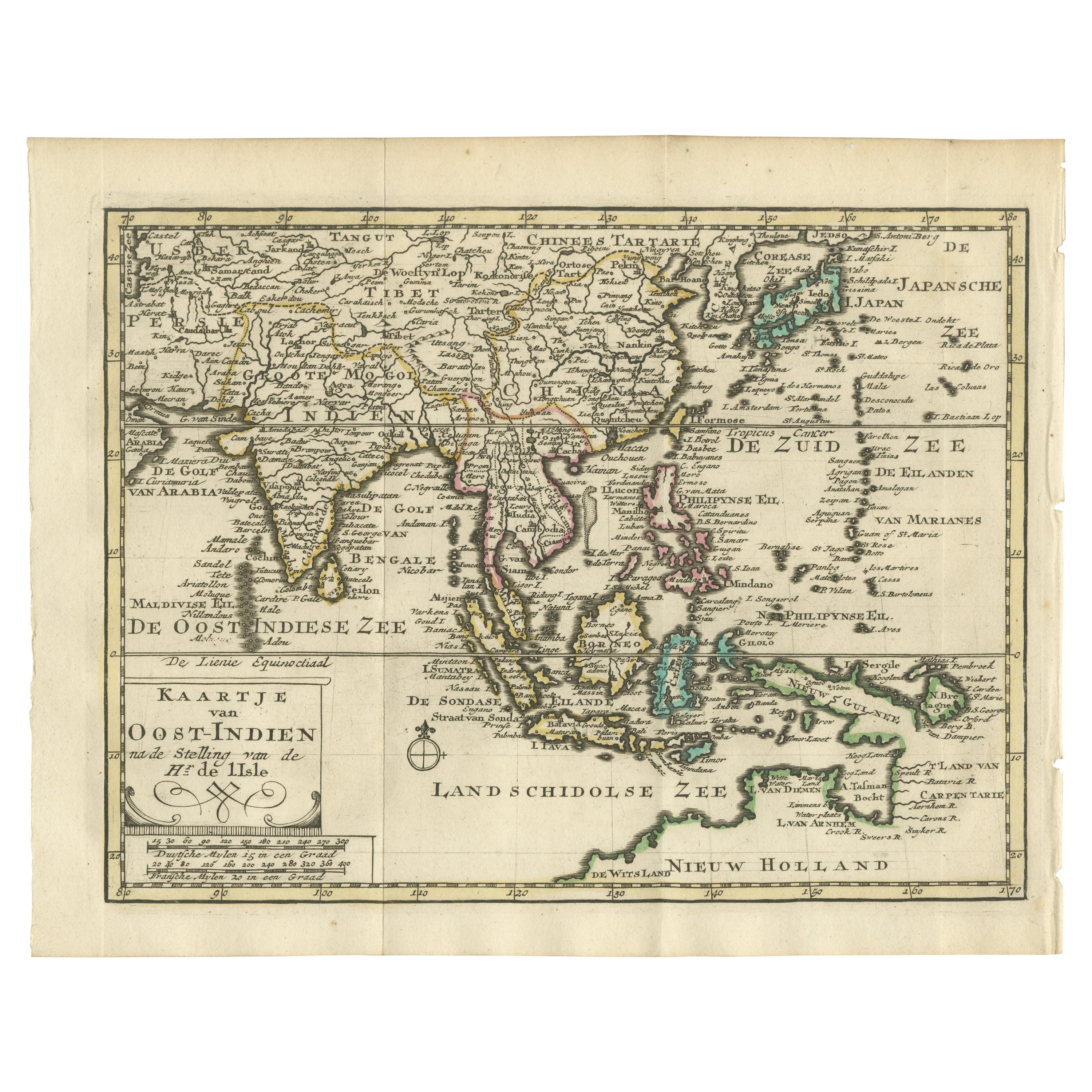
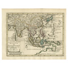
Authentic Old Map of Southeast Asia with Original Border Coloring, 1745
Located in Langweer, NL
Title: "Kaartje van Oost-Indien na de stelling van den Heer Guillaume de L'Isle"
Translates to "Map of the East-Indies based on the work of Mr. Guillaume de L'Isle." Guillaume de L...
Category
Antique 1740s Maps
Materials
Paper
$415 Sale Price
20% Off
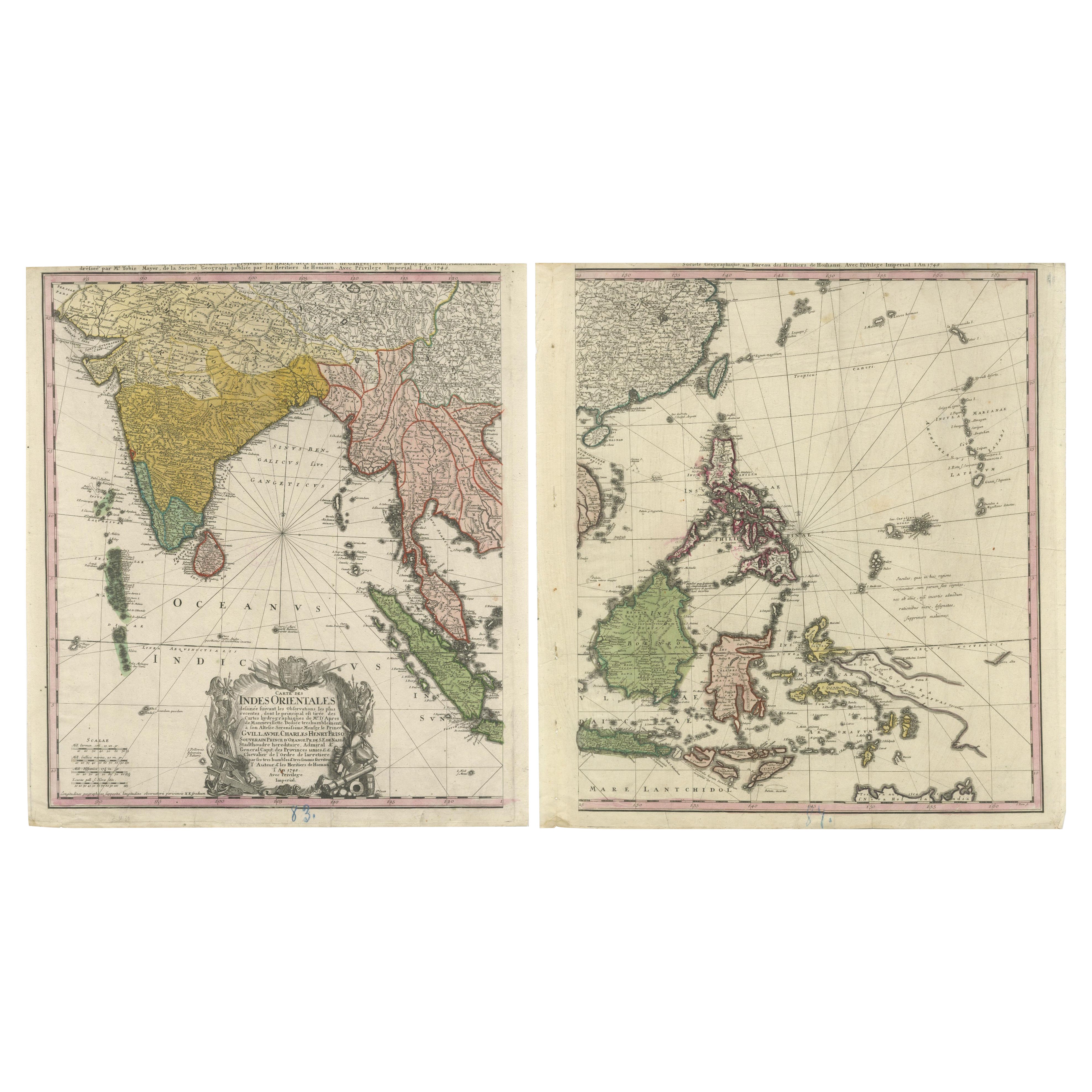
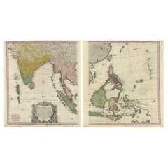
1748 Homann Heirs Double Map of the East Indies and Southeast Asia
Located in Langweer, NL
Title: 1774 Homann Heirs Double Map of the East Indies and Southeast Asia
Description:
This stunning 1774 double map by the Homann Heirs showcases the East Indies and Southeast ...
Category
Antique 1740s Maps
Materials
Paper
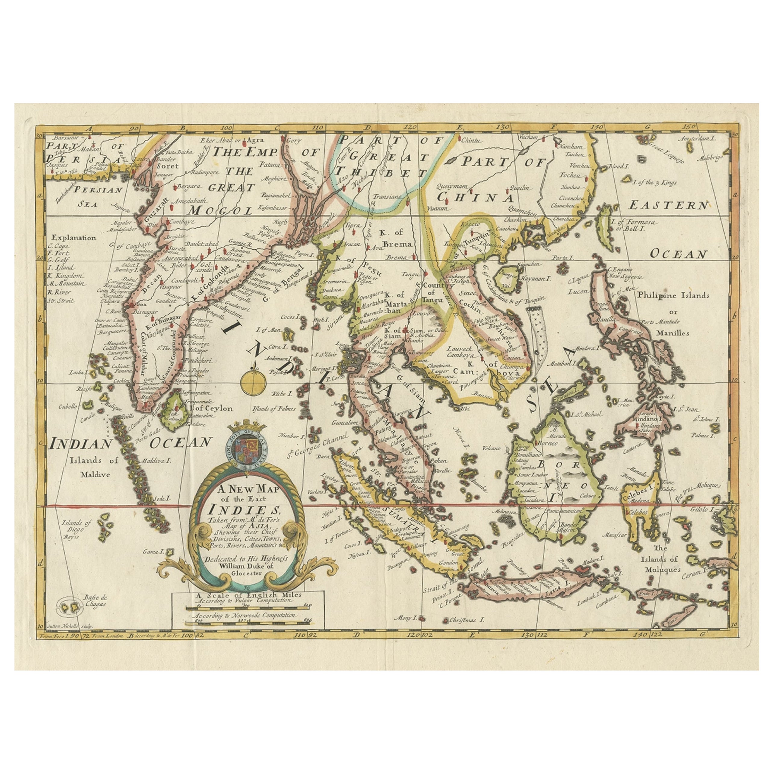
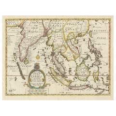
Old Map Covering All of Southeast Asia from Persia to the Timor Island, 1712
Located in Langweer, NL
Description: Antique map titled 'A New Map of the East Indies'. Old map covering all of Southeast Asia from Persia to the Timor Island, inclusive of the modern day nations of India, ...
Category
Antique 1710s Maps
Materials
Paper
$1,417 Sale Price
20% Off
You May Also Like
Map of the East Indies: An Original 18th Century Hand-colored Map by E. Bowen
Located in Alamo, CA
This is an original 18th century hand-colored map entitled "An Accurate Map of the East Indies Exhibiting the Course of the European Trade both on the Continent and Islands" by Emanu...
Category
Mid-18th Century Old Masters Landscape Prints
Materials
Engraving

Antique 1803 Italian Map of Asia Including China Indoneseia India
Located in Amsterdam, Noord Holland
Antique 1803 Italian Map of Asia Including China Indoneseia India
Very nice map of Asia. 1803.
Additional information:
Type: Map
Country of Manufacturing: Europe
Period: 19th centu...
Category
Antique 19th Century European Maps
Materials
Paper

$584 Sale Price
20% Off
Original Antique Map of South East Asia by Thomas Clerk, 1817
Located in St Annes, Lancashire
Great map of South East Asia
Copper-plate engraving
Drawn and engraved by Thomas Clerk, Edinburgh.
Published by Mackenzie And Dent, 1817
Unframed.
Category
Antique 1810s English Maps
Materials
Paper

Antique French Map of Asia Including China Indoneseia India, 1783
Located in Amsterdam, Noord Holland
Very nice map of Asia. 1783 Dedie au Roy.
Additional information:
Country of Manufacturing: Europe
Period: 18th century Qing (1661 - 1912)
Condition: Overall Condition B (Good Used)...
Category
Antique 18th Century European Maps
Materials
Paper

$648 Sale Price
20% Off
Asia Declineatio: A 17th Century Hand-colored Map of Asia by Justus Danckerts
Located in Alamo, CA
This is a scarce 17th century beautifully hand-colored copperplate engraved map of Asia entitled “Exactissima Asiae Delineatio in Praecipuas Regiones Caerterasque Partes divisa et de...
Category
Late 17th Century Old Masters Landscape Prints
Materials
Engraving

Large Original Vintage Map of S.E Asia, with a Vignette of Singapore
Located in St Annes, Lancashire
Great map of South East Asia
Original color. Good condition
Published by Alexander Gross
Unframed.
Category
Vintage 1920s English Maps
Materials
Paper

More Ways To Browse
Antique Ivory Collectables
Baroque Cartouche
Philippines Antique
18th Century Uniform
Antique Oak Island
White Oak Island
China Place Settings
Borneo Wood
Antique Wood Furniture Philippines
Antique Brown Borneo
Borneo Mat
Carlo Scarpa 1934 Chairs
Christofle Marly
1900 Antique Chairs
Glass Table Italian Round
Alvar Aalto Poster
Geometric Metal Table
Post Modern High Chairs