Beaux Arts Maps

BEAUX ARTS STYLE

Beaux Arts furniture included chairs replicating models from the Renaissance and sofas inspired by Louis XIV. These pieces filled high-ceilinged rooms that featured tapestries fit for a medieval castle and were illuminated by crystal chandeliers reminiscent of those in European palaces. Leon Marcotte Company created furnishings for the White House mimicking the style of Louis XVI, while in France, cabinetmaker Louis Majorelle reproduced 18th-century pieces that would influence his later Art Nouveau style.

Students at the École des Beaux-Arts in 19th-century Paris meticulously sketched Roman and Greek art and architecture as part of a curriculum that elevated the classical world. This reverence for history informed the architecture and design being constructed in the French capital and beyond, where columns and pediments were joined with elements referencing the Renaissance and Baroque eras, culminating in grand civic buildings such as the Palais Garnier opera house constructed under Napoleon III.

Beaux Arts style, also known as Classical Eclecticism for its flamboyant mixing of influences, made its way to the United States in the late 19th century through American architects who studied in Paris, like Richard Morris Hunt and Charles Follen McKim. They designed monumental turn-of-the-century buildings like train stations, libraries, museums and mansions that featured soaring entry halls and grand stairways with nearly every surface embellished, from mosaic floors to stained-glass ceilings. The luxurious interiors of these Beaux Arts buildings, which weren’t crowded with objects as in the Victorian era, matched this spirit of opulence and embraced the past.

Find a collection of Beaux Arts decorative objects, lighting, wall decorations and other furniture on 1stDibs.

to
1
1
2
75
35
18
13
6
5
5
4
4
3
1
1
2
2
1
1
1
1
1
1
2
2
2
Style: Beaux Arts
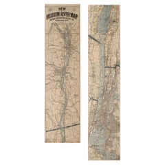
1917 "New Hudson River Map" by Wallace Bruce, Later Edition, Folding Map
Located in Colorado Springs, CO
Presented is a 1917 printing of “New Hudson Map” by Wallace Bruce. The map was published by Bryant Union Publishing Co., in New York City. The map is a later edition, issued in a distinct strip-chart format that is over 100 inches long. The map includes amazing detail, compiled mostly from U.S. Coast Survey data. It is drawn on a scale of 1.5 miles per inch, allowing ample space for it to show historical landmarks, landings, islands, list prominent residents, and more. The verso is filled with related text and illustrations about the Hudson River valley. The map folds into cream paper wrappers, titled "Hudson River Map...
Category

1910s American Vintage Beaux Arts Maps

Materials

Paper

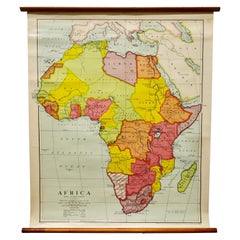
Large University Chart “Africa Physical ” by Bacon
Located in Godshill, Isle of Wight
Large University chart “Africa Physical ” by Bacon W&A K Johnston’s charts of physical maps by G W Bacon, This is a Physical map of Africa, it is lithograph set on Linen mounte...
Category

Early 20th Century Beaux Arts Maps

Materials

Linen

Related Items
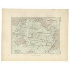
Antique Physical Chart of the Pacific Ocean by Johnston, '1850'
Located in Langweer, NL
Antique map titled 'Physical Chart of the Pacific Ocean showing the currents and temperature of the ocean'. Original antique chart of the Pacific Ocean. This map originates from 'The...
Category

Mid-19th Century Antique Beaux Arts Maps

Materials

Paper

Antique Physical Chart of the Pacific Ocean by Johnston, '1850'
$188 Sale Price
20% Off
H 11.03 in W 14.18 in D 0.02 in
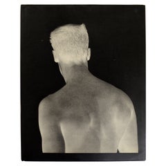
Bruce Weber by Bruce Weber, 1st Limited Edition
Located in valatie, NY
Bruce Weber by Bruce Weber. Published by Twelvetrees Press, Los Angeles, 1983. Stated 1st Limited Edition (1/5000) hardcover with dust jacket. Beautifully illustrated with over 50 full-page photogravure plates of male models and actors, a few tinted with halftone colors. Contains subjects: Brothers, Matt...
Category

1980s American Vintage Beaux Arts Maps

Materials

Paper

New Encyclopedia of Dog Hardcover Book by Bruce Fogle
Located in North Hollywood, CA
New Encyclopedia of Dog Bruce Fogle. "One of the most comprehensive explorations of the canine world ever published." All About Dogs Everything you need to know about man's best fr...
Category

Early 2000s American Beaux Arts Maps

Materials

Paper

Antique Rowing Print, Cambridge University
Located in Oxfordshire, GB
Cambridge preparing for the boat race. A wonderful atmospheric rowing lithograph of the Cambridge crew getting into a rowing scull preparing for a race....
Category

1890s British Antique Beaux Arts Maps

Materials

Paper

Antique Rowing Print, Cambridge University
$236
H 8.67 in W 11.82 in D 0.04 in
Francis Bacon: Full Face and in Profile by Michel Leiris, (Book)
Located in North Yorkshire, GB
Bacon is one of the most painterly artists of our time: his colour-drenched canvases are disturbing and stimulating. This volume comprises his series of portraits and self-portraits,...
Category

20th Century Beaux Arts Maps

Materials

Paper

1907 Chart of Nantucket Harbor by George Eldridge
Located in Norwell, MA
Chart of Nantucket Harbor from 1907 by cartographer George W. Eldridge. The chart shows the channel passing by the jetty into the harbor, by Brant Point to Steamboat Wharf. Also show...
Category

Early 1900s North American Antique Beaux Arts Maps

Materials

Paper

Set of 5 Large Original Vintage Sea Charts, circa 1920
Located in St Annes, Lancashire
5 great maps or charts of the oceans I particularly like the color of these maps Unframed Original color By John Bartholomew and Co. Edinburgh Geographical Institute Published, ...
Category

1920s British Vintage Beaux Arts Maps

Materials

Paper

Set of 5 Large Original Vintage Sea Charts, circa 1920
$180 / set
H 17.5 in W 22.5 in D 0.07 in
Mariner's Chart Poster
Located in Hamilton, Ontario
Mariner's chart poster (nautical).
Category

20th Century Beaux Arts Maps

Mariner's Chart Poster
$1,795 Sale Price
20% Off
H 24.25 in W 43 in D 0.1 in
The Hudson by Carl Carmer, First Edition
Located in valatie, NY
The Hudson by Carl Carmer. Farrar & Rinehart, New York:, 1939. First edition hardcover with dust jacket with Brodart cover. Best of the Rivers of America series. The Hudson is less a...
Category

1930s American Vintage Beaux Arts Maps

Materials

Paper

The Hudson by Carl Carmer, First Edition
$125
H 8.25 in W 6 in D 1.5 in
Hudson River Sloop "Victorine" in Case
Located in Norwell, MA
Nice boat model of the "Victorine", a famous Hudson River sloop that was built in 1845 in Piermont, New York. The model is finely crafted with a planked deck, tiller, companionway, h...
Category

1970s Vintage Beaux Arts Maps

Materials

Wood

Hudson River Sloop "Victorine" in Case
$1,295
H 26 in W 27 in D 9 in
Massachusetts Beautiful by Wallace Nutting, Signed First Edition Thus
Located in valatie, NY
Massachusetts Beautiful by Wallace Nutting. Old America, Garden City Publishing Company, Inc. 1935. First Edition Thus Signed hardcover no dust jacket. Part of His "States Beautiful" series. With many black and white photographs and illustrations of localities throughout the state of Massachusetts...
Category

1930s American Vintage Beaux Arts Maps

Materials

Paper

Hudson River And Its Painters by John K. Howat
Located in valatie, NY
Hudson River And Its Painters by John K. Howat. Published by American Legacy Press, 1983. Hardcover with dust jacket. Foreword by Carl Carmer, preface by James Biddle. Contains works...
Category

1980s American Vintage Beaux Arts Maps

Materials

Paper

Hudson River And Its Painters by John K. Howat
$65
H 12.25 in W 9.5 in D 0.75 in
Previously Available Items
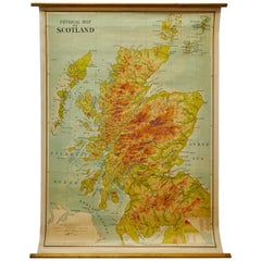
W&A K Johnston’s Charts of Physical Maps by G W Bacon
Located in Godshill, Isle of Wight
Large university chart “Physical Map of Scotland” by Bacon W&A K Johnston’s charts of physical maps by G W Bacon, This is colorful Physical map of Scotland, it is large lithogr...
Category

Early 20th Century Beaux Arts Maps

Materials

Canvas

Beaux Arts maps for sale on 1stDibs.

Find a broad range of unique Beaux Arts maps for sale on 1stDibs. Many of these items were first offered in the Early 20th Century, but contemporary artisans have continued to produce works inspired by this style. If you’re looking to add vintage maps created in this style to your space, the works available on 1stDibs include more furniture and collectibles and other home furnishings, frequently crafted with fabric, linen and other materials. It’s true that these talented designers have at times inspired knockoffs, but our experienced specialists have partnered with only top vetted sellers to offer authentic pieces that come with a buyer protection guarantee. Prices for maps differ depending upon multiple factors, including designer, materials, construction methods, condition and provenance. On 1stDibs, the price for these items starts at $796 and tops out at $796 while the average work can sell for $796.

Recently Viewed

View All