Edwardian Maps
to
10
10
77
35
19
13
6
5
4
4
4
3
1
1
10
10
3
7
10
7
7
7
3
3
10
10
10
2
Style: Edwardian
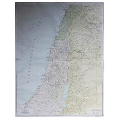
Large Original Vintage Map of Israel, circa 1920
Located in St Annes, Lancashire
Great map of Israel
Original color.
Good condition
Published by Alexander Gross
Unframed.
Category
1920s English Vintage Edwardian Maps
Materials
Paper
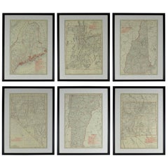
Set of 6 Original Vintage Maps of American States, circa 1900
Located in St Annes, Lancashire
Wonderful set of 6 vintage maps.
Random American states including Maine, Utah, New Hampshire, Nevada, Vermont and New Mexico.
Monochrome with red color outline.
Published by Rand,...
Category
Early 1900s American Antique Edwardian Maps
Materials
Paper
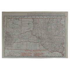
Original Antique Map of South Dakota by Rand McNally, circa 1900
Located in St Annes, Lancashire
Fabulous monochrome map with red outline color
Original color
By Rand, McNally & Co.
Published, circa 1900
Unframed
Minor edge tears.
Category
Early 1900s American Antique Edwardian Maps
Materials
Paper
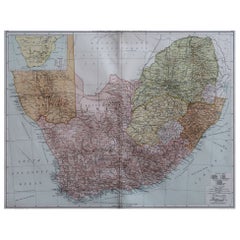
Large Original Vintage Map of South Africa, circa 1920
Located in St Annes, Lancashire
Great map of South Africa
Original color.
Good condition / repair to a minor edge tear middle bottom
Published by Alexander Gross
Unframed.
...
Category
1920s English Vintage Edwardian Maps
Materials
Paper
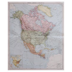
Large Original Vintage Map of North America, circa 1920
Located in St Annes, Lancashire
Great map of North America
Original color. Good condition
Published by Alexander Gross
Unframed.
Category
1920s English Vintage Edwardian Maps
Materials
Paper
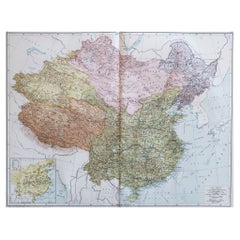
Large Original Vintage Map of China, circa 1920
Located in St Annes, Lancashire
Great map of China.
Original color. Good condition.
Published by Alexander Gross
Unframed.
Category
1920s English Vintage Edwardian Maps
Materials
Paper
Large Original Vintage Map of Mexico, circa 1920
Located in St Annes, Lancashire
Great map of Mexico
Original color.
Good condition
Published by Alexander Gross
Unframed.
Category
1920s English Vintage Edwardian Maps
Materials
Paper
Large Original Antique Map of Arkansas by Rand McNally, circa 1900
Located in St Annes, Lancashire
Fabulous monochrome map with red outline color
Original color
By Rand, McNally & Co.
Published, circa 1900
Unframed
Minor edge tears.
Category
Early 1900s American Antique Edwardian Maps
Materials
Paper
Large Original Vintage Map of New Zealand, South Island, circa 1920
Located in St Annes, Lancashire
Great map of South Island, New Zealand
Original color.
Good condition / repair to a minor tear on right edge
Published by Alexander Gross
Unframed.
Category
1920s English Vintage Edwardian Maps
Materials
Paper
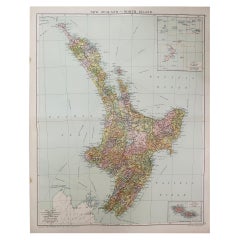
Large Original Vintage Map of New Zealand, North Island, circa 1920
Located in St Annes, Lancashire
Great map of North Island, New Zealand
Original color.
Good condition / minor foxing to right edge
Published by Alexander Gross
Unframed.
Category
1920s English Vintage Edwardian Maps
Materials
Paper
Related Items
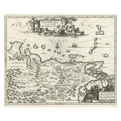
Antique Map of Venezuela by Montanus, 1671
Located in Langweer, NL
Antique map titled 'Venezuela cum parte Australi Novae Andalusiae'. The map extends from Coquibocoa to the Orinoque River, centered on Bariquicemento and Cape de Curiacao. Large cart...
Category
Mid-17th Century English Antique Edwardian Maps
Materials
Paper
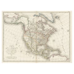
Antique Map of North America, 1821
Located in Langweer, NL
Antique map of America titled 'Carte de l'Amerique septentrionale'. Scarce map of North America, shortly after the Louisiana Purchase and the first ...
Category
19th Century Antique Edwardian Maps
Materials
Paper
Antique Map of North America by Johnston, 1882
Located in Langweer, NL
Antique map titled 'North America'.
Old map of North America. This map originates from 'The Royal Atlas of Modern Geography, Exhibiting, in a Series of Entirely Original and Authen...
Category
19th Century Antique Edwardian Maps
Materials
Paper
Antique Map of South Africa by Lowry, 1852
Located in Langweer, NL
Antique map titled 'South Africa'. Two individual sheets of South Africa. This map originates from 'Lowry's table Atlas constructed and engraved from the most recent authorities' by ...
Category
Mid-19th Century Antique Edwardian Maps
Materials
Paper
$143 Sale Price / set
20% Off
H 12.21 in W 9.65 in D 0.02 in
Antique Map of North America by Dufour 'circa 1834'
Located in Langweer, NL
Antique map titled 'Amérique Septentrionale'. Uncommon map of North America. Published by or after A.H. Dufour, circa 1834. Source unknown, to be determined.
Category
Mid-19th Century Antique Edwardian Maps
Materials
Paper
$190 Sale Price
20% Off
H 8.08 in W 10.44 in D 0.02 in
Antique Map of North America by Lapie '1842'
Located in Langweer, NL
Antique map titled 'Carte de l'Amérique septentrionale'. Map of North America, with an inset map of the Aleutian Islands. This map originates from 'Atlas universel de géographie anci...
Category
Mid-19th Century Antique Edwardian Maps
Materials
Paper
Antique Original Painted Russian Icons Painted on Wood Panels, circa 1900's
Located in Round Top, TX
Pair, original painted Russian icons on wood.
Portrayal of Saint George, Saint Simon and Saint Aviva
Age related crackles, dings/scratches, scuffs/nick...
Category
Early 19th Century Russian Antique Edwardian Maps
Materials
Wood, Paint
$6,125 / set
H 35 in W 19.5 in D 1.25 in
Antique Map of the United States of America by Lapie '1842'
Located in Langweer, NL
Antique map titled 'Carte des États-Unis d'Amérique'. Map of the United States of America (USA). This map originates from 'Atlas universel...
Category
Mid-19th Century Antique Edwardian Maps
Materials
Paper
$572 Sale Price
20% Off
H 19.89 in W 26.78 in D 0.02 in
Antique Map of North America by Lowry '1852'
Located in Langweer, NL
Antique map titled 'North America'. Original map of North America. This map originates from 'Lowry's Table Atlas constructed and engraved from the...
Category
Mid-19th Century Antique Edwardian Maps
Materials
Paper
Original Antique Map of Africa
Located in Langweer, NL
Antique map titled 'Afrika'. Original antique map of Africa, drawn by Van Beusekom. Published by 'Seyffardt's Boekhandel' in Amsterdam, circa 1870.
Category
Late 19th Century Antique Edwardian Maps
Materials
Paper
Antique Map of the United States of North America, c.1882
Located in Langweer, NL
Antique map titled 'United States of North America'. Old map of the United States of North America. This map originates from 'The Royal Atlas of Modern Geography, Exhibiting, in a Se...
Category
1880s Antique Edwardian Maps
Materials
Paper
$333 Sale Price
20% Off
H 24.22 in W 19.49 in D 0 in
Antique Map of North America by Levasseur '1875'
Located in Langweer, NL
Antique map titled 'Carte générale de l'Amérique Septentrionale'. Large map of North America. This map originates from 'Atlas de Géographie Modern...
Category
Late 19th Century Antique Edwardian Maps
Materials
Paper
$476 Sale Price
20% Off
H 18.71 in W 24.02 in D 0.02 in
Previously Available Items
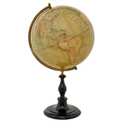
Large early 20th century globe on stand by Jordglob
Located in Debenham, Suffolk
Large early 20th century globe on stand by jordglob circa 1909.
Beautiful Swedish globe of generous proportions. A 1909 globe in good condition suspended on a brass arm, which sits...
Category
Early 20th Century Swedish Edwardian Maps
Materials
Metal
Large Original Vintage Map of New Zealand, North Island, circa 1920
Located in St Annes, Lancashire
Great map of North Island, New Zealand
Original color.
Good condition
Published by Alexander Gross
Unframed.
Category
1920s English Vintage Edwardian Maps
Materials
Paper
Large Original Vintage Map of New Zealand, South Island, circa 1920
Located in St Annes, Lancashire
Great map of South Island, New Zealand
Original color.
Good condition
Published by Alexander Gross
Unframed.
Category
1920s English Vintage Edwardian Maps
Materials
Paper
Large Original Vintage Map of South Africa, circa 1920
Located in St Annes, Lancashire
Great map of South Africa
Original color.
Good condition
Published by Alexander Gross
Unframed.
Category
1920s English Vintage Edwardian Maps
Materials
Paper
Large Original Antique Map of Oklahoma by Rand McNally, circa 1900
Located in St Annes, Lancashire
Fabulous monochrome map with red outline color
Original color
By Rand, McNally & Co.
Published, circa 1900
Unframed
Repairs to minor edge tears.
Category
Early 1900s American Antique Edwardian Maps
Materials
Paper
Large Original Vintage Map of Israel, circa 1920
Located in St Annes, Lancashire
Great map of Israel
Original color. Good condition
Published by Alexander Gross
Unframed.
Category
1920s English Vintage Edwardian Maps
Materials
Paper
Large Original Vintage Map of Mexico, circa 1920
Located in St Annes, Lancashire
Great map of Mexico
Original color.
Good condition
Published by Alexander Gross
Unframed.
Category
1920s English Vintage Edwardian Maps
Materials
Paper
Large Original Vintage Map of South East Asia, circa 1920
Located in St Annes, Lancashire
Great map of South East Asia
Original color.
Good condition
Published by Alexander Gross
Unframed.
Category
1920s English Vintage Edwardian Maps
Materials
Paper
Large Original Antique Map of North Carolina by Rand McNally, circa 1900
Located in St Annes, Lancashire
Fabulous monochrome map with red outline color
Original color
By Rand, McNally & Co.
Published, circa 1900
Unframed
Repairs to minor edge tears.
Category
Early 1900s American Antique Edwardian Maps
Materials
Paper
H 20.5 in W 27.5 in D 0.07 in
Original Antique Map of Connecticut & Rhode Island by Rand McNally, circa 1900
Located in St Annes, Lancashire
Fabulous monochrome map with red outline color
Original color
By Rand, McNally & Co.
Published, circa 1900
Unframed.
Category
Early 1900s American Antique Edwardian Maps
Materials
Paper
H 14 in W 20.5 in D 0.07 in
Edwardian maps for sale on 1stDibs.
Find a broad range of unique Edwardian maps for sale on 1stDibs. Many of these items were first offered in the Early 20th Century, but contemporary artisans have continued to produce works inspired by this style. If you’re looking to add vintage maps created in this style to your space, the works available on 1stDibs include more furniture and collectibles, wall decorations and other home furnishings, frequently crafted with paper and other materials. If you’re shopping for used Edwardian maps made in a specific country, there are England, Europe, and United Kingdom pieces for sale on 1stDibs. While there are many designers and brands associated with original maps, popular names associated with this style include and Rand McNally & Co.. It’s true that these talented designers have at times inspired knockoffs, but our experienced specialists have partnered with only top vetted sellers to offer authentic pieces that come with a buyer protection guarantee. Prices for maps differ depending upon multiple factors, including designer, materials, construction methods, condition and provenance. On 1stDibs, the price for these items starts at $50 and tops out at $800 while the average work can sell for $50.
Recently Viewed
View AllMore Ways To Browse
Bavarian Porcelain Vases
Beer Tankard
Bjorn L
Black Cabinet With Flowers And Birds
Black Tansu Chest
Blue Morpho
Blue Opaline Crystal Vases
Bow Front Buffet
Boy And Girl Statues
Brass Donkey
Brass Hound
Bread Oven
Bronze Atlas Sculpture
Bronze Door Stop
Bronze Shakespeare Sculpture
Buddha Bell
Bull Terrier
Butlers Chest
