Neoclassical Maps

NEOCLASSICAL STYLE

Neoclassical design emerged in Europe in the 1750s, as the Age of Enlightenment reached full flower. Neoclassical furniture took its cues from the styles of ancient Rome and Athens: symmetrical, ordered, dignified forms with such details as tapered and fluted chair and table legs, backrest finials and scrolled arms.

Over a period of some 20 years, first in France and later in Britain, neoclassical design — also known as Louis XVI, or Louis Seize — would supersede the lithe and curvaceous Rococo or Louis XV style.

The first half of the 18th century had seen a rebirth of interest in classical antiquity. The "Grand Tour" of Europe, codified as a part of the proper education of a patrician gentleman, included an extended visit to Rome. Some ventured further, to sketch the ruins of ancient Greece. These drawings and others — particularly those derived from the surprising and rich archaeological discoveries in the 1730s and ’40s at the sites of the Roman cities of Pompeii and Herculaneum — caused great excitement among intellectuals and aesthetes alike.

Neoclassical furniture is meant to reflect both grace and power. The overall appearance of neoclassical chairs, tables and cabinetry is strong and rectilinear. These pieces are, in effect, classical architecture in miniature: chair and table legs are shaped like columns; cabinets are constructed with elements that mirror friezes and pediments.

Yet neoclassicism is enlivened by gilt and silver leaf, marquetry, and carved and applied ornamental motifs based on Greek and Roman sculpture: acanthus leaves, garlands, laurel wreaths, sheaves of arrow, medallions and chair splats are carved in the shapes of lyres and urns. Ormolu — or elaborate bronze gilding — was essential to French design in the 18th and 19th centuries as a cornerstone of the neoclassical and Empire styles.

As you can see from the furniture on these pages, there is a bit of whimsy in such stately pieces — a touch of lightness that will always keep neoclassicism fresh.

Find antique neoclassical furniture today on 1stDibs.

to
5
5
76
35
18
13
6
4
4
4
3
1
1
5
5
4
4
3
3
2
1
1
5
5
5
Style: Neoclassical
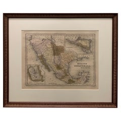
1834 Mexico & Guatemala Framed Map by H.S. Tanner
Located in Stamford, CT
1834 Mexico & Guatemala map of published by H.S. Tanner, Philadelphia, Pennsylvania. Engraved by J. Knight. As found high end custom framing with carved wood frame, custom matting a...
Category

1830s American Antique Neoclassical Maps

Materials

Glass, Wood, Paper

Framed 1838 Mexico & Gulf of Mexico Map
Located in Stamford, CT
Framed 1838 Mexico & Gulf of Mexico map. Printed by Fisher, Son & Co. of London in 1838. As found framed condition. Map has not been examined outside of th...
Category

1830s English Antique Neoclassical Maps

Materials

Glass, Wood, Paper

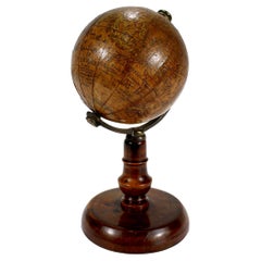
Antique 19th Century Miniature French Edition Globe by C. Abel-Klinger
Located in Philadelphia, PA
A fine antique French Edition miniature globe. By C. Abel-Klinger. On a turned wooden stand with an uncalibrated brass half meridian. The globe is marked with an integral l...
Category

19th Century German Antique Neoclassical Maps

Materials

Paper

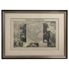
1847 Amerique Septentrionale Framed Map
Located in Stamford, CT
1847 Amerique Septentrionale Framed Map Illustrated by Raimond Bonheur. As found framed condition.
Category

1840s American Antique Neoclassical Maps

Materials

Glass, Wood, Paper

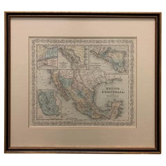
Large 1856 Mexico & Guatemala Framed Map by Charles Desilver
Located in Stamford, CT
Large 1856 Mexico & Guatemala Framed map. Published by Charles Desilver, Philadelphia, Pennsylvania. As found high end custom framing with black giltwood frame, custom matting and UV...
Category

1850s American Antique Neoclassical Maps

Materials

Glass, Wood, Paper

Related Items
Detailed Regional Map of the Gulf of Bengal and the Lower Ganges River, ca.1750
Located in Langweer, NL
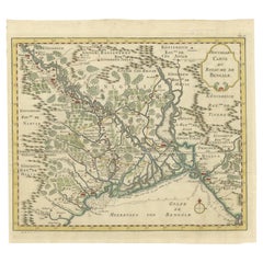
Title of this original and rare antique map: Nouvelle Carte Du Royaume De Bengale Mapmaker: Jacques-Nicolas Bellin (1703-1772). He was among the most important mapmakers of the eighteenth century. In 1721, at only the age of 18, he was appointed Hydrographer to the French Navy. In August 1741, he became the first Ingénieur de la Marine of the Dépôt des cartes...
Category

1750s Antique Neoclassical Maps

Materials

Paper

Texas California Mexico Map – Antique Tallis Map with Gold Region, c.1850
Located in Langweer, NL
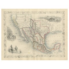
Texas California Mexico Map – Antique Tallis Map with Gold Region, c.1850 This highly decorative and historically rich map titled 'Mexico, California and Texas' was published around...
Category

Mid-19th Century Antique Neoclassical Maps

Materials

Paper

Antique North America Map, USA, Canada, Mexico, Cartography, Colton, Victorian
Located in Hele, Devon, GB
This is an antique North America map. A USA, framed lithography atlas engraving of the continent by JH Colton, dating to the Victorian period and later, circa 1860. Fascinating, large framed map...
Category

Mid-19th Century American Antique Neoclassical Maps

Materials

Paper

19th Century Terrestrial Globe by G. Thomas, Editeur & Globe Maker, Paris, 1890s
By G. Thomas, Éditeur
Located in San Francisco, CA
Rare 19th century terrestrial globe by G. Thomas, Editeur & Globe Maker, Paris, circa 1890s The globe sits atop a wooden stand and measures 4" diameter x 6.5" high. The globe i...
Category

Late 19th Century French Antique Neoclassical Maps

Materials

Paper

19th Century German Miniature Pocket Terrestrial Globe
Located in Essex, MA
A miniature 19th century 3.5 inch diameter pocket terrestrial globe by C. Abel-Klinger, Nuremberg, Germany, in English for the English speaking markets. Signed with cartouche reading...
Category

1880s German Antique Neoclassical Maps

Materials

Brass

19th Century German Miniature Pocket Terrestrial Globe
$1,230 Sale Price
50% Off
H 3.5 in Dm 3.5 in
19th Century French Empire Miniature Commode
Located in Winter Park, FL
A 19th century French Empire miniature commode. A well executed miniature chest made of walnut and veneer of walnut with two large drawers below a smaller top drawer and with solid walnut columns. Inscription written in ink on the back of each of the large drawers: Don D...
Category

Early 19th Century French Antique Neoclassical Maps

Materials

Walnut

19th Century French Empire Miniature Commode
$1,800
H 11.5 in W 12 in D 7.75 in
19th Century Terrestrial Globe - by Ikelmer Paris
By Ikelmer
Located in Casteren, Noord-Brabant
A beautiful antique globe, issued by the French maker Ikelmer Paris. The globe was made around 1880-1890. The globe is made of paper, the base is made of black lacquered wood. The gl...
Category

Late 19th Century French Antique Neoclassical Maps

Materials

Wood, Paper

19th Century Miniature Wooden Bookcase
Located in Delft, NL
A 19th century miniature wooden bookcase An oak miniature bookcase, raised on plinth and 2 charming shelves. (2 loose shelves) Decorated at the fron...
Category

19th Century Dutch Antique Neoclassical Maps

Materials

Oak

19th Century Miniature Wooden Bookcase
$4,496
H 27.96 in W 18.51 in D 7.29 in
World Globe With Wooden Foot, and Brass 20th Century
Located in Mombuey, Zamora
Beautiful and elegant ball of the world to decorate any studio, living room or bedroom, it is small, with the base about 26 cm high and 10 wide.
Category

20th Century Italian Neoclassical Maps

Materials

Brass

World Globe With Wooden Foot, and Brass 20th Century
$670 Sale Price
20% Off
H 14.57 in W 8.08 in D 8.08 in
19th C. French Miniature Buffet
Located in Winter Park, FL
A late 19th c. French miniature doll furniture buffet made of walnut with rosewood trim and oak as a secondary wood. Two small dovetailed drawers above cabinet doors opening to an in...
Category

19th Century French Antique Neoclassical Maps

Materials

Oak, Rosewood, Walnut

19th C. French Miniature Buffet
$650
H 18.75 in W 16 in D 9.5 in
Late 19th century antique globe by Joseph Forest
Located in Oostende, BE
The meridian, attached to each pole, is in engraved brass. The base is in blackened turned wood. It is signed “Dressé par J Forest” Joseph Forest, born March 20, 1865 in Paris and ...
Category

Late 19th Century French Antique Neoclassical Maps

Materials

Wood

Engraving of a Map of Florida, the Gulf Coast, Caribbean & Central America, 1728
Located in Langweer, NL
This exceptional antique map, titled "Nouvelle Carte Marine de Toute les Cotes de l´Amerique" and alternatively known as "Nieuwe groote en seer Curieuse Paskaart van Geheel-WestIndie...
Category

Mid-18th Century Dutch Antique Neoclassical Maps

Materials

Paper

Previously Available Items
Large Terrestrial and Celestial Globe with Astrological Signs, Circa 1970
Located in Plainview, NY
An exquisite late 20th century vintage large terrestrial and celestial globe with astrological signs displaying magnificent details ma...
Category

Late 20th Century American Neoclassical Maps

Materials

Mahogany, Paper

Very Large 19th Century World Globe, France
Located in Girona, Spain
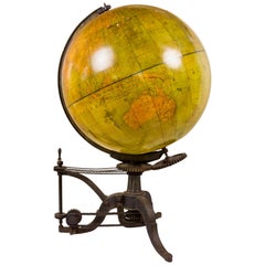
Huge 19th century globe, Terrestrial globe Original working cast iron stand Stand allows globe to turn and pivot Made by Barbot, Paris, France circa 1880, France Very good vint...
Category

19th Century French Antique Neoclassical Maps

Materials

Metal

Rare Engraved Map of Africa by Samuel Boulton, 1800
By Samuel Boulton
Located in Miami Beach, FL
Rare and important large engraved map of Africa with old water coloring accents. The cartouche on the upper right reads "Africa with all its states, kingdoms, republics, regions, ...
Category

Early 1800s English Antique Neoclassical Maps

Materials

Paper

18th Century Map of the Bourgogne Region
Located in Vosselaar, BE
This large map of the French Bourgogne region was printed and mounted in the late 18th century. Since the governemental centralisation by the Sun King (Louis XIV) the succesing monar...
Category

Late 18th Century French Antique Neoclassical Maps

Materials

Canvas

18th Century Map of the Bourgogne Region
H 55.12 in W 41.7 in D 1 in

Neoclassical maps for sale on 1stDibs.

Find a broad range of unique Neoclassical maps for sale on 1stDibs. Many of these items were first offered in the Early 20th Century, but contemporary artisans have continued to produce works inspired by this style. If you’re looking to add vintage maps created in this style to your space, the works available on 1stDibs include more furniture and collectibles, wall decorations and other home furnishings, frequently crafted with paper, glass and other materials. If you’re shopping for used Neoclassical maps made in a specific country, there are North America, United States, and Europe pieces for sale on 1stDibs. While there are many designers and brands associated with original maps, popular names associated with this style include and Rand McNally & Co.. It’s true that these talented designers have at times inspired knockoffs, but our experienced specialists have partnered with only top vetted sellers to offer authentic pieces that come with a buyer protection guarantee. Prices for maps differ depending upon multiple factors, including designer, materials, construction methods, condition and provenance. On 1stDibs, the price for these items starts at $472 and tops out at $3,600 while the average work can sell for $2,175.

Recently Viewed

View All