Items Similar to A Tallis Map of British Guiana with Colonial Vignettes and Other Landmarks, 1851

Want more images or videos?
Request additional images or videos from the seller
1 of 6
A Tallis Map of British Guiana with Colonial Vignettes and Other Landmarks, 1851
$274
$342.5120% Off
£206.28
£257.8520% Off
€232
€29020% Off
CA$377.46
CA$471.8220% Off
A$422.73
A$528.4120% Off
CHF 220.57
CHF 275.7220% Off
MX$5,163.48
MX$6,454.3520% Off
NOK 2,806.35
NOK 3,507.9320% Off
SEK 2,645.32
SEK 3,306.6520% Off
DKK 1,766.02
DKK 2,207.5220% Off
About the Item
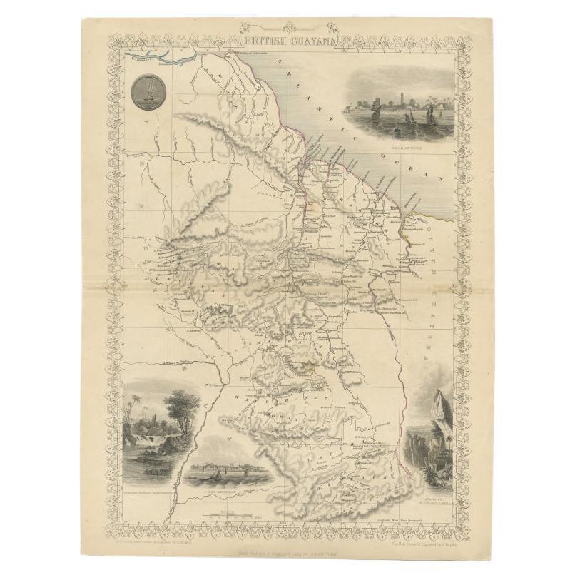
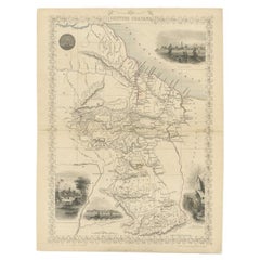
This Tallis map of British Guiana (now known as Guyana) is a richly decorated document, much like other maps from the esteemed cartographic publisher John Tallis & Company. The firm, particularly known during the Victorian era, produced maps that were as much informative as they were ornamental.
**The Maker - John Tallis & Company:**
John Tallis, along with his partner John Frederick Tallis, focused on creating maps that were visually appealing, featuring elaborate borders and illustrative vignettes that captured the imagination of their audience. These maps are highly collectible today for their artistic value and historical significance.
**The Map - British Guiana:**
The map itself would have provided a comprehensive view of British Guiana, detailing its physical geography, including river systems, elevation changes, settlements, and other key geographic features. British Guiana was an important colony in South America due to its production of sugar and other resources, and it was the only English-speaking country on the continent.
**The Countries:**
Guyana is bordered by the Atlantic Ocean, Brazil, Suriname, and Venezuela. It has a rich history, from the native Amerindian cultures to Dutch and British colonization. It's known for its diverse ethnic makeup and as the location of the infamous Jonestown massacre.
**The Tallis Series:**
The series produced by Robert Montgomery Martin provided an extensive survey of the British Empire's colonies, catering to the British middle and upper classes' growing interest in the empire's global reach. The maps served not only as tools for education and reference but also as symbols of British pride and achievement.
Today, these maps are prized for their detail, beauty, and as snapshots of history, giving insight into the geographical understanding and imperial mindset of the period.
The insets in more detail:
The insets on this map of British Guiana (now Guyana) provide a detailed look into specific geographical and cultural aspects of the region during the mid-19th century:
1. **Seal of the Colony**: This inset is a detailed illustration of the official seal of British Guiana. It usually features a depiction that has symbolic meaning, often related to the colony’s economic activities or its relationship with the British Crown.
2. **Ataraipu, or the Devil's Rock**: This vignette depicts a notable landmark known as the Devil’s Rock (Ataraipu). The scene is set in a dramatic landscape, possibly illustrating a natural rock formation that stands out in the region.
3. **Georgetown**: This is an illustration of Georgetown, the capital city of British Guiana. It shows a waterside view with ships, indicating the importance of Georgetown as a hub for trade and transportation.
4. **New Amsterdam**: Here, a view of the town of New Amsterdam is depicted, which is another key settlement in British Guiana. Like Georgetown, it is shown as a coastal town with ships, highlighting its role in maritime commerce.
5. **Christmas Cataract, River Berbice**: This vignette likely shows one of the natural waterfalls on the Berbice River, capturing the natural beauty and possibly the challenges of navigating the river.
These insets serve to provide not just visual context but also to emphasize the strategic economic and cultural importance of British Guiana to the British Empire. Maps with such detailed vignettes were not only useful for navigation but also served an educational purpose and were often used to showcase the empire’s reach to audiences back in Britain. These illustrations can be a critical selling point for the map today, offering historical insights into the British colonial perspective of the time.
- Dimensions:Height: 14.26 in (36.2 cm)Width: 10.71 in (27.2 cm)Depth: 0 in (0.02 mm)
- Materials and Techniques:
- Period:
- Date of Manufacture:1851
- Condition:Good given age. Original fold in middle as published. General age-related toning, please study scan carefully.
- Seller Location:Langweer, NL
- Reference Number:Seller: BG-13736-41stDibs: LU3054339291532
About the Seller
5.0
Recognized Seller
These prestigious sellers are industry leaders and represent the highest echelon for item quality and design.
Platinum Seller
Premium sellers with a 4.7+ rating and 24-hour response times
Established in 2009
1stDibs seller since 2017
2,531 sales on 1stDibs
Typical response time: <1 hour
- ShippingRetrieving quote...Shipping from: Langweer, Netherlands
- Return Policy
Authenticity Guarantee
In the unlikely event there’s an issue with an item’s authenticity, contact us within 1 year for a full refund. DetailsMoney-Back Guarantee
If your item is not as described, is damaged in transit, or does not arrive, contact us within 7 days for a full refund. Details24-Hour Cancellation
You have a 24-hour grace period in which to reconsider your purchase, with no questions asked.Vetted Professional Sellers
Our world-class sellers must adhere to strict standards for service and quality, maintaining the integrity of our listings.Price-Match Guarantee
If you find that a seller listed the same item for a lower price elsewhere, we’ll match it.Trusted Global Delivery
Our best-in-class carrier network provides specialized shipping options worldwide, including custom delivery.More From This Seller
View AllAntique Map of British Guayana with Insets of Georgetown, Devil's Rock Etc, 1851
Located in Langweer, NL
Antique map titled ‘British Guayana’. Includes decorative vignettes titled Georgetown, Christmas Cataract River Berbice, New Amsterdam and Ataraipu or the Devil’s Rock. Originates fr...
Category
Antique 19th Century Maps
Materials
Paper
$425 Sale Price
20% Off
Free Shipping
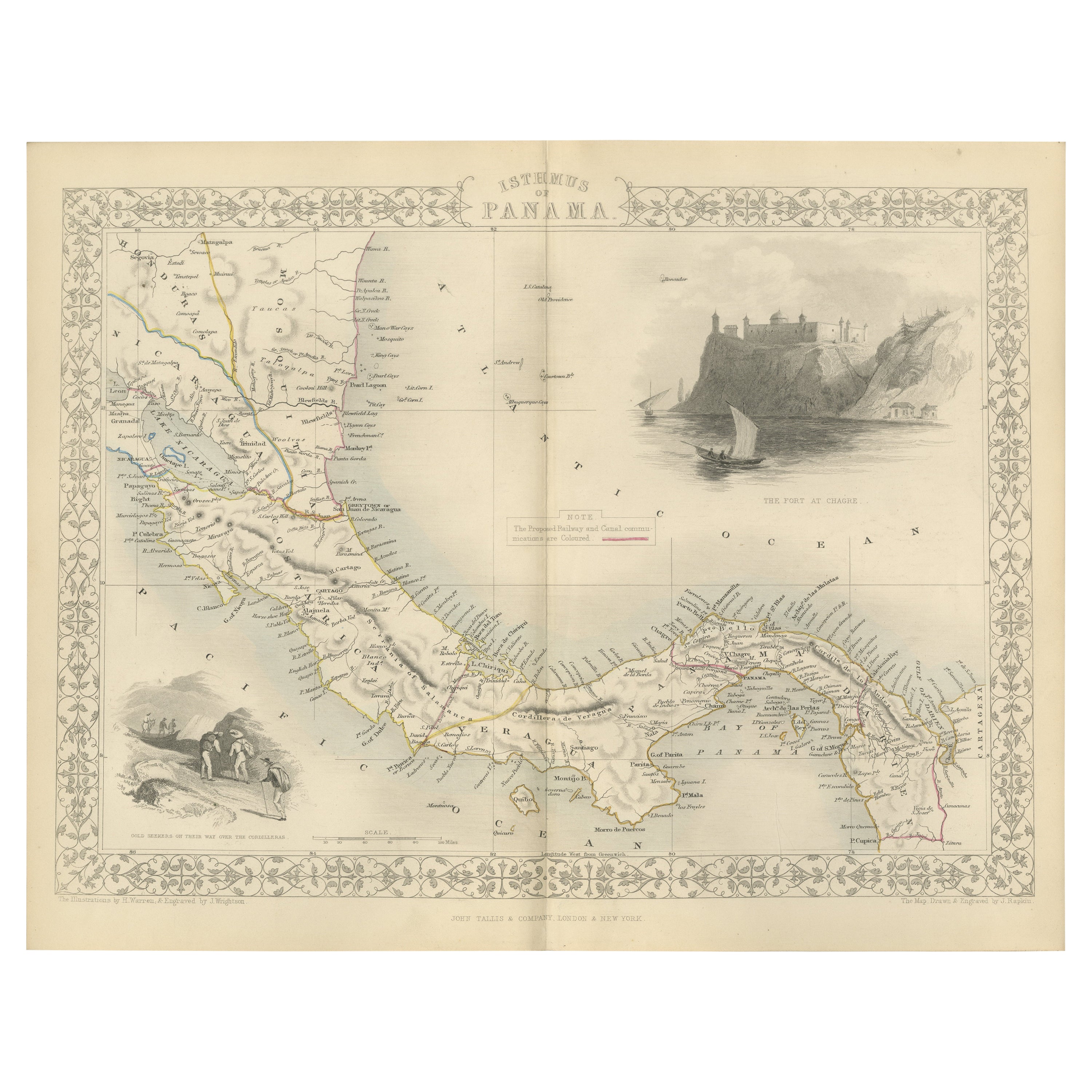
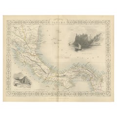
Crossroads of Empires: A John Tallis Map of the Isthmus of Panama, 1851
Located in Langweer, NL
The Tallis map of the Isthmus of Panama is a beautifully detailed work, characteristic of the maps produced by John Tallis & Company, which was one of the last cartographic firms to ...
Category
Antique 1850s Maps
Materials
Paper
$274 Sale Price
20% Off
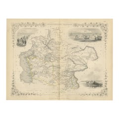
Antique Map of the Northern Part of South America by J. Tallis, circa 1851
Located in Langweer, NL
A decorative and detailed mid-19th century map of the northern part of South America (including modern day Venezuela, Colombia, Ecuador, Guyana, Suriname and French Guiana) which was drawn and engraved by J. Rapkin (vignettes by H. Winkles & W. Lacey) and published in John Tallis & Co.'s The Illustrated Atlas (London & New York: circa 1851).
The Illustrated Atlas, published from 1849 onwards, was the last decorative world atlas. The 'Venezuela, New Granada...' map was typical of the many Fine ones which appeared in this work with its decorative border and attractive vignettes. Illustrated are views of Mount Chimborazo, Ecuador; the 'Fall of the Bagota' (Tequendama Falls, Colombia); Rheas and a prospect of Paramaribo Harbour (Dutch Guiana...
Category
Antique Mid-19th Century Maps
Materials
Paper

$259 Sale Price
20% Off
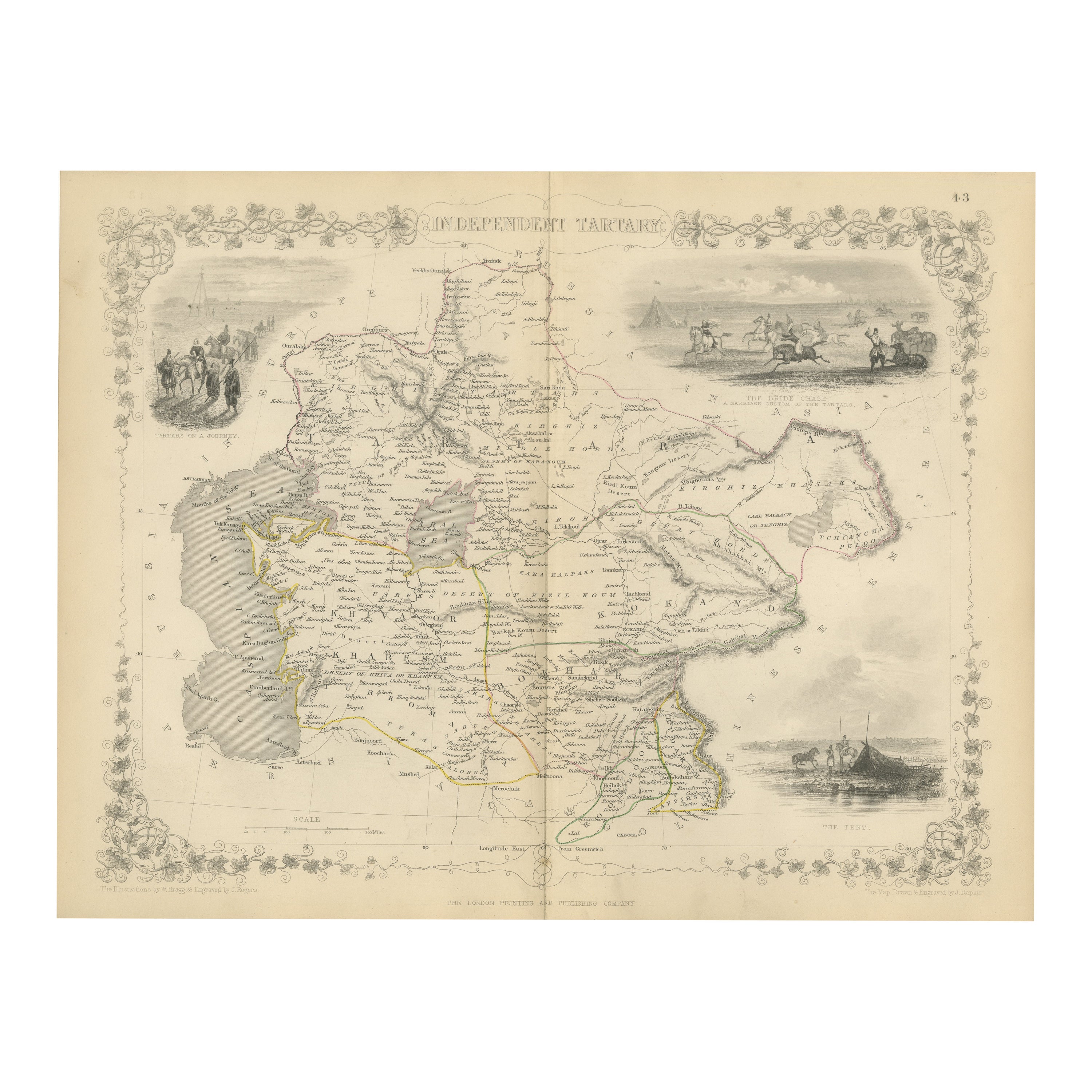
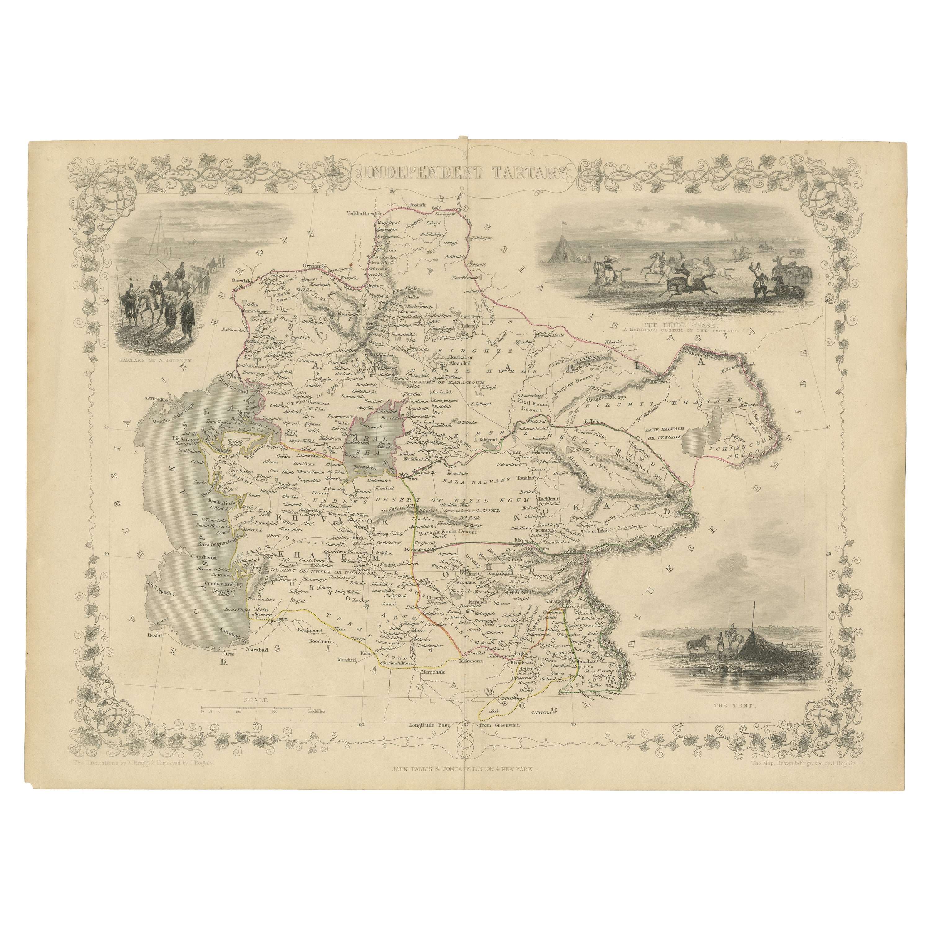
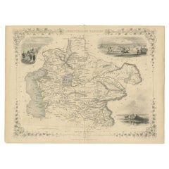
Map of Independent Tartary with Vignettes of the Region's Culture, 1851
Located in Langweer, NL
The map of Independent Tartary is part of the collection by John Tallis & Company, which were unique for their elaborate decorative elements and detailed illustrations.
**The Maker ...
Category
Antique 1850s Maps
Materials
Paper
$274 Sale Price
20% Off
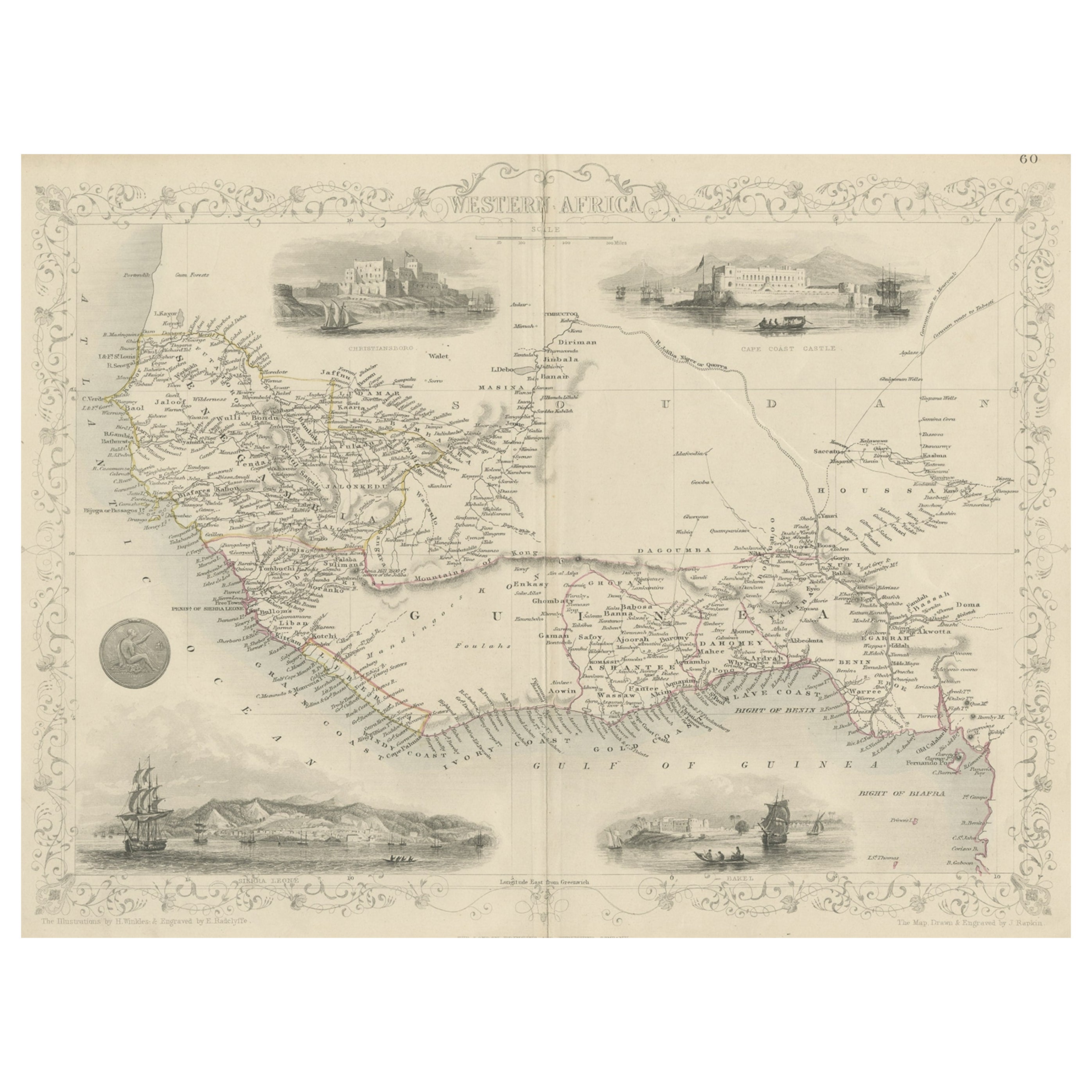
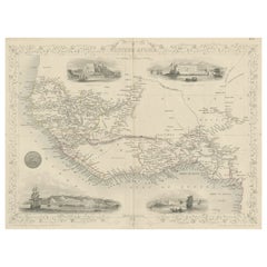
Antique Map of Western Africa with Vignettes of Cape Coast Castle etc, ca.1851
Located in Langweer, NL
Antique map titled ‘Western Africa’. Includes decorative vignettes titled Christiansborg, Cape Coast Castle, Sierra Leone and Bakel. Originates from 'The Illustrated Atlas, And Modern History Of The World Geographical, Political, Commercial & Statistical, Edited By R. Montgomery Martin'. Published; John Tallis London, New York, Edinburgh & Dublin. 1851. Drawn and Engraved by J. Rapkin.
Artists and Engravers: John Tallis (1817-1876) was a British map...
Category
Antique 1850s Maps
Materials
Paper
$330 Sale Price
20% Off
Gateway to the Steppes: Tallis's Masterpiece Map of Indepent Tartary, 1851
Located in Langweer, NL
The map is of "Independent Tartary," a historical region in Central Asia that covered parts of what are now Kazakhstan, Uzbekistan, Turkmenistan, and surrounding areas. The map was p...
Category
Antique 1850s Maps
Materials
Paper
$311 Sale Price
20% Off
You May Also Like
1851 Map of "Independent Tartary", Ric. R018
Located in Norton, MA
1851 Map of
Independent Tartary
"Russia"
Ric.r018
A highly decorative 1851 map of Independent Tartary by John Tallis and John Rapkin. Covers the regions between the Caspian Sea and Lake Bakquash and between Russia and Afghanistan. These include the ancient Silk Route kingdoms of Khiva, Tartaria, Kokand, and Bokhara. Today this region roughly includes Kazakhstan, Uzbekistan, Turkmenistan, Kyrgyzstan, and Tajikistan. This wonderful map offers a wealth of detail for anyone with an interest in the Central Asian portion of the ancient Silk Road. Identifies various caravan routes, deserts, wells, and stopping points, including the cities of Bokhara and Samarkand. Three vignettes by W. Bragg decorate the map, these including an image of Tartars on a Journey, a horseback Bride Chase, and a tartar camp site. Surrounded by a vine motif border. Engraved by J. Rapkin for John Tallis's 1851 Illustrated Atlas .
Tartary Antique Map...
Category
Antique 19th Century Unknown Maps
Materials
Paper

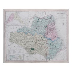
Original Antique English County Map, Durham, J & C Walker, 1851
Located in St Annes, Lancashire
Great map of Durham
Original colour
By J & C Walker
Published by Longman, Rees, Orme, Brown & Co. 1851
Unframed.
Category
Antique 1850s English Other Maps
Materials
Paper
Large Original Antique Map of Java and Borneo, Fullarton, C.1870
Located in St Annes, Lancashire
Great map of Java and Borneo
Wonderful figurative borders
From the celebrated Royal Illustrated Atlas
Lithograph. Original color.
Published by Fullarton, Edinburgh. C.1870
Unfr...
Category
Antique 1870s Scottish Maps
Materials
Paper

Original Antique English County Map - Monmouthshire. J & C Walker. 1851
Located in St Annes, Lancashire
Great map of Monmouthshire
Original colour
By J & C Walker
Published by Longman, Rees, Orme, Brown & Co. 1851
Unframed.
Category
Antique 1850s English Other Maps
Materials
Paper

1839 Map of Karte Des "Russischen Reiches in Europa Und Asien" Ric.R0013
Located in Norton, MA
1839 map of Karte Des
"Russischen Reiches in Europa and Asien"
Ric.r013
Map of the European and Asian parts of Russian Empire. Karte der Russischen Reiches in Europa und Asien...
Category
Antique 19th Century Unknown Maps
Materials
Paper

Map Colonies Francaises Martinique, 1845
Located in BUNGAY, SUFFOLK
Colonies Francaises, Martinique, Amerique DU SUD
Geographie et Statistique par V.Levasseur. Ing'r Geographe.
Illustre par Raymond Bonheur, peintre.
Grave par Laguihermie, Rue St...
Category
Antique 19th Century French Maps
Materials
Paper

More Ways To Browse
British Empire
British Colonial Antique Furniture
19th Century British Colonial Furniture
Antique Devil
Imperial Brazil
Brazilian Colonial Furniture
British Guiana
Antique Oushak Carpets
Blue Coffee Tables
1945 Chair Juhl
Antique Three Leg Table
Folke Arstrom
Silver Over Copper
Vintage Barware Glasses
Antique Etched Glass
Antique French Shell
Coffee Table Black Italian Modern
Christofle America