Items Similar to Topographical and Infrastructure Map of the Province of Valencia, 1901
Want more images or videos?
Request additional images or videos from the seller
1 of 6
Topographical and Infrastructure Map of the Province of Valencia, 1901
$484.72
$605.9020% Off
£365.57
£456.9620% Off
€416
€52020% Off
CA$670.17
CA$837.7120% Off
A$750.70
A$938.3820% Off
CHF 394.29
CHF 492.8720% Off
MX$9,128.28
MX$11,410.3420% Off
NOK 4,993.06
NOK 6,241.3320% Off
SEK 4,739.76
SEK 5,924.7020% Off
DKK 3,166.86
DKK 3,958.5820% Off
About the Item
A historical map of the province of Valencia, dated 1901. The map includes intricate details such as topographical features, with mountain ranges and river systems prominently marked. The province's boundaries are clearly outlined, and various types of roads and railways are indicated, suggesting the map's usefulness for navigation and understanding the region's geography during the early 20th century.
The map includes a legend or "signos convencionales," which explains the symbols used to represent cities, towns (pueblos), administrative boundaries (límite de provincia), railways (ferrocarril en explotación and en construcción for operational and under-construction railways respectively), roads (carreteras), and telegraph lines (telégrafo), among others.
Additionally, the map is adorned with the coat of arms of Valencia, highlighting regional pride and identity. The crest, along with the cartographic style, suggests an official or governmental source for the map.
The province of Valencia is located along the Mediterranean coast, which is evident from the map's orientation. Valencia is known for its fertile lands, which benefit from the rivers such as the Turia and Júcar, and for its rich history and cultural heritage. The map would be particularly useful for historians, geographers, and others interested in the historical landscape and infrastructure development of Valencia at the turn of the 20th century.
The province of Valencia, located on the eastern coast of Spain, is part of the autonomous community of the Valencian Community. It is bordered by the provinces of Castellón to the north, Teruel to the west, Cuenca and Albacete to the southwest, Alicante to the south, and the Mediterranean Sea to the east. The capital of the province is the city of Valencia, which is also the third-largest city in Spain.
Valencia is known for its rich history, culture, and economic dynamism. It is famous for its vibrant festivals, including the internationally renowned Falles (Las Fallas), which features the creation and destruction of ninots (large wooden, cardboard, or plaster statues). The region is also famous for its traditional dish, paella, which has become a symbol of Valencian and Spanish cuisine worldwide.
The province has a diverse geography, ranging from the sandy beaches along the coast to the rugged terrain and mountain ranges inland. It is also home to the Albufera Natural Park, a significant wetland reserve south of the city of Valencia. The economy is varied, with strong sectors in agriculture (particularly citrus fruits), industry, tourism, and services.
In terms of infrastructure, the map would show a network of roads and railways connecting the province's various towns and cities, including an extensive system of smaller roads and paths serving the agricultural areas. The map could also indicate areas of particular historical interest, such as Roman ruins or medieval castles, as well as the locations of rivers, mountain ranges, and other natural features.
- Dimensions:Height: 20.08 in (51 cm)Width: 14.77 in (37.5 cm)Depth: 0 in (0.02 mm)
- Materials and Techniques:
- Period:1900-1909
- Date of Manufacture:1902
- Condition:Good condition. Central vertical folding lines as issued. Aged paper with typically warm, yellowish-brown hue, especially around the edges and folding lines. Check the images carefully.
- Seller Location:Langweer, NL
- Reference Number:Seller: BG-13642-431stDibs: LU3054338033292
About the Seller
5.0
Recognized Seller
These prestigious sellers are industry leaders and represent the highest echelon for item quality and design.
Platinum Seller
Premium sellers with a 4.7+ rating and 24-hour response times
Established in 2009
1stDibs seller since 2017
2,517 sales on 1stDibs
Typical response time: <1 hour
- ShippingRetrieving quote...Shipping from: Langweer, Netherlands
- Return Policy
Authenticity Guarantee
In the unlikely event there’s an issue with an item’s authenticity, contact us within 1 year for a full refund. DetailsMoney-Back Guarantee
If your item is not as described, is damaged in transit, or does not arrive, contact us within 7 days for a full refund. Details24-Hour Cancellation
You have a 24-hour grace period in which to reconsider your purchase, with no questions asked.Vetted Professional Sellers
Our world-class sellers must adhere to strict standards for service and quality, maintaining the integrity of our listings.Price-Match Guarantee
If you find that a seller listed the same item for a lower price elsewhere, we’ll match it.Trusted Global Delivery
Our best-in-class carrier network provides specialized shipping options worldwide, including custom delivery.More From This Seller
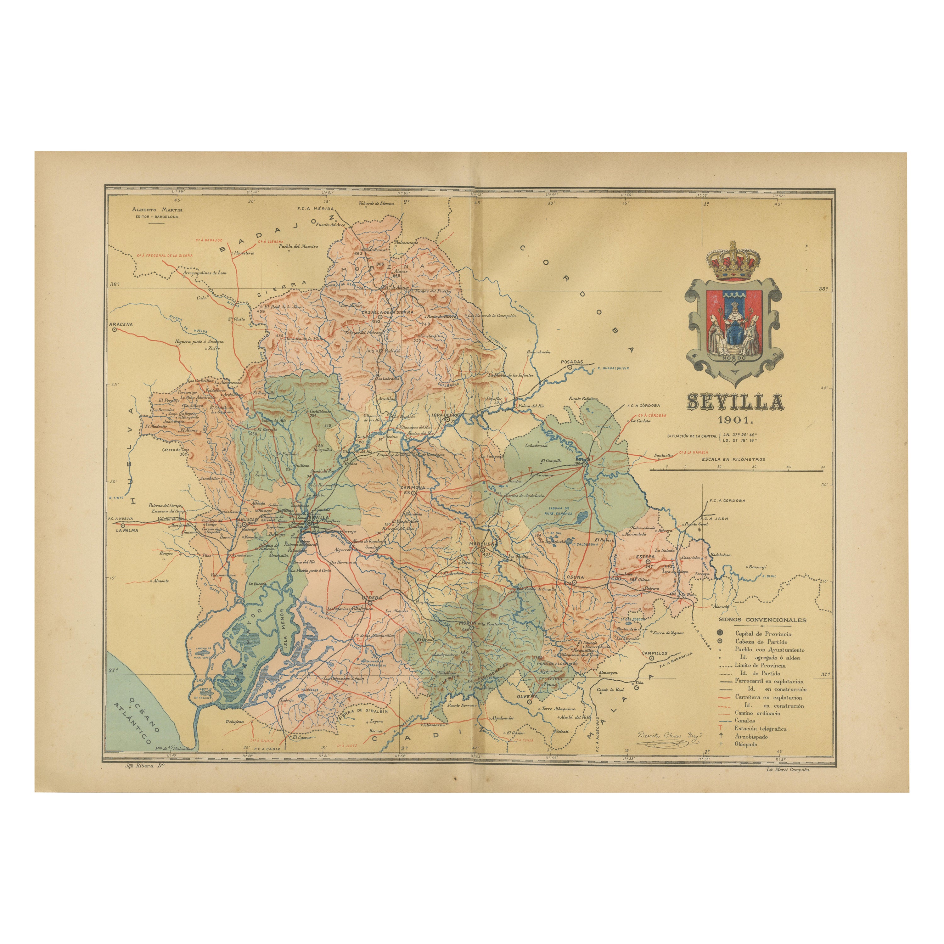
View AllMap of Sevilla Province, 1901: A Depiction of The Spanish Cultural Heartland
Located in Langweer, NL
The print for sale here depicts a historical map of the province of Sevilla (Seville) from the year 1901. Sevilla is located in the southern part of Spain and is part of the autonomo...
Category
Antique Early 1900s Maps
Materials
Paper
$261 Sale Price
30% Off
Free Shipping
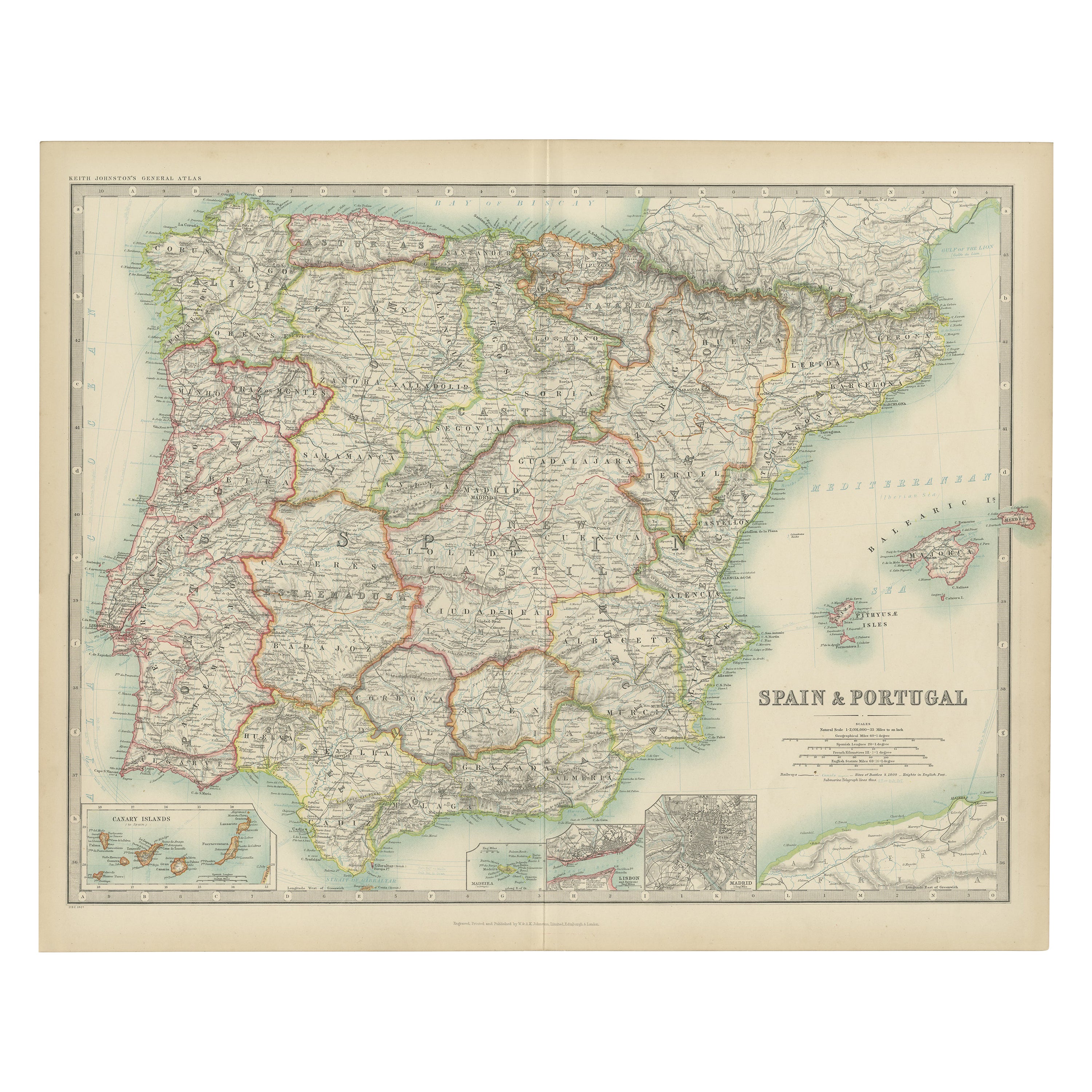
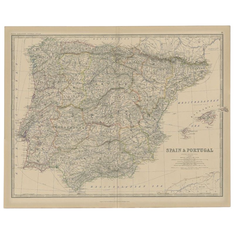
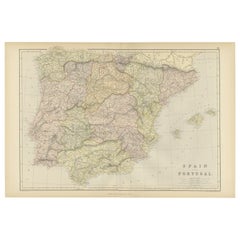
Antique Map of Spain and Portugal by Johnston, '1909'
Located in Langweer, NL
Antique map titled 'Spain and Portugal'. Original antique map of Spain and Portugal. With inset maps of the Canary Islands, Madeira, Lisbon and Ma...
Category
Early 20th Century Maps
Materials
Paper
$233 Sale Price
20% Off
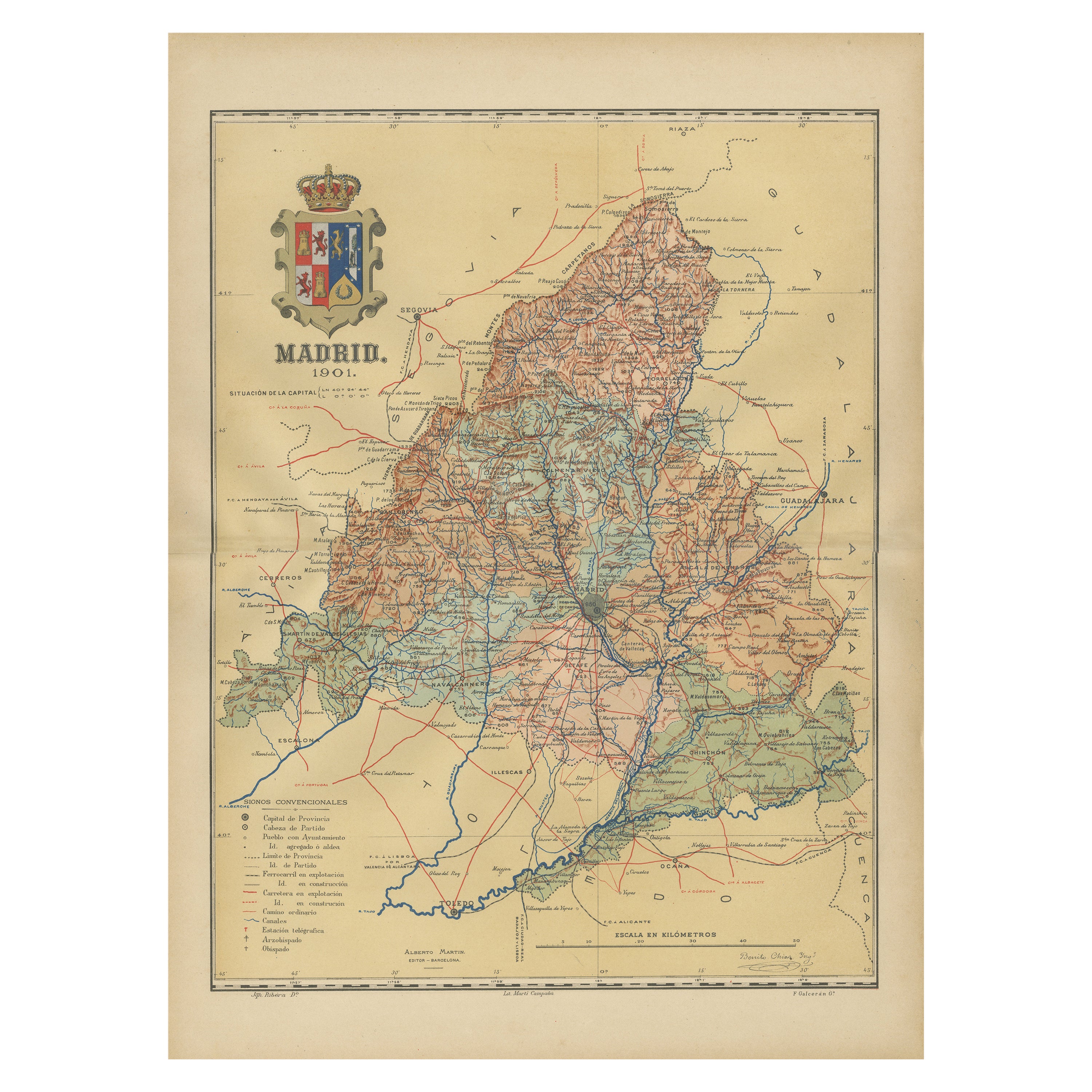
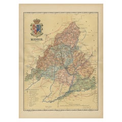
Madrid 1901: A Historical Map of Spain's Capital Province
Located in Langweer, NL
The map is of the province of Madrid, the capital region of Spain, as it appeared in 1901. Here are the key features it displays:
The map shows the central part of Spain, with the Guadarrama mountain range prominently visible, marking the natural border to the north of Madrid.
Blue lines likely indicate rivers, including the Manzanares River, which flows through Madrid, and the Jarama River, a tributary to the Tagus.
Red lines depict the roads and railways, outlining the infrastructure that connects Madrid's various towns and cities within the province and beyond.
Symbols and labels mark the locations of cities, towns, and villages, with Madrid itself likely being the focal point. Dotted lines may represent the administrative divisions within the province. The map includes a legend (Signos Convencionales) that explains the symbols used for provincial capitals, roads, railways, and other geographic features.
The coat of arms of Madrid, featuring a bear and a strawberry tree (madroño), is prominently featured, symbolizing the city's and the province's historical coat of arms.
About the province of Madrid:
Madrid is not only the capital of Spain but also the heart of the Iberian Peninsula, both geographically and politically. The city is renowned for its rich repositories of European art, including the Prado Museum's works by Goya, Velázquez, and other Spanish masters. The province of Madrid is characterized by a blend of historical and modern elements, with a rich cultural life that includes theater, opera, and flamenco, as well as gastronomy that features a mix of traditional Spanish dishes and international cuisine...
Category
Antique Early 1900s Maps
Materials
Paper
Original Antique Map of Spain and Portugal, 1882
Located in Langweer, NL
Embark on a historical voyage with an original Antique Map of Spain and Portugal from the esteemed 'Comprehensive Atlas and Geography of the World,' meticulously crafted in 1882. Thi...
Category
Antique 1880s Maps
Materials
Paper
$158 Sale Price
20% Off
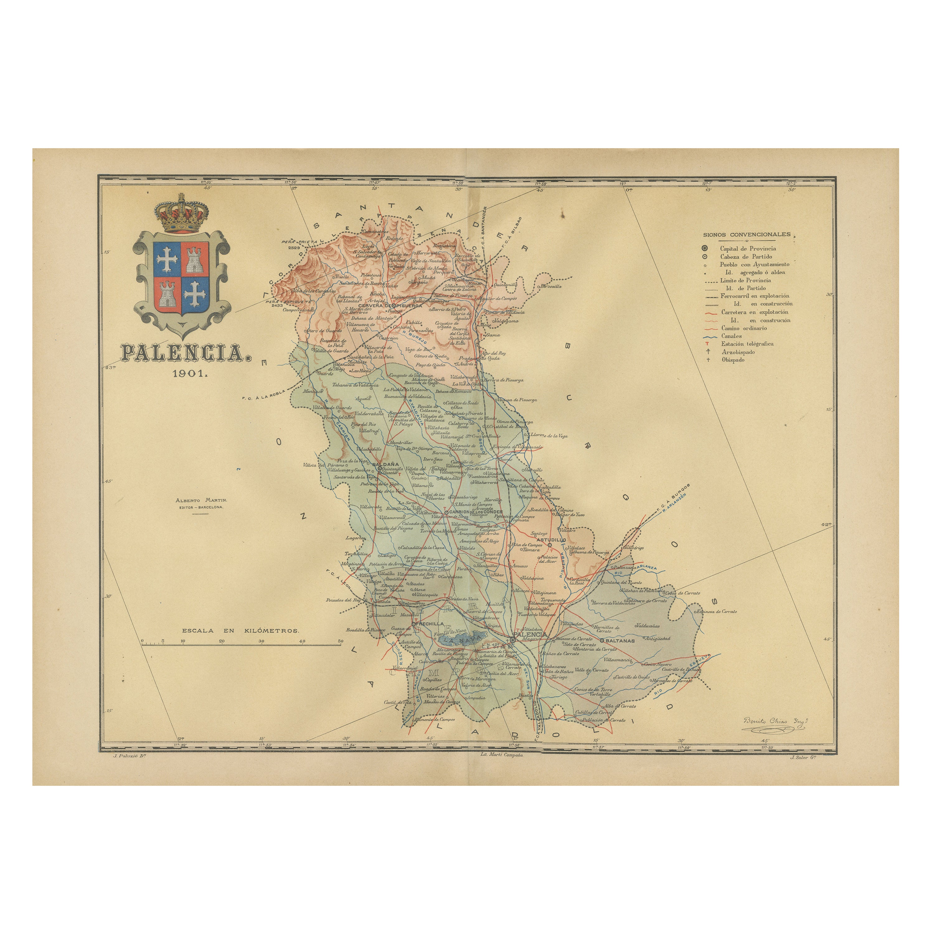
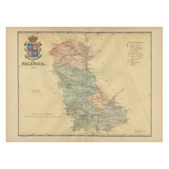
Original Antique Map of Palencia Province, in Northern Spain, 1901
Located in Langweer, NL
This historical map is of Palencia, a province in the northern part of Spain.
Palencia is situated within the autonomous community of Castilla y León. It is bordered by the provinc...
Category
Antique Early 1900s Maps
Materials
Paper
$363 Sale Price
20% Off
Free Shipping
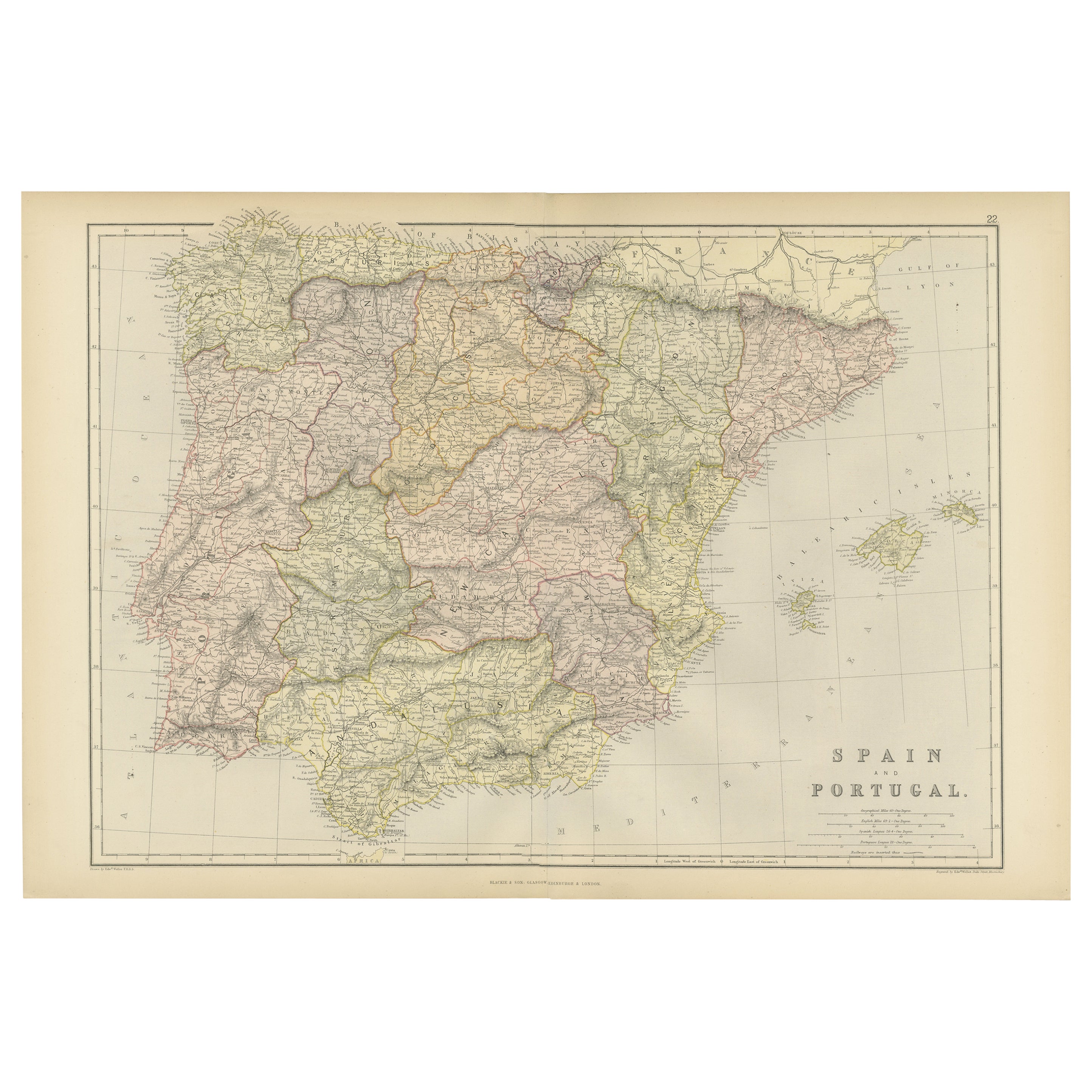
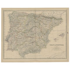
Antique Map of Spain and Portugal, 1882
Located in Langweer, NL
"Antique map titled 'Spain & Portugal'.
Old map of Spain and Portugal. This map originates from 'The Royal Atlas of Modern Geography, Exhibiting, in a S...
Category
Antique 19th Century Maps
Materials
Paper
$214 Sale Price
20% Off
You May Also Like
Large Original Vintage Map of Spain, circa 1920
Located in St Annes, Lancashire
Great map of Spain
Original color.
Good condition
Published by Alexander Gross
Unframed.
Category
Vintage 1920s English Maps
Materials
Paper

Original Antique Map of Spain and Portugal, circa 1790
Located in St Annes, Lancashire
Super map of Spain and Portugal
Copper plate engraving by A. Bell
Published, circa 1790.
Unframed.
Category
Antique 1790s English Other Maps
Materials
Paper

18th Century Hand Colored Map of Spain and Portugal by Visscher
By Nicolaes Visscher II
Located in Alamo, CA
This is an early 18th century map of Spain and Portugal, with attractive original hand-coloring, entitled "Hispaniae et Portugalliae Regna per Nicolaum Visscher cum Privilegio Ordinu...
Category
Antique Early 18th Century Dutch Maps
Materials
Paper

Map of Spain and Portugal - Original Etching - Late 19th Century
Located in Roma, IT
This Map of Spain and Portugal is an etching realized by an anonymous artist.
The state of preservation of the artwork is good with some small diffused stains.
Sheet dimension: 28...
Category
Late 19th Century Modern Figurative Prints
Materials
Etching

Original Antique Map of the American State of Arizona & New Mexico, 1903
Located in St Annes, Lancashire
Antique map of Arizona and New Mexico
Published By A & C Black. 1903
Original colour
Good condition
Unframed.
Free shipping
Category
Antique Early 1900s English Maps
Materials
Paper

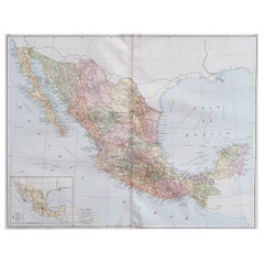
Large Original Vintage Map of Mexico, circa 1920
Located in St Annes, Lancashire
Great map of Mexico
Original color.
Good condition
Published by Alexander Gross
Unframed.
Category
Vintage 1920s English Edwardian Maps
Materials
Paper
More Ways To Browse
Medieval Castle
Railway Map
Used Furniture Fall River
Antique Oushak
Mid Century Danish Directors Chairs
Moller 70
Argentina Travel Poster
Century Furniture Faux Bamboo
Early American Chairs
Hans Muller
Vintage Wood Table With Glass Top
19th Century Square Table
Antonio Bonet
Galle Chairs
Large Chinese Rug
1940s Vintage French Art Deco
20th Century Spanish Table
Antonio Bellini