Items Similar to Vintage Swedish Topographic School Map of European Alps, Made in Sweden 1922
Want more images or videos?
Request additional images or videos from the seller
1 of 21
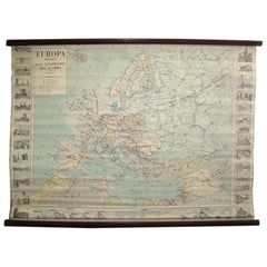
Vintage Swedish Topographic School Map of European Alps, Made in Sweden 1922
$425
£324.94
€374.26
CA$595.56
A$664.88
CHF 348.39
MX$8,138.80
NOK 4,424.53
SEK 4,171.77
DKK 2,793.14
About the Item
Vintage Swedish Topographic School map of European Alps, Made in Sweden 1922
This vintage Swedish school map is so unique and a great example of why these are so collectible.
Wooden poles at the top and bottom of this linen fabric with printed paper attached.
Comes with expected use wear and age one would expect from a piece with usage and considering the materials.
- Dimensions:Height: 46 in (116.84 cm)Width: 71 in (180.34 cm)Depth: 1 in (2.54 cm)
- Materials and Techniques:
- Place of Origin:
- Period:
- Date of Manufacture:1922
- Condition:Wear consistent with age and use.
- Seller Location:Los Angeles, CA
- Reference Number:1stDibs: LU5468228269292
About the Seller
5.0
Vetted Professional Seller
Every seller passes strict standards for authenticity and reliability
Established in 2017
1stDibs seller since 2020
110 sales on 1stDibs
Typical response time: 2 hours
- ShippingRetrieving quote...Shipping from: Los Angeles, CA
- Return Policy
Authenticity Guarantee
In the unlikely event there’s an issue with an item’s authenticity, contact us within 1 year for a full refund. DetailsMoney-Back Guarantee
If your item is not as described, is damaged in transit, or does not arrive, contact us within 7 days for a full refund. Details24-Hour Cancellation
You have a 24-hour grace period in which to reconsider your purchase, with no questions asked.Vetted Professional Sellers
Our world-class sellers must adhere to strict standards for service and quality, maintaining the integrity of our listings.Price-Match Guarantee
If you find that a seller listed the same item for a lower price elsewhere, we’ll match it.Trusted Global Delivery
Our best-in-class carrier network provides specialized shipping options worldwide, including custom delivery.More From This Seller
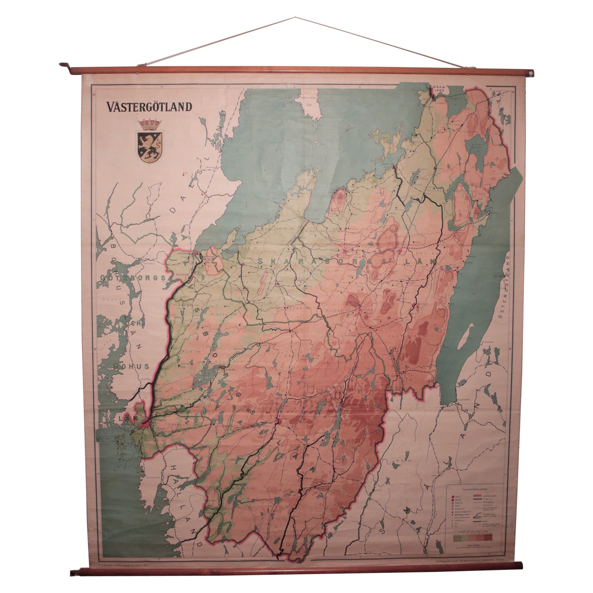
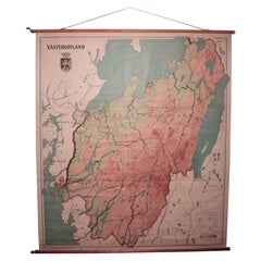
View AllVintage Swedish School Map of Vastergötland, Made in Sweden 1920
Located in Los Angeles, CA
Vintage Swedish School Map of Vastergötland, Made in Sweden 1920
Västergötland also known as West Gothland or the Latinized version Westrogothia in older literature, is one of the...
Category
Vintage 1920s Swedish Maps
Materials
Linen, Wood, Paper
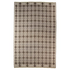
Elsa Gullberg, Polychrome Diamond Shaped Pattern Rug, Sweden 1940's
By Elsa Gullberg
Located in Los Angeles, CA
Elsa Gullberg - Polychrome Diamond Shaped Pattern Rug, Sweden 1940's - 243x183cm
This delicate polychromatic diamond shaped patterned rug is attributed to Elsa Gullberg.
Elsa Gullberg (14 March 1886 – 1 March 1984) was a Swedish interior architect and textile designer. She was a pioneer of modern textile design in Sweden and played an instrumental role in transforming the textile industry. She was one of the renowned Swedish textile designers including Erik Wettergren, Carl Bergsten and Gregor Paulsson, who worked to modernize textile industries in Sweden.
Ofter referred to as Sweden...
Category
Mid-20th Century Swedish Scandinavian Modern Russian and Scandinavian Rugs
Materials
Wool
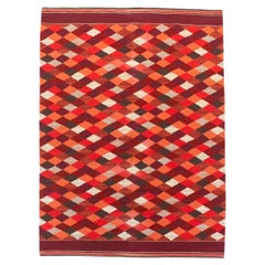
$3,187 Sale Price
25% Off
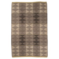
Large Vintage Swedish Flat-Weave Carpet, Sweden, 1960's
Located in Los Angeles, CA
Large vintage Swedish flat-weave carpet - Sweden 1960's
Measures: 121.5" x 78.7".
Category
Mid-20th Century Swedish Scandinavian Modern Russian and Scandinavian Rugs
Materials
Wool
$5,752 Sale Price
35% Off
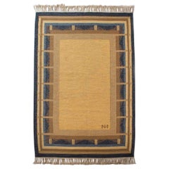
Vintage Double Sided Swedish Flat-Weave Carpet, Sweden, 1960's
Located in Los Angeles, CA
Vintage double sided Swedish flat-weave carpet, Sweden, 1960's
Measures: 146 x 192 cm.
Category
Mid-20th Century Swedish Scandinavian Modern Russian and Scandinavian Rugs
Materials
Wool
$3,080 Sale Price
20% Off
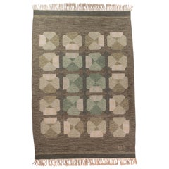
Alestalon Mattokutomo, Golden and Blue Finnish Flat-Weave Rug, Finland, 1950s
By Alestalon Mattokutomo
Located in Los Angeles, CA
Alestalon Mattokutomo - golden and blue Finnish flat-weave rug, Finland, 1950s
Handmade flat-weave by Alestalon Mottokutom, this exquisite and rare piece has a golden table of Cla...
Category
Mid-20th Century Finnish Mid-Century Modern Russian and Scandinavian Rugs
Materials
Wool, Linen
$4,550 Sale Price
30% Off
Alestalon Mattokutomo Finnish Flat-Weave Rug, Finland, 1950s
By Alestalon Mattokutomo
Located in Los Angeles, CA
Alestalon Mattokutomo Finnish flat-weave rug, Finland, 1950s. Size: 97" x 63"
Handmade by Alestalon Mottokutom, this exquisite flat-weave rug has a very interesting complexity of de...
Category
Mid-20th Century Finnish Mid-Century Modern Russian and Scandinavian Rugs
Materials
Linen, Wool
$3,900 Sale Price
40% Off
You May Also Like
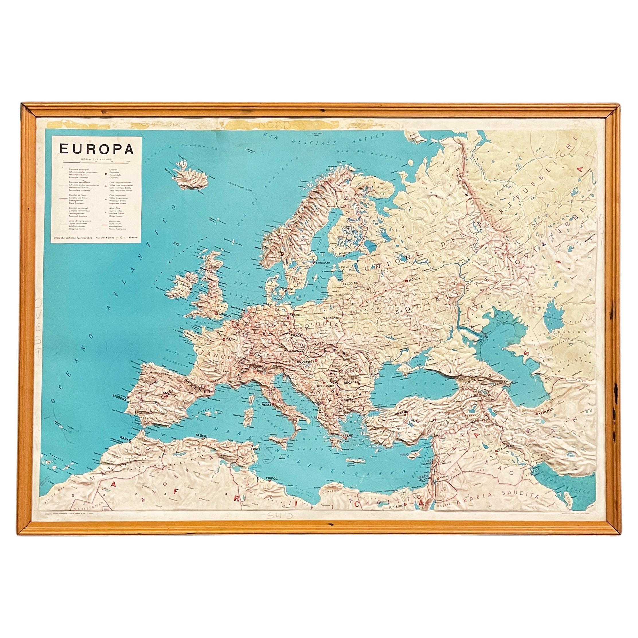
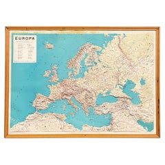
Italian modern Topographic geographical map in wood frame of Europe, 1950s-1990s
Located in MIlano, IT
Italian modern Topographic geographical map in wood frame of Europe, 1950s-1990s
Three-dimensional geographical map of Europe on paper. The topographic map presents the states with t...
Category
Late 20th Century Italian Modern Decorative Art
Materials
Wood, Paper
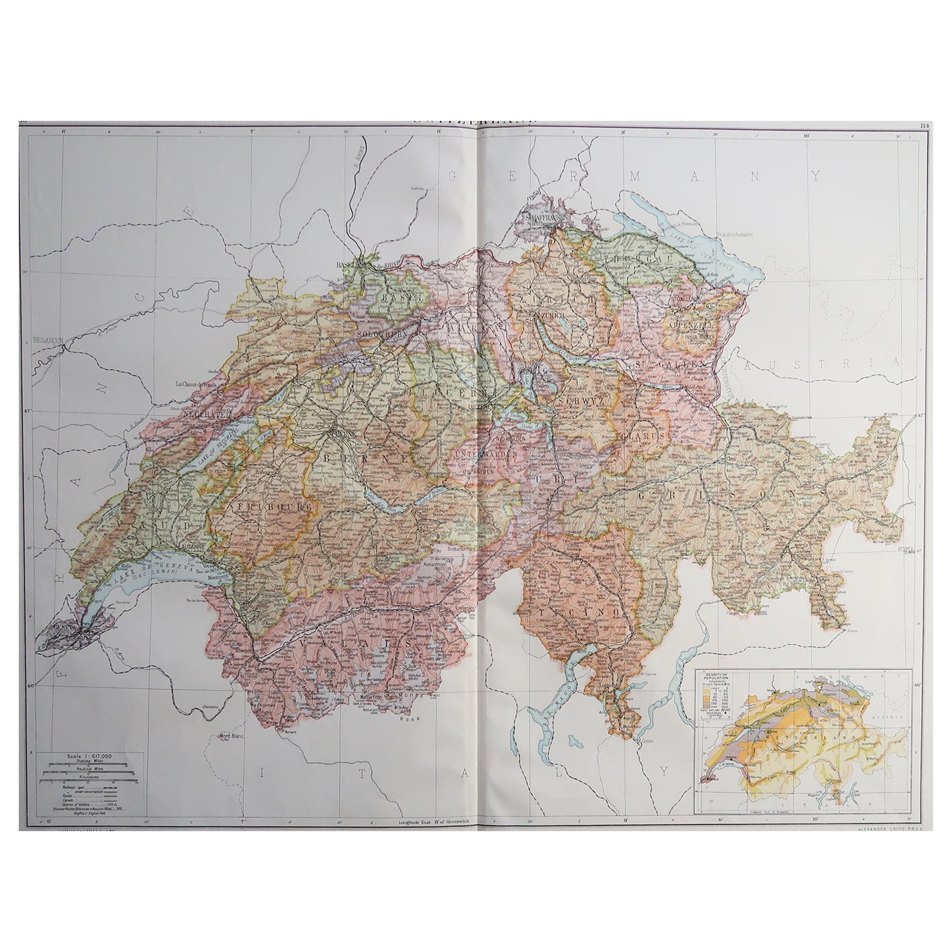
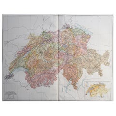
Large Original Vintage Map of Switzerland, circa 1920
Located in St Annes, Lancashire
Great map of Switzerland
Original color.
Good condition
Published by Alexander Gross
Unframed.
Category
Vintage 1920s English Maps
Materials
Paper
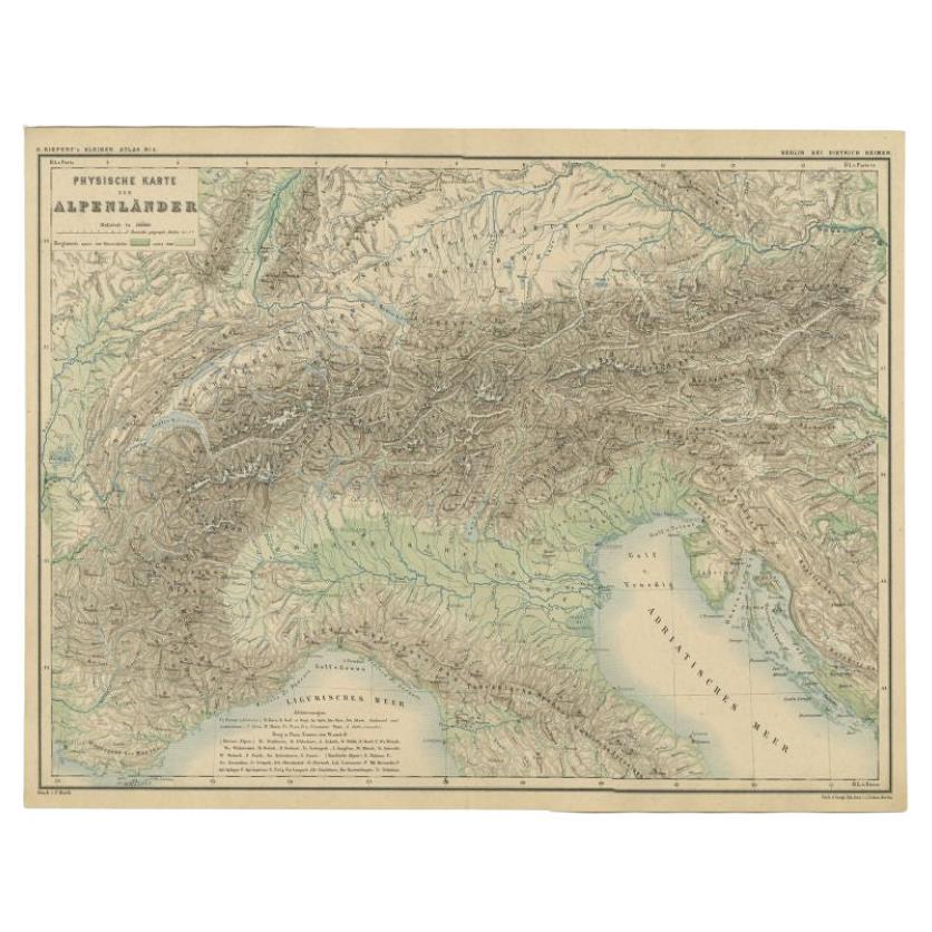
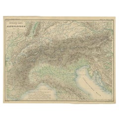
Antique Map of the Alpine Countries, Published in Germany, c.1870
Located in Langweer, NL
Antique map titled 'Physische Karte der Alpenländer'. Old map of the Alpine countries. This map originates from 'H. Kiepert's Kleiner Atlas der Neueren Geographie für Schule und Haus...
Category
Antique 19th Century Maps
Materials
Paper
$103 Sale Price
34% Off
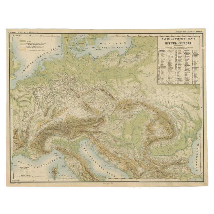
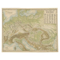
Nice Colourful Antique Map of the Rivers and Mountains of Europe c.1870
By Heinrich Kiepert
Located in Langweer, NL
Antique map titled 'Fluss und Gebirgs Karte von Mittel-Europa'. Old map of the European continent depicting the European mountains and rivers. This map originates from 'H. Kiepert's ...
Category
Antique 19th Century Maps
Materials
Paper
$226 Sale Price
20% Off
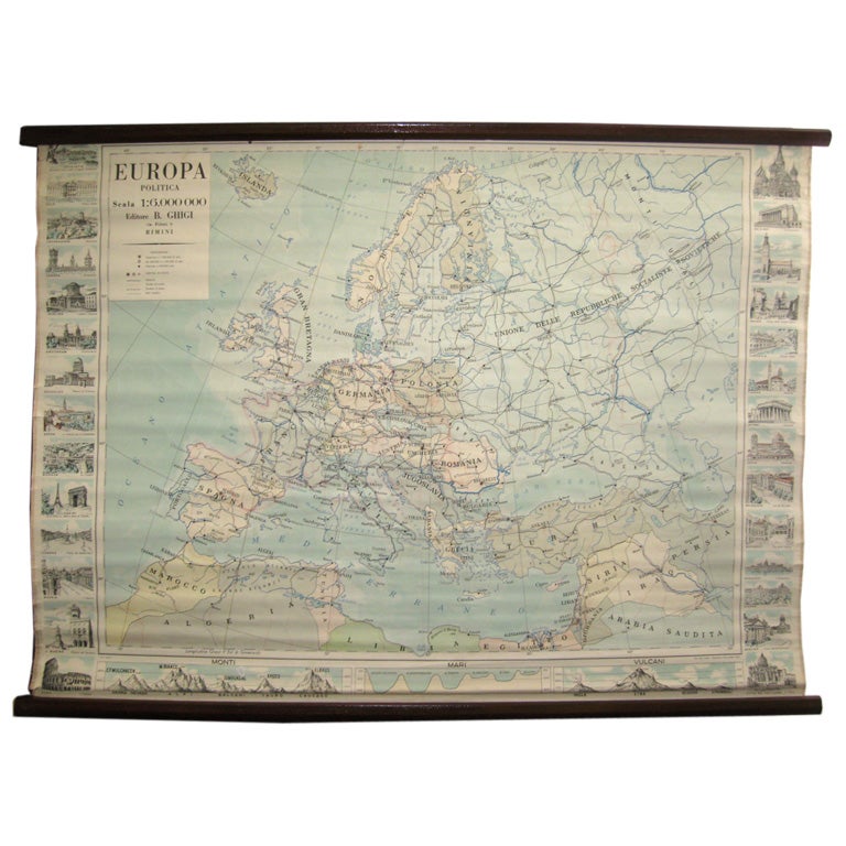
Map of Europe
Located in Los Angeles, CA
28 cities capitol drawings around the border of this Europe political map.
Category
Vintage 1950s Italian Mid-Century Modern Prints
$500
Very Large Vintage Map of Canada, German, Education, Institution, Cartography
Located in Hele, Devon, GB
This is a very large vintage map of Canada. A German, quality printed educational or institution map, dating to the mid 20th century, circa 1965....
Category
Mid-20th Century German Maps
Materials
Paper

More Ways To Browse
Alps Furniture
Caucasus Map
Map Of Puerto Rico
Nevada Antique Map
Shetland Map
Antique Chicago Maps
Kolkata Antique Furniture
Antique Bermuda Furniture
Antique Dairy Collectibles
Antique Map Of Cuba
Antique Map Of Yorkshire
Antique Map Vietnam
Antique Maps Massachusetts
Guyana Antique Map
Peninsular War
Santa Cruz Island
Ukraine Antique Map
Antique Life Buoy