Items Similar to 1970s Framed Antique Map of Italy 1746 Original

Want more images or videos?
Request additional images or videos from the seller
1 of 10
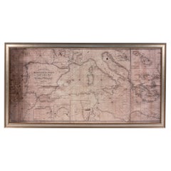
1970s Framed Antique Map of Italy 1746 Original
$280
£214.07
€246.57
CA$392.37
A$438.04
CHF 229.53
MX$5,362.03
NOK 2,914.98
SEK 2,748.46
DKK 1,840.19
About the Item
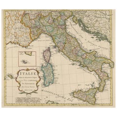
An extraordinary original antique map, framed in the 1970s by Brehm Nuremberg, Germany, showing Italy. Map is dated 1746 and approx. 7 ¼" wide and 5 ¾" high in viewable size. Framed in a handmade wooden frame.
- Dimensions:Height: 9.13 in (23.2 cm)Width: 10.75 in (27.31 cm)Depth: 0.5 in (1.27 cm)
- Materials and Techniques:
- Period:
- Date of Manufacture:1970s
- Condition:Wear consistent with age and use. Minor fading. With signs of wear as expected with age and use. Obviously this item is not new, so please check all photos before purchase.
- Seller Location:Nuernberg, DE
- Reference Number:Seller: RegC_Bo4_OWA_0291stDibs: LU3998114108521
About the Seller
5.0
Platinum Seller
Premium sellers with a 4.7+ rating and 24-hour response times
Established in 2006
1stDibs seller since 2018
2,707 sales on 1stDibs
Typical response time: <1 hour
- ShippingRetrieving quote...Shipping from: Nuernberg, Germany
- Return Policy
Authenticity Guarantee
In the unlikely event there’s an issue with an item’s authenticity, contact us within 1 year for a full refund. DetailsMoney-Back Guarantee
If your item is not as described, is damaged in transit, or does not arrive, contact us within 7 days for a full refund. Details24-Hour Cancellation
You have a 24-hour grace period in which to reconsider your purchase, with no questions asked.Vetted Professional Sellers
Our world-class sellers must adhere to strict standards for service and quality, maintaining the integrity of our listings.Price-Match Guarantee
If you find that a seller listed the same item for a lower price elsewhere, we’ll match it.Trusted Global Delivery
Our best-in-class carrier network provides specialized shipping options worldwide, including custom delivery.More From This Seller
View All1970s Framed Antique Map of Hungaria Hungary 1629 Original
Located in Nuernberg, DE
An extraordinary original antique map, framed in the 1970s by Brehm Nuremberg, Germany, showing Hungary. Map is dated 1629 and approx. 7 ¼" wide and 6 ?" high in viewable size. Frame...
Category
Vintage 1970s Decorative Art
Materials
Glass, Wood
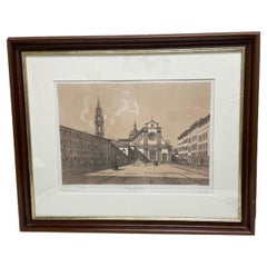
Framed French Copper Print Place Santa Trinita, Florence, Italy
Located in Nuernberg, DE
An extraordinary print, made by a French artist. Framed in Austria. Beautiful wooden frame, with some dents and scratches but this is old-age. frame was made in the 1970s or older. F...
Category
20th Century French Decorative Art
Materials
Glass, Wood
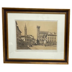
Framed French Copper Print La Villa Ducale De Caffaggiolo, Florence, Italy
Located in Nuernberg, DE
An extraordinary print, made by a French artist. Framed in Austria. Beautiful wooden frame, with some dents and scratches but this is old-age. frame was made in the 1970s or older. F...
Category
20th Century French Decorative Art
Materials
Glass, Wood
Framed French Copper Print Plaza San Spirito, Florence, Italy
Located in Nuernberg, DE
An extraordinary print, made by a French artist. Framed in Austria. Beautiful wooden frame, with some dents and scratches but this is old-age. frame was made in the 1970s or older. F...
Category
20th Century French Decorative Art
Materials
Glass, Wood
Framed French Copper Print Plaza San Firence, Florence, Italy
Located in Nuernberg, DE
An extraordinary print, made by a French artist. Framed in Austria. Beautiful wooden frame, with some dents and scratches but this is old-age. frame was made in the 1970s or older. F...
Category
20th Century French Decorative Art
Materials
Glass, Wood
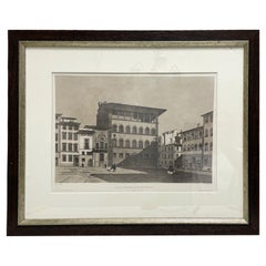
Framed French Copper Print Palazzo Guadagni Holy Spirit Square, Florence, Italy
Located in Nuernberg, DE
An extraordinary print, made by a French artist. Framed in Austria. Beautiful wooden frame, with some dents but this is old-age. frame was made in the 1970s or older. Found at an est...
Category
20th Century French Decorative Art
Materials
Glass, Wood
You May Also Like
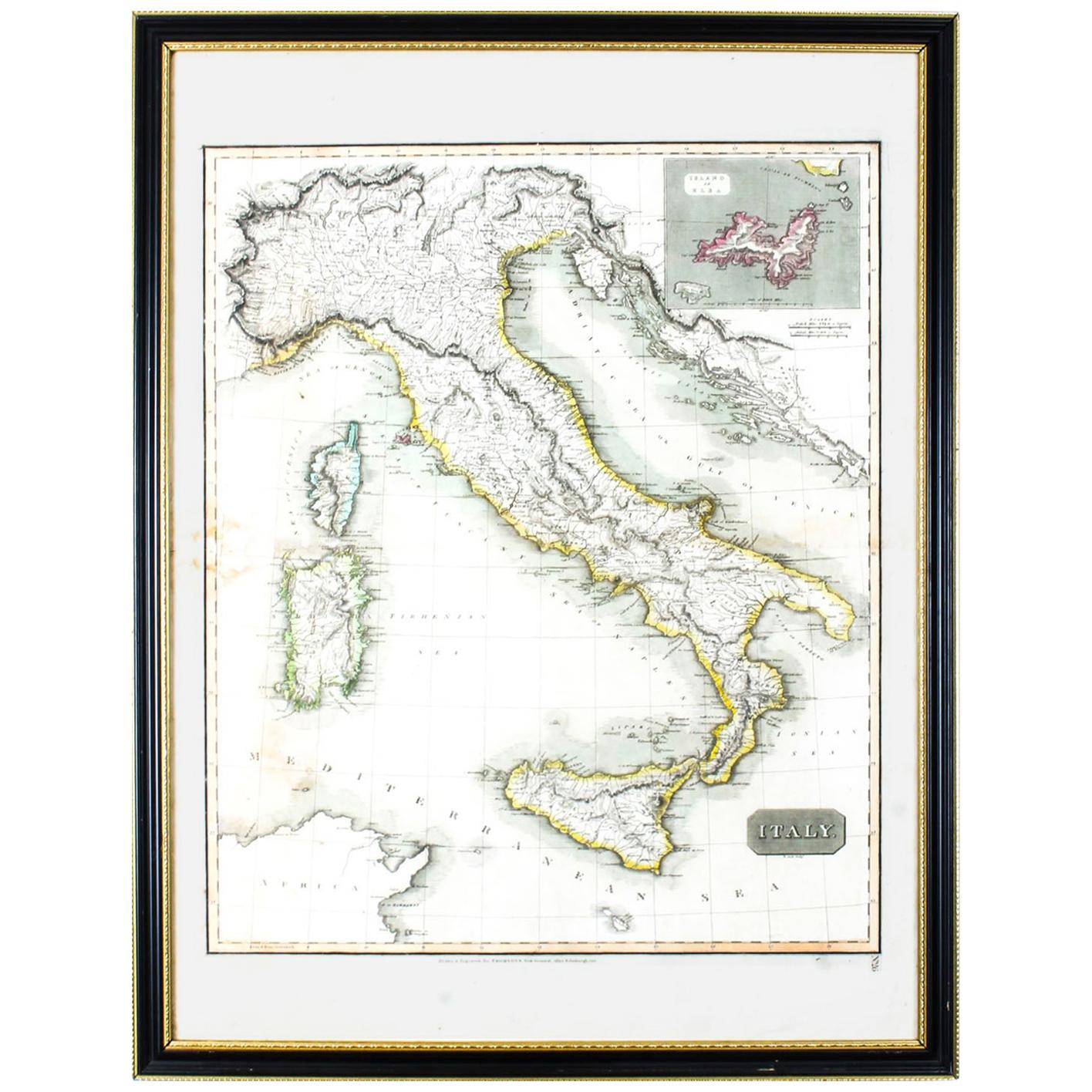
Antique Map of Italy Drawn & Engraved by R. Scott for Thomsons, Edinburgh 1814
Located in London, GB
This is a magnificent museum quality antique hand-coloured map of Italy, dating from 1814.
This historic and very rare antique map was drawn and engraved by R. Scott for Thomsons, New General Atlas, Edinburgh.
The map is very detailed and the various colours - yellow, grey and green - beautifully highlight the different natural and political divisions of Italy as it was before the Italian Unification...
Category
Antique 1810s Scottish Prints
Materials
Other

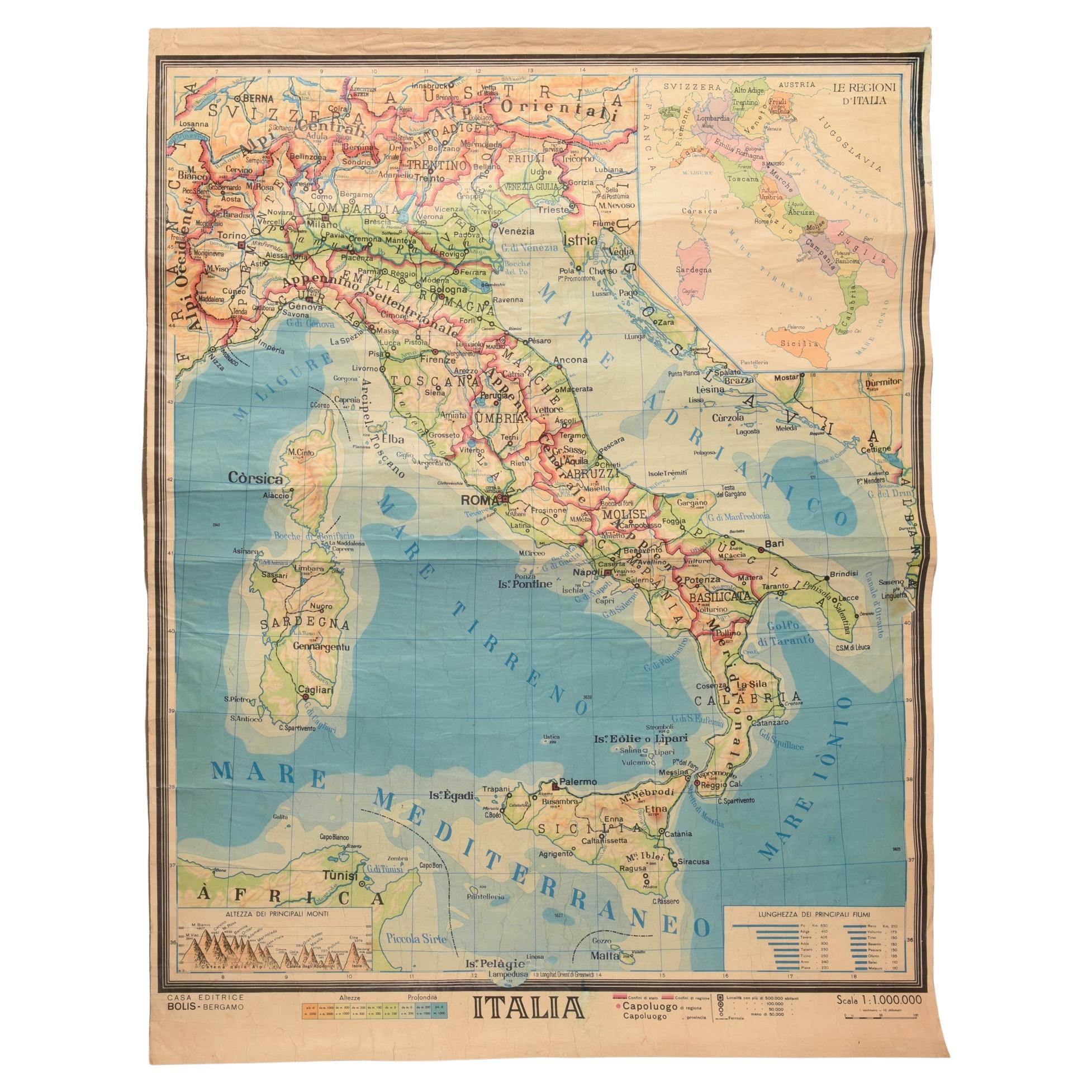
Geographical Map of Italy
Located in Alessandria, Piemonte
BOLIS Publishing House - Bergamo.
A beautiful large map of Italy, on paper but suitably reinforced to preserve it correctly. The maps were usually p...
Category
Mid-20th Century Italian Other Prints
Materials
Paper

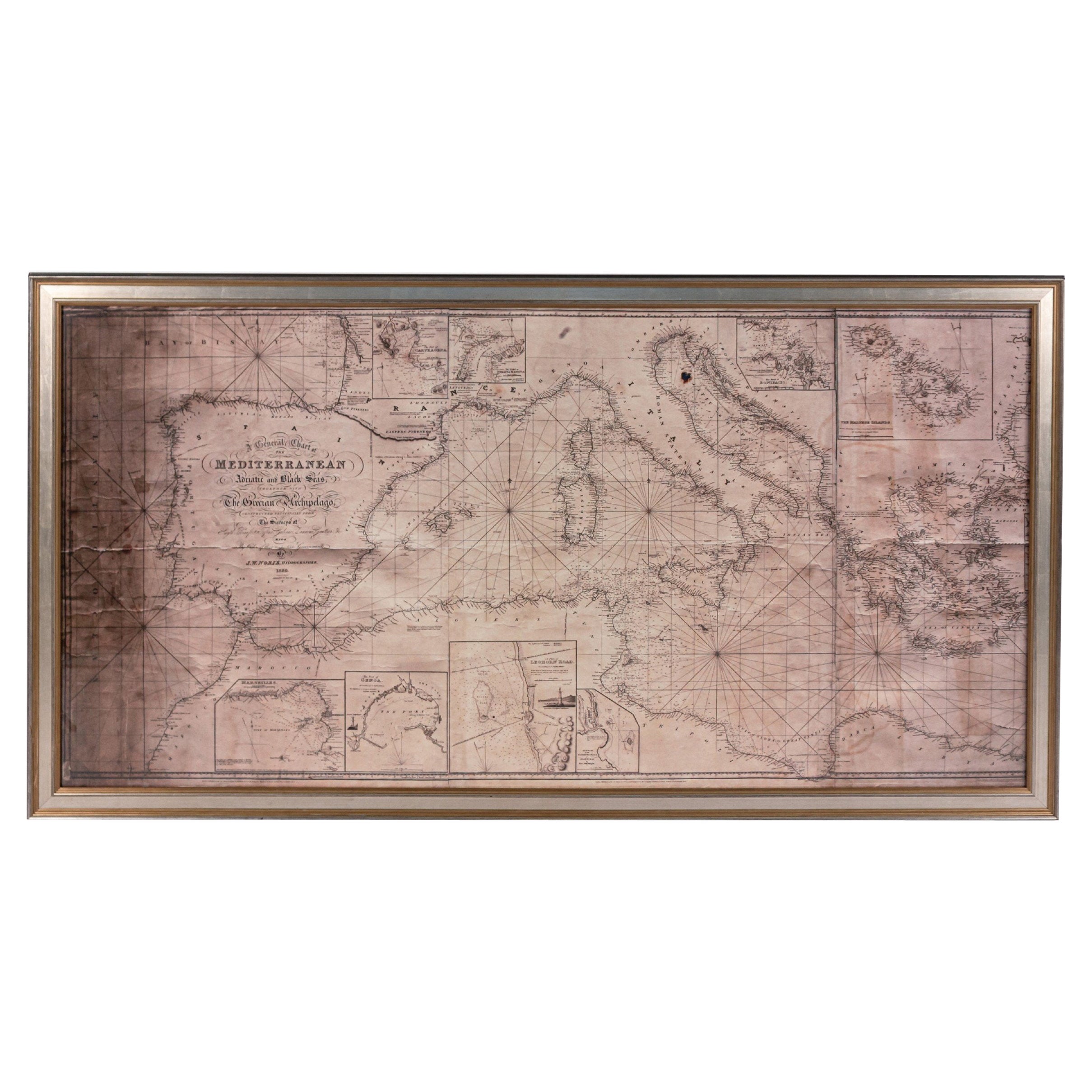
Large Framed Map of the Mediterranean
Located in Queens, NY
Large map/chart chart of The Mediterranean and the Grecian Archipelago showing Italy, Sardinia, Corsica, part of France, etc. in a black frame.
Category
20th Century French Mid-Century Modern Maps
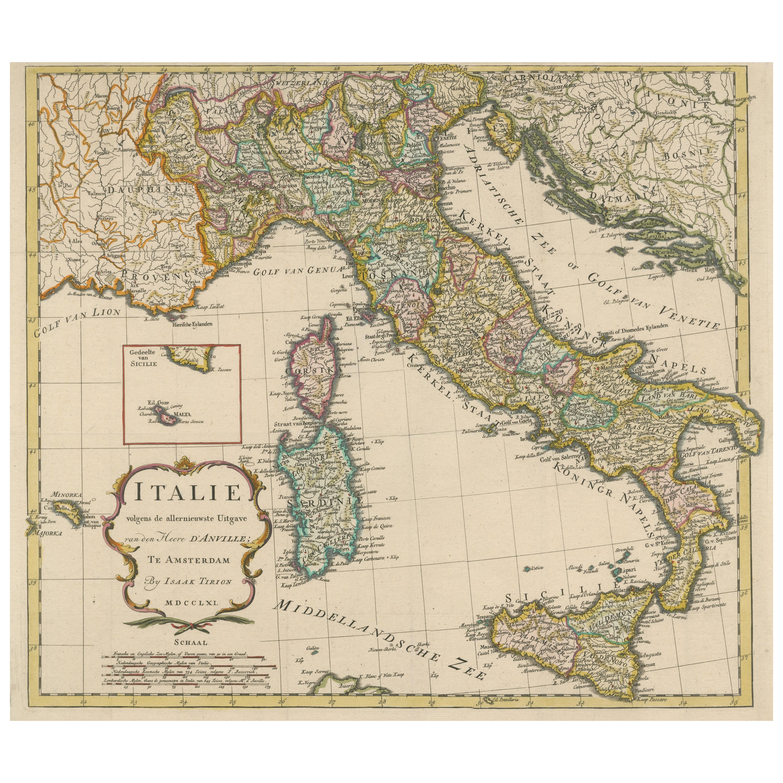
Detailed Antique Map of Italy and surrounding Islands
Located in Langweer, NL
Antique map titled 'Italie volgens de allernieuwste Uitgave van den Heere d'Anville'. Very detailed antique map, based on D'Anville's important map of It...
Category
Antique Mid-18th Century Maps
Materials
Paper
$586 Sale Price
20% Off
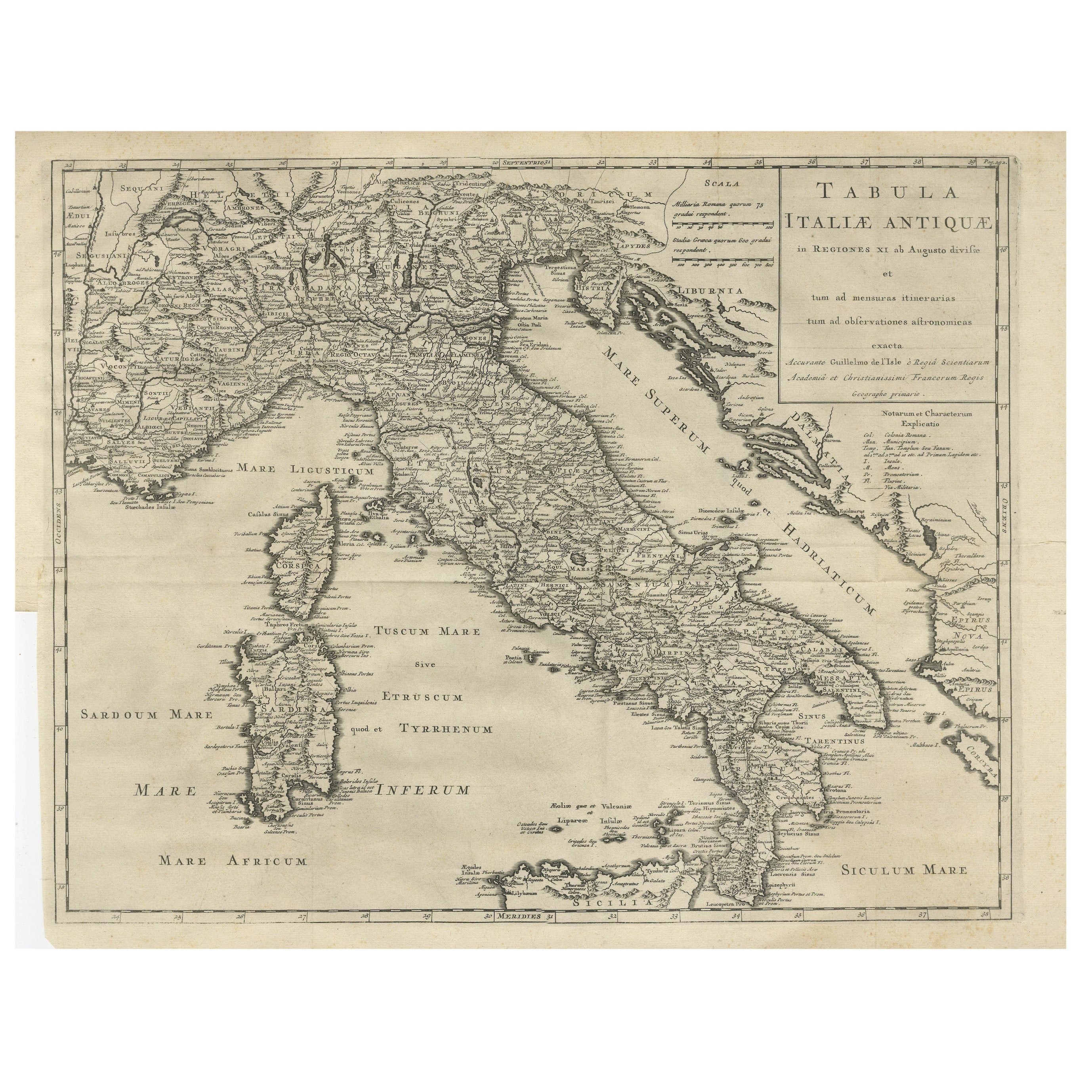
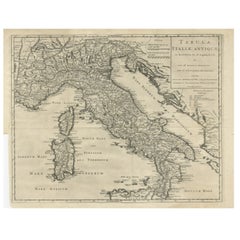
Antique Engraved Map of Italy in Roman Times, ca.1730
Located in Langweer, NL
Plain engr. map of Italy according to the division of Emperor Augustus by G. Delisle.
Title: "Tabula Italiae Antiquae In Regiones XI Ab Augusto Divisae Et Tum Ad Mensuras Itinerari...
Category
Antique 1730s Maps
Materials
Paper
$642 Sale Price
20% Off
Italy, Sicily, Sardinia, Corsica and Dalmatian Coast: A 17th Century Dutch Map
By Theodorus Danckerts
Located in Alamo, CA
This hand colored 17th century Dutch map entitled "Novissima et Accuratissima totius Italiae Corsicae et Sardiniae Descriptio" by Theodore Danckerts depicts the Italian Peninsula in ...
Category
Antique Late 17th Century Dutch Maps
Materials
Paper

More Ways To Browse
Metal Wall Plaques
Mother Of Pearl Wall Art
Tiger Wall Art
Tile Plaque
Plaster Plaque
Oval Wall Plaque
Birds Eye Maple Frame
Diaz Costa
Chinese Carved Wall Panels
Chinoiserie Panel Pair
J Muller
Bird Metal Wall Art
Sea Shell Wall Art
Oyster Wall Art
Plaster Wall Panel
Antique Chinese Wall Hanging
Picasso Tile
Glazed Terracotta Tiles