Items Similar to 17th-18th Century Siege of Graves Mapping Engraving By Willian III


Want more images or videos?
Request additional images or videos from the seller
1 of 10
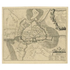
17th-18th Century Siege of Graves Mapping Engraving By Willian III
$560
£424.20
€489.41
CA$785.19
A$875.27
CHF 460.69
MX$10,610.77
NOK 5,865.42
SEK 5,453.42
DKK 3,652.82
About the Item
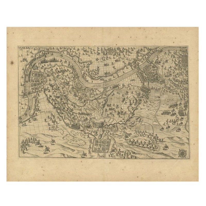
RARE French 17th-18th Century Enhanced Siege of Graves Mapping Engraving BY William III, also widely known as William of Orange,
The Siege of Grave in Dutch Brabant started by Monsieur Carl de Rabenhaupt in July 1674. Carl von Rabenhaupt (6 January 1602 – 12 August 1675) was a Bohemian Hussite nobleman who fought in Dutch and Hessian service during the Thirty Years War and came out of retirement to help the Dutch defend Groningen during the Franco-Dutch War. He made a name for himself as a siege specialist, taking or successfully defending many fortified cities along the Dutch-German border. In July 1674, Rabenhaupt started to invest the French occupied Grave. His force was only strong enough to fully besiege the town when Brandenburg troops reinforced him in August. The garrison under Noël Bouton de Chamilly inflicted heavy casualties on the besiegers and only capitulated on 27 October to Rabenhaupt and Stadtholder William of Orange. RIJKSMUSEUM COLLECTION, William III, also widely known as William of Orange
- Dimensions:Height: 18.5 in (46.99 cm)Width: 23 in (58.42 cm)Depth: 1 in (2.54 cm)
- Materials and Techniques:Paper,Engraved
- Place of Origin:
- Period:
- Date of Manufacture:17th Century
- Condition:Wear consistent with age and use.
- Seller Location:Kingston, NY
- Reference Number:Seller: 58391stDibs: LU4840238487172
About the Seller
4.0
Vetted Professional Seller
Every seller passes strict standards for authenticity and reliability
Established in 2018
1stDibs seller since 2019
62 sales on 1stDibs
- ShippingRetrieving quote...Shipping from: Kingston, NY
- Return Policy
Authenticity Guarantee
In the unlikely event there’s an issue with an item’s authenticity, contact us within 1 year for a full refund. DetailsMoney-Back Guarantee
If your item is not as described, is damaged in transit, or does not arrive, contact us within 7 days for a full refund. Details24-Hour Cancellation
You have a 24-hour grace period in which to reconsider your purchase, with no questions asked.Vetted Professional Sellers
Our world-class sellers must adhere to strict standards for service and quality, maintaining the integrity of our listings.Price-Match Guarantee
If you find that a seller listed the same item for a lower price elsewhere, we’ll match it.Trusted Global Delivery
Our best-in-class carrier network provides specialized shipping options worldwide, including custom delivery.More From This Seller
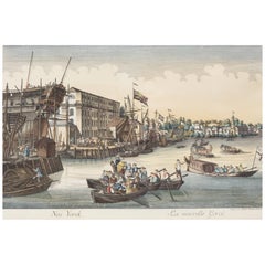
View All18th Century Balthasar Frederich Lazelt Colored Engraving Print
Located in Kingston, NY
18th-century view of Lower Manhattan Harbor New York Entrance by Balthasar Frederic Lazelt colored engraving of New York's original harbor landings filled with ships and commerce, 17...
Category
Antique 18th Century Prints
Materials
Paper
Attrib. Eduard Baldus copper print plate titled, "The Peace"
By Edouard Baldus
Located in Kingston, NY
The copper engraving plate is titled "The Peace, " which is attributed to Edouard Baldus, who signed the work. This plate was used to create eng...
Category
Antique 16th Century French Renaissance Decorative Art
Materials
Copper
Mystery Artist French School Pastel on Paper Painting
Located in Kingston, NY
Mystery Artist 18th Century French School Portrait of a Noble Lady Wearing a Blue Cape. Extensive writing on the reverse as to who she is, but illegible.
Measurement: Art: 23 1/2 x ...
Category
Antique 18th Century French Rococo Paintings
Materials
Paper

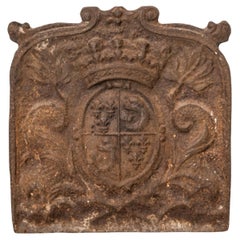
Royal French Fireplace Shield From Chateau Near Fountainbleau
Located in Kingston, NY
French Fireplace Shield with Royal Coat of Arms, a Piece of French Heritage from the 17th century
Weight: 55 Lbs.
Measurements: Size: 19 x 18 1/4 in. (48.3 x 46.4 cm.)
Category
Antique 17th Century French Baroque Antiquities
Materials
Iron
Peter Lastman, attrib. Mystery Old Master Painting, Dutch School
Located in Kingston, NY
Peter Lastman inscribed on reverse Old Master painting, probably Dutch school, late 17th century. Oil on curved canvas depicting the entrance of King David on Horseback. No apparent ...
Category
Antique 17th Century French Paintings
Materials
Canvas

Watercolor Painting of Diana and Cupid
Located in Kingston, NY
An 18th-century watercolor painting depicting Diana and Cupid, elegantly framed in an oval gilt frame.
Measurement: Art: 10 x 8 3/4 in. (25.4 x 22.2 cm.), Frame: 13 1/4 x 11 1/2 in....
Category
Antique 18th Century French Rococo Paintings
Materials
Other

You May Also Like
Antique Map of the Region of Grave by Orlers, 1615
Located in Langweer, NL
Antique map of the region of Grave, also including Cuijk and Ravestein. This map originates from 'La genealogie des illustres Comtes de Nassau' by Jan Jansz. Orlers.
Artists and E...
Category
Antique 17th Century Maps
Materials
Paper
$152 Sale Price
20% Off
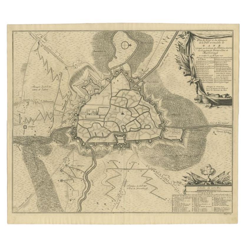
Antique Map of the Siege of Gent by Dumont, 1729
By Dumont
Located in Langweer, NL
Antique map titled 'Plan of the Siege and Attacks of the City and Citadel of Ghent'. Large map depicting the siege of the Belgian city of Gent in 1708 during the war of the Spanish S...
Category
Antique 18th Century Maps
Materials
Paper
$319 Sale Price
20% Off
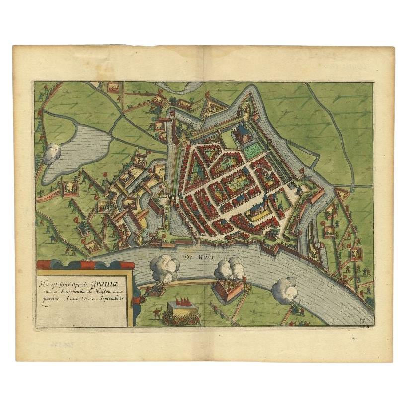
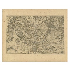
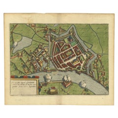
Antique Plan of the Siege of Grave by Guicciardini, c.1608
Located in Langweer, NL
Antique map titled 'Hic est situs oppidi Grauiae (..)'. Bird's eye view plan of Grave, The Netherlands, Holland. Showing the siege of Grave in the year 1602. Source unknown, to be de...
Category
Antique 17th Century Maps
Materials
Paper
$457 Sale Price
20% Off
Antique Bible Plan of Jerusalem by Covens & Mortier, 1743
Located in Langweer, NL
This plan originates from ‘Biblia Sacra, dat is, de H. Schriftuer van het Oude, en het Nieuwe Testament, naer de laetste Roomsche keure der gemeine Latijnsche overzettinge, in nederd...
Category
Antique Mid-18th Century Maps
Materials
Paper

$523 Sale Price
20% Off
Antique Map of The Siege of Gennep, the Netherlands, c.1650
Located in Langweer, NL
Antique map titled 'Belagerung des Besten Schloss und Passes Gennep'. Old map of the Siege of Gennep, the Netherlands. This map originates from 'Theatrum Europaeum' by M. Merian. Art...
Category
Antique 17th Century Maps
Materials
Paper

$228 Sale Price
20% Off
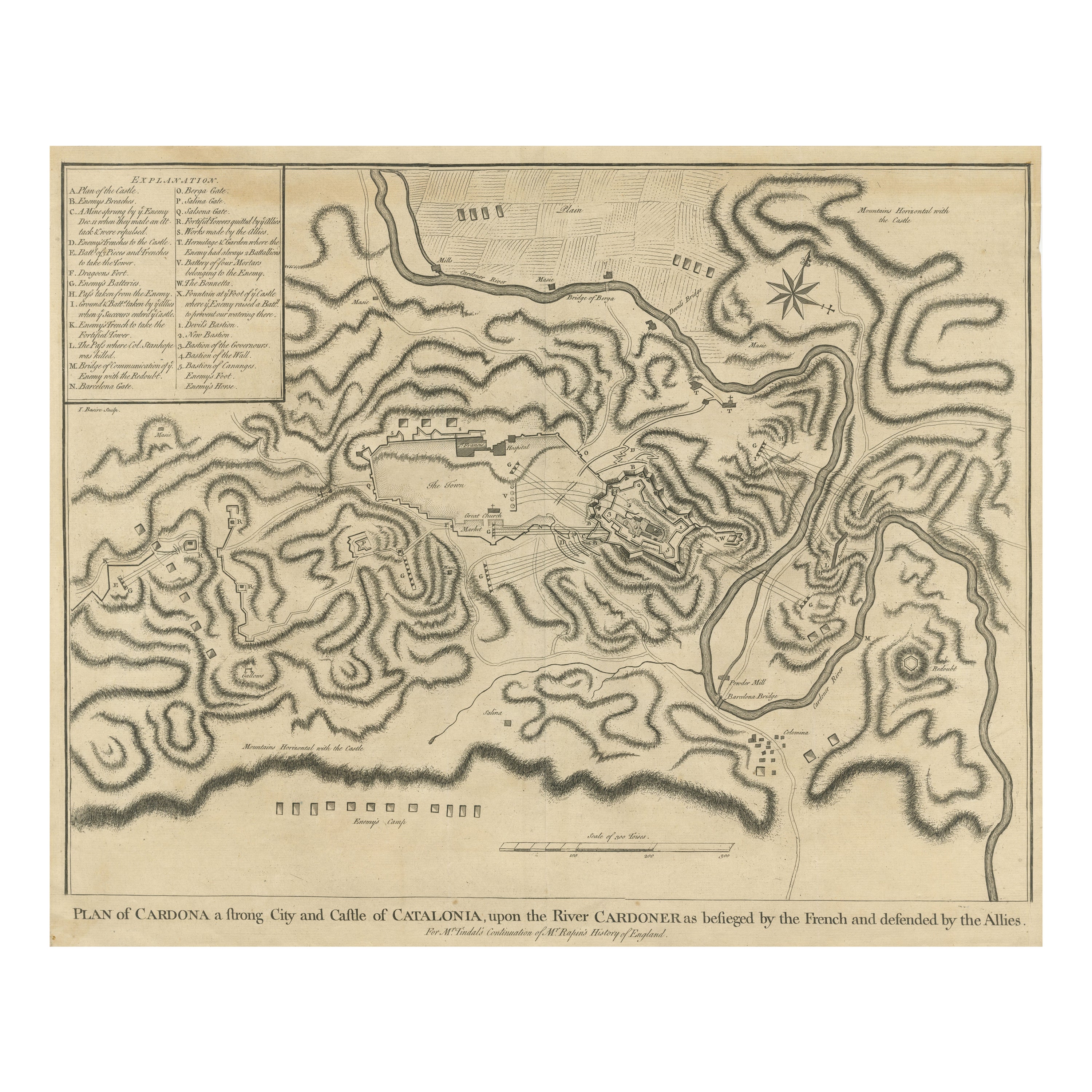
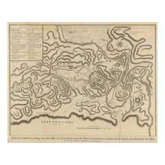
Antique Plan of the Siege of the Castle of Cardona in 1714
Located in Langweer, NL
Antique print titled 'Plan of Cardona a strong city and castle of Catalonia, upon the river Cardoner as besieged by the French and defended by the Allies'. A plan of the siege of the...
Category
Antique Mid-18th Century Prints
Materials
Paper
$323 Sale Price
20% Off
More Ways To Browse
Silver Cube Table
Silver Victorian Card Boxes
Silverware Chest Cabinet
Six Panel Byobu
Song Dynasty Jar
Spice Drawers
Sterling Silver Antique Pill Boxes
Swan Cup
Swedish Box 18th
Tall Floor Sculptures
Tall Japanese Cabinet
Teak Indian Doors
Thistle And Rose
Turquoise Inlay Table
Used Flat File Cabinets
Used Marble Countertops
Used Wash Fountain
Van Keppel Green