Items Similar to Antique Print of the Region around Pasuruan Indonesia by Valentijn '1726'

Want more images or videos?
Request additional images or videos from the seller
1 of 5
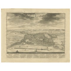
Antique Print of the Region around Pasuruan Indonesia by Valentijn '1726'
$299.54
£222.94
€250
CA$410.29
A$456.33
CHF 238.28
MX$5,553.07
NOK 3,043.22
SEK 2,854.01
DKK 1,903.16
Shipping
Retrieving quote...The 1stDibs Promise:
Authenticity Guarantee,
Money-Back Guarantee,
24-Hour Cancellation
About the Item
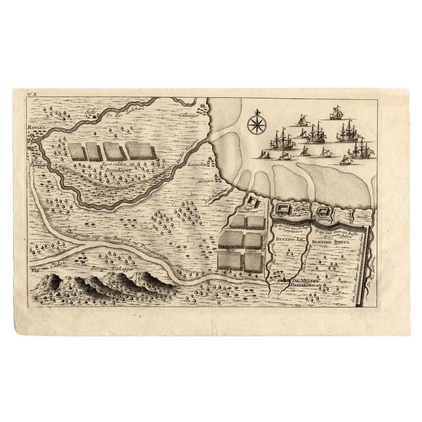
Antique print of the region around Pasuruan near Surabaya, Indonesia. It shows the location of rice fields, the village Bangil, as well as three places named Pagger (also Pagar), a cluster of buildings surrounded by a bamboo fence. The location of a earthen wall with pallisade and small cannons (Bas) is also given. This print originates from 'Oud en Nieuw Oost-Indiën' by F. Valentijn.
- Dimensions:Height: 8.27 in (21 cm)Width: 13 in (33 cm)Depth: 0.02 in (0.5 mm)
- Materials and Techniques:
- Period:
- Date of Manufacture:1726
- Condition:Good, age-related toning. Minor wear. Blank verso. Please study image carefully.
- Seller Location:Langweer, NL
- Reference Number:Seller: BGRN-2981stDibs: LU3054320617312
About the Seller
5.0
Recognized Seller
These prestigious sellers are industry leaders and represent the highest echelon for item quality and design.
Platinum Seller
Premium sellers with a 4.7+ rating and 24-hour response times
Established in 2009
1stDibs seller since 2017
2,502 sales on 1stDibs
Typical response time: <1 hour
- ShippingRetrieving quote...Shipping from: Langweer, Netherlands
- Return Policy
Authenticity Guarantee
In the unlikely event there’s an issue with an item’s authenticity, contact us within 1 year for a full refund. DetailsMoney-Back Guarantee
If your item is not as described, is damaged in transit, or does not arrive, contact us within 7 days for a full refund. Details24-Hour Cancellation
You have a 24-hour grace period in which to reconsider your purchase, with no questions asked.Vetted Professional Sellers
Our world-class sellers must adhere to strict standards for service and quality, maintaining the integrity of our listings.Price-Match Guarantee
If you find that a seller listed the same item for a lower price elsewhere, we’ll match it.Trusted Global Delivery
Our best-in-class carrier network provides specialized shipping options worldwide, including custom delivery.More From This Seller
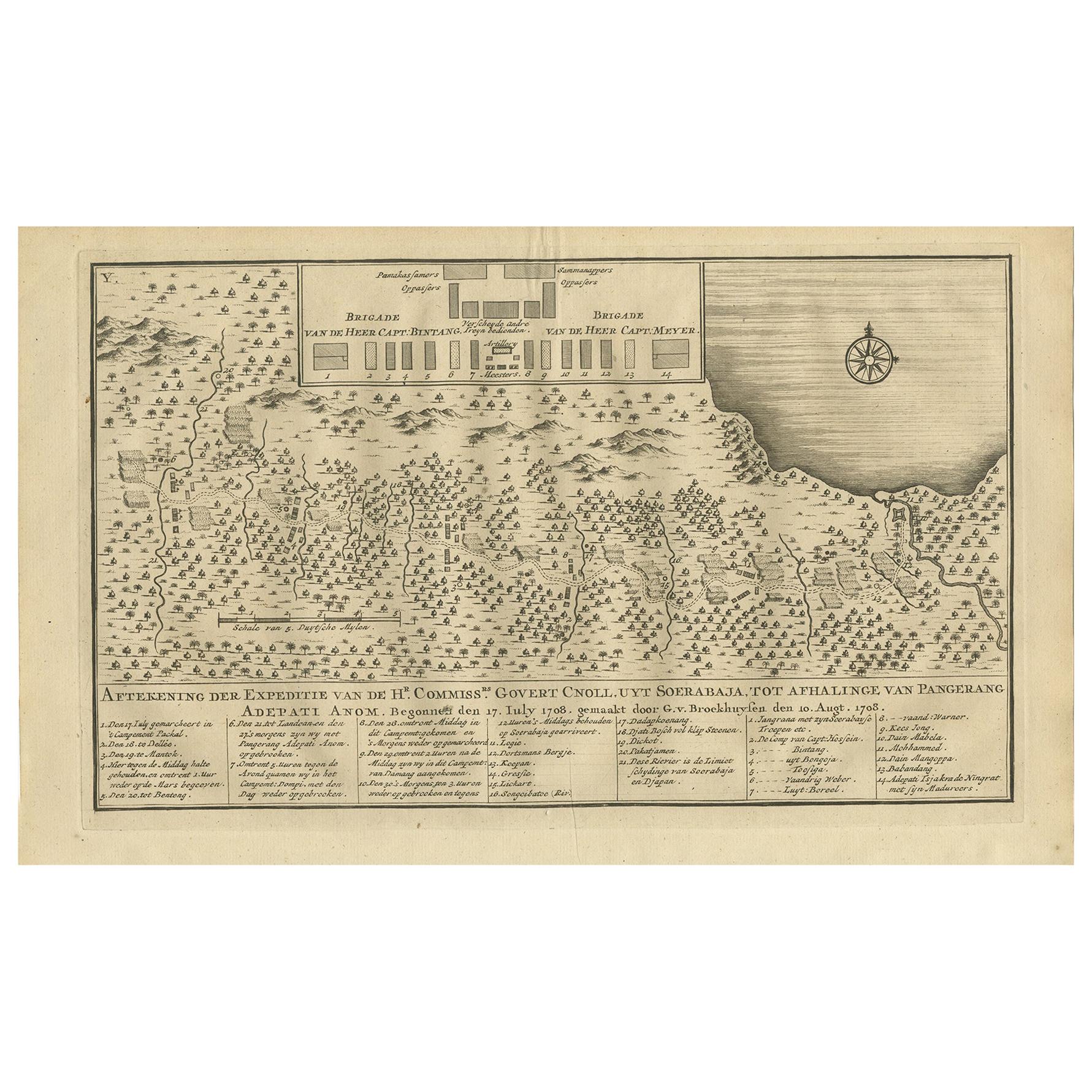
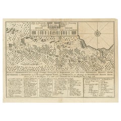
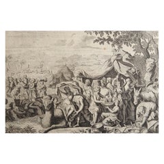
View AllAntique Print of the Expedition of Govert Knol from Surabaya to Pangerang, 1750
Located in Langweer, NL
Antique print titled 'Aftekening der Expeditie van de Hr. Commissaris Govert Cnoll uyt Soerabaja, tot afhalinge van Pangerang Adepati Anom'. Map showing the expedition of Commissione...
Category
Antique Mid-18th Century Prints
Materials
Paper
$115 Sale Price
20% Off
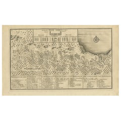
Antique Print of the Expedition from Surabaya to Pangerang by Valentijn, '1726'
Located in Langweer, NL
Antique print titled 'Aftekening der Expeditie van de Hr. Commissaris Govert Cnoll uyt Soerabaja, tot afhalinge van Pangerang Adepati Anom'. This print depicts the expedition...
Category
Antique Mid-18th Century Prints
Materials
Paper
$143 Sale Price
20% Off
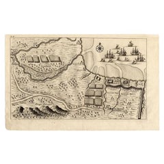
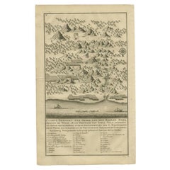
Antique Map of the Region of Pasuruan, Java, Indonesia, 1726
Located in Langweer, NL
"Map of the region around Pasuruan. It shows the location of rice fields, the village Bangil, as well as three places named Pagger (also Pagar), a cluster of buildings surrounded by a bamboo fence. The location of a earthen wall with pallisade and small cannons...
Category
Antique 18th Century Maps
Materials
Paper
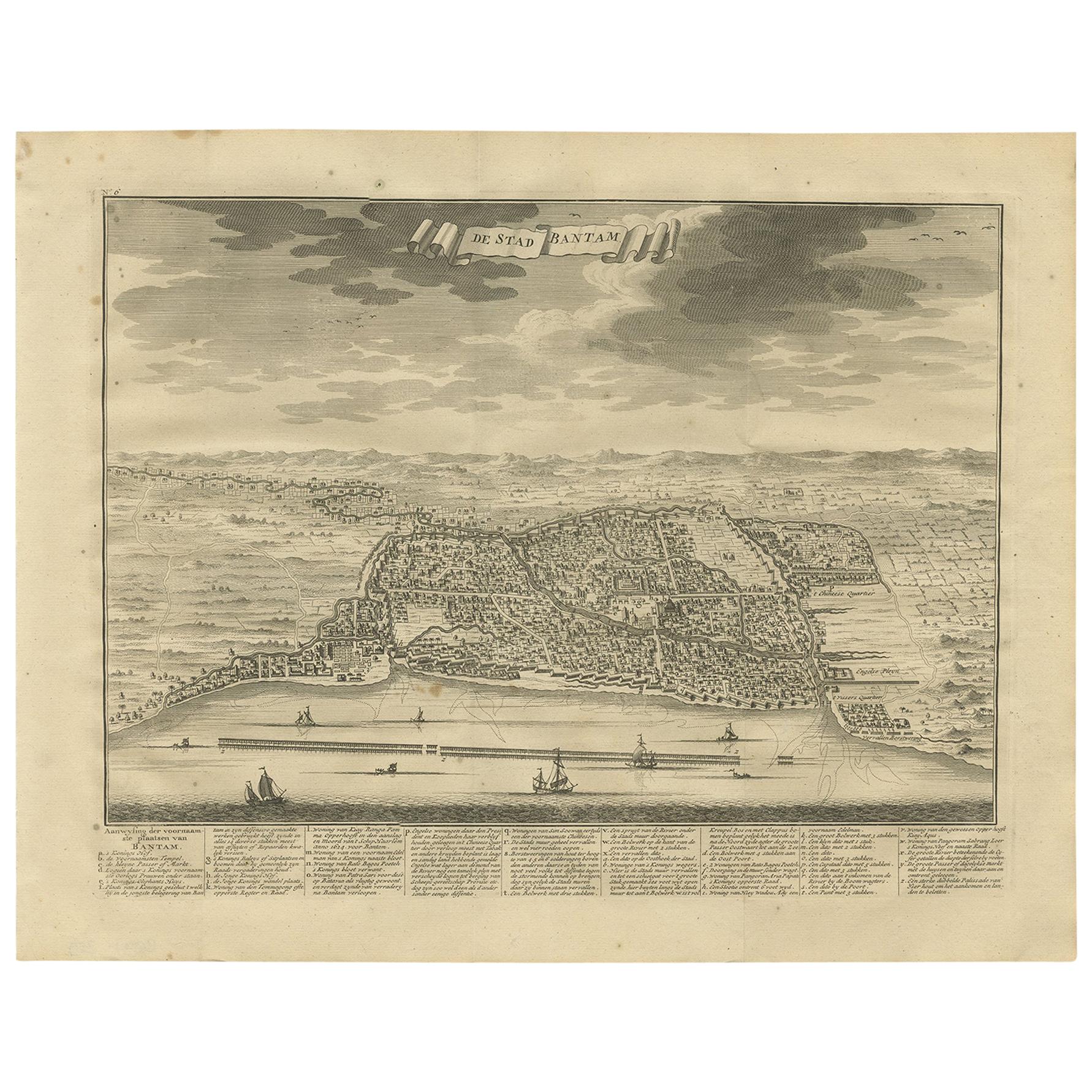
Antique Print of Bantam or Banten, Java, Indonesia, '1726'
Located in Langweer, NL
Antique print titled 'De Stad Bantam'. Decorative town-view of the town of Bantam (Banten). In lower margin key a-z to the principal places in town. The Banten Sultanate was founded ...
Category
Antique Mid-18th Century Prints
Materials
Paper
$479 Sale Price
20% Off
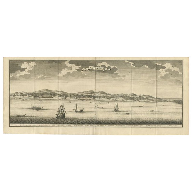
Antique Print of Ambon, Indonesia by Valentijn, 1726
Located in Langweer, NL
Antique print Indonesia titled 'Amboina'. Beautiful view of Ambon, Indonesia. With several ships in the foreground. This print originates from 'Oud en Nieuw Oost-Indiën' by F. Valent...
Category
Antique 18th Century Prints
Materials
Paper

$498 Sale Price
20% Off
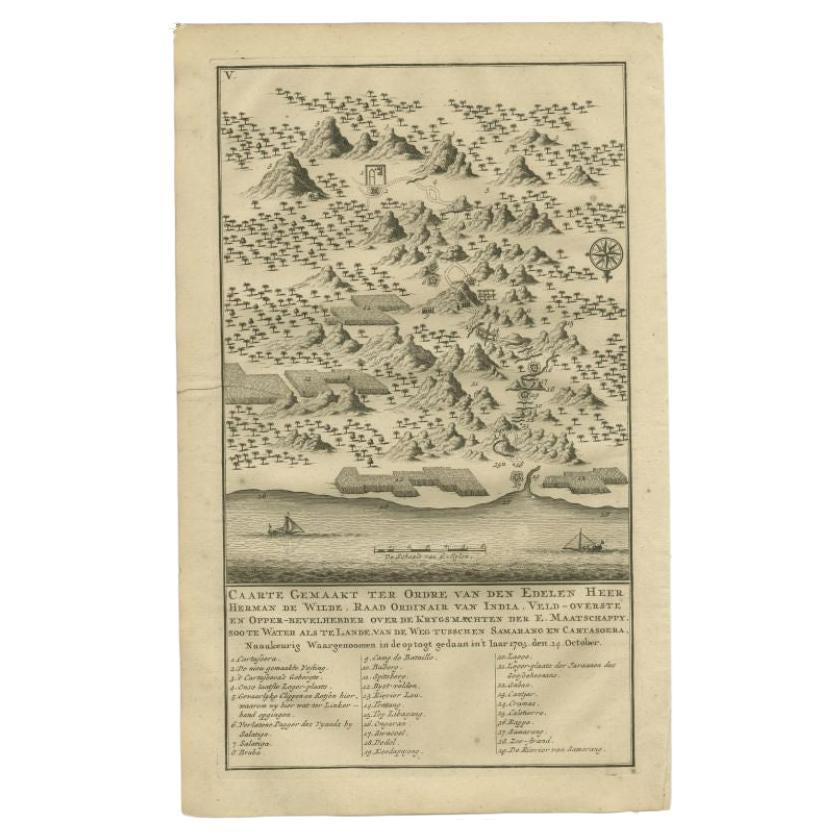
Antique Print of the Road Between Semarang and Kartosuro, Java, 1726
Located in Langweer, NL
Antique print titled 'Caarte Gemaakt ter Ordre van den Edelen Heer Herman de Wilde ..... Van de weg tusschen Samarang en Cartasoera.' This print shows a map of the road between Semar...
Category
Antique 18th Century Prints
Materials
Paper
You May Also Like
Antique Voc Print Holland Malaysia Old Map Melaka History, 1663
Located in Amsterdam, Noord Holland
From my own collection I offer this impressive Antique print of the city of Malakka
A very interesting piece for collectors . It is an museum piece from the Dutch Institute of Orien...
Category
Antique 17th Century European Paintings
Materials
Paper

$293 Sale Price
20% Off
1635 Willem Blaeu Map of Northern France"Comitatvs Bellovacvm" Ric.a08
Located in Norton, MA
1635 Willem Blaeu map of northern France, entitled.
"Comitatvs Bellovacvm Vernacule Beavvais,"
Colored
Ric.a008
“COMITATVS BELLOVACVM…” Amsterdam: W...
Category
Antique 17th Century Unknown Maps
Materials
Paper

17th-18th Century Siege of Graves Mapping Engraving By Willian III
Located in Kingston, NY
RARE French 17th-18th Century Enhanced Siege of Graves Mapping Engraving BY William III, also widely known as William of Orange,
The Siege of Grave in Dutch Brabant started by Monsie...
Category
Antique 17th Century French Prints
Materials
Paper

Original Antique Print After Jan Luyken, Amsterdam, Genesis XXXI, 1724
Located in St Annes, Lancashire
Wonderful copper-plate engraving after Jan Luyken
Published by Marten Schagen, Amsterdam. 1724
Text on verso
The measurement given is the paper size.
Category
Antique 1720s Dutch Renaissance Prints
Materials
Paper
1640 Willem Blaeu Map Entitled "Contado di molise et principato vltra, " Ric.a003
By Willem Blaeu
Located in Norton, MA
1640 Willem Blaeu map entitled
"Contado di molise et principato vltra,"
Colored
Ric. a003
Measures: 38 x 49.6 cm and wide margins
DBLAEU.
Cou...
Category
Antique 17th Century Dutch Maps
Materials
Paper

1643 Willem&Joan Blaeu Map NW Flanders "Flandriae Teutonicae Pars Prientalior
Located in Norton, MA
1643 Willem and Joan Blaeu map of northwest Flanders, entitled
"Flandriae Teutonicae Pars Prientalior,"
Ric0012
" Authentic" - Map of the northwest Fl...
Category
Antique 17th Century Dutch Maps
Materials
Paper

More Ways To Browse
Indonesian Bamboo
Racehorse Engraving
Sister Kent
Sunflower Engraving
Used Furniture Erie Pa
Alejandro Selkirk Island
Antique Paper Guillotine
Arthur Weaver Golf
Crimean Tatar
David Wilkie
Henry Thomas Alken
Hornbill Casque
Icart Nudes
Immaculate Heart Of Mary
Knoll Poster
Louis Icart Nude
Thomas Evans
Adam Eve Wall Decorative Plates