Items Similar to Antique Print of the Road Between Semarang and Kartosuro, Java, 1726
Want more images or videos?
Request additional images or videos from the seller
1 of 5
Antique Print of the Road Between Semarang and Kartosuro, Java, 1726
About the Item
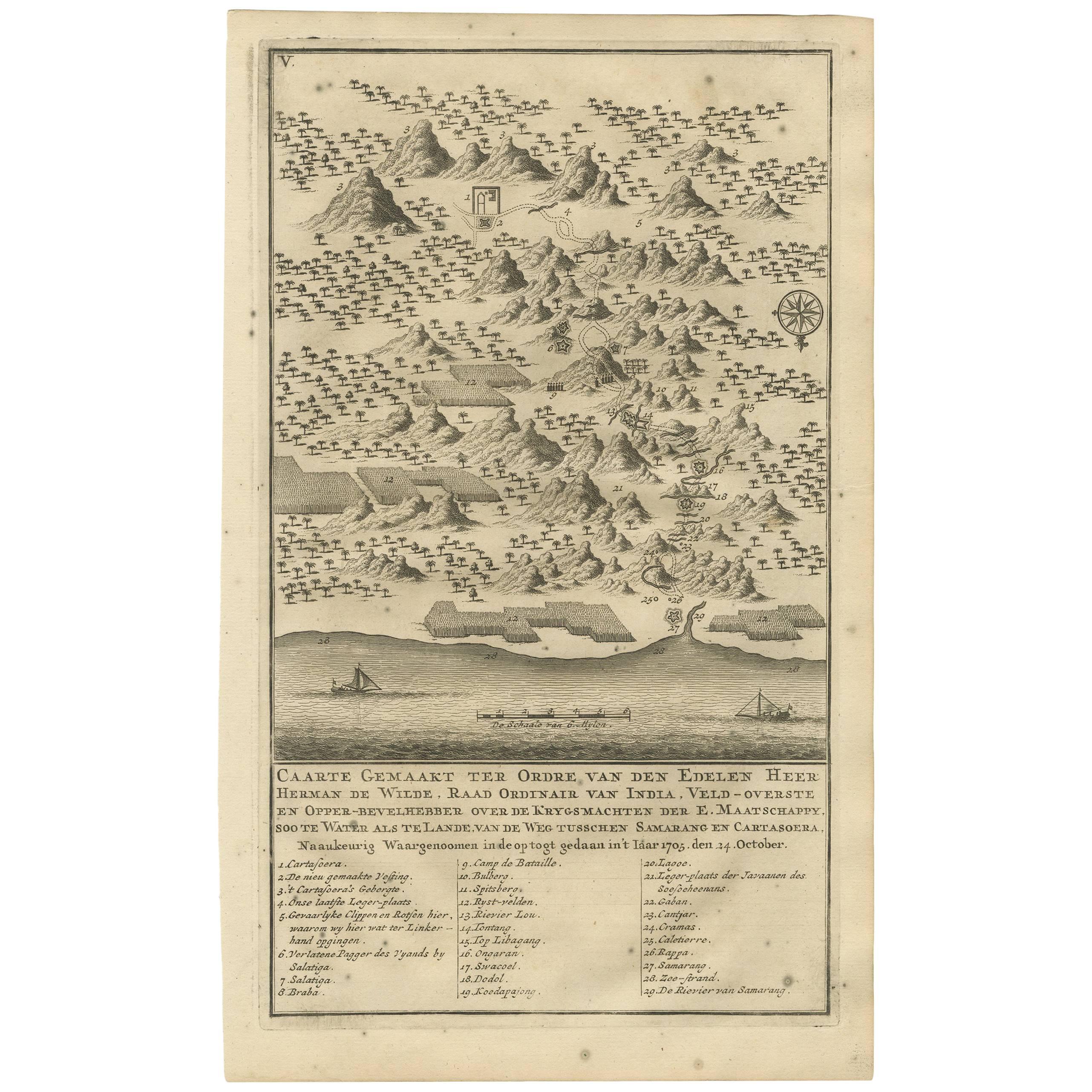
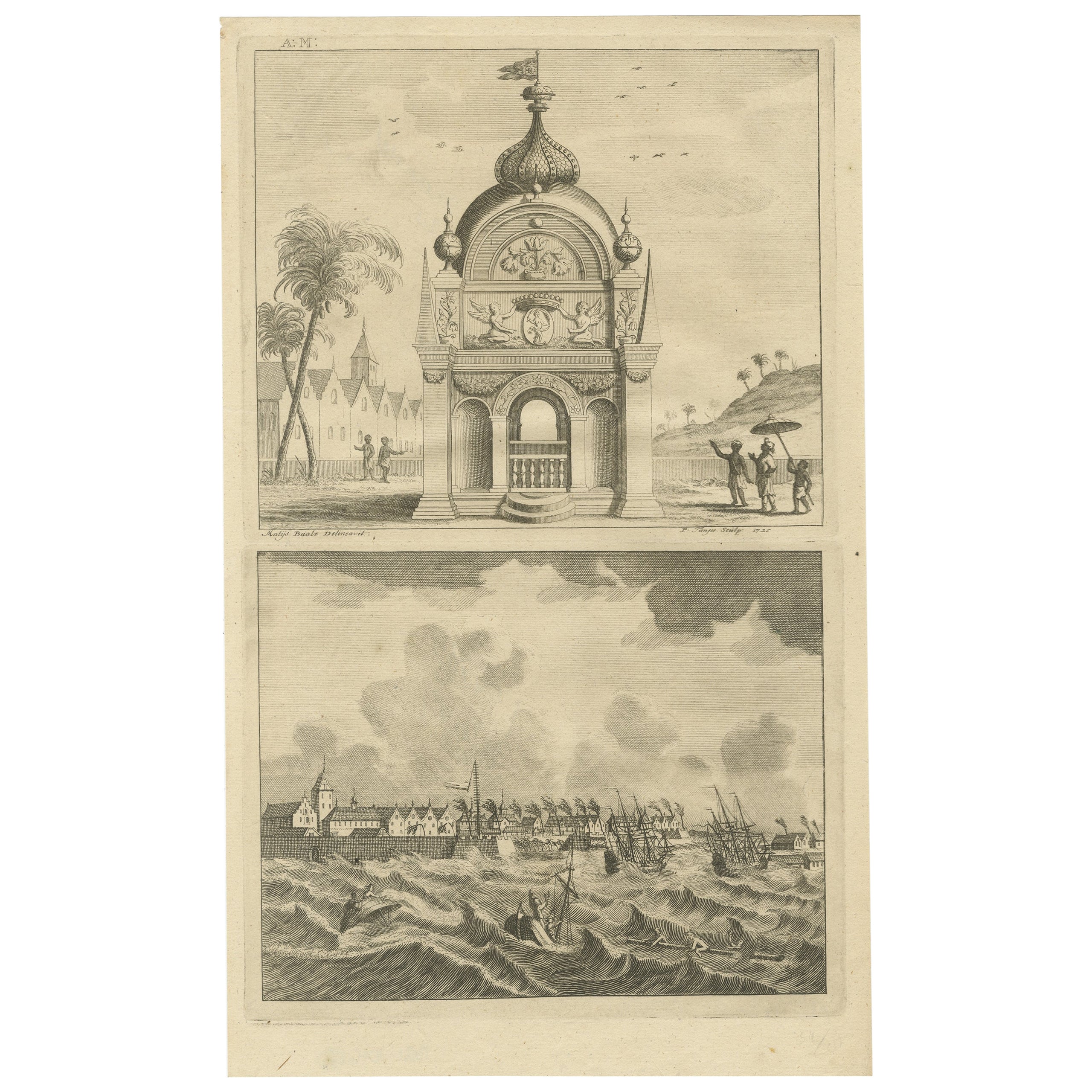
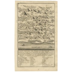
Antique print titled 'Caarte Gemaakt ter Ordre van den Edelen Heer Herman de Wilde ..... Van de weg tusschen Samarang en Cartasoera.' This print shows a map of the road between Semarang and Kartosuro (Java, Indonesia), made by the orders of Lord Herman de Wilde (currently part of Surakarta) on the island of Java, Indonesia. This print originates from 'Oud en Nieuw Oost-Indiën' by F. Valentijn.
Artists and Engravers: François Valentijn (1666-1727), a missionary, worked at Amboina from 1684 to 1694 and 1705 to 1713 and travelled extensively in the VOC's lands.
Condition: Good, general age-related tonig. Minor wear, Dutch text on verso. Please study image carefully.
Overall size: 20.5 x 33 cm.
Image size: 17 x 29 cm.
Whilst cartography holds a special place in our collection, we also offer thousands of antique prints covering fields of interest as diverse as architecture, natural history, religion, ethnology and many more. Antique prints have long been appreciated for both their aesthetic and investment value. They were the product of engraved, etched or lithographed plates. These plates were handmade out of wood or metal, which required an incredible level of skill, patience and craftsmanship. Whether you have a house with Victorian furniture or more contemporary decor an old engraving can enhance your living space. We offer a wide range of authentic antique prints for any budget.
- Dimensions:Height: 13 in (33 cm)Width: 8.08 in (20.5 cm)Depth: 0 in (0.01 mm)
- Materials and Techniques:
- Period:
- Date of Manufacture:1726
- Condition:Condition: Good, general age-related tonig. Minor wear, Dutch text on verso. Please study image carefully.
- Seller Location:Langweer, NL
- Reference Number:
About the Seller
5.0
Platinum Seller
These expertly vetted sellers are 1stDibs' most experienced sellers and are rated highest by our customers.
Established in 2009
1stDibs seller since 2017
1,933 sales on 1stDibs
Typical response time: <1 hour
- ShippingRetrieving quote...Ships From: Langweer, Netherlands
- Return PolicyA return for this item may be initiated within 14 days of delivery.
More From This SellerView All
- Antique Map of the Road Between Semarang & Kartosuro by F. Valentijn, 1726Located in Langweer, NLAntique print titled 'Caarte Gemaakt ter Ordre van den Edelen Heer Herman de Wilde ..... Van de weg tusschen Samarang en Cartasoera. ' A map of the road between Semarang and Kartosur...Category
Antique Early 18th Century Maps
MaterialsPaper
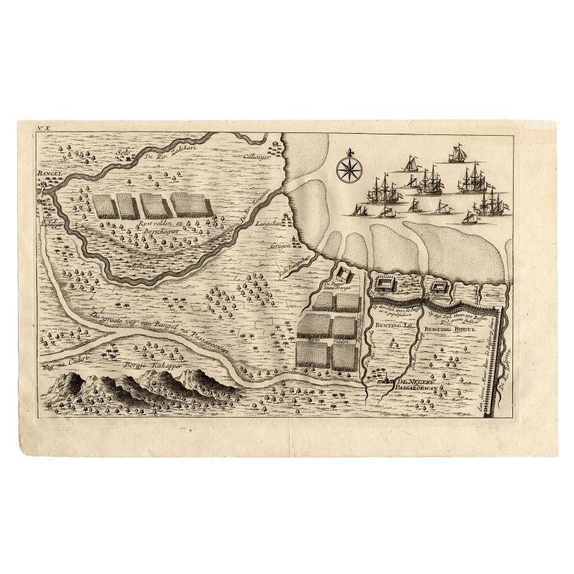
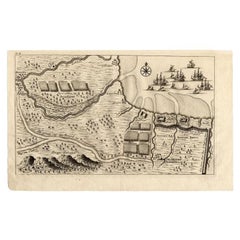
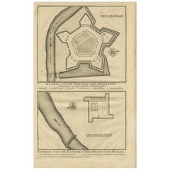
- Antique Map of the Region of Pasuruan, Java, Indonesia, 1726Located in Langweer, NL"Map of the region around Pasuruan. It shows the location of rice fields, the village Bangil, as well as three places named Pagger (also Pagar), a cluster of buildings surrounded by a bamboo fence. The location of a earthen wall with pallisade and small cannons...Category
Antique 18th Century Maps
MaterialsPaper
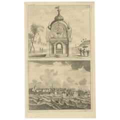
- Antique Print of the castle of Semarang and a fortress by Valentijn, 1726By F. ValentijnLocated in Langweer, NLAntique print titled 'Kaarte van de Vesting van Samarang. Kaarte van de Pagger Goed begin tot Damak. ' Plans of the castle of Semarang and the fortress (Pagger/Pagar) Demak. From the...Category
Antique Mid-18th Century Prints
MaterialsPaper
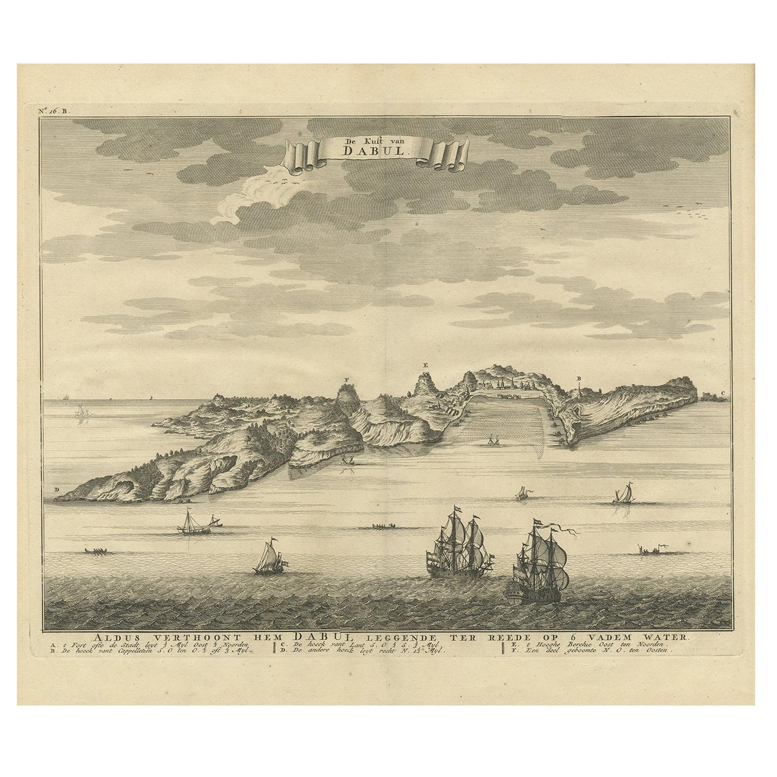
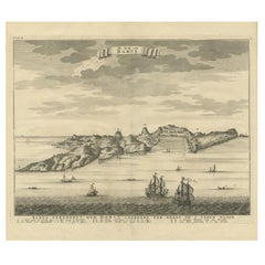
- Antique Print of the Coast of Dabhol 'India', 1726By F. ValentijnLocated in Langweer, NLAntique print titled 'De Kust van Dabul'. Antique print of the coastline near Dabhol in India. This print originates from 'Oud en Nieuw Oost-Indiën' by F. Valentijn.Category
Antique Early 18th Century Dutch Prints
MaterialsPaper
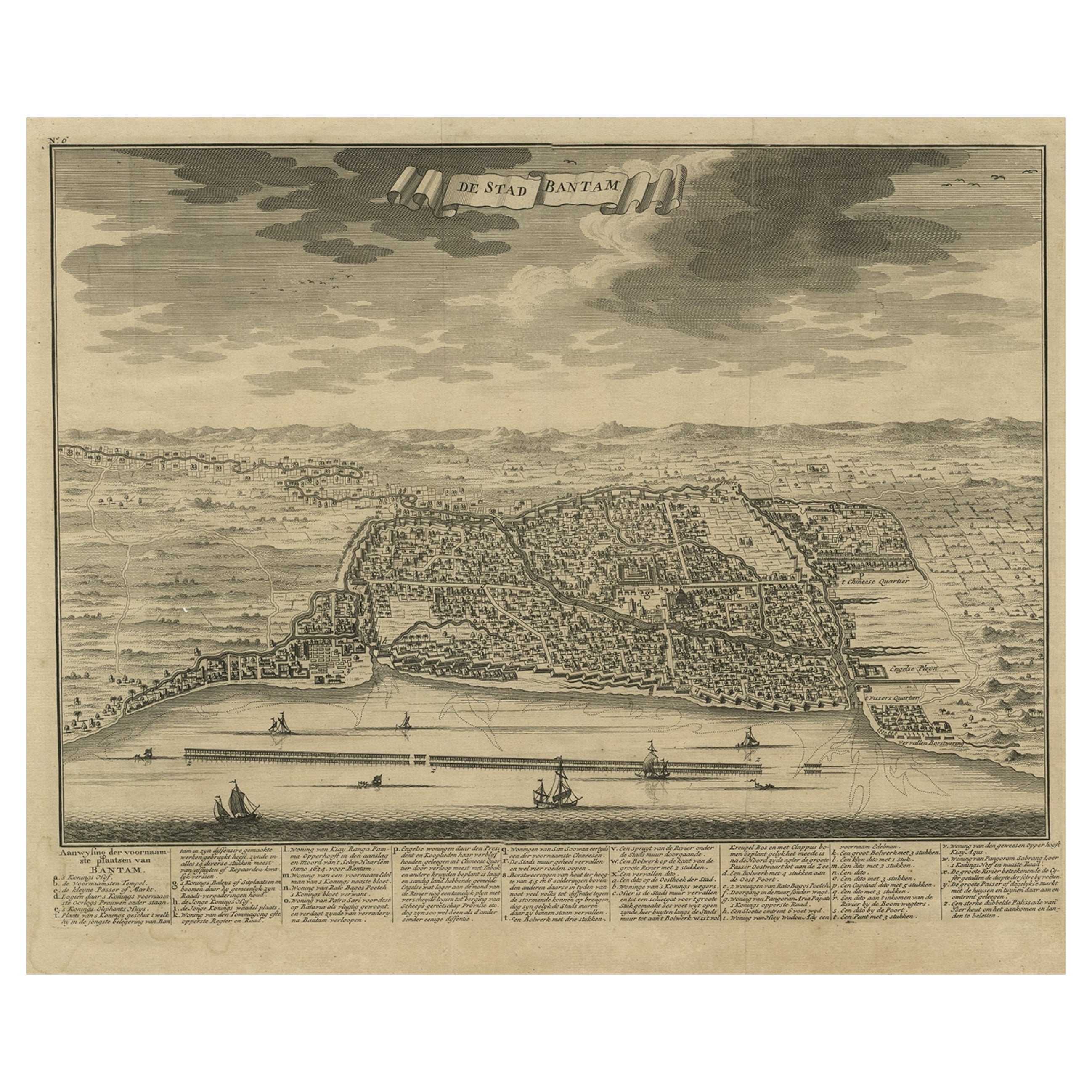
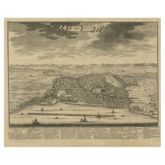
- Decorative View of the Indonesian Town of Bantam 'Banten', Java, 1726Located in Langweer, NLDecorative town-view of the town of Bantam (Banten). In lower margin key a-z to the principal places in town. The Banten Sultanate was founded in the 16th century and centred in ...Category
Antique 1720s Maps
MaterialsPaper
- Antique Print of the Coromandel Coast in India, 1726Located in Langweer, NLAntique print depicting the Coromandel Coast, India. This print originates from 'Oud en Nieuw Oost-Indiën' by F. Valentijn. Artists and Engravers: François Valentijn (1666-1727), a ...Category
Antique 18th Century Prints
MaterialsPaper
You May Also Like
- Antique 1901 National Publishing Company's Road Map of New Jersey GeologicalLocated in Dayton, OHThe National Publishing Company's road map of New Jersey, showing all county and township divisions, cities villages and post-offices, railroads, ste...Category
Antique Early 1900s Victorian Prints
MaterialsPaper
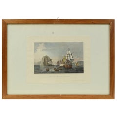
- Antique Lithographic Print of the Diamond Rock Battle Early 1900s, Oakwood FrameLocated in Milan, ITLithographic print of the diamond rock battle, the main port of the island of Martinique, taken from the book Historical Gallery of Versailles 112. Chacoane is the engraver. Original...Category
Early 20th Century French Nautical Objects
MaterialsPaper
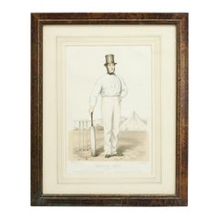
- Antique Cricket Print of Joseph Guy of NottinghamLocated in Oxfordshire, GBCricket print of Joseph Guy of Nottingham. A framed, tinted and hand colored lithographic portrait of the All- England cricketer Joseph Guy (1813 - 187...Category
Antique 1850s British Sporting Art Sports Equipment and Memorabilia
MaterialsPaper
- Civil War Panorama of the Seat of War by John Bachmann, Antique Print circa 1864Located in Colorado Springs, COPanorama of the seat of war. Bird's-eye View of Virginia, Maryland, Delaware and the District of Columbia. This third state of this fascinating bird's eye view of the northernmost p...Category
Antique 1860s American Maps
MaterialsPaper
- N.E. View of the United States Capitol, Washington, DC Antique Proof Print 1858Located in Colorado Springs, COThis engraved print shows a view of the United States Capitol Building, in Washington, D.C. The print depicts the neoclassical building from the northeast orientation, with a bustling street scene in front. The steel engraving is a proof printing, drawn and engraved by Henry Sartain and published in 1858. Plans began in May 1854 to build a new cast-iron dome for the United States Capitol. The then-architect of the Capitol Thomas Walter and his team were sold on the aesthetics of a new dome, as well as the utility of a fire-proof one. A year later, on March 3, 1855, President Franklin Pierce...Category
Antique 1850s American Prints
MaterialsPaper
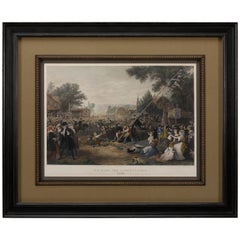
- "Raising the Liberty Pole" Hand-Colored Antique Print, 1875Located in Colorado Springs, COThis nineteenth-century engraving shows a liberty pole being raised in a town square in 1776, while a sign bearing the face of King George III is removed in the background. The rioto...Category
Antique 1870s American Historical Memorabilia
MaterialsPaper


Recently Viewed
View AllMore Ways To Browse
Indonesian Decor
Oud Wood
Herman Metal Prints
Hand Cast Ring
Mid Century Modern Brass Wall Sculpture
Paneled Oak Chest
Antique Door Knobs
Antique Door Knob
Tall Antique Chest
Antique Tall Chest
Louis Multi
Door Knobs Antique
French Louis Xv Commode Marble Top
Round Drawer Pulls
Chinese Open Cabinet
Antique Satinwood Cabinet
Tapestry And Flower
Vintage Industrial Kitchen Cabinets