Items Similar to Carta ad uso del viaggio di Anacarsi il giovine del cartografo D'Anville 1790
Want more images or videos?
Request additional images or videos from the seller
1 of 11
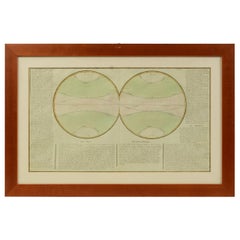
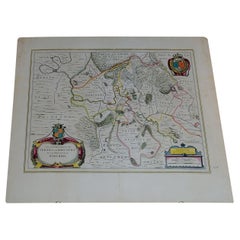
Carta ad uso del viaggio di Anacarsi il giovine del cartografo D'Anville 1790
$531.65
£398.51
€450
CA$730.40
A$815.42
CHF 427.27
MX$9,981.60
NOK 5,426.34
SEK 5,116.35
DKK 3,425.56
Shipping
Retrieving quote...The 1stDibs Promise:
Authenticity Guarantee,
Money-Back Guarantee,
24-Hour Cancellation
About the Item
Carta che riproduce la mappa dell’Accademia e i suoi contorni nei pressi di Atene ad uso del viaggio di Anacarsi il giovine, del Signor Barbie di Bocage; la carta, realizzata dal cartografo D'Anville, faceva parte dell'opera: Viaggio del giovane Anacarsi in Grecia di Jean Jacques Barthélemy (1716-1795), rinomato filologo e classicista, pubblicata in lingua italiana attorno al 1790. Stampa da incisione su lastra di rame, coloritura coeva. Misure con cornice cm 42x34 – inches 16.5x13.4. Buono stato.
Anacarsi fu uno dei sette savi della Grecia antica, e secondo Erodoto visse all’inizio del VI secolo a.C. e durante la sua vita viaggiò per molte terre, dando prova ovunque di grande saggezza”. L’opera di Barthélemy, Viaggio del giovane Anacarsi in Grecia (Voyage du jeune Anacharsis en Grèce dans le milieu du IVe siècle), in cui un giovane discendente del saggio Anacarsi visita la Grecia del IV secolo a.C., conteneva minuziose descrizioni di luoghi, usi e costumi dei Greci, ed ebbe grande fortuna alla fine del XVIII secolo e nel XIX secolo.
- Dimensions:Height: 13.4 in (34.04 cm)Width: 16.5 in (41.91 cm)Depth: 1 in (2.54 cm)
- Materials and Techniques:
- Period:
- Date of Manufacture:1790
- Condition:Wear consistent with age and use.
- Seller Location:Milan, IT
- Reference Number:1stDibs: LU1020238154482
About the Seller
5.0
Vetted Professional Seller
Every seller passes strict standards for authenticity and reliability
Established in 1999
1stDibs seller since 2014
398 sales on 1stDibs
Typical response time: 1 hour
- ShippingRetrieving quote...Shipping from: Milan, Italy
- Return Policy
Authenticity Guarantee
In the unlikely event there’s an issue with an item’s authenticity, contact us within 1 year for a full refund. DetailsMoney-Back Guarantee
If your item is not as described, is damaged in transit, or does not arrive, contact us within 7 days for a full refund. Details24-Hour Cancellation
You have a 24-hour grace period in which to reconsider your purchase, with no questions asked.Vetted Professional Sellers
Our world-class sellers must adhere to strict standards for service and quality, maintaining the integrity of our listings.Price-Match Guarantee
If you find that a seller listed the same item for a lower price elsewhere, we’ll match it.Trusted Global Delivery
Our best-in-class carrier network provides specialized shipping options worldwide, including custom delivery.More From This Seller
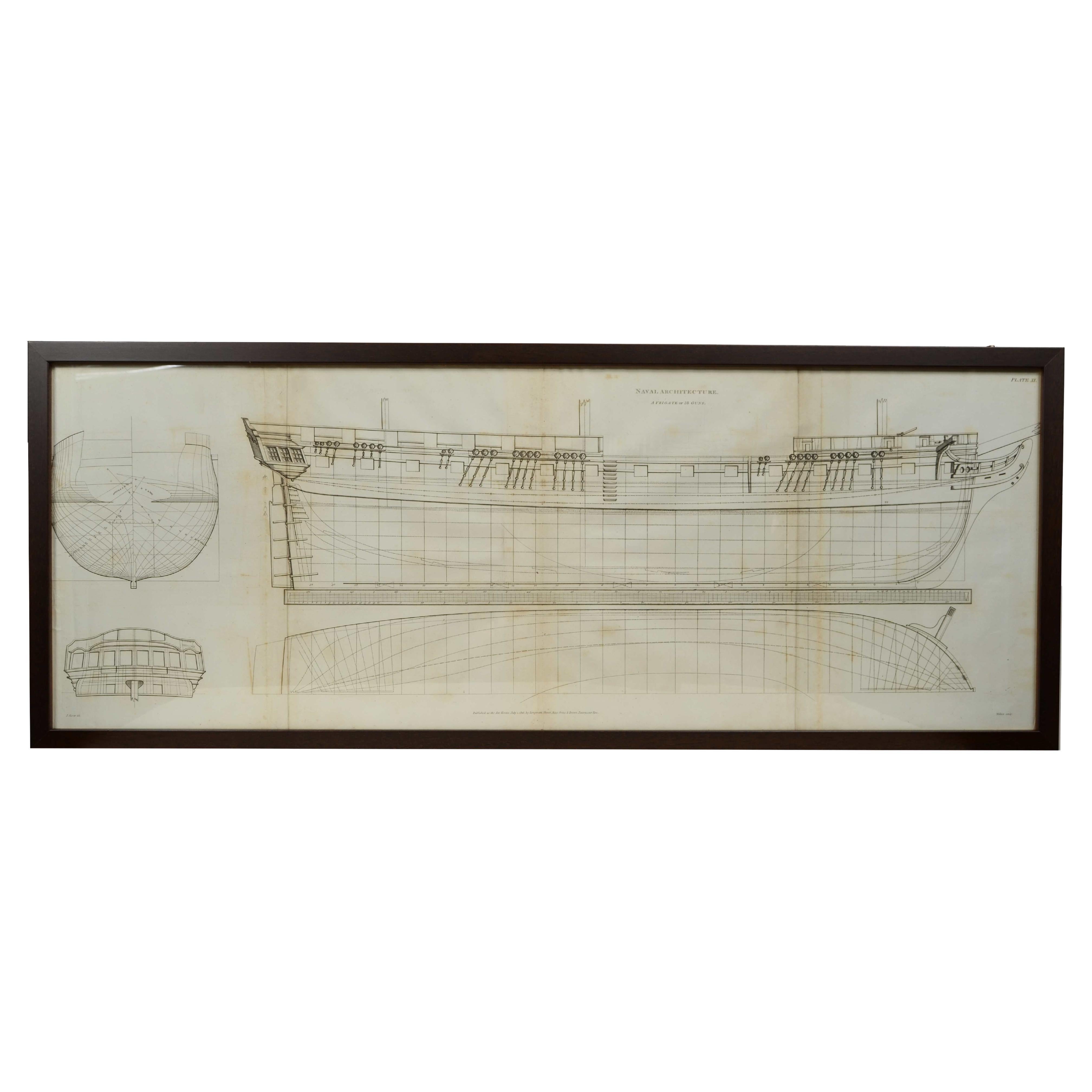
View AllStampa da incisione su lastra di rame. Published as the act directs July 1. 1816
Located in Milan, IT
Stampa da incisione su lastra di rame. Published as the act directs July 1. 1816 by Longman, Hurst, Rees, Orme & Brown Paternoster Row.
Si tratta della tavola n. XI della pubblicazio...
Category
Antique Early 19th Century Prints
Materials
Paper
Old Map Depicting the Entire Earth's Surface Divided into Six Parts France 1850
Located in Milan, IT
Map depicting the entire earth's surface divided into six parts which depicts the position of peoples on Earth based on the assumption that it is impossible for each people to have t...
Category
Antique Mid-19th Century French Maps
Materials
Glass, Wood, Paper

Bolla di trasporto marittimo su carta del 15 ottobre 1873, da Genova a Cagliari
Located in Milan, IT
Bolla di trasporto marittimo su carta del 15 ottobre 1873, da Genova a Cagliari della ditta Zucoli Sturla & C. incaricata di caricare mercanzie a bordo del brigantino Marin Faliero v...
Category
Antique 1870s Prints
Materials
Paper
1850 Old French Map Depicting the Entire Earth's Surface Divided into Two Parts
Located in Milan, IT
Geographical map depicting the entire earth’s surface divided into two parts that correspond to the two hemispheres or globes, the map deals with the latitudes and longitudes, the me...
Category
Antique Mid-19th Century French Maps
Materials
Glass, Wood, Paper

1850 Old French Map Depicting the Entire Earth's Surface Divided into Two Parts
Located in Milan, IT
Map depicting the entire earth's surface divided into two parts corresponding to the two hemispheres and showing the Arctic to Antarctic polar circle, the tropics of Cancer and Capri...
Category
Antique Mid-19th Century French Maps
Materials
Glass, Wood, Paper
Lithograph on paper of Amalfi Italy signed Auguste Anastasi mid-19th century.
Located in Milan, IT
Lithograph on paper by Amalfi in the province of Salerno Italy datable to around the mid-19th century depicting the view of the ancient ruins with the village the perched village and the sea, signed lower right Auguste Anastasi...
Category
Antique Mid-19th Century Prints
Materials
Paper
You May Also Like
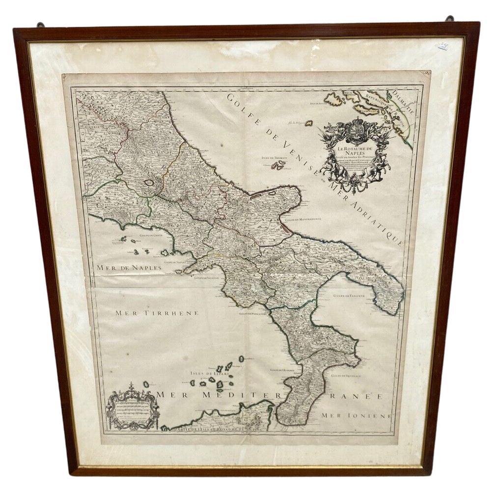
Antica Carta Geografica Regno di Napoli - 1706 - XVIII Secolo Francia
Located in Milano, MI
Antica Cartina Regno di Napoli XVIII Secolo 1:700000
Descrizione:
Meravigliosa Cartina con raffigurazione del regno di Napoli , la cartina è stata realizzata in Francia nella pri...
Category
Antique Early 1700s European Louis XVI Picture Frames
Materials
Paper
Italian Neo-Classic Map of Italy
Located in Queens, NY
Italian Neo-classic style framed print of map of Italy
Category
20th Century Italian Neoclassical Paintings
Materials
Paper
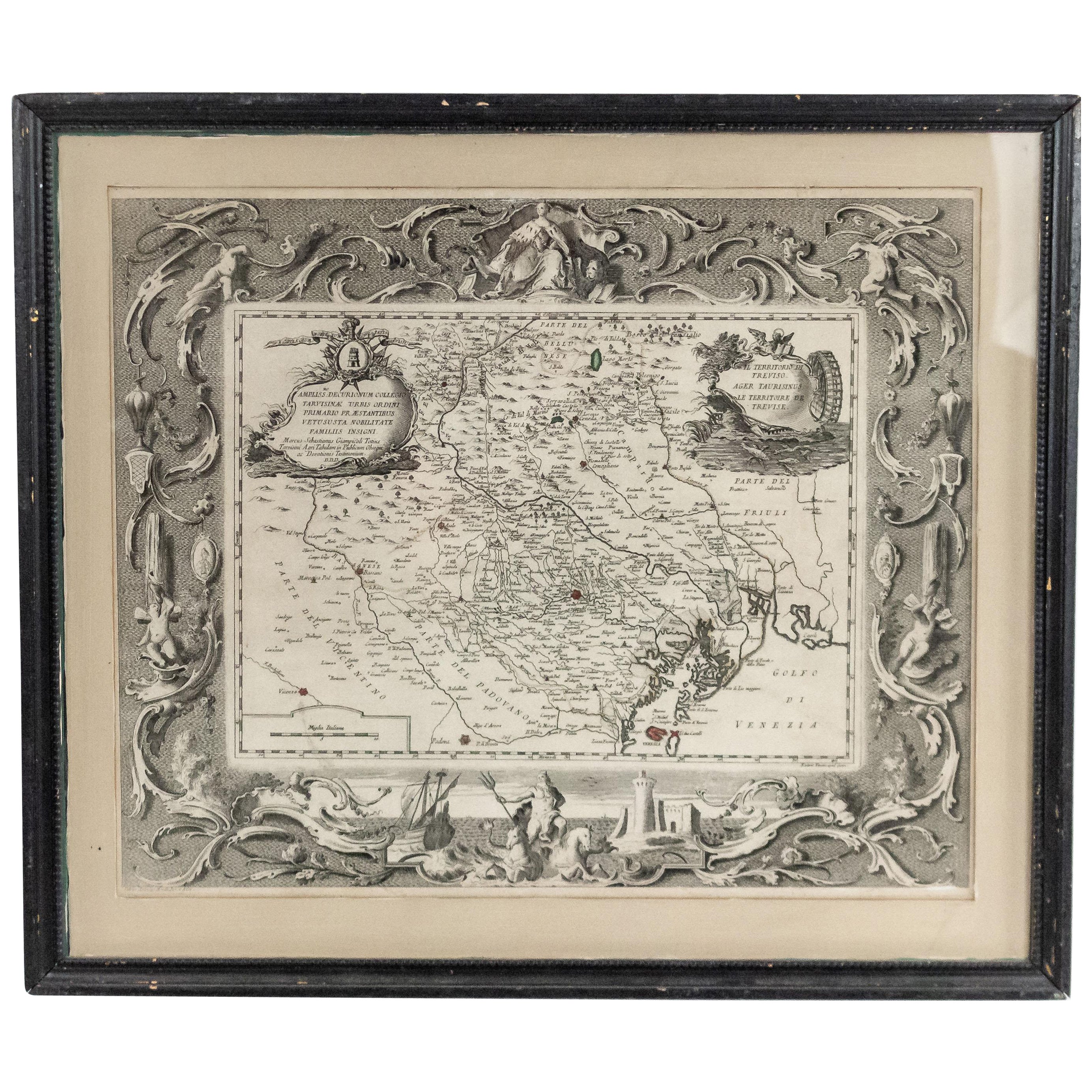
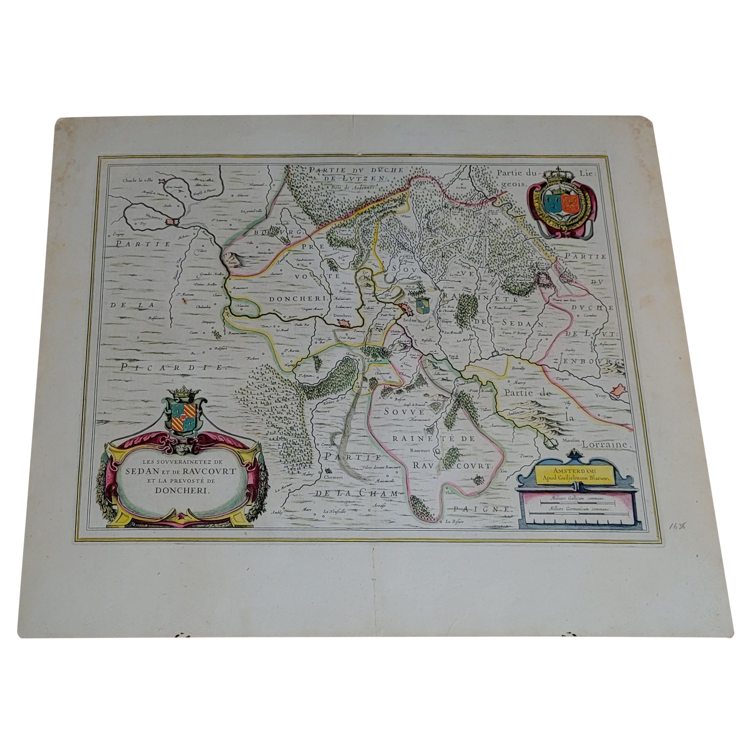
1656 "La Souverainete de Sedan et de Raucourt, et la Prevoste de Doncheri Ric004
Located in Norton, MA
1656 map entitled
"La Souverainete de Sedan et de Raucourt, et la Prevoste de Doncheri,"
Hand Colored
Ric0004.
Description:
Lovely map centered on Sedan and Doncheri an...
Category
Antique 17th Century Dutch Maps
Materials
Paper
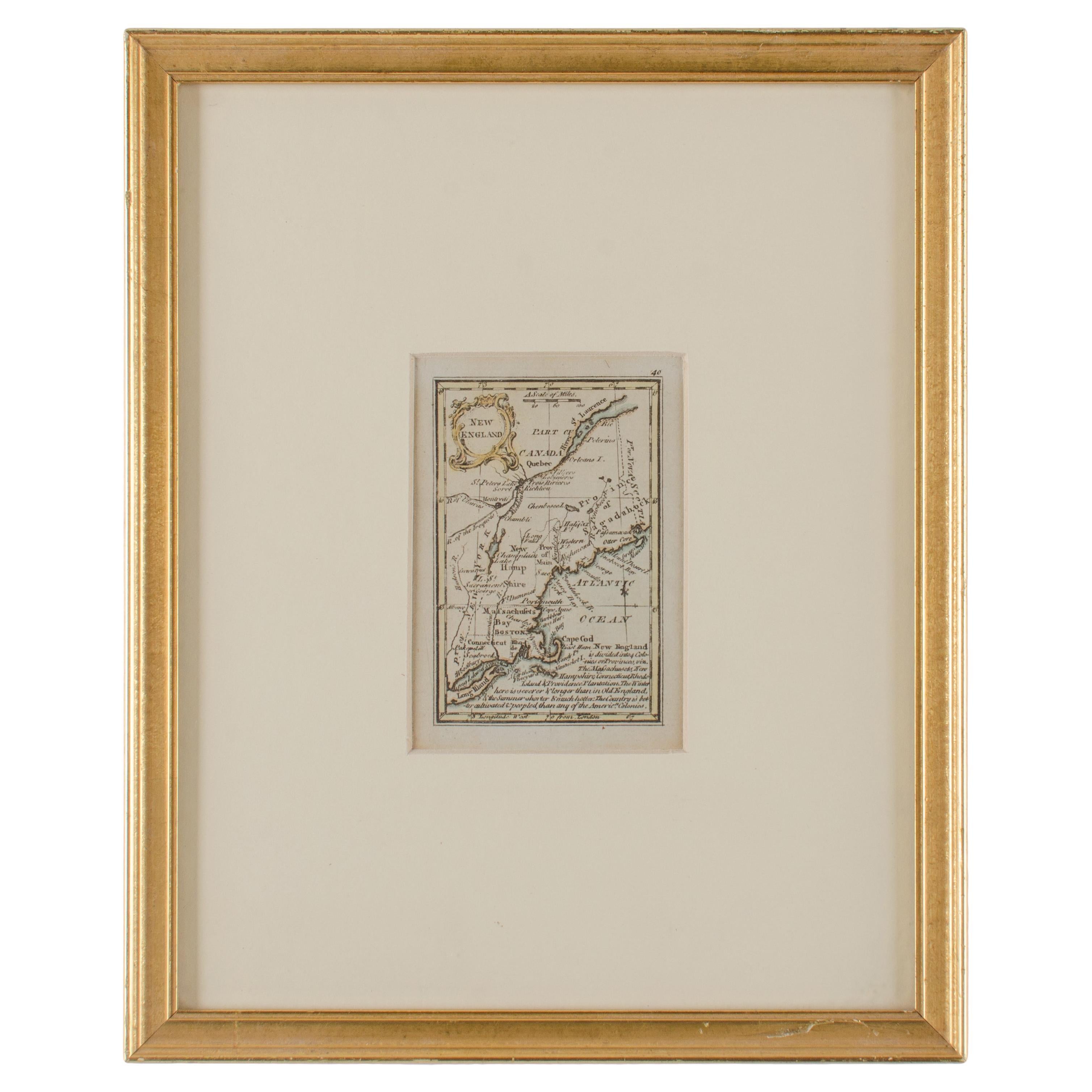
John Gibson - Map of New England
Located in Savannah, GA
A miniature map of New England from John Gibson’s The Atlas Minimus published in 1758.
John Gibson worked in London from 1748-1773 as a geographer and engraver, producing numerous ...
Category
Antique 1750s British Other Prints
Materials
Glass, Paper
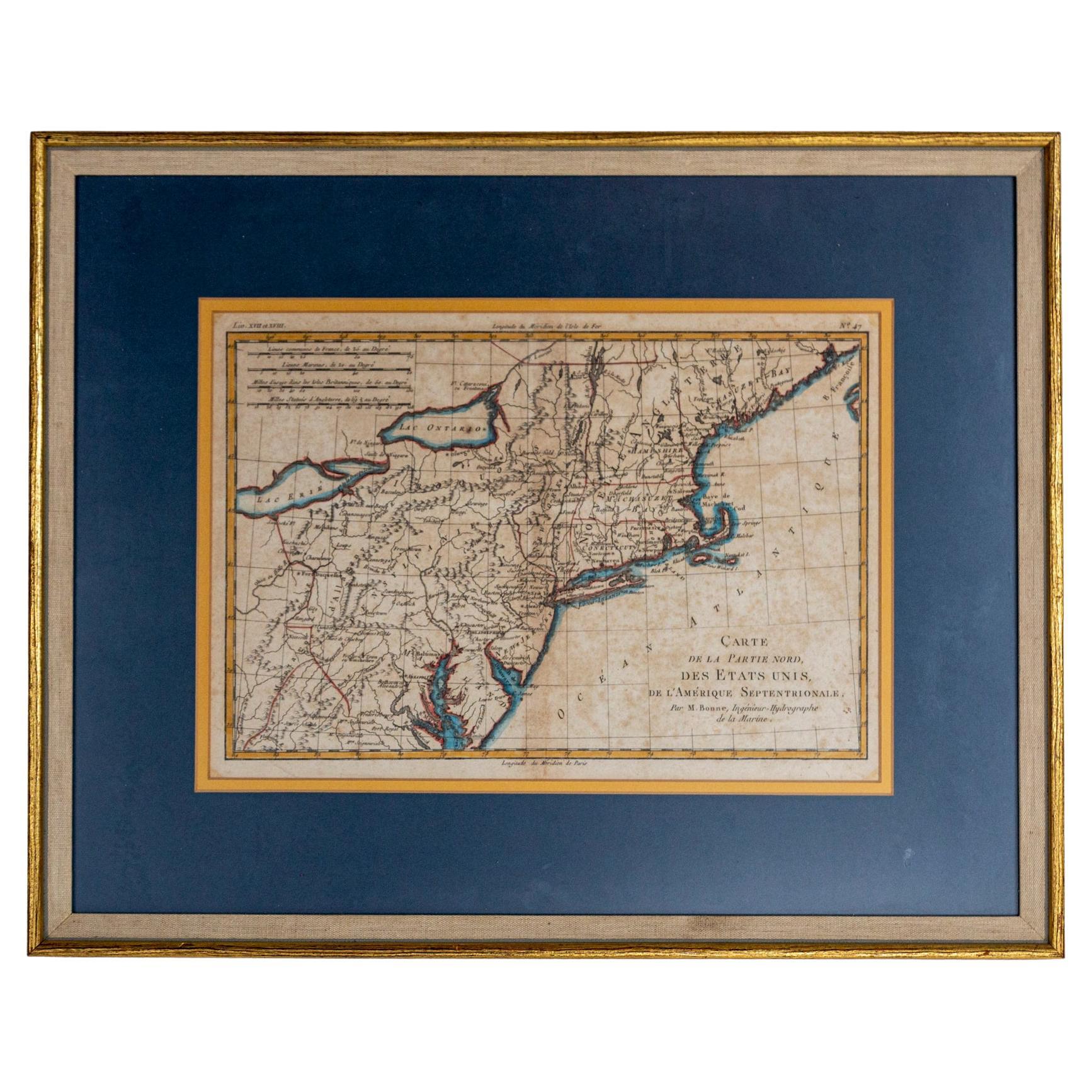
Hand-Colored French Map, Carte des Etats Unis, Par Bonne, Late 18th Century
By Rigobert Bonne
Located in Chappaqua, NY
Hand-colored French map, Carte de la Partie Nord, des Etats Unis, de l'Amérique Septentrionale, late 18th century. A French map of New England published at the end of the Revolutionary War...
Category
Antique Late 18th Century French Louis XVI Prints
Materials
Paper
18th Century Map of Rome & Surrounding Vicinity
Located in New Orleans, LA
Intriguing framed map of Rome and the surrounding vicinity featuring detailed cartography, ornamental illustrations, and text index at the bottom. A great, historical conversation pi...
Category
Antique 18th Century Italian Antiquities
Materials
Paper
More Ways To Browse
Chinese Ink Box
Chinese Table With Mother Of Pearl Inlay
Chinoiserie Fans
Chippendale Locked Cabinet
Clay Water Jug
Coiled Rattan
Column Indonesia
Concrete Garden Animals
Copper Buddha
Danish Teak Secretary Desk
Delft Jar With Lid
Delft Lions
Denmark Bronze Box
Derbyshire Marble
Display Cabinets with Lights
Distressed Antique Dresser
Dupont Silver
Dutch Cabinets 17th 18th Century