Items Similar to Geographical Pictures of the USA – Set VII by A. Wheaton & Co., ca. 1929


Want more images or videos?
Request additional images or videos from the seller
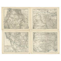
1 of 15
Geographical Pictures of the USA – Set VII by A. Wheaton & Co., ca. 1929
$415.89per set
£309.16per set
€350per set
CA$572.07per set
A$637.37per set
CHF 336.15per set
MX$7,727.14per set
NOK 4,276.36per set
SEK 3,983.70per set
DKK 2,666.46per set
Quantity
About the Item
Geographical Pictures of the USA – Set VII by A. Wheaton & Co., ca. 1929
A complete set of educational pictorial cards titled Geographical Pictures – Set VII: The United States of America, published around 1929 by A. Wheaton & Co., Exeter, England. This charming series was part of an early 20th-century British educational project aimed at introducing schoolchildren to the cultures and landscapes of various nations through vivid imagery and accessible commentary.
The set includes a collection of printed illustrations mounted on cards or sheets (depending on edition), each depicting notable scenes, landmarks, or cultural aspects of the United States. The style is highly characteristic of the 1920s–30s, blending an educational tone with artistic flair. Views often include iconic American subjects such as New York’s skyline, rural farming life, Native American scenes, or industrial and natural landmarks like the Grand Canyon or Niagara Falls.
The cards were likely used in classrooms for geography lessons, offering students visual aids to complement their studies. The publisher, A. Wheaton & Co. of Exeter, was known for its high-quality educational materials and published similar sets covering various countries and regions.
This set is an appealing collectible for those interested in interwar educational materials, early 20th-century visual culture, or Americana from a European perspective. It also serves as a decorative and nostalgic historical reference to how the United States was perceived and taught abroad during that period.
Condition: Very good overall. Slight age toning, minor edge wear. All prints intact and well preserved for their age.
Framing tips: These prints work well in simple dark wood or black frames with white or cream mounts. A gallery wall of multiple scenes creates an appealing vintage display.
Technique: Printed illustrations
Maker: A. Wheaton & Co., Exeter, ca. 1929
- Dimensions:Height: 10.44 in (26.5 cm)Width: 12.21 in (31 cm)Depth: 0.4 in (1 cm)
- Sold As:Set of 13
- Materials and Techniques:
- Place of Origin:
- Period:
- Date of Manufacture:circa 1929
- Condition:Condition: Very good overall. Slight age toning, minor edge wear. All prints intact and well preserved for their age.
- Seller Location:Langweer, NL
- Reference Number:Seller: BG-14038-891stDibs: LU3054346190002
About the Seller
5.0
Recognized Seller
These prestigious sellers are industry leaders and represent the highest echelon for item quality and design.
Platinum Seller
Premium sellers with a 4.7+ rating and 24-hour response times
Established in 2009
1stDibs seller since 2017
2,567 sales on 1stDibs
Typical response time: <1 hour
- ShippingRetrieving quote...Shipping from: Langweer, Netherlands
- Return Policy
Authenticity Guarantee
In the unlikely event there’s an issue with an item’s authenticity, contact us within 1 year for a full refund. DetailsMoney-Back Guarantee
If your item is not as described, is damaged in transit, or does not arrive, contact us within 7 days for a full refund. Details24-Hour Cancellation
You have a 24-hour grace period in which to reconsider your purchase, with no questions asked.Vetted Professional Sellers
Our world-class sellers must adhere to strict standards for service and quality, maintaining the integrity of our listings.Price-Match Guarantee
If you find that a seller listed the same item for a lower price elsewhere, we’ll match it.Trusted Global Delivery
Our best-in-class carrier network provides specialized shipping options worldwide, including custom delivery.More From This Seller
View AllAntique Railroad Map of the United States by Rand, McNally & Co, 1900
Located in Langweer, NL
Antique map titled 'Rand, McNally & Co's New Official Railroad map of the United States with portions of The Dominion of Canada, The Republic of Mexico and the West Indies'. Large railroad map of the United States, sectionalised and laid on linen. Map shows state boundaries for the United States, Mexico, the West Indies, and lower portion of Canada; major cities and towns, military posts, Native American reservations, and railroads; Oklahoma and "Indian Territory." Inset: "Map of Alaska...
Category
20th Century Maps
Materials
Linen, Paper

$2,227 Sale Price
25% Off
Free Shipping
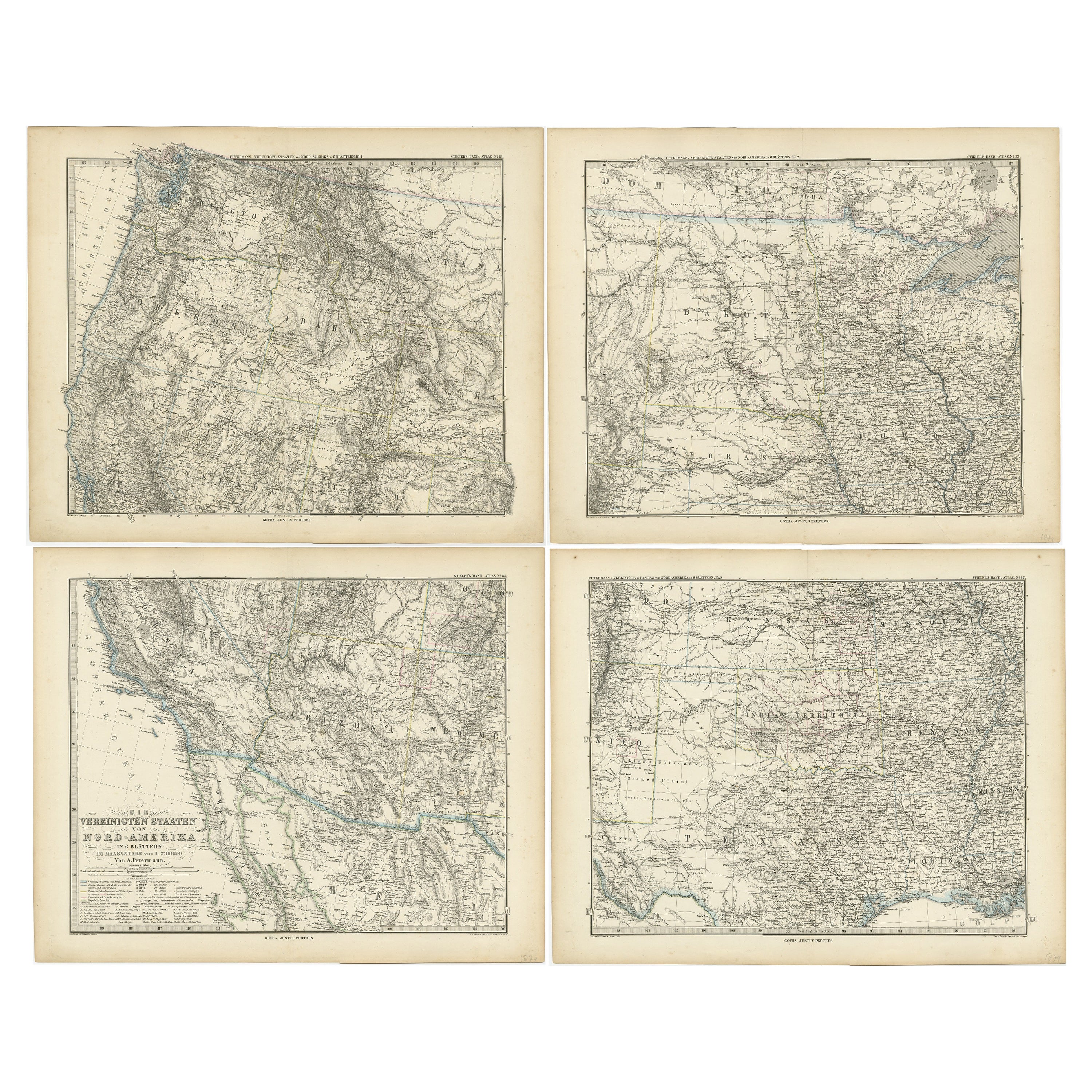
Set of 4 Antique Maps of part of the United States of America
Located in Langweer, NL
Set of four individual antique maps of part of the United States. Published as part of a set of six individual maps.
These maps originate from Stielers Handatlas, published circa 1...
Category
Antique Mid-19th Century Maps
Materials
Paper
$710 Sale Price / set
35% Off
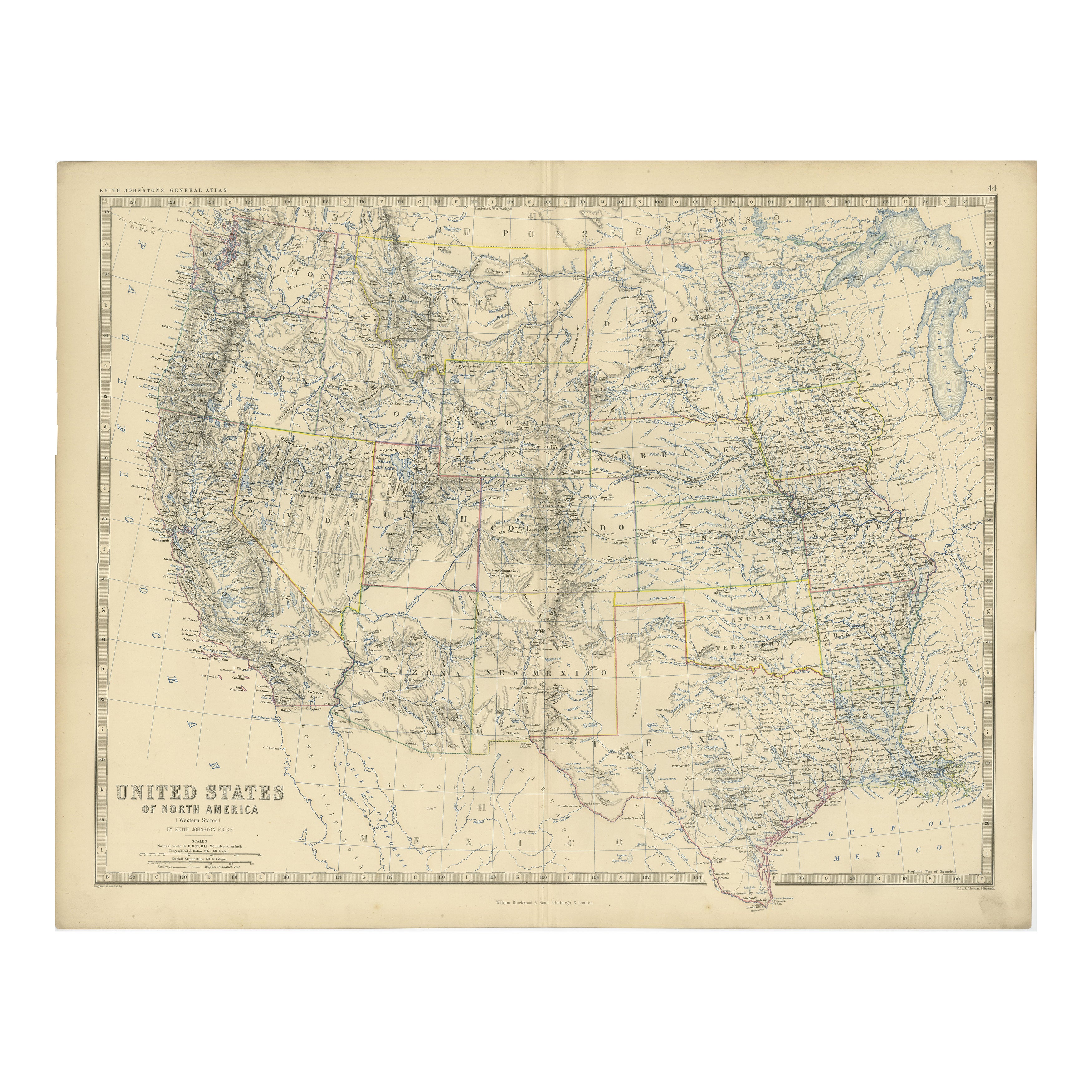
1874 Map of Western United States – Detailed Atlas by Keith Johnston
Located in Langweer, NL
1874 Map of Western United States by Keith Johnston – Detailed Atlas
This is an original antique map titled “United States of North America (Western States)” by Alexander Keith John...
Category
Antique 1870s Scottish Maps
Materials
Paper

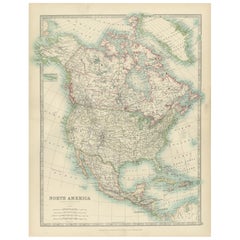
Explore North America in 1903 - Intricately Detailed Antique Map
Located in Langweer, NL
North America, 1903 - A Colorful Historical Map with Detailed Borders
This attractive map of North America was engraved, printed, and published by W. & A.K. Johnston in 1903. A wond...
Category
Early 20th Century Maps
Materials
Paper
Antique Map of the United States of North America, c.1882
Located in Langweer, NL
Antique map titled 'United States of North America'. Old map of the United States of North America. This map originates from 'The Royal Atlas of Modern Geography, Exhibiting, in a Se...
Category
Antique 1880s Maps
Materials
Paper

$332 Sale Price
20% Off
Antique Map of the United States ' North East ' by Johnston '1909'
Located in Langweer, NL
Antique map titled 'United States of North America'. Original antique map of United States of North America ( North East ). This map orig...
Category
Early 20th Century Maps
Materials
Paper

$237 Sale Price
20% Off
You May Also Like
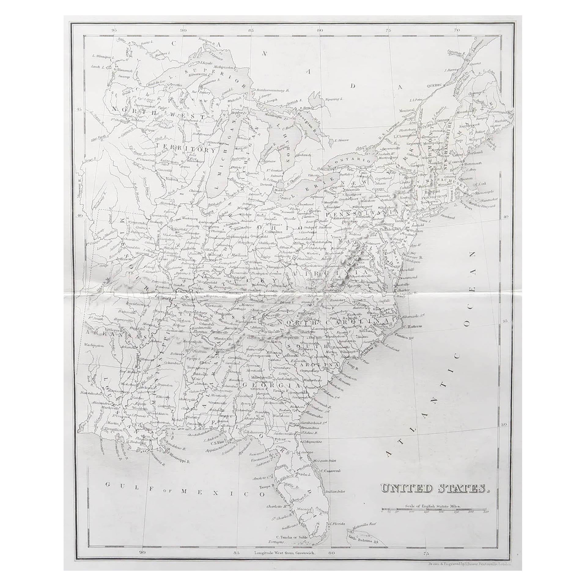
Original Antique Map of The United States of America by Dower, circa 1835
Located in St Annes, Lancashire
Nice map of the USA
Drawn and engraved by J.Dower
Published by Orr & Smith. C.1835
Unframed.
Free shipping
Category
Antique 1830s English Maps
Materials
Paper

North America. Century Atlas antique vintage map
Located in Melbourne, Victoria
'The Century Atlas. North America'
Original antique map, 1903.
Central fold as issued. Map name and number printed on the reverse corners.
Sheet 40cm by 29.5cm.
Category
Early 20th Century Victorian More Prints
Materials
Lithograph

Large Original Vintage Map of North America, circa 1920
Located in St Annes, Lancashire
Great map of North America
Original color. Good condition
Published by Alexander Gross
Unframed.
Category
Vintage 1920s English Edwardian Maps
Materials
Paper

Large Original Antique Map of the United States of America. 1891
By Rand McNally & Co.
Located in St Annes, Lancashire
Fabulous map of The United States
Original color
By Rand, McNally & Co.
Dated 1891
Unframed
Free shipping.
Category
Antique 1890s American Maps
Materials
Paper

1859 "Map of the United States of America..." by J. H. Colton
By J.H. Colton
Located in Colorado Springs, CO
Presented is an 1859 “Map of the United States of America, the British Provinces, Mexico, the West Indies and Central America with Part of...
Category
Antique 1850s American Maps
Materials
Paper

Original Antique Map of North America by Dower, circa 1835
Located in St Annes, Lancashire
Nice map of North America
Drawn and engraved by J.Dower
Published by Orr & Smith. C.1835
Unframed.
Free shipping
Category
Antique 1830s English Maps
Materials
Paper
