Items Similar to Geological Map of Asia by A.K. Johnston – Mountains and Valleys 1852


Want more images or videos?
Request additional images or videos from the seller
1 of 11
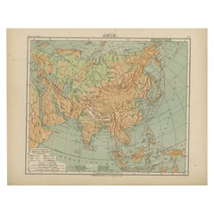
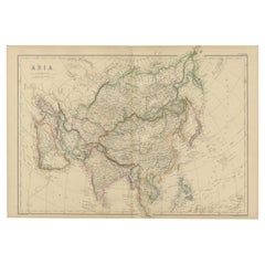
Geological Map of Asia by A.K. Johnston – Mountains and Valleys 1852
$306.44per item
£230.81per item
€260per item
CA$422.60per item
A$474.77per item
CHF 248.07per item
MX$5,794.77per item
NOK 3,149.73per item
SEK 2,964.81per item
DKK 1,979.02per item
Quantity
About the Item
Geological Map of Asia by A.K. Johnston – Mountains and Valleys 1852
This finely engraved and hand-colored map titled "The Mountains, Table Lands, Plains & Valleys of Asia" was created by Alexander Keith Johnston and published in 1852 by William Blackwood & Sons, Edinburgh and London. It is Plate 6 from Johnston’s influential *Physical Atlas of Natural Phenomena*, a landmark in thematic cartography that transformed the way scientific information was visualized and disseminated in the 19th century.
This map provides a physical topography of the Asian continent, distinguishing mountainous regions, elevated plateaus, broad plains, and deep valleys using subtle but effective color gradients and hachuring techniques. It visually separates highland and lowland areas through natural earth tones—green for lower elevations and brown for uplands and ranges—offering a clear sense of the continent’s relief.
Major geographic features such as the Himalayas, the Tibetan Plateau, the Altai and Ural Mountains, the Gobi Desert, and the river basins of the Yangtze, Ganges, and Indus are all meticulously labeled. It also identifies the vast steppes of Central Asia, the fertile valleys of Southeast Asia, and the volcanic chains of the Indonesian archipelago.
Rather than being a political map, this chart focuses on the geological framework of the region, a scientific approach that makes it a valuable tool for understanding the environmental forces shaping the continent. The precise execution reflects Johnston’s background in both geography and engraving, as well as his dedication to making complex data accessible to a broader audience.
Alexander Keith Johnston (1804–1871) was one of the leading figures in 19th-century mapmaking. His *Physical Atlas* was among the first atlases devoted entirely to natural phenomena and was widely used by educators, scientists, and explorers alike. The maps in this series remain some of the finest examples of scientific visualization in antique cartography.
Condition and framing tips:
Excellent condition with light age toning and very clean printed surfaces. Ideal for framing in a black, mahogany, or walnut frame with an ivory, pale green, or warm earth-toned mat to complement the natural hues. A sophisticated addition to any library, study, or collector’s wall.
- Dimensions:Height: 10.79 in (27.4 cm)Width: 13.59 in (34.5 cm)Depth: 0.01 in (0.2 mm)
- Materials and Techniques:
- Place of Origin:
- Period:
- Date of Manufacture:1852
- Condition:Very good condition. Light overall toning near the margins. The paper remains strong and well-preserved. Folding line as issued.
- Seller Location:Langweer, NL
- Reference Number:Seller: BG-13207-61stDibs: LU3054345386602
About the Seller
5.0
Recognized Seller
These prestigious sellers are industry leaders and represent the highest echelon for item quality and design.
Platinum Seller
Premium sellers with a 4.7+ rating and 24-hour response times
Established in 2009
1stDibs seller since 2017
2,533 sales on 1stDibs
Typical response time: <1 hour
- ShippingRetrieving quote...Shipping from: Langweer, Netherlands
- Return Policy
Authenticity Guarantee
In the unlikely event there’s an issue with an item’s authenticity, contact us within 1 year for a full refund. DetailsMoney-Back Guarantee
If your item is not as described, is damaged in transit, or does not arrive, contact us within 7 days for a full refund. Details24-Hour Cancellation
You have a 24-hour grace period in which to reconsider your purchase, with no questions asked.Vetted Professional Sellers
Our world-class sellers must adhere to strict standards for service and quality, maintaining the integrity of our listings.Price-Match Guarantee
If you find that a seller listed the same item for a lower price elsewhere, we’ll match it.Trusted Global Delivery
Our best-in-class carrier network provides specialized shipping options worldwide, including custom delivery.More From This Seller
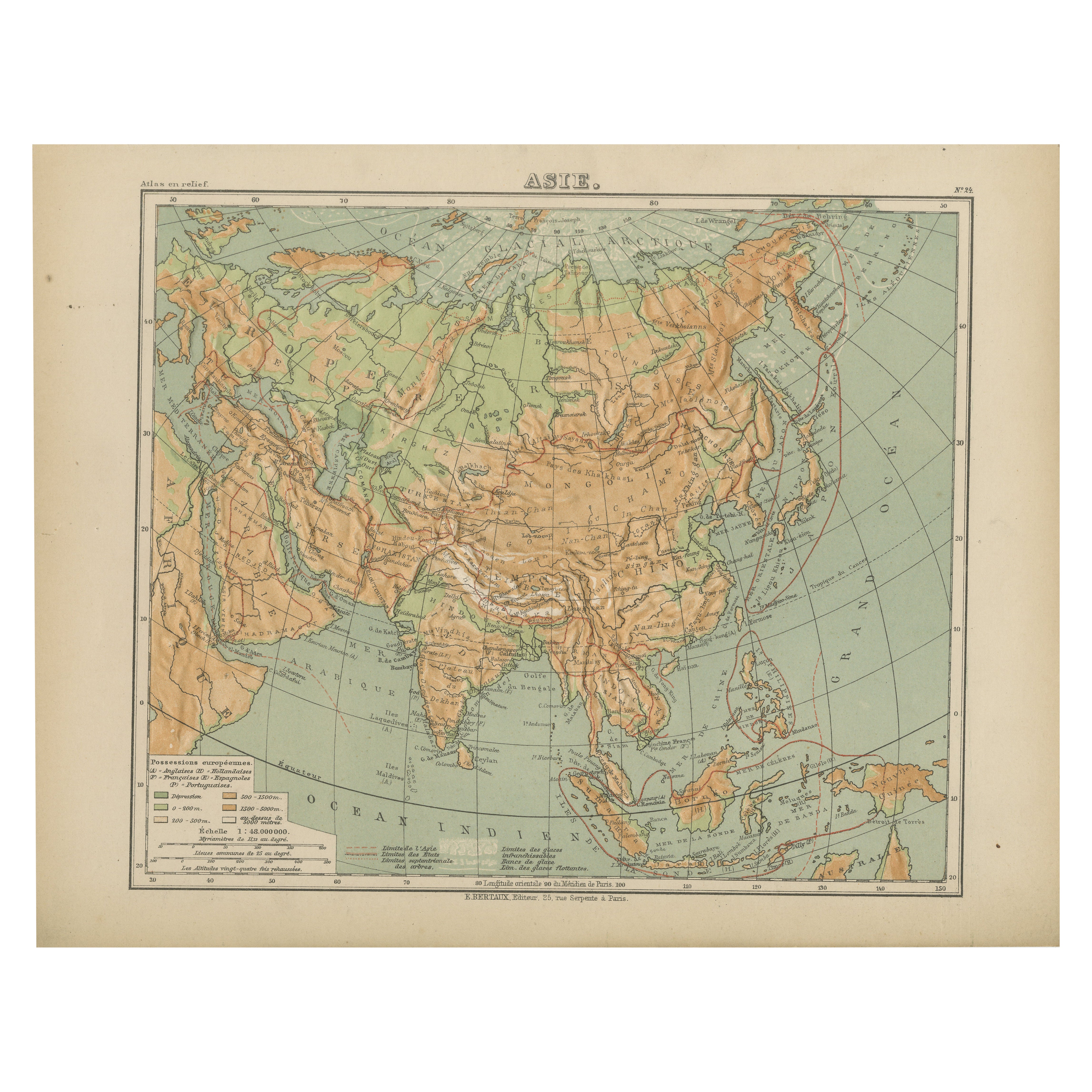
View AllRelief Atlas Map of Asia by Hachette – Antique French Map, circa 1883
Located in Langweer, NL
Antique Map of Asia – Relief Atlas Map by Hachette, circa 1883
Description:
This antique map titled “Asie” was published by Hachette in Paris around 1883 and originates from their e...
Category
Antique Late 19th Century French Maps
Materials
Paper
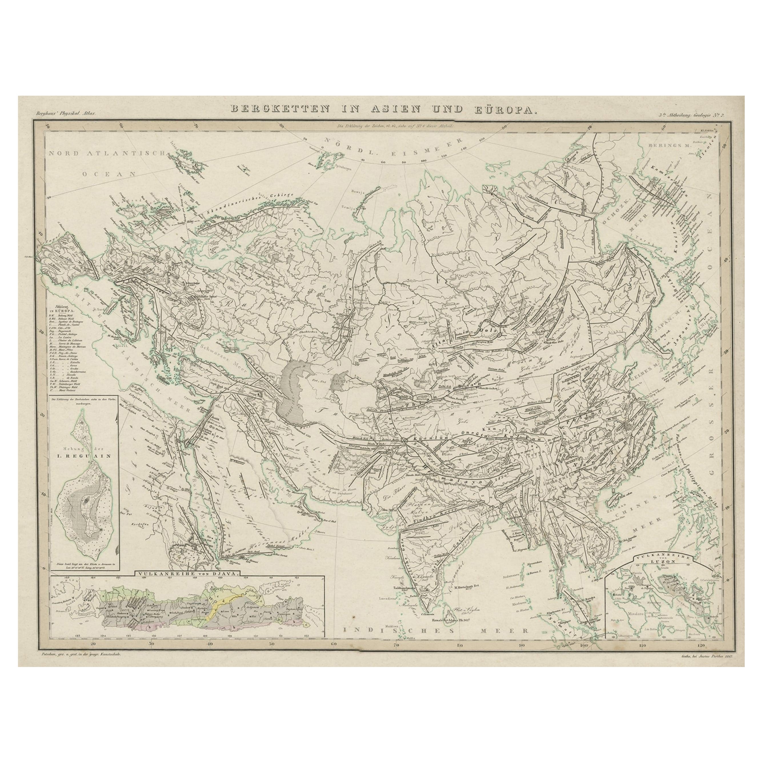
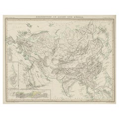
Original Antique Map Showing the Mountain Ranges in Asia and Europe, 1849
Located in Langweer, NL
Antique map titled 'Bergketten in Asien und Eüropa'. Original antique map showing the mountain ranges in Asia and Europe. In outline color with inset maps of Java, Luzon, and Reguain...
Category
Antique 1840s Maps
Materials
Paper
$264 Sale Price
20% Off
Antique Map of Asia with Intricate Provincial Boundaries, Published in 1903
Located in Langweer, NL
Title: Antique Map of Asia, 1903, with Intricate Provincial Boundaries and Coastal Features
Description:
This antique map, titled "Asia," was engraved and published in 1903 by the r...
Category
Early 20th Century Maps
Materials
Paper
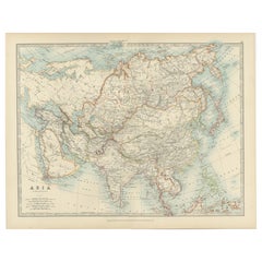
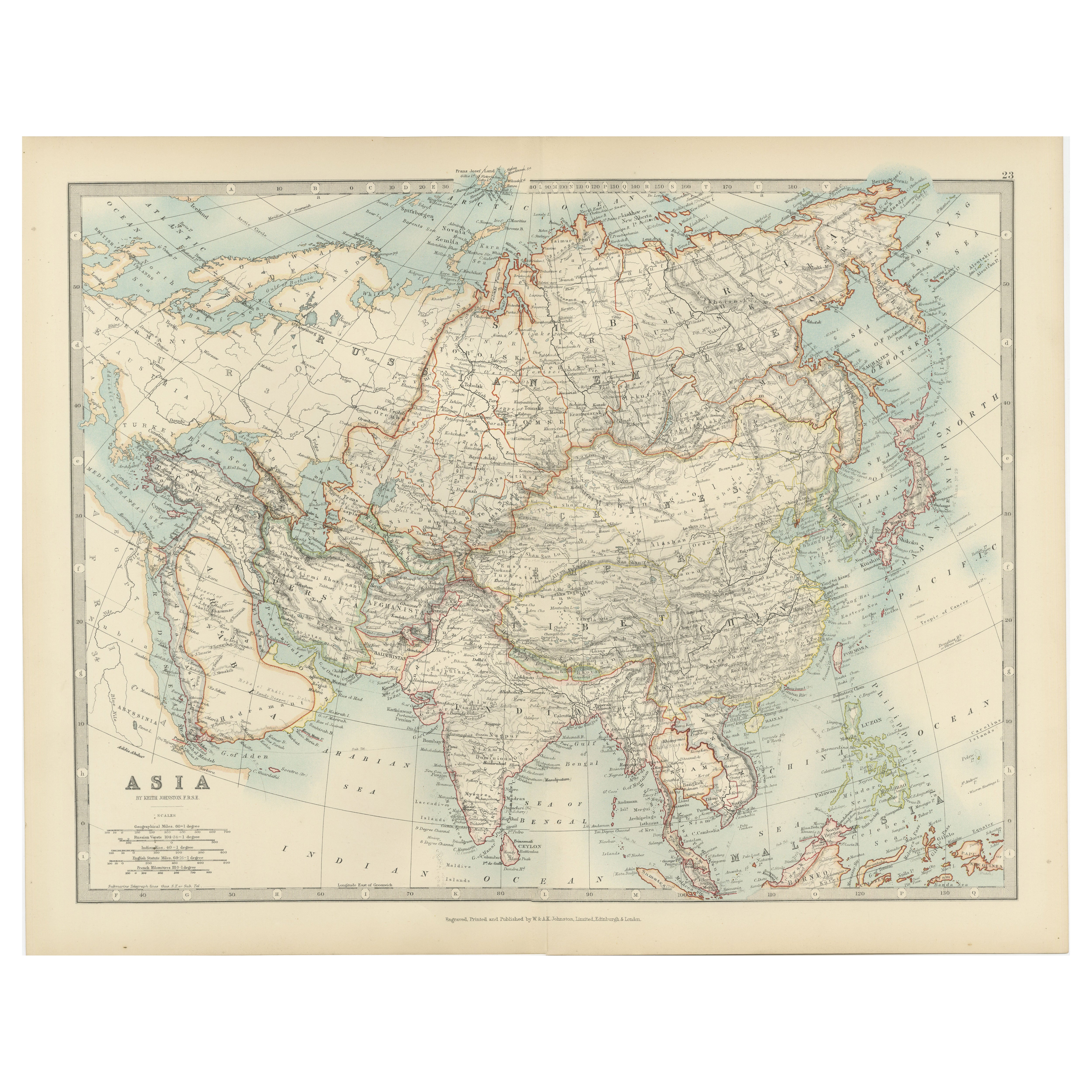
Antique Map of Asia by K. Johnston, circa 1879
Located in Langweer, NL
No. 28 of Keith Johnston's General Atlas. Published by William Blackwood & Sons Edinburgh & London, circa 1879.
Category
Antique Late 19th Century Maps
Materials
Paper

$249 Sale Price
20% Off
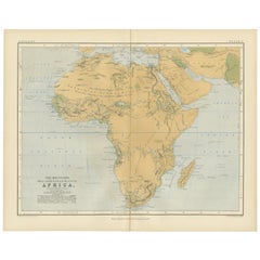
Geological Map of Africa by A.K. Johnston – Mountains and Valleys 1852
Located in Langweer, NL
Geological Map of Africa by A.K. Johnston – Mountains and Valleys 1852
This antique map titled "The Mountains, Table Lands, Plains & Valleys of Africa" was produced by the distingui...
Category
Antique Mid-19th Century Scottish Prints
Materials
Paper
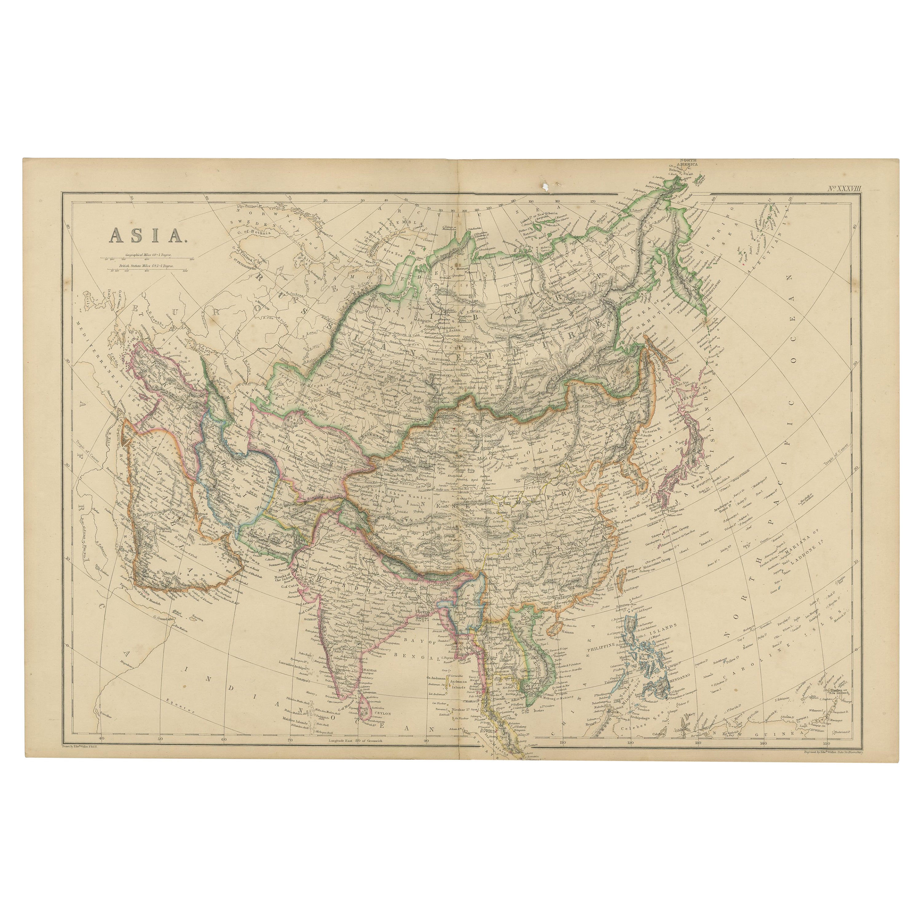
Original 1859 Map of Asia from W.G. Blackie's Imperial Atlas of Modern Geography
Located in Langweer, NL
Antique map titled 'Asia'. Original antique map of Asia. This map originates from ‘The Imperial Atlas of Modern Geography’. Published by W. G. Blackie, 1859.
The "Classic Cartograph...
Category
Antique Mid-19th Century Maps
Materials
Paper
$235 Sale Price
20% Off
You May Also Like
Original Antique Map of China, Arrowsmith, 1820
Located in St Annes, Lancashire
Great map of China
Drawn under the direction of Arrowsmith
Copper-plate engraving
Published by Longman, Hurst, Rees, Orme and Brown, 1820
Unfr...
Category
Antique 1820s English Maps
Materials
Paper

Large Original Antique Map of Asia by Sidney Hall, 1847
Located in St Annes, Lancashire
Great map of Asia
Drawn and engraved by Sidney Hall
Steel engraving
Original colour outline
Published by A & C Black. 1847
Unframed
Free shipping
Category
Antique 1840s Scottish Maps
Materials
Paper

China and Japan, English antique map by Alexander Keith Johnston, 1901
Located in Melbourne, Victoria
'China and Japan', antique lithographic map by Keith Johnston.
Central vertical fold as issued.
495mm by 625mm (sheet)
Alexander Keith Johnston FRS...
Category
Early 20th Century Victorian More Prints
Materials
Lithograph

Original Antique Map of The Eastern Hemisphere by Dower, circa 1835
Located in St Annes, Lancashire
Nice map of the Eastern Hemisphere
Drawn and engraved by J.Dower
Published by Orr & Smith. C.1835
Unframed.
Free shipping
Category
Antique 1830s English Maps
Materials
Paper

Antique 1803 Italian Map of Asia Including China Indoneseia India
Located in Amsterdam, Noord Holland
Antique 1803 Italian Map of Asia Including China Indoneseia India
Very nice map of Asia. 1803.
Additional information:
Type: Map
Country of Manufacturing: Europe
Period: 19th centu...
Category
Antique 19th Century European Maps
Materials
Paper

$584 Sale Price
20% Off
Map of the World - Original Etching - 1820
Located in Roma, IT
Map of the World is an Original Etching realized by an unknown artist of 19th century in 1820.
Very good condition on two sheets of white paper joine...
Category
1820s Modern Figurative Prints
Materials
Etching

More Ways To Browse
Antique Chart Table
Tibetan Antique Table
Antique Blackwood Table
French Herbarium
French Kitchen Hutch
French Regency Bed
French Tea Trolley
Frog Wood Sculpture
George Iii Dressing Table
Georgian Style China Cabinet
Ginger Jar Blossom
Glass Music Box
Golden Closet
Greek Key Tray
Grotto Wall
Gun Storage
Gustavian Tall Cabinet
Half Round Window